Alpen Mountain
December 3, 2017
1711m
Squamish / Mamquam Main FSR, BC
Alpen Mountain is one of the smaller summits about a dozen kilometers south-east of Squamish. This giant wooded hill is chocked by logging roads on all sides but the summit block does have a steep profile that pokes above treeline. The access is from Mamquam Main and then a spur road that goes to within 300 vertical meters from the top. This spur road is heavily used by snowmobilers and in fact, there’s even a luxurious cabin at the road’s end, but this peak is relatively less known in the scrambler community. The reason is simple as there’s literally no aesthetic scrambling involved. To me it serves merely as a winter objective but on a clear day it does offer some of the finest views.
This past November was downright dreary with only two days of sunshine. I did make use of those two days with an ascent of Tigger Peak, but that was in some of the most miserable conditions ever which further downgraded my enthusiasm. But then a month later we are now seeing a huge change in the weather pattern. A dominator high pressure system is kicking in and probably will last at least two full weeks if not longer. The stoke level is high and I wanted to make good use of this window right away. The problem arose soon as the hills got dumped by at least 60 cm of fresh snow in the last few days but Alan Blair (Spectrum) was keen to help me out with this trail-breaking thing.
It didn’t take us long to make an agreement with this objective as there simply weren’t a lot of choices. The sky just got bright enough when we turned onto the Mamquam Main road and this road was in probably the roughest condition I’ve ever seen. It was still easy peasy with my Tacoma but any small car would probably have to stop at the big rise past the Stawamus-Indian FSR turn-off as the surface was badly eroded at many places. Locating the correct spur road was done purely by GPS navigation and then I drove another short while till hitting snow. I do not have winter tires nor chains so opted to park right away. Other trucks had pushed further but I had no desire to risk that.
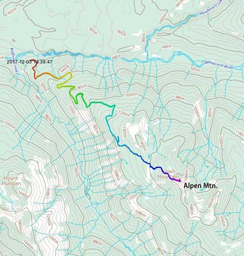
Alpen Mountain standard route. GPX DL
The layer or dust gradually transitioned to continuous snow after a couple switchbacks and then all the tire tracks stopped. We kept boot-packing following a fresh set of boot tracks but they stopped and turned into the bush (probably hunters) and beyond that we soon donned snowshoes. Thankfully there were some old snowmobile tracks to follow but we did have to break trail on top of those tracks. A couple hours later at roughly 1250 m elevation we made a mistake by taking a left turn branch but realized it soon. I did draw a GPS track before heading out but forgot to do a snap shot of the maps on my phone. This costed us lots of confusion but then we did manage to get some cell signals. I then logged onto the web and found the topo map we wanted and that confirmed this left branch would eventually come to a dead end, so we backtracked. The correct spur road is about 300 m farther down.

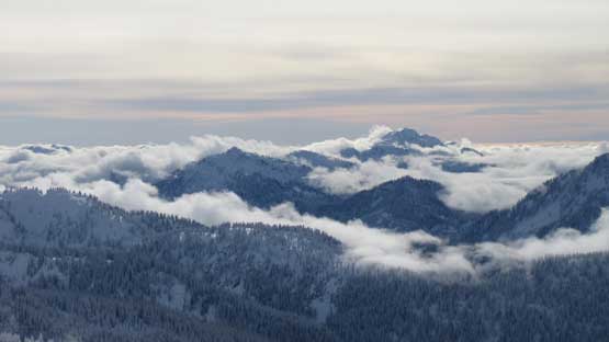
Morning view of Mt. Tantalus
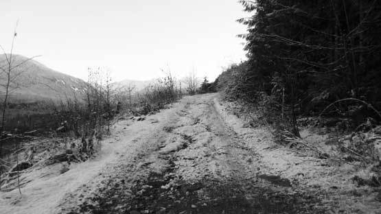
This is roughly where we parked. Snow means “stop driving”.
Fast forward. A couple hours later we were finally on this last spur road
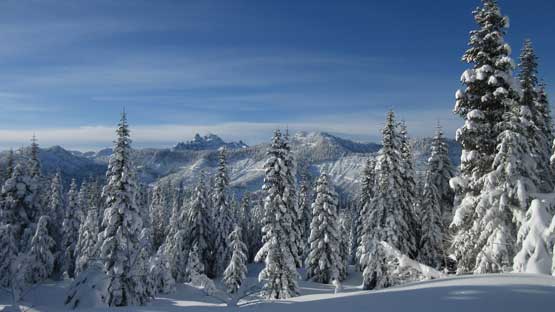
The views were slowly opening up. I like the trees with fresh snow.
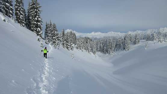
This narrower spur then took a straight beeline due south-east towards the mysterious cabin but we didn’t see a cabin at the road’s end. Judging by the old sledder’s tracks the cabin must be slightly to the north which was opposite to our peak so we opted for not bothering. Immediately after turning right that the heavy duty trail-breaking started. The first stage was a relatively steep forested ascent into a broad gulch feature. To maintain a correct bearing a GPS unit was super handy. Once reading that gulch feature the terrain opens up and we could see the upper mountain ahead. We followed the edge of this opening area and then ascended underneath a sub-summit on again, mostly open slopes. And then the next stage was a steep traverse into, and then a gentle ascent towards the high col.

We followed the old snowmobile tracks to the road end.

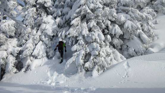
Here’s where we left the road and started breaking trail.
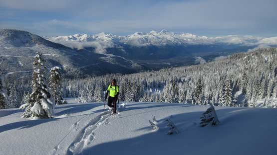
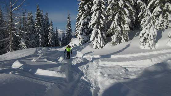
Al enjoying the winter wonderland.

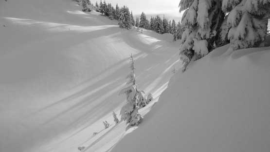
After merging into this broad gulch feature we stuck to the openings
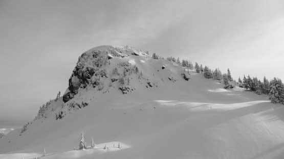
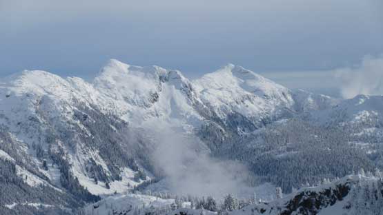
The true summit block in view now.
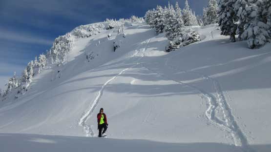
We got too high towards the false summit and had to cut across a steep traverse here.
Traversing…
The true summit looks pretty steep from this high col and it sure is. We did look around but it didn’t seem like there’s a gentler path so the solution? Let’s go straight up.. About halfway up we encountered a near vertical step that we kind of had to break through a small cornice. Not a huge deal. Then a bit of zig-zagging through thinning trees got us onto the upper face. A direct attack looked steep and technical but there seemed to have a gentler bench traverse leading out to the right (south). This traverse was thin and open and led us to the uppermost south ridge. The final ascent on south ridge was a 2nd class scramble on slippery boulders.

Al leading one of the steep rolls.

About halfway up the summit block.
Zig-zagging through dense trees

Onto more open slopes near the top.

Charging up…

We opted to traverse due right (south) from this point

Lots of post-holing just as we were hoping for…
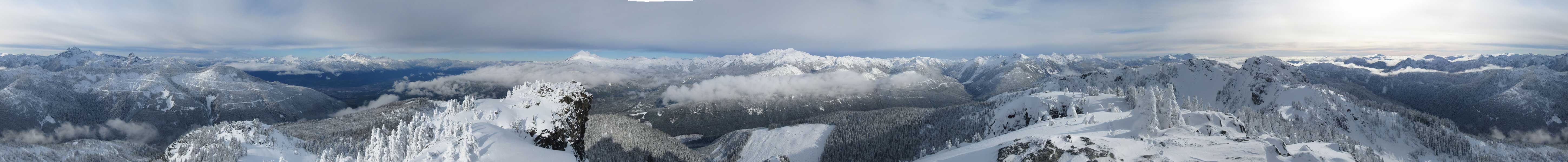
Summit Panorama from Alpen Mountain. Click to view large size.

This is looking down the east side. Lots of logging roads on that side too…
The south peak is a few meters lower so we didn’t bother.
Sky Pilot Mountain is always an eye-catching giant.
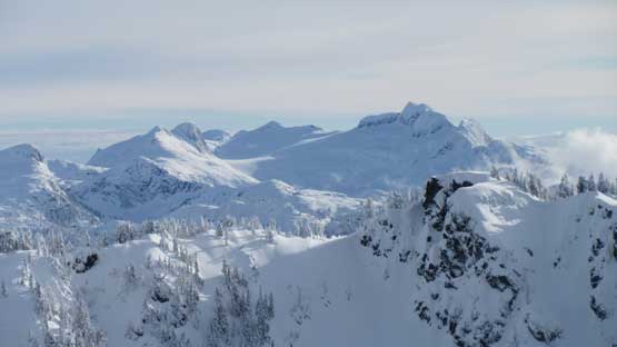
The highest out there is Cathedral Mountain deep in the North Shore
Seed Peak (L) and Mt. Gillespie (R) that I ascended in the fall of 2016
Meslilloet Mountain which I also ascended in the fall of 2016
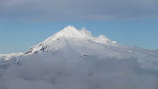
Atwell Peak and Mt. Garibaldi massif

Our group shot on the summit of Alpen Mtn.
We stayed on the summit for at least half an hour and eventually we figured it’s better to hurry up to beat the Sunday’s traffics. Plunging down the soft powder took literally no time and thank to the stable conditions we even opted for a couple steeper rolls. The logging road plod lower down felt like a drag near the end but still we managed to finish the descent in just 2 hours.
We had lots of fun plunging down these steep rolls

Back to the true/false col now.

Mamquam Mountain in the afternoon lighting
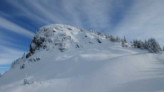
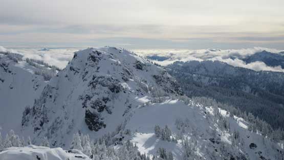
A review shot of the summit block.

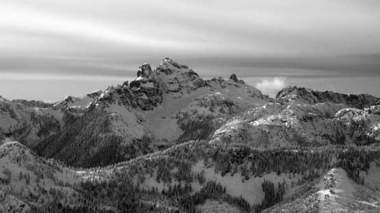
A closer look at Pelion Mountain
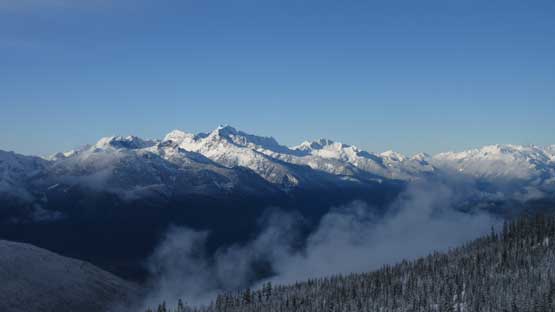
A full panorama of Tantalus Range

Oh the logging road plods..

There are quite a few confusing branches that you better come with a GPS track
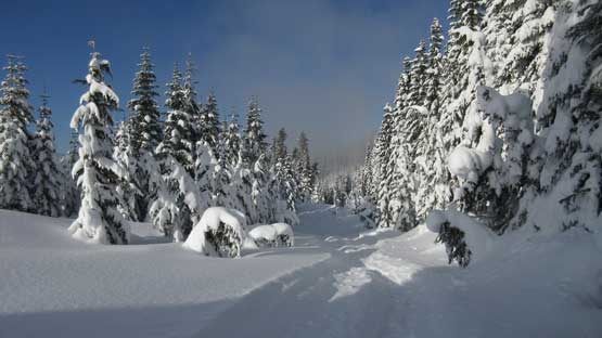
As typical as it gets. This soon became boring.
The driving back home was uneventful and we did manage to beat the horrible Sunday afternoon gong show in that corridor. Overall I would highly recommend Alpen Mountain as a snowshoe or ski trip but make sure you save it for a sunny day to enjoy the views but I doubt this will ever become too popular. First of all you need a truck to get there and secondly, the true summit might be a bit steeper and more complicated than what the topographic maps suggest. A stable snowpack is also a must. But if you time it right the reward is also big.
