Mount Meroniuk
July 13, 2020
1799m
Chilliwack Lake, BC
Mt. Meroniuk is one of the lesser summits immediately next to Chilliwack Lake. It does not offer much mountaineering interest, but the summit block does require some problem solving on class 3 and wet terrain. The only route that makes sense is by a traverse from Paleface Mountain, and the access is by the logging roads in Paleface Creek drainage. The new logging activities has improved the road conditions in recent years. Earlier in the day Gur, Val, John and I drove to 1200 m in my Tacoma and ascended up and over Paleface Mountain.
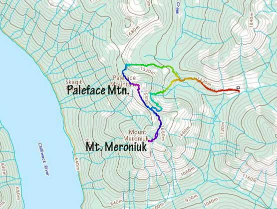
Paleface Mountain to Mt. Meroniuk traverse. GPX DL
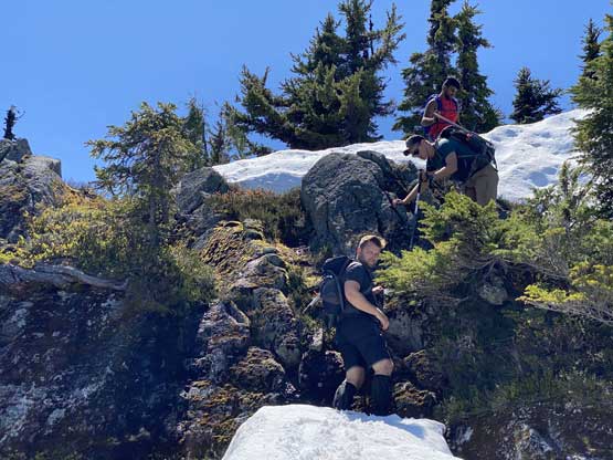
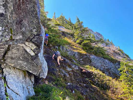
After descending to the low saddle we bushwhacked aiming for the intermittent bumps between the two peaks. The first bump required one short but fun class 3 step but after that we had to lose at least 30 m elevation, with again, a bit of class 3 scrambling thrown in. We then easily traversed over the next (lesser) bump to the base of the summit block of Mt. Meroniuk.

The south ridge of Paleface Mountain behind

Gur just after finishing a fun 3rd class step
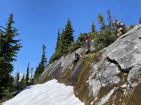
Another tricky step along the connecting ridge

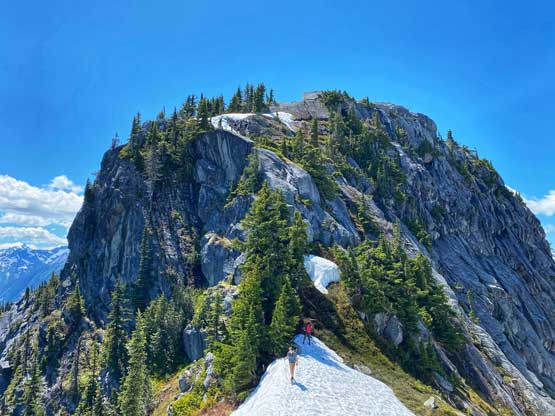
Approaching the base of Mt. Meroniuk’s summit block

The north end of Chilliwack Lake down low
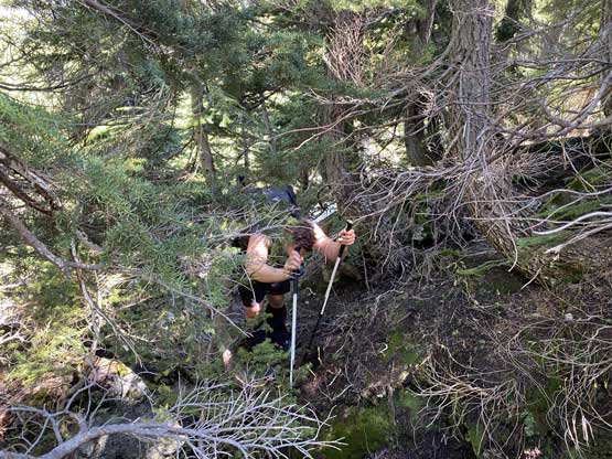
I was hoping for a direct attack on the nose but after committing to a 4th class move I was forced to backtrack by some smooth and featureless slabs. I gingerly downclimbed that step and meanwhile, Val had discovered an awkward hand crack to drop into a wet and mossy gully on climber’s right side. This short bits of down-climb was 4th class and needed a bit of creativity in finding “foot holds”. The gully looked intimidating but actually not too bad with some positive (though wet) ledges and plenty of green belays. We even found an old sling indicating previous parties had rappelled the same route. There was still minor route-finding challenges as well as at least two or three 3rd class steps above the gully that made things more interesting, but overall the summit was not difficultly attained.

Val traversing into the wet and mossy 3rd class gully

Gur climbing up a steep section in the gully. Vege belay is the key

Ascending some snow higher up.

Val almost at the summit

John M. approaching the summit of Mt. Meroniuk with Thompson Peak behind
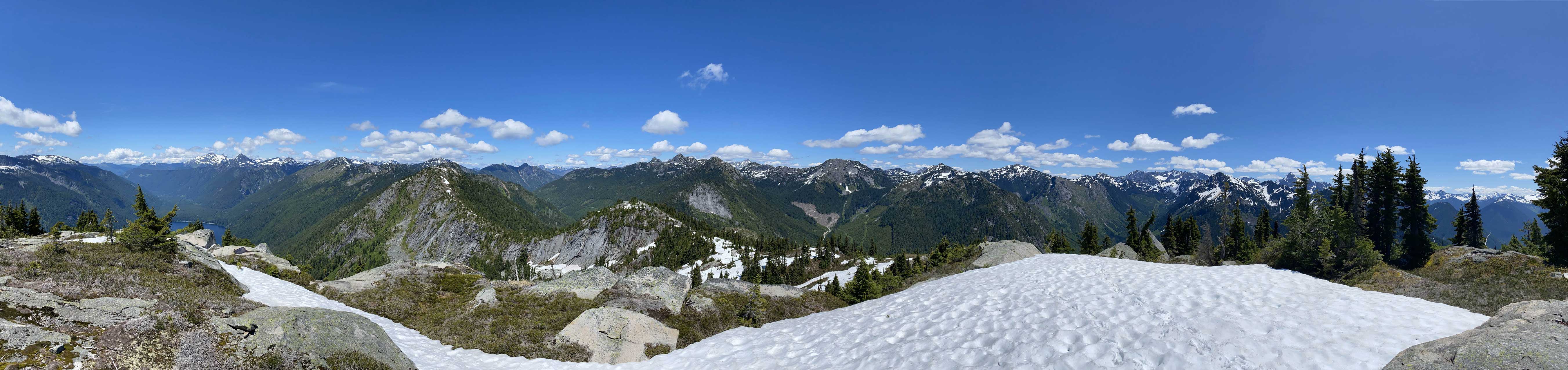
Partial Summit Panorama from Mt. Meroniuk. Click to view large size.

Paleface Mountain in the foreground

Looking across the slopes of Flora Peak towards Welch/Foley/Williams on left

Mt. Holden in the foreground

A zoomed-in shot of Mt. Rahm, Mt. Custer and Mt. Spickard

Zooming-in towards Mt. Redoubt

Me on the summit of Mt. Meroniuk

Another photo of me on the summit
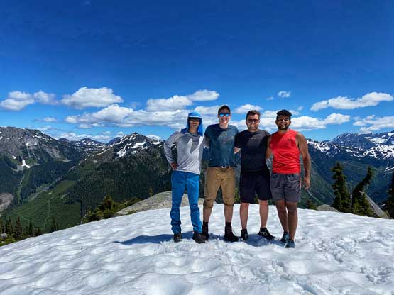
Our group shot on the summit of Mt. Meroniuk
Once taking enough photos we reversed our route down the scramble part taking extra care of the wet foot placements. We then ascended up and over the intermittent bumps back to the south ridge of Paleface Mountain, but instead of retracing our route over Paleface Mountain we opted to explore an alternative descent down from Paleface/Meroniuk col. This proved to be an adventurous decision. Time wise we probably did save a bit but we had to put a lot of mental work in. There were a few rock bands that must be bypassed and we made at least one major mistake in guessing the weaknesses. We went down skier’s right side but eventually were forced to traverse a long ways back skier’s left dealing with sustained “level 3” bushwhacking. But once we bypassed that troublesome cliff we had a cruise sail, albeit steep descent down in mature forest and eventually intersected the “Paleface Pass” trail and then easily plodded back to the truck.

Time to head down.
One of the trickier steps higher up on the summit block
John down-climbing the wet, 3rd class gully

Val re-ascending that 4th class step
A review shot of the summit block

Descending some steep snow

Gur having fun boot-skiing

John checking the GPS for our alternative descent

Boulder fields…

A lot of navigation and guess work
We were cliffed out and time to bushwhack back up and traverse around

Now, bushwhacking down the easier section of the forest

Mt. Edgar towards the rear end of the trip

Back to the good portion of the trail
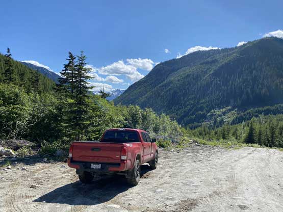
It’s Taco time…
Our round trip time was 6.5 hours tagging the two peaks exploring different routes. We probably could have done them faster had we done more homework, but it was a pretty fun day overall with friends. The drive home was uneventful but the Chilliwack Lake Road was just as slow as in the morning.
