Mount Jellicoe
August 26, 2014
3075m
Kananaskis – Smith Dorrien Valley, AB
Mt. Jellicoe is a somewhat obscured peak buried deeply in the British Military Group in the heart of Kananaskis Country. It caught my attention initially through Andrew Nugara’s Snowshoeing in the Canadian Rockies book. For that reason ideally I should do it in winter on snowshoes but that would require the perfect condition and weather. And if that kind of condition happens chances are I’ll be on other peaks such as Collie or Ayesha. So it never got realized in this past two winter/spring seasons. Now came to this summer, Jellicoe was originally our back-up plan in case we couldn’t get up Mt. French. However, we summitted French too early in the day and we increased our ambition to grab Jellicoe as well. Doug and I quickly made our way down Mt. French, strapped crampons on and onto Haig Icefield.

Mt. French and Mt. Jellicoe scramble route. GPX DL
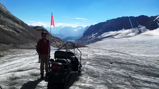
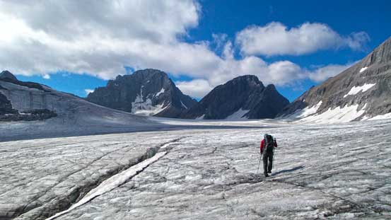
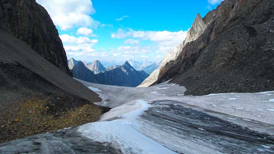
The summer route is essentially the same as winter route. We aimed more-or-less straight towards the SW corner of Jellicoe across Haig Icefield. The glacier was dry and crevasses were easily avoided. There were still a few crevasses we had to step across, but nothing trickier than that. It’s quite a long way across the icefield and at the meantime we had to lose some elevation. Towards the opposite end of the glacier we talked to a snowmobiler who obviously was in charge of the cross-country ski team. He informed us another route up the summit which sounded a bit more technical. So we decided to stick to the original plan.
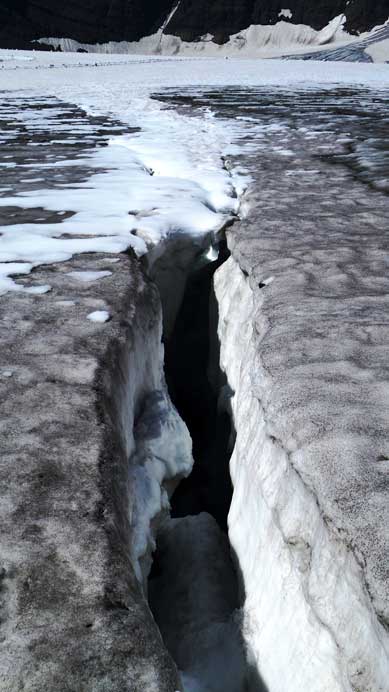
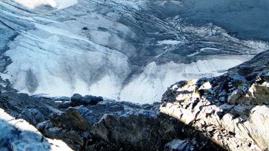
Crevasses on Haig Icefield
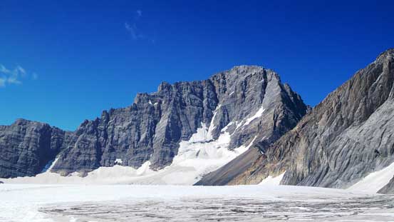
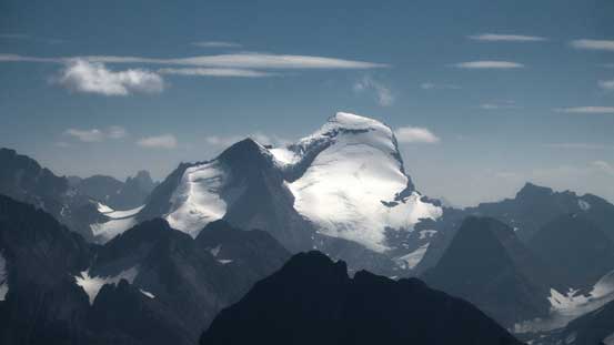
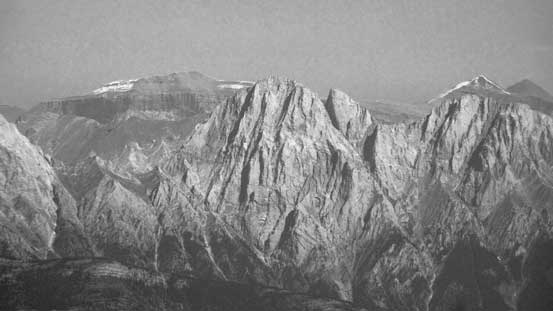
Mt. Sir Douglas the majesty
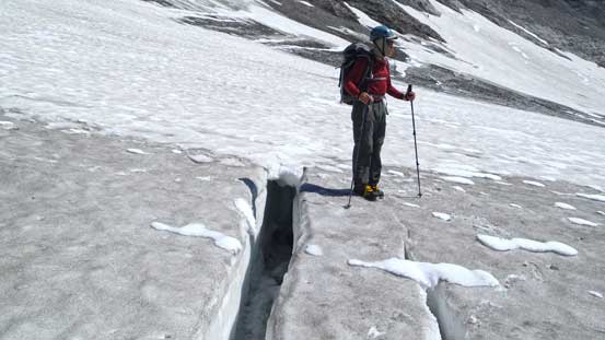
Doug in Haig Icefield with a crevasse
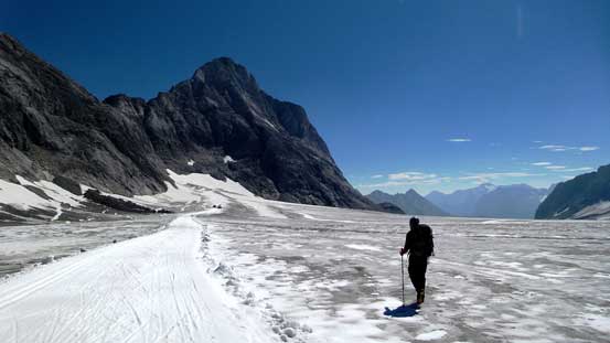
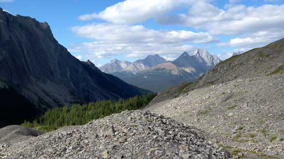
Hiking towards the base of Mt. Jellicoe
We talked to this snowmobiler on the icefield
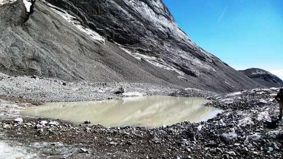
A muddy pond
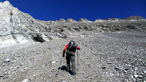
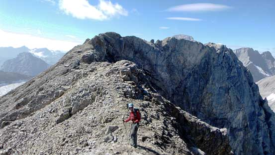
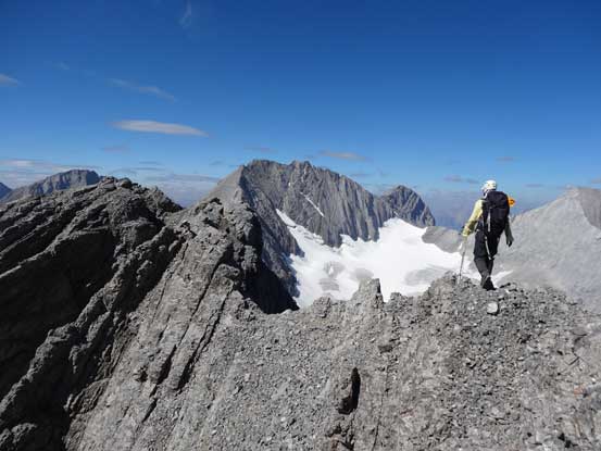
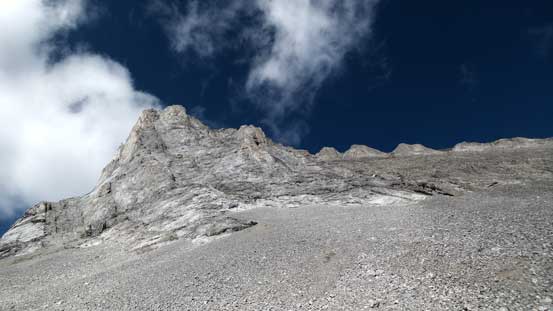
We ditched all the unnecessary snow gears to speed up the ascent. From the base to the summit ridge was essentially a huge scree/rubble slog. The lower slope was steeper and offered a few hands-on parts on firm rock, but soon after that we were back to scree slog. We broke a “spine” on the slope and crossed over to the climber’s right side and eventually made to the ridge. We followed the ridge up until it narrowed down at the false summit.

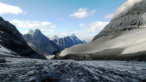
Panorama of Haig Icefield at the base of Jellicoe
Doug slogging up the typical terrain on Jellicoe

Oh I hate scree slog…
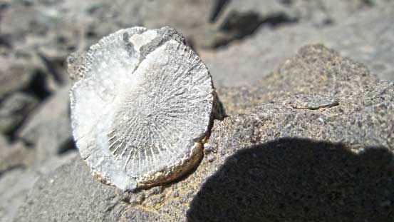
Fossils everywhere on this mountain
We finally could pick a line on rock rather than scree
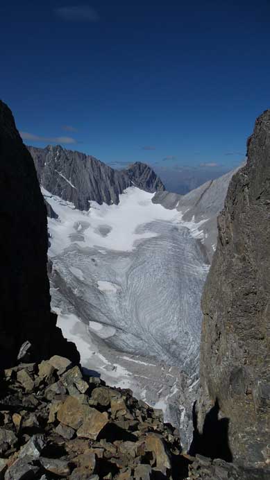
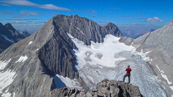
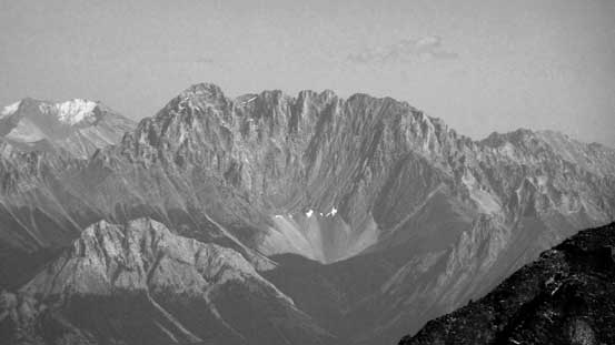
Smith-Dorrien Glacier seen from a gap on the summit ridge
Doug ascending towards the false summit
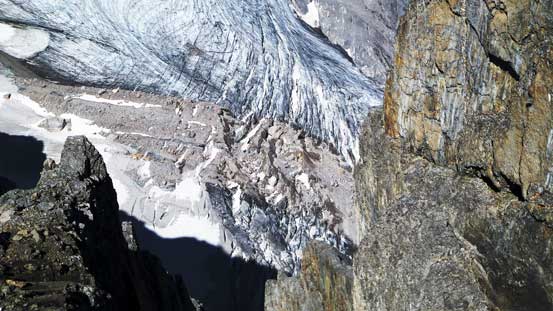
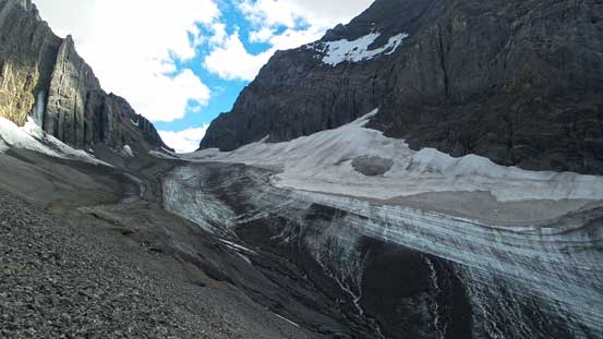
The heavily crevassed Smith-Dorrien Glacier
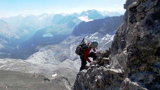
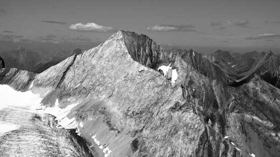
The traverse to true summit was class 3 scrambling only in dry condition but with considerable amount of exposure especially towards Smith-Dorrien Glacier. In winter I know most parties had to pitch it out due to massive cornices. We quickly made our way over to the true summit. The views were fabulous towards each direction even with the smoke. This summit offers a better view of the glaciers than Mt. French and we also took a lengthy break on the top.
Me on the summit ridge. Photo by Doug Lutz
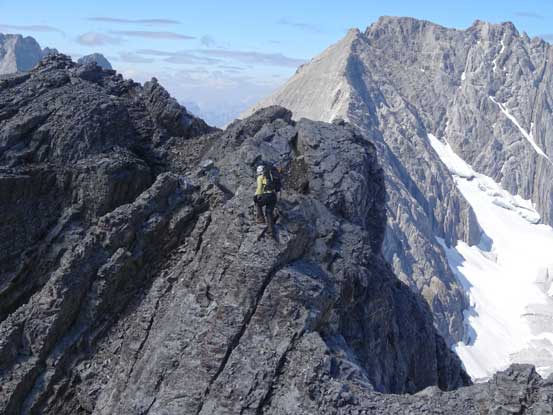
Me tackling a challenging step on the ridge. Photo by Doug Lutz

Doug on the ridge
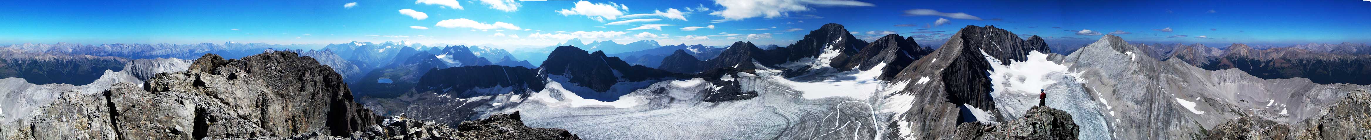
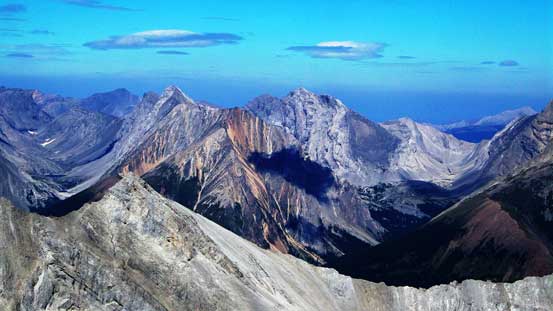
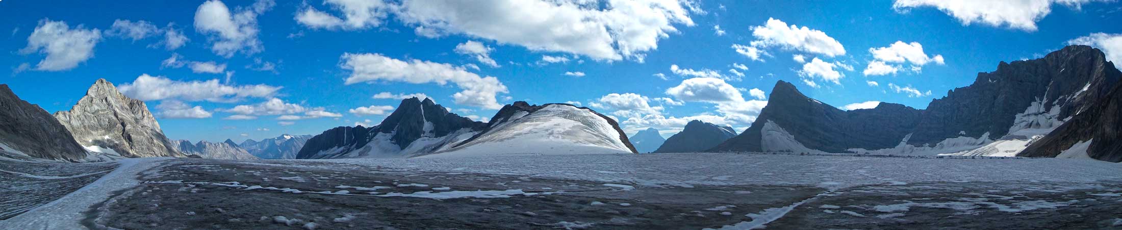
Summit Panorama. Click to view large size.
Mt. Sir Douglas

Mt. King George rises behind Mt. Maude
Mt. Joffre
Mt. Rae
Doug with Mt. French behind – our previous objective
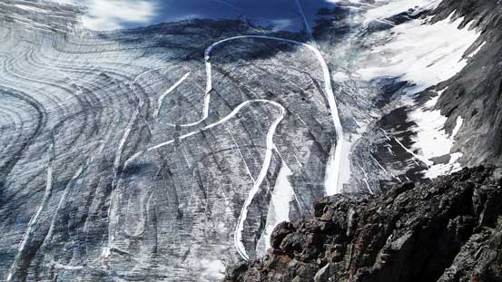
The x-country ski tracks on Haig Icefield
If you don’t like height then don’t look down…
Impressive slabs on Mt. Smith-Dorrien
Mt. James Walker across Smith Dorrien Valley
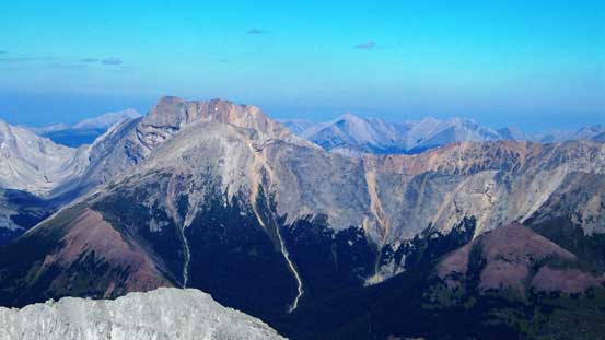
Mt. Inflexible is another challenging scramble
Mt. Blane in the Opal Range – I’d like to climb it someday
Mt. Elpoca
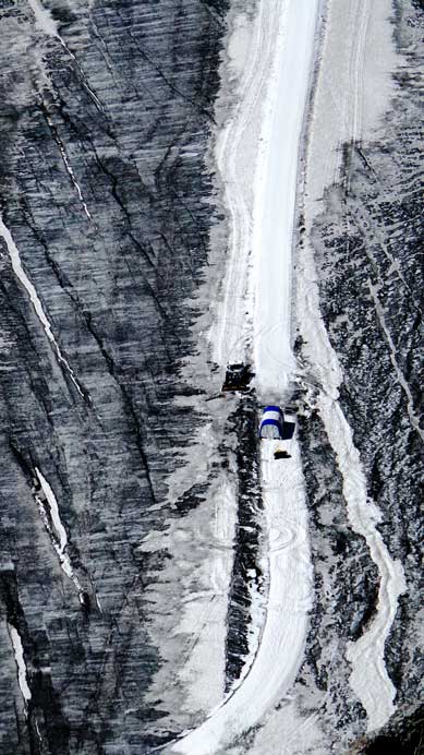
A close-up look at the training facility

Me on the summit of Mt. Jellicoe

Panorama of Haig Glacier. Click to view large size.
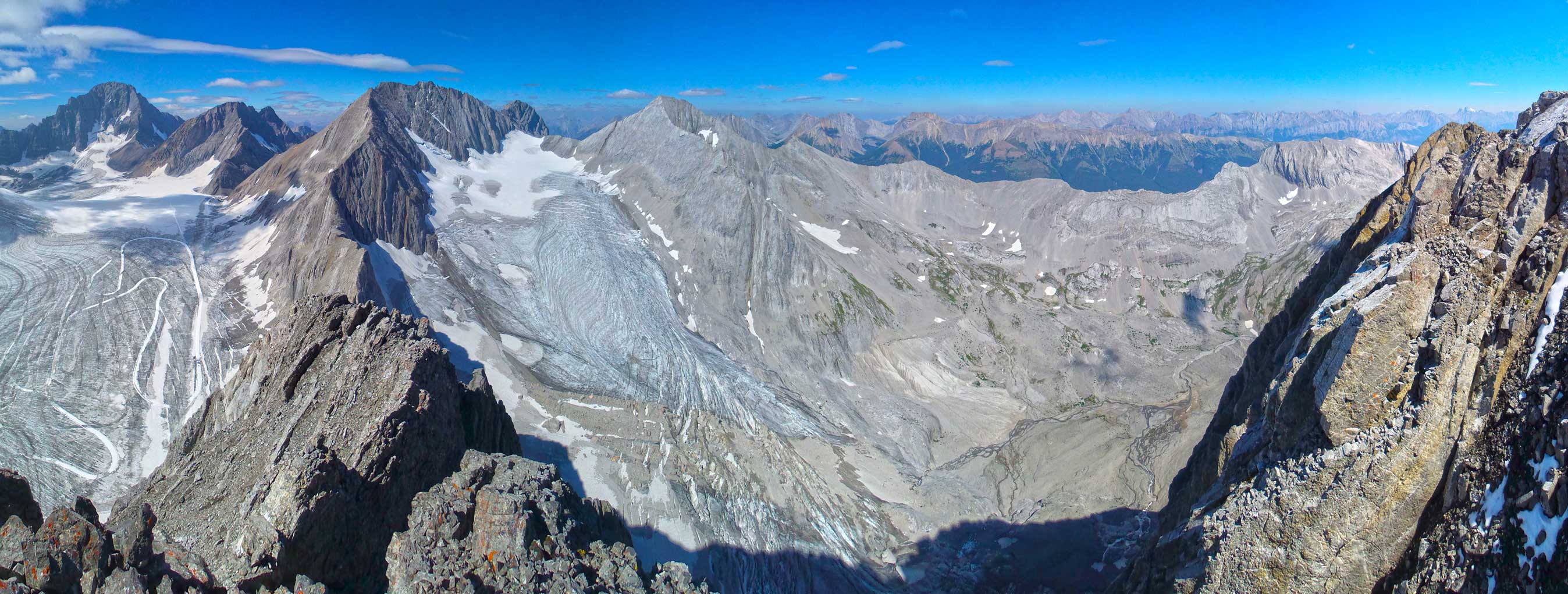
Panorama of Smith Dorrien Glacier and its valley

Panorama looking south. The alternate route – via Turbine Canyon goes up this way.
Since we had a long way back down we had to start descending. Coming down the scree/rubble was not as fast as on French but still pretty quick. Soon we were back to where we ditched gears. Strapping crampons on we set on Haig Glacier back towards French/Robertson col. There was considerable melting by this time of the day at for many time we had to plunge in shallower water on top of the ice. Thankfully my boots were water-proof but Doug wasn’t nearly as lucky. Near the col we had to be extra careful with the crevasses as the snow bridges were no longer trustful. We jumped a few of the holes without touching the questionable snow. Back down French Glacier, it was hard on the knees so we soon bailed to the rock on skier’s right. We picked a different line than on the way up, staying lower avoiding side-hilling for as much as we could. It’s indeed a better route and soon we were back in the forest.

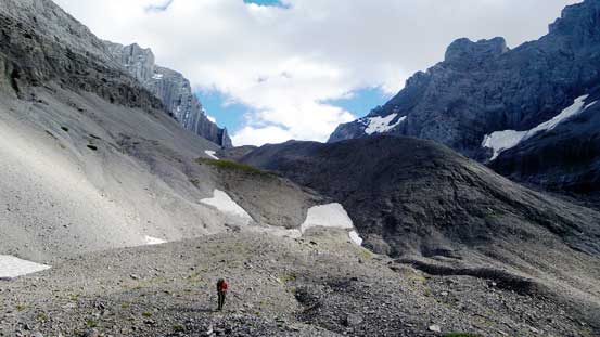
Regain a bit of elevation to the base of Jellicoe
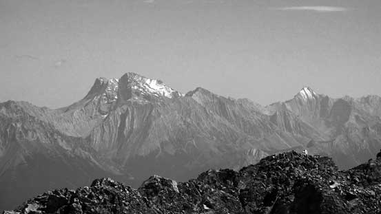
Looking back at Mt. Jellicoe
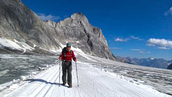
Doug on Haig Icefield aiming towards the distant French/Robertson col
Doug using the ski tracks. Jellicoe behind

Mt. Jellicoe, our objective
Panorama from the Icefield. Click to view large size.
Back to French/Robertson col

Looking down French Glacier

Holes on French Glacier

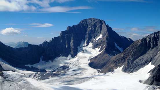
Mt. French
Hiking down the dry glacier was hard on our knees
Looking back at French Glacier
Back down the moraine
Pretty soon we’d enter the trees
The rest of the way back was a true slog. There were a few waterfalls adding to the variety but not by much. I was already very tired and negotiating all the micro up-hill sections and the dead falls was quite exhausting. And the trail would never come to an end. Well, it eventually would and we were back to the log jam to cross over French Creek. Back onto the old logging road, what was left was a easy walk back to the car. Our round trip time was 14 hours 20 minutes including all the stops which was not a bad pace.
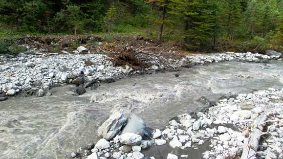
The muddy French Creek

Doug on the depproach
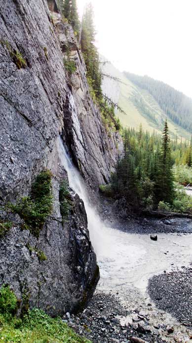
One of the many waterfalls
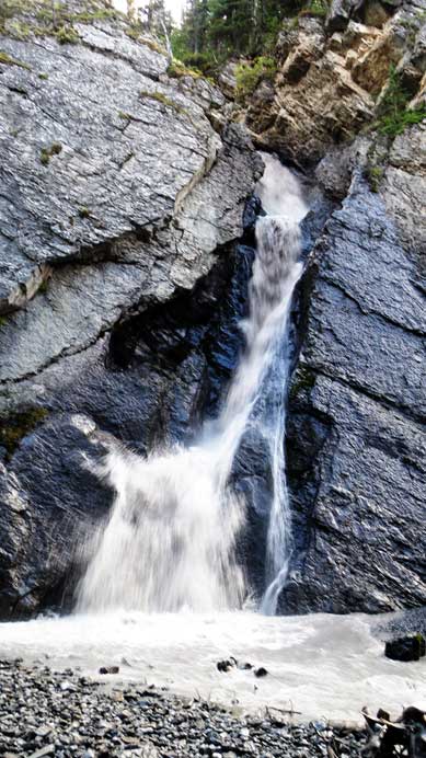
The same waterfall
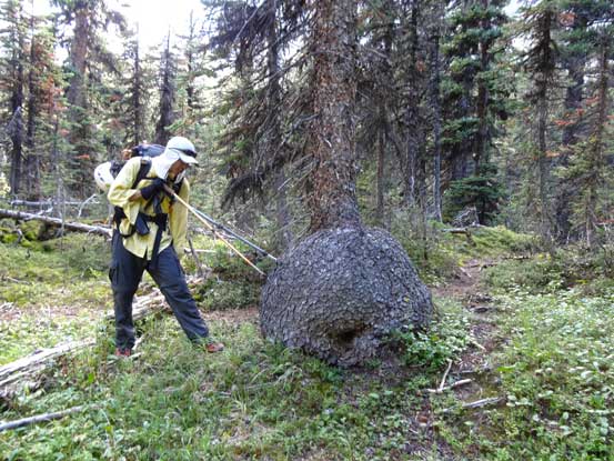
Me trying to stab the tree trunk tuber. Photo by Doug Lutz
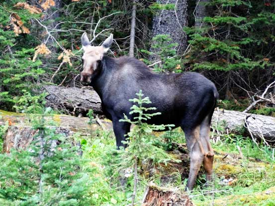
A baby moose.

The mom moose
The drive back home was again, exhausting. Doug did all the drive back to Red Deer but I didn’t manage to catch up any sleep during this part. On the way back to Edmonton I had to stop and take a nap at about halfway, and eventually got back by about 3 am in the morning. And I noticed the forecast for the next couple days had down-graded so we made a very correct call of pushing a bit on this Tuesday. It was a very successful and satisfying trip.

I was looking at some of my old photos from 1992 and was unsure if they were from the summit of Jellicoe. Your photos helped me clarify the issue. They were. Thanks. Keep on going up.