Lookout Peak (East Harrison)
March 3, 2024
1529m
Harrison Lake East, BC
Not to be confused with the tens if not hundreds of other peaks named “Lookout”, this is a small but somewhat obscured peak on the east side of the southern half of Harrison Lake. This was one of the few remaining objectives in the area for me, as I had done most of the other “East Harrison” peaks in 2017-2021 period. Lookout Peak had eluded me for years as I could not find much “beta” on the internet, and the standard south side approach appeared significantly overgrown on the satellite images, to the point that I wouldn’t even bother to try without seeing a condition update in the recent era. Now let’s fast forward to 2024. Thank to the Facebook groups I had learnt that the access road, though indeed very bushy, was not as bad as I thought such that an approach on foot, though unpleasant, was actually possible. There were at least 4 or 5 trip reports popped out on the social media within the past 2 years, so I was eager to finally check this peak off the list. I was planning to wait for a good weather window as the view was supposed to be really nice, but I always ended up doing something else had the weather been that nice. This past Sunday saw some mediocre forecasts and I could not make up my mind until the very last minute. There was a special avalanche warning for much of the area, but there’s no avalanche terrain on Lookout Peak, so that eventually made my decision.
There had been over 150 cm of snowfall within the past 7 days and the temperature stayed cold throughout, so I was anticipating some heinous trail-breaking in the dry powder. That normally wouldn’t be a problem, but I was still locked out of my apartment thank to the fire damage so I had no access to my trusty Men’s 30′ Lightning Ascents. I could have just toughed it out using the women’s 25 inches but my experience told me that’d be a dumb idea. I had snowshoed 350 peaks over 13 seasons and I knew what gear I needed in this kind of conditions. Thankfully I remembered at the last minute that I had purchased a pair of 30′ McKinley snowshoes a couple years ago as a temporary replacement for the broken pair of Lightning Ascents as the Lightning Ascents were out of stock for a couple years during the pandemic. I did end up getting my trusty Lightning Ascents so I had completely forgotten that pair of McKinleys stored in my parents’ house, which had never actually been used. My parents had kept all of my redundant gears including this pair of McKinleys and three other pairs of broken Lightning Ascents so it made perfect sense to take this trip as an oppourtunity to test out the “new” gears. Last but not least, I had been looking hard for someone strong enough to share ~50% of the trail-breaking duty with me, and that turned out to be Seb Gulka. Vlad and Kate also decided to come along, but the majority of the post-holing would be shared between Seb and I. The four of us agreed to group in Harrison Hot Springs at 6:45 am as I wasn’t particularly keen on an ungodly early start, especially now with the downgraded weather forecast calling for isolated flurries and mostly overcast skies throughout the day. I was actually hoping for 1-2 hours later, but Seb had an evening pizza party so it’d be nicer to get him back in time.
The morning was grey and frosty and there had been fresh snow down to the valley floor, so I was not anticipating to drive much higher than the traditional Slollicum Peak’s trail-head on East Harrison FSR. And because of that we abandoned the idea to take the newly graded Slollicum FSR, which was used by the few groups in the past month. Instead, we would aim for the “connector trail” that should give us the most direct attack in the current situation. I managed to drive us a few switchbacks higher but eventually parked at 500 m elevation. I turned around and parked because of the slippery conditions but this was actually the highest we could have driven to, as a boulder was blocking the road a few hundred meters further. There was about 10 cm of fresh snow at this elevation.
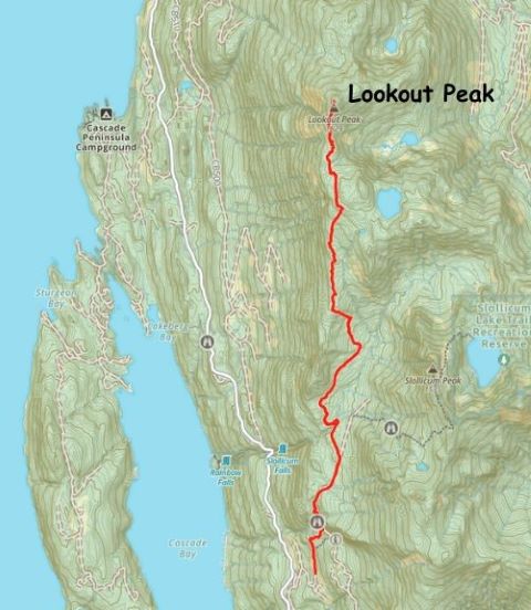
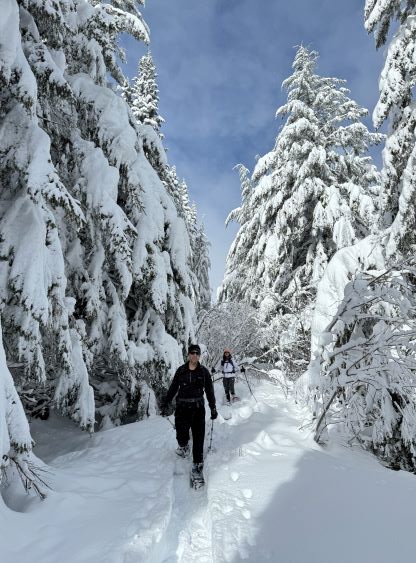
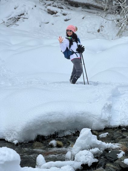
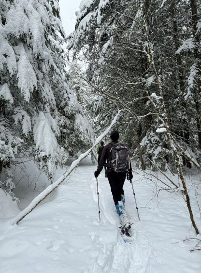
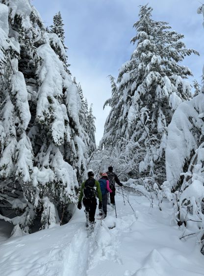
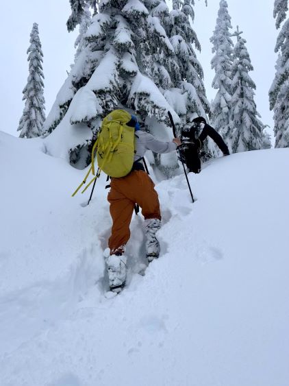
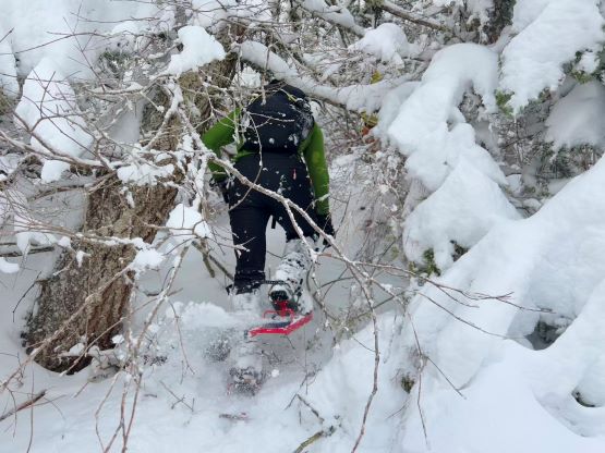
A short walk brought us to the end of this spur road but a quick check in the GPS revealed that we had overshot the proper trail-head of that “connector trail”. Vlad suggested we should just bushwhack straight up the slopes as we were only about 150 vertical meters underneath the upper FSR. I was initially not too keen on this idea but reluctantly agreed. The bushwhacking was a little bit annoying but was overall tolerable, and the “short-cut” we did was actually shorter than the proper “connector trail”, so we probably have saved time after all, especially later on the return. The worst was to negotiate some snow-covered boulder fields but with care, it wasn’t too bad. Once joining the upper FSR we donned snowshoes and the trail-breaking had become increasingly heavy from ~800 m elevation onward. This made me glad to have brought the 30′ McKinleys. As planned, Seb and I took turn breaking trail past the Slollicum/Lookout junction to the supposed river crossing of Slollicum Creek. At least one group had driven to and across this creek in February during the dry/warm spell but it took us over 1 hour to get to this spot. Vlad and I had brought crocs for the crossing as most people did end up having to take their shoes off, but on this particular day it was an easy “rock hop” on snowshoes. Vlad and I then ditched our crocs on the far side of the creek.


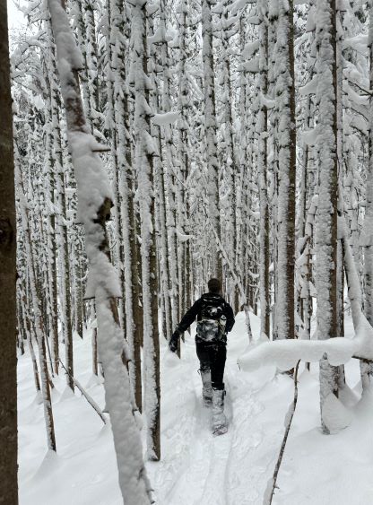
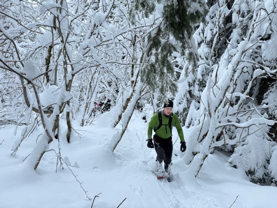
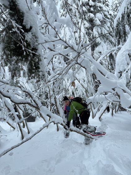
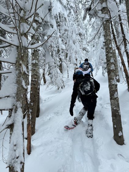
The road on the far (north) side of Slollicum Creek was initially wide and open, but quickly degraded into a mess of alders. People had reported the alders to be “not too bad” but they either had no snow or much more snow. For us it was an annoying bushwhack as the snow was not thick enough to completely cover the alders, but dense enough to bend them over and leaving fresh stuffs on the branches. For about 2 km distance the situation was tolerable but from the switchback at 1050 m elevation the bushwhacking had become full on. Seb and I quickly formulated the plan to “short-cut” this switchback by shooting straight up the forest on the north side, and this turned out to be a brilliant idea. We not only avoided most of the bushwhacking but also reduced the amount of post-holing. This was a decision made completely in-situ based on our experience. We did hit a short but very steep slope and the wallowing was up to my chest, so it took a while. We rejoined the road at 1150 m elevation on the long south ridge of Lookout Peak and Vlad took over the lead for a short while. There’s no sign of improvement in the bushwhacking situation so I consulted with the maps again. The next in-situ decision was made to completely abandon the road and use the actual south ridge that is more or less parallel to the road. The result was mostly as expected, that we significantly reduced both bushwhacking and post-holing. The only downside was some added undulating terrain and route-finding, but that’s not a problem at all.
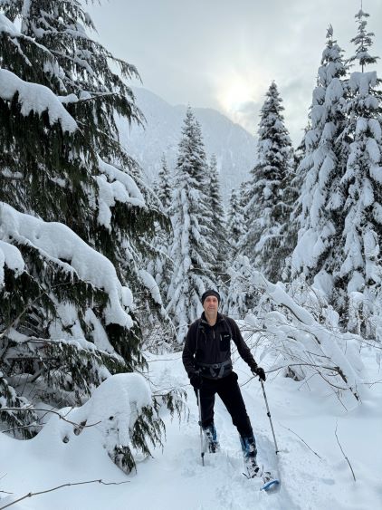
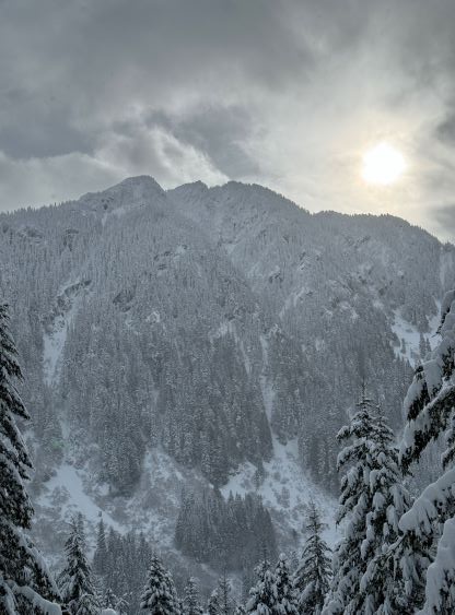

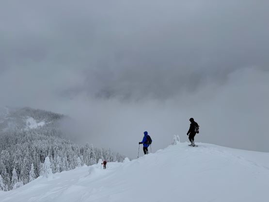
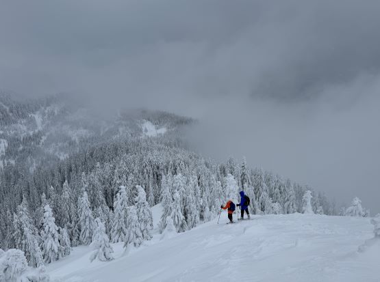
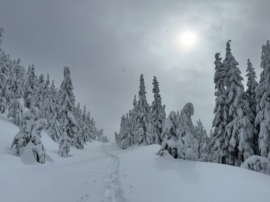
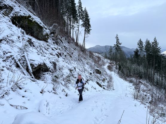
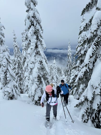
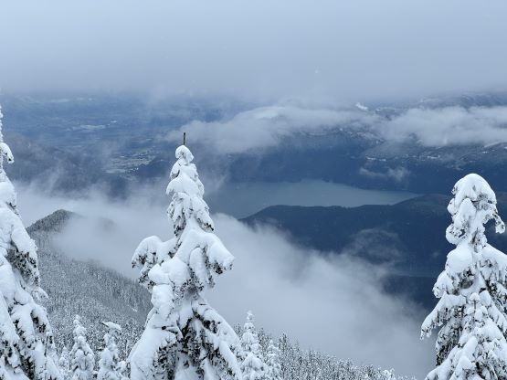
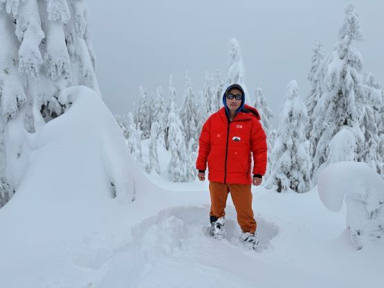
After about 3 hours into the trip we finally decided to take a short break, and then we emerged onto the cut-block at the 1300 m zone. The road does an annoying large switchback in this area so we again, went straight up the cut-block to reduce the amount of post-holing. The going had become very steep underneath the upper switchback, but with the 30′ snowshoes it was still manageable. By the time we finally rejoined the uppermost switchback we were only about 1 km from the road’s end, so we easily plodded northwards with our objective finally in sight. To connect to the proper south ridge of Lookout Peak we had to deal with about 50 m elevation loss, and then more post-holing and bushwhacking in annoying undulating terrain. We had slowed down the pace by now, as it’s clear that we would be able to make the summit and still get Seb back home in time for the pizza party. The weather was unfortunately not very cooperating, that we got treated with fog and periods of snow instead of the supposed magnificent views of Harrison Lake. The true summit was forested nevertheless, and we did wait for about 20 minutes but eventually gave up as there’s minimal sign of improvement in the weather.


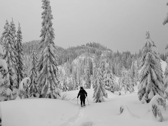


There’s not much worth noting about the descent as the heavier the ascent was, the easier the descent would be. All we needed was to follow the existing tracks and in steeper areas we could even “snowshoe-ski” down the deep powder. Since I do not ski I had developed a bunch of “techniques” to somehow enjoy snowshoeing down the otherwise, perfect ski terrain. While traversing back across that uppermost FSR we met another group-of-4 coming up, which was very surprising given the weather and the conditions. They turned out to be also from the SWBC Peakbaggers group. The weather did show some brief signs of improvement in the next hour so I hoped they got at least some views that we had missed. The weather then turned to a consistent snow/rain shower for the final hour of plodding back to the truck. Our round trip time was just under 8.5 hours, which was actually not too bad considering the lower starting spot and the heinous conditions. It was raining most of the way back home.