Mount Forbes
May 30 – June 2, 2015
3612m
Lyell / Mons Icefields, AB
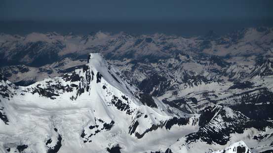
The mighty Mt. Forbes is the 8th highest peak in the Canadian Rockies and the highest entirely in Banff National Park. It’s so recognizable from pretty much every good vantage point in the Central Rockies that taking a picture of this white tooth (the N. Face), or the pyramid shaped rock face (the E. Face) sticking out of a sea of peaks has become an obligatory. In many ways it’s similar to Mt. Assiniboine. For example, the official heights of the two are only different by 6 meters; they are both horn-shaped and both tower above the adjacent peaks by a good 500 meters; they’re not the roadside classics for tourists taking pictures but among the most prominent peaks in the Rockies; and they’re both technically straightforward in the right conditions, but takes a long day to approach. The biggest difference is that one is a rock climb and the other is mostly snow/ice.
After successfully bagging a series of Rockies’ snow climbing giants – Mt. Columbia, Mt. Fraser, Howse Peak, The 4 Twins, Mt. Bryce in 5 weekends in a roll, Ben and I took the following weekend easier by doing a short, but demanding rock climb, and then the condition was back in favour of mountaineering. The next big one on our “loosely followed summer schedule” would be Mt. Forbes so that’s it. Apparently Sunday and Monday would be our only weather window but by approaching from Alberta side (the Glacier Lake trail) we could have done the approach and return in rainy days (Saturday and Tuesday). Having two days to climb Forbes would also allow us a shot at the much-lower, but still impressive Mons Peak nearby. This turned out to be a perfect plan.
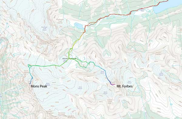
Ascent routes for Mount Forbes and Mons Peak. GPX DL
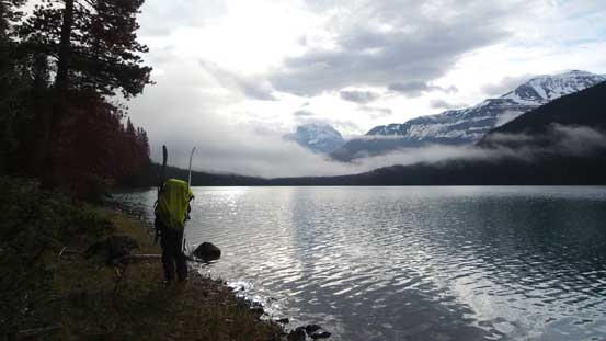
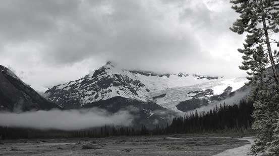
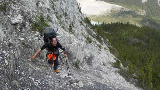
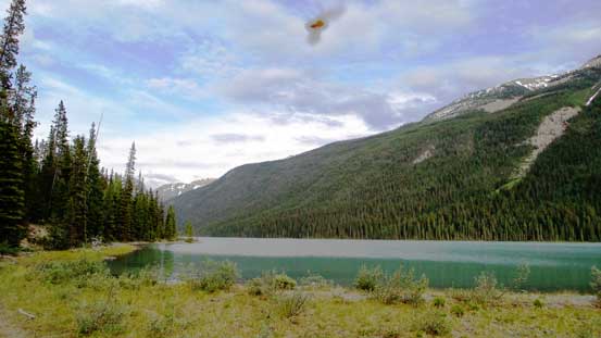
The approach via Glacier Lake is described as a 25-kilometer “death march” with some miserable bushwhacking, some ugly scrambling and a painful river crossing by many parties. Having to haul skis and snowshoes on top of that we gave it a full respect so started our trek at 5 am from the parking lot. The first 9 km to Glacier Lake was mundane and boring like hell and apart from that, the theme was the up-and-downs… There’s even a huge bump to go up and over that I think involved at least 200 m of unnecessary height gain/loss if not 300 m… I don’t know why they built the trail this way rather than following closely to Glacier River, but oh well. The weather was unsettled as expected and there was a thick layer of fog when we arrived at the Lake, and soon enough it started to rain.
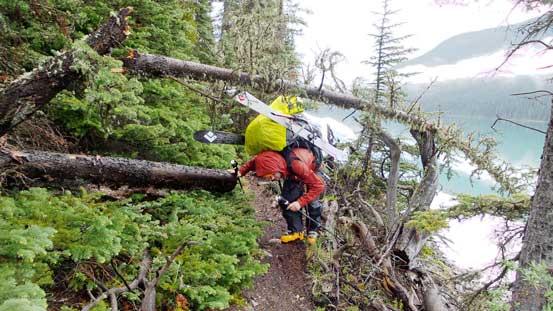
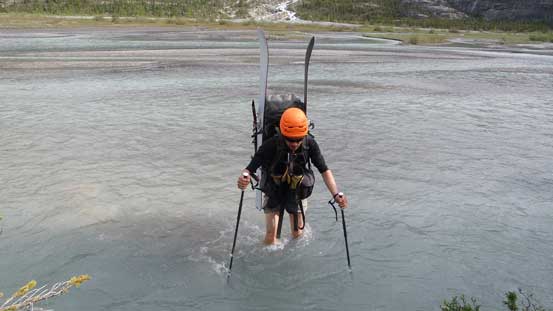
It took us roughly 1 hour to contour around this lake (it’s much bigger than Lake Louise by comparison) and the trail was in a surprisingly good shape. On the other side the trail was still reasonable to follow but soon enough it entered the bush on the right side and we had to deal with a lot of deadfalls. There was a narrow, but deep river channel immediately to our left that we crossed on a good log bridge and after that the trail disappeared into a swamp section. We adjusted our bearing aiming more-or-less towards the river and after crossing a few small streams we regained the trail. Despite the fact Raff’s group forded the river here and Bill Corbett also suggested this in his The 11,000ers book, the river did not look easy to us and the trail was in a better shape than we’d expect, so we decided to keep following the trail and see. In the next 2 hours or so we managed to loosely follow this trail (some sections had fresh maintenance evidences) all the way to the end of Glacier River Valley where a small glacial lake located. The river looked much better here at a braided section and the deepest channel (the first one) was only a little higher than knee deep. Shortly after we were on the other side where the real grind would begin.
Partway across Glacier Lake, looking back
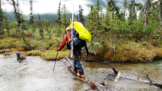
Doing this with skis on your pack is painful…
Almost bashed to the opposite side of Glacier Lake
The mighty Glacier River didn’t look so friendly to ford
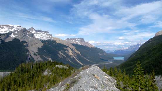
Looking deeply into the valley towards Division Mountain
Logs helped a big time negotiating this marshy section

Me crossing a log bridge. Photo by Ben
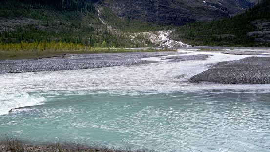
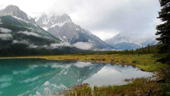
Cool colours showing the Mons drainage meeting the Lyell drainage
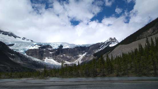
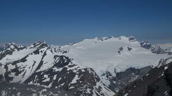
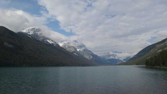
The South-East Lyell Glacier. We were at the end of this valley now
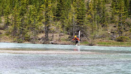
Ben crossing the first channel – the deepest one

The rest of the channels were shallow and easy
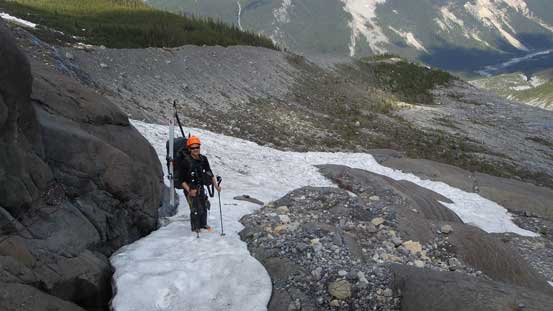
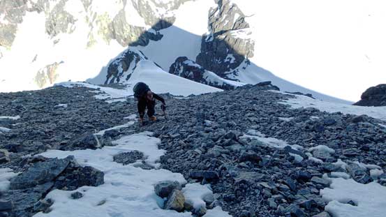
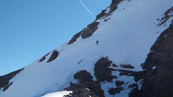
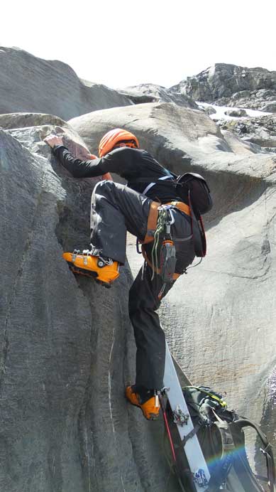
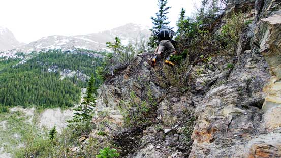
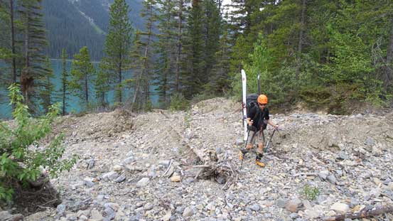
After scrambling up a series of rock bands on climber’s right side we joined the supposed climber’s trail. The trail was surprisingly easy to follow, though there’s still some bushwhacking to deal with as it’s quite overgrown. The bushy trail yielded to some indistinct sections on down-sloping scree slopes higher up. Some zig-zagging with bit of guess work we managed to follow the trail more-or-less and hit the moraine crest, and looking ahead it’s the infamous Mons Headwall. There’re two routes through the headwall. The direct scrambling option involves some 5th class rocks but is reported to be more fun than the climber’s right option which goes up ugly bush and exposed scree and some “awkwardly placed” boulders. We chose to scramble up the headwall and I have to say we underestimated the challenge. The first half was a pleasant step-kicking up a snow slope but the second half involved a maze of wet slabs which was nearly impossible on ski boots/rigid mountaineering boots. With some dedicated tip-toeing on the slabs (even using knees to gain a tiny bit of friction) we managed to overcome the first 5th class section and found a rappel anchor (which was a huge relief as we wouldn’t want to down-climb what we just went up).. Then following some indistinct cairns we kept traversing and zig-zagging, then pulled up two steps of 5th class bouldery challenge which we had to remove our backpacks (and haul them up separately), before eventually completely getting lost. We were too far up on climber’s right but after a few more tricky rock steps and a few sketchy traverses on steep and very exposed snow we eventually cleared this mess, with the view of Mons Icefield finally in front of us, though we also realized there’s more awkward terrain as well as 50-100 vertical meters’ elevation loss to get there.
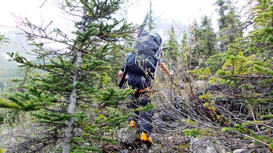
Bushwhacking on a trail…
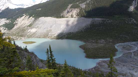
This glacial lake at the end of Glacier Lake Valley is quite pretty

Looking back on the long valley we just bashed across

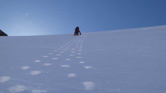
Grinding our way steeply up
And, negotiating some awkward scree

Now, onto the moraine crest, looking ahead towards the headwall. It did not look easy
Ascending snow initially

Snow significantly eliminated our work on the lower half
But now what… We had no choice but climbing the slabs.
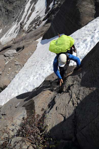
Me negotiating the first tricky section. Rigid boots only made it harder.
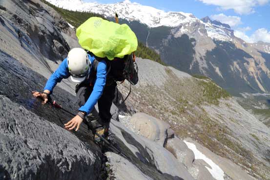
Me climbing the most exposed part. Note the wetness…

Pulling up the first bouldary step.

Finally being able to see our objective in the far distance…
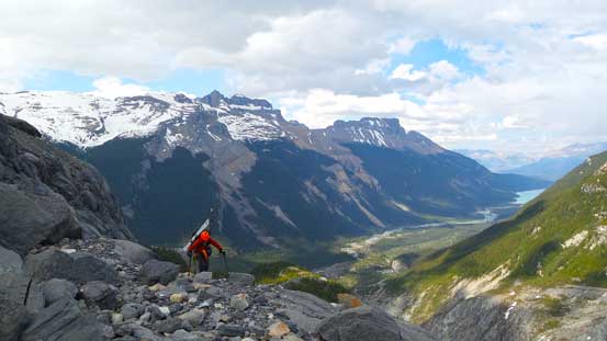
Ben cresting the highest point on our approach day.
Slowly dropping down towards Mons Glacier
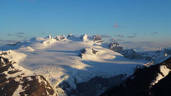
We were both completely beat at this point so after rehydrating at one of the beautiful tarns/lakes we decided to set up camp soon, at the toe of Mons Glacier. We pushed to the farthest rock island before dropping out packs. Mountaineers aiming for Mt. Forbes only should keep pushing for another 1-1.5 hours to the toe of Forbes’ North Glacier but for us the low camp by Mons Glacier was ideal as we were also going to climb Mons Peak. The sunset views were somehow obscured by the clouds so we went to bed early.

Lots of prime bivy spots though. Click to view large size.
It rained us overnight and the next morning we woke up at 2:30 am hoping for an attempt on Forbes but unfortunately the weather was still soaking in with low clouds everywhere. The air temperature was also ridiculously high (at least 10 degrees higher than the forecasted) so there’s no freeze at all. Since we had two days of climbing we decided to sleep in and ascend Mons Peak on this day. The trip up Mons Peak is written in a separate trip report. Ironically the summit pyramid on Mons Peak is steeper than anything we have done on Forbes, but oh well. In the evening the weather finally cleared up which aligned nicely with the newest weather forecast, so our mood was high.
Evening colours on Mons Peak after our successful ascent of it
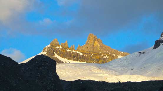
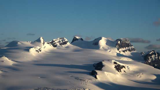
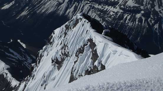
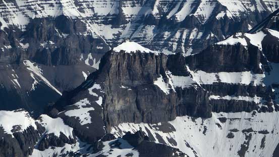
This pinnacle on Mt. Forbes is very impressive. Not sure if it’s been climbed
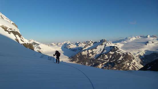
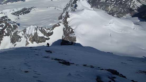
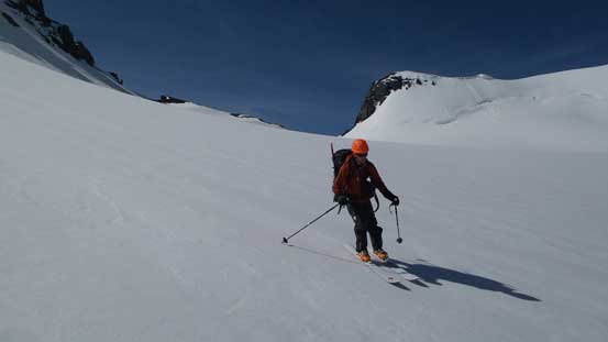
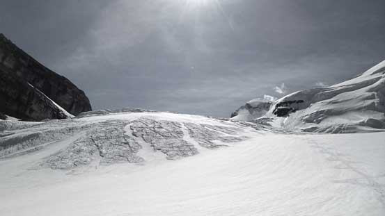
The weather was also calling for very warm temperature (19 degrees in the afternoon) so we woke up at 2 am to beat the sun. It was a bit slow going but by 3:30 am we were already on our way up a series of moraine ribs/steps towards North Glacier. This entire section was not difficult, but a whole lot longer than expected. We ended up spending more than 1 hour in the dark negotiating this ugly section and also got too far up on climber’s right side so missed the opportunity to access the glacial toe. Thankfully our route also worked out by joining the glacier about 100 vertical meters higher up. We crampon’d across/up a section of ice before switching gears to snowshoes/skis on the firn line. The heavily crevassed middle section did not look very friendly but as we got closer we managed to stay entirely on snow weaving around the crevasses and seracs. There were some huge sags but the bridges were all very strong, and soon enough we were on the way crossing the upper glacier, aiming at the distant bergschrund.
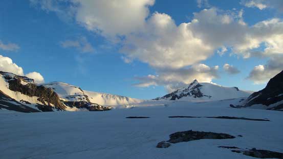
Mons Peak just before alpenglow. Apparently it’s gonna be a gorgeous morning!!
Alpenglow on Mt. Rosita – a sub-peak of Mt. Forbes

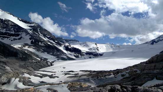
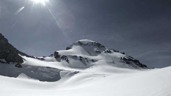
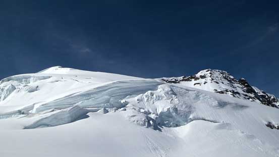
Looking ahead our route through this glacier

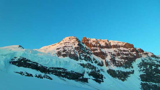
Alpenglow on Mons Peak – what a sexy peak!!

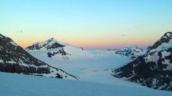
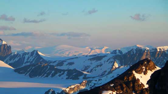
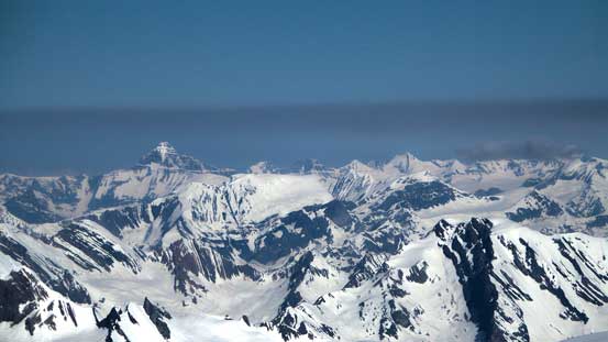
Alpenglow on the Lyells.

Another picture showing alpenglow on Mons Peak and Mons Icefield
Now, it’s time for the Golden Glow

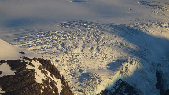
Uhh the crevasse field…

It wasn’t hard to find a way though, but a month later, mmm, I’m not so sure…
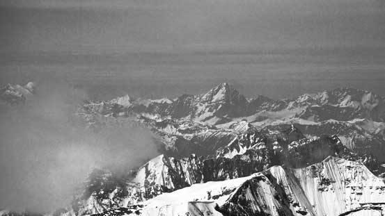
Another look at the Lyells
The fat mountain – Snow Dome showed up
From L to R: Lyell 5 to 1 (Christian, Walter, Ernest, Edward, Rudolph)
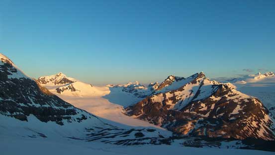
Icefalls on the Lyell Icefield
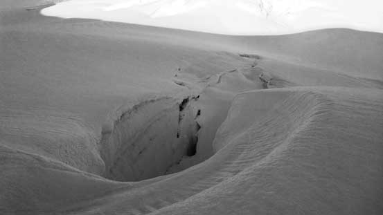
Another huge crevasse that we crossed on a solid snow bridge
High up on the North Glacier now
Looking ahead to the face
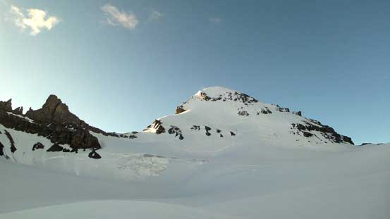
The bergschrund was very visible with huge sags and gaps but after some careful examination we decided to just ascend straight up through the most bridged part. We kept the ropes on for the rest of the face climb just for this reason. Thankfully the bridge was strong so we managed to cross easily, and then we were front-pointing up the 35-40 degree slope. Having already climbed Lefroy and Bryce this one did not impose any problem on us (of course we got the perfect conditions). There was even a flatter bench about halfway up that we managed to get by with just “French technique” for a long while. Near cresting the W. Ridge terrain became steeper again (still, no steep than 40 degrees), but this part was perfect for step-kicking so went by fast.

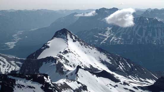
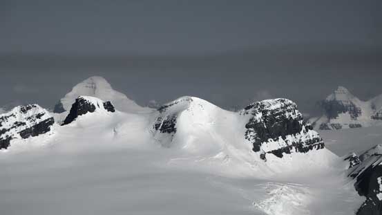
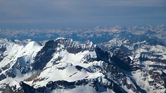
Mt. Rosita is usually served as a back-up plan in case snow condition isn’t good
Morning colours over the Eastern horizon.

Ben ascending the typical terrain on this face

Higher up on the face, the views are opening up!!
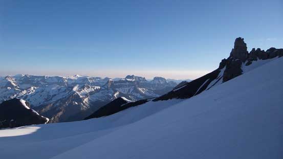
The west ridge was a lot less steep but did involve a short tricky section. I have seen trip reports indicating people attacking the rock step directly (and rappelling on the way down), but once getting closer we found a nice continuous snow gully just to the climber’s left side. After ditching rope and harness we went for it. The gully was very steep but still much better than the rotten rock. The rest of the ascent was a bit foreshortening but was uneventful except for being cautious about the cornices hanging on the right side. The summit has one of the best panoramas the Canadian Rockies offer and I’m super glad we didn’t summit it in a white-out like many groups did…
A section of loose scree to ascend on the W. Ridge

The snow gully bypassing the rock band was filled in
High up on the west ridge
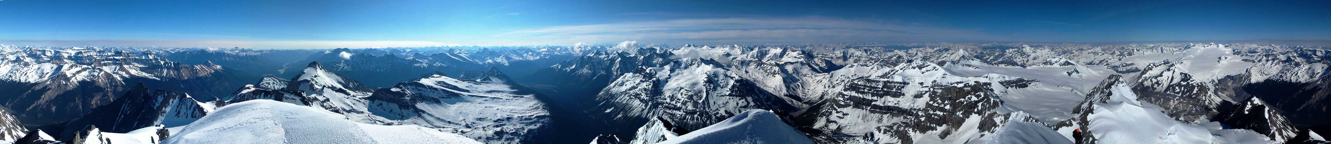
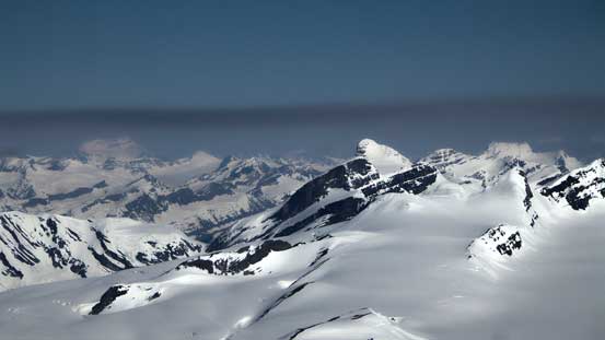
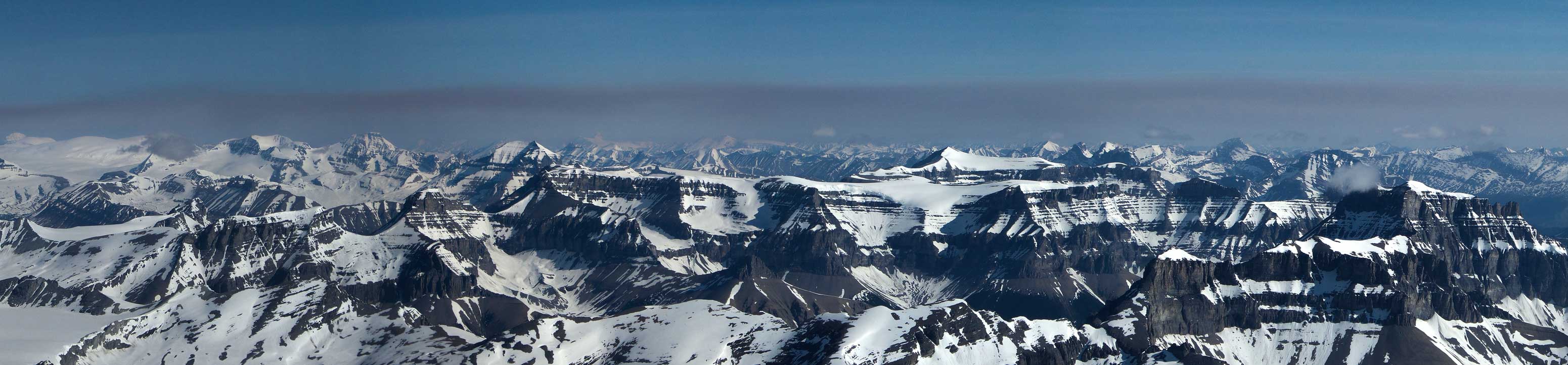
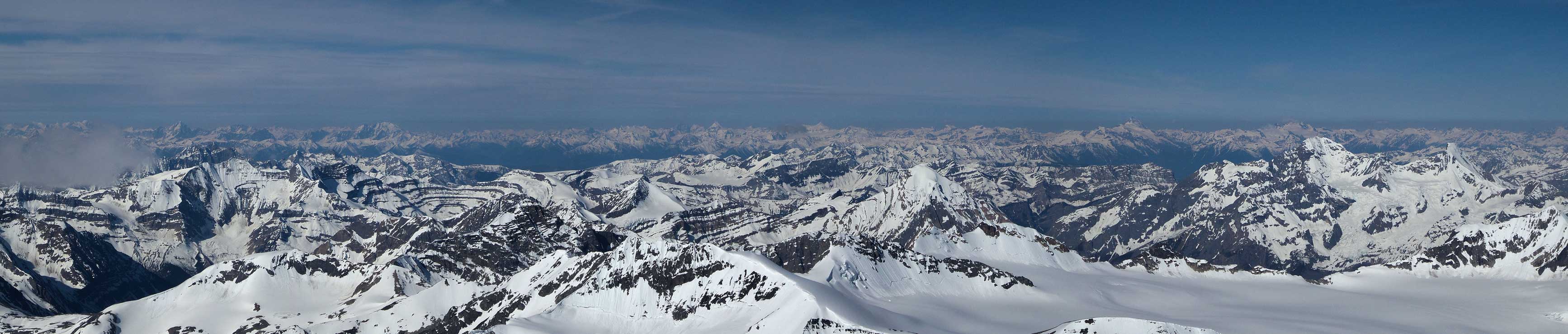
Summit Panorama from Mt. Forbes. Click to view large size.
Mt. Outram looks tiny from here…
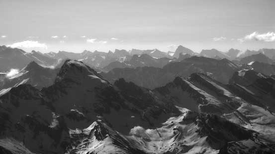
Howse Peak in the foreground also looks tiny…
All the familiar peaks on the Wapta Icefield are way below us now…
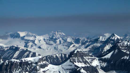
Mt. Cline in the distance with Mt. Wilson in the foreground.
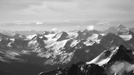
Looking down on the Freshfield Icefield

Conway Group on the Freshfields

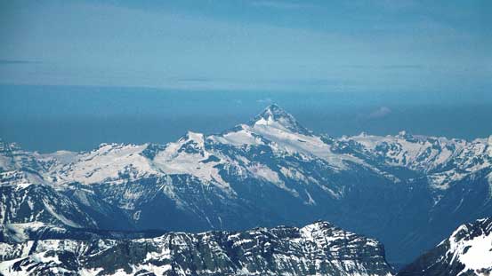
Mt. Mummery – another Rockies giant now way below us
Impressive snow formation on Forbes’ SW Ridge – the route of the first ascent party took…
The Rogers Pass classic – Mt. Sir Donald which we bagged last year.

Another Selkirk’s giant – Mt. Rogers which we also bagged last year
The pointy peak is Iconoclast Mountain
The huge bulk of Mt. Sir Sandford – highest in the Selkirks

The Adament Group rises behind the summit of Rostrum Peak
The super-sexy Icefall Peak is part of Bush Mountain
Tsar Mountain in the distance, looming above Pawn Peak in the Chess Group
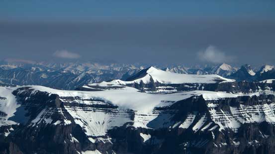
Mt. Columbia looming above Lyell III, Lyell II and Lyell I
Castleguard Mountain looks tiny comparing with The Twins…
Many 11,000ers visible – Clemenceau, Alexandra, Bryce (Main and Center), King Edward, Lyell V
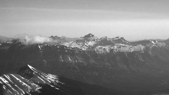
We had great memories from Andromeda and Athabasca. On the far right is Mt. Saskatchewan
Mt. Amery is another one we’d wish to climb. The summit looks fairly flat…
This is the seldom visited Bush Pass. Nivernille Col is also visible if you know what I’m talking about…
Sulliwan Peak is basically just a low point on Mt. Erasmus massive
Mt. Dent on the Barnard Dent Group

Mt. Freshfield the queen of the Freshfield Icefield
In this panorama shot you can see the long ridge traverse from Amery to Hooge/Monchy. On far right is Erasmus
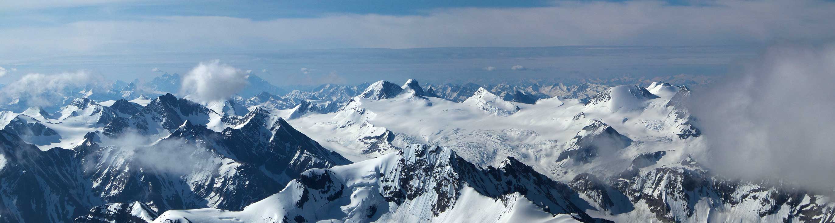
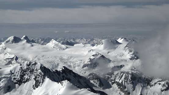
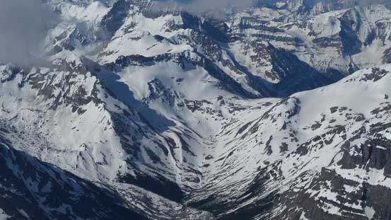
Panorama of the Freshfield Icefield
Panorama of a sea of peaks in BC Rockies. In the foreground are Alan Campbell, Arras and Rostrum and Icefall
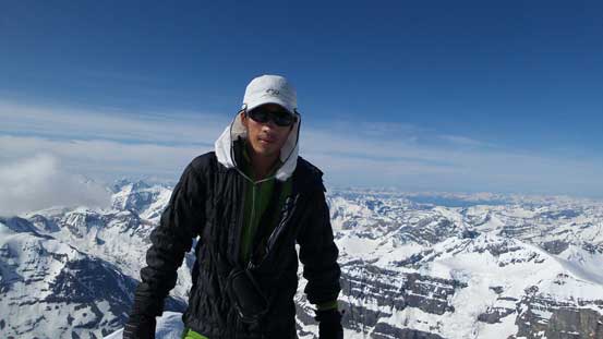
Me on the summit of Mt. Forbes – my 28th 11,000er!!
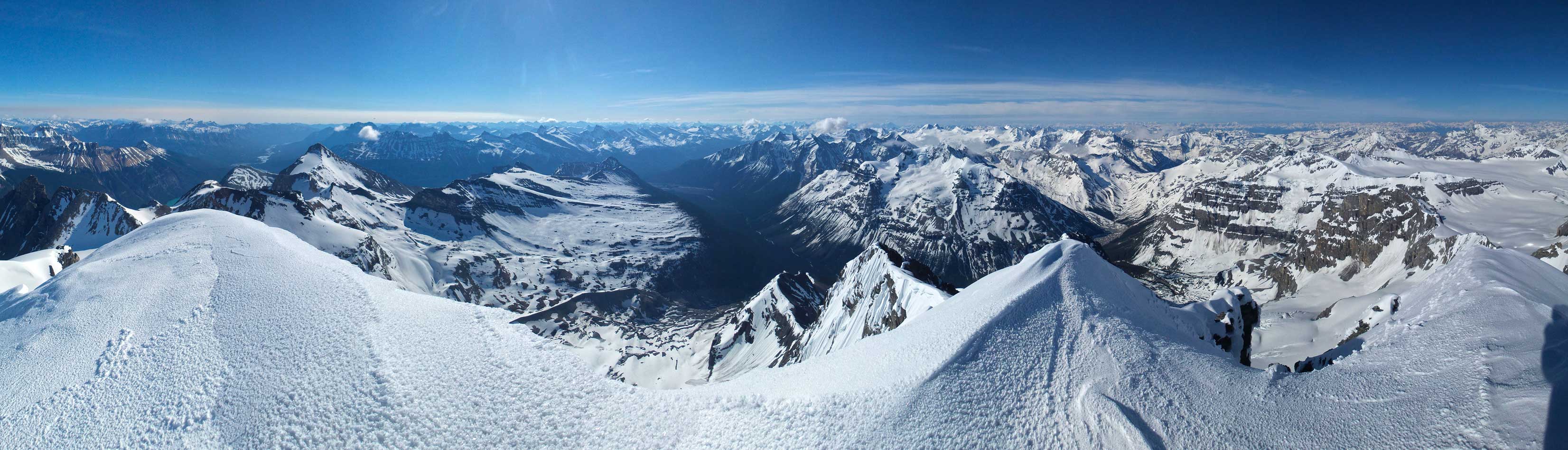
Another panorama from the summit. Click to view large size.
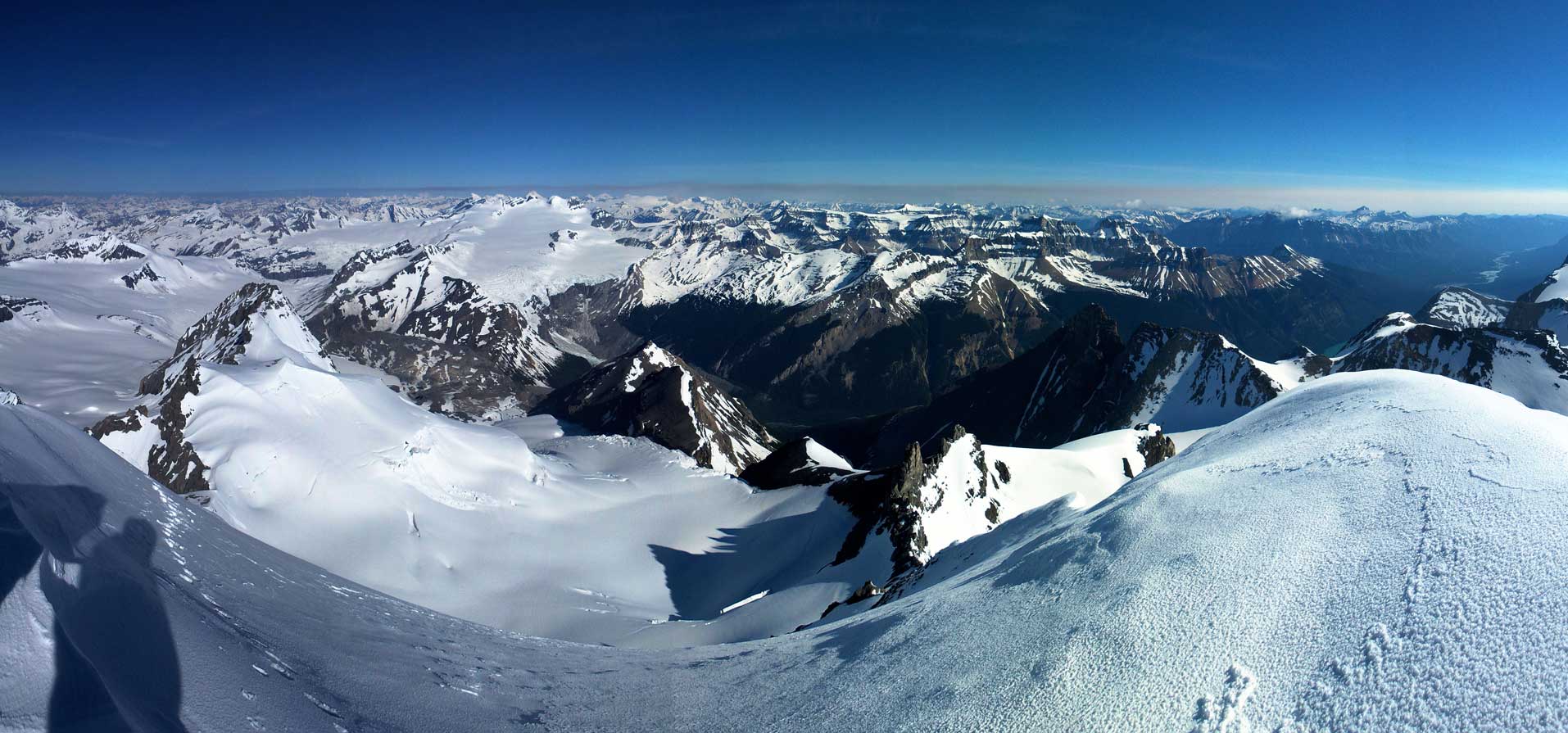
One more panorama. Click to view large size.
The descent required some caution but still, much easier than Bryce or Lefroy. We managed to descend facing outwards for the entire West Ridge except for the snow gully, and for the NW Face except for the two steeper rolls we also managed to descend facing outwards… We were hoping to beat the sun but looked like the sun was going to beat us by about half an hour, but still there’s no big deal as the snow condition was great. And now came the skiing and snowshoeing part. Apparently Ben got lucky as the sun was just turning the surface snow into corn, but my knees would hurt as the snowpack was still solid hard (which meant no gliding so every step down would be on my knees). Down through that crevasse field on snowshoes solo with the sun beating down the slopes felt a bit freaky but went by quickly. The rest of the return back to camp was painful though. We picked a different route trying to stay on snow for as much as possible but ended up having to remove skis/snowshoes multiple times, and also had to deal with isothermal snow post-holing, especially for me being on snowshoes.

Ben descending the west ridge

And, dropping into the snow bypassing gully

Ben finishing down-climbing the gully

And now, dropping down the NW Face
Perfect step-kicking!

I went for a side vantage point for some pictures
See? We could walk down facing outwards…

Almost down to the bergschrund, the sun finally hit us

Lots of Type 1 fun
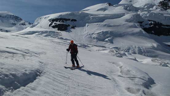
Ben enjoying the skiing on perfect corn snow
Looking back towards our mighty objective
A huge crevasse…
One last look at the Lyells
Impressive serac scenery
Back through the crevasse field…

Crevasses and seracs on Forbes North Glacier
Looking back on North Glacier

Not the most pleasant terrain to descend

Down to Mons Glacier now…
Our round trip time was 8.5 hours from the low camp which was not too bad. We took a short 1-hour break before slowly breaking camp. Given the 10-20 mm of rain on Tuesday’s forecast our goal was to knock off as much distance as possible on Monday. On the way down that maze of headwall we stayed on the low route following indistinct cairns and managed not to get off-route anymore. For the two bouldery steps we had to remove our backpacks to down-climb, and for the crux pitch we did a 15-meter rappel, and then we were back on the snow slope which led easily down. Some ugly side-hilling (we didn’t want to reascend to the moraine crest) brought us back on trail, and the rest of the descent down to Glacier River flats was not the most pretty, but at least didn’t take us too long.
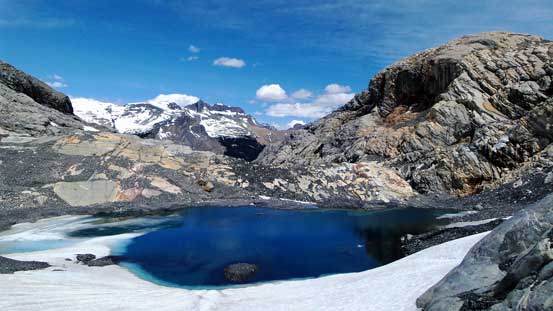
A beautiful tarn at the toe of Mons Glacier

This waterfall comes down from North Glacier

Time to negotiate the headwall…
Down-climbing the upper bouldary step…
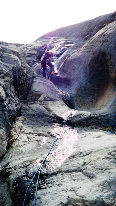
Rappelling the crux. No way to down-climb given the wetness and the ski boots…
Walking down the moraine crest. Glacier Lake will be our Day 3’s destination
Not the most pleasant trail to descend…
Re-crossing the river was not a big deal and soon were back on the trail. My feet was giving me big problems on this trip but thankfully there’s no functional issue and I managed to (sort of) maintain a fast pace. Knowing roughly where to go this time there’s little to describe other than some extreme patience. Oh by the way, the mosquitoes were out on full force… It was brutal but thankfully I didn’t forget to bring my bug spray… We made all the way back to the west end of Glacier Lake before calling a quit. Had my feet doing OK we could have finish off the death march on Day 3 but by making all the way back to the lake we had already avoided bushwhacking in rain anyway. It was almost midnight when I eventually fell asleep (so a total awaken time of 22 hours on this day), and 6 hours later I’d be up again.
Re-crossing Glacier River
Typical scenery on the long slog back

Slogging, slogging, slogging…

More slogging…

Time for the marshy section
And, we made to the Lake…
The weather on Tuesday was much better than expected. Well, we’d only need 3 hours to get out anyway, but it never did rain on us. The sky was overcast which was actually good since it’s apparently a hot day. Other than the mosquitoes it was a perfect day for hiking out. Re-ascending the big hill was frustrating like hell but once topping out on the crest we were awarded with a super fast descent all the way back to Howse River.
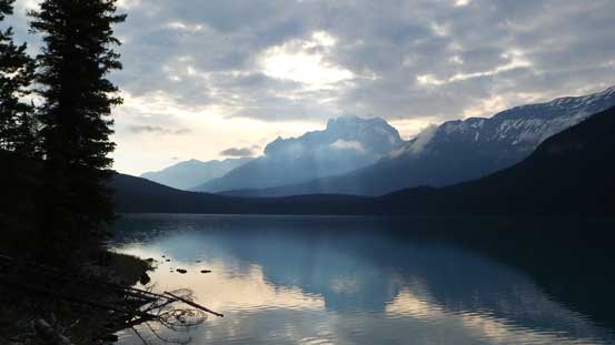
A view from Glacier Lake on Tuesday morning
Continuing the slog back
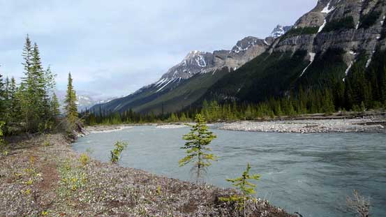
Glacier River view from the campground on its East end
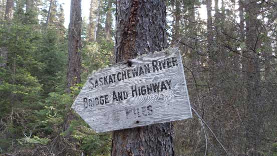
Sign on the trail
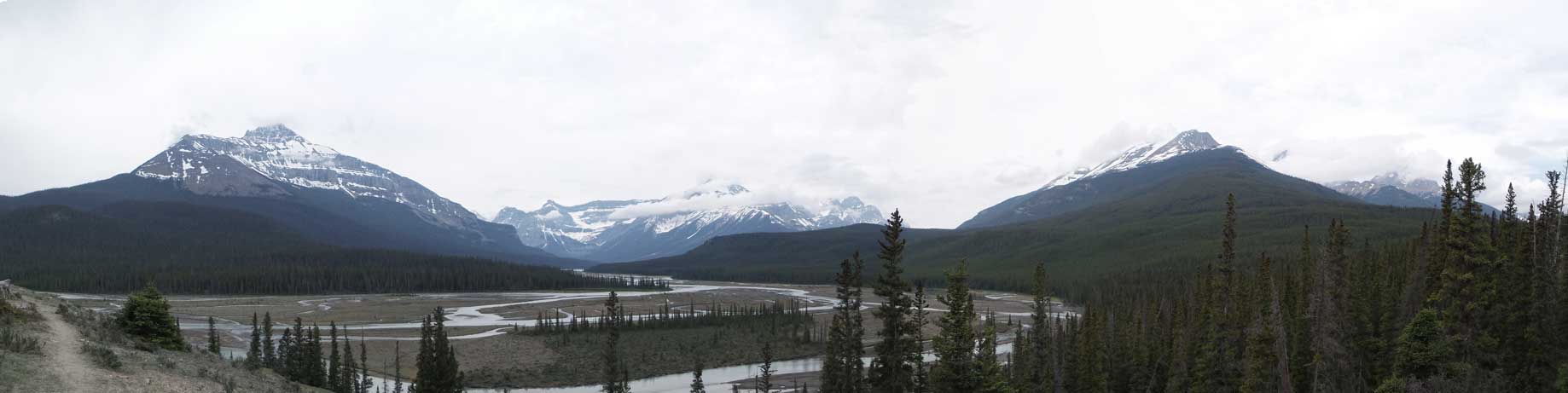
Due to the overcast sky, there wasn’t much to see from this Howse River viewpoint

Back across the bridge

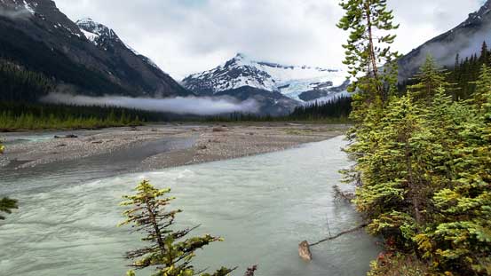
Now, this is a mighty river…
Overall this was a very successful trip bagging the highest peak in Banff Park (and still getting awesome views), as well as being able to finish both objectives and still managed to finish the trip half a day ahead of schedule. Can’t ask for better. Given the forecast I think we stole a big trip out. On the other hand, I did not enjoy this approach though so when I come back for the Lyells I’ll go in via the BC side from Icefall Brook.

[…] Steven Song […]
[…] shorter, have spectacular views and was entirely self-supported. The Glacier Lake approach route never sounded that attractive to me, with talk of route finding, bushwhacking, steep and loose scree and days spent just on […]
no need to climb the head wall..once moraine crest is over, walk up to the right, to end if the “tree zone”. There is a walk able trail traversing to the Mons glacier above the trees. It is not easy to find but it is there. We have done it twice.
no need to climb the head wall..once moraine crest is over, walk up to the right, to end if the “tree zone”. There is a walk able trail traversing to the Mons glacier above the trees. It is not easy to find but it is there. We have done it twice.
Yep you are right. Climber’s right bypass. Too bad the beta back in 2015 wasn’t as detailed as nowadays.
Randomly came across this but the fact that one of you (Ben?) walked this entire thing in ski boots is absolutely insane to me.