Welch Peak
August 18, 2020
2431m
Chilliwack, BC
Welch Peak is the highest in Cheam Range and is very iconic and well-known. The routes are well documented in Matt Gunn’s Scrambles in SW British Columbia as well as on other online sources. There are generally only two routes that make sense – the south ridge and the E/SE Ridge and both involve some long period of exposed class 3 scrambling. The rock quality on this peak is varied. It’s composed of mostly choss, but on steeper sections the rock quality is actually not too bad. The access of Welch Peak is via Williamson Lake trail, which itself is accessed by some very steep and rough logging roads that require a decent 4×4 and high clearance vehicle. I drove to the trail-head in my Tacoma with all terrain tires. A stock truck is probably not good enough for the task.
Throughout the summer Winnie M. and I had been talking about peaks and climbs and we did manage to get out together on some trips including Mt. Judge Howay and Ashlu/Porterhouse/Amicus combo, but this was the first time that we got out in just two of us. Winnie is capable rock climber but needed to gain experience in mountaineering. I figured a combo of Welch Peak and Foley Peak with a camp at Williamson Lake would make a good introductory to choss. These peaks would be “scrambling only” but she needed to progress gradually. From my perspective this was only 1 day after my Whitecap Group’s ascents so I wanted something not stressful nor physically demanding. On Tuesday morning I picked her up from Vancouver and in an hour and half we had made to the start of the logging road in Chilliwack River Valley. The driving direction was pretty clear with the GPS technology nowadays. Once past the Chipmunk FSR’s turn-off the road had become heavily pot-holed and the going was extremely slow. My friends Duffy and Gurbaz had given us some recent updates on the road that “if I made past 600 m elevation I could probably go all the way to the trail-head”. I drove past the “slanted crux” where a couple kids rolled their ATV and died earlier in this year without a problem and then carefully negotiated the “gigantic water bar” at the end of Foley Lake. I was surprised that my truck could handle this water bar without bottoming out. Beyond that the road was very narrow and rough but did not involve any major “crux” such that with some careful crawling I did manage to make the trail-head. I was sure that my truck was not particularly happy about this decision but I also didn’t feel like pushing it too hard neither.
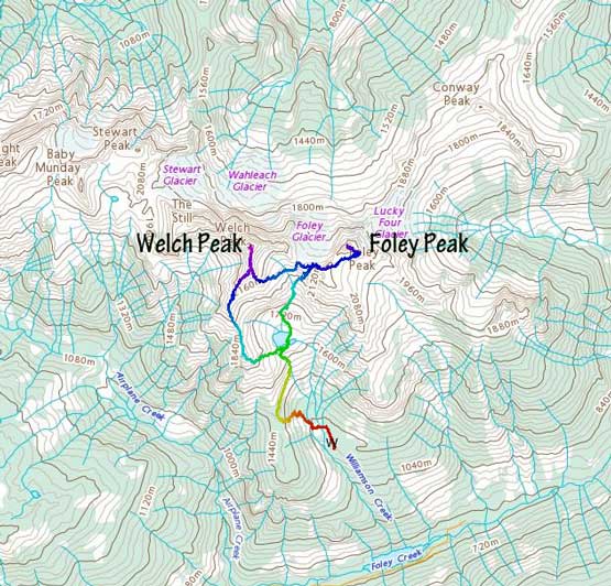
Welch Peak and Foley Peak scramble routes. GPX DL
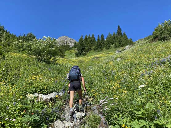
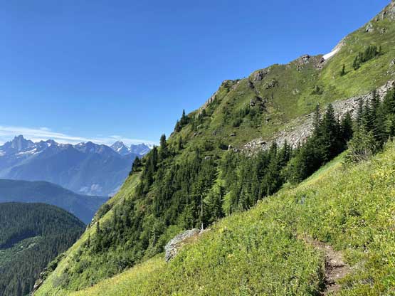
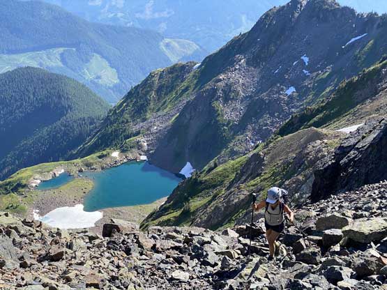
I had anticipated having to walk at least an hour on the road and now with that time shaved off we were on a much more relaxed schedule. We took our time on the steep approach hike towards Williamson Lake. The trail started by following the deactivated logging roads but soon entered the forest and the grade picked up immediately. A while later we came to some grassy slopes and avalanche paths that the terrain felt more WA Cascades than BC Coast. The trail was not the easiest by hiking standard. It actually involved a couple scrambling moves as well as some steep and slippery traversing stretches, but in terms of navigation the trail was easy to follow. It didn’t take us long to reach Williamson Lake. Again, since we were doing great on time we decided to pitch out the tent before going for the scrambles. We also took our time filtering water.
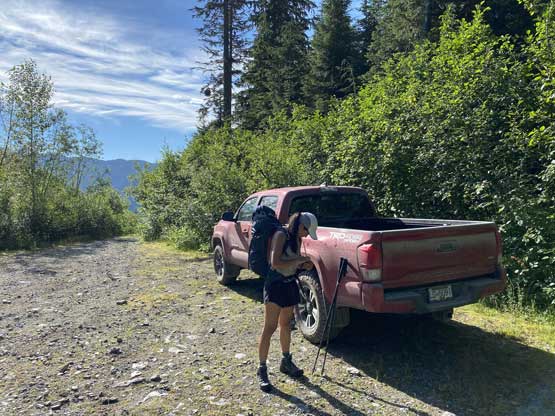
Winnie and the trusty Taco at the trail-head
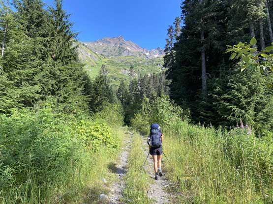
Winnie starting the hike
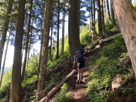
Entering the forest for a while
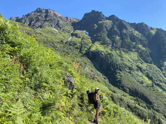
Coming out of the forest onto this gigantic avalanche path
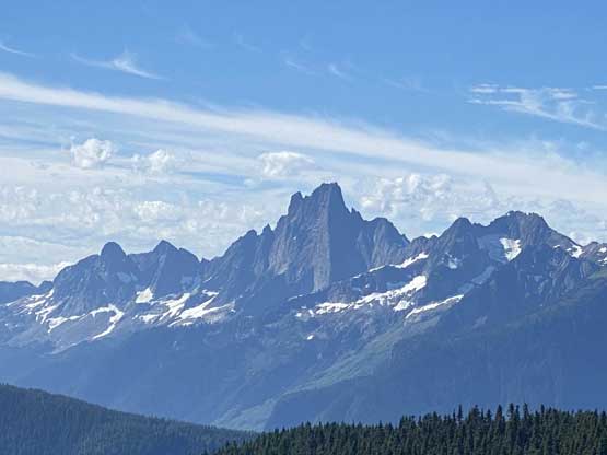
The NE Buttress of Slesse Mountain displaced behind
The trail was steep and loose
Gaining the crest of a ridge just before Williamson Lake
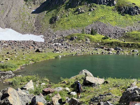
Winnie dropping down to Williamson Lake
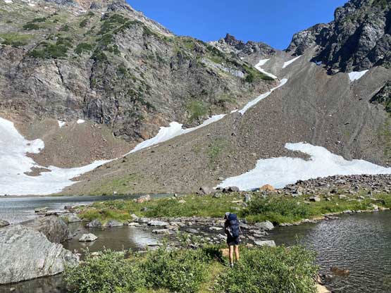
Scoping out the best place to pitch our tent.
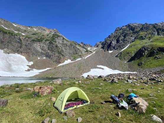
We had the whole place to ourselves for two days!
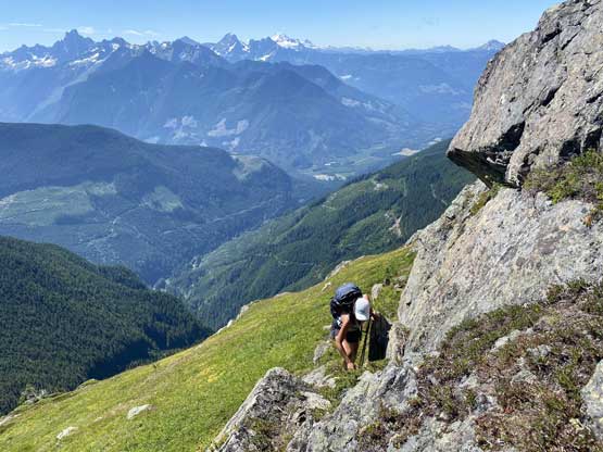
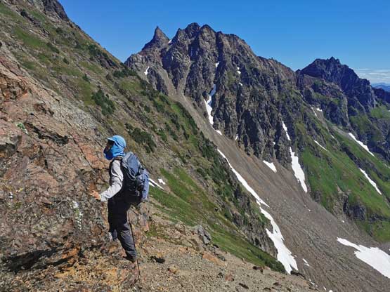
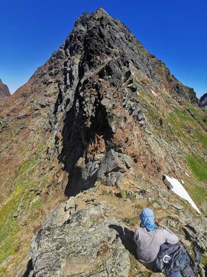
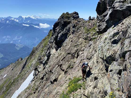
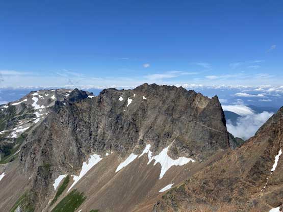
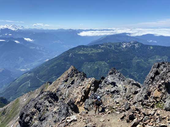
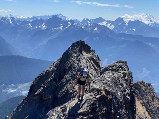
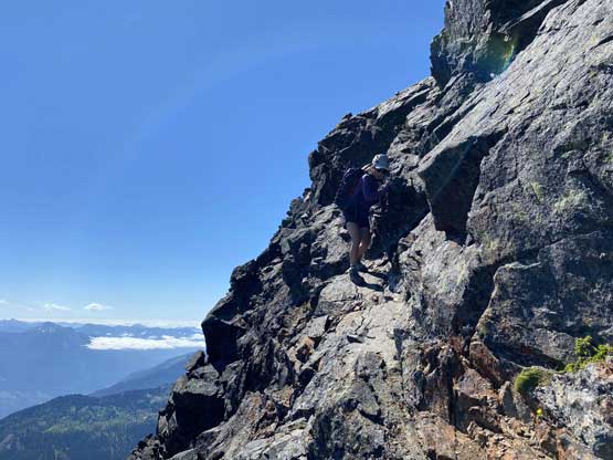
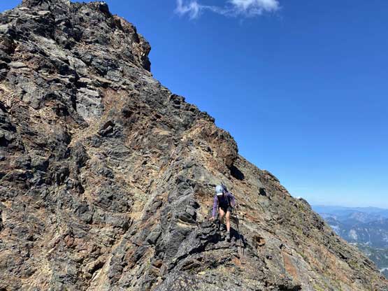
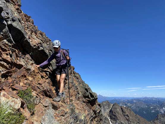
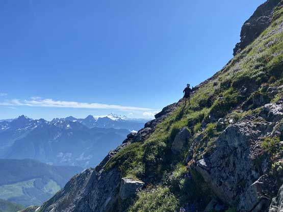
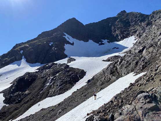
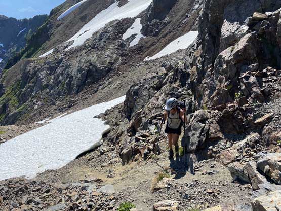
The plan was to ascend Welch Peak via the full south ridge and make the next decision on the summit. We did not know how this day would turn out and we had little idea how fast could we move on the terrain. The initial grunt onto Welch Peak’s south ridge was not particularly fun thank to the steep grass and the heat. We merged into a gully feature near the ridge on purposely seeking additional challenges. We could have stayed climber’s left but wanted to do a bit more hands-on scrambling. The lower stretch of the south ridge was mostly class 2 with occasional class 3 steps and was easy going in general. After a while the ridge flattened out with actually a few steps of down-climbing, and then steepened again up the right hand side of a triangular face. This stretch was again, generally easy going with minimal exposure. The “real game” began as we faced an imposing tower that the direct attack appeared definitely 5th class so we were forced to descend/traverse out climber’s right seeking bypass options. There were some tricky moves as well as lots of loose rocks, but the exposure and scrambling was not sustained and in short time we were back onto the ridge crest.

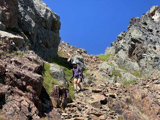
Winnie scrambling up a variation gully to gain the lower south ridge
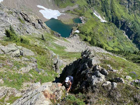
Exiting the variation gully onto the south ridge
The scrambling started on the lowest section of the south ridge.
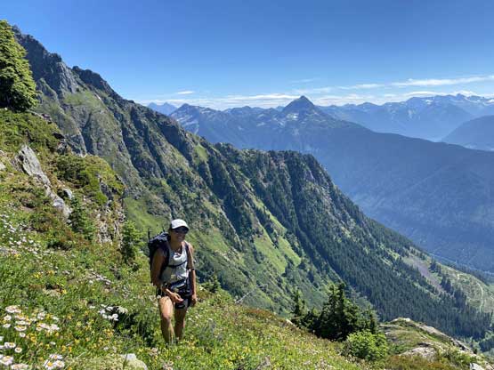
Winnie enjoying the experience
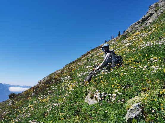
Me laying out on a flower field… Photo by Winnie M.
I tried pretty hard to take these photos..
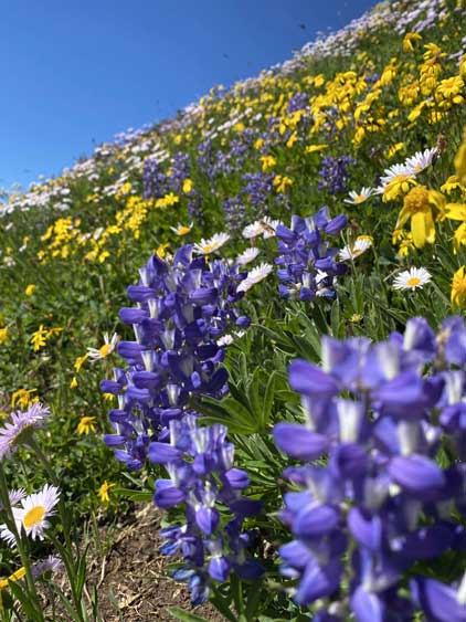
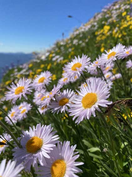
Not sure about the names of these flowers
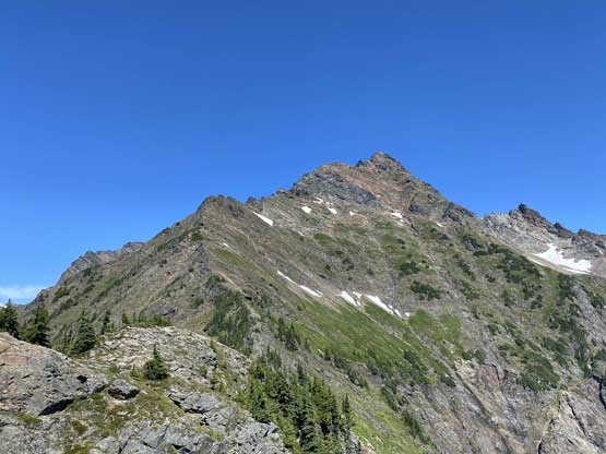
The south ridge of Welch Peak ahead
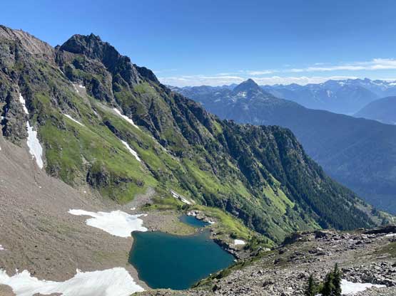
Looking back down at Williamson Lake
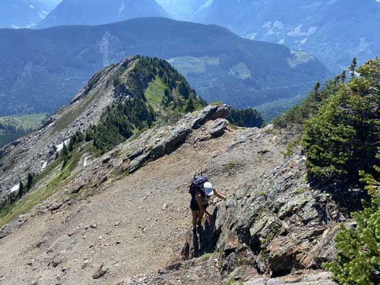
Winnie scrambling up another short step
Me scoping out the route. Photo by Winnie M.
Me taking a break in front of an imposing rock tower
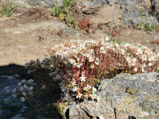
More flower photos. Photo by Winnie M.
Winnie scrambling up the chossy bypass to avoid that tower
Some side-hilling and some traversing
After a while we were back onto the ridge crest
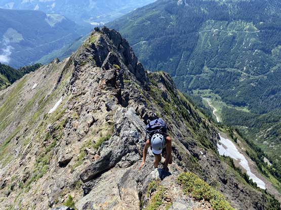
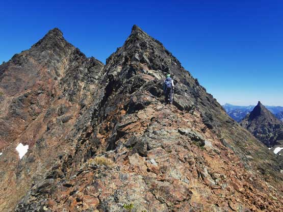
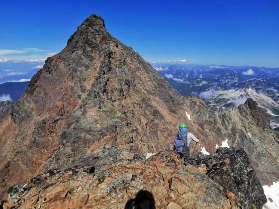
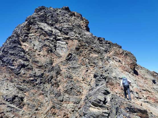
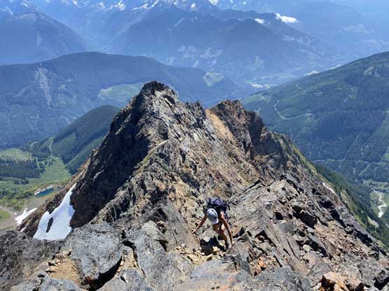
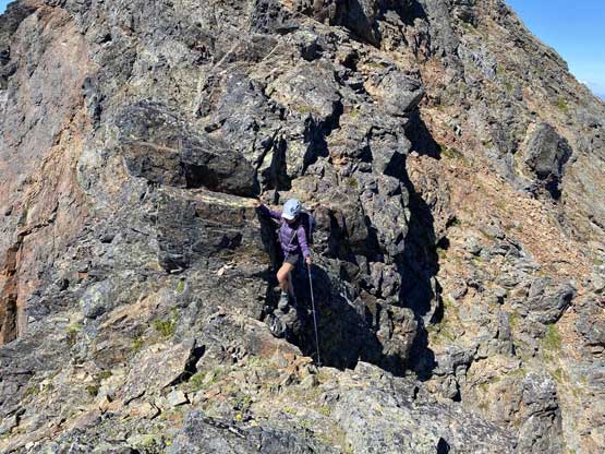
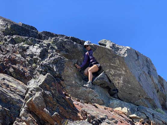
Another step higher up had a fixed rope dangling down for added handholds. Without the rope this step would be 4th class and had considerable amount of exposure. There were also quite a few challenging steps but again, nothing sustained. Before realizing we were already on the false summit looking at the scary-looking summit ridge traverse. To access the true summit was had to descend a bit of ways into the col, which was mostly 3rd class. The scrambling out of the col had one or two harder moves, and then the uppermost south ridge was technically easy, but involved some route-finding. Overall both of us found this scramble “easier than expected”.
Winnie scrambling up the crux beside the fixed rope
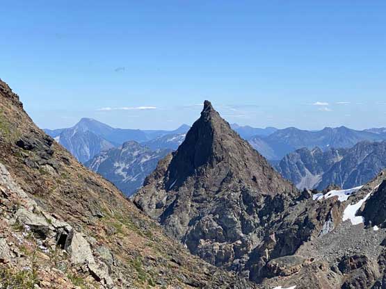
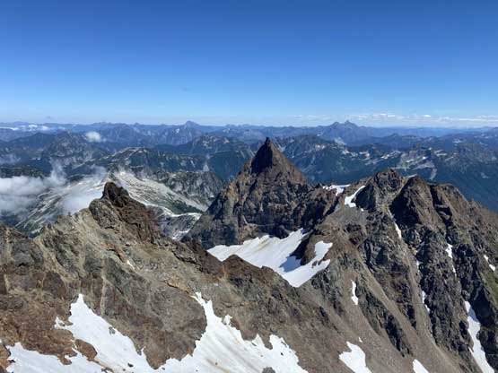
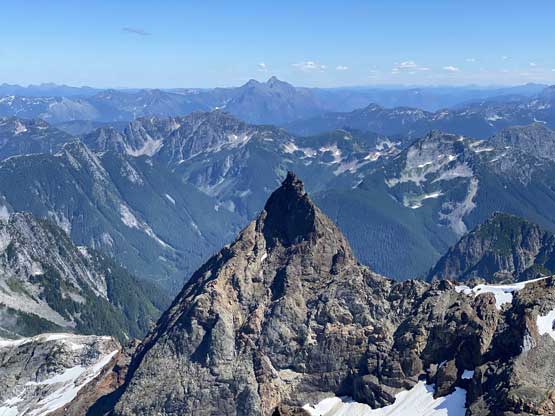
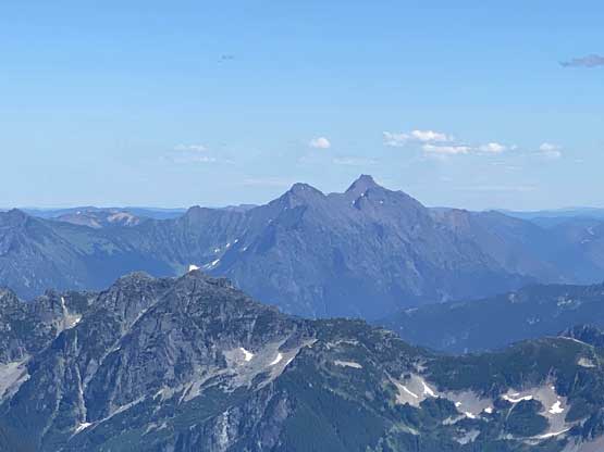
Foley Peak looks impossible from this angle…
Looking at The Still
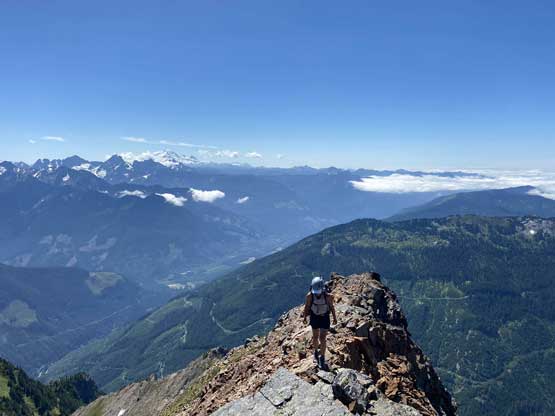
Me heading towards the false summit. Photo by Winnie M.
Winnie walking across the sky
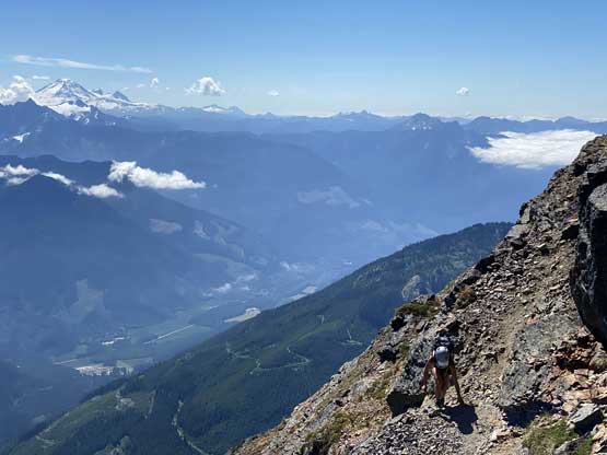
Chilliwack River Valley way the hell below us now

Linking up some loose gullies
Winnie scrambling up onto the false summit on the typical terrain here
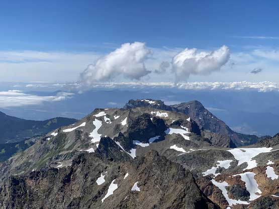
We were higher than Foley Peak now
Me heading for the true summit. Photo by Winnie M.

Winnie down at false/true col
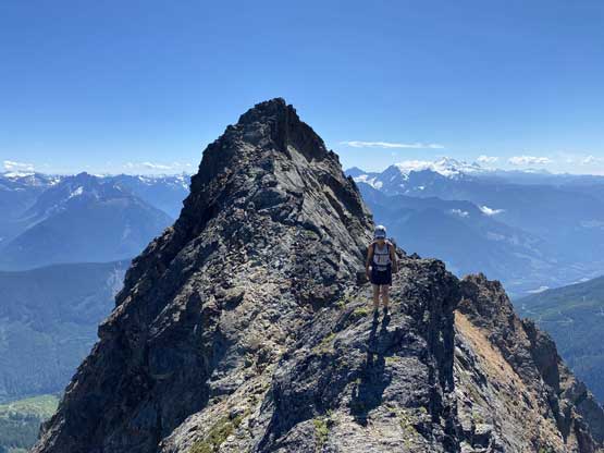
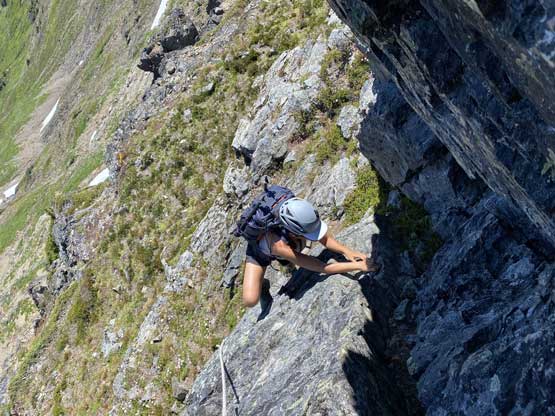
Winnie balancing over the exposed ridge between false and true summits
A bit higher up now, and still balancing on exposed ridge
Me leading the last section just below the true summit. Photo by Winnie M.
Winnie on her last few steps to the summit of Welch Peak
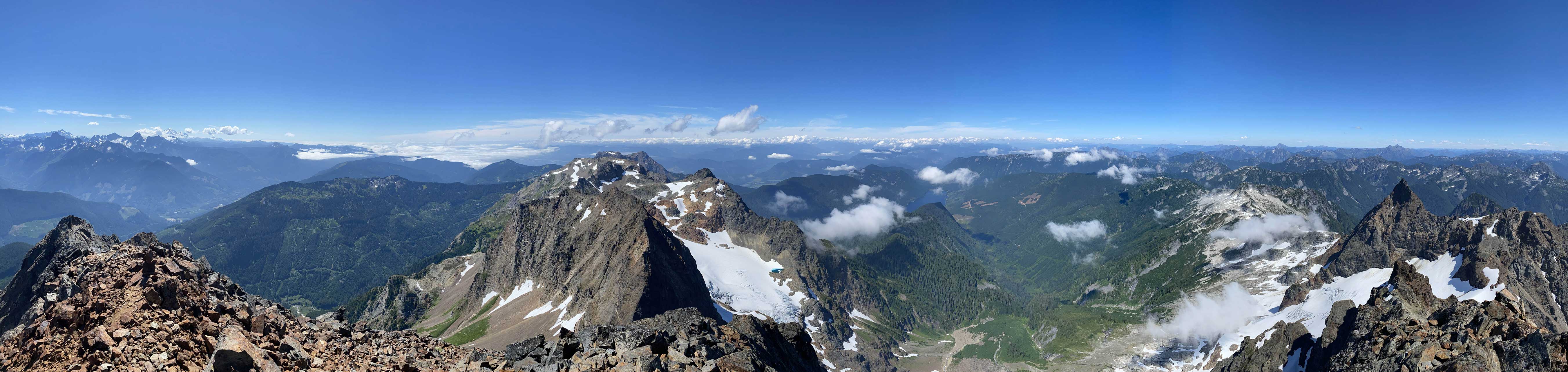
Partial Summit Panorama from Welch Peak. Click to view large size.
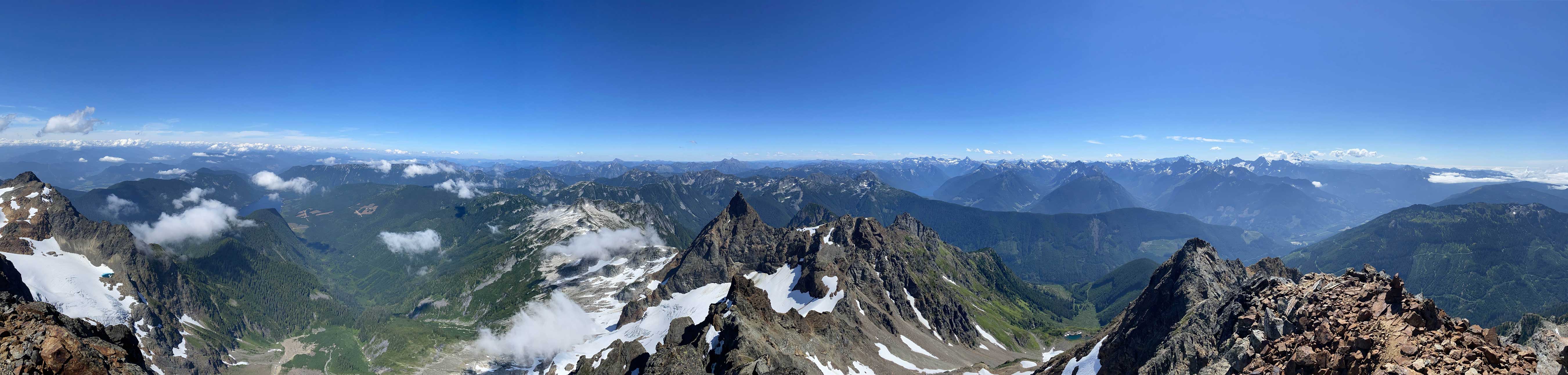
Partial Summit Panorama from Welch Peak. Click to view large size.
Wahleach Glacier under the north face of Welch Peak
Foley Peak, our next objective
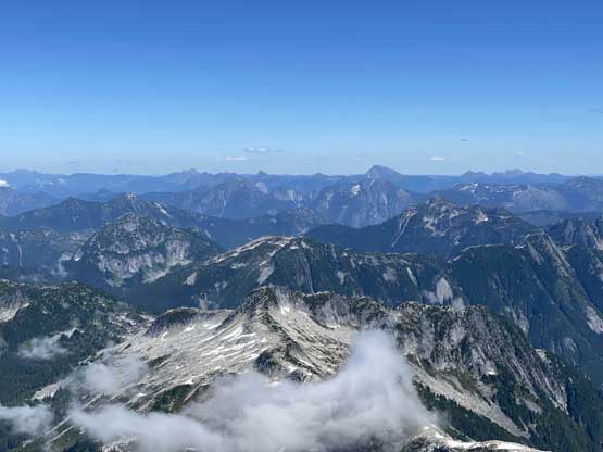
The rest of the Cheam Range peaks towards Cheam Peak
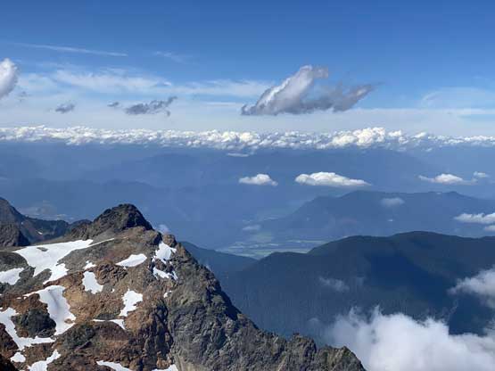
Looking down towards Agassiz/Harrison Lake past Stewart Peak
Conway Peak in the very foreground; Mt. Outram behind
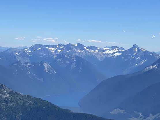
Mt. Redoubt et al. in WA North Cascades behind Chilliwack Lake
Mt. Rexford in the foreground
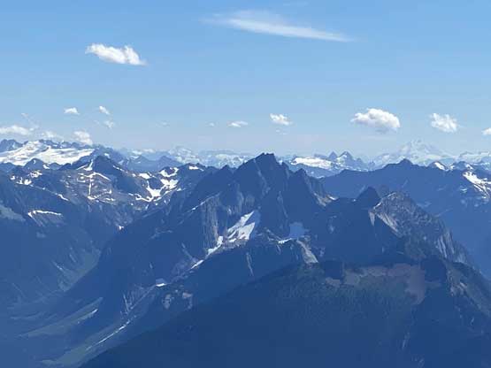
A zoomed-in view of the massif of Silvertip Mountain
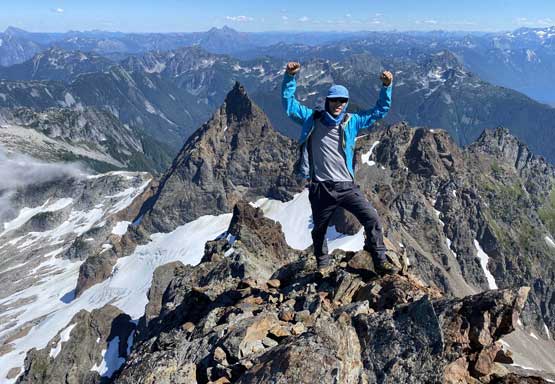
Me on the summit of Welch Peak
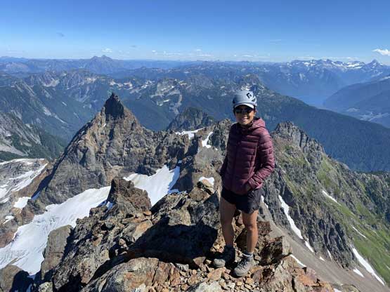
Winnie on her first Cheam Range summit…
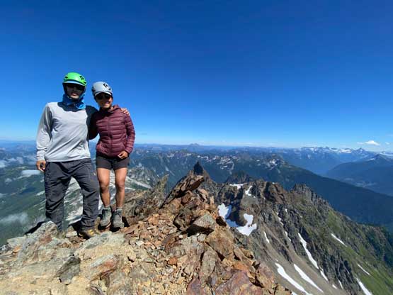
Winnie and I on the summit of Welch Peak. Fun one!
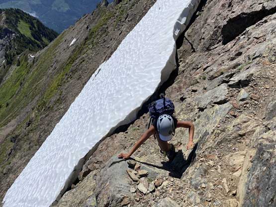
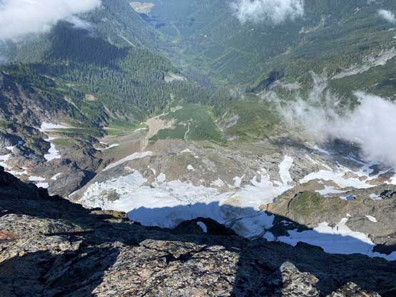
At this point we jacked up the ambition to descend the SE Ridge and link up with an ascent of Foley Peak in the evening. This meant we had to get going. The first business was to scramble back to the false summit, which was pretty straightforward. Then we picked up the SE Ridge following Al’s 2019 GPS tracks. We did not follow the exact line they took and did one optional 4th class down-climb. It could have been avoided had we done a bit of back-tracking but we determined it was doable and just went for it. There were lots of 3rd class choss on this route and after a while I made the call to traverse high towards Welch/Foley col losing as little elevation as we humanly could. While exploring the unknown terrain I made a call to scramble down some down-sloping and loose 3rd class choss onto a large snowfield. The snow was unfortunately not soft, that without crampons and ice axe it felt a bit sketchy. I at least had my mountaineering boots so went on it anyway and gingerly down-climbed kicking some hard steps. Winnie watched me and opted to down-scramble through the moat and cut onto snow lower down. Winnie had brought at least a pair of microspikes so strapped them on for extra traction. The lower part of this snow slope was mellow enough that we just boot-skied. Looking back I probably would not recommend this descent variation without snow gears…
Carefully making her way down the uppermost south ridge
Back to the exposed ridge traversing section
Winnie making a tricky move
The optional 4th class down-climb on the SE Ridge
Winnie negotiating the typical ledggy terrain on the SE Ridge
Lots of choss between ledges
Traversing this grassy bench trying to stay high
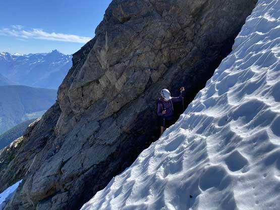
To gain the snow was trickier than expected
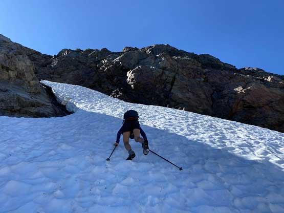
It was a bit difficult to down-climb without ice axe and crampons…
The bottom of our snow descent
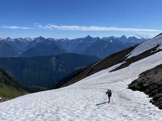
It was still not obvious how we were going to link up with Foley Peak’s scramble route as it doesn’t even start at the proper Welch/Foley col. From our position it only made sense to traverse to the col so that’s exactly what we did. The traverse involved minimal elevation loss but lots of side-hilling on choss. From the col we scrambled along the ridge crest over a few bumps and more 3rd class terrain. I had some concern about the feasibility of this section but that proved to be unnecessary. After joining Gurbaz’s GPS track the trip continued with an ascent of Foley Peak.
The typical side-hill across never-ending choss slopes
Aiming for one of the cols there
At least we had a few patches of snow to ease things off
Winnie on a very loose gully to gain Welch/Foley col
Scrambling above Welch/Foley col with Williamson Lake behind
