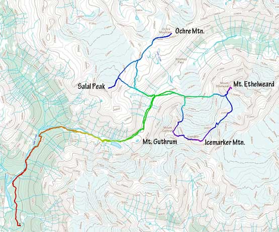
Mount Ethelweard
June 24-26, 2021
2819m
Salal Creek / Upper Lillooet FSR, BC
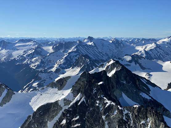
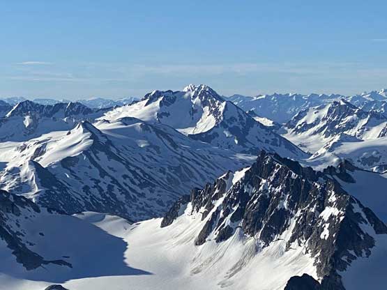
Mt. Ethelweard is the highest peak in the immediate vicinity of Athelney Pass on the Bridge-Lillooet Divide somewhere around 50 km to the north-west of Pemberton. This peak is difficult and remote. The access requires extensive driving on logging roads with ever-changing gate status and unknown road conditions and the approach takes normal party a full day via the Salal Creek “trail”, which is more of a “route” than a “trail”. The ascent is supposedly only “class 3” via the series of gullies on SW Face but that’s only if one nails the route-finding, which itself is not an easy task on this mountain. Matt and I had lots of discussion about Mt. Ethelweard over the past few months and we both agreed to time it while there’s still significant snow coverage to (hopefully) make the SW Gully a snow climb. This had been complicated with the road status as the driveable end is at 1150 m elevation. We did not want to walk extra distance so the best time would probably be “late spring” or in other words, June. When this trip eventually happened the timing was a little bit on the late side such that the gully was no longer a continuous snow climb, but it was still manageable.
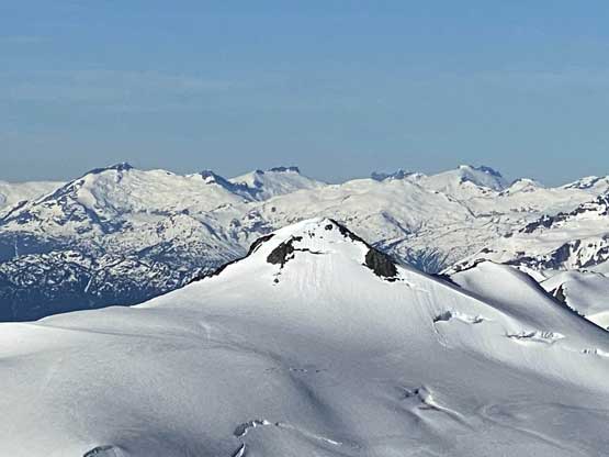
I have heard a lot of good stories about parties camping at Athelney Pass so my plan was to camp and “clean off” the peaks in one massive trip. There are five summits all easily accessible from the pass – Ethelweard, Icemaker, Guthrum, Salal and Ochre. I had a few friends keen on this mission but in the end it was Brayden Wong, a new friend whom I just met a few days prior on Sugarloaf Mtn. joining at the last minute. Brayden is an incredible strong climber able to lead into 5.11 range but more importantly, he also has a very keen attitude on non-climbing trips like this. Our plan was to have 4 days of food to make sure we could definitely get all 5 peaks but it’s likely that we would finish the trip in 3 days. Our planned summit-day for Mt. Ethelweard to Mt. Guthrum traverse was on Friday in which Matt’s “Midnight Crew” was also gunning for the summit, but in their usual single-push fashion. This was not the most ideal window due to a massive heat wave kicking in on Friday but at least the weather was guaranteed bluebird. The heat wave proved to be quite a bit concerning from the access perspective but in the end we all got lucky.
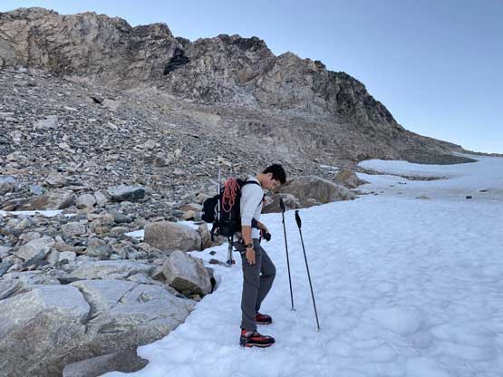
We would not need a full day to hike to Athelney Pass but given the number of uncertainties we still decided to start early. I picked up Brayden from his home in Langley at 4 am and were in Pemberton a few hours later. The drive up the Lillooet FSR to the end of Salal FSR was as smooth as our little scouting trip went a few days earlier. There were some ruts and water bars near the end but even a Subaru could make it. I opted to park my Tacoma immediately before a deep ditch (with running water) about 100 m from the driveable end. The road continued for over 2 km beyond this spot but it was deactivated enough that no motor vehicle (including ATVs and dirt bikes) could push any further.
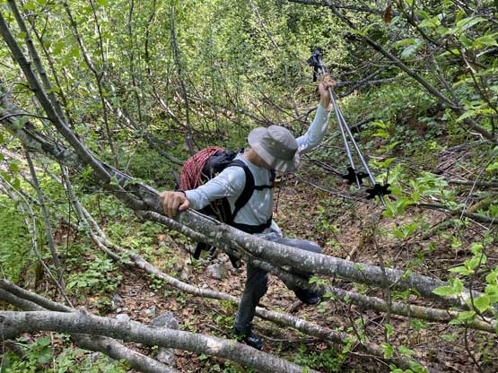
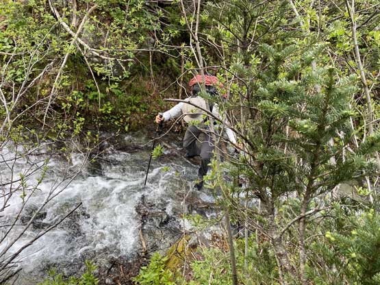
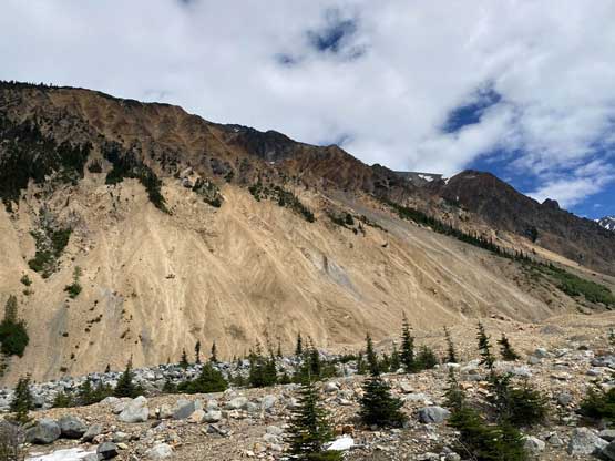
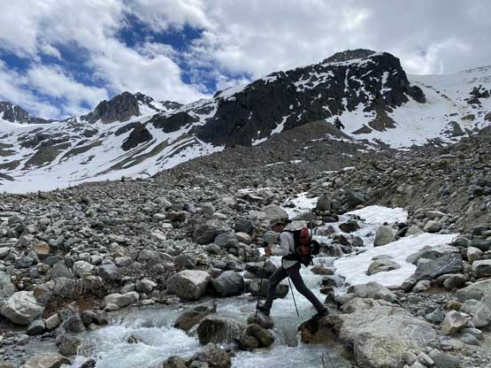
In terms of gears we decided to haul quite a bit of redundancies in case the route’s harder than expected, including but not limited to a rope, two axes each, mountaineering boots, harness, helmet and some rock pros. My pack weighed over 40 lb and Brayden’s was 38 lb at the start, a wee bit heavier than expected especially considering we were both going minimal in clothing and sleeping gears (thank to the heat wave). Right off the bat we encountered a long slash of dead-falls and boulders on the road and I assumed that’s made on purposely to prevent vehicular access. The road beyond that initial mess was actually in an excellent driveable shape and made a gradual descent towards Salal Creek. We followed the road to the end where we must thrash through a cut-block to access the river bank, where that “trail” was supposedly located. We saw minimal evidence of a “trail” but did see cairns here and there. I came prepared with GPX track downloaded from Sean C.’s trip report of Salal Peak so whenever in doubt, we had that track as reference to either correct or to confirm our bearing. After a while of walking on rubbles it’s apparent that we could no longer walk on the river bank unless we wanted to cross the main channel of Salal Creek, which was impossible. For the next few kilometers we were constantly hopping back and forth between the river bank and the bushy forest right next to it. The bushes were not the thickest I’d seen, but the branches were stiff and the “trail” through the forest was not easy to follow. We did however, manage to avoid any significant period of bushwhacking because we were mostly able to stay on that “trail”. There were at least two tricky creek crossings on this trail that we managed to cross without wetting our feet (which was no longer the case on the return hike, but more on that later).


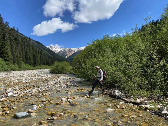

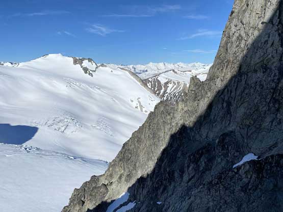
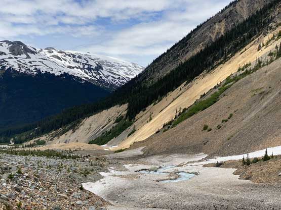
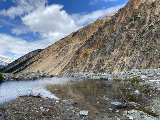
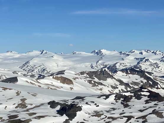
At one point the trail started to go away from the river and ascended steeply up the forest on climber’s right side to more than 100 m away from the bank. This portion of the trail was in a great shape but I could not have imagined to have missed it. Almost a kilometer later after traversing through some nasty slide alders and underbrush the trail made a sharp turn due west taking a straight beeline towards Salal Creek and sure enough we were back at the rubbles near the creek. For the next kilometer we again, deviated from the creek into some sparsely treed terrain. The trail in this stage was still, easy to follow. Near 1350 m was where we finally exited the forest and from there onward to Athelney Pass we would no longer need to bushwhack. That did not mean the going would get much easier as the trade-off was some constant walking on rubbles and boulders. We did have a good trail to follow here and there but the trail was not continuous and route-finding decisions must be made for every minute or two. There was another tricky creek crossing near 1550 m elevation but again, we managed to cross without wetting our feet. Beyond that spot we ascended onto the crest of a moraine with excellent views looking down at an unnamed, glacial-fed lake and beyond that the valley finally made a turn due north towards the distant Athelney Pass.


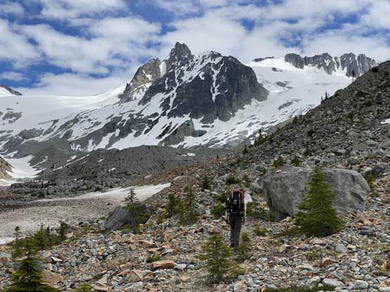


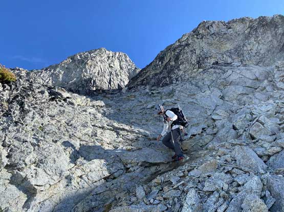
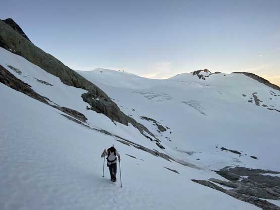
For the next stage we missed the trail by going too far up on climber’s right that we had to do a lot of boulder hopping. I made a call to take a break mostly to swap footwear to mountaineering boots as this type of terrain was no longer suitable for trail shoes (at least for me) and after that, we began making some slow but steady progress up that flat and never-ending valley towards Athelney Pass. The terrain was a mix of boulders and snow and the going was generally not too bad. We found a great spot to camp about 1.5 km from the actual pass and decided to set up camp, despite that both Sean’s and Alex’s groups camped farther up the valley. I think we made a decent call here because even in retrospect, I would still camp right here. Our time to the camp was 5.5 hours and we made here at 4 pm. This meant we had a very chill evening routine ahead and in fact, we both caught some valuable sleep before dinner time.


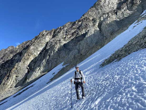
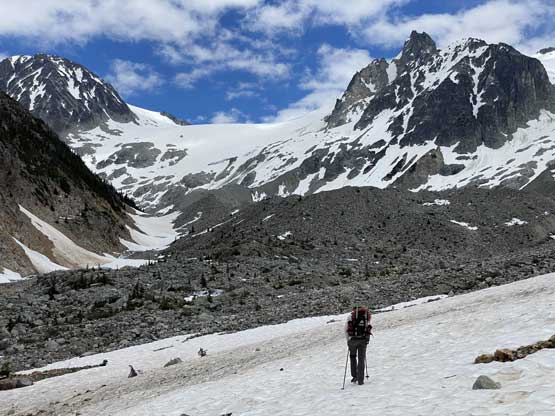
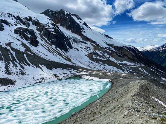
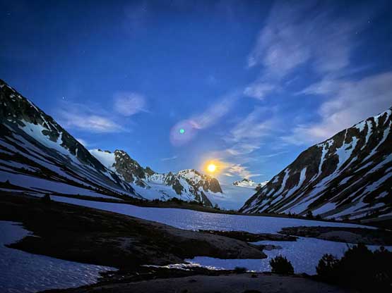
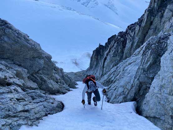
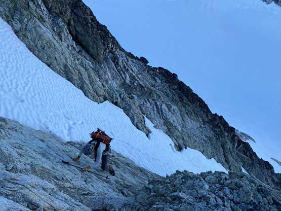
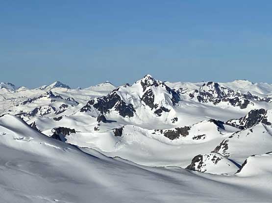
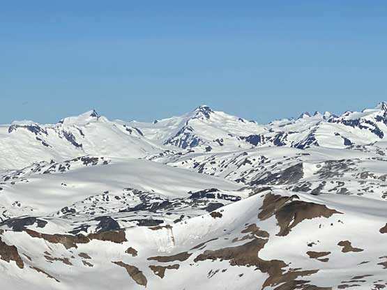
The next morning we woke up at 3 am and started the ascent towards Mt. Ethelweard half an hour later. There were a few ways to get there and we decided to take a “high route” by cutting across the tongue of that glacier draining from Icemaker Mtn. down towards Athelney Pass. This rising traverse worked out nicely other than a short and inevitable section of elevation loss to get down onto the glacier. The plod across the tongue was as easy as expected. On the far side we strapped crampons on and made a long and steep ascent at the edge of some serac walls dispatching a few hundred meters of elevation rapidly. This zone was not as steep as appeared. Once above the serac zone we still had some elevation to gain to the base of Mt. Ethelweard’s SW Gully. During this stage we had some great morning lighting even though we couldn’t see the actual sunrise.


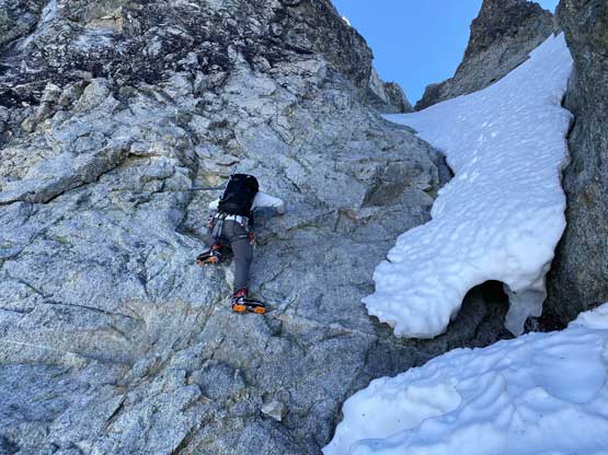
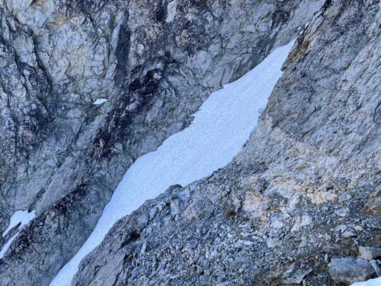
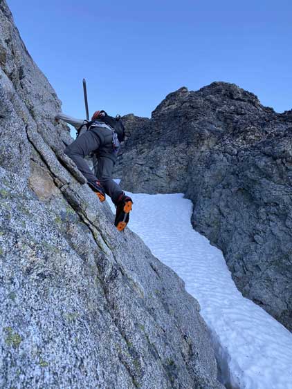
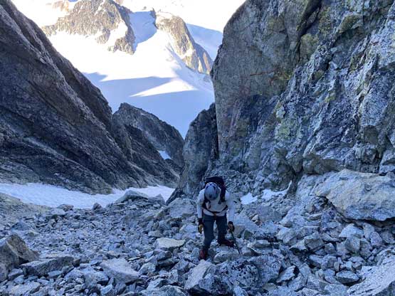
The base of the SW Gully was not easy to locate without extensive research before the trip because there were simply too many gullies and the main one was hidden from view. Once I saw it I knew this was it, but I was disappointed to see the bottom section already melted out and now had a running waterfall in the middle. The alternative solution was to ascend the easier terrain on climber’s right of the gully but at some point we must make a traverse to get back into it. There was a low-angled snow finger immediately to the right so that’s where we climbed towards and halfway up this finger of snow we bailed it, traversed a shitty section of choss to access the narrower and steeper finger of snow to the left (but still to the right of the main gully). This mini-couloir went at a solid 45+ degree in the middle. We ascended pretty much to the top of this couloir before making a somewhat awkward transition onto rock. The rock appeared to be 3rd class slab at least for the initial few meters so we took the crampons off. We scrambled up until the mini-ridge feature to our left allowed us to get onto it and once there, I was happy to see an easy path of descent to get into the main gully and once into the main gully we spent anther transition to strap crampons on and take ice axes out.
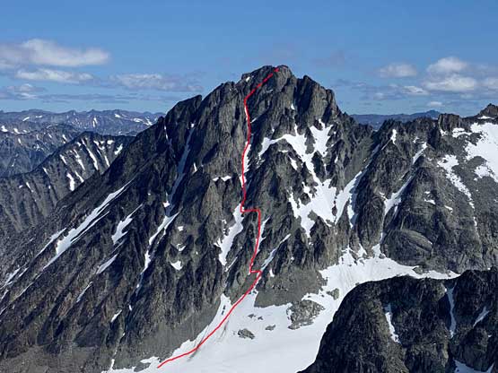
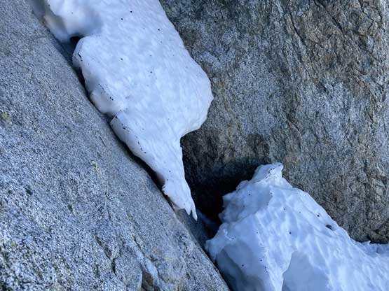
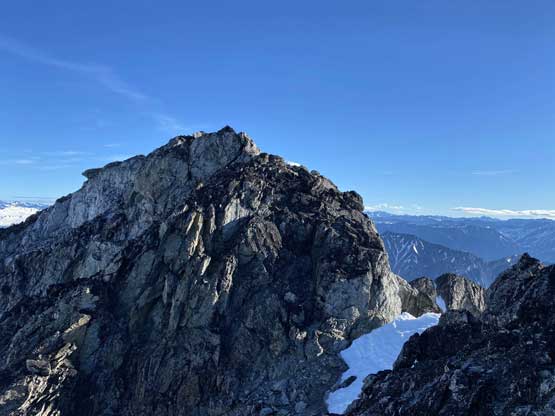
Immediately ahead was that one tricky section that Alex had warned me about and sure enough, it was partially melted out leaving a meter-high gap between snow. Ascending this gap seemed rather foolish given the uncertainty with the moat so the only solution was the rocks on climber’s left which did not look any easier than “class 4”. Brayden went up a harder line by purely using rocks and after watching him soloing this pitch I decided to let him drop me a rope for a belay. Once the belay’s set up I decided to traverse a few moves horizontally to jam my right foot into the gap between the upper snow strip and the rock slab, and this worked out quite easily albeit still with a few tricky moves without much of a “foot hold”. This turned out to be the crux of the ascent. Beyond this step we had a long section of easy cruising on 35-40 degree snow until the snow ran out. The rocks were horribly loose by the Coast standard such that even in a group-of-2 we had to be uber careful. Upon reaching the major fork we took the left branch onto more snow. The snow of course was short-lived and upon reaching the next fork we took the right one aiming directly at the notch between the two summits. We guessed the right (east) summit to be the true summit and we were right. A few 3rd class moves got us up there. We then traversed to the west summit which appeared to be about 2 m lower.

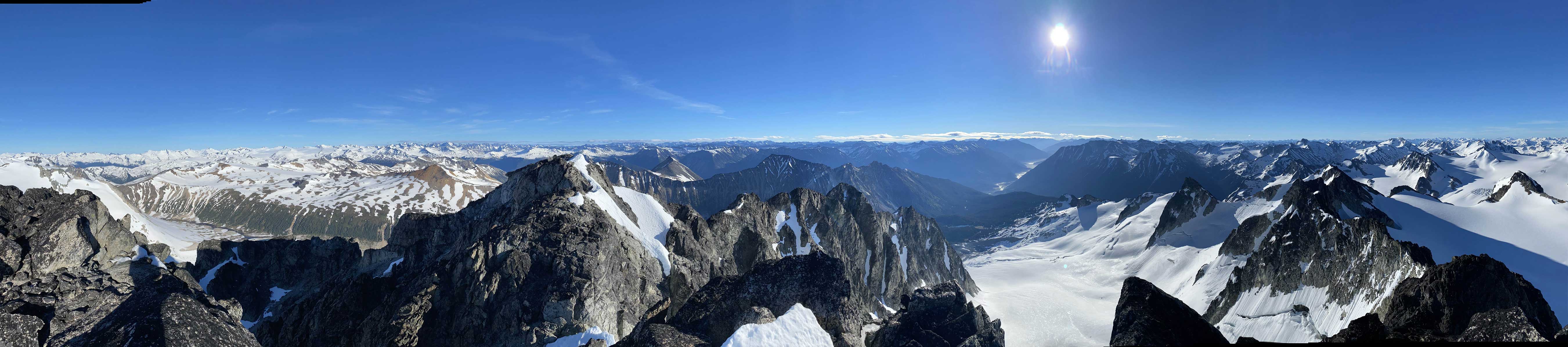
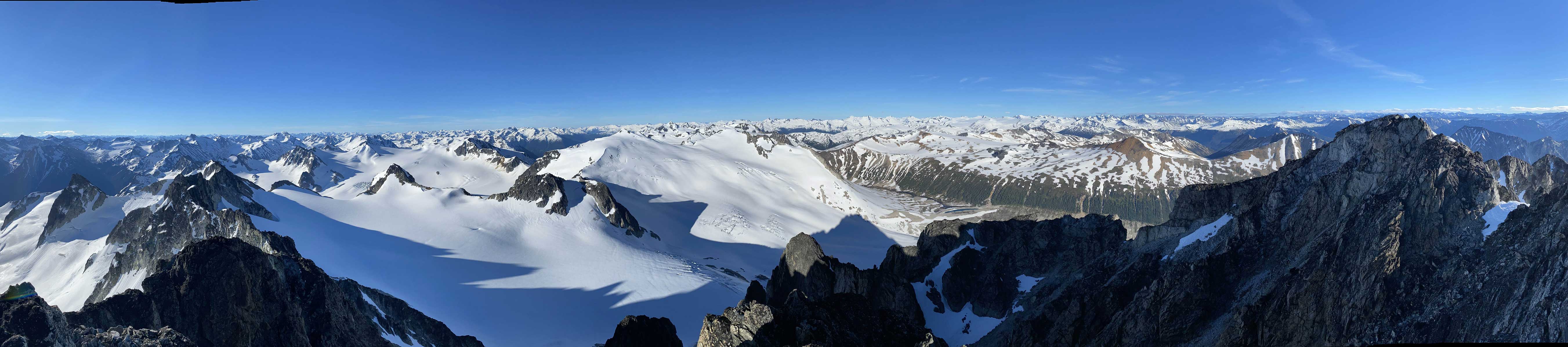


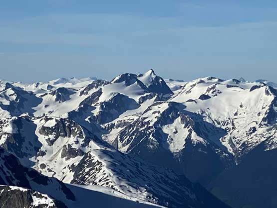


We didn’t linger too long on the summit because we had a long day ahead. The descent off the upper gullies required lots of careful management with loose rocks and for that crux step we decided to just down-climb, which wasn’t too bad. Again, we each reversed our own micro selection of the route there. The rest of the descent was rather uneventful and once at the bottom of the SW Face we immediately turned our attention towards Icemaker Mountain and Mt. Guthrum. At this point I thought the Midnight Crew would have already showed up but I was not positive that they definitely could find/follow that trail in the pitch dark. If not, they could be hours delayed, so we carried on our path.