Morton Peak (Mara Mountain Lookout)
August 30, 2020
2245m
Sicamous, BC
“Morton Peak” is the highest point in Hunters Range or the immediate area in Okanagan-Shuswap Highlands. It’s one of the few ultra-prominent peaks in the interior plateau of British Columbia. The name is however, unofficial and originally assigned by bivouac.com. I’m sure for the locals this is more known as “Mara Mountain Lookout” as that’s the same of the lookout site on the summit. For peak-baggers living outside the local areas I’m sure this peak is more known as “Morton Peak” as Google Earth had adopted the bivouac.com name making it “semi-official” in my opinion. The sole reason I even noticed this peak was because of the prominence. I don’t like the idea of doing “ultras” for the sake reason of lists but I do agree that the “ultras” had pushed me to travel around. This is also the single Ultra that my friend Adam Walker had done in the interior BC so I wanted to get it done so that it’s easier for the two of us to team up for some ultra-bagging road-trips.
I happened to be around Sicamous with my trusty Tacoma. The first thing I did was to grab some food in the Tim Hortons. I made a mistake by going for the walk-in option and that turned into a half-an-hour waiting game… After this bit of morning gong show I let the GPS technology to direct me to the logging roads on the south side of Morton Peak. I don’t even remember the names of these roads as there are plenty of beta and GPS tracks on peakbagger.com and the roads are all labelled on my Gaia app. The driving was long, but easy up to the point that everyone opted to stop, but I remembered Adam saying “with the Taco I might can drive farther”. I’m one lazy hiker that if I can drive higher I definitely will not want to walk, so pushed another 200 vertical meters to around 1850 m. This stretch surely put my Tacoma into test as I crawled over endless boulders. Without all-terrain tires there’s no way and even with the tires I felt bad, so opted to turn around and park before reaching the treeline zone.
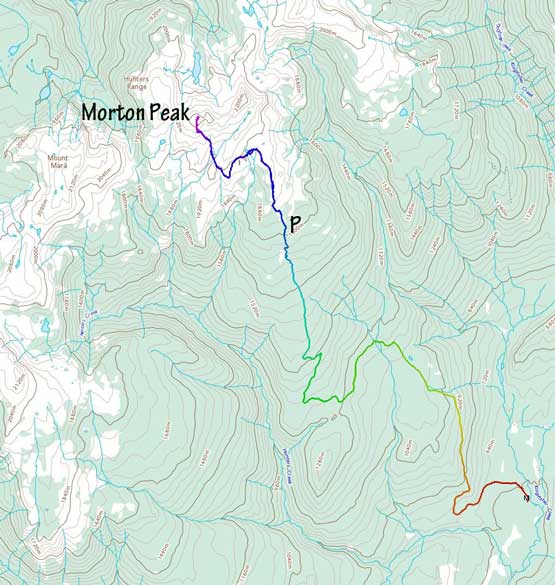
Morton Peak south side route. GPX DL
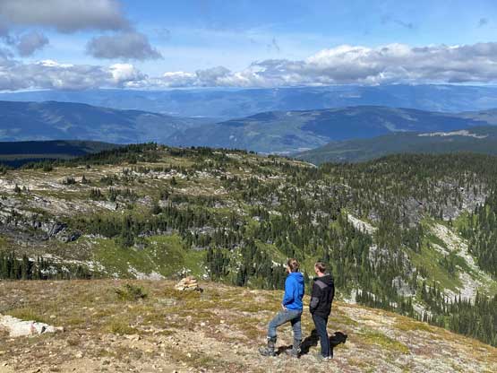
From where I parked I easily walked on the deteriorating roads and was passed by several groups of dirt-bikers and ATVs. At just under 2000 m elevation I followed the road turning left onto some undulating terrain including a fairly long stretch of elevation loss. I could have followed the road all the way to the summit, but that’s roundabout and inefficient. Instead, I left the road aiming for the south ridge through open meadows. The ascent was a bit boring, but was quite scenic. I took fair amount of flower photos. The lookout structure on the summit was also cool that I opted to explore a bit of the inside.
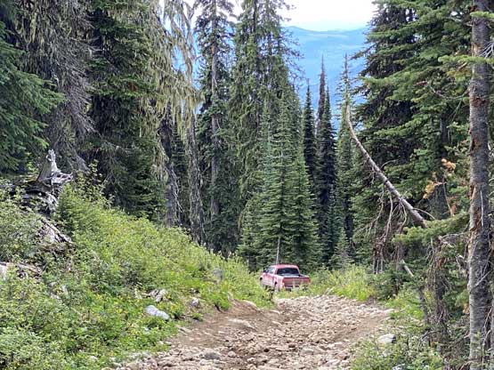
Taco parked..

Lots of ATV activities up there

One of the tarns at around 2000 m
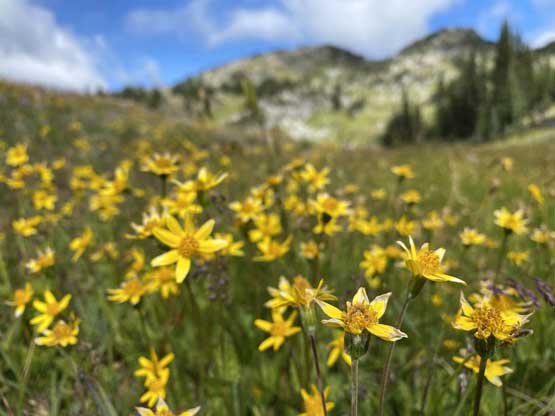
Flower field! I’ve left the road at this point

Partial Summit Panorama from Morton Peak. Click to view large size.

Partial Summit Panorama from Morton Peak. Click to view large size.
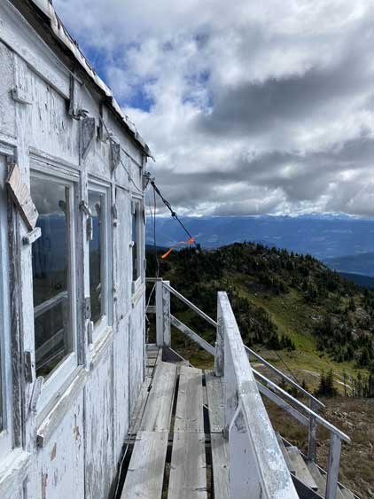
The summit lookout structure

Morton Lake to the north. The lake is actually officially named
Two dirtbikers arrived at the summit.

Dirt bike!
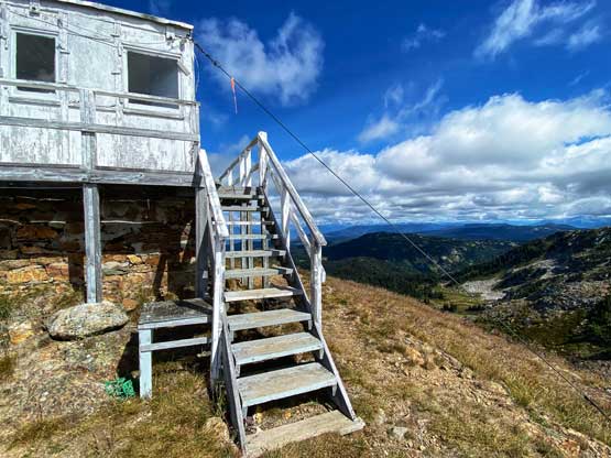
Another photo of the lookout

Me on the summit of Morton Peak
Once having enough of the views I leisurely walked down the mountain following the same route I took. The drive required some great care but I did manage to not bottom out of the truck. I let the GPS to direct me to Armstrong before making the next decision to drive up Tuktakamin Mountain.

Leaving the summit, looking back at the lookout

A southern view into more of the typical scenery of this area

The officially-named Mt. Mara to the west

Flowers!

I now know the name of this – Lupine!…
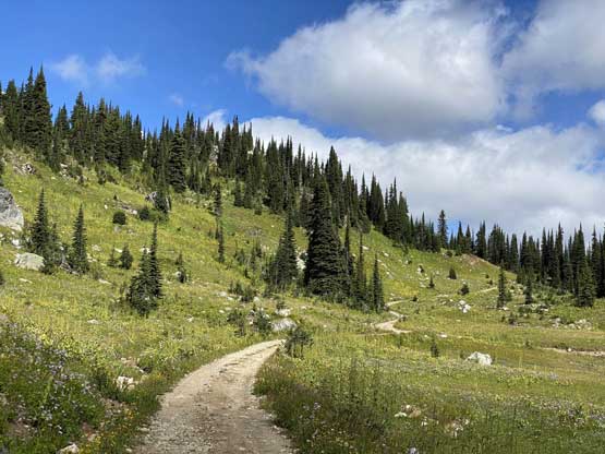
Back to the ATV road
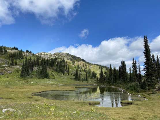
Back to that tarn at 2000 m
