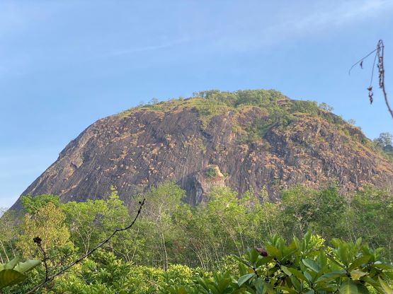
Bukit Besak
August 31, 2023
602m
Sumatra, Indonesia
Bukit means “hill” in English and Bukit Besak is one of the hills in the vicinity of Lahat in South Sumatra. This is not a major mountain by any measure but does boast over 300 m prominence. There are some sharp towers in this area including Bukit Serelo which requires rock climbing to reach the top. The lower flanks of Bukit Besak are also extremely steep but thankfully there’s a non-technical way to reach the summit. Adam noticed this peak by browsing topographic maps and I immediately agreed to squeeze it in. The plan for our last day in South Sumatra was to drive 4 hours to the airport and fly from Palembang to Jakarta. The drive to Bukit Besak from our hotel would require 1 hour each way, and the hike would take at least 2 hours, so the plan was to wake up at 4 am and leave at 4:30 am.
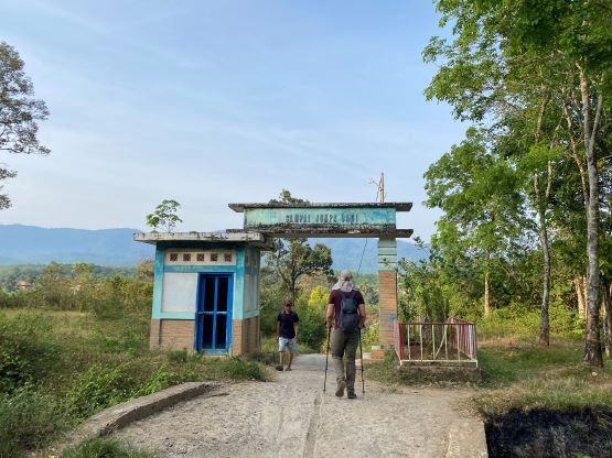
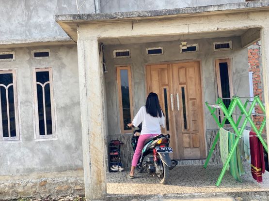
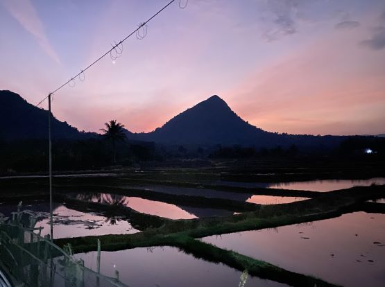
Our driver opted to stay in our hotel room but he needed to get up an hour earlier to do his praying things, so we didn’t get much sleep at all. That’s fine with me as I could sleep in the car whenever needed, but Adam was not very happy about the noises that our driver made. Nonetheless we we made to the trail-head and started hiking at 5:30 am. It was still in the pitch dark and the direction was confusing. None of us could find a GPX track on the internet despite the popularity of this objective. At least we were able to find the correct trail-head.
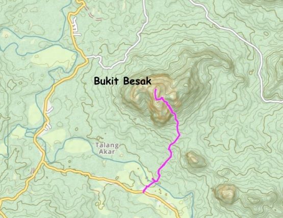
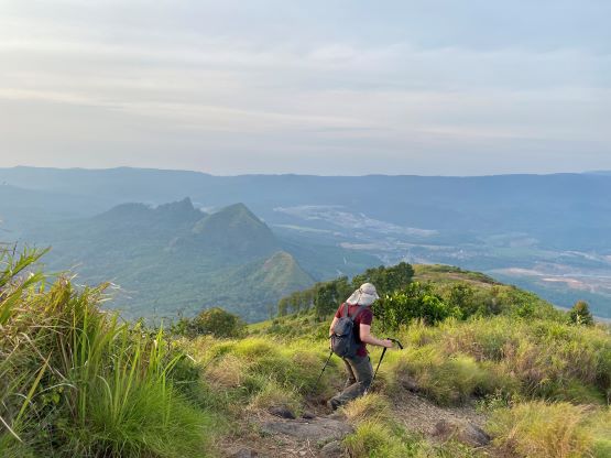
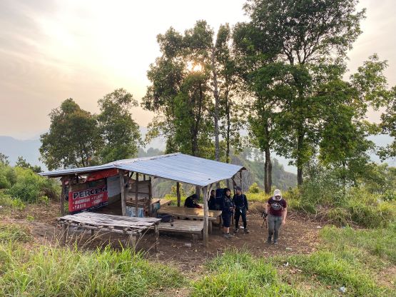
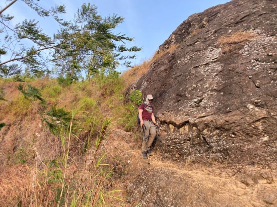
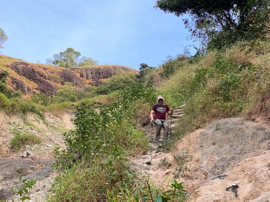
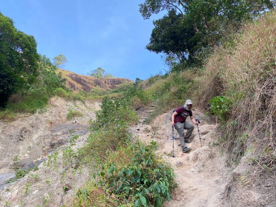
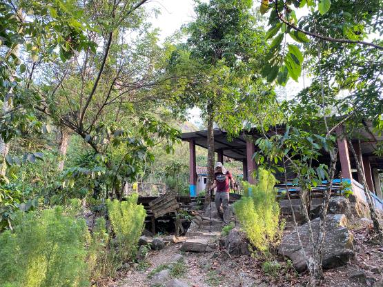
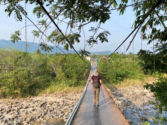
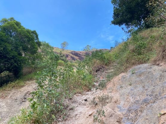
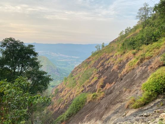
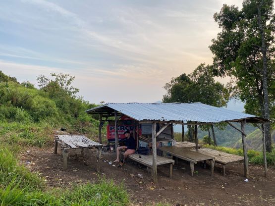
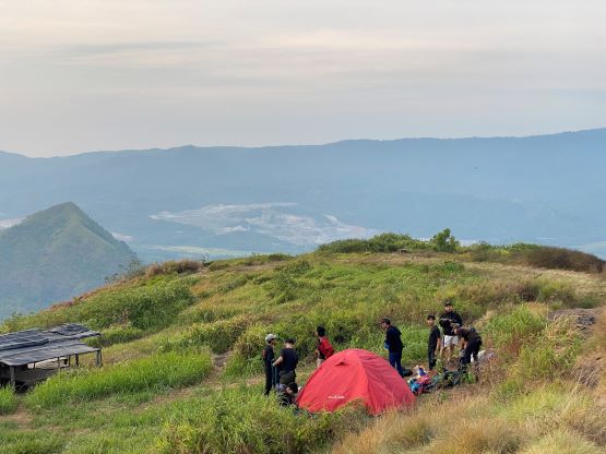
The village’s former chief was welcoming us and our driver opted to park at the chief’s place to socialize while waiting for us. The chief directed us to “just go straight” even though there were a maze of roads, mostly only suitable for ojek traffics. Adam and I nonetheless found a way through this maze of ojek roads. We crossed a major river on a suspension bridge, and arrived at what seemed like a registration post, which was closed at this time of a day. We took a wrong path but realized the mistake after coming to a dead end. After a brief backtrack we found the correct, signed path heading for the summit. The route-finding was straightforward from this point onward as the trail is heavily used, but the trail is steep and loose at places. This was also a sea-level objective so the heat was brutal for us not used to the humidity in these equatorial countries, even in the early morning in the shades. We eventually came to a large camping area on the upper plateau, and the true summit was a few minutes north of the camp. The trail leading to the true summit was narrow and overgrown, but manageable. I did the entire ascent wearing no shirt.
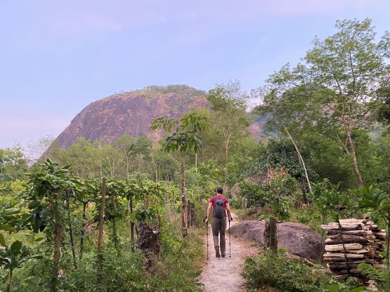

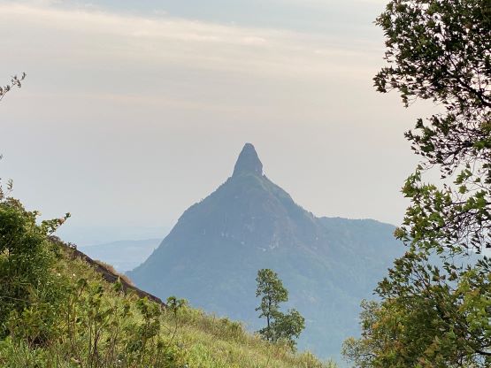
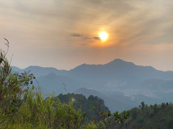
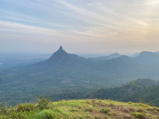
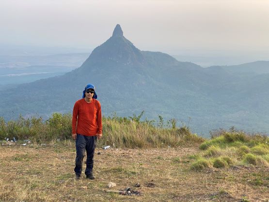
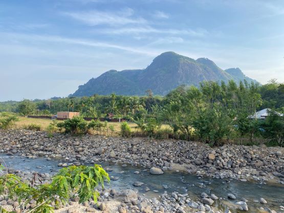
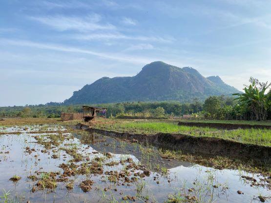
The best view from this peak was towards Bukit Serelo to the north. The “beta” on the internet was sparse or non-existing (at least in English), but we did manage to talk to some locals. It’s definitely a rock climb, but we had no way to know how difficult the climb would be. I think I will bring two ropes, rock shoes and a full trad rack on my next visit to resolve the problem. The descent was uneventful and we finished the round trip in exactly 2 hours. We wasted no time and immediately drove back to the 4-star hotel in Muara Enim, arriving in time for a late buffet breakfast and a well-needed shower. Our driver drove extremely fast (at times, 180 km/h) and got us to Palembang international airport by 1 pm, more than 5 hours before the scheduled flight. Despite that we were able to do the check-in and were now waiting patiently in Saphire Lounge with wifi, food and unlimited time. The wifi here is the fastest I’ve had in this country. It’s basically as good as my home wifi, so I might as well write the trip report, wasting no time.