Gunung Bisma
August 11, 2023
2365m
Java, Indonesia
Gunung Bisma, also known as Gunung Bismo is the third highest peak on Dieng Plateau. This was the secondary objective as earlier in the morning Adam and I had just finished an ascent of Gunung Prau, the highest in the area. We noticed Gn. Bisma on the maps and given that it’s in the same area as Gn. Prau it made the most sense to squeeze them into the same day. This was supposed to be a “rest day” but we couldn’t justify skipping this peak. The artical on Gunung Bagging website actually speaks highly about this objective with a good trail and some great views.
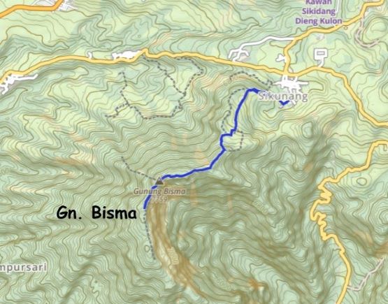
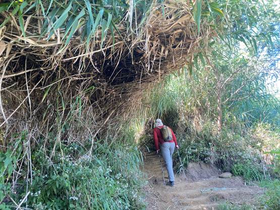
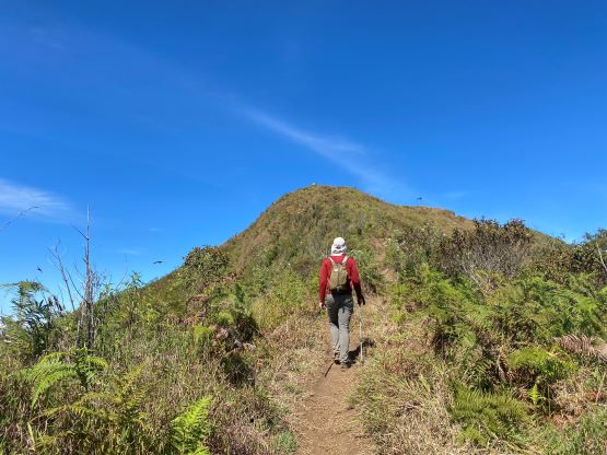
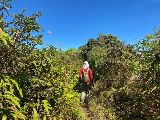
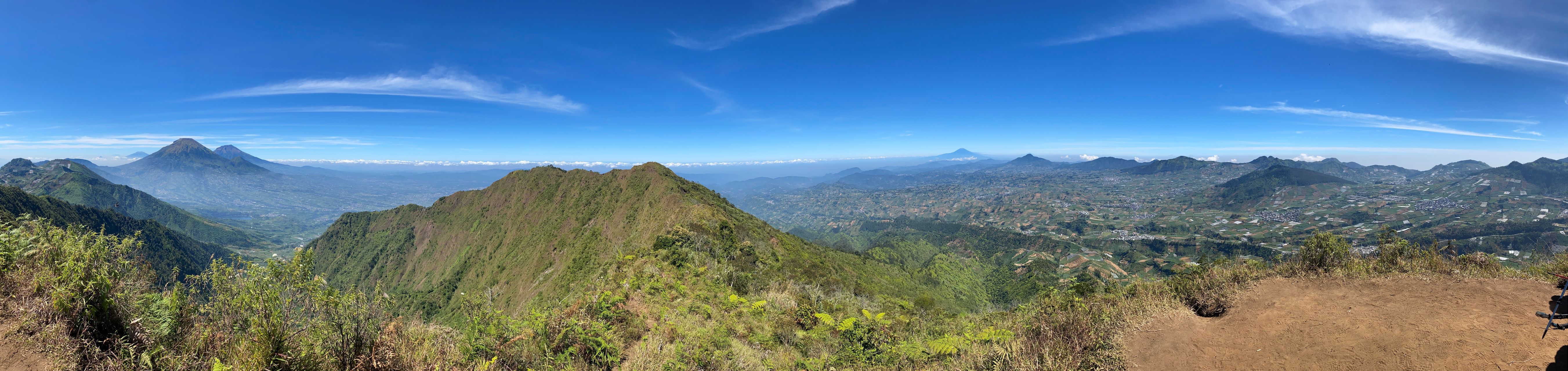
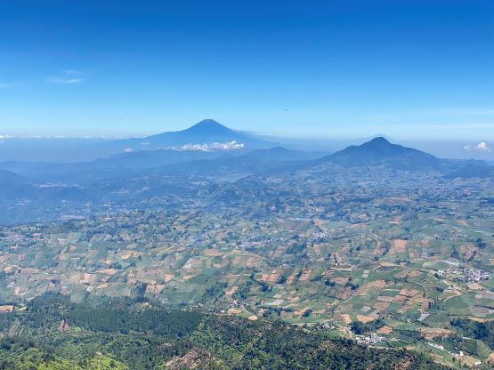
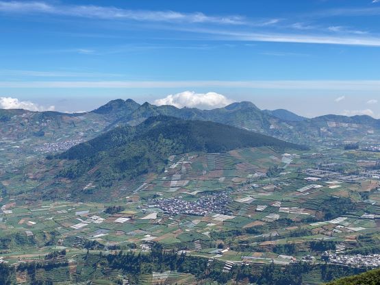
The most logical way to hike this objective is from Sikunang to the north-east. The trail was indeed in a good shape, but the ascent was a bit longer than I thought, with 300 m elevation gain and over 5 km of round trip distance. As a result this also turned into a 2-hour outing, but that’s okay. Much of the trail was in open areas so the views were indeed good, but then we were hiking entirely under the merciless sun. The lower section of the trail was actually in the farm lands. The farmers were all friendly towards us for trekking on their lands.


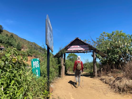

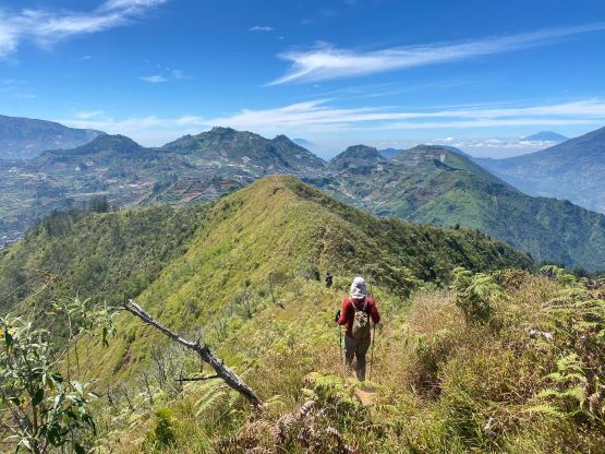
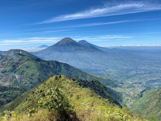
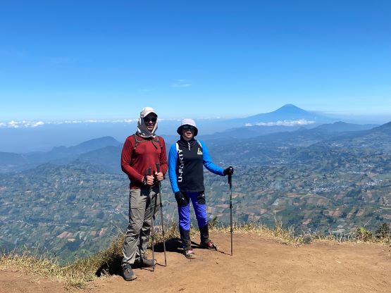
There were at least 3 Pos on this route and some people actually camped up there. There’s one steep section (dry mud staircases) between the 2nd and the 3rd Pos and after that we were on the summit ridge. This was a long ridge traverse over a few subsidiary bumps. All of those bumps had their own names, but none of them boasts enough prominence to qualify as a separate peak. The plod to the true summit took a while, and once there we noticed the next bump down the ridge to be just as high, if not higher. Adam and I are very thorough on this peak-bagging thing that if we aren’t sure we must ascend both. Thankfully the trail continues to the next bump so we had little trouble traversing there. I would still think the official summit was the highest one, but it’s good to be extra secure.


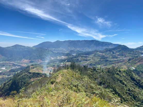


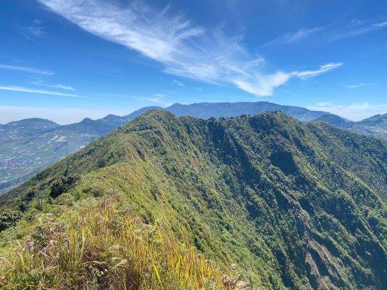
After a needed food/energy break we started the descent. Traversing back across the entire length of the summit ridge was undulating but once it’s over we had a fast dash back to the trail-head. I made a slight route-finding error near the end by going onto some narrow farm trails, but the trail did connect back to the main one. The driver did not change the parking location and was patiently waiting for us at the trail-head this time. We then drove back to the guesthouse to pack up and check out, and then drove 4 hours westwards to our next guesthouse under Gunung Slamet.