Gilbert Mountain
June 4, 2022
2446m
Twisp River / Washington Pass, WA
Gilbert Mountain is not far from Washington Pass but is known by few people asides the die-hard Washingtonian peak-baggers. This peak is buried behind the fabled Kangaroo Ridge and Liberty Bell groups such that the access is actually from Twisp via the long and winding Twisp River Road. This adds at least 2 hours into the drive. When Eric G. threw out this objective I had never even heard about it, but I immediately agreed with the plan after some brief research. Eric and I needed a trip together before he leaves for the summer expedition so that I could get my Western Mountaineering -40C sleeping bag that I had ordered online to ship to his place in Seattle, but Eric needed the objective to be on the Washington’s Top 200 list. Unfortunately there weren’t many low-hanging fruits left to pick, but Gilbert Mountain did seem to be that ideal choice despite the long ass drive. I also convinced Selena Eon to join at the last minute but she also had to drive out separately, so among three of us there were over 30 hours of driving needed, which was not really fuel-efficient but whatever. I’m always game for the long drives.
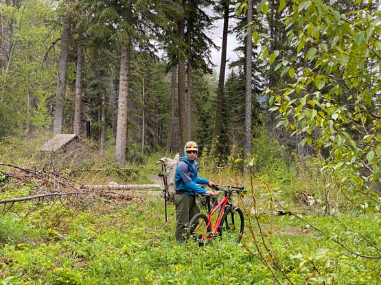
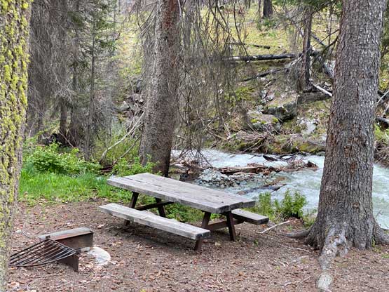
I managed to get off work a little bit earlier than expected and left White Rock at 8 pm on Friday night. The border crossing was without event. I then drove southwards and then eastwards across the entire stretch of North Cascades Highway to Winthrop. The gas at Winthrop was not ideal but I didn’t know if I had enough fuel to make back to the cheaper zone, so loaded 25 dollars at the small town. I then drove south to Twisp and turned onto Twisp River FSR. The plan was for Eric to arrive first to saw through any dead-fall on the road. I ended up catching up to Eric near the road’s end and there was no dead-fall left for us to cut. We did see lots of evidence of logs being recently cut so having chainsaws was still essential. Selena ended up being the first person arriving at the “trail-head” and we all went to sleep in our respective Toyotas (one Taco, one Tundra and one 4Runner) before 1 am. We did not drive to the road’s end as the final kilometer was closed, so Eric and I could still put our bikes in use.

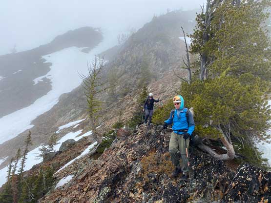
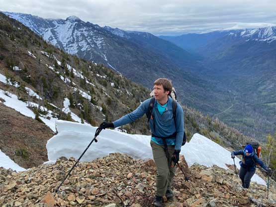
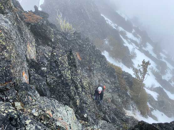
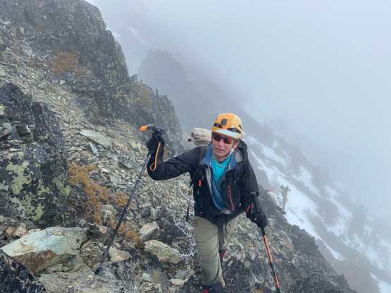
We knew the snow conditions could be terrible so the alarm was still set at 4:30 am. We eventually started the day at 5 am. Eric and I easily rode to the road’s end and found a tree to hide and lock our bikes and meanwhile Selena had caught up to us. The route we planned was the direct south face following Fletcher’s GPS track and the route looked drier than expected. In retrospect we could have left the snowshoes in the truck but nobody wanted to drive 5+ hours each way to take a gamble on our success chance. I ended up carrying snowshoes and two ice tools for no use. We took a short-cut from the bikes to intersect Twisp Pass Trail instead of back-tracking to find the proper connector. We then only followed this trail for about 5 minutes before bailing into the forest. We had about 20 minutes of level-2 bushwhacking to content with. The brushes were a lot more friendly than suggested on the satellite images so that was a pleasant surprise. The bright green colours on the satellite images turned out to be actually grass and not-so-thick underbrush. We also missed Fletcher’s GPS track by staying too far on climber’s right due to not paying enough attention, but we decided to just shoot straight up finding our own route, as the terrain appeared rather similar no matter where we went. We didn’t feel the need to traverse leftwards. There’s one short class 2, but somewhat exposed ledge to scramble across and that’s it. After that we were back on easier terrain and re-joined the existing GPS track.


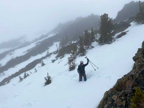
The next stage was a long stretch of “easy scrambling” on loose rubble before hitting some intermittent snow patches. We stayed more on the ridge on both the ascent and descent to avoid going onto snow for much as possible as Eric and Selena were wearing trail runners at this point. I was actually thinking to hop into the snow gully on climber’s right as early as possible but it didn’t really matter. Eventually after a couple sections of class 2-3 scramble on loose rocks the others had to don mountaineering boots and meanwhile we decided to don crampons as well, as the snow slopes appeared rather steep. I did not bother with ice axe as Eric offered to lead across the steep traverse (using his Billy Goat ascent plates that he planned to use in the Karakoroms this summer). The snow seemed rather soft and sure enough I was sinking through his foot steps but there overall weren’t too much added post-holing. We eventually got back onto the rocky rib roughly 100 m vertically under the summit.


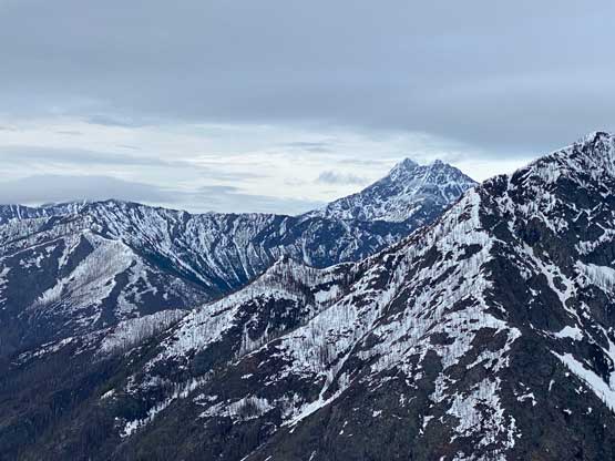
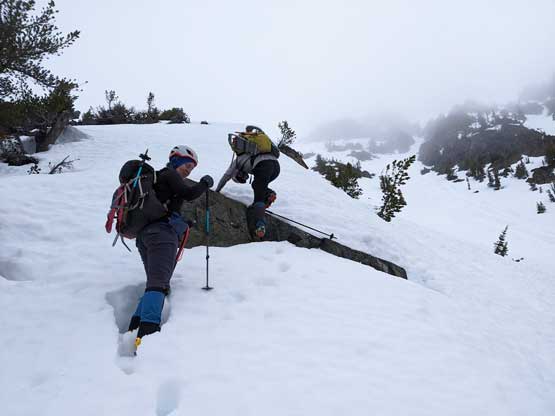

The snowshoes were ditched as it’s apparent that they were training weight on this day, but we still carried the ice axes and crampons as the cloud layer blew in and we lost the visibility. We stuck more ore less on Fletcher’s GPS track on the final ascent on the rocky ridge overcoming a few gendarmes. The scrambling was harder than expected with lots of loose 3rd class and the rocks were damp and slippery. But it wasn’t a difficult fair to eventually top out on the summit. We found no view, but a cool register to look into.


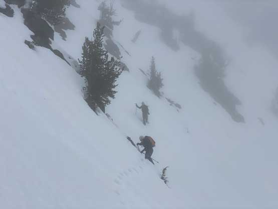
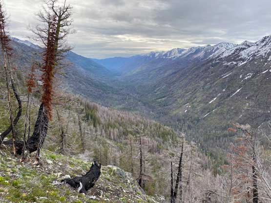
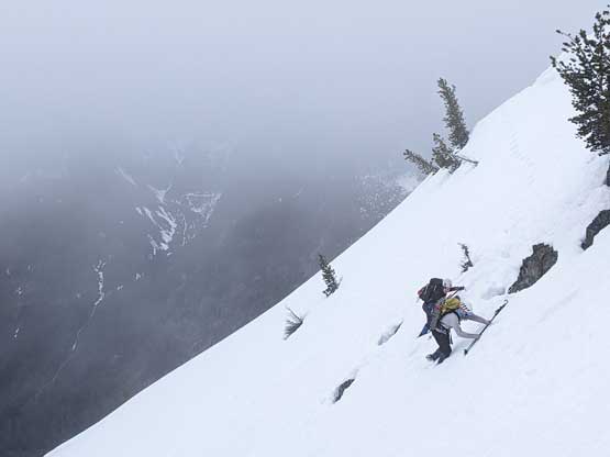
After almost an hour’s of waiting and chatting we decided that the view wouldn’t show up and we were correct. The ceiling just kept dropping throughout the day and we even got some light drizzle somewhere on the descent. I led an experimental route down the upper slopes by looking at the satellite images and linking up several broad snow gullies to avoid down-climbing those gendarmes. The price we paid was some waist deep wallowing in isothermal snow. The wallowing was extremely bad but none of us complained as we had encountered that on every single trip in this spring season. After grabbing our ditched gears we more-or-less followed our own route down the south face with only smaller variations near the bottom, mostly because it’s pointless to follow the exact GPS track on this route. The final bike ride back to the trucks made Eric and I glad to have brought them as that was significantly more enjoyable than walking. We finished the trip at noon so given the long driving distance we really had to bag another peak to make this trip more worthwhile. I had come prepared with a secondary plan and the others were easily sold.