Leading Peak
July 28, 2021
765m
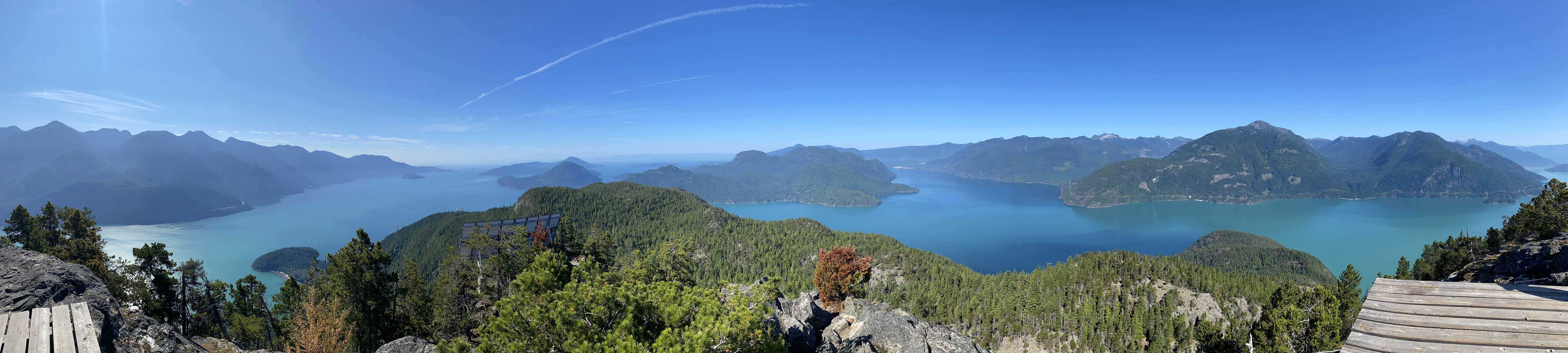
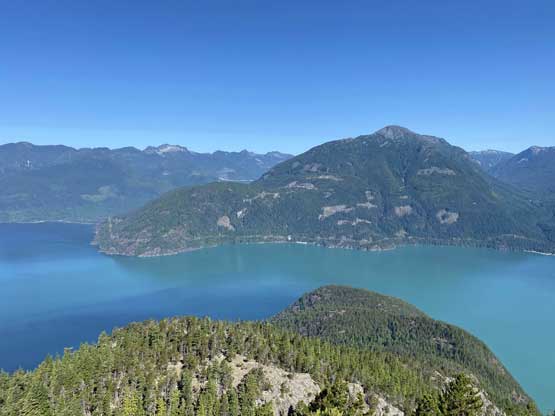
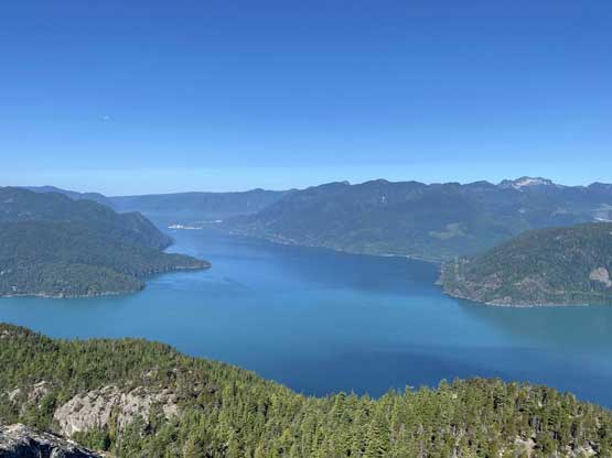
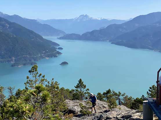
Anvil Island / Howe Sound, BC
Leading Peak is the highest point on Anvil Island one of the smaller, but rugged islands in Howe Sound. The peak isn’t tall by any standard but stands over 700 m above the sea and boasts a somewhat attractive profile for those commuting up and down the Sea to Sky Highway. There is no BC Ferry going onto this island and the access is either by renting a private water taxi from Horseshoe Bay, or by paddling from Porteau Cove. The water taxi is not cheap (300+ dollars for a round trip) but can fit a sizeable party to split the cost. Paying money for a mechanized access had never been an issue for me but a few months ago Matt J. suggested to paddle across. My paddling experience was limited to packrafting and I knew the packraft is not designed to cross open water like this, but Matt had enough confidence in his inflatable kayak to make it work. In the end Matteo and Mike from that Bagger Challenge group decided to join the team so now we had two kayaks and that sounded considerably safer.
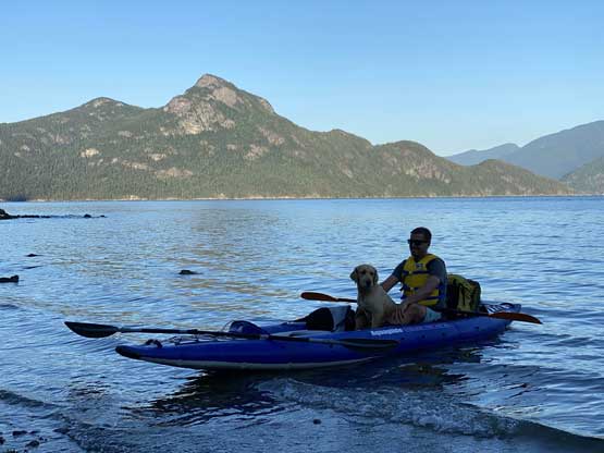
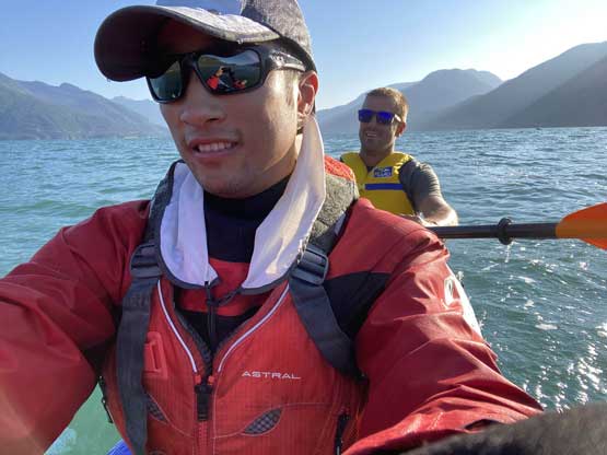
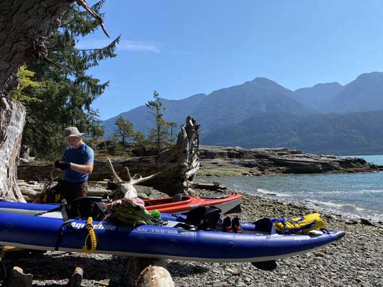
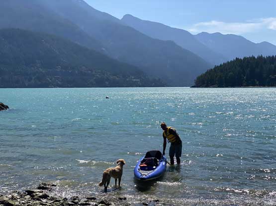
We estimated this was going to be a short day so did not leave Matt’s house until 6 am in the morning. Matteo volunteered to drive us to the cove as his hard kayak’s already strapped onto his truck. At the cove we had to take our time to inflate Matt’s kayak, and meanwhile I donned my dry suit. I had bought some proper whitewater rafting clothing and equipment two years ago and it’s good to make use of them again. The others opted to dress light as it’s just a paddle across 5 km of flat water.
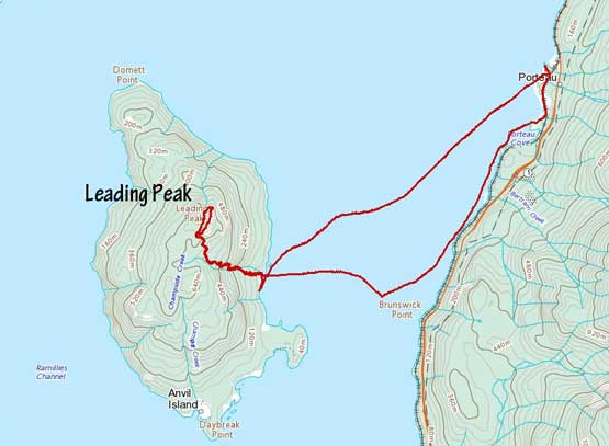
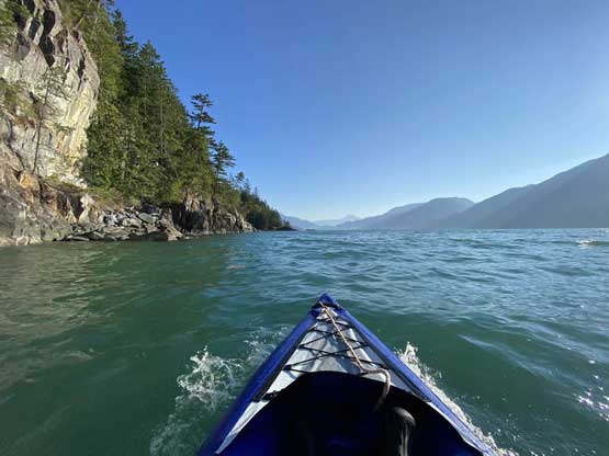
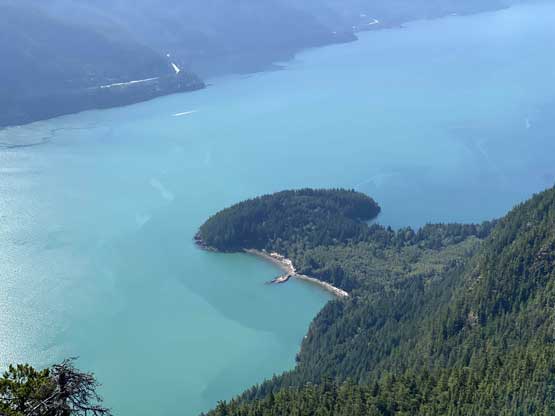
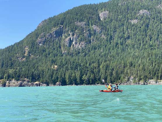
The morning was very calm with some light tail wind so our paddle out towards Anvil Island was very straightforward. The original plan was to paddle all the way around to the southern end of the island to go up from Bible Camp and the standard route as Matt had some concerns about the logistics of the eastern (shorter) trail, but the wind kept pushing us towards the east shore so after paddling halfway across we made the spontaneous decision to aim at the direct access. The paddle took us almost exactly 1 hour. Near the shore I had to double-check with the maps to correct our bearing as we had overshot the trail-head.
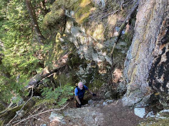
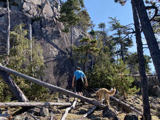
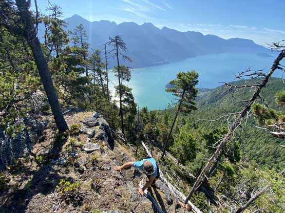
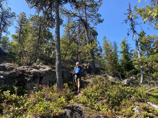
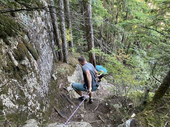
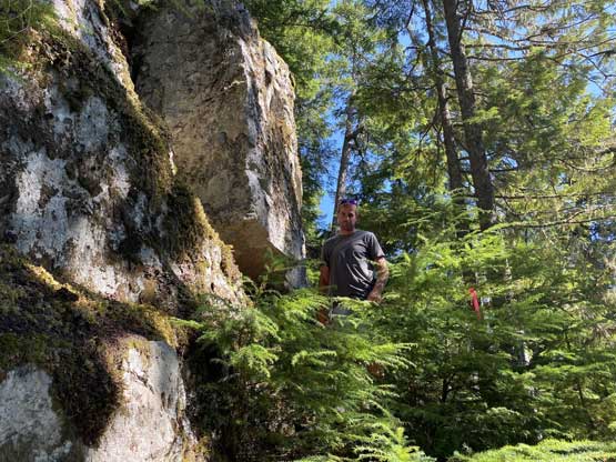
We again, took our time to secure the boats and to dry ourselves. By going up this direct trail we also shaved off a least 100 m of elevation gain because now we no longer needed to ascend up and over the south summit. The quality of this trail amazed us. There were some poorly defined sections at the bottom but after crossing an old logging road the going became super straightforward. There were a few steep spots that required brief scrambling but overall this was also not as steep as I expected. About 500 m of gain later the terrain petered out and the next thing we had intersected the “proper” trail near the saddle between the south and the true summits.


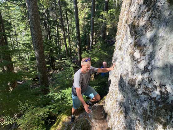

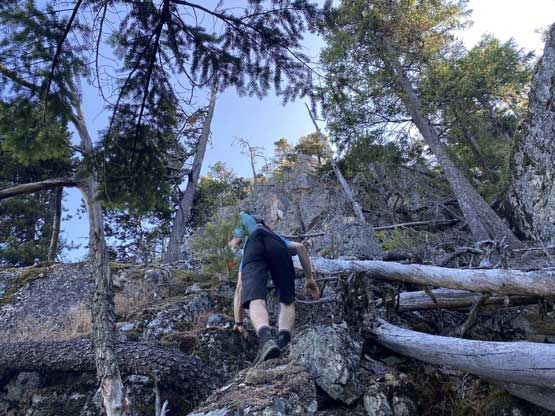
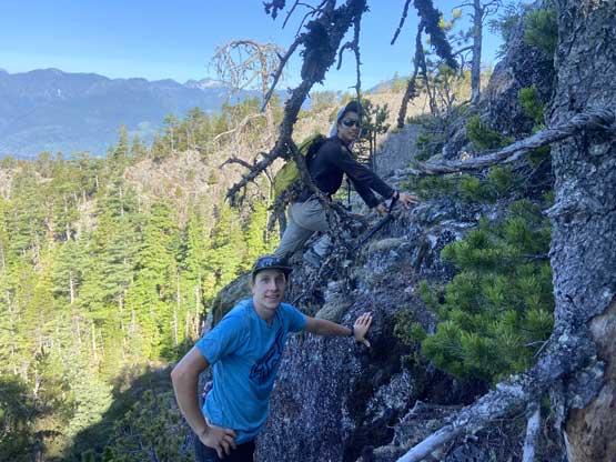
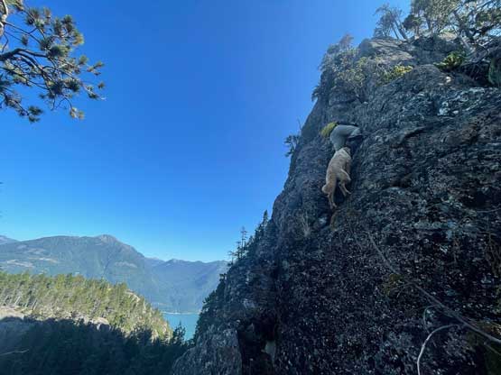
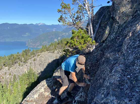
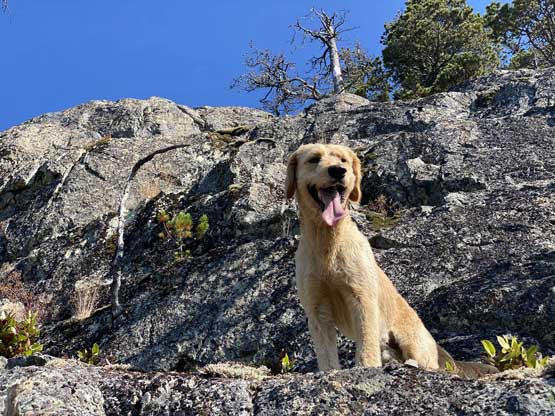
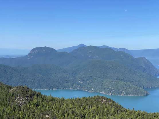
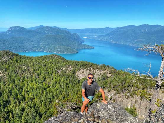
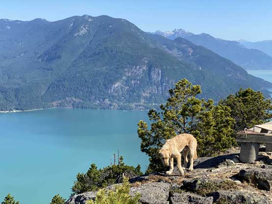
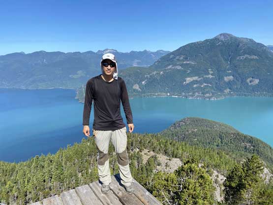
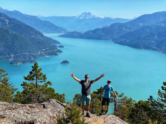
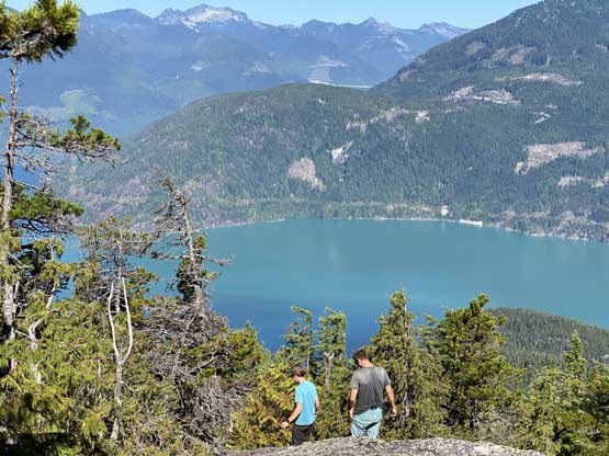
We followed the proper trail for a short while ascending into a deep chasm feature. We had some glimpses of the summit area and Matt, Matteo and I made a spontaneous decision to scramble up the south ridge to avoid some elevation loss/regain. I had absolutely no idea what to expect but Matt assured us that he had seen trip reports of this route. It turned out to be a very fun but short scramble with some 3rd and 4th class steps depends on micro-terrain. I was very glad to have taken this non-standard way up. We even got to the summit earlier than Mike who had gone around on the standard trail. The views from this summit was incredible especially considering how small of a peak this was. It’s not much taller than say, “West Knob”…

After having enough of the views we all descended the standard trail around the north side of the summit block and that involved re-ascending into that aforementioned chasm feature. The rest of the hike-out was steep and boring but uneventful. We did have to pay attention to the turn-off of our direct trail and the lower portions of this trail was quite slippery. Matteo led us down the entire way and kept a steady but non-running pace.

We took another long break at the boats. The winds had picked up but it seemed like the direction of the wind was overall in favour of us. I ate all four sandwiches that I brought up here as I knew the paddling could be tiring. The waves weren’t too bad, but we did have to angle a bit into the wave as our boats sure looked tiny in the ocean. This meant we got fairly close to Brunswick Point before making a turn due north towards Porteau Cove. Now with tail winds we had a blast paddling across the last few kilometers. Matt’s kayak was leaking somehow so we parked at the beach in Porteau Cove Park to drain the water. From there I just walked the last kilometer back to the truck and I have to say that walking in dry suit was not very pleasant in this heat.


In the end this was a very pleasant outing to mix up hiking, peak-bagging and sea kayaking. Instead of dealing with the logistics of water taxi I would highly recommend to bag Leading Peak in this manner but paddling in open ocean does require some experience especially if the waves pick up.
