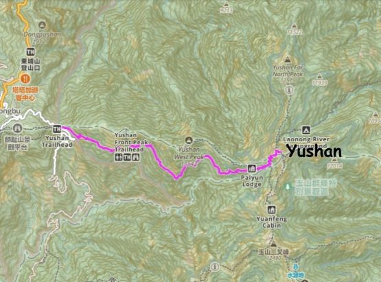
Yushan / 玉山
September 11, 2023
3952m
Chiayi, Taiwan
Yushan, or 玉山 is the highest peak in Taiwan and because Taiwan is an island this peak subsequently boasts significant amount of prominence, making it the 26th most prominent peak in the entire world. In English the name of this peak is “Jade Mountain”. Taiwan has an amazing hiking culture that almost every single summit is named and has at least one trail that reaches the summit. They have lots of remote peaks that require multi-day expedition even for the fittest, and they even have their own peak-bagging lists. Yushan, by comparison, is a fairly straightforward ascent. The most difficult aspect is actually the “red tape”, that even with the ability to communicate in Chinese I felt that Yushan involves some of the most annoying permit bullshits among all the trips I’ve done in the world.
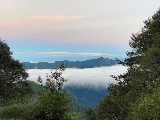
The red tape would be significantly more complicated if not “impossible” if one is planning to do it over 2 days and that is the standard way, but it is easily doable in one day even for the “averaged” scramblers from North America. Adam and I ended up completing the ascent in 7.5 hours round trip and we were going at a fairly slow pace by our standard, and yet nobody at the trail-head believed that. For most Taiwanese people it would take 7-8 hours just for the ascent. I’m fairly certain that those who read this trip report will plan an 1-day ascent so there’s no point in illustrating the complicated process to obtain an overnight permit. To obtain the 1-day permit one needs to fill in some complicated forms to be submitted into a lottery bowl, and about 1 month prior to the trip the national park would draw the lots. There’s a quota system of maximum 60 day-trippers per day. The chance of winning the lottery on a summer weekend should be around 25% but much higher on a weekday. Adam and I opted to make our bid on a Monday in September after the start of the school season, and we had more than 80 hikers bidding for these 60 permits. Having a smaller group significantly increased the chance of winning as to win the slots every member in the team must win. The result of the lottery draw was positive, so we would carry on with the itinerary. We had submitted the date, the intended route and the detailed information of ourselves so there’s absolutely no flexibility whatsoever, so we also had to win the lottery against the weather god. One word can be used to summarize the weather in Taiwan in summer and that is “horrible”. As the trip became closer I started to check the weather forecast and noticed typhoons after typhoons with lots of rain and thunderstorms. A quick glance using Meteoblue showed more than 20 mm of precipitation for every single day for the entire 14-day forecasted period, and believe it or not, the forecast was actually correct. Some of the access roads were washed out by the continuous downpouring that it was barely possible for us to drive to the trail-head.
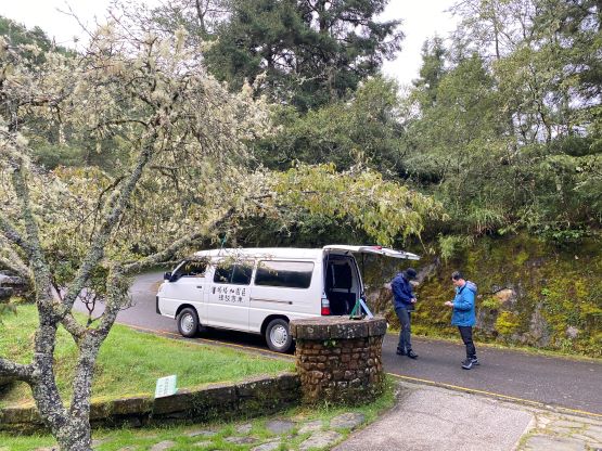
In fact, planning an ascent of Yushan as a foreigner in summer is a terrible idea but we were already in eastern Asia and we might as well give it a try. The best time should be fall, spring or even winter as that’s their dry season, but the ascent (and the permit system) can be complicated by the presence of snow. In any case the day of our ascent actually held the best forecast compared to the previous few days even though there was still over 20 mm of rain. The majority of the precipitation should fall in the afternoon so by starting in the early morning we hoped to avoid most of the misery. We might make the summit with some views if we were extremely lucky. For the transportation to the trail-head we decided to hire a private driver and I got that sorted out by joining a Taiwanese Facebook group. The entire communication was in Chinese so I don’t think there’s any chance for Adam to do this part of the job. Most groups would prefer to spend a night at Dongpu Lodge near the trail-head, to get more sleep and also to help with the acclimatization, but we decided to just do it in a single push from Taichung, about 4 hours of driving away. Adam always prefers to sleep in a not-so-noisy place so that Dongpu Lodge was out of consideration, and thankfully our driver was able to make the adjustment. I made the plan to leave Taichung at 1:30 am and the driver was okay with that. The driver’s son had actually completed the entire 100-Baiyue list and the driver himself had climbed Yushan as a day-trip so he understood some of the weirdest climber’s needs that could otherwise not be understood by the “normal” humans.
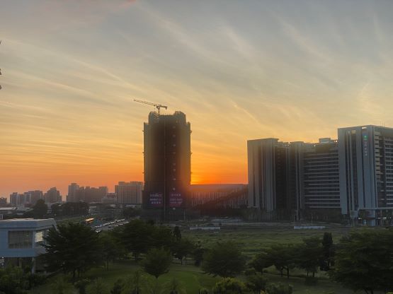
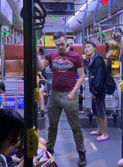
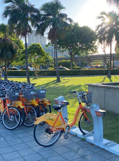
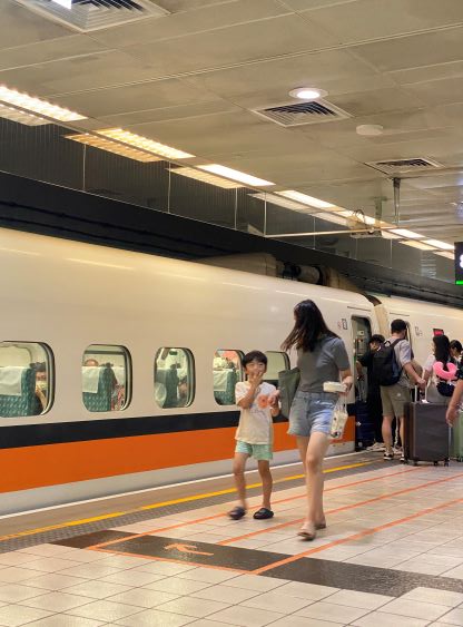
The 10th of September was a full day of travelling from Chiba, Japan to Taichung, Taiwan and our method was to take public transportation mostly to save some money. The flight was not delayed, thankfully, but the company (Tigerair Taiwan) was trying really hard to get our carry-on bags checked so to collect more money from us, but we make some hard resists and they eventually let us in. I would not use this airline again in the future. EVA Airways should always be the go-to for travelling to and from Taiwan, but we did not book the flights until the very last minute so our options were limited. After landing in Taiwan we did the usual stops for the SIM card and money exchange and then took the MRT to the HSR (High Speed Rail) station. Obtaining two seats in the HSR was proven to be difficult on a Sunday afternoon, but the ticket counter did manage to secure our spots, albeit with about an hour of waiting. I used that waiting time to do some walking as I had wished to visit Taiwan ever since high school, and I was quite excited to finally be here. The HSR ride was uneventful but because of the delay we did not make to the hotel until late in the evening. I figured that I might as well just pull through another “all nighter” so I turned on the computer and got the Fuji-san’s trip report typed out. I was able to do the trip report efficiently so I eventually earned myself about 2 or 3 hours of sleep. The driver was on time but showed up at a different hotel, but the problem was quickly fixed and we departed from Taichung at 1:45 am. The drive to the trail-head at Tatajia information center was the second crux after the “red tape” bullshit. The continuous downpouring had done enough damage to Chiayi that they even shut down the work and the school for the day. Not to my surprise our intended route (嘉-130) was blocked by multiple mudslides. We unfortunately relied too much on Google so did not discover that until we were right in front of a slide. We were thankfully able to bypass the slide by detouring a long ways around on 台-18 and eventually made to Tatajia after more than 4 hours leaving Taichung. The drive was quite slow. Despite that the rain had stopped there was a lot of pooling and the lanes weren’t that visible.

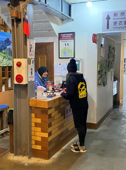
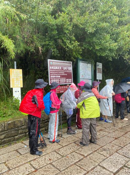
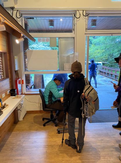
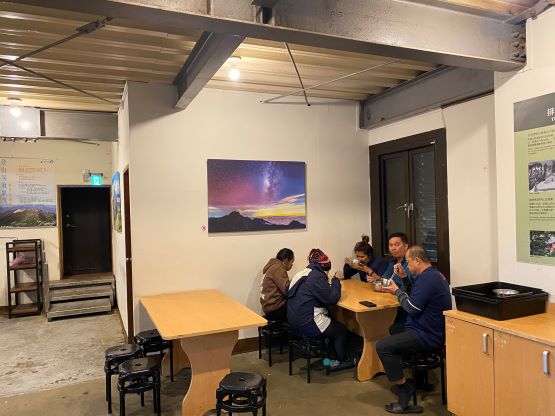
It was here that I learnt that the final 3-km of the road was closed for private vehicles even at night time. I previously was hoping to drive that final stretch before the start of the shuttle services, but that was apparently not possible. We had to either walk the distance or to wait until 6:30 am to take the shuttle van. The former option would not give us much advantage in time, so we might as well just wait for the opening. The place to hop onto the bus is the visitor center which was about 5 minutes of walking from the parking lot, and several groups came within the next half an hour. The waiting game had then become a socializing experience as I was able to talk in Chinese. They indeed opened the information center at 6:30 am, so we did our registration and hopped onto the shuttle van. Even though we had done the entire red-tape process correctly we still had to make two check-ins during the hike and one online check-out afterwards. The shuttle van could only take 7 people in one grab, so the earlier to line up there the better. Adam and I were early enough to get onto the first bus, and that’s it. We finally made our way to the trail-head. The ascent of the mountain from the trail-head would be a piece of cake, and by comparison, the majority (like over 80%) of the work was to get to this spot. This surely would seem ridiculous or unacceptable for those based in Canada who had never bagged a peak more than a day of travel away from their home (there are a LOT of people like that), but this is the “norm” in the global scale. Even in some parts of the U.S. like the east coast the red tape can be harder than the ascent.
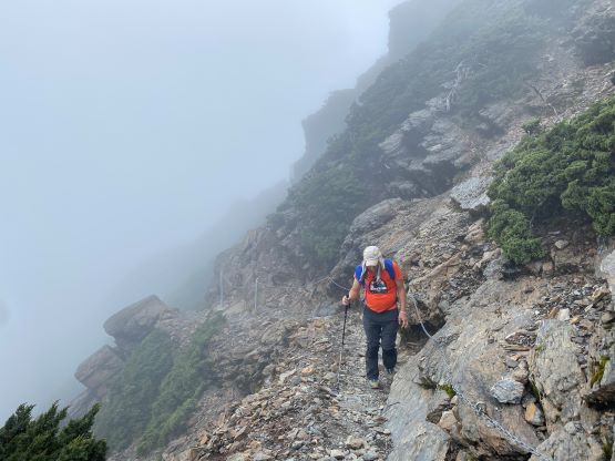
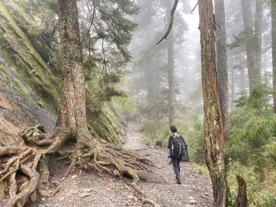
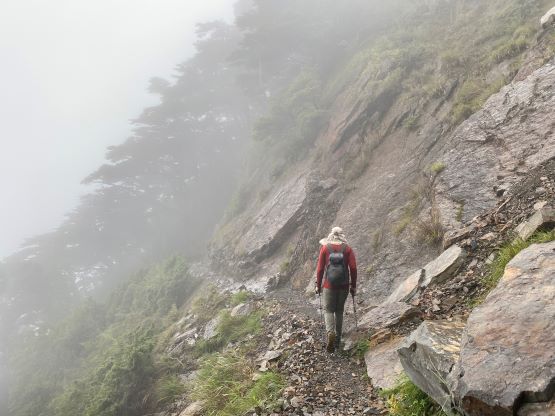
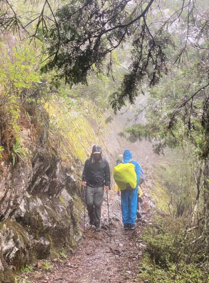
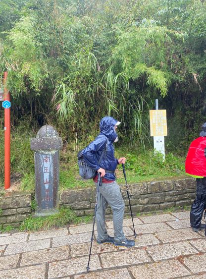
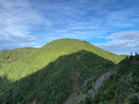
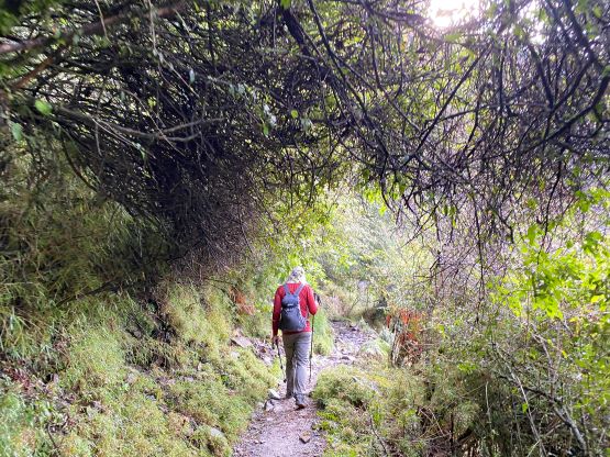
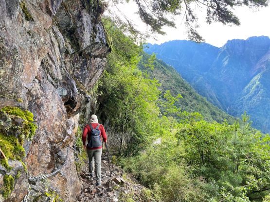
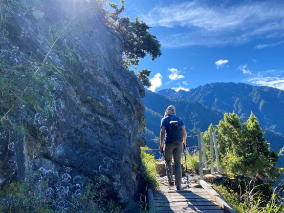
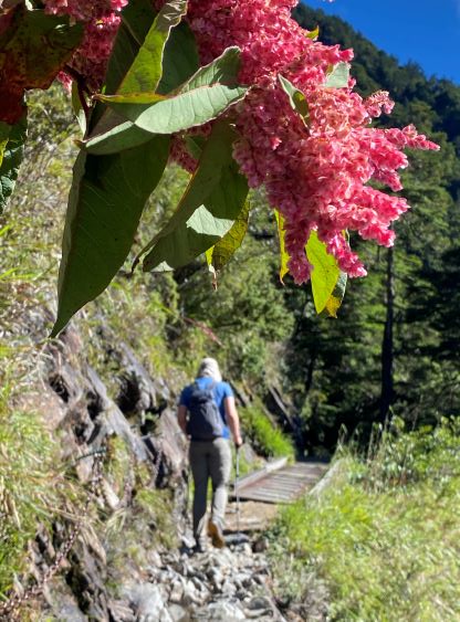
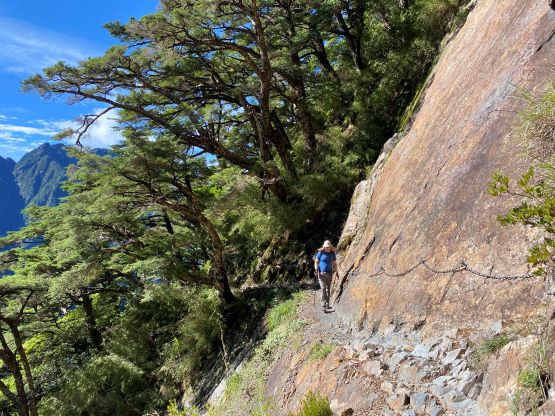
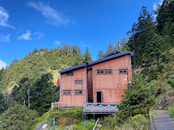
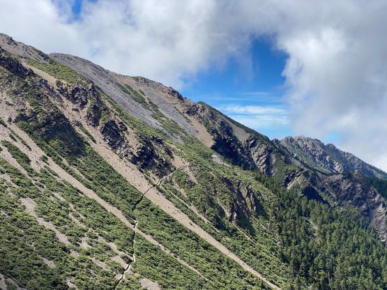
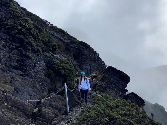
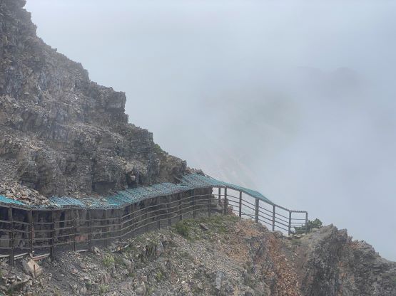
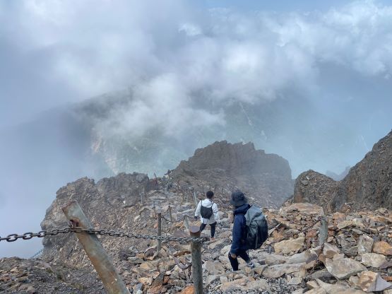
One earlier group that I met at the Tatajia info. center had also arrived at the trail-head, though by walking, and they wanted to take a picture with me. After the picture show I took off, caught up to Adam in a few minutes and then started dashing up the trail. The registration guy at the info. center warned me that if we couldn’t show up at Paiyun Lodge (the next check-in point) by 10 am they would turn us around and it would not matter how “experienced” we were, so we had 3 hours to get there. The normal 1-day itinerary is to wake up at Dongpu Lodge (trail-head) at 1 am, walk up the road and spend 5-6 hours walking to Paiyun Lodge, and that guy did not understand why we wanted to start so late in the day. He basically made the claim that we were doomed and could not make it, but permitted us to “give it a try” nonetheless. I checked the map and assured Adam that we would be at Paiyun Lodge by 9:30 am if not 9 am, so there’s little to worry about. The hike was very cool as we constantly traversed on the edge of the cliffs and at times, there’ll be fixed chains, hand-rails and wooden boards to add some security. The walk was longer than I thought probably because of the altitude, but we still made to Paiyun Lodge in 2 hours 45 minutes, arriving with about half an hour’s spare. The registration guy in this lodge only warned us against the incoming weather, and even permitted us to take a break and drink some water even though we did not pay a single penny to stay in this lodge.


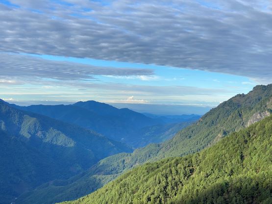
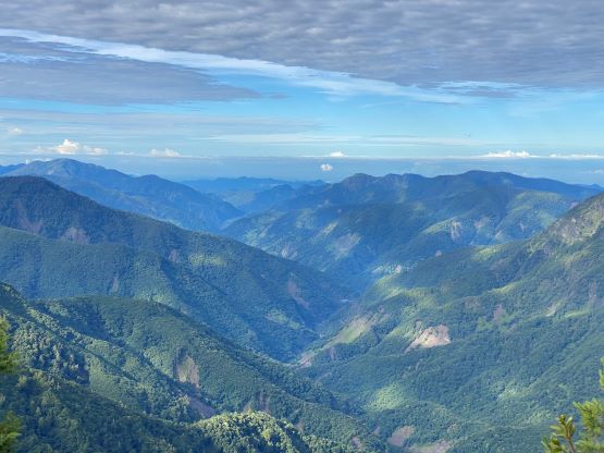
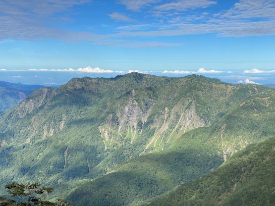


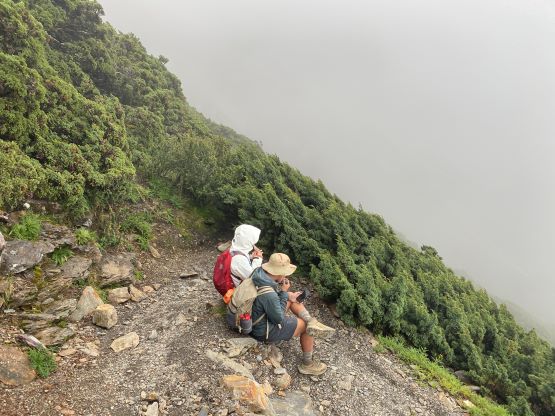
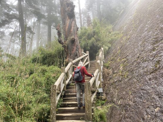
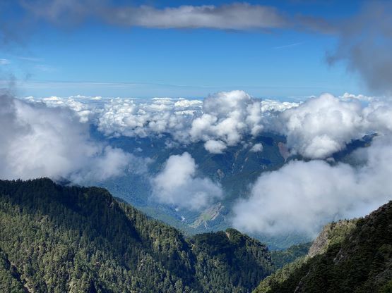
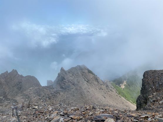
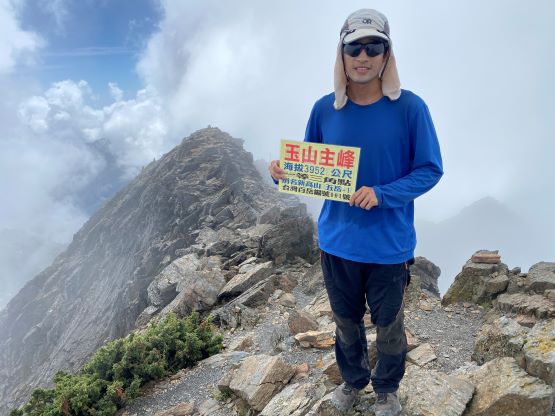
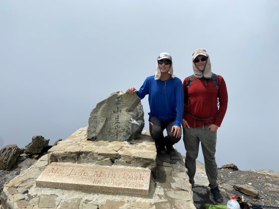
The forecast was calling for rain starting at noon and I did not take it seriously as the forecasts had been proven to be completely useless in Indonesia, Malaysia and especially in Japan, but this time it was correct. The ascent to the true summit of Yushan from Paiyun Lodge was straightforward but does require over 500 m elevation gain, which could be painfully slow at this altitude. The trail was still well-engineered and they turned an otherwise 3rd class peak into a “walk-up”. There were a shit ton loads of chains and stone staircases on the upper route. I entered the clouds from about 100 m below the summit and the view was a bit of a bummer. I was able to get most of the views towards the west but there’s not much to see from the actual summit. Adam arrived 15 minutes later and we took a long break regathering some strength. There’s another group of Taiwanese sharing the summit with us, and a few day-trippers were still on their way up. I had thought about to tag the east peak or even the north peak because I certainly had enough time to do an add-on or two, but I was not motivated in the white-outs. This was the correct decision as the rain would start within half an hour. It would be extremely miserable had I gone for the east peak.


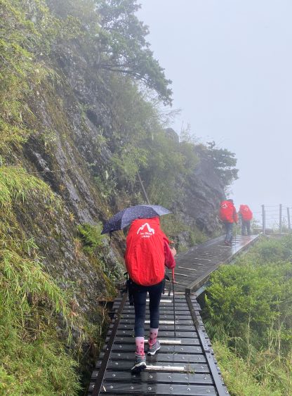
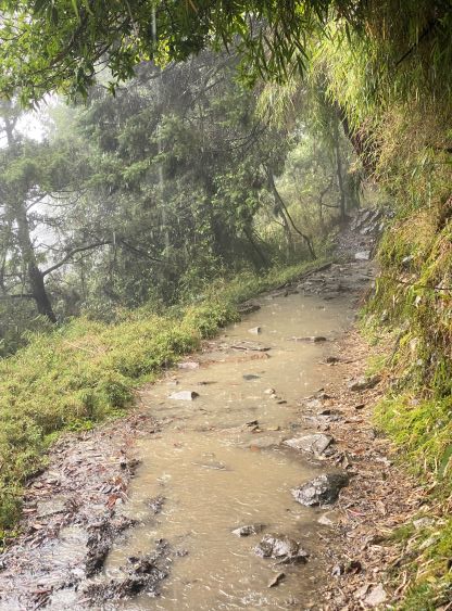
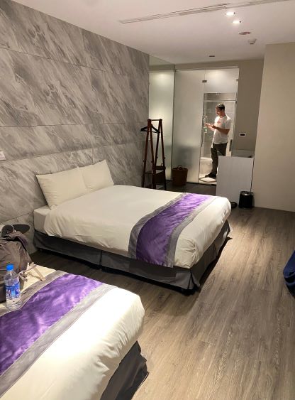
There was absolutely no view from the descent and the rain started when I got to about halfway down from the summit to Paiyun Lodge. The rain was fairly tame so I just pushed to the lodge without donning anything, and waited in the lodge for Adam to come. I was not anticipating a real downpour for the next couple hours but the downpour did come. The trail eventually became a river with the depth of water exceeding my ankles at times, and the pouring did not let go until we were very much back to the trail-head. I only brought a hardshell jacket which could be used as a rain jacket, and as a result I got completely soaked. There wasn’t a single piece of gear that was able to stay dry. I had to give up taking pictures as my phone was already acting up because of the water, and I double-wrapped my passport and money in zip-locks and so the papers didn’t get soaked. Our hiking speed was slow. This was probably the rainiest hike I’ve ever done, but the temperature was warm enough that it wasn’t that much of a sufferfest. Adam and I had to wait for about 20 minutes at the trail-head as the van could only take 7 hikers in one grab. There were already 10+ hikers lining up in front of us. We thankfully had left all of the luggage with the driver so we quickly found some dry cloths and changed the wet ones. Not doing much lingering we drove down the direct route (closed/controlled at night time) northwards to Nantou and then Taichung. I caught up at least an hour of sleep in the vehicle and I felt decently fresh after getting back to Taichung. We then took the High Speed Rail to Baiqiao station near Taipei. Finding the next hotel was difficult as there are two Merryday Hotels within the same city and we took a bus to the wrong one. Thankfully the receptionist was able to arrange us a taxi to the correct hotel, which was frustratingly only a few minutes from the HSR station. We ended up taking a bus tour in Xinbei city and wasted more than an hour of time.