Mount Turner
December 30, 2014
2806m
Banff – Mt. Shark to Assiniboine, AB
Mount Turner is a prominent peak en route from Mt. Shark to Assiniboine via Bryant Creek, but doesn’t seem to draw much attention from the scrambling community. My first time having a real impression with this peak was on Mt. Fortune two years ago. Ever since that I’ve done some research and found that in fact, a few of my friends had ascended it in winter on skis. Speaking the route they took, it’s merely a Class 1 scramble via the long NW ridge, but does involve a very long approach (35 km round trip distance with 1700 m cumulative elevation gain).
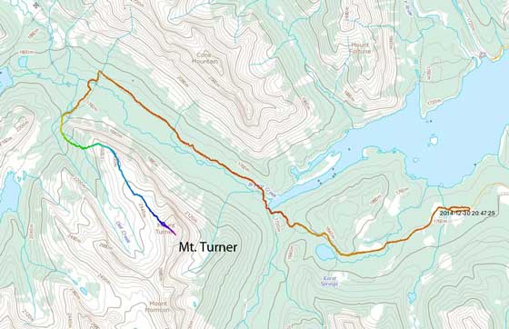
Mt. Turner scramble route. GPX DL
A brief high pressure system arrived towards the end of 2014 and Grant and I were gaming for a day-trip. To take full advantage of the blue sky my suggestion was to pick the most (physically) difficult objective we could succeed… Obviously I knew Mt. Turner’s going to be a long day but I never actually looked at the statistics. To make a comparison the distance and elevation gain is similar to Castleguard Mountain, and planning something like that as a day-trip in December on snowshoes is surely aggressive…
And we didn’t manage to start our day early. We did wake up at 4 am in Calgary but it took us forever to get ready in the morning. By the time we started the trek it was already 8 am and we didn’t even need to use head-lamps. (That’s still okay as we just had to descend in the dark then). It was also super cold. The forecasted temperature was about -28 degrees but I was sure it’s colder than that. My camera failed instantaneously and I couldn’t turn it on in the first 2 hours or so… That really reminded me Balfour and Ghita…
I’ve done the Bryant Creek winter approach almost exactly one year ago, and I knew exactly what to expect. For Mt. Turner we’d follow this popular cross-country ski trail for 12.1 km to Owl Lake junction. This is one of the most boring trail I’ve ever done with minimal views nor net elevation gain, but lots of up-and-downs. That was alright in the morning but we knew those elevation re-gain would be very tedious towards the end of this trip.. On the positive side there were many skiers setting up the tracks so we didn’t have to break trail, and this initial 12 km approach took us 2 hours 40 minutes.

I eventually got my camera working. I had to warm it up inside my jacket…

Through the trees we got some brief view of the impressive Cone Mountain
Unfortunately the Owl Lake trail wasn’t tracked so we had to start post-holing from there. We rarely have to sink passing our knees fortunately, but that’s not due to a consolidated snowpack, but rather the fact we didn’t have much snow at all… The average snow depth at lower elevation was about a foot, and that’s it… At sections the snowpack wasn’t deep enough to cover the grass. The trail led us down (yes, down) to a good bridge crossing Bryant Creek, but soon after that we started losing the trail. That wasn’t problematic as we were already pretty close to the base of Mt. Turner’s long NW Ridge. Aiming towards the ridge we started bushwhacking with tedious trail-breaking. Ascending to treeline was a long haul – much longer than what’s suggested by the map. Good thing was the temperature finally rose up a bit and near the treeline we were finally treated with sunshine and some nice views.
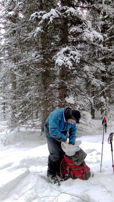
Grant taking a short break in the bush. It was freakin’ cold…
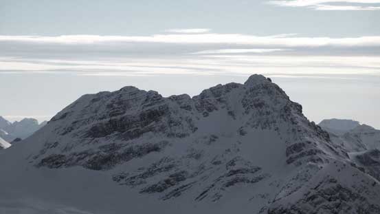
Two hours later we finally got some nice views. This is Mt. Mercer
An unnamed peak with Allenby Pass on right
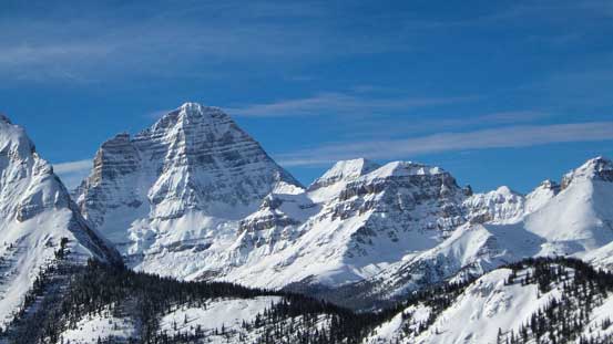
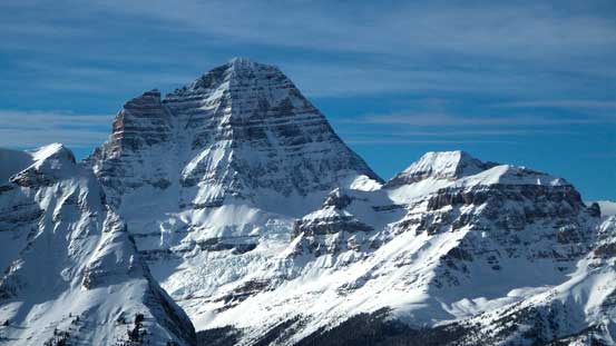
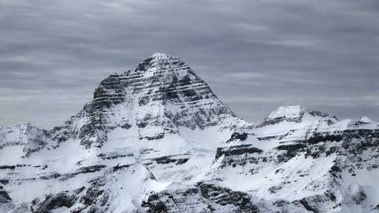
Oh the mighty Mt. Assiniboine.
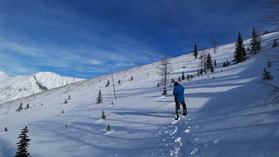
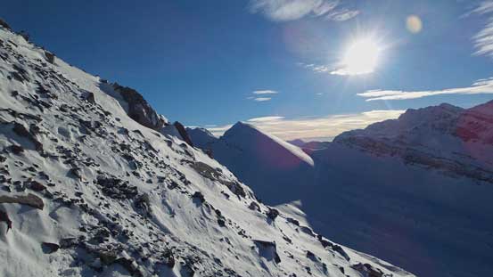
Near treeline. We veered left to hit the wind-blown slopes

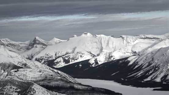
Looking up Bryant Creek towards Assiniboine Pass.

Cone Mountain is a sexy-looking peak

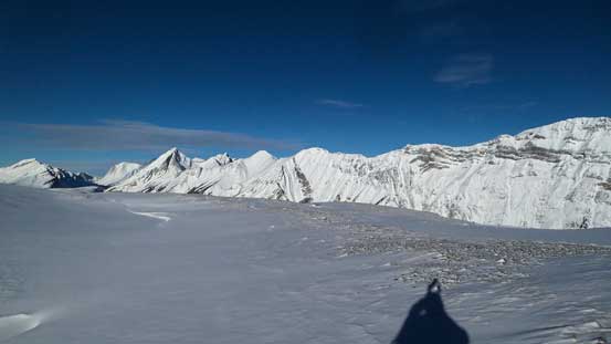
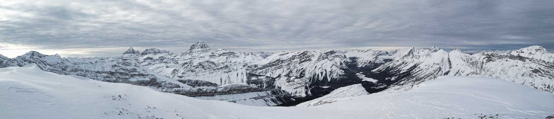
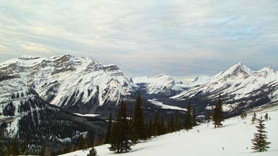
A panorama view from the treeline. Click to view large size.
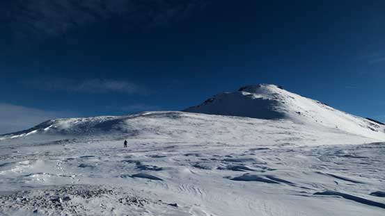
Up and over the first highpoint on this long ridge we finally saw the distant summit block. It didn’t appear to be far away but we knew the view was foreshortening. According to my GPS we still had to gain 500 m height… The next horizontal kilometer along the ridge was on undulating terrain with again, elevation loss and regain (that’s the theme of this route). But thankfully post-holing was finally over. Seeing the entire ridgeline being wind blown we ditched snowshoes and proceeded on foot.
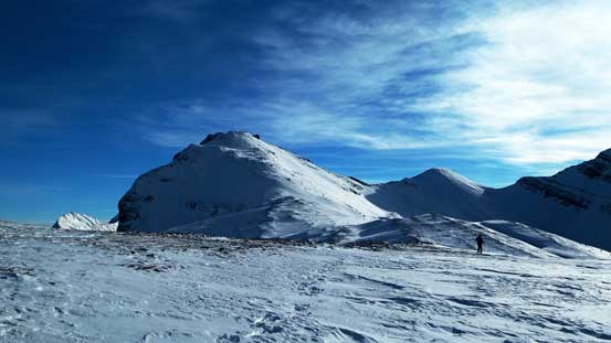
From the first highpoint we could see the summit – still a freakin’ long way to go…
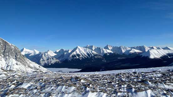
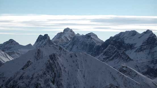
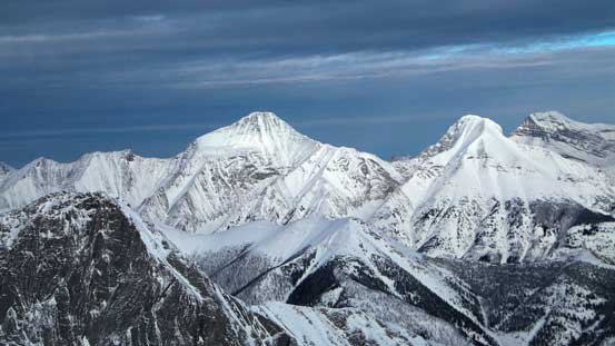
Great view of the familiar peaks by Kananaskis Range

Some impressive peaks started to show up – Mt. Alcantara?
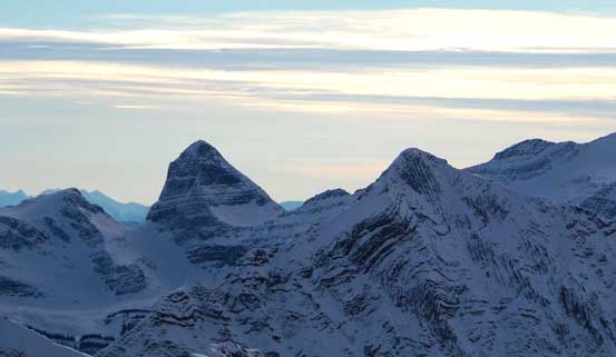
Another view of Assiniboine
More of the gorgeous views – all for the hard work we’ve done.
Slowly approaching the final summit block.
I ditched my backpack at just below the final summit block – 300 m elevation gain on steep rubble slope mixed with snow. At this point there was a layer of high clouds rolling in on a rapid pace and we lost blue sky in no time. That was a bit disappointing but we’d already got most of the views. Our summit stay was short due to the fact it was getting late. We’d only have about 2 hours daylight time left..
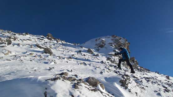
Grant ascending the typical terrain on the summit push
The terrain was steep.. Mt. Morrison in the background.

Another view from the final 300 m ascent

Partial summit panorama. Click to view large size.
Partial summit panorama. Click to view large size.

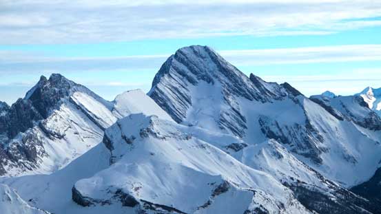
Impressive Mt. Galatea – highest peak in Kananaskis Range
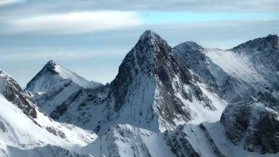
The super sexy Mt. Birdwood
Mt. Sir Douglas

Mt. Joffre in the distance
The rugged Royal Group, with Mt. King George being the highest
A zoomed-in view of the summit ridge of White Man Mountain
This pointy peak is unofficially named “Shark’s Fin”
Mt. Assiniboine again

Unusual view of Eon Mountain and Aye Mountain. Eon is high on my ‘list’.
Old Goat Mountain and Mt. Nestor
The huge slope of Mt. Sparrowhawk

Mt. Engadine with The Tower behind
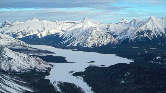
A view of Spray Lake
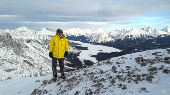
Me on the summit of Mt. Turner
The descent went by quickly and in short time we were back down the summit block. We utilized snow for as much as we could to save our knees. Snowshoeing down through the trees was fast but by this point I was getting really tired. I was overall not on my best physical condition and I knew the rest of this long return would have been miserable. And it was… We managed to get back to the main Bryant Creek cross-country ski trail just before it’s too dark to see. Head-lamps on, we still had 3.5 hours of “zombie walk” to go. Towards the end Grant went ahead to warm up the car, as I could no longer move as quickly as in the morning.
A view from the descent
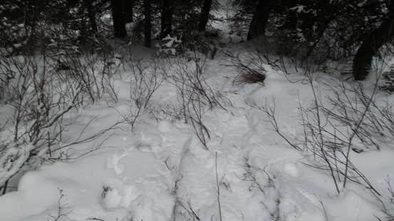
See the problem? We need more snow….
Our round trip time was 13 hours and this was surely an exhausting day out. 35 km on snowshoes that’s a wee bit too much for a day-trip especially for this time of a year. Wearing full-rigid mountaineering boots was also a poor choice, and I have to say these boots do not fit the best with snowshoes.. I really enjoy snowshoeing downhill on soft snow, but not so much if wearing rigid boots. For those of you interested in Mt. Turner, you can spend a night (or even two nights) in Bryant Creek Shelter to make your trip easier.
It was almost midnight when we got back to Calgary. That was too late and I was too exhausted to drive back home. Thank Grant again for offering me another stay in his house. I slept in the next morning till 9 am. The weather was inspiring to make another ascent, but too bad I no longer had enough energy, so drove home. A great finish of an awesome year!

Thank you, Steven for a great day out in the mountains! It was truly a glorious way to experience some very familiar mountains from a different perspective.
What a way to end the year!