Rainy Mountain
September 25, 2018
1682m
Sunshine Coast / Tetrahedron Provincial Park, BC
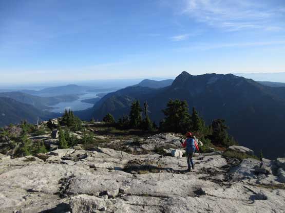
The broad summit immediately to the east of Tetrahedron Peak has an unofficial name “Rainy Mountain” or “Rainy Peak” probably due to the proximity to Rainy River. This peak has a very gentle south and east slopes but boasts a very impressive north face. There’s a user-maintained trail running steeply up from Rainy River FSR frequently visited by the locals, but the status of this peak remains obscured among scramblers from Vancouver, BC. The main prize of this area is by no doubt Tetrahedron Peak but it makes sense to combine it with an ascent of Rainy Mountain. It’s “right there” so why not. Earlier in this day Lily and I had made a very bushy ascent of Tetrahedron Peak via E. Ridge.

Tetrahedron Peak (via East Ridge) and Rainy Mountain via Rainy Trail. GPX DL
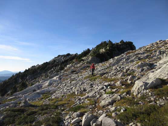
From Rainy/Tetrahedron col it appears that the ascent via W. Ridge could potentially impose some issues. The lower portion of Rainy’s W. Ridge involved more bush thrashing intermittent by some 3rd class scrambling on down-sloping and wet granite. The game of route-finding still applied in order to stay within “3rd class” terrain. Lily and I had to do two short but very strenuous 4th class steps but I wasn’t sure whether or not we found the easiest route.
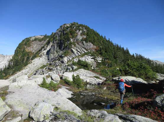
At Rainy/Tetrahedron col going for the West Ridge of Rainy Mountain
Lily on the lower W. Ridge
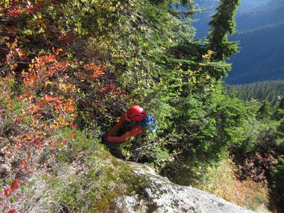
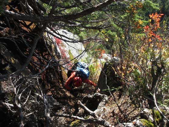
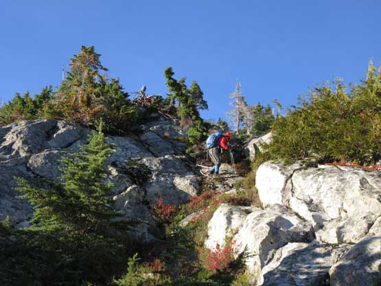
Lily pulling up a 4th class vertical bushy step.
This step-across was very airy…
Lots of bushwhacking. This was the theme of this day…
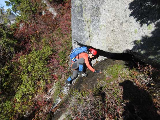
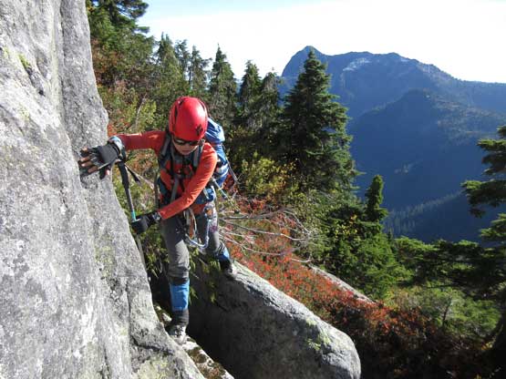
Mantling up another awkward 4th class wet step…
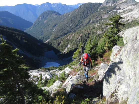
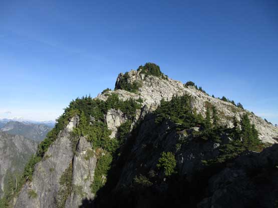
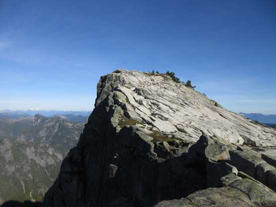
Higher up the bush finally gave way to some open slabby terrain and this resumed for the rest of this ascent. If not because of the lateness and tiredness I sure would have enjoyed this peak but at this point we just had to press on. The summit ridge seemed to drag on for quite a while. The true summit is the first one but we continued all the way to the second (eastern) summit before dropping the packs for a much-needed break.
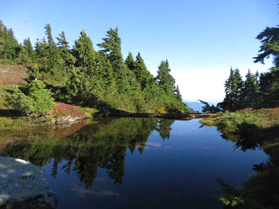
We passed a lovely tarn along the route
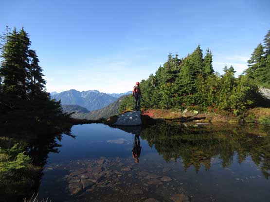
The same tarn with Lily’s reflection
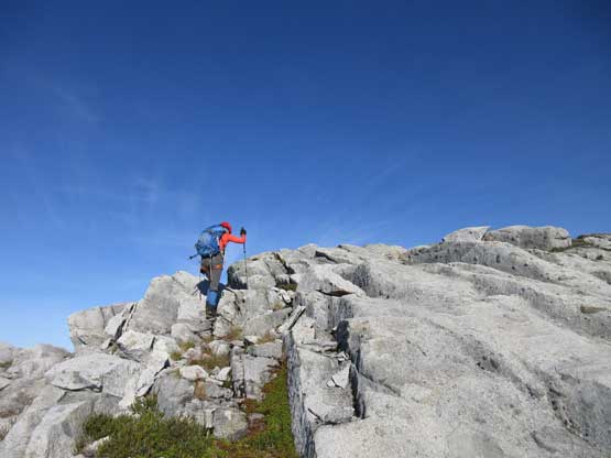
We stuck relatively close to the crest of Rainy’s W. Ridge
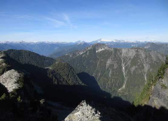
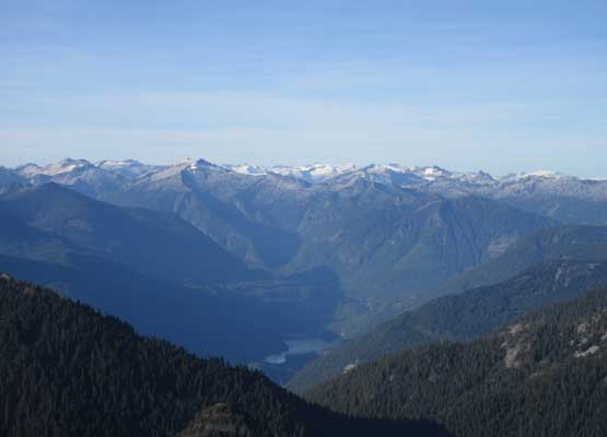
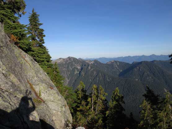
This is a northern view into the typical Sunshine Coast scenery
Onward onto the summit ridge
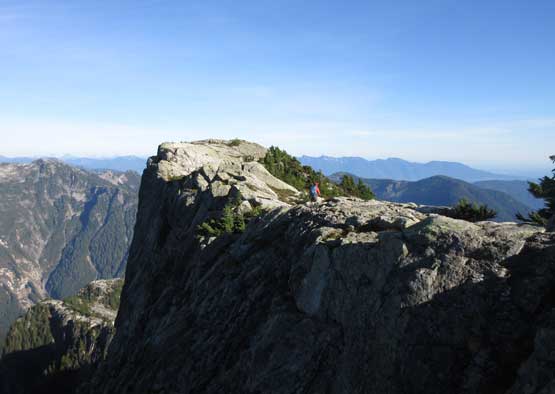
Hitting the summit ridge finally. The true summit ahead
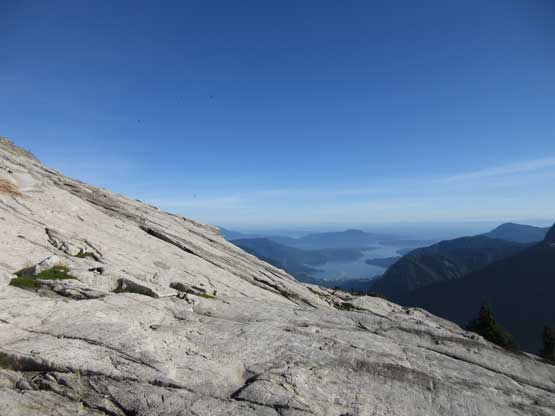
Slabby walk in the sky! Howe Sound in the background
Lily approaching the summit

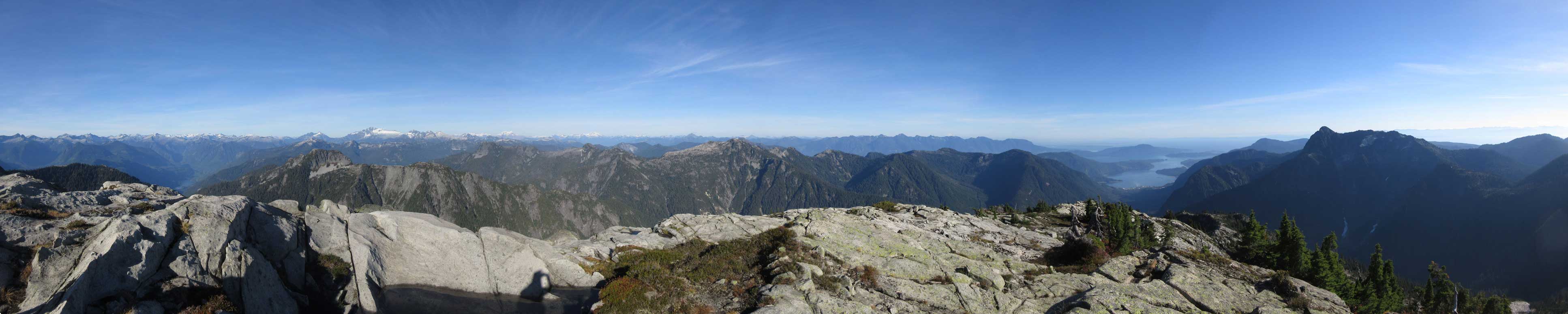
Summit Panorama from Rainy Mountain. Click to view large size.
Traversing to the eastern summit
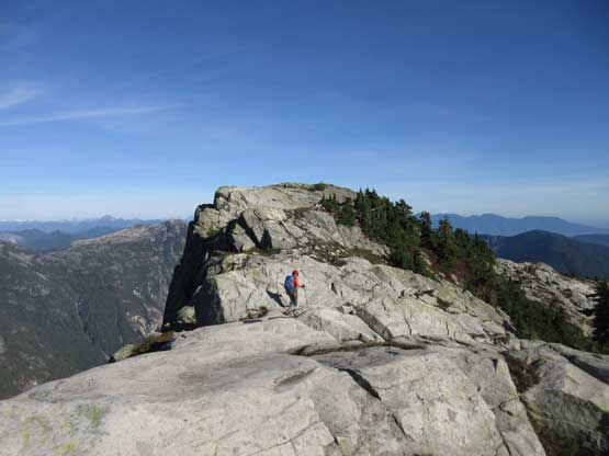
More about the traverse to the eastern summit
Panorama from Rainy’s E. Summit. Click to view large size.
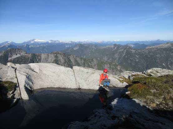
Lily filtering water from the “summit tarn”
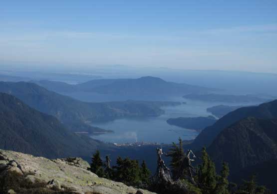
This is zooming-in towards Howe Sound
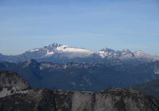
The unusual perspective of Tantalus Range
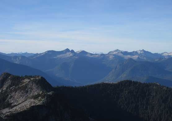
Looking up the Clowhom River valley into Tzoonie/Phantom area
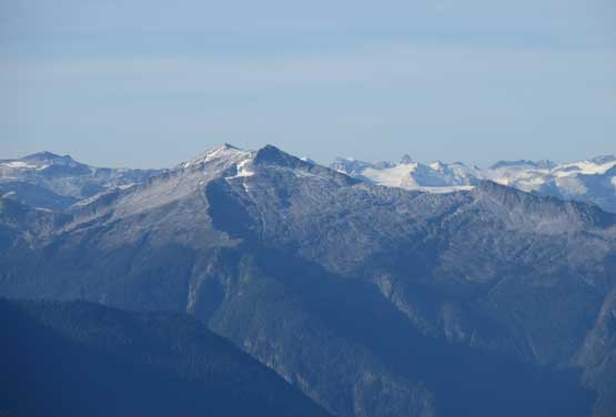
This is looking over the southern sub-summits of Tzoonie Mountain
Looking over another sub-summit of Tzoonie, into Ashlu-Elaho Divide
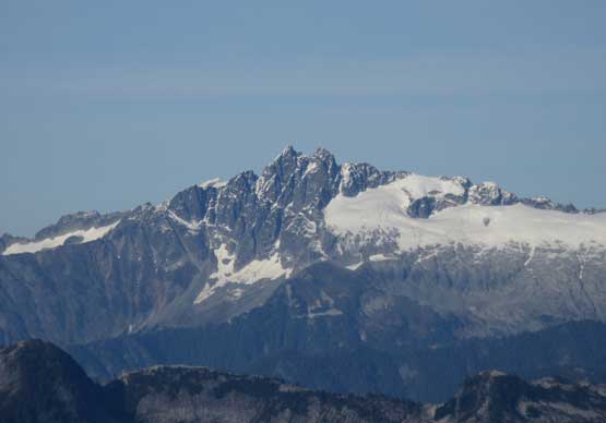
Mt. Tantalus and Mt. Dione
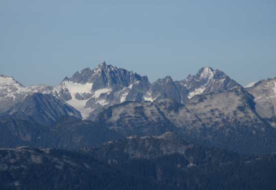
Serratus Mountain and Alpha Mountain
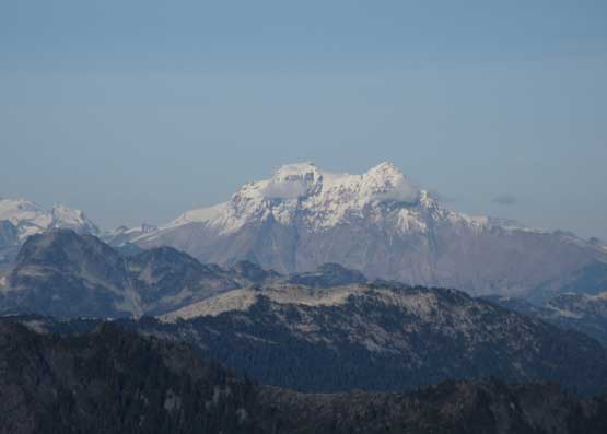
Mt. Garibaldi and Atwell Peak
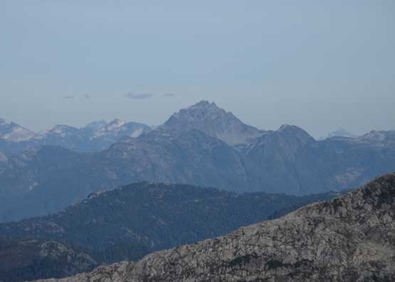
Sky Pilot Mountain
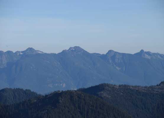
Hanover – Brunswick – Harvey – West Lion on the Howe Sound Crest

Looking over “Polytope Peak” (fg) towards Pelion/Ossa massif
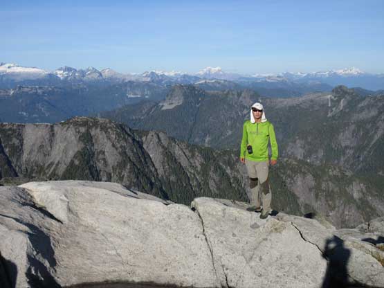
Me on the summit of Rainy Mountain
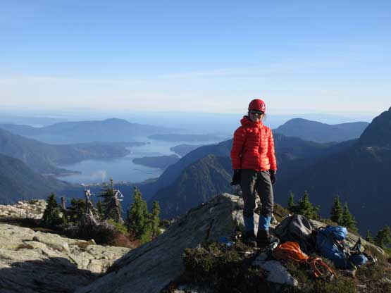
Lily on the summit of Rainy Mountain
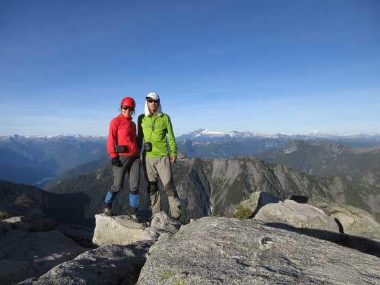
Lily and myself on the summit of Rainy Mountain
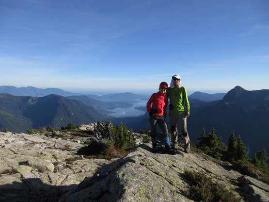
Another shot of Lily and myself on the summit
I had thought about descending the south ridge all the way to our “traversing bench” before cutting all the way back to the lower east ridge but I also knew there’s a steep route coming up much higher along the east ridge. While descending the south ridge I looked hard for that short-cut but failed to find one, so we went most of the way down the S. Ridge before dropping into a bowl full of boulders. This was still about 100-200 m higher than our “traversing bench” and to our surprise we encountered a lot of ribbons and cairns marking the “standard route” for Rainy Mountain. We followed the ribbons and faint tracks down the lower E. Ridge and then into the forest. We rushed down the overgrown section before completely running out of daylight time. Eventually at elevation of 800 m we turned the headlamps on. The trail was confusing as fuck to descend in dark but thankfully I had some good GPS navigation skills.. We ended up shooting down the switchbacks section without having to do any major detouring or back-tracking.. We easily plodded back across the old logging road and then crossing back across that three-wire bridge was uneventful.
Descending the upper south ridge with Panther Peak behind
Descending the south ridge
The typical terrain…
This is looking across Rainy River into Mt. Varley and area
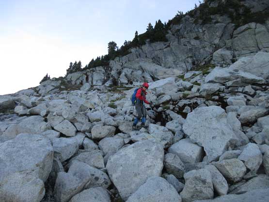
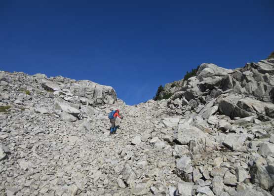
Off the south ridge now. Onto a gigantic boulder field
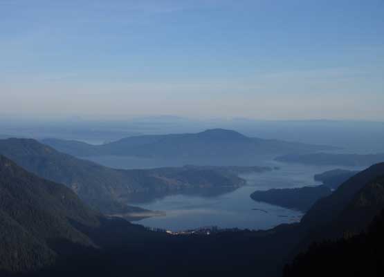
One last look at Howe Sound and Port Mellon
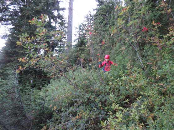
Into the overgrown… This trail will never see me again…
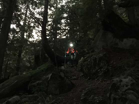
Already too dark to see without headlamps
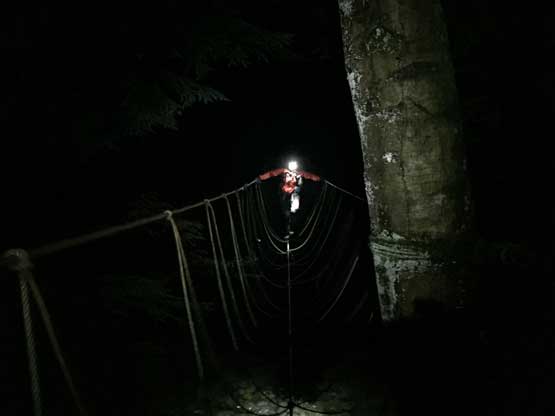
Crossing the three-wire bridge in pitch dark…
Back to the truck our round trip time was 12.5 hours which was a tad longer than expected. The amount of bushwhacking in this trip exceeded my expectation and the cumulative elevation gain was also not for the faint or heart. It’s overall an “BC adventure” that deserves respect. At this point it was almost 9 pm. We turned on the engine and drove down the rough Rainy River FSR without mishap, and did make the last ferry back to Lower Mainland. After dropping Lily off at her home I eventually made back to my home just before midnight. Not bad, not bad…
