Paton Peak
September 21, 2021
1020m
North Shore Mountains, BC
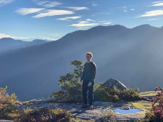
“Paton Peak” was used to be referred as the Paton Lookout and is rather just a minor diversion from the main Coliseum Mountain trail with hardly any prominence to speak of. However, a couple years ago the folks in that Bagger Challenge determined this lookout to “qualify” being a separate “peak”. For at least two years I was not buying it and I thought I would definitely skip this “peak” as I didn’t want to count such an unofficially-named add-on bump on my peaks’ list when I eventually decided to go for Coliseum Mtn. en route to Cathedral Mtn. I eventually changed my mind literally at the very last minute because the name “Paton Peak” had become too popular these days to reject. Unlike most minor bumps in the North Shore Mountains this one actually offers some open views. The position of “Paton Peak” and the views reminded me Evans Peak in Golden Ears area. The latter had become an Instagram hotspot in the last few years while it’s just a matter of time for the former to catch the masses’ attention.
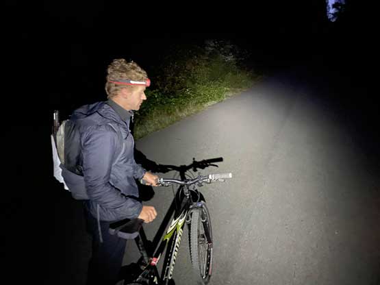
For obvious reasons Cathedral Mountain was the primary objective but en route I would also tag “Paton Peak”, Coliseum Mountain and Mt. Burwell with very minimal added effort. Cathedral Mountain has the reputation to be a monstrous day-trip that had been on my watch list forever but the biking approach always scared me off. I casually mentioned this idea to Francis as both him and I had Tuesday off work and the weather seemed brilliant. The recent snowfall events suggested us to tackle something more local and lower elevation. Francis was instantly sold on the idea but both of us needed to borrow our own bike and none of us had much experience in biking. Thankfully this approach is on a paved road. I was able to borrow a bike from Matt J. and his North Shore Bike Shop. The original plan was for Matt to join us on part of this trip but Matt pulled the plug at the last minute. I slept at Matt’s guestroom the night before. Apparently the parking logistics of this Seymour Valley Trailway is a pain in the ass but Matt knew a secret all-day parking zone with only marginal added distance. Francis and I met at that spot at 5:30 am in the pitch dark and soon began our ride.

We turned onto Rice Lake Road and crossed Lynn Creek on a concrete bridge. Immediately after the bridge we had a short stretch of steep uphill bike on gravel road and after that we got very confused. I had done zero research about the approach and my reference GPS track only covered the hiking portion. I thought the Seymour Mainline on my Gaia map was the correct road to take but it was gated with very aggressive “no trespassing” signs. I thought we had to ignore the signs just like every other trip with private property issues but before committing to that we realized there’s actually a gate keeper even this early in the day. That guy saw our confusion and gave us the proper direction. After following his instruction for a while I realized the proper road was actually labelled as “Seymour Valley Trail” on my map. I always thought a “trail” is a dirt path for foot travel but maybe that’s not the case here… Francis also had to give me a short instruction on how to do gear switch. The paved road had lots of up-and-downs so being able to switch gears was crucial.. To my surprise I did not find the uphills to be overly exhausting nor the downhills to be overly scary. In under an hour we arrived at Stoney Creek Picnic Area covering over 10 km distance. We turned left onto an old logging road, paddled a short ways but pushed/walked to the proper trail-head once the grade became too steep.
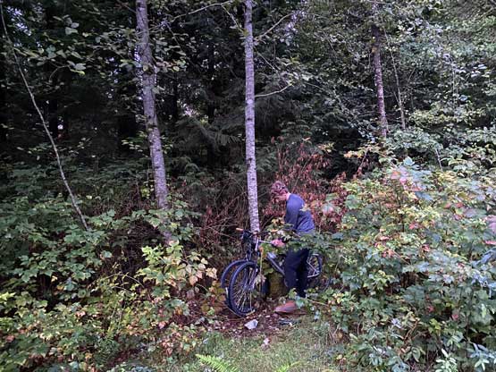
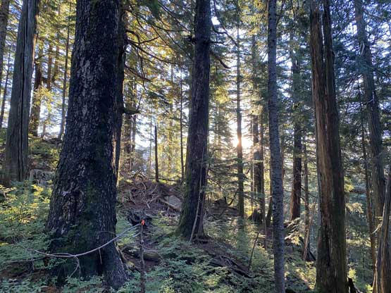
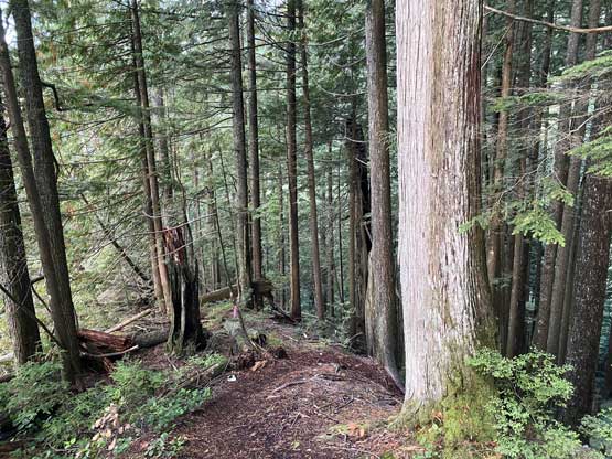
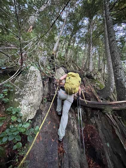
By the time we finished stashing the bikes we also no longer needed head-lamps. The trail was easy to locate and also very easy to follow, but just like most trails in the North Shore Mountains it’s very steep, slippery, rooty and sometimes rocky. As someone coming from the Rockies I thought the immediate coastal areas had the hardest trail quality. There were even 3 or 4 batman ropes installed on some steepest stretches to facilitate the hike and at times I thought we were doing short sections of 3rd class scrambling.
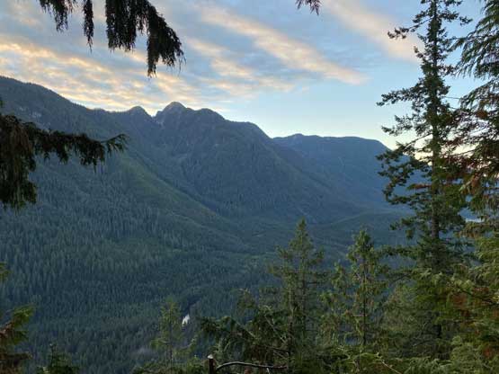
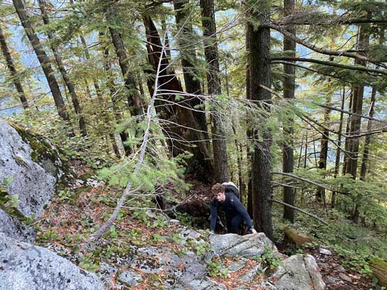
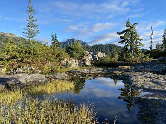
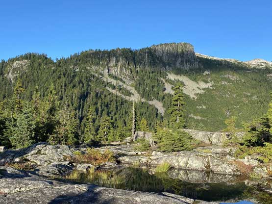
The original plan was to bag “Paton Peak” on the return because it’s overall just a bonus objective but we somehow managed to miss the trail junction. After hiking across a short but scenic corner slab I checked the GPS and sure enough we missed the Coliseum’s turn and were already halfway up towards Paton’s summit, so we might as well bag this one first. The summit was more open than expected such that we eventually went farther to explore the northern edges. We had a long day ahead but otherwise we could have easily spent an hour here playing those “Instagram photography”. On the descent I took a massive spill on some wet slabs almost injuring my hand and that gave me a good heads-up for the rest of this day. The trail continued descending a short ways passed the junction into Coliseum/Paton saddle and the next objective would be Coliseum Mountain.