Mount Washington (Olympics)
May 22, 2018
1907m
Hoodsport / Olympic National Park, WA
There are quite a few peaks named “Mt. Washington” in Washington state (understandable) and this is the one in the Olympics. Together with the lower neighbour, Mt. Ellinor, the double-summit massif towers majestically above Lake Cushman for more than one vertical mile, and thank to the logging roads and trails Mt. Washington and Mt. Ellinor are also the most accessible “major summits” in the Olympics. The standard route on Mt. Washington is an enjoyable scramble in summer but the same route can also be done in spring. Around the same time of last year I ascended Mt. Ellinor but at that time I wasn’t aware that a competent mountaineer could easily traverse the two to make a double-header. My main inspiration for this trip came from a recent trip report on NWHikers.net. I knew the condition was in and the weather would be perfect and I was too lazy to pick anything else.
I literally didn’t make the decision until 9 pm Monday evening but I did manage to grab some food from T&T Supermarket in the afternoon. After all sorts of last-minute stuffs I managed to roll out of the house after 10 pm. At this time of a day the ferry rides were no longer an option so I had to drive all the way down south and around but that’s fine. The upside is the absence of traffic and I made to the parking lot at 2 am in the morning. The connector road still had lots of pot-holes just as I remembered from my Mt. Ellinor trip but the upper road was in a fine shape. I probably could have gotten by with just the Corolla but I was glad to have the Tacoma.
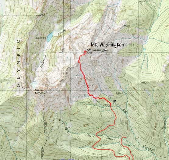
Mt. Washington standard route. GPX DL
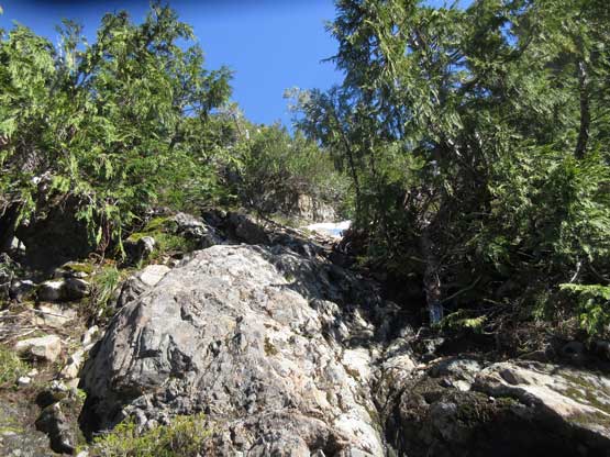
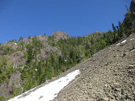
My alarm went off at 5 am and another half an hour I was already on the trail. The climber’s trail to access Mt. Washington isn’t marked on any map but is surprisingly easy to follow. It’s steep with lots of roots and rocks but what else could I expect. After a while the trail briefly disappeared in the “lower basin” with a stream crossing. I couldn’t see where the trail connects but thankfully there’s plenty of footprints left by the previous day’s parties. The ascent into the upper basin was again, steep at places with increasingly amount of patchy snow.
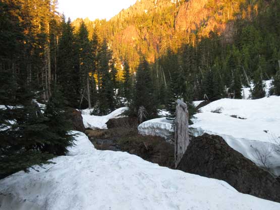
I came into the lower basin right by the alpenglow time.
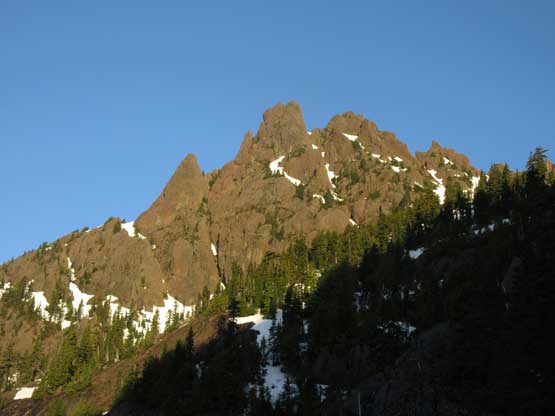
The first view of Mt. Ellinor which I ascended a year ago.
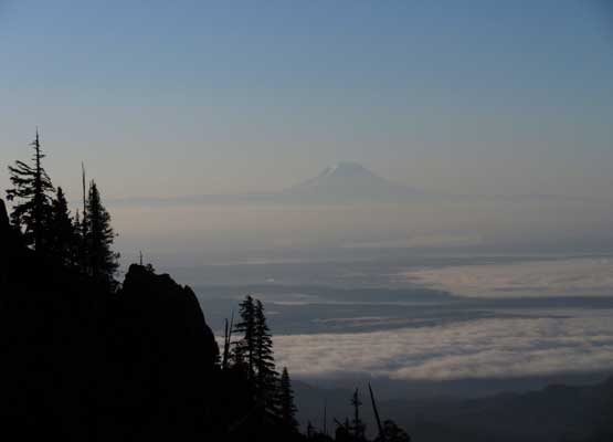
Mt. Rainier on the horizon. Note the low clouds layer
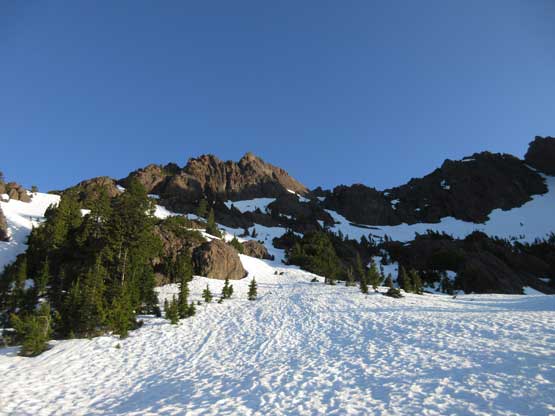
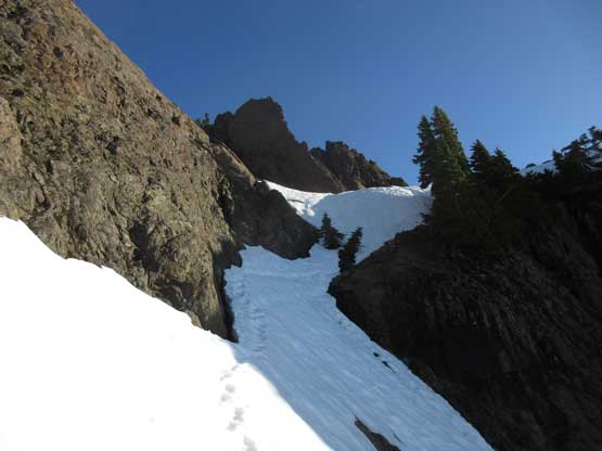
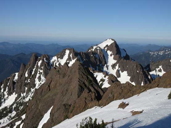
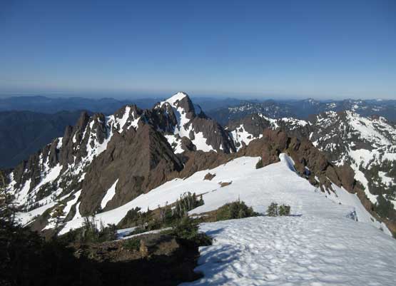
The upper route finally in view. The condition was really good.
As I ascended into the upper basin the route ahead displaced in front. There are a few options but the most obvious set of tracks leads into the “chute” route. I would simply follow the set of tracks, and meanwhile the snow had become continuous with excellent firm conditions. The surface wasn’t too firm for me to don crampons. The climb was actually quite steep but easy going with the set of boot track “staircases”. The only difficulties were the two moat crossings with each requiring a few Class 3 moves on wet, down-sloping rocks. To exit the upper chute there’s a steep traverse that felt a tiny bit exposed. There’s two or three moves that I wished to have strapped the crampons on, but that position was awkward for gear transition. I just kicked really hard for multiple times and it worked fine.
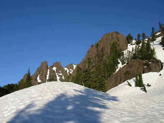
Taking a well-deserved break in the “upper basin”
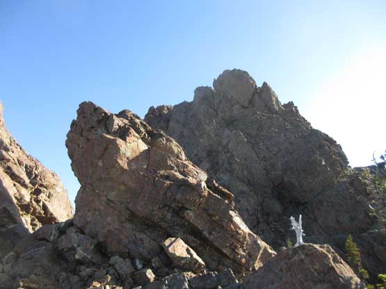
A cool rock formation. I wonder if it’s climbed and how chossy it is…
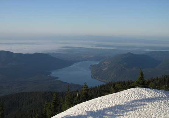
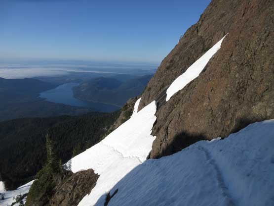
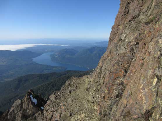
Lake Cushman
Fast forward. Already crossed the first moat. Easy peasy so far.
Ascending steeply up the “chute”. There were steps made by others.
Partway up the chute, looking down.

A sideways shot reveals the slope angle. It’s definitely not a “hiking” trip….
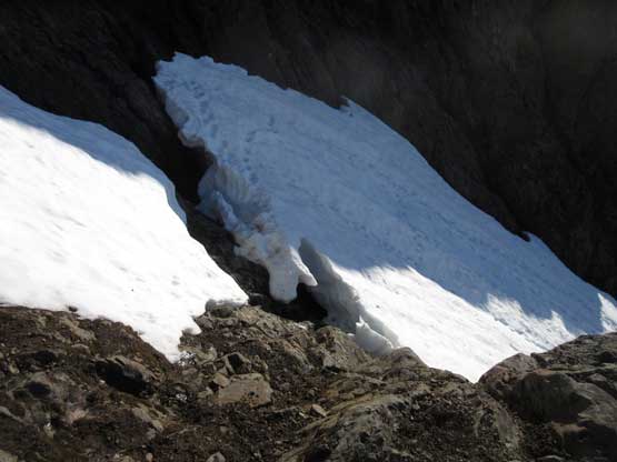
Already above the second moat, now looking down.
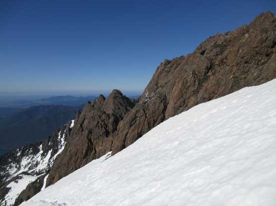
There’s a steep traverse following the upper moat.
Looking back at the traverse I just did….
Once above this “chute” section the grade eased off. Meanwhile the condition got even icier but by staying on the previous parties’ tracks I still didn’t feel the need to don crampons. It’s easy snow travel to the summit ridge and the block appeared bone dry. This is one trip that I didn’t do much homework so I wasn’t really expecting a “summit block challenge”. At first I thought the route goes on climber’s right but decided to check out the left side first. There’s a faint set of path leading that way and after a big of zig-zag I thought I found an easy line up. The scrambling was 3rd class with one boulder move near the top. Pretty sure I was off route as there’s no indication of cairns whatsoever but at that point I just sucked it up. The summit was then reached and I did look for an alternative way down and there it was. I saw boot tracks on a patch of snow field on the south side.
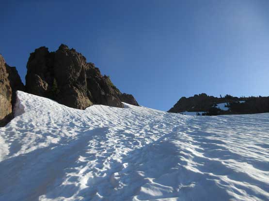
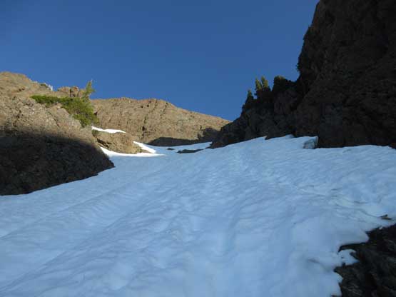
Above the steep section now. The terrain’s easy going.
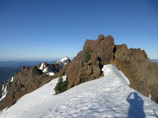
Cresting the summit ridge now. Can’t ask for a better morning.
A closer look at Mt. Ellinor
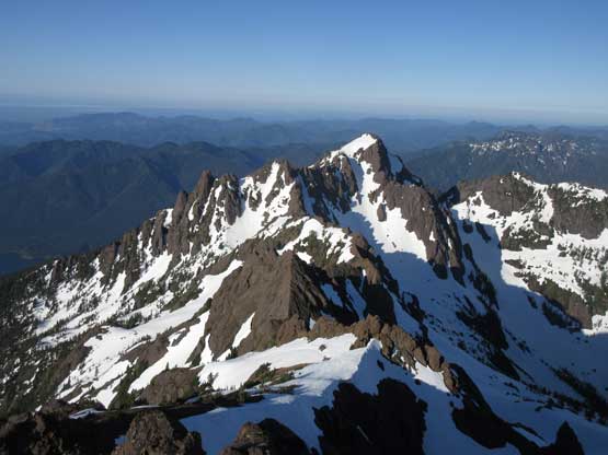
An obligatory shot of the summit block despite the bad sun angle
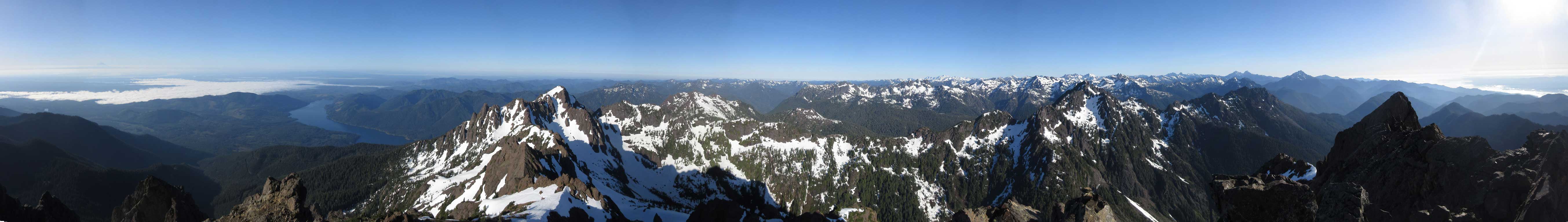
Summit Panorama from Mt. Washington. Click to view large size.
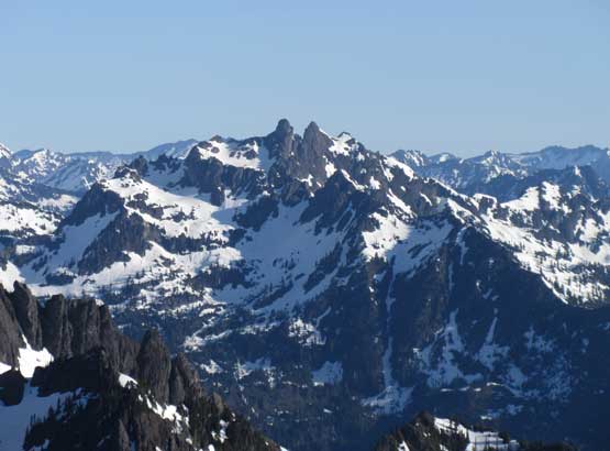
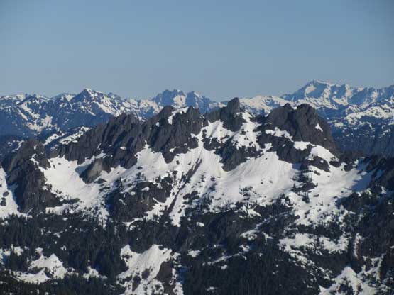
The Brothers is apparently a popular climb
Mt. Constance
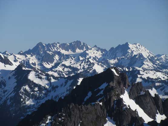
Mt. Stone
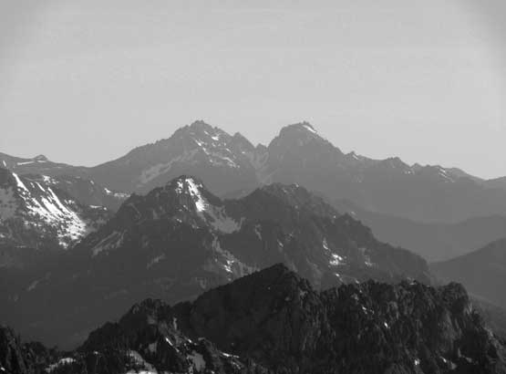
Anderson Mountain and West Peak are rarely climbed Olympic’s giants
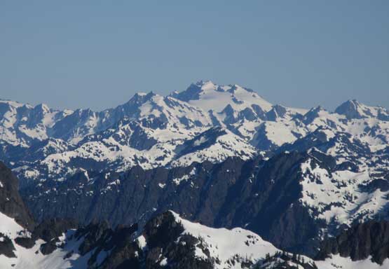
Everyone knows this – Mt. Olympus
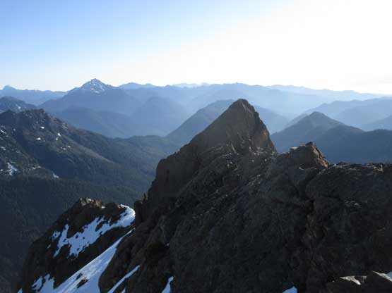
In the foreground is Mt. Cruiser
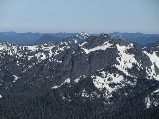
Mt. Lincoln in the foreground
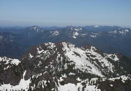
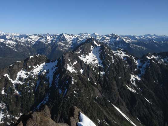
Looking over the summit of Copper Mountain towards the SW Olympics

Mt. Ellinor doesn’t look big now.
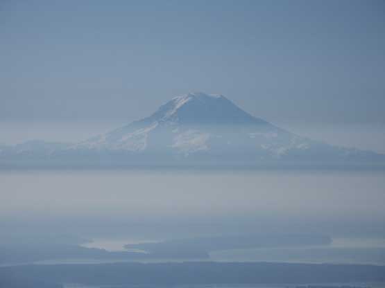
Mt. Rainier poking above the haze layer
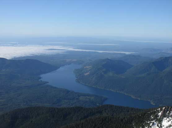
Another shot of Lake Cushman
A wider view of Mt. Ellinor and the traverse between the two
In the foreground is Mt. Pershing
This is just a sub-summit of Mt. Washington with the eastern Olympics behind
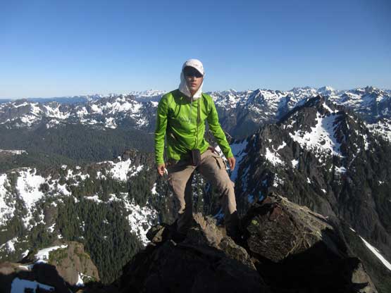
Me on the summit of Mt. Washington
After about half an hour on the summit I figured it’s time to head down before the snow softening up. I didn’t want to down-climb that boulder move so went to explore that snow field on the south side. It was quite steep and the fun part? I had left my snow gears on the summit ridge so now I had no ice axe nor crampons with me. Thankfully the snow was soft enough to kick-step facing into the slope while using my hands as anchors. It was cold, but worked. The short ledge traverse below the snow field was easy without any significant scrambling moves and soon enough I was off the summit block. This time I decided to don all of the proper gears for the descent. Other than down-climbing the two rock sections in those moats (with crampons) the rest was uneventful. Between the two moats I down-climbed the entire chute facing into the slope as the snow was getting slushy very quickly. As I steadily worked my way back into the “upper basin” the post-holing finally took over. There’s not much worth documenting about the rest of the hike.
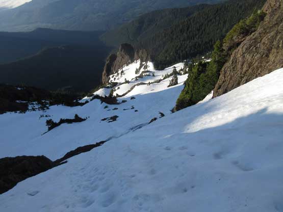
Time to descend. I did manage to find the standard way off
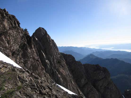
Another sideways shot to show that spectacular sub-summit

This shot shows that upper snowfield I just down-climbed
There’s an easy ledge traverse beneath the summit block.
Back to where I ditched the snow gears. Time to put them on…
Dropping in.
It’s that steep traverse now. The snow’s getting slushy.

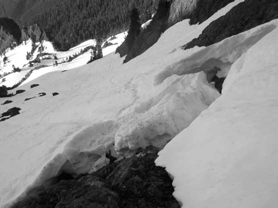
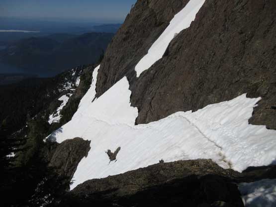
A close-up shot of the lower moat.
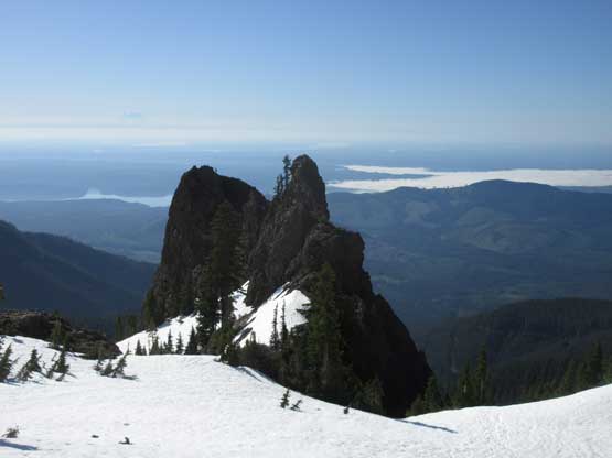
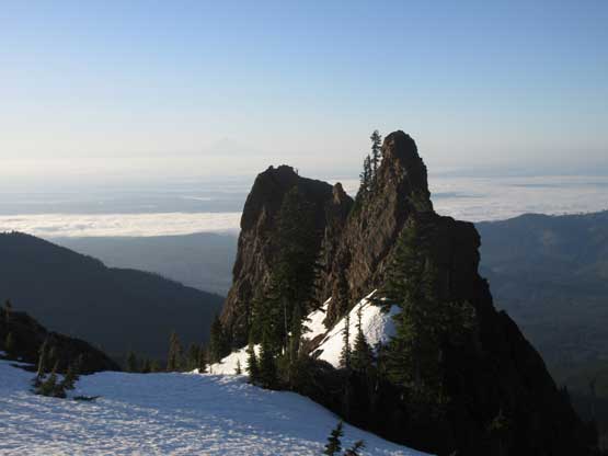
It’s that rock pinnacle again.
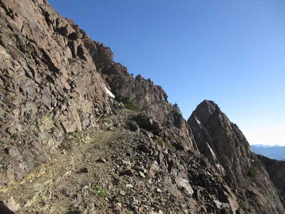
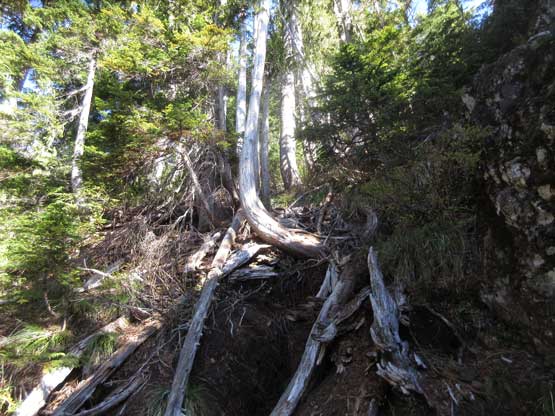
Into the woods now… The trail’s easy to follow most of the time

There’s this scree slope thrown in for the fun
A review shot of this scree slope. It reminded me the ol’ Rockies
The trail is very steep at places with lots of roots
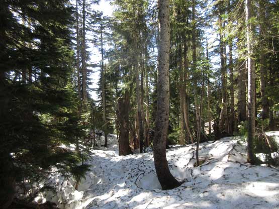
At other sections it’s flatter but still holds snow
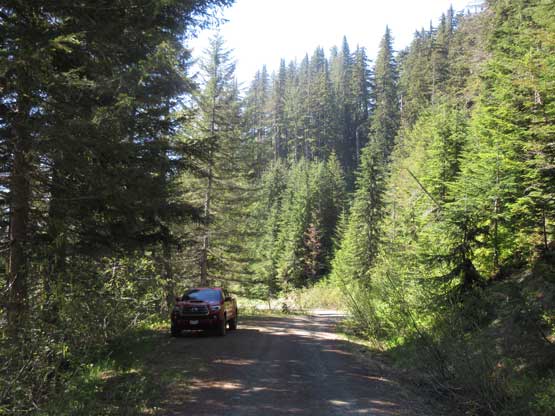
Back to the road now. Done.
I think my round trip time is around 6 hours which was pretty much as expected. The trail-head was still shaded and I was tired from the long drive. To make up some sleep I took an hour’s nap in the truck before heading down to Hoodsport for lunch. At this point I still didn’t know what to do next but the plan was taking the Port Townsend ferry ride so I had to go north. I thought about driving up Mt. Walker but figured that’s too lame.
As I drove northwards a new plan formed that I remember there’s some easy summits off Hurricane Ridge Road near Port Angeles. The season should be “summer” enough for the road to open and a bonus is that I’ve never gone up that way. I also remember there’s Mt. Angeles right off the highway and a quick check on Google confirmed that. I was too lazy to research the detailed route information because this peak “seemed” like an easy stroll.
