Rogers Peak (Mount Rogers)
June 30 – July 1, 2014
3169m
Rogers Pass, BC
Mount Rogers massive is one of the biggest mountains in Rogers Pass area, towering above most of the nearby summits except for Mt. Sir Donald. It has 5 named summits – Rogers, Grant, Fleming, Swiss and Truda. Rogers Peak is the westernmost of the 5 and is the highest, also the technically easiest. While the other 4 summits all require some 4th to low 5th class rock climbing, the standard route up Rogers Peak via its south face is merely a steep snow ascent under ideal condition. The nature of this climb makes it an ideal early season objective and has been on my list ever since I saw Raff’s photo album.
After a rainy month of June, a high pressure system finally returned granting excellent weather everywhere in BC and Alberta on this past Canada Day. Ben and I were game for something big. Unfortunately there was very little condition update from guides on some of the classic alpine objectives recently. We knew the summer season was roughly 2 weeks behind schedule but nothing more than that. We decided to pick objective a bit more conservatively so Mt. Rogers seemed like the right idea, even though that meant 2 more hours’ driving. I’m not saying Rogers is “easy” as it’s still a mountaineering objective with glacier travel, long section of steep snow and 2000 m of vertical gain. We just had more confidence on this one.

Mt. Rogers ascent route. GPX DL
Obviously that’s a long drive for us so we left as early as possible on Monday, and after 7.5 hours or so’s drive we made to the Hermit trail-head. I know lots of people do this one as a day-trip but we decided to knock off the approach on Monday evening. This not only gave us better snow condition on the ascent, but also made our lives a bit easier as waking up at a ridiculous hour, climbing a big mountain and driving all the way back to Edmonton in one day would be brutal… Starting at 8:15 pm (BC time) we’d have about 2 hours before head-lamp time and that’s totally sufficient for this approach. The Hermit trail brings one steeply up more than 800 vertical meters over horizontal distance of 2.2 km and is very well maintained. Despite the fact we were hauling overnight gears and snowshoes, we made progress quickly. In 1.5 hours we made to the Hermit Meadows, and during which we were treated with exceptional evening glow. The campsite at Hermit Meadows was snow covered but we managed to find a dry spot (that’s just enough for two bivy sacks) with a running stream beside. Perfect! Time to catch up some sleep.
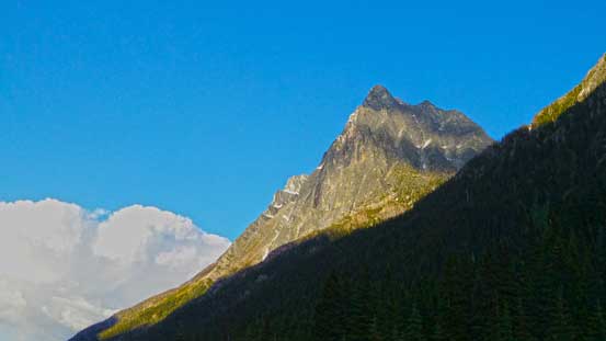
Mt. MacDonald from trail-head

Evening lightning shone on Mt. MacDonald
Evening glow on Youngs Peak and Asulkan area

Evening glow on Mt. Bonney
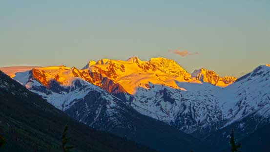
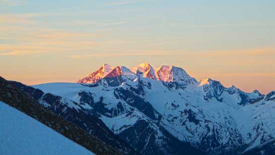
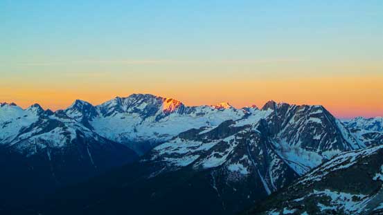
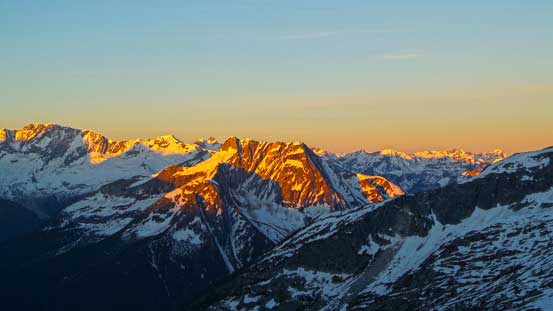
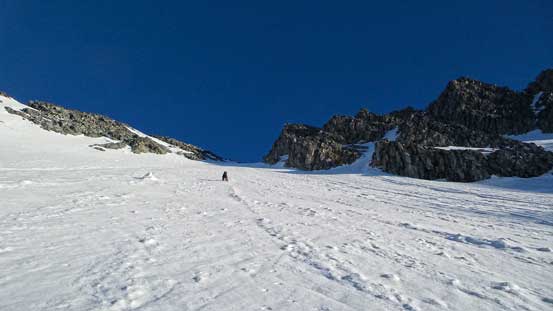
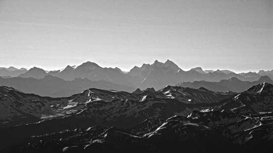
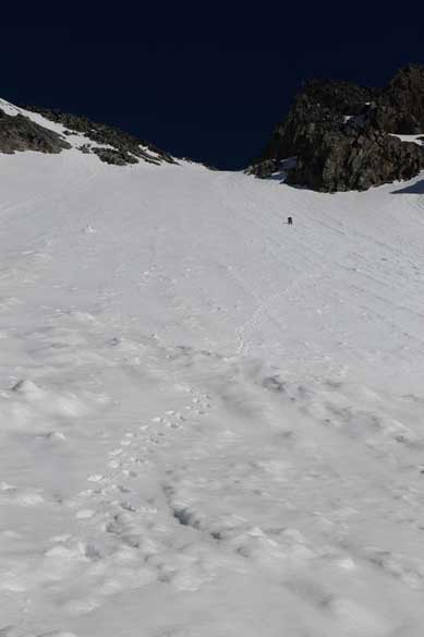
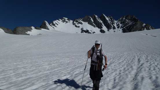
The night was clear and windy, but not cold. At 3:30 am we woke up and it was already bright enough to not use head-lamps. After a quick breakfast (3 apple pies for me) we started the day. Immediately we noticed there wasn’t much of a freeze at all, but oh well. We were hoping the condition would improve higher up. From the bivy site we worked our way eastwards over a couple gullies and ridges on rolling terrain. This part was a bit confusing but thankfully we were able to pick up an old track possibly from folks climbing Mt. Tupper recently. Once the snow became continuous we strapped the snowshoes on. They weren’t totally required on this day but the heal-lifts and the crampons did make our travel easier on the uphill terrain. We worked our way up an obvious ramp and instead of gaining the broad Rogers/Tupper pass we veered left towards Swiss Glacier. At this point we were treated with a splendid alpenglow view.
Almost alpenglow time
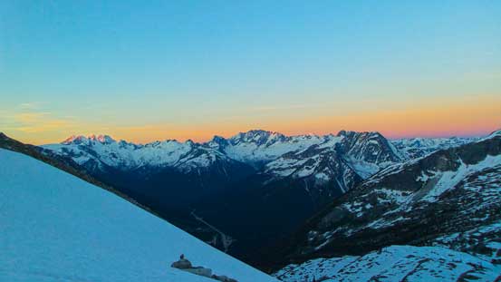
The classic reddish horizon before alpenglow
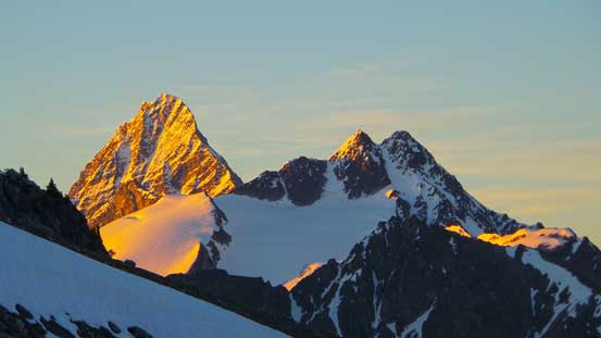
Alpenglow on Mt. Dawson
Alpenglow on Mt. Bonney
Mt. Sir Donald with the twin summits of Avalanche Mountain in front
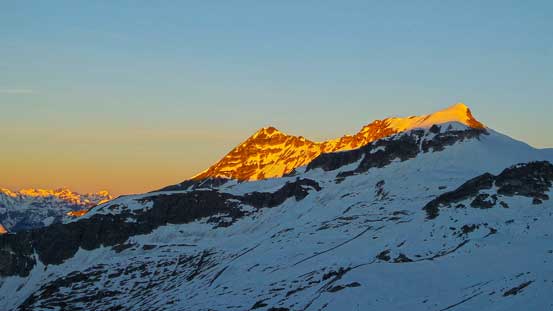
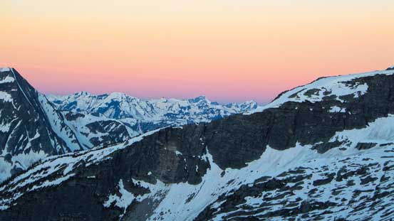
Glow on Grizzly Mountain and Little Sifton
Cheops Mountain at center in the foreground
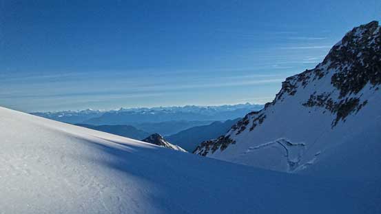
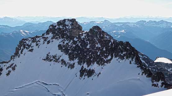
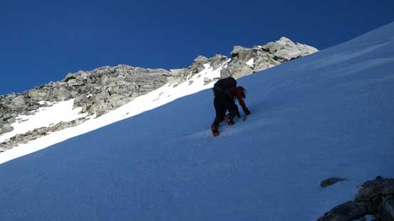
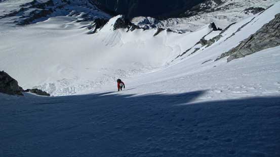
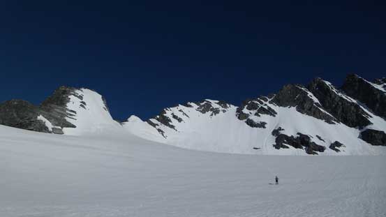
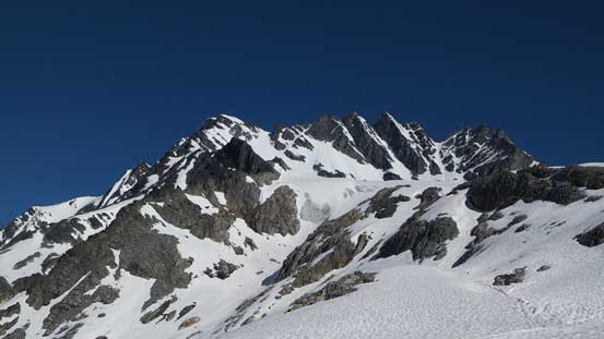
Up the Swiss Glacier we aimed more or less straight towards the steep ascending gully on Rogers’ south face. It looked insanely steep but we knew the view was usually deceiving. And yes, as we approaching the face on this gentle but foreshortening glacier the slope started to appear less steep. At the mean time the snow condition was getting better and better the higher we went. There was lots of avalanche debris and the bergschrund was very filled in (hardly to even see a sagging). We managed to snowshoe to the top of this debris field before switching to crampons. At this point there was little to worry about the snow condition as it was icy hard. From here on it was front-pointing all the way up this face. The slope wasn’t that steep but it was a long way up thank to the foreshortening view. At the steepest part I took out my ice tool and used it for the rest of the trip. This was actually my first time using an ice tool on an alpine climb and I have to say I really like it.
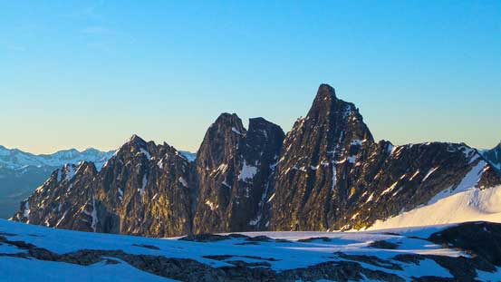
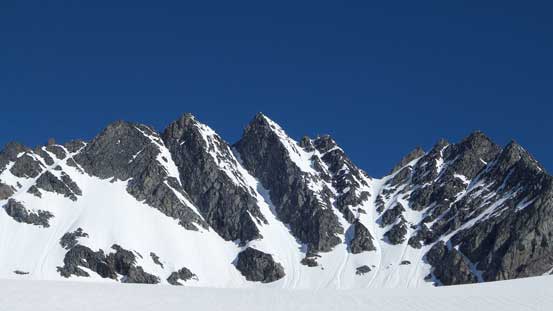
Mt. Tupper looks very striking from just below Swiss Glacier.

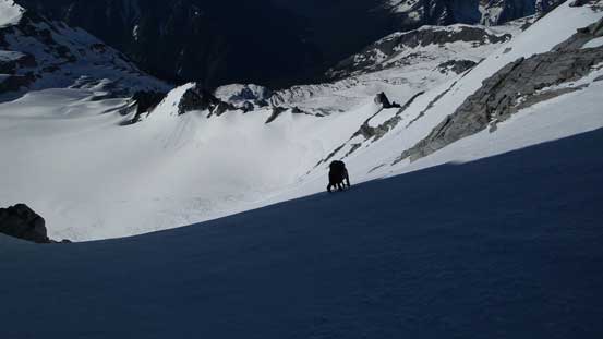
Ben snowshoeing up Swiss Glacier. Our ascending gully is just left of center

Start to climb up the gully/south face
The view’s already magnificent at this stage
Lots of front-pointing
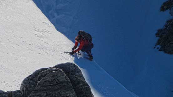
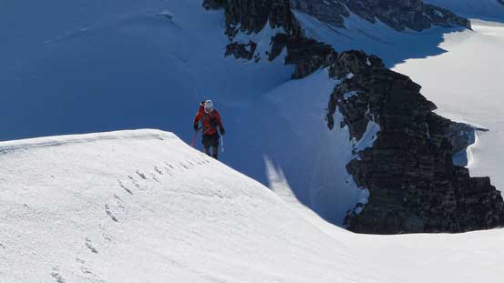
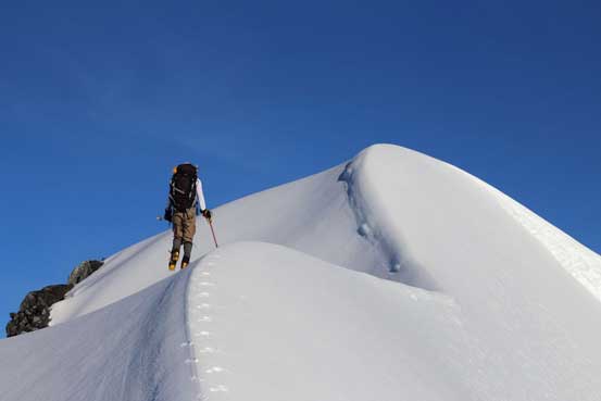
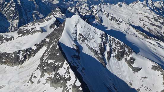
Exiting the gully/face we went a bit too far climber’s right. There was a flat and dry spot proving some resting but immediately after that we had to break through a very steep band/cornice. Without the tool it was nearly impossible to get over this step. After that we were officially on Rogers/Grant col, veering left we gained steeply up the summit ridge. Further up it narrowed down to within a foot wide with severe exposure on the right side. We balanced over one section but soon we bailed to the left side. Though steeper than the ridge crest, it felt a lot safer, and shortly after we were standing on the summit, with incredible views towards each direction. It felt exceptionally good to stand above most of the Selkirk summits except for the biggest ones, and towards east it was a full panorama of the Rockies. Having done a few peaks nearby I was able to point out the 11,000ers from Clemenceau all the way to Assiniboine.
Cresting Rogers/Grant col, we could see the Rockies on the other side

Looking down at the steep gully we just ascended

Ben climbing over a vertical band/cornice. The ice tool helped a big time here
Same as above

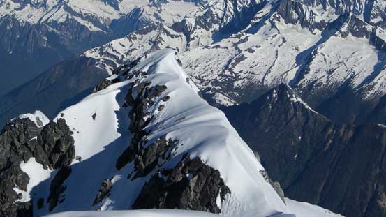
The summit ridge.
Ben ascending the summit ridge
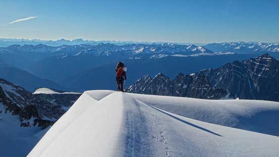
Me balancing over the snow arete. Photo by Ben N
Ben balancing over an exposed section

The last push

Impressive seracs on the north side.

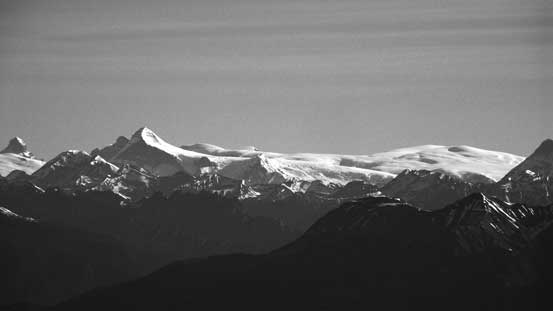
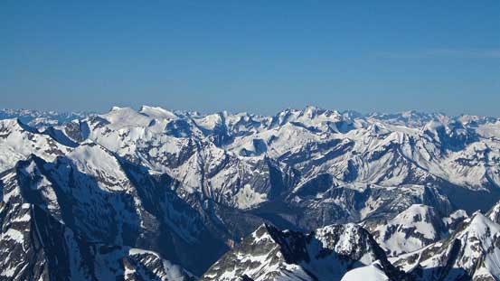
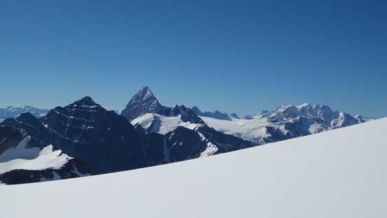
Summit Panorama. Click to view large size.
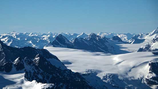
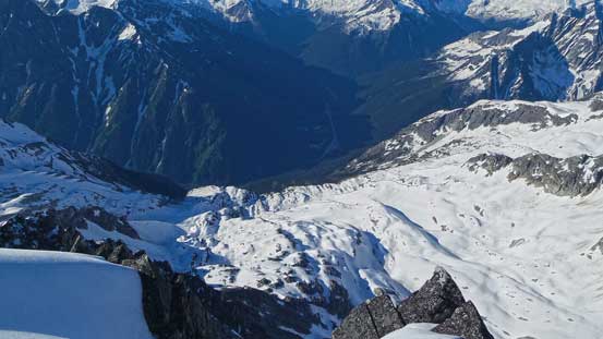
Looking down at Illecillewaet Neve
Mt. Bonney
Iconoclast Mountain
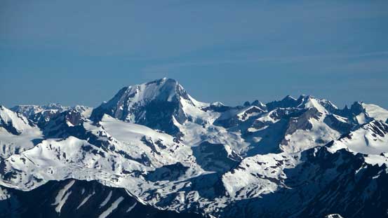
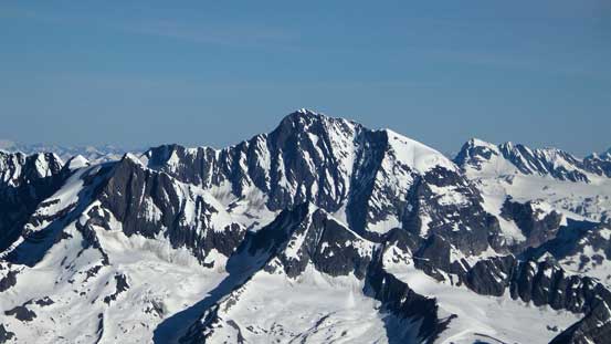
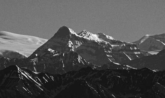
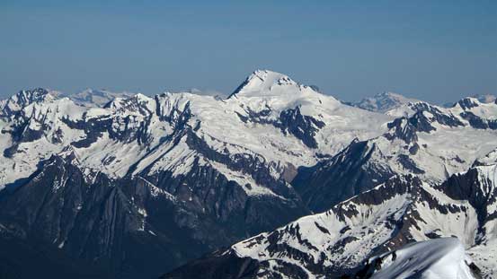
Highest in the Selkirks – Mt. Sir Sandford

The classic – Mt. Sir Donald
Mt. Begbie in the Monashees
Mt. Clemenceau and Tsar Mountain looking far north
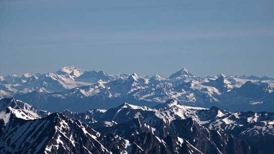
Mt. Columbia and Columbia Icefield
Mt. Bryce looks big from all angles

Fang Rock and the surrounding glacier
Hope Peak, Charity Peak on left, and Virtue Mountain right of center
Sorcerer Mountain
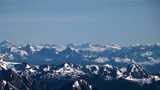
In the distance we could see Chaba Icefield

Mt. Forbes is the big one; Mt. Freshfield on the far right
The Goodsirs are among the toughest ascents in the Rockies

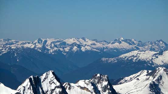
Illecillewaet Neve and Mt. Dawson
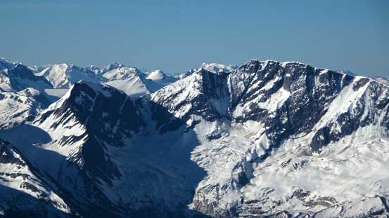
Other peaks on Mt. Rogers massive including Swiss, Fleming and Grant
Mt. Sifton looks like a tiny bump from here
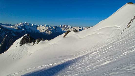
The west ridge has some impressive cornice scenery
Looking down at Hermit Meadows, and way down at Highway 1 and Rogers Pass
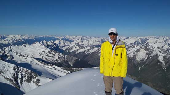
Me on the summit of Rogers Peak

Another panorama from the summit. Click to view large size.
On the descent we picked a better line from the col to avoid down-climbing that cornice, and shortly after it was the time to down climb the face. The snow was still icy hard for most of the face except for the very bottom so it was a step-by-step process, facing inwards and front-pointing. Eventually we made down and switched gears to snowshoes, but soon we realized the snow wasn’t the optimum for downhill snowshoeing. It wasn’t soft enough so I strapped the ‘shoes to my backpack and walked down the glacier. At a couple rolls I even glissaded to speed things up. Soon Ben switched to boot travel too. The return to our bivy site was fast and fun except for the rolling terrain near the end.

Starting the descent
We down climbed this part to avoid the cornice section
Then, ready to down climb the face…

Front-pointing all the way down
More of the down-climb
Can you spot me on the face? Photo by Ben N
A view of Sir Donald from the descent
Looking back at the south face
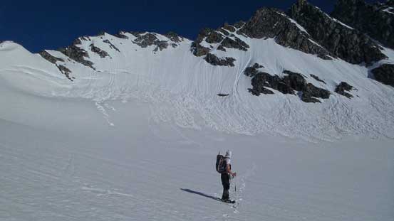
Descending Swiss Glacier
Grant, Fleming, Swiss and Truda. They’re all lower than Rogers Peak
Ben on Swiss Glacier
Looking back at our objective. What a beautiful mountain.

Negotiating the rolling terrain near Hermit Meadows

Typical terrain at Hermit Meadows. Pretty confusing. Photo by Ben N

There’s a neat waterfall
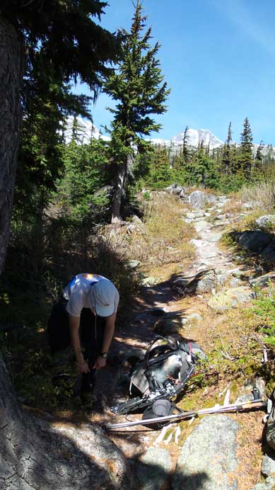
After a short food break, we quickly packed the rest of our gears and proceeded the descent. Once again we had to appreciate the excellent trail. It certainly made the return much more enjoyable than bushwhacking. It felt faster than expected and we made back to the parking lot at 11 am (again, local time). Our round trip time was 9 hours which was certainly much faster than anticipated. Being able to finish the trip that early meant we could take our time driving back home. It’s a bloody long way from Rogers Pass to Edmonton…
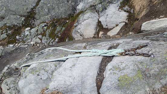
Rope on the hiking trail. Can’t ask for better maintenance
Into the woods. The hike back down this trail went by fast
Overall, Mount Rogers proved to be an excellent objective for early season snow climb. At elevation of 3169 m it’s wee bit lower on most people’s “lists” compared with Rockies’ 11,000ers but don’t forget you start at Rogers Pass which only has elevation of 1200 m. For the climb it involves all aspects of snow climbing from glacier travel, bergschrund crossing (later in the season) to steep snow up to 40 degrees, and the views are exceptional on a clear day. I’ll highly recommend it as an easier alternative objective for classics like Lefroy or North Victoria.

Sounds and looks like a beautiful alpine snow climb. A couple of friends and I are planning on doing it, this summer. Along with Uto Peak, Mt. Shaughnessy and possibly some other moderate mountains in the Rogers Pass area. After years of outings in the Rockies, it’s time for the Selkirks…Have you any specific advice, for this one?
Pretty standard snow ascent and in stable conditions you can even do it in winter. Don’t go too late though as you want snow, not dirty ice.. Early July would be the latest.. It was my first trip with two axes.