Plinth Peak
May 19-20, 2024
2677m
Pemberton, BC
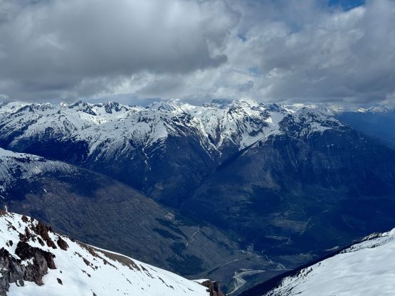
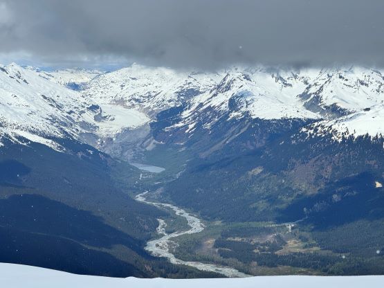
Plinth Peak is the highest in Meager Group, the most recent that erupted in the Garibaldi Volcanic Belt. The eruption dammed Lillooet River and formed Keyhole Falls 2000 vertical meters down from the summit. This is the most geologically unstable area in the entire SW BC with significant landslide hazards and the logging road (Upper Lillooet Mainline) is gated whenever the temperature and/or precipitation exceeds a certain threshold, which happens most of the time during summer months. Most peaks in this group are rugged, technical and rarely climbed, but the highest one (Plinth Peak) somehow happens to be the easier one with at least one non-technical route to the summit. This is a good news for the peak-baggers as Plinth Peak boasts almost 1000 m prominence and is one of the more significant summits in the vicinity. However despite the lack of technical difficulty, the uncertain access and the daunting approach means this peak will never become popular, and in fact there was hardly any “beta” about the approach and the route I ended up taking beside some brief mentioning on bivouac.com.
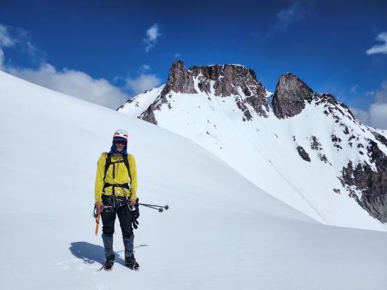
The old access had been destroyed by a large landslide two decades ago and currently there’s only one viable way to cross Lillooet River, that is to use the industrial bridge above Keyhole Falls. This approach is essentially a modification of the old climber’s approach to the elusive Wahoo Tower (in the current era most opt to take a helicopter in, myself included in July 2021), as well as the skier’s exit after a 10-day traverse across Lillooet Icefield. There were a few trip reports on ClubTread and bivouac.com and I was able to put together a plan based off those old “beta”. The weather forecast for this May long weekend was mediocre but the farther NW the better. I remembered at the last minute that I still needed Plinth Peak and because the window happened on a weekend Alex B. and Chris G. were able to join. With this team I jacked up the ambition to climb as many peaks as possible over 2 days and we would bring enough gears to be able to tackle almost anything. We decided to bring a 60-m rope, a full rock rack, two pickets, two ice tools (each), steel crampons and proper mountaineering boots. Adding in the winter camping gears our packs were about 40 lb each, and the approach would involve over one vertical mile of elevation gain with plenty of bushwhacking. We were definitely in for some quality suffering. Chris and I left Surrey after work on Saturday and picked up Alex from the church. I drove us up the familiar Sea to Sky corridor and made to Pemberton just after sundown. The 49 km up Upper Lillooet Mainline went mostly without event except for taking a wrong spur (labelled on Gaia as the main road). We corrected the mistake and drove uneventfully down to the bridge across Lillooet River. Not to our surprise there’s a gate and the gate appeared to be locked, but upon closer examination we were able to open it. This shaved off another 1.5 km distance and we were eventually stopped by snow and avalanche debris on the road. It rained overnight so I hastily got the tent erected. Chris and I were originally bivying open but we needed a shelter from the unexpected precipitation.


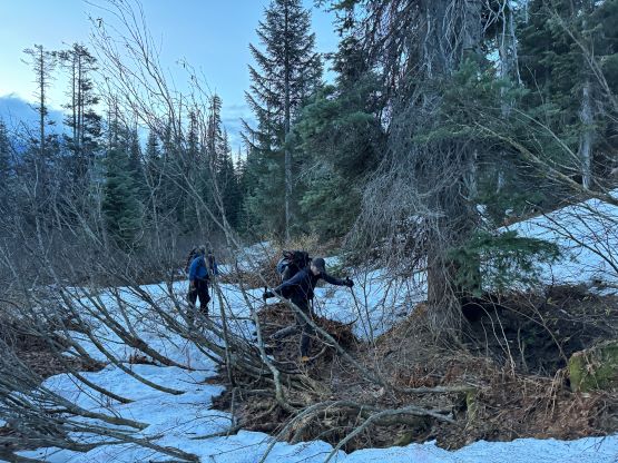
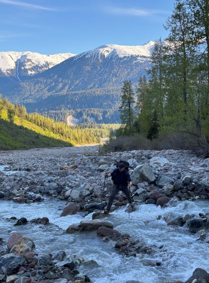
We woke up at 4 am in the morning and started just after it’s bright enough to not use the head-lamps. The initial 2 km was dashing down the remaining portion of this road and the condition was surprisingly good. If not because of the snow that came down from an avalanche path we should be able to drive to the end. We then took the lowest spur descending past a mining site losing close to 100 m elevation, and then dived into the bushes. There was still some snow to help making the bushwhacking easier, and the post-holing actually made us don snowshoes for at least 1 km distance. We did have to cross a swampy section but generally speaking the initial third of the thrashing wasn’t too bad. The middle third had one 500-m of opening but other than, was the worst with plenty of alders. We had to cross several avalanche paths and there was no obvious “better” way. I did more GPS checking on the way in and took a more meandering route, but took a more direct way on the return, and it sucked either way. The final third of the bushwhacking was mostly in open forest with some pick-up sticks and some alders, but nothing sustained. There appeared to have an old road on the satellite images, but it was not useable even for foot travel. In fact, it’s much easier to plod in the open forest paralleling that road on the uphill side. I led most of this bushwhacking approach and we finished this section in under 2 hours on a decently fast pace. The valley appeared as open as on the satellite images so the stoke was high.

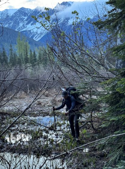


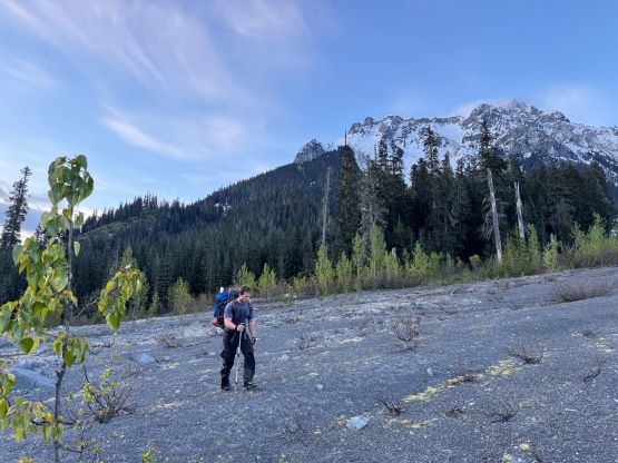
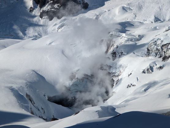
The bottom half of this valley was entirely dry, contrary to the snow-covered forest that we plodded through earlier in the morning. The creek that drained the middle of this valley would require a ford so we tried hard to stay entirely on climber’s left side of the valley. We had to do two notable sections of bushwhacking but eventually found a way to rock-hop across the creek to the right hand side without having to take the boots off. That was done on a more braided stretch and the plan was to take the exact same way back a day later. We also had to ascend some annoyingly loose red choss to get to the snowline. There’s one reliable stream with clean water so we waited until the last minute to load up the water bottles, with mine being two liters combined. Up until this point the approach was definitely annoying, but nowhere as bad as I thought. I had budgeted 8 hours of plodding to the camp at Meager/Plinth col and it seemed like we’d definitely get there with time to spare. Once the snow became continuous we donned snowshoes for the added traction and from there it was as “simple” as 1000 vertical meters of grunting to Meager/Plinth col, but boy this ascent was tiring. There was a fumarole on the north slopes of Mt. Job so the smell was like farting the whole way. And to break the headwall under the col we had to ascend a long stretch of 40-degree snow wall, that forced us to swap the snowshoes for crampons. Thankfully it wasn’t as difficult as appeared, and we got to the col shortly after.


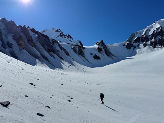

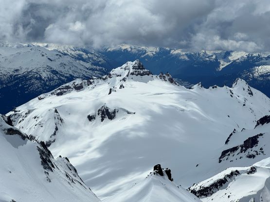
There are two ways that I had thought about Plinth Peak’s ascent. From the satellite images the SW chutes appeared to be entirely covered in snow but that couloir was over 500 vertical meters long, and to do it would not position us well for the other peaks. Instead, I took the “advice” in Fred Touche’s brief trip report on bivouac.com, that a traverse into the couloir could be done from just under an obvious pinnacle on the south ridge. This option was likely more involved technically but required less physical effort as we could ditch all of the overnight and unnecessary gears at Plinth/Meager col. I insisted for us to bring the rope and gears as I wasn’t 100% certain about that short traverse into the couloir. It did turn out to be steep and somewhat difficult, but nowhere to justify bringing the rope for future reference. We wrapped around the SE side of Plinth’s south summit but eventually came to a section of insanely steep side-hilling. Instead, I made the call to climb straight up the east face of that south peak (40+ degrees) and then traversed to the south/main peak saddle. We inspected a few possible spots to cut into the SW chute but it wasn’t until we climbed to the very base of that obvious pinnacle/buttress where things finally looked promising. The climb to the base of the pinnacle involved more wallowing on rotten, steep and thin south-facing slopes. The snow was so shitty that I had to use my knees to help distributing weight, and Chris mostly sank thigh deep following behind.


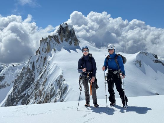
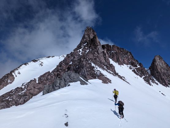

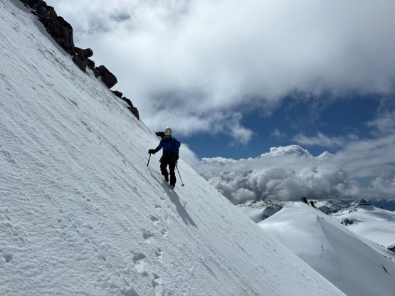
The traverse was obvious but involved ~20 m elevation loss, and the snow condition was entirely different on the west facing slopes. The steepest part was 40-45 degrees with some decent exposure. We all did with just one ice tool but we could have taken the second tool out for some added security. The rest of the ascent was just a numbing plod up the foreshortened upper “chute”, or should I say “valley”. This broad slope eventually brought us to the west ridge which we easily followed to the summit. I thought we had to find a hidden couloir or some but the west ridge itself was rather easy. Out of the 4 peaks we climbed in this trip Plinth Peak was the easiest and also the most boring. None of us was quite impressed frankly speaking, but we knew the fun ones were about to come.


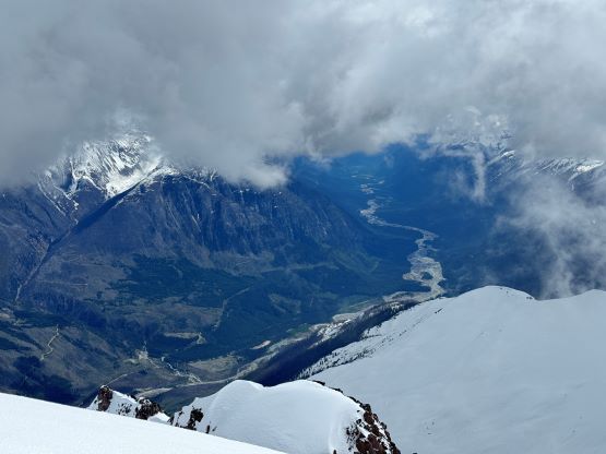

The weather was also a mixed bag so we quickly started the descent after taking a much needed break up there. I led us mostly retracing our steps back down the upper part of the SW “chute” and then back across that exposed and steep traverse. The snow condition on the south facing slopes was even worse and we were now post-holing crotch deep, but we did not trigger any slide. To descend that steep east facing slopes off the south summit we tried to find a different line but it was just as steep. I think to descend the entire south ridge would be less steep but that was not visible from above. In any case we got back to Plinth/Meager col in a timely manner, took another break and set off for Mt. Meager.