Mount Rhondda
March 9, 2013
3015m
Wapta Icefield, AB/BC
This weekend was a bit tricky with avalanche conditions but the weather looked gorgeous anywhere in the Rockies. The major problem would be solar radiation and storm snow, so I figured it would be a good time to head up Wapta Icefield again. The aggressive terrain would be on the approach which we’d (likely) pass by earlier in the morning and late in the evening. Originally I thought about just doing Mt. Thompson which would be a long day by itself. But after estimating the time required for each section, I really thought we should increase the ambition to grab both Mt. Rhondda and Mt. Thompson, and Ben and I certainly had the fitness to do this car to car in one day. Staying in Bow Hut for one night would be an option, but why bother… We can rock the approach in just 2 hours.
For some reasons that I’m not even sure, I forgot my camera when we left Edmonton, but thankfully I realized that after driving 20 km out of city… By 8:30 pm we eventually sorted out all of the last minute issues and drove out of the city. It took us a bit more than 5 hours to get to Bow Lake. After catching up a few hours’ sleep we started the trudge by 5 am. The sky was crystal clear and we could see millions of stars, but the moon light was non-existence. Therefore we had to use head-lamp this time. However, since I had done the approach 3 times in the past, and following skin tracks, we should have no problem with that.
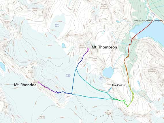
Mt. Rhondda and Mt. Thompson standard winter ascent route. GPX DL
It was very cold when we started the Bow Lake crossing. Well, as a classic type of frost hollow, Bow Lake sucks the cold air, especially at night and in the morning hours. The crossing went by quick, but we managed to temporarily lose the tracks on the other side, and ended up breaking our own trails for a few hundred meters. We quickly regained the tracks. Up and over the first hill, we made to the second canyon. We had a lot more snow cover than in December, and we didn’t need to take off snowshoes over rock steps this time, and we quickly went through this terrain trap and up a forested slope on climber’s left side, and then we were looking at the final bowl below Vulture Peak. We lost tracks here again, and ended up post-holing for a much longer distance. The sky was getting brighter and brighter and we eventually regained the tracks and followed it up the final steep slope to Bow Hut, exactly 2 hours from car. I was sweating like hell and my t-shirt was soaked, and my jacket was socked from inside as well… I stripped off a layer on my legs, re-filling water bottle, and taking out harness, rope and stuffs. Didn’t sound like much, but this stay took us 20 min… The Hut was definitely a time sucker for us…
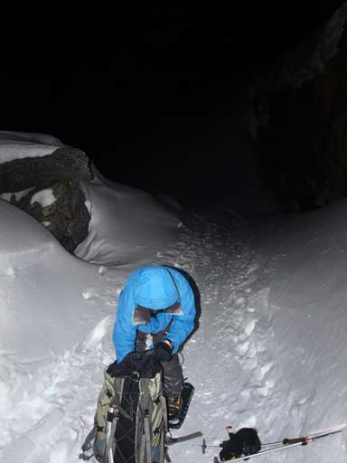
Snowshoeing up the approach in dark
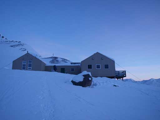
Arriving at Bow Hut
By 7:20 am, we were the first group going up the glacier. There was skin tracks but marginally visible. Once at the base of headwall, we lost the tracks.. Being on snowshoes meant we didn’t need to do any unnecessary switchback. I picked a direct line aiming for a bit climber’s right than the usual route to St. Nick/Olive col. This would give us the most direct route to Mount Rhondda. Rhondda has a steep south facing slope so we figured out it would be better to grab it first, rather than doing Thompson first. The morning view of St. Nick, Thompson, and Portal was just amazing. Once we topped above the headwall, we could see our objective, which looked to be just right there, but actually far away. I was psyched for this because I had read quite a few trip reports indicating this foreshortened view. We did have to break trail, but that wasn’t too bad, and it was NOT post-holing. After what seemed like a long time, we arrived at Rhondda’s base.
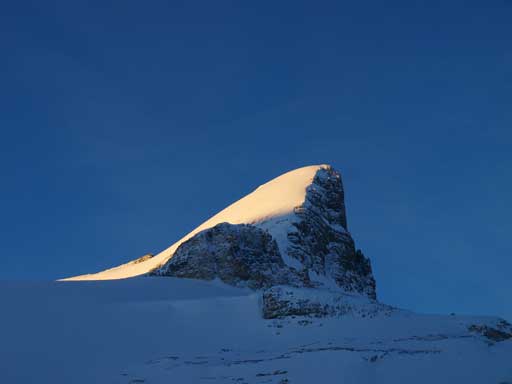
St. Nicolas Peak
Another photo of St. Nick
Now we were shone by sunlight.
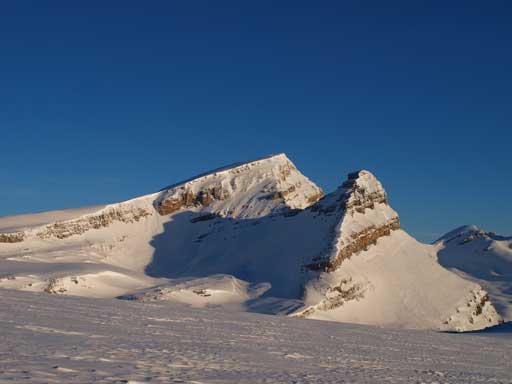
Mount Thompson and Portal Peak

Mount Jimmy Simpson
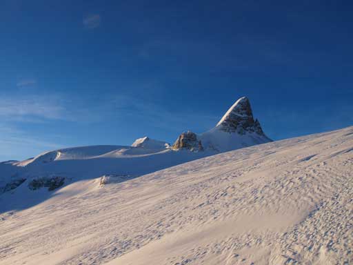
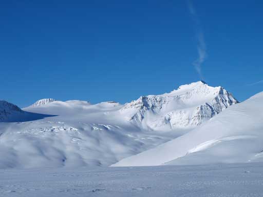
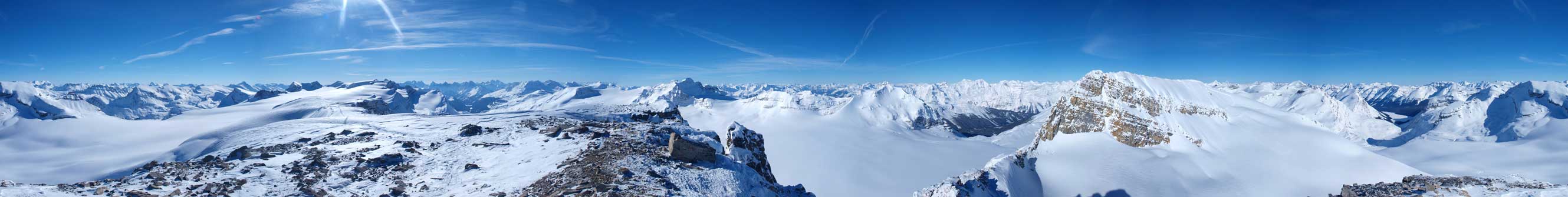
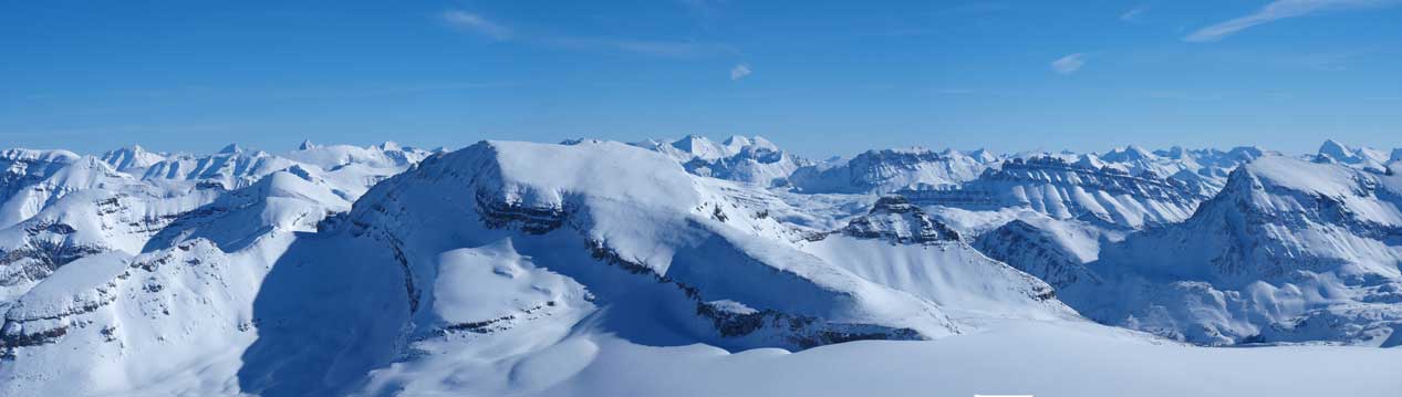
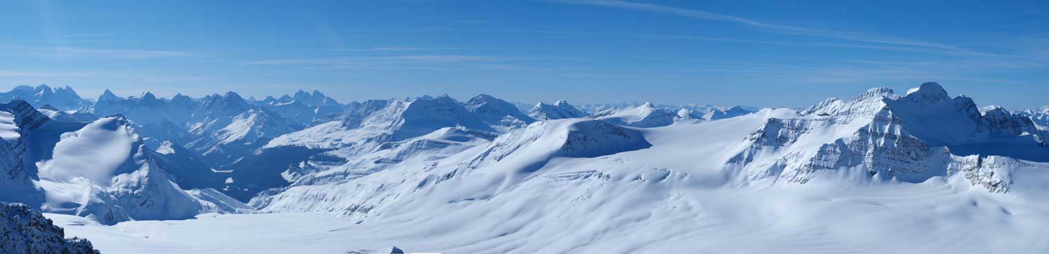
Morning panorama of Wapta Icefield. Rhondda on the far left
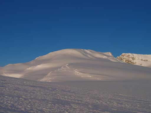
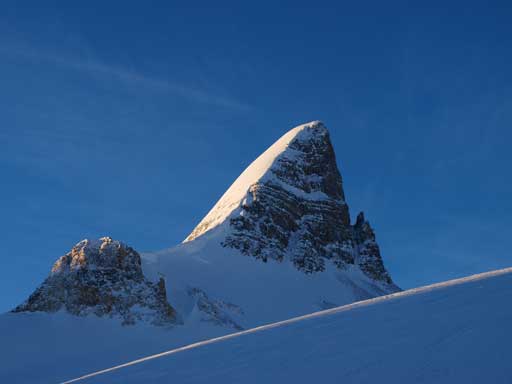
Mount Rhondda. Despite the view, it’s actually quite far away
Mount Collie and the heavily crevassed area.
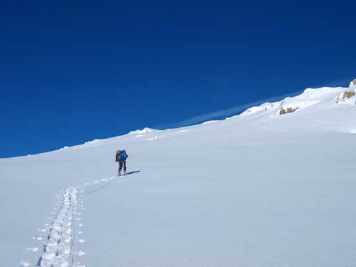
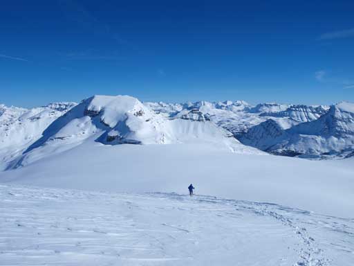
Ben slogging up Mt. Rhondda
It was still far away from the steeper slope. Once at there, we ascended this slope a bit on climber’s right side, and eventually we made to the summit ridge. The view opened up for the other side and we could see a good distance away. It was Ben’s first time on Wapta, and I knew exactly what that feel was. The view was just beyond amazing. The summit ridge was a lot longer than expected. I also found a plaque saying “crevasse”, but I didn’t find any crevasse nearby… Well, I ditched backpack here, up and over a couple bumps, and eventually made to the true summit, which was at the far end. Lots of impressive peaks nearby including Mount Habel across the gap. It was only 10:10 at this point and we had the entire day ahead of us. Looking east, Mount Thompson appeared to be a true slog. It was a bit rockier, but it definitely had enough snow to keep our snowshoes on. There are quite a few viewpoints on the summit of Rhondda, and make sure you wonder around for some photos.

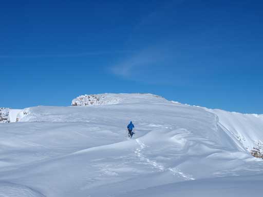
Already awesome from the summit ridge
The true summit ahead
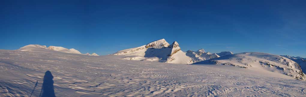
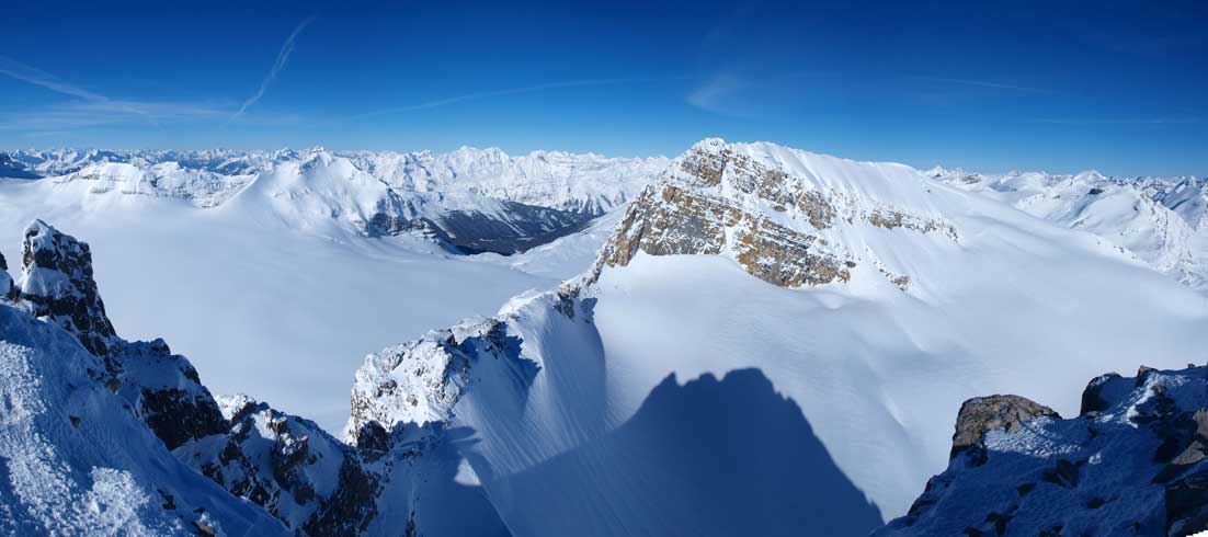
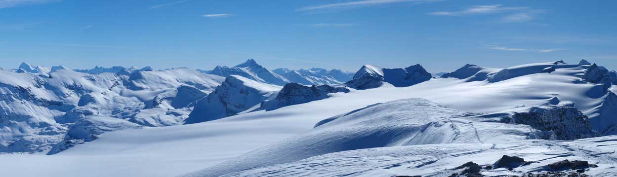
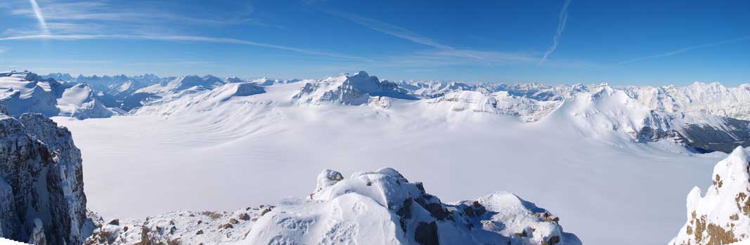
Summit Panorama, click to view large size
The impressive Mount Habel

Mount Collie on left. You can see the distant Selkirks
Ayesha Peak on left. Mount Mummery and Freshfield Icefield on right.
Peyto Peak left of center. Peyto Lake right of center.
Mount Thompson, the pure slog.. Just poking above Thompson you can see Willingdon.
Mount Hector is the high peak left of center. Olive and Gordon on right.
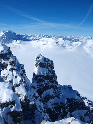
Interesting pinnacle.
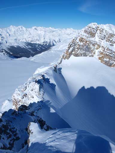
The connecting ridge to Mount Habel, not the normal route though…
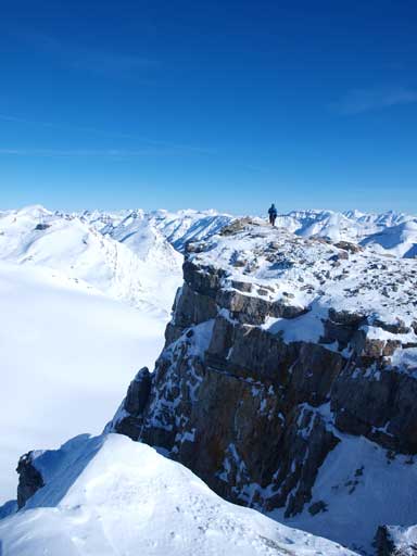
Looking back at Ben on the summit. I was standing on the western outlier
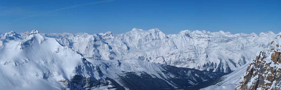
Panorama of Yoho Park. You can see the distant 11,00ers like Victoria, Hungabee, Goodsirs

Impressive cliffs on the west side of Rhondda. Mount Gordon in the background.
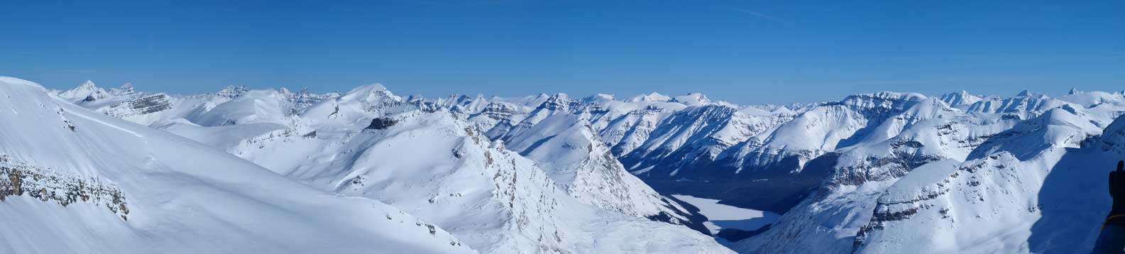
Panorama of west part of Wapta Icefield. I’ll do Collie and Ayesha someday
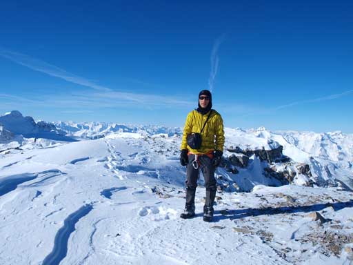
Me on the summit

Ben walking to the western outlier

Ben on the western outlier. Collie in the background.
We didn’t stay long because we hadn’t finished our goal for this day, and we quickly started the walk back along summit ridge, and then enjoyed the fast plunge down the steeper south slope. We me a group of 6 skiers on their way up Rhondda, and after saying goodbye to them we retraced our steps down, to retrieve our gears.
Going down Mount Rhondda. Thompson, our next objective, on left side.

Another group of skiers were going up Rhondda

Looking back at the south slopes of Mt. Rhondda
Now we realized that we should have brought the gears up all the way to the base of steep slope, as that would give us the most direct line towards Mount Thompson. Oh well, once we got the gears, we aimed directly to Mount Thompson.
