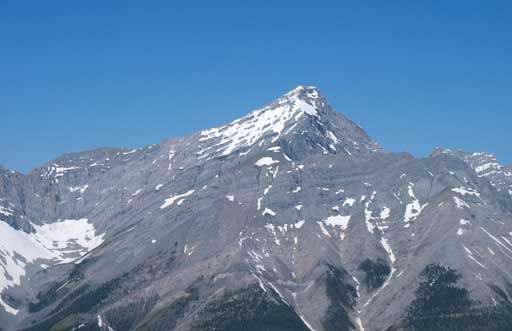
Mount Sparrowhawk
July 11, 2012
3121m
Kananaskis – Smith Dorrien Valley, AB
After finishing Norquay, Aylmer, Panorama and Paget, I took a (much needed) rest day in Canmore to regather my strength. Clayton (a fellow scrambler from ClubTread) and I had been talking to each other for quite a while and we figured it’s the time to do a trip together. It was a bit difficult to finalize an objective but eventually we came across Mt. Sparrowhawk which we were both very interested in. This is arguably one of the most popular scrambles in the western half of Kananaskis Country. This is one of the tallest peaks in that area and yet, one of the easiest ascents (both speaking technically and physically), so no wonder why. I liked the way of driving on the rough Smith Dorrien road at 80 kph. Well, Clayton has a truck so that’s why.
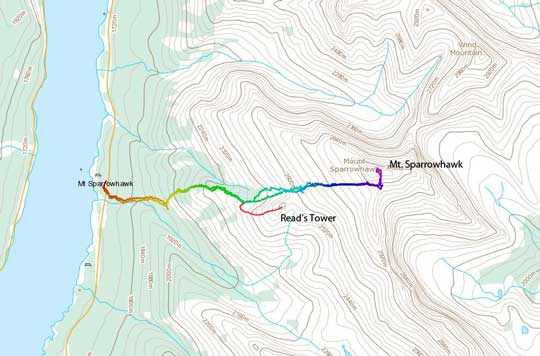
The standard scramble route for Mt. Sparrowhawk and Read’s Tower
We made a not-so-early start at 8:45 am, especially under the forecast of possible afternoon thunderstorms. However, this wasn’t a long objective so it was okay. For the direction, I suggest not to follow Kane’s description. Alan Kane says to not follow Read’s Ridge trail as it leads to cliff bands… But actually there’s no cliff band at the end of Read’s Ridge trail (which we found out later)… Well, after following Read’s Ridge trail for about 15 min, we started the bushwhacking. We traversed towards climber’s left, trying to find the stream that Kane mentions. The bush wasn’t bad though, but did slow us down. We crossed a drainage and went up the ridge on the other side. Surprisingly, this eventually led us back to Read’s Ridge. “Damn it… We should have just followed the trail then”. At the base of Read’s Tower, we found that there’s no cliff band at all.
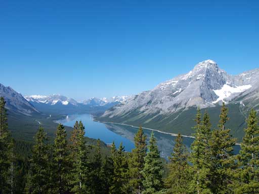
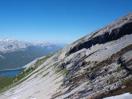
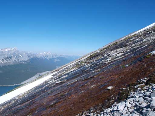
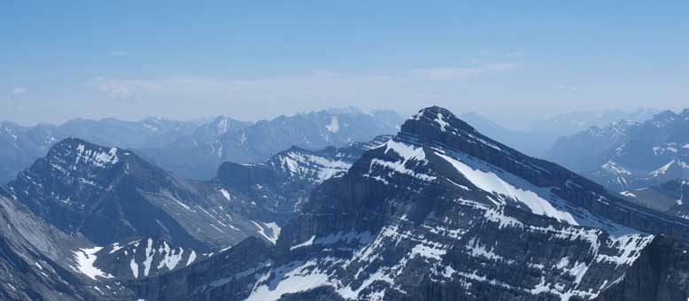
Morning view of Spray Lake and Mount Nestor
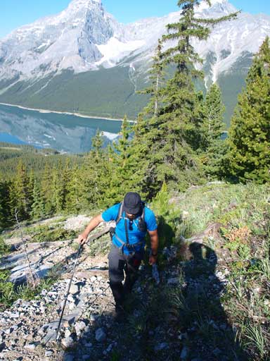
Clayton hiking up
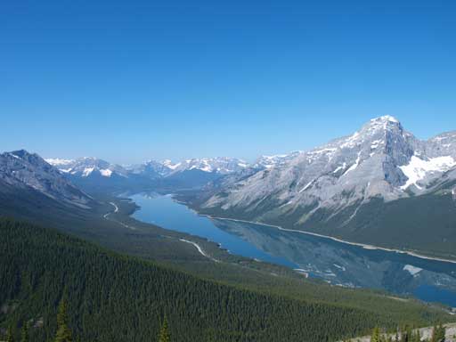
Another look at Spray Lake, with Mt. Nestor looming behind
A closer look at Old Goat Mountain, the highest in Goat Range
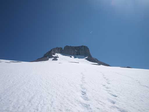
After a quick break, we started the traverse diagonally up beneath Read’s Tower. We should have just dropped down a bit and ascend the bottom of the gully. By that way, we could avoid side-sloping on loose stuff. The snow in the gully helped us a lot. (I didn’t even use an ice axe until near the summit, so the snow was easy). There’s not much to say for the rest, as it’s merely a simple slog on snow or occasionally, scree and slab. Be sure to look back at the impressive face of Read’s Tower on the way up.
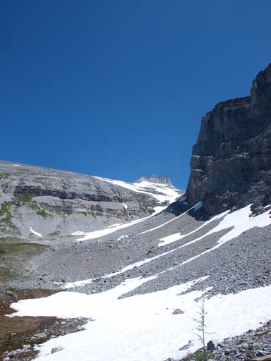
The gully that we’d ascend soon.
Typical grade on this gigantic slope
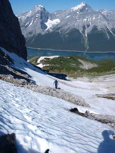
Clayton follows me up the snow gully beneath Read’s Tower
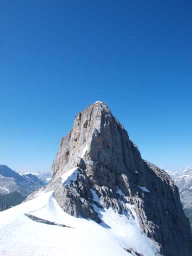
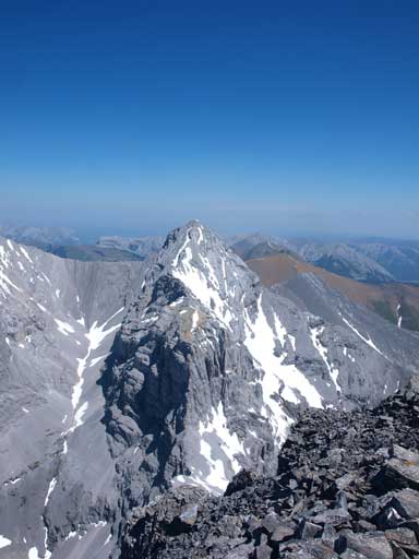
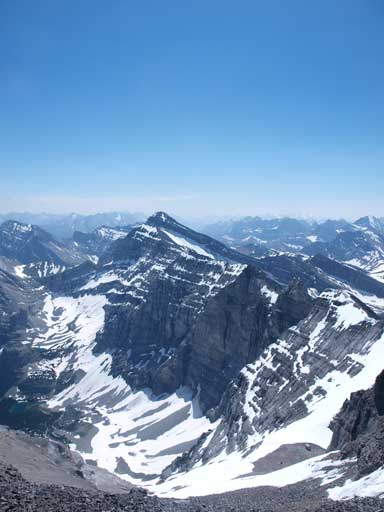
The impressive Read’s Tower
More and more interesting colours would show up as the snow melts.
Read’s Tower
The typical snow walk.My boots are too flexible and I didn’t enjoy the snow that much.
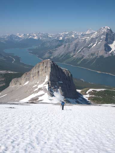
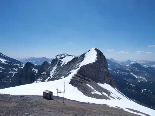
The summit block ahead. Route goes up from climber’s right.
Near the summit block, we had to cross a steep snow slope. It was steep enough to take out my ice axe for security. A slide on that slope would send me down the other side of the mountain, where big cliff bands exist. After some tedious scree bashing, we stood on this lofty summit. We stayed there for almost 1 hour soaking in the views and to escape the heat. The register was in a bad shape as it was wet.. I took several close shots of Mount Lougheed’s alternate route (moderate route), and it’s bone dry now.
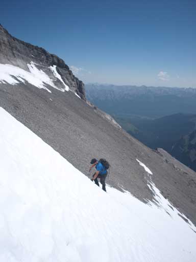
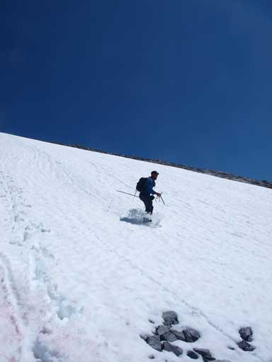
Clayton kicking step up the steep snow. This is the only part that we need an axe.
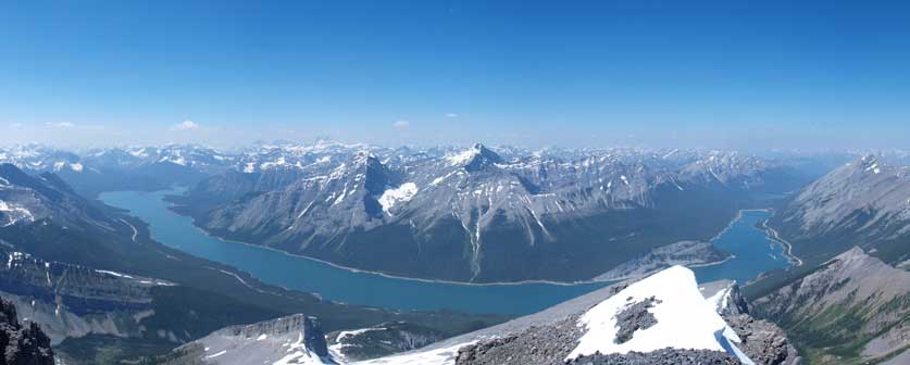
A panorama of Spray Lake from the summit. Nestor and Old Goat look much smaller now.
Panorama of Kananaskis Range. The high peak in the background is Mt. Sir Douglas
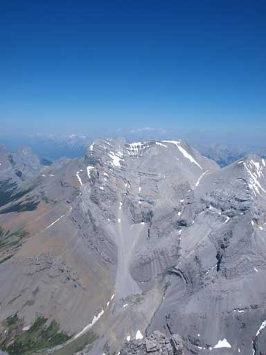
This one is Mount Bogart.

Zooming-in towards the N. End of Spray Lakes

Eon, Aye and Mount Assiniboine. No need to introduce more.

Old Goat Mountain on left.
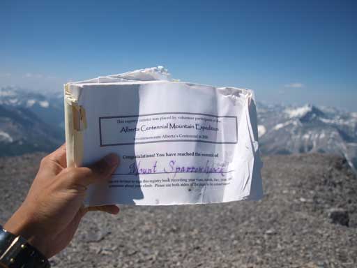
The summit register

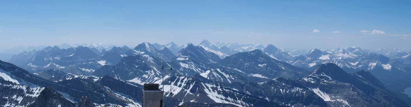
Looking north
Wind Mountain, aka. Mt. Lougheed IV
The true summit of Mt. Lougheed, aka. Lougheed II
Mount Bogart
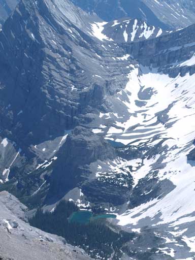
This rock actually has a name, Bogart Tower. The lakes are Memorial Lakes

Me on the summit.
Descending on scree and snow was really effortless. Except for a few isothermic sections, the whole way down to Read’s Ridge was fast. And because I haven’t done Read’s Tower yet, I decided to give it a go as well. The ascent was written in a separate trip report as it’s counted as a separate peak.
Now we were down to the base of summit block. This ridge eventually leads to Mount Bogart, but I don’t think it’s scramble-able.
Clayton enjoys boot skiing. I suck on this so I slide down on my butt.
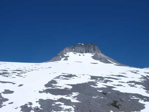
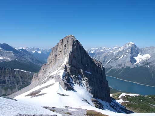
The summit block of Mt. Sparrowhawk seen from Read’s Tower
For the rest of the descent, since we lost the trail on the way up and ended up bushwhacking, we paid much closer attention on following the supposed Read’s Ridge trail, which was not very pleasant neither. There’s a loose layer of dirt coating on firm ground, and the grade was pretty steep. We both took a couple slips and falls, but we made back nonetheless without incident. I think I was super bagged and tired at this point (the 6th day of my peak-bagging trip).

Time to go home…
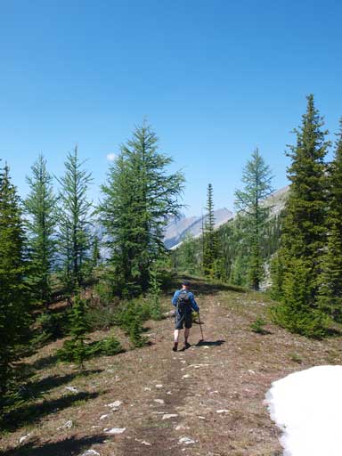
Into the trees

Typical trail condition…
Our round Trip time was 8 hours including all of the stops and detours. At the end of the day, we enjoyed the cold water in Spray Lake. That was awesome, as the temperature was 31 degree in Canmore… I was exhausted so it’s time to drive back home and have a much needed rest.
