Vicuna Peak
October 15, 2015
2126m
Coquihalla Pass, BC
The original plan for this past Thursday between Simon, Vlad and myself was a small peak named Zum by Coquihalla area (~4 hours), but with the superb weather and condition Vlad suggested to increase our ambition tagging the two higher peaks nearby – Vicuna and Guanaco (~6 hours). Simon had done these two many years ago but they do share the same approach road with Zum Peak so we could still take the same car. I did some quick last minute research on ClubTread and after seeing the pictures of Vicuna’s huge slab face I started to agree with Vlad’s idea, so up the Coquihalla the next morning this was another area that’s entirely new to me.
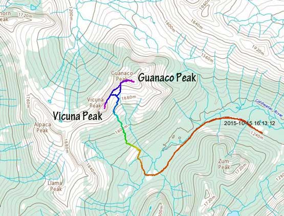
Vicuna Peak and Guanaco Peak scramble route. GPX DL
Vicuna Peak is one of the more technical and at the same time, one of the highest peaks in the Coquihalla area. The easiest route that goes up the NE Ridge from Vicuna/Guanaco col is a pleasant Class 3 scramble with one tricky Class 4 step aided by a fixed chain. There’s a good trail leading to Vicuna/Guanaco col but to get there we had to drive (or walk) about 12 km on the Upper Coldwater FSR. The road was a bit rough with fair amount of potholes but generally in a good shape to the recreation site by Little Douglas Lake turn-off (~6 km). That’s also the turn-off for Zum’s bushwhack route so after saying good luck to Simon we resumed the driving. The next 2 km or so was still reasonable but soon the alders closed in. After “car-bushwhacking” for another kilometer we decided to call it quit so parked at a pull-out. From there it’s about 1 hour’s walk to the trail-head with a few creek crossings.

It’s obvious why we stopped driving…
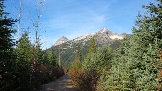
Our objectives – Vicuna and Guanaco ahead
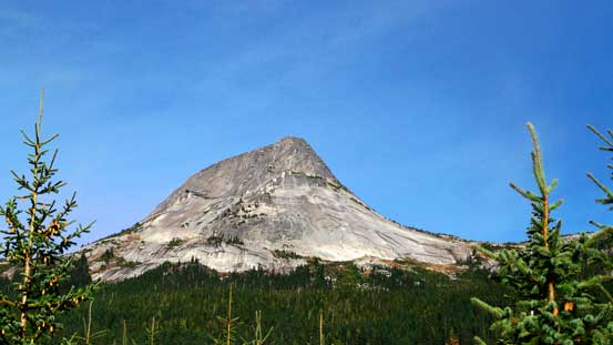
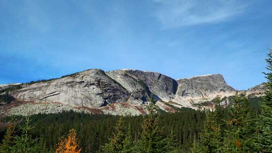
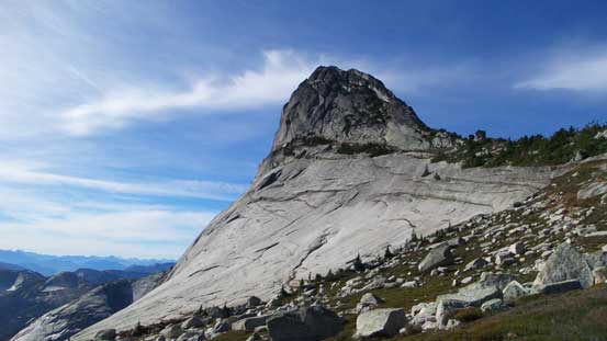
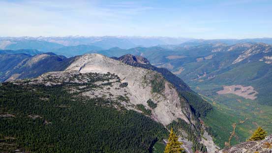
The impressive SE Face of Vicuna Peak
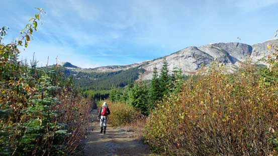
Vlad continuing up the logging road
The face of Alpaca Peak
The trail-head was marked by a cairn and looking left we immediately found the path. Up through the forest it was very easy to follow, but after about halfway up we entered a boggy area. It was impossible to not wet your boots (even in October) and sometimes it’s even better to bushwhack beside rather than stepping on the trail.. Thankfully it wasn’t too overly muddy and the season was late enough that there was no mosquito around… In about 20 minutes we cleared this miserable section and then the forest started to thin out, and in short time we arrived at that famous natural staircase on a big granite boulder. The view of Vicuna Peak’s SW Face was impressive as we traversed underneath it back towards climber’s right, and another half an hour later we arrived at the col.

Upwards through the steep forest
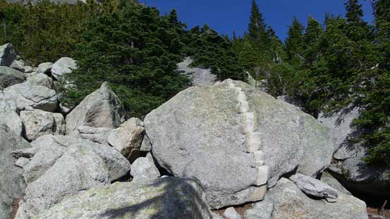
Arriving at the famous natural staircase
Vlad climbing up the staircase

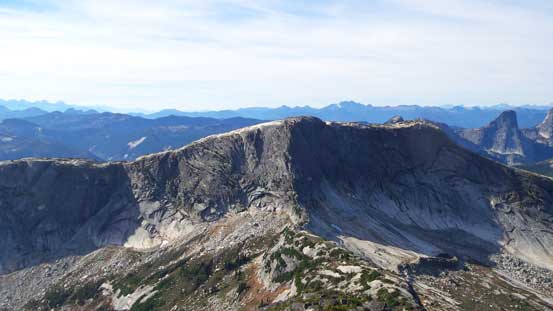
The huge slabs of Vicuna Peak’s SE Face
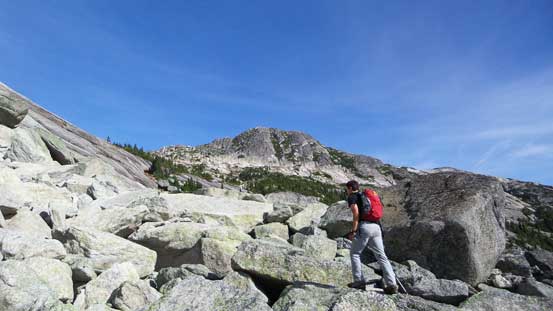
Ascending through a boulder field. We lost the trail here briefly

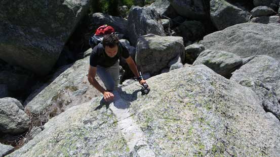
Vlad playing around with the grippy slabs
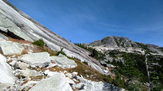
The trail traverses immediately underneath these slabs

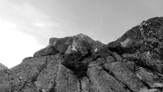
A bushy scrambling spot
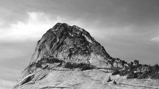
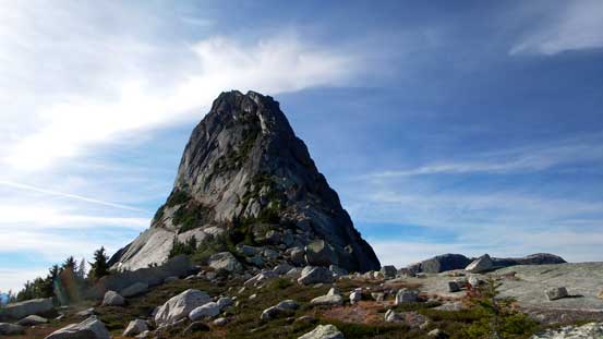
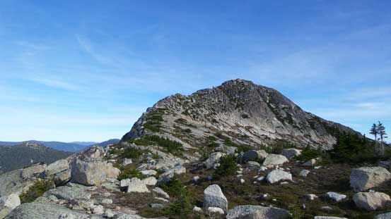
Vicuna Peak
A close look at the summit block of Vicuna. Route goes up the right side ridge
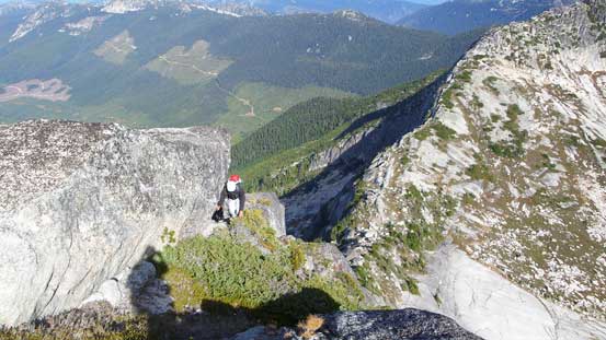
Arriving at the col now, looking towards Vicuna Peak
And, Guanaco Peak
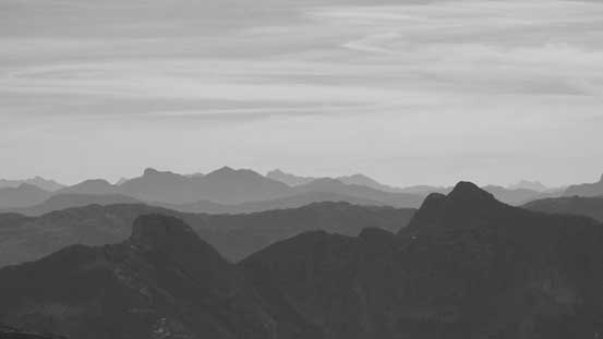
The views opened up towards the north side. Bighorn Peak in the foreground
We took a necessary break but too bad the wind started to pick up, so up the ridge we went. It started fairly easily but soon got steeper and steeper as we encountered some fun 3rd class sections. The scramble was shorter than expected and it didn’t take us long to arrive at the crux. It didn’t look difficult but once starting the pitch I realized there weren’t that many handholds available (if not using the chain). It’s the terrain that you’d expect from granite climbing, in other words, it’s down-sloping, slabby and involves some big steps with some moderate exposure. There’s a crack for some good foot jams but the positive handholds were minimal, but then there’s the chain so we both used it…. And then there’s still fair a bit of scrambling to reach the summit.
The scrambling starts

There’s a flatter section
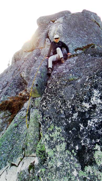
And then, it’s time for the crux
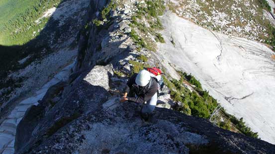
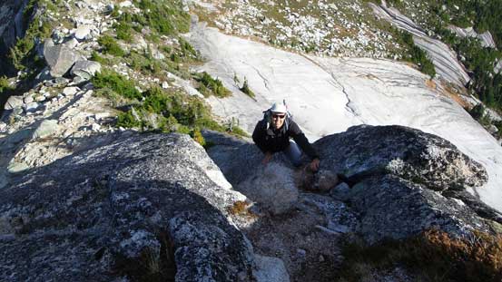
Vlad climbing up the crux
Still a bit of scrambling after the crux
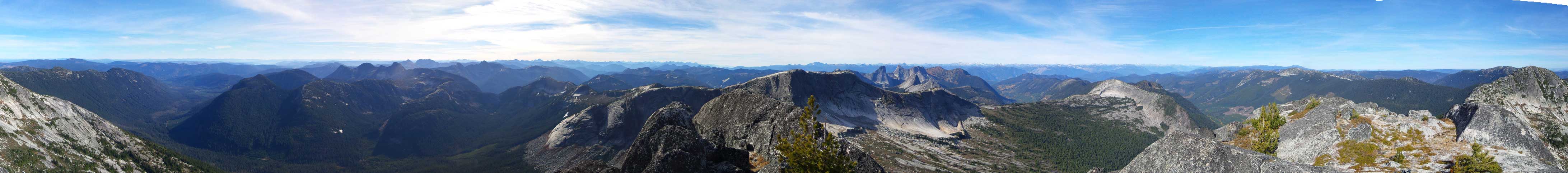
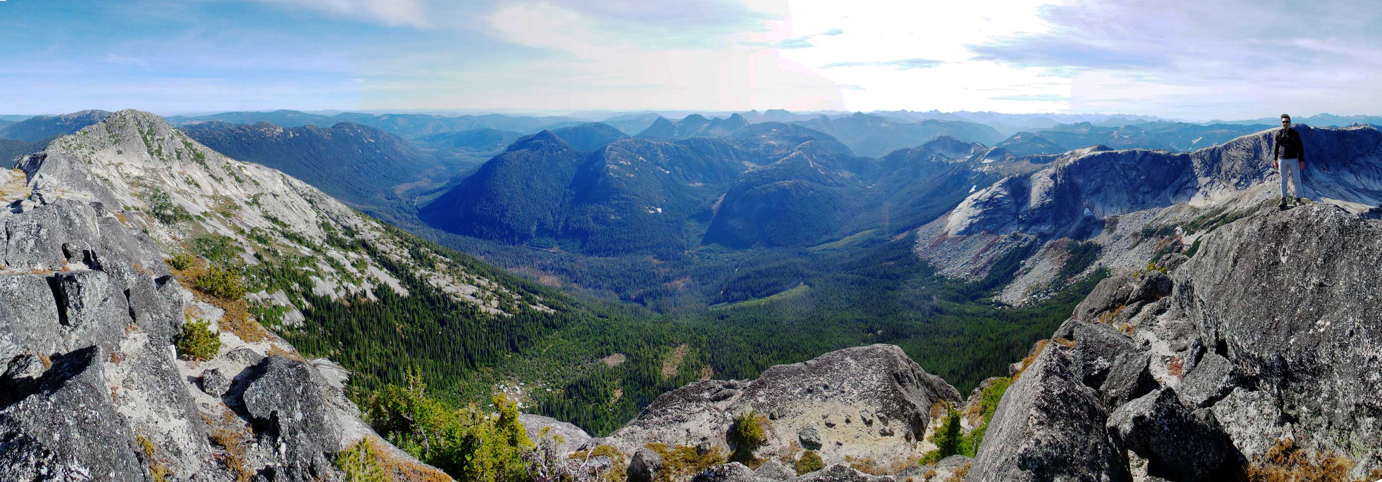
Summit Panorama from Vicuna Peak. Click to view large size.

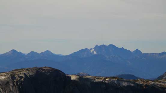
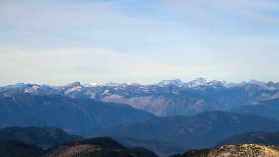
Steinbok (L), Ibex (C) and Chamois (R) in the Anderson River Group
The Old Settlers in the East Harrison area
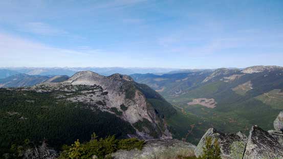
Looking south passing Needle Peak (fg, R) towards Snass Mountain (bg, L)
Coquihalla Mountain (bg, R) rises behind Yak Peak (fg, L)
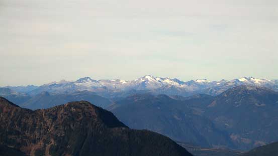
Mt. Baker and the peaks on Cheam Range
Mt. Breakenridge and Traverse Peak by Harrison Lake area
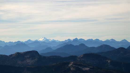
Scuzzy Mountain (fg, L) and Mehatl Peak (bg, R)
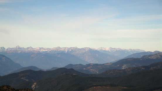
Looking up the Fraser River valley towards Lytton area, including Stein Mountain (R)
Bighorn Peak
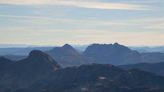
Alpaca Peak
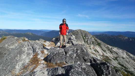
Me on the summit of Vicuna Peak
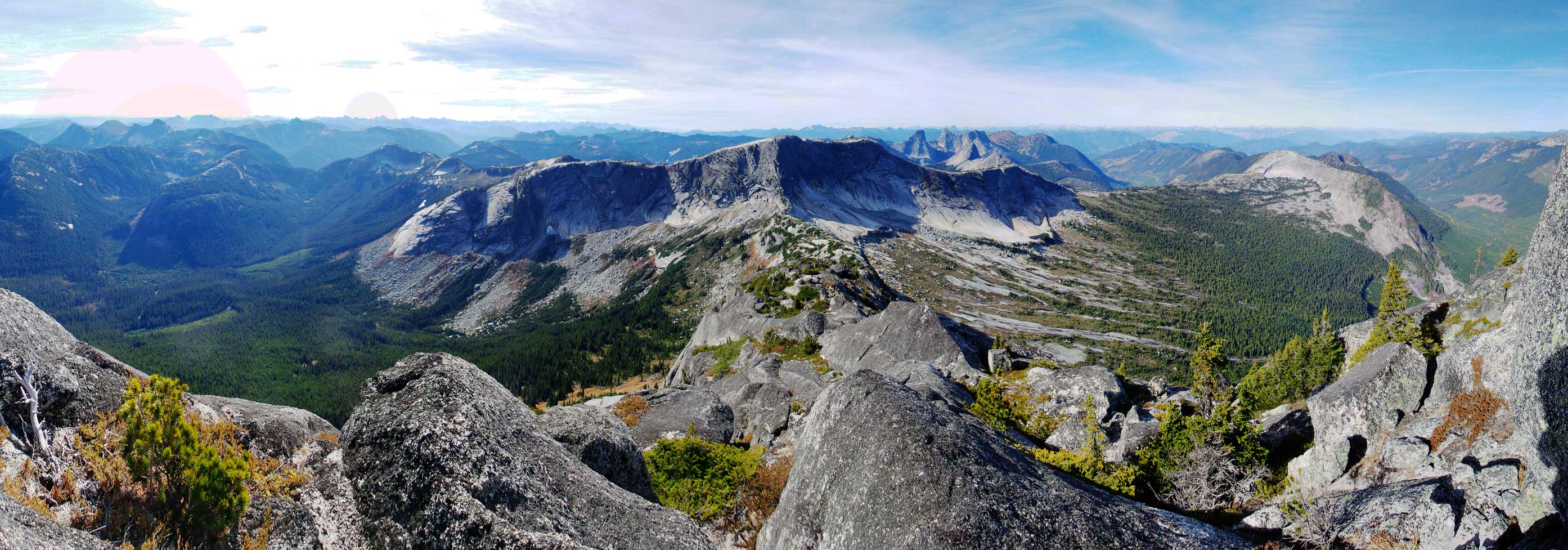
Another panorama from the summit. Click to view large size.
One more panorama from the summit. Click to view large size.
On the descent we again, used the chain to assist the down-climb. The rest of the down-scramble was pretty fun with some stemming, “crab-walking”, and a few interesting big steps.

The bottom half of the crux (aided by a plastic cable)
Vlad down-climbing the crux section
I’d recommend Vicuna Peak to competent scramblers looking for an interesting ascent. The approach is short and easy and the scramble is very fun on solid granite. The down-side is the somewhat long drive including a rough and bushy logging road.. Back to the col we took another break, and then it’s time to head up Guanaco Peak.
