Southfork Mountain
June 30, 2012
2350m
Castle Wilderness, AB
Southfork Mountain is a mere bump in the “West Castle” region at the far northern end of Barnaby Ridge but since it’s officially named it’s on my “list” as a peak-bagger. Eric, Raff and I ascended it as the bonus objective after finishing the true summit of Barnaby Ridge earlier in the day.
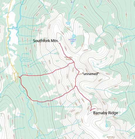
Barnaby Ridge to Southfork Mountain scramble traverse route
There’s one unnamed peak between the true summit of Barnaby Ridge and Southfork Mountain. To traverse to Southfork Mountain we had to ascend up and over that unnamed peak. Getting to this unnamed peak was just a hike, albeit scenic, but involved quite a bit of elevation loss and regain.
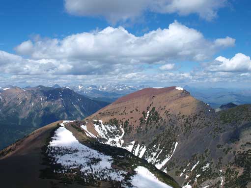
GR907662 seen from Barnaby Ridge
Going up this unnamed GR (907662)

I won’t consider this GR being a separate summit though.

Looking back at Barnaby Ridge from GR907662
The East side of Castle area
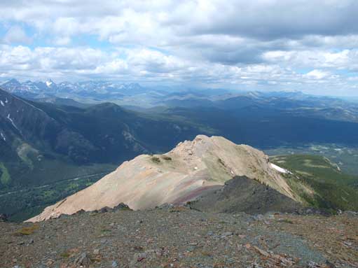
There were some interesting moderate scrambling sections to get down GR907662, and we all enjoyed that. Despite the lower elevation, Southfork Mountain does offer great views down to Southfork Lakes which are not visible from GR907662. We also got a better view of Crowsnest Pass area, including Flathead Range and Crowsnest Mountain (our objective for the next day). There was a canister but no booklet inside…
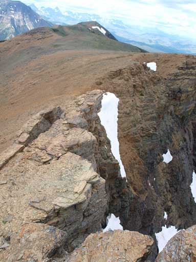
Some optional hands-on stuffs while descending GR907662
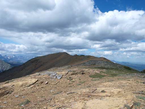
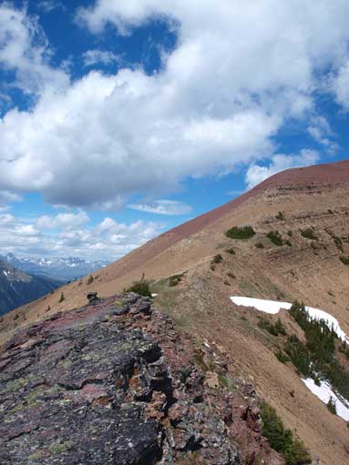
Going towards Southfork Mountain
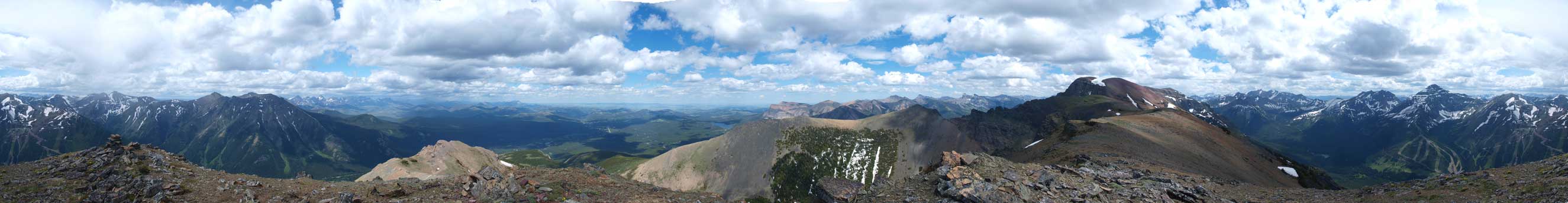
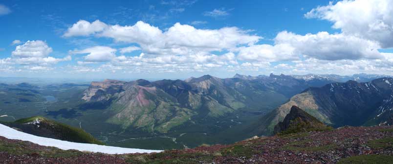
Summit Panorama. Click to view large size.
Isolated sunlight shone on the north ridge of Southfork Mountain.

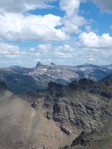
Mount Haig
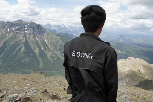
Raff on the summit

Southfork Lakes
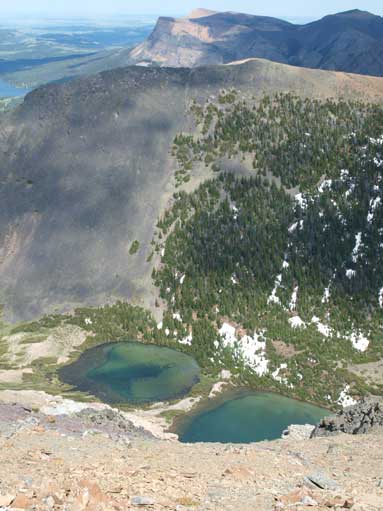
Southfork Lakes. There is a route going up from this way.
Castle Peak and Windsor Mountain
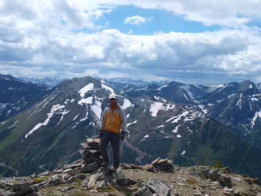
Me on the summit. Photo by Raff K
During the traverse we took a note on an alternate descending gully, which could save us from re-ascending that unnamed GR. We stayed a bit longer on Southfork Mountain before heading down. The initial part of the alternate descent route was a fast scree run that ended at a boulder field. Lower down, we re-entered the thick bush… Following the drainage down, we encountered lots of avalanche debris (dead falls, etc) just about going into the forest. Negotiating dead falls and thick bush was the major theme for the next 1.5 hours and it was worse than our ascent gully. It was probably the worst bushwhacking I’ve ever done so far in my peak bagging career.

Scree skiing down the upper gully
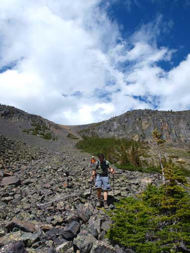
Ready for the bush?
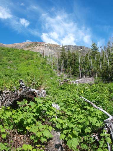
The bush part starts
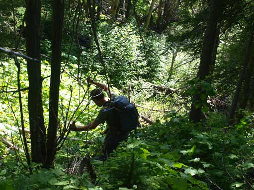
And it would soon turn to a hellish experience
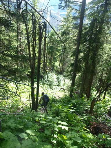
Typical typical…
We enjoyed the water in West Castle River before getting back to car. Raff had other plans for the next two days. And Eric and I would drive to Crowsnest Pass for the next ascent in this trip.
