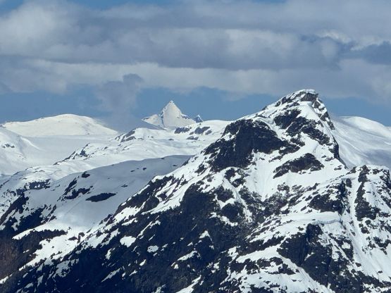
“Aunt Peak” (Sisqa S3)
May 17, 2026
2268m
Pemberton, BC
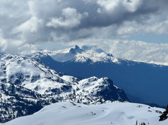
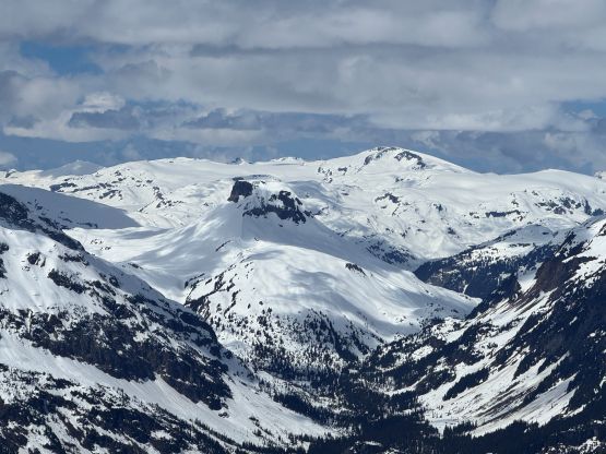
“Aunt Peak” was formerly known as “Sisqa S3” as it’s the substantial unnamed peak about 3 km to the south of Sisqa Peak, on the edge of Pemby Icecap. The name “Aunt” comes from the family theme of the area, as “Sisqa” means “uncle” in the native languages. There weren’t a lot of information about this objective on the internet but Simon had a trip report in which he accessed it from Soo FSR (south side) in summer conditions. Upon looking at the various map layers I agreed with the south side access but I preferred to have snowline down to 1300 m to cover the underbrush. I also preferred a more direct route than the undulating ridge route that Simon took.
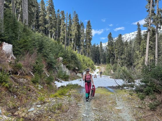
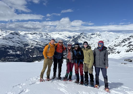
In any case there’s a mediocre window exactly one week after I finished Sisqa Peak etc. and the weather suggested that we should aim for the same area for the maximum chance of seeing blue skies. I instantly decided to explore my experimental route on “Aunt Peak” and managed to put together a large but strong team. Harry and Rob would come with me in a single push home-to-home whereas Tanja would drive Elise and Francois out of Squamish. We agreed to leave Squamish at roughly 5:30 AM in two vehicles. Ideally we would need two 4Runners or equivalent but our second best vehicle was my Subaru Forester, which probably would make do but with some uncertainties. There’s no recent beta about the last few kilometers of the Soo FSR/Torrent Spur so realistically I only counted on being able to drive to the bridge crossing Torrent Creek, which would add about an hour of walking each way.
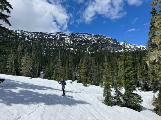
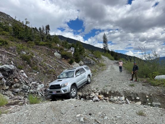
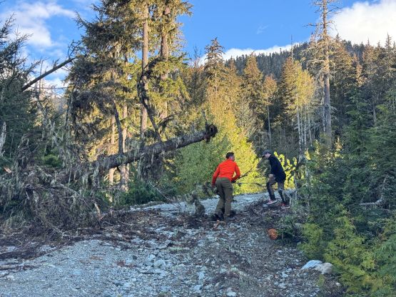
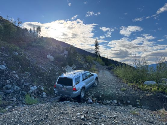
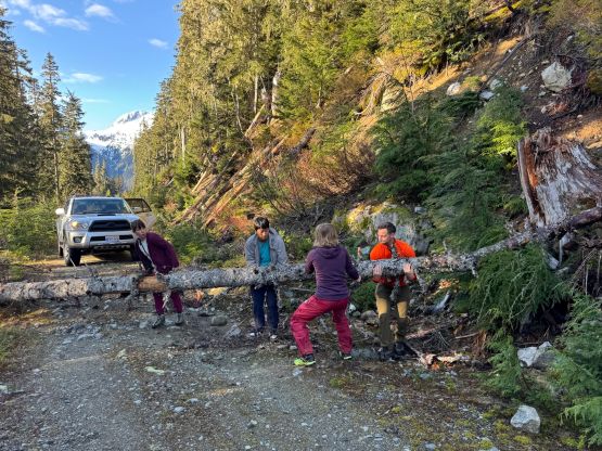
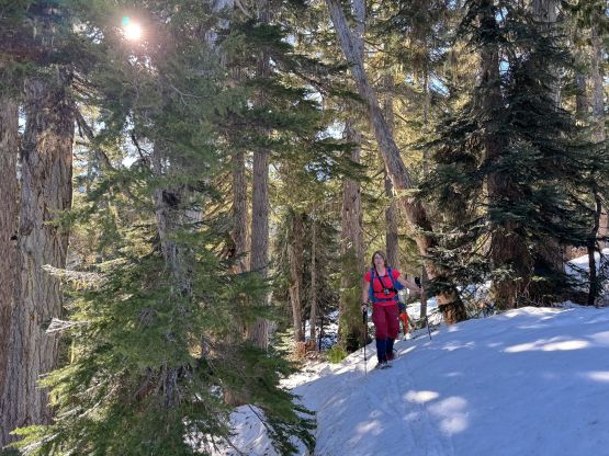
We regrouped at the start of Soo FSR and I led the way in front. The road was mostly smooth but there were at least 100 deadfalls that had been cleared in the last day or two. None of us had brought a chainsaw so I wondered how far we could actually go. The wash-out at kilometer-15 was still there and the crossing required at least a Subaru. The bridge over Torrent Creek was intact. Immediately after the bridge we encountered a few deeper ditches but didn’t impose too much of a problem to the Subaru. There were two notable wash-outs in the vicinity of that large switchback on the map. The first one was at the Subaru’s limit whereas the second one was pushing the 4Runners to its limit, so I turned around and parked in front of the 2nd washout. We also encountered several downed trees that hadn’t been cleared but we were always able to move them around without having to cut anything. The 6 of us then all squeezed into Tanja’s 4Runner and we pushed all the way to the snowline, about 1 km from the road’s absolute end. This was shaping to become the “best case scenario” and the trip was now looking to be a short one.
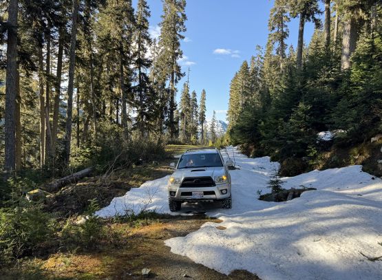
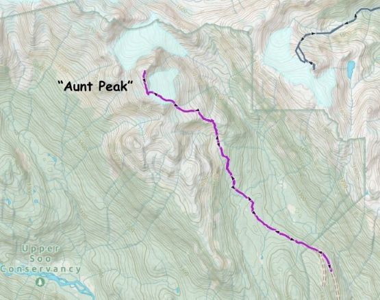
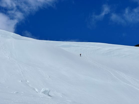
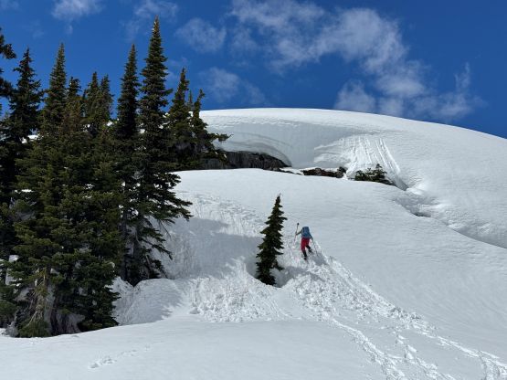
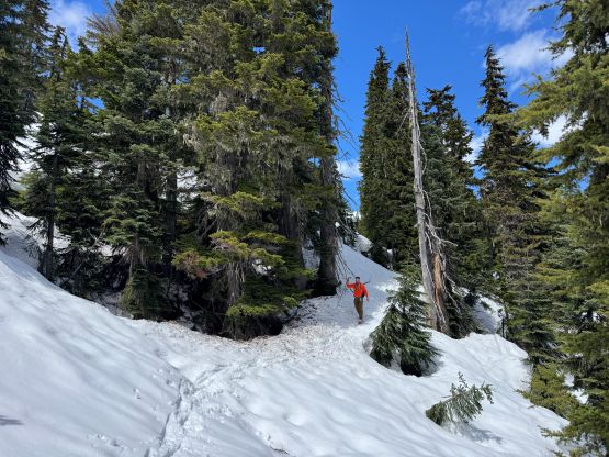
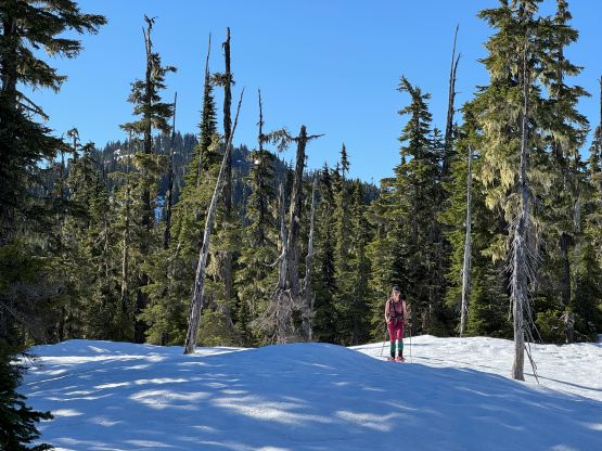
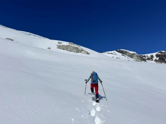
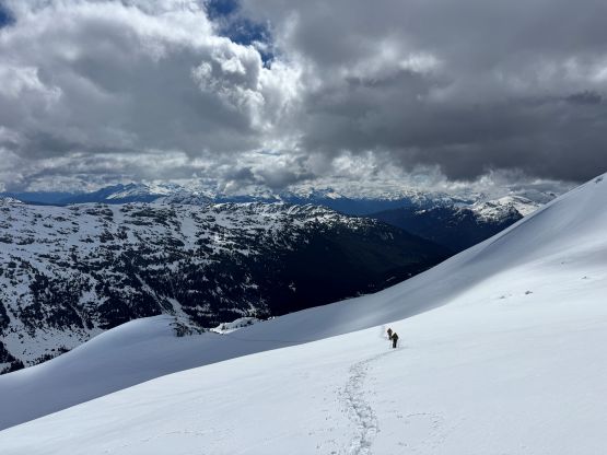
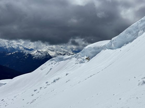
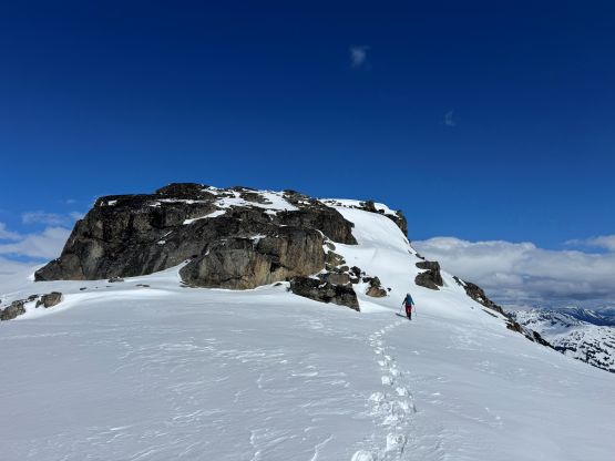
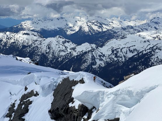
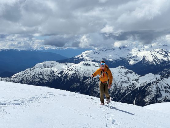
The snow was bullet proof thank to the deep overnight freeze but the temperatures were skyrocketing and the weather was sunny, so I expected the condition to soften up in no time. Near the end of the road we were already starting to punch through the crust so we stopped to strap the snowshoes on. From the end of the road we actually picked up a set of skin tracks that were at least 1-2 days old, so we mostly followed their tracks. I did ignore the skin tracks as soon as I didn’t agree with their route-finding (as who knows what the hell they were doing), but our routes always ended up merging after 5 or 10 minutes, so those guys actually knew what they were doing. A long while later it seemed like the skiers had gone down towards Torrent Creek, presumedly going towards “Zener Col” so I abandoned their tracks and made a sharp turn bearing left (uphill). My route utilized a ramp system to gain the SE aspect of “Aunt Peak” and there’s no “beta” whatsoever on the internet. Skiers usually don’t give a fuck about summitting anything so I wasn’t expecting them to actually lay a full set of tracks for us up the objective.
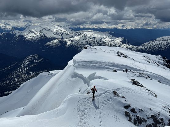
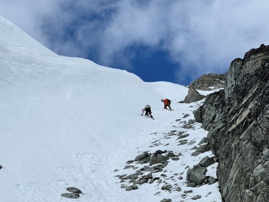
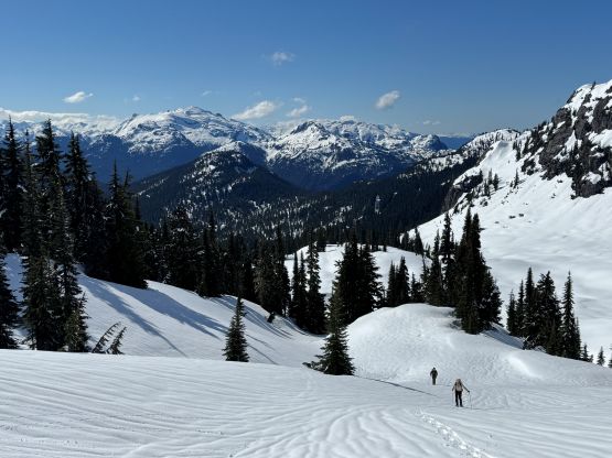
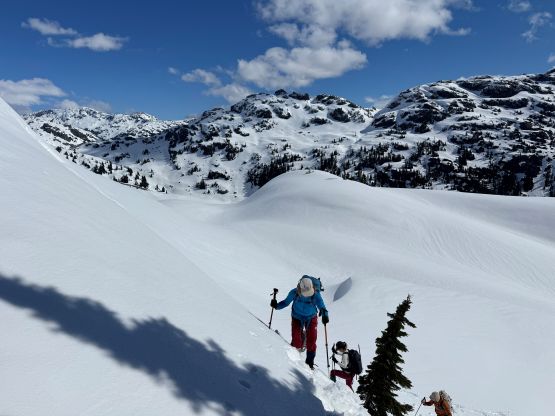
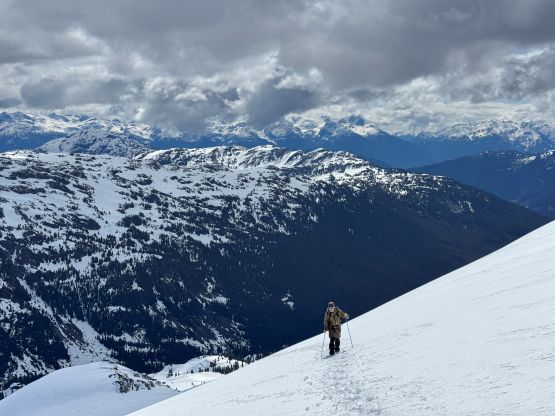
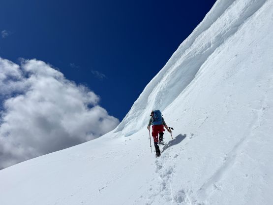
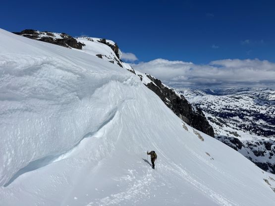
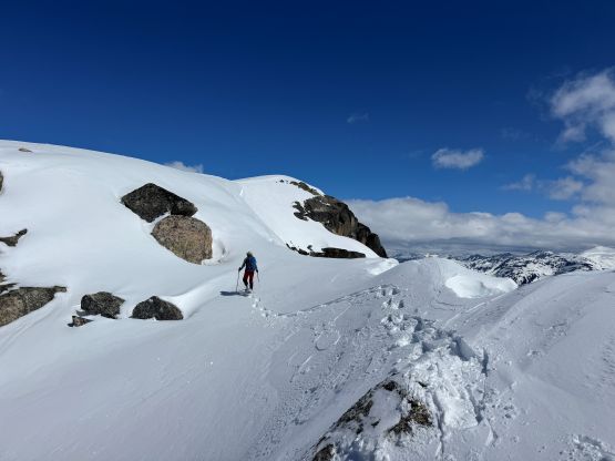
The route mostly worked out as expected, but the condition deteriorated quickly. At the treeline zone we were already post-holing calf deep on snowshoes and the new (15+ cm) snow was not bonding well to the old interface. I was triggering small slides while side-hilling up a few steeper rolls so we stopped to turn on the transceivers. I brought the avi gears but wasn’t actually expecting to use them. At 1800 m we came to the “upper mountain” and made the final decision to attack the SE Face head-on. I had proposed several route options and it seemed like the most direct way would go, so why not. Our route took advantage of a gigantic wind scoop but the grade was steep enough to test everyone’s snowshoeing abilities. Elise broke the pivot of one of her snowshoes, but this wasn’t the first time happening in my trip so I had come prepared with a ski strap, which solved the problem. There’s another section of steep climbing underneath some large cornices to gain the south ridge, and the south ridge itself was also more complicated than I thought, with some micro-terrain and route-finding involved.
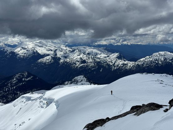
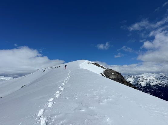
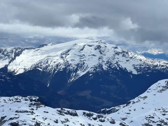

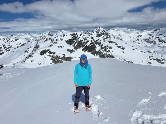
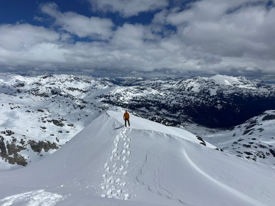
Given the conditions we abandoned the idea of going towards “Sisqa S1” so took a long break on the summit and then headed down. This was indeed shaping to become a short outing. The snow was terribly mushy on the descent but this is normal at this time of a year. We pretty much retraced our own snowshoe tracks all the way back to the vehicle without contemplating about anything fancy. Our round trip time was just over 5.5 hours and we weren’t even pushing the speed. I thought about tagging the unnamed P200m forested bump looming above the “trail-head” but I was certain that no one else would be keen, so didn’t even bother to make the suggestion. Instead, we opted to drive out and did the P200m bump overlooking the start of Soo FSR. This “peak” at least has a trail and doesn’t involve wallowing in the mushy snow. I then drove us back to North Vancouver dealing with the Sunday afternoon traffics. Harry had to help me for about 20 minutes of driving since I was having trouble staying awake. After dropping Harry and Rob off I went straight down through the downtown gong show, all the way to White Rock for 2 hours of exhausting work from 8:30 to 10:30 PM. I eventually got back home at after 11 PM. Speaking the approach we took, I think it would work out nicely for accessing Sisqa Peak (over “Zener Col”), or as a starting point for the longer Pemby Icecap traverse. The timing window is more flexible than the Rutherford FSR option. I guess the skiers like to keep their things “secret” but this is definitely not a rarely done approach despite the lack of information on the internet.