Abernathy Peak
June 20, 2022
2536m
Twisp River, WA
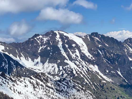
Abernathy Peak is known as one of the easier Bulgers in Washington that comes in shape earlier in the season as it locates on the drier side of the Cascades. Because of that, this peak has become decently popular in the recent years such that it’s not uncommon to have multiple parties ascending even on a weekday. The downside of this peak is the associated long drive and because of that most parties opt for a car-camp at the trail-head. I had been eyeing on this objective even prior to the pandemic and this time, I finally found two volunteers to come with me from Vancouver. The weather forecast for Monday indicated a possible sunny day on the east side of the Cascades. It wasn’t a guaranteed shot, but I decided to take a gamble on the weather and we won this time.
I had just been to this area two weeks earlier on Gilbert Mountain so I knew the road’s good for a passenger car. Holly and I then piled into Phil’s car and the three of us left White Rock at 7:30 pm. The border crossing was heavy at Peace Arch but we detoured to the Pacific Crossing and made across in under 20 minutes. It was then a cruise sail down I-5 and then eastwards up North Cascades Highway. We made to near Rainy Pass when darkness fell and then drove over Washington Pass to Winthrop, and then Twisp. The cruise up Twisp River Road was decently easy and only the final few miles were on gravel. We eventually made to Scatter Creek trail-head just before midnight. Two other vehicles were already parked and it seemed like they were car-camping as well. Holly and I quickly set up our tent while Phil opted to sleep inside the vehicle and we agreed to wake up at 6 am and go from there. The other guys seemed to have started somewhere at 2 or 3 am but we decided to stick to our plan to get more sleep.
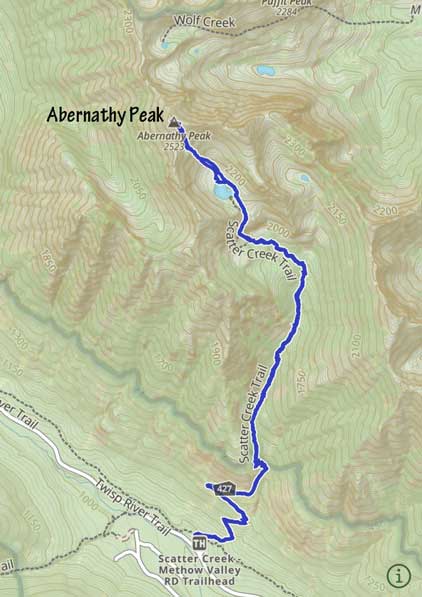
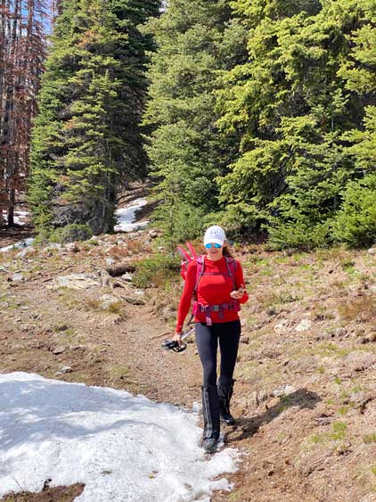
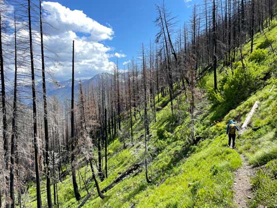
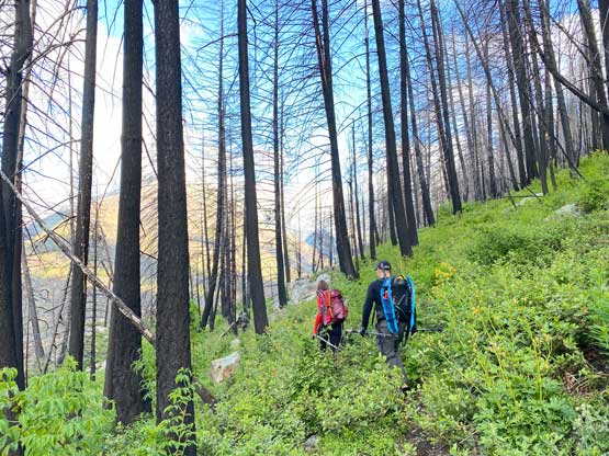
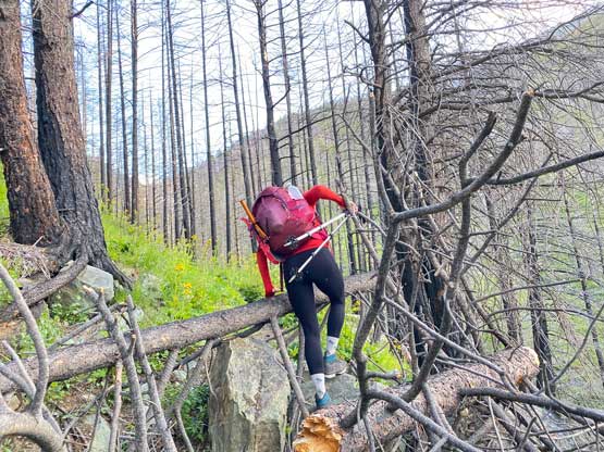
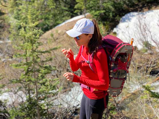
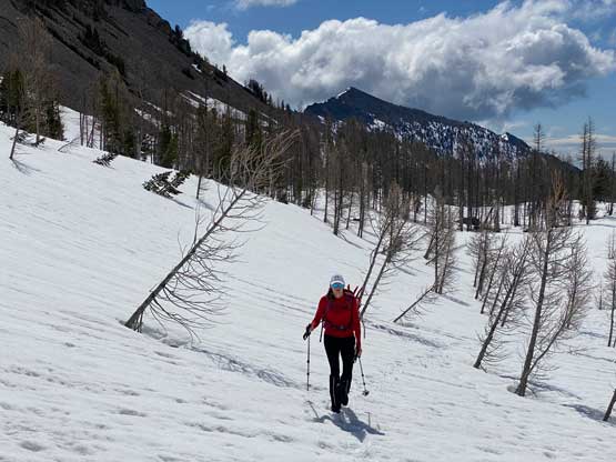
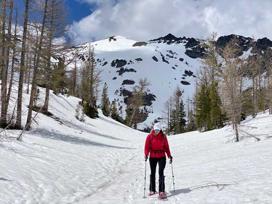
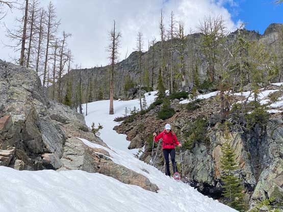
The morning routine seemed to have taken longer than usual but we did manage to start the plod at 7 am. We decided to carry snowshoes, ice axe and crampons not knowing what exact conditions to expect, but they all turned out unnecessary. I did read somewhere that there’s one creek crossing so two of us brought sandals and they proved to be useful. The approach was on a somewhat overgrown trail but the trail was overall easy to follow. A few forks at the beginning were confusing but I had come prepared with a GPS track so the navigation wasn’t a problem. About 1.5 hours into the plod we saw some intermittent patches of snow and then there came the creek crossing. It was shallow but would definitely wet our boots, so we took our time donning river shoes. I then ditched both sandals and the trail-runners and donned mountaineering boots. It started to feel like we might not end up needing the snowshoes neither but we couldn’t see the entire route ahead. I was very tempted to ditch the snowshoes here but in the end decided to carry them to at least Scatter Lake and see from there.
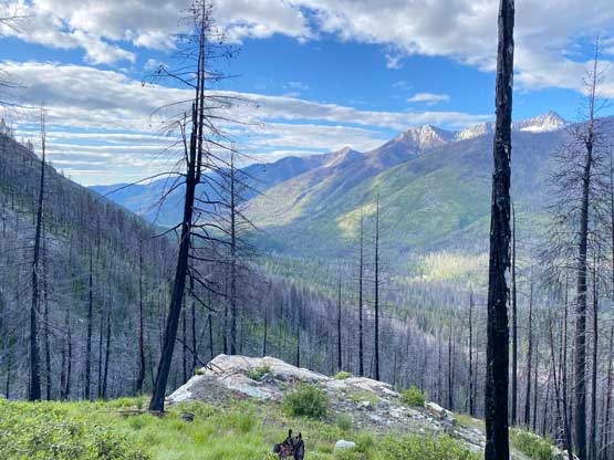
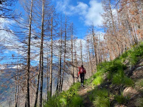
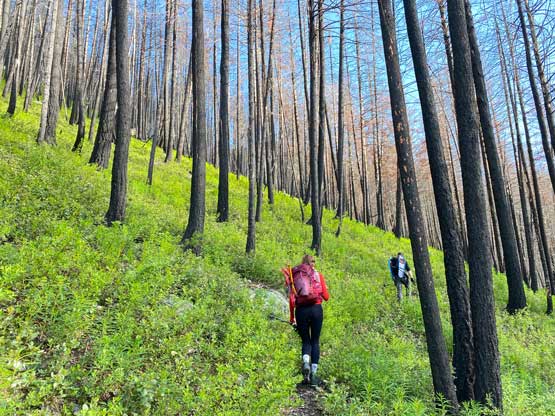
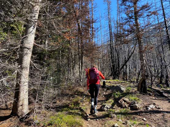
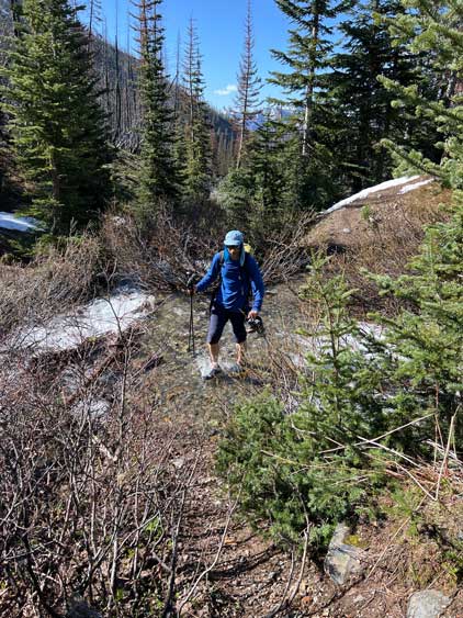
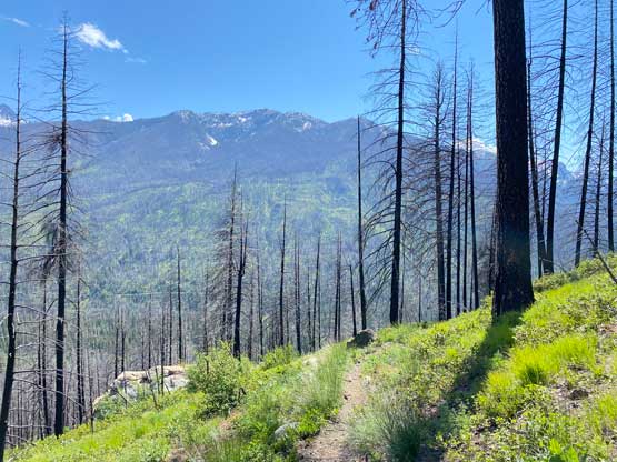
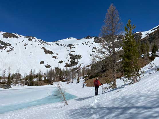
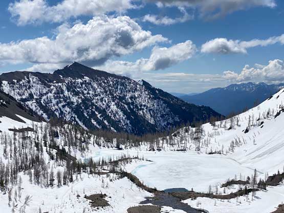
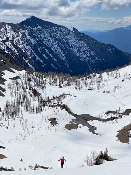
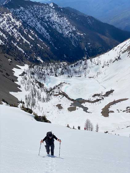
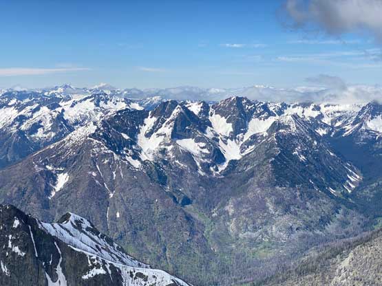
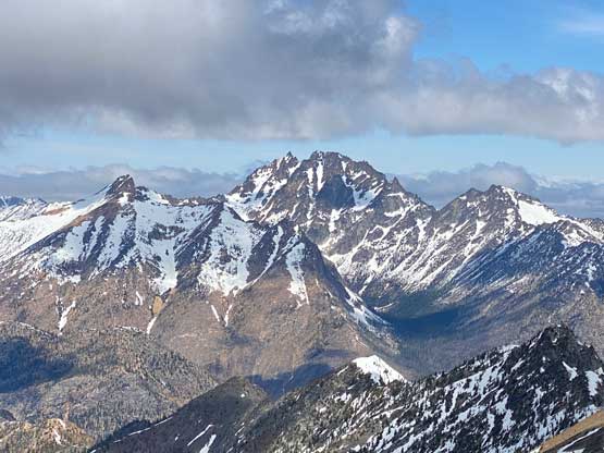
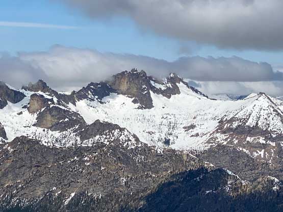
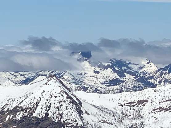
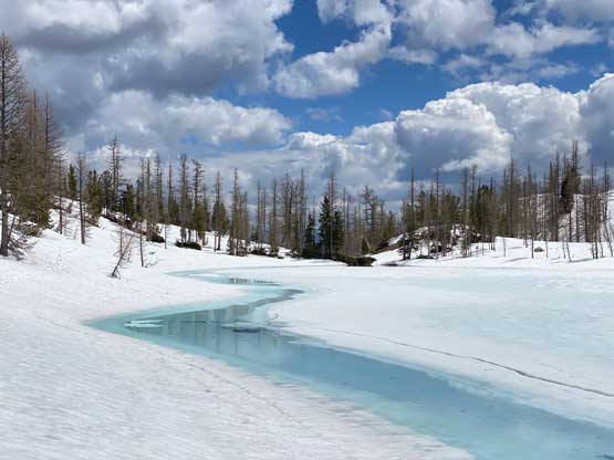
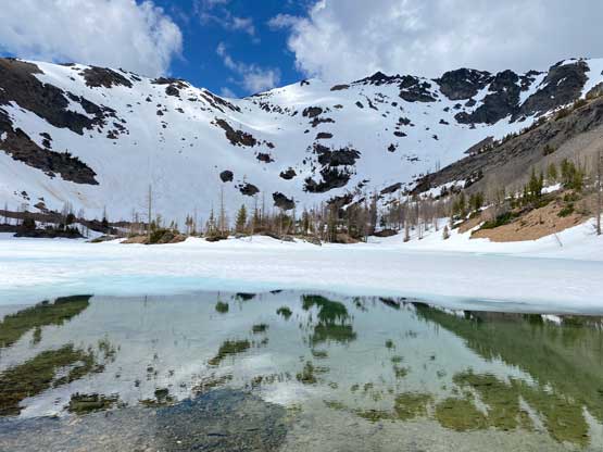
The snow stayed intermittent for the next while and the trail wasn’t that easy to follow at places. I had to consult with the GPS multiple times to make sure we were on track. Not too far beyond the creek crossing we came into a bowl with open views ahead. The GPS track traversed climber’s left and then right but it seemed to me that ascending straight the hell up the obvious snow slope made the most sense, so we did that. About 1/3 of the way up the snow slope we crossed path with previous party’s tracks and followed them merging into the (snow covered) creek just below Scatter Lake. We boot-packed the left side of this creek and popped at the shore of Scatter Lake in short time. The edges of the lake were already starting to melt but the main body was still frozen.
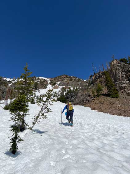
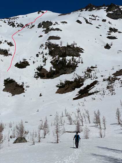
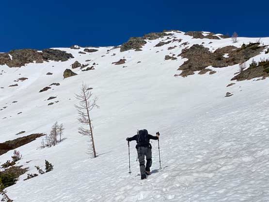
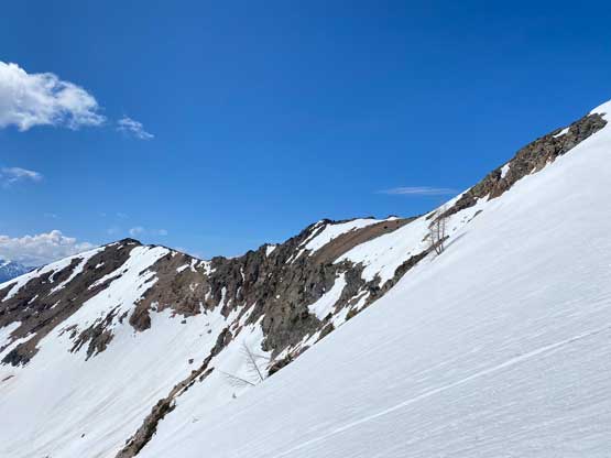
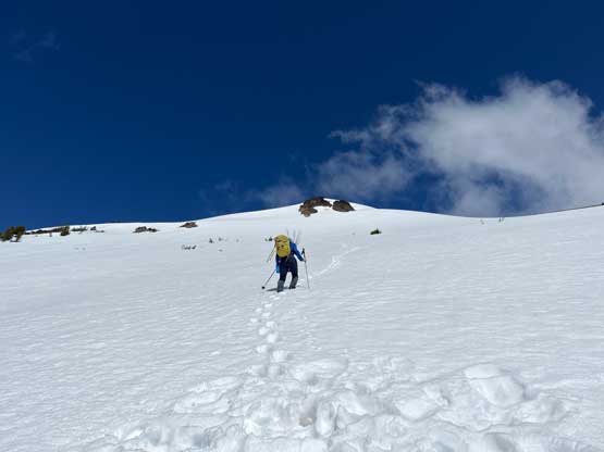
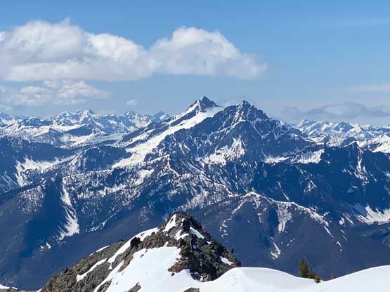
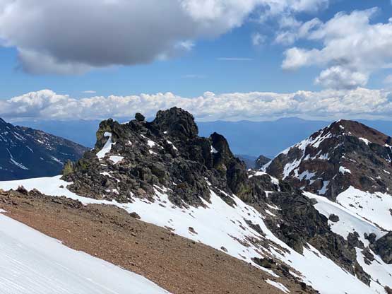
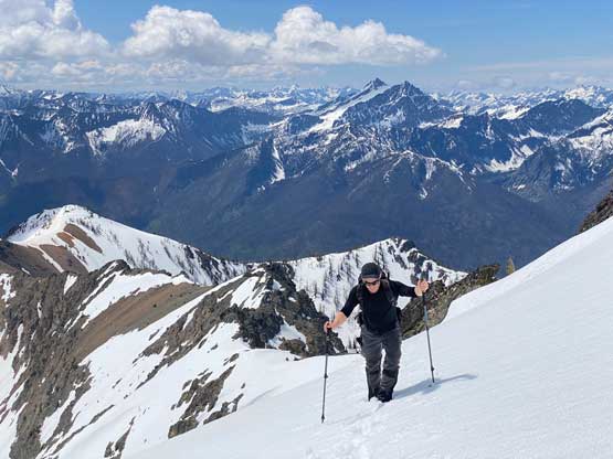
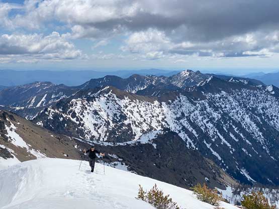
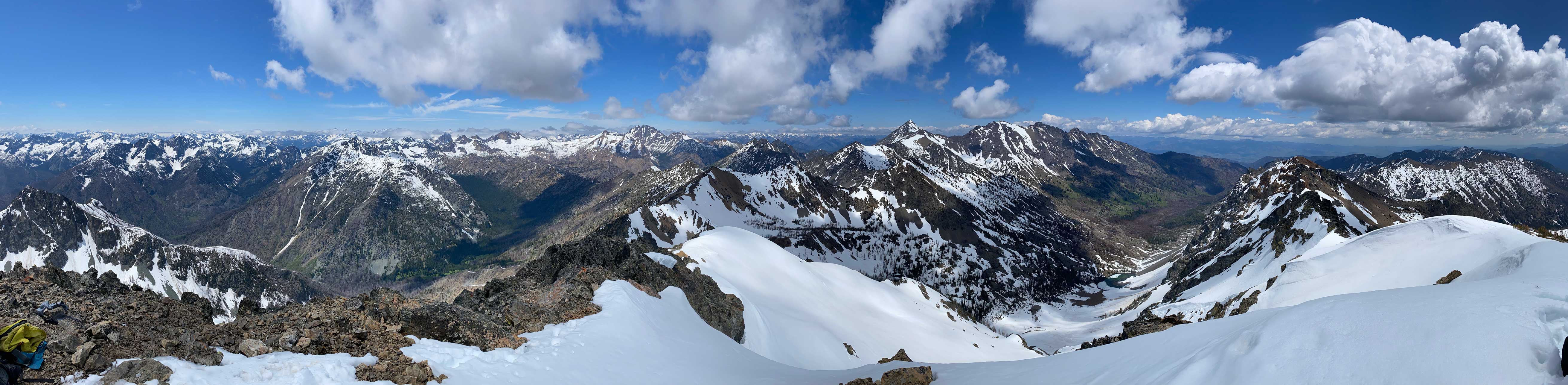
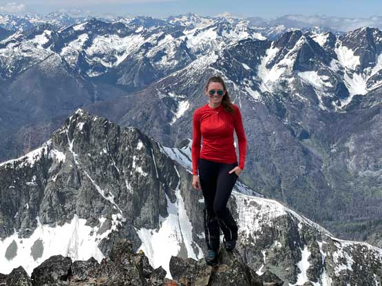
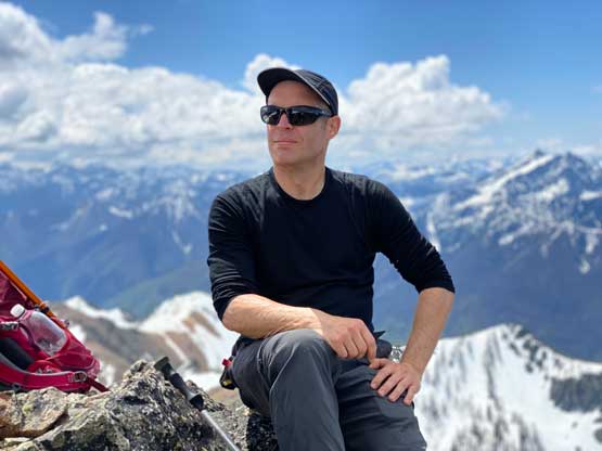
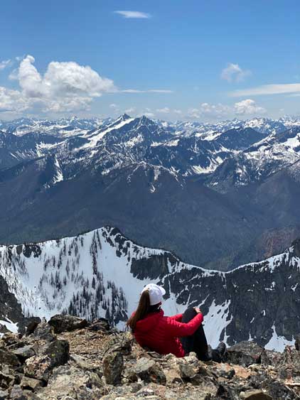
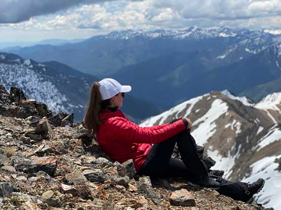
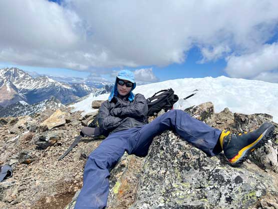
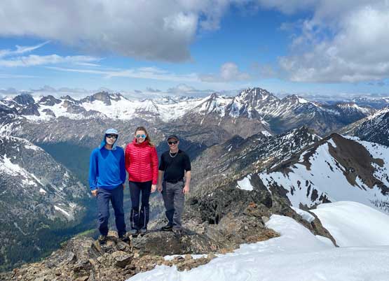
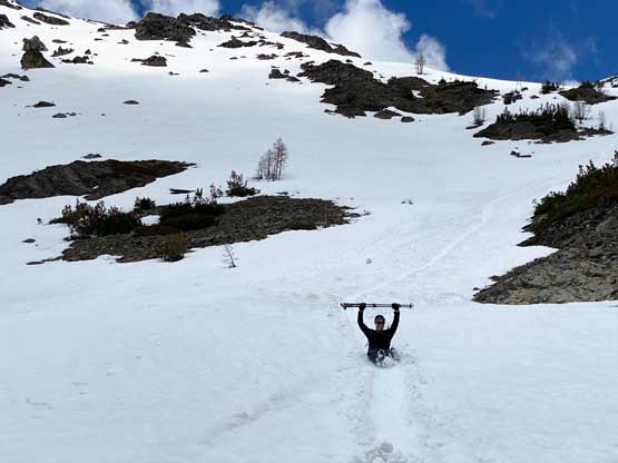
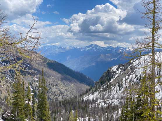
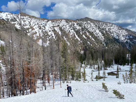
We followed the foot prints traversing the north-east edge of the lake with sections of deep post-holing and then there came the final 400 m ascent up the SE Face to the summit. The other guys were nowhere to be seen, so I assumed that they took some variations lower down near that creek crossing. I had studied the maps and determined that the creek crossing could be avoided by staying entirely on climber’s left side, but I didn’t want to do so as bringing a pair of sandals was no big deal. Seeing the route ahead we made the final decision to ditch the snowshoes and soon started the boot-pack. The up-track was very easy to follow so this was rather like a staircase to heaven kind of climb. The slope did become steep (35-40 degrees) but the snow’s soft and the tracks were obvious. None of us ended up needing the ice axe nor the crampons and it was just a matter of putting one foot in front of another. Eventually we topped out onto the uppermost east ridge and easily traversed to the true summit. Two weeks ago I had missed the views from Gilbert Mountain so I was very glad the weather cooperated this time.
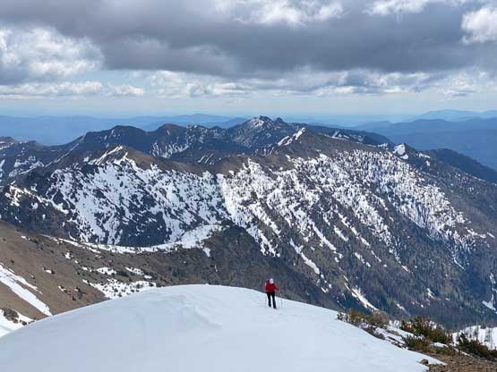
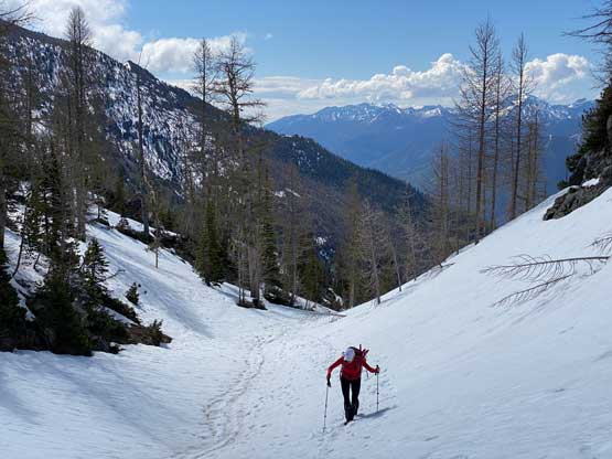
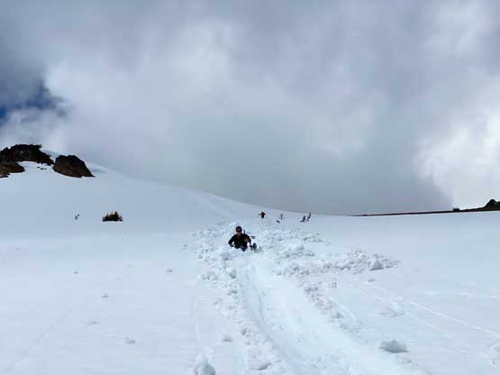
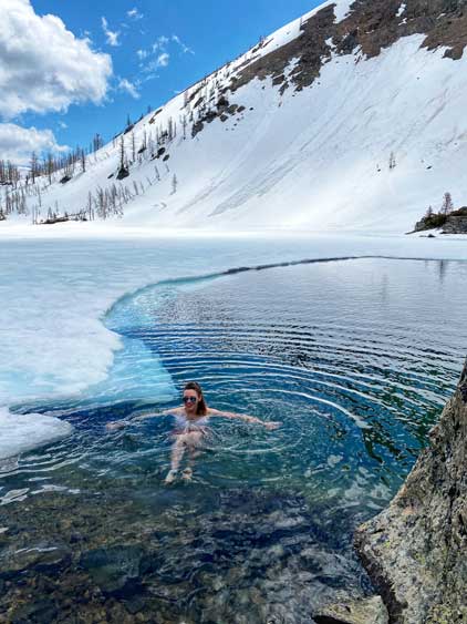
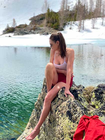
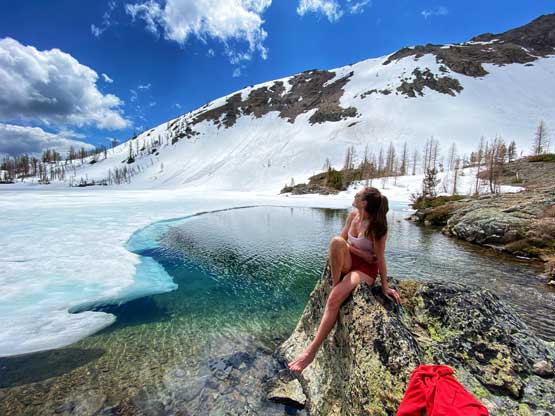
We stayed over an hour on the summit so the snow had become very mushy on the descent. Right off the bat we started to trigger small wet slides but nothing’s concerning. We mostly glissaded the entire SE Face losing 400 m elevation in no time. Our butts were very sore, but the joy of speed made it worthwhile. Holly and Phil then went for a dip in the frozen Scatter Lake. I was tempted as well, but didn’t want to risk catching a flu or something before my summer international expedition, so opted not.
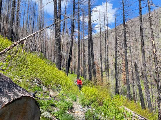
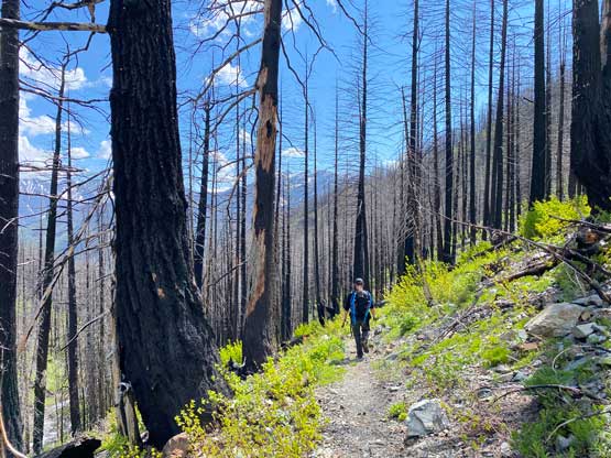
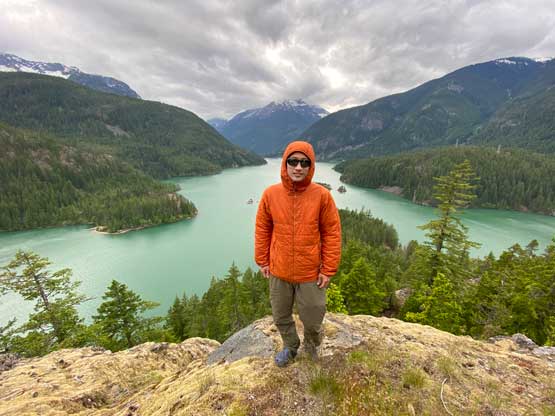
Upon seeing the creek crossing the others decided to balance over some alders to avoid taking the boots off. I’m never a big fan of that plus I also needed to swap footwear back to the trail-runners, so did the proper wet crossing using the sandals. The rest of the descent was rather uneventful and our round trip time was under 9 hours taking in account of all stops and delays. Phil was high on energy and did the entire drive back home by himself. We stopped a few tourists stops on North Cascades Highway including Diablo Lake lookout and Gorge Creek viewpoint. We then stopped in Marblemount for a proper dinner and eventually made back to White Rock at 10:30 pm.