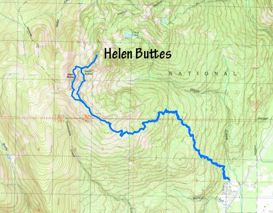
Helen Buttes
July 20, 2022
1695m
Marblemount / North Cascades Highway, WA
Helen Buttes boasts over 600 m or 2000 feet of prominence but is relatively obscured and unheard probably because of the fact that it requires more elevation gain than the peak’s height. This is not an entirely heinous ascent as much of the elevation is dispatched by a well-maintained, albeit sea-level-up trail (Cow Heaven Trail), but from the end of the trail to the summit one does need to cover various degrees of unpleasant terrain. Some people chose to climb Helen Buttes in winter to avoid the associated unpleasantness but winter has winter’s issues as parts of this route are subjected to avalanche hazards. Matt had been looking at this peak for months. I wasn’t particularly keen but agreed nonetheless. It would be a good objective to test out my aerobic fitness immediately after coming back from high altitude.
I did do some last-minute homework as learnt that there’s a “high route” over the SW sub-peak and a “low route” traversing across some steep and slippery grass slopes and both routes involved over 150 m elevation loss and regain. We were hoping for the high route but would decide on-field. We were also not sure about the snow conditions so opted to bring ice axe, crampons and boots. I ended up using the boots but the other snow gears turned into training weight. Matt picked me up at 6 am from White Rock and in no time we were down in Washington. About 2 hours later we made to the trail-head directly behind Marblemount’s ranger station. As usual eating’s not allowed in Matt’s vehicles so I spent an additional 20 minutes having breakfast at the trail-head. The bugs were out, but not outrageous yet.
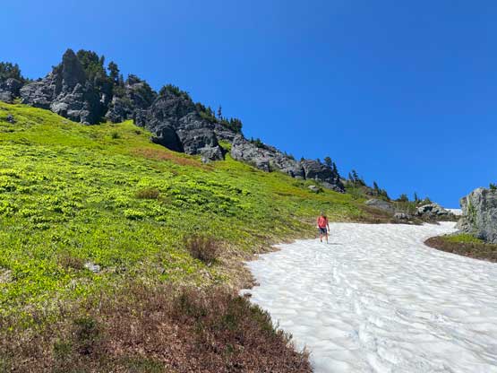
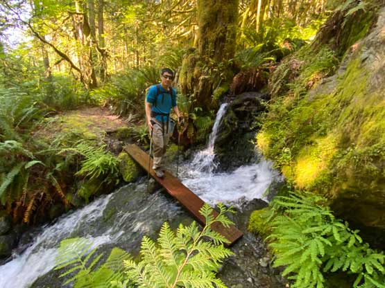
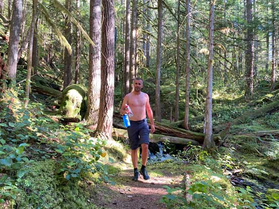
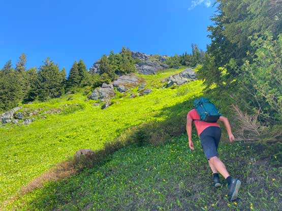
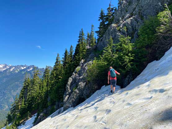
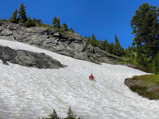
This was shaping up to be a hot day and none of us ended up bringing enough water, but thankfully there were numerous streams to reload on various stages of the trip. About 300 vertical meters up the trail we encountered two stream crossings and took a couple breaks. We both went shirtless from that point onward as the day was also humid. I stayed shirtless until what seemed like an unofficial campground at 1300 m, about 2 hours into the trip. We took another long break donning sunscreen etc. The trail continued beyond this spot but became unofficially maintained. A few switchbacks later we arrived at the “lake” marked on the maps. The lake was still frozen and covered in snow and I took another break to swap footwear from trail runners to mountaineering boots. I decided to also ditch a few pieces of cold weather equipment as those seemed totally unnecessary in this toasty day.


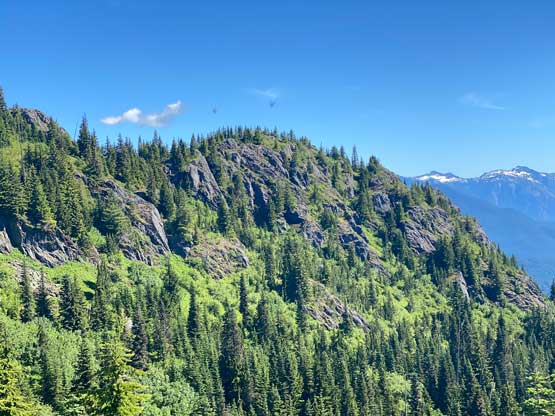

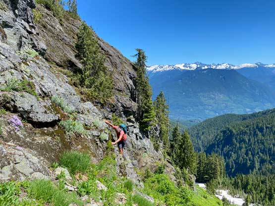
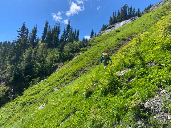
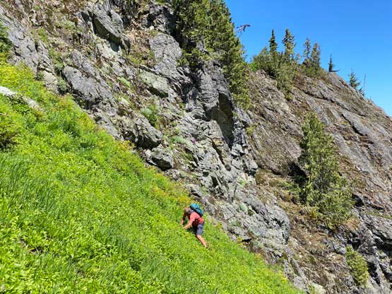
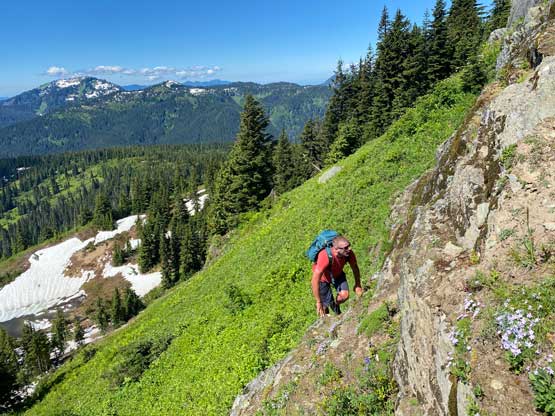
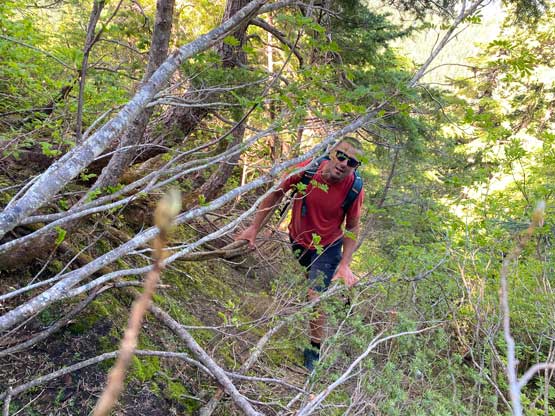
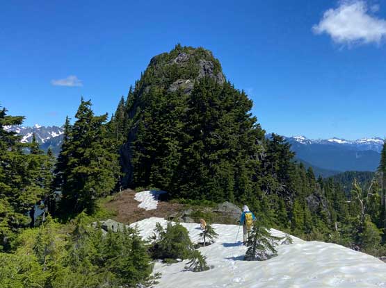
The general bearing was to follow the broad ridge due NW towards the south (false) butte. We were mostly able to cruise on snow but on the narrower parts of the ridge we encountered bands of dense bush. We also located an intermittent trail and some flags that seemed to lead us towards the wrong direction away from the ridge, but based on our experience “a trail with flagging” rarely would go wrong, so we followed. This trail led us down onto a broad bench but disappeared soon, so we ascended a zone of insanely steep and slippery grass to hop back onto the south ridge of the south butte. We then scrambled class 2-3 rock to top out on one of the high points on this butte, but not the highest point. My original plan was to traverse over the highest point of this false butte but without enough prominence we couldn’t claim this as a separate summit anyway, so Matt threw out the idea to traverse north to bypass the rugged parts. The variation led to more bushwhacking. But after wrapping around to the north side of the south butte we located a snow passage to descend easily to south/north col.

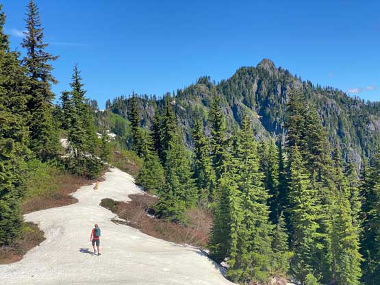


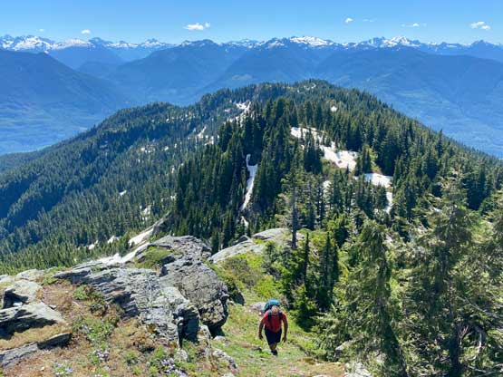


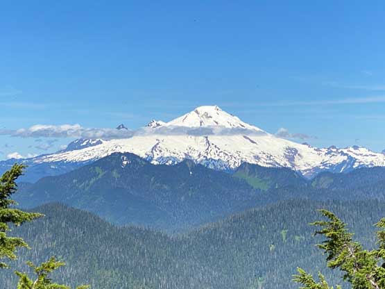
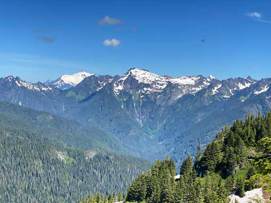
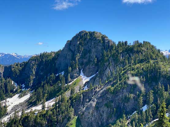
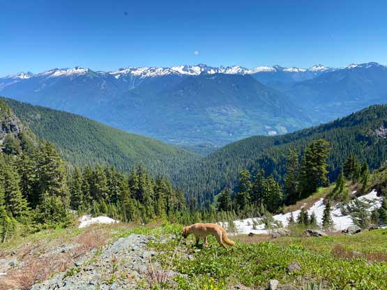
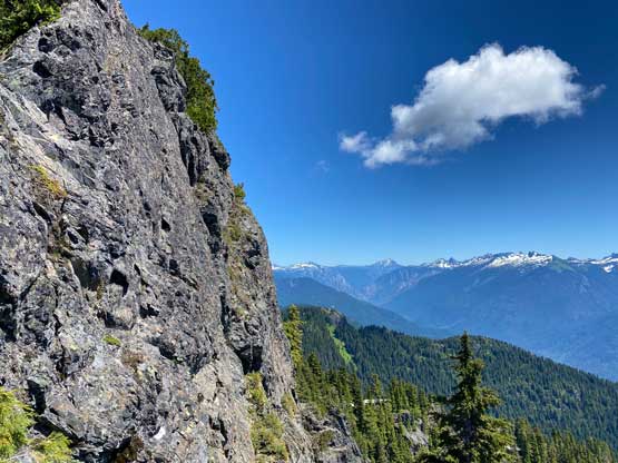
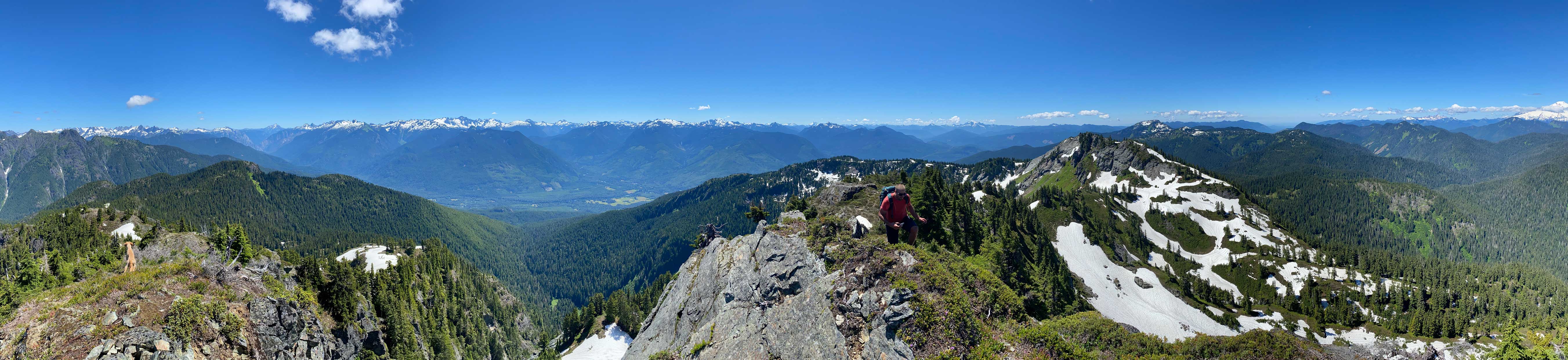
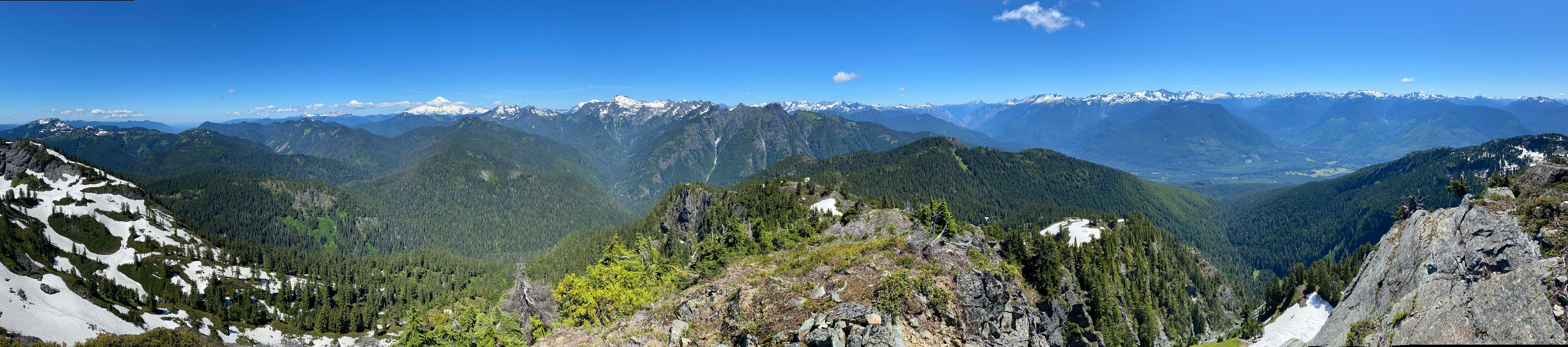
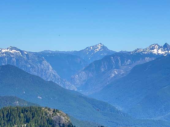
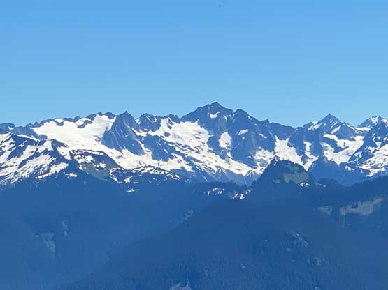
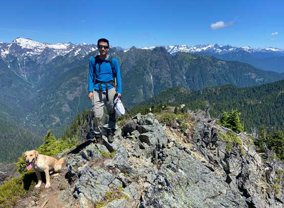
The ascent of the north (true) butte from this col was very similar to what we had just done, more bushwhacking and scrambling. The bushwhacking was mostly tolerable with some patience to search for the route with the least resistance. We mostly just followed the ridge crest. The summit block appeared daunting but turned out mostly just class 2-3 with mild exposure. I chose to scramble next to the edge, more exposed but less thrashing. The true summit was actually a ways back so we had to scramble over quite a few false bumps to get to. The views were actually amazing so the 4+ hours of hard work paid off.


We followed the exact route we took to descend to the north/south col with fresh memories of those micro-terrain route-finding challenges. We then decided to take the “low route” to complete a loop. While descending snow and grass we made a spontaneous decision to challenge the existing GPS track by not descending that far down. We located a “notch” on the rocky rib ahead and sure enough a possible route laid ahead. The result was that we shaved off almost 100 m elevation loss/regain but the price we paid was some class 3+ scrambling with exposure in addition to some heinous side-hilling on slippery grass. I probably wouldn’t recommend our variation but on the GPS map the line looked nice. After that long and tedious side-hilling we only had less than 50 m regain to get back onto the south ridge of the south butte. From there we easily plunged and bushwhacked back to where I ditched the trail-runners and then took another long break. The heat had really taken a toll on us. The rest of the descent was exhausting but uneventful. We lost about 1300 m elevation in under 2 hours and our round trip time was 7 hours 50 minutes. Matt then drove us back to Bellingham to have a massive pizza dinner and I eventually got back home at a very reasonable hour.