Mount Duke
January 27, 2019
2379m
Caspar Creek / Duffey Lake Road, BC
Mt. Duke is a prominently-looking summit at the south end of Caspar Creek valley not far from the core of Joffre Group. The standard route (NW Ridge) from Vantage/Duke col has seen some increasing traffic over the last decade by scramblers. Most access Mt. Duke by going up and over Vantage Peak via Cerise Creek approach, and such outing offers some superb views on a summer day. The same route, NW Ridge has also been done in winter by skiers, albeit less frequently. The winter approach is via logging roads in Caspar Creek valley. An ascent of NW Ridge of Mt. Duke in winter is a real mountaineering adventure that offers a hell lot more challenge than in summer time. I had been wishing to ascend as many peaks in Joffre Group in winter as possible because the access of this area is so easy in winter. I had climbed the five “core peaks” in winter but still needed the adjacent ones, and among which Mt. Duke was the hardest. The original plan among Al, Cheyenne and myself wasn’t Mt. Duke but rather the nearby Mt. Caspar.
A dominator high pressure system kicked in for once again over the weekend and this time I finally gathered enough motivation to climb something that’s more than just a “hill”.. I was too busy with work to follow the condition updates so picked the relatively safe Mt. Caspar. The avalanche rating was “moderate” and big lines in its vicinity such that the NW Face of Mt. Matier had just been skid by friends, so I was confident that Mt. Caspar would definitely go. I hadn’t done a real winter ascent in this season yet and I was definitely not in my best shape. The ascent of Mt. Caspar wouldn’t require much specialized equipment but we did brought two pairs of crampons and two ice axes among the three of us. I wouldn’t need an ice axe for such a climb and Al decided that he wouldn’t needed crampons. It turned out that we certainly brought the right gears for Mt. Caspar, but was a bit underequipped for Mt. Duke.
Mt. Duke via Caspar Creek and NW Ridge. GPX DL
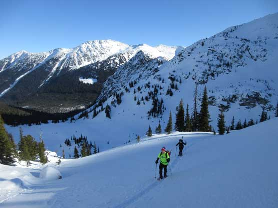
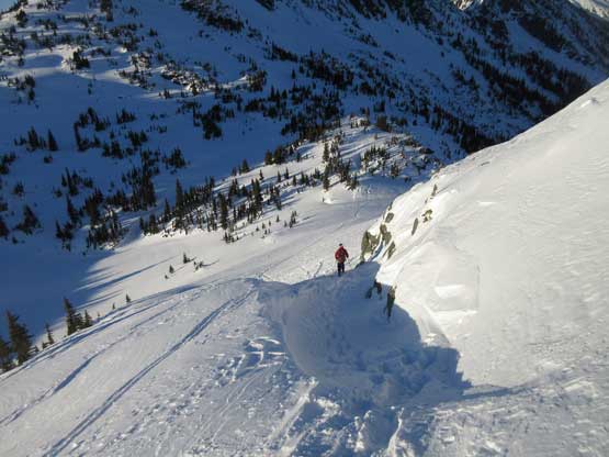
By 5 am the three of us had grouped in the church of West Vancouver and three hours later we were cruising up the winding Duffey Lake Road. The traffic in the morning was non-existent and by 8:30 am we managed to start the plod. The parking lot is at about 200 m west of the Caspar FSR’s start, on the north side of the main road. After walking to the start of Caspar Creek FSR we soon donned snowshoes. The road bed was packed by snowmobilers and skiers but it’s always easier to don snowshoes taking advantage of the extra traction. The plod along this boring road would last 7 km and it sure sucked. I think we all felt half-asleep but at least we could see Mt. Duke for once in a while through the openings. At this point we were still gunning for Mt. Caspar but after seeing the recent tracks made by skiers branching off to the right, clearly going up the valley north of Mt. Duke we changed our mind spontaneously. I told the group that if the skiers went for Mt. Duke then we should just use their tracks to reduce the effort of trail-breaking. The downside was that we might not have brought enough gears for Mt. Duke but I figured we probably still could make it nonetheless. The decision was made and soon we crossed the frozen Caspar Creek to the west side and a short while later we discovered some secret treasure that I probably shouldn’t blow it out on the internet.. The direction of the skin tracks was confusing that I had to check the GPS several times and wondered why the heck those guys would go straight up the forest instead of following the valley, but after discovering the treasure thing I soon got the reason. And sure enough the skin tracks turned 90 degrees due south and the next thing we had joined a wider set of tracks in the middle of the valley and we now were going towards the right direction. We soon entered a field of gigantic boulders.
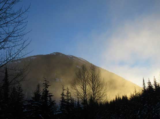
Morning mist.

After a while of plodding Mt. Duke finally came in view
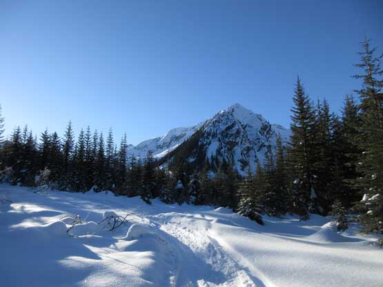
The typical road plod. It’s a very boring one
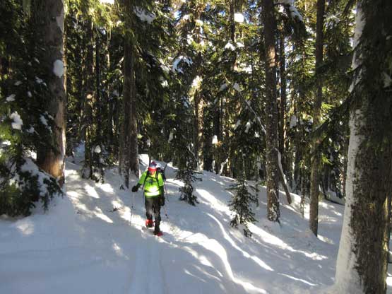
Entering the forest now.
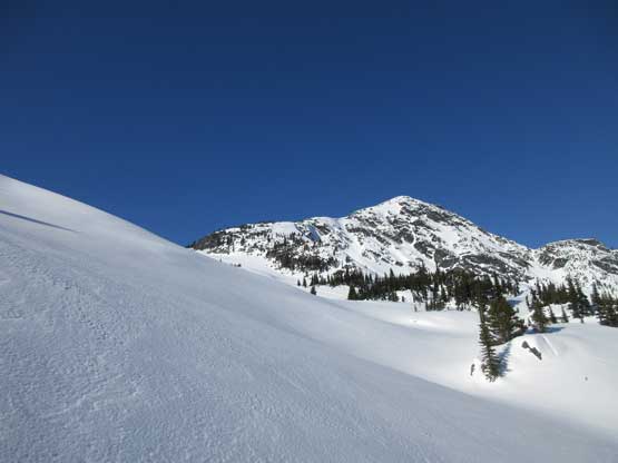
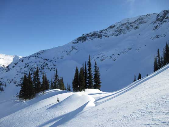
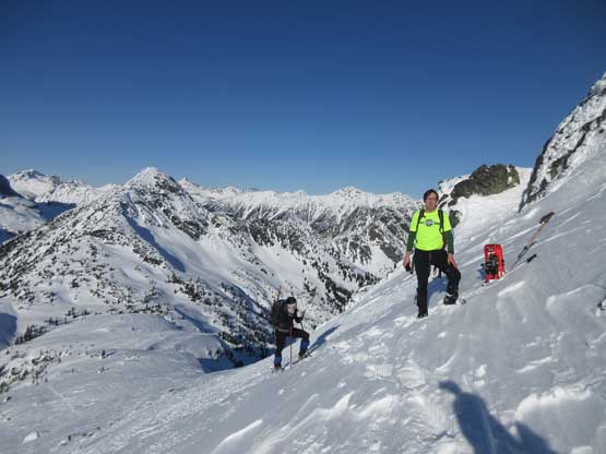
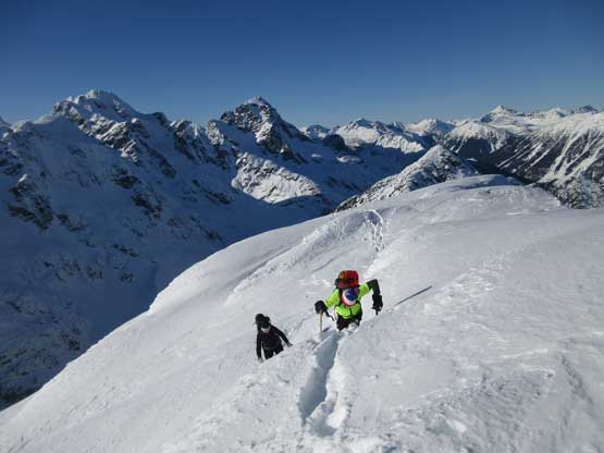
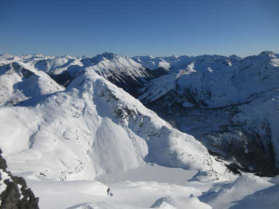
Based on the skin tracks it’s clear that this hanging valley was skid much often than I would have expected. It’s almost like a “highway” shooting SW. The main set of track stayed well to the south (climber’s left) side of the creek and went up and over a few steeper rises and gullies, before plateauing out at a bowl directly north of Mt. Duke. The north face loomed impressively above us and it’s almost tempting to just bootpack up the face, but it appeared that we had to ascend a steep and unsupported slope high up with huge cornices looming above, so we decided to just do the standard route. Instead of following the skin tracks we opted to make a snowshoe track by going straight up a few slopes. The skin track seemed inefficient for snowshoe travel and for some reasons we were actually looking forward to break some trail in the powder at this point. The trail-breaking was not easy as expected, but we powered it through and the next thing, we had made to Vantage/Duke col admiring the snowy giants in Joffre Group.
Upwards and onward up the valley north of Mt. Duke

Al and Cheyenne breaking trail in the fresh powder

Cheyenne and me following up. Photo by Alan B.
This would be a prime ski country I have to admit… Vantage Peak behind.
Gorgeous terrain all around.
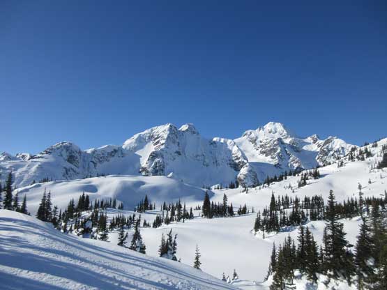
At Vantage/Duke saddle looking at the giants in Joffre Group

Mt. Howard is a very impressive summit
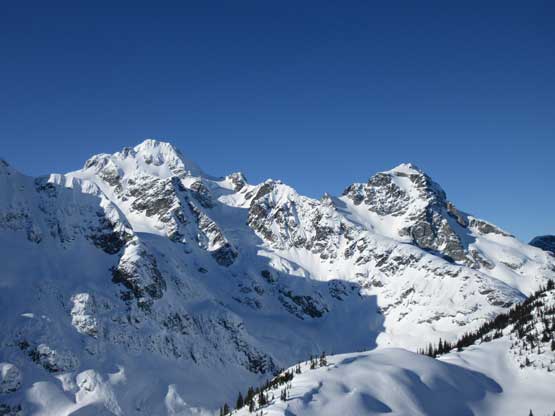
Mt. Matier and Joffre Peak
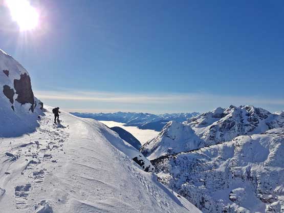
What laid ahead looked quite involved but the strategy was to break it down into individual pieces and solve the problems one by one. There’s no more tracks to guide our way at this point but it’s not that we actually needed them. The first obstacle was a steep pyramid that I led a zig-zagging line attacking from the climber’s right side and it worked out nicely. After that bit of steeps the terrain flattened out for a while but the real game was just about to begin. We had to ascend a long stretch of steep terrain that appeared to be a mix bag of rime, rock and steep snow. Note that Al did not have crampons and I did not have an ice axe, so some very careful route-finding had to be made… We also decided to carry snowshoes just in case we needed them higher up. With 300 vertical meters to go who knew what laid ahead (I didn’t do much research before the trip because Mt. Duke wasn’t the original plan). The key was finding some snow ramps that weren’t quite visible from below, and the crux step came higher up when we had no choice but making a few mixed moves on thinly covered rocks with exposure… No huge deal though..

Al leading up the lower NW Ridge
Al and Cheyenne with Vantage Peak behind
Me snowshoeing across a narrow ledge. Photo by Alan B.
Al decided to take the snowshoes off for some added security here

Me and Cheyenne with Joffre Group behind. Photo by Alan B.

It’s time to boot-pack. The terrain’s getting steep in no time

Al and Cheyenne putting in some work.

Cheyenne climbing up…

This step is tricky and we had to be careful about what’s underneath the snow

This is one of the many steep rolls of snow to ascend.

The terrain plateaus out briefly but the cruxes were just about to come…
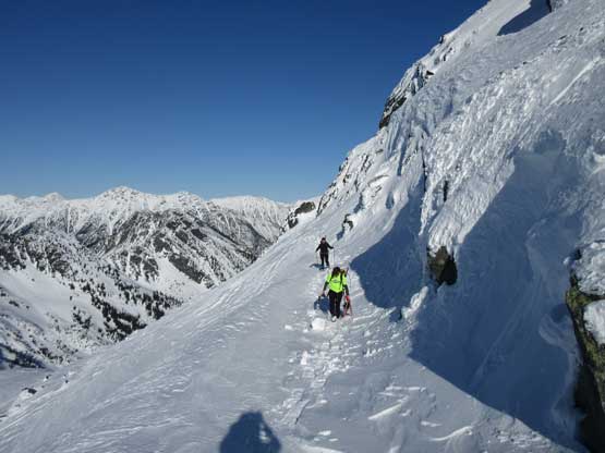
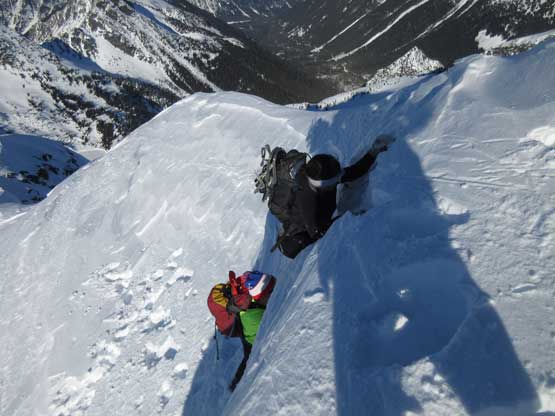
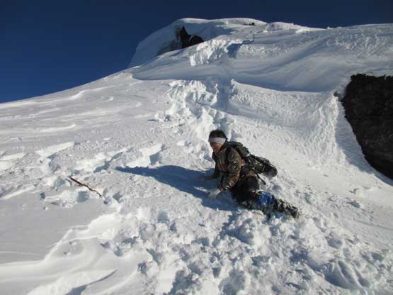
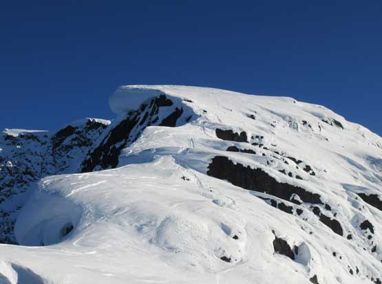
Just when I thought the steeps were over we saw more fun stuffs laying ahead… This time I couldn’t even spot a line to attack at the first glance. The ridge crest seemed to offer the easiest climbing but with the massive cornices dangling on the edge that would be a death trap. The climber’s right side had no cornice, but very steep and all rock bands were heavily rimed. I’m sure most parties would turn around here but I wanted to invest it more in depth. I came up with a theoretical solution to use the ridgeline to attack, but staying well away from the edge which meant we had to climb up a few vertical steps. Upon further investing I called that the steps could be climbed and I just needed to chop off the overhang, and use two axes fully planted as levers to pull/stem myself up the vertical trench. The first step was about 3 m tall and required a lot of arm strength. I then threw the axes down and we took turn pulling up the step. The second step was about half the size that required a bit of different technique. It’s more overhanging than the previous step and the snow offered very poor foot placement but the upper lip seemed solid enough. I firmly planted two axes and went for a mentel, and sure enough, problem solved.

Al studying the first vertical step. It’s harder than appeared.

After a bit of chopping I got up, and this was Cheyenne fighting gravity..

The cornices were uber huge on this particular day…

Me giving the second vertical step a mentel. Photo by Alan B.
Cheyenne and Al climbing up the second step.
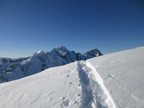
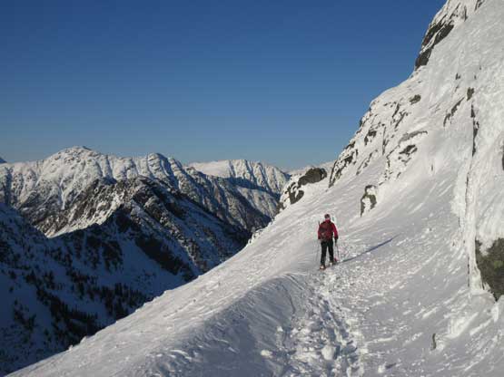
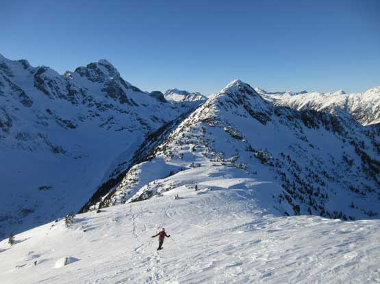
Once all three of us got above the sketch zones we resumed the ascent. The ridgeline was still heavily corniced and route-finding was still challenging. There’s not a lot of rock feature to guide our way at this point and in order to not fall off the edge we had to stay well to the right of the ridge crest. This required some side-hill climbing on steep snow with pretty good exposure. At last the slope mellowed out and we were now on a huge plateau kind of field with the summit block looming impressively in front. The climb up onto the summit appeared sketchy but I wouldn’t want to think too much about it yet. In no time we were wallowing and sinking into weak spots that were waist deep. I knew how frustrating to keep transitioning gears but at this point it would be foolish to not donning snowshoes. We hauled them up for a reason and it’s time to justify our effort, even though it might mean we had to take them off in a mere 10 minutes. At the summit block I said should look for a possible attack from the back (south) side in case there’s a walk-up route, and I was correct. The backside was moderately exposed with one (sort of) sketchy traverse but otherwise it’s a walk-up to the summit. The summit ridge did drag on for quite a while with again, some frustrating up-and-downs. What a hard won summit Mt. Duke was! Cheyenne claimed that this was the craziest she had ever done and I sure was not surprising. We earned ourselves half an hour to soak in the views before descending.

Plodding into heaven.
Al and Cheyenne marching up the upper ridge, staying well away from the edge
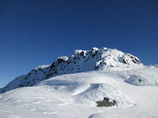
The summit block finally came into view
Traversing around the SW corner

We found an easy ramp of snow and didn’t even need to take the ‘shoes off

The summit ridge lasted forever though…
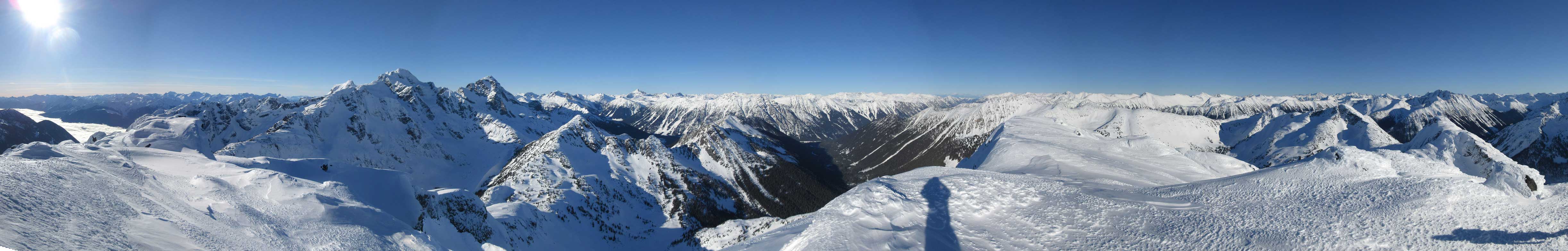
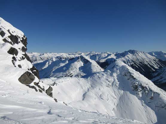
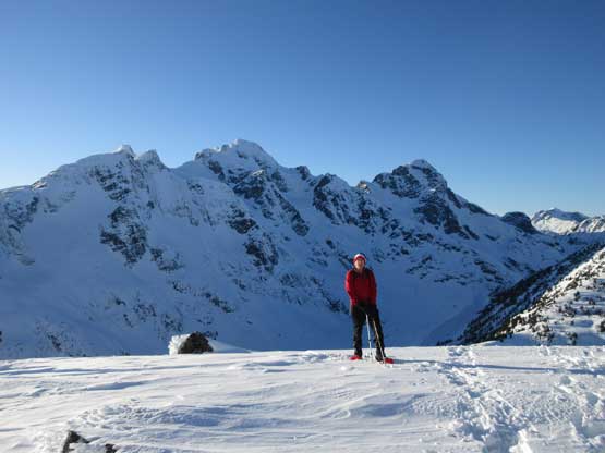
Summit Panorama from Mt. Duke. Click to view large size.

Mt. Matier with Mt. Howard blended to its left

Joffre Peak is that fang of rock. Cayoosh Mountain behind on skyline

“Mt. Kosegarten” in the foreground

Snowspider Mountain to the south

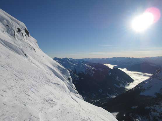
Low clouds covering Lillooet River Valley

Gideon Peak in the Bible Group

Mt. Marriott

Way in the distance is Mt. Seton the highest peak in Cayoosh Range

That big one is Elusive Peak in the distance

Silent Hub Peak

A zoomed-in view of Skihist Mountain – highest and the most prominent in SW BC
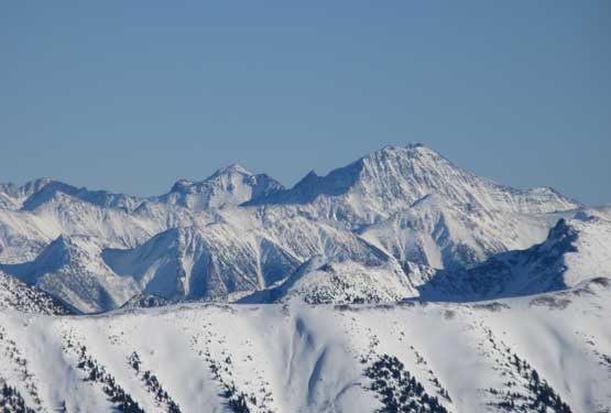
A zoomed-in shot of Petlushkwohap Mountain – second highest in SW BC
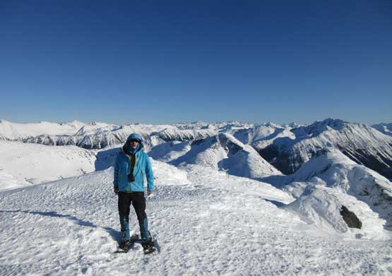
Me on the summit of Mt. Duke
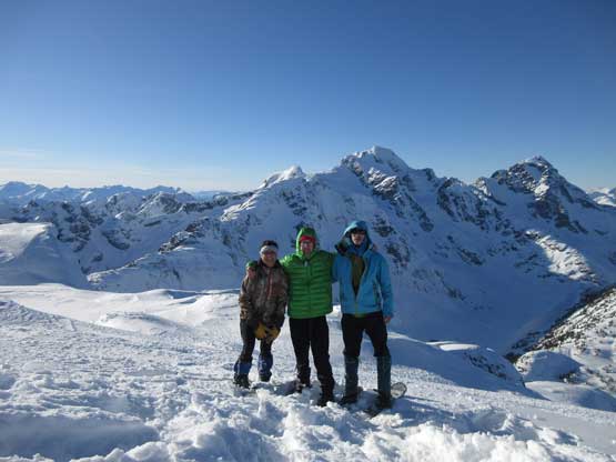
Our group shot on the summit of Mt. Duke
I thought the descent would take a while but I was wrong. Cheyenne was struggling with the downhill snowshoeing due to the lack of experience, but otherwise the descent off NW Ridge was a very fluent flow. I had concerns about those two vertical steps but upon seeing them from above we just jumped them. A rope would be handy but given what we had brought up “jumping” was the best idea. Jumping the second step (3 m) was scary because I hadn’t done such thing in the past, but the landing was pretty pleasant. The rest of the NW ridge descent was very scenic.

Heading back across the long and undulating summit ridge
“Greifswald Peak” and a frozen tarn between Duke and Greifswald

This is that short exposed stretch on the south-side ramp bypass

Snowshoeing with a superb position
Snowshoes for the win!!
What a day…

Down-climbing

Al just about to jump the upper step
Cheyenne finishing jumping the upper step. It was hell of a fun one…
Our tracks on the tricky zone.

Al descending the lower steep zone. This part wasn’t easy
Traversing back across that ledge. This time we just snowshoed across
We made back to Vantage/Duke col with less than 1 hour of daylight time. The plunge beside our uptrack was fast and fun and in no time we were way down in the valley. Near Caspar Creek we opted to explore the “main set of skin tracks” which turned out to be a mistake. I think it costed us more time than retracing our ascent route, but who cares… Once joining the Caspar Creek FSR we sped up and rushed the final 7 km. I led the pace and I wanted to see how fast we could snowshoe on such a boring road. I turned the music on and set the (impossible) goal to beat sunset. Of course we failed, but we only needed headlamps for the last half an hour. The round trip time was 10 hours and I was proud of our pace given how challenging the climbing was..
Al descending easy terrain towards Vantage/Duke col
Al with Mt. Howard, Mt. Matier and Joffre Peak behind

Cheyenne snowshoeing down the lower NW Ridge
Entering a mini gully feature and soon we had to descend another steeper zone

Snowshoe tracks!!
Back to the truck I soon turned the engine on and let the windshield to defrost itself. Meanwhile Al got his tripod set up for the usual post-trip routine photo, and this concluded another awesome outing. I ate about 20 dollars of McDonalds in Pemberton and the drive back home was exhausting, but uneventful. I eventually went to sleep at 11 pm, about 19 hours after waking up in the morning..
