Conte Peak (Botanie Fire Lookout)
November 24, 2019
1995m
Lytton / Fraser Canyon, BC
“Conte Peak” is a very unofficially-assigned name by bivouac.com due to the proximity of this peak to Conte Creek. The more locally-accepted name would be “Botanie Mountain-South Peak” or “Botanie Fire Lookout” but I still prefer “Conte Peak” for better differentiation from the main summit of Botanie Mountain, which lies about 4 km to the north separated by a 300-meter gap and some minor summits. A lot of people mistakenly refer Botanie Mountain as where the popular lookout is, but such confusion is not acceptable in the peak-bagging community. The peak where that lookout locates is more visible from Lytton, more frequently visited and offers better views, but is not where the true summit is. And from now on I would refer this peak as “Conte Peak” to sync with bivouac.com.
As mentioned above this peak is more famous for its fire lookout and the associated 4×4 experience to get there. A very steep, narrow and rough road climbs all the way to the summit from Botanie Valley Road and attracts 4×4 enthusiasts from all over the SW BC. I feel safe to say that this peak sees far more traffic from locals and 4×4 drivers than weekend-warrior peak-baggers, and in fact the whole area around Lytton is still very much “underdeveloped” on online hiking sources. I had put in some research about these peaks but I wasn’t confident that my Tacoma could handle the drive. Alex threw out the suggestion and my reply was that we would count on walking the whole road starting from the valley bottom. I would for sure going to at least give the road a try, but on the trip planning stage everyone needed to be prepared for the worst case scenario. Marius was also keen on the mission. I also downloaded maps for the roads on the north (true) summit of Botanie Mtn. in case we ended up having extra time, and this proved to be an excellent decision. The most recent update was from July this year that the road was cleared to 1500 m so who knows…
Conte Peak / Botanie Fire Lookout drive and hike. GPX DL
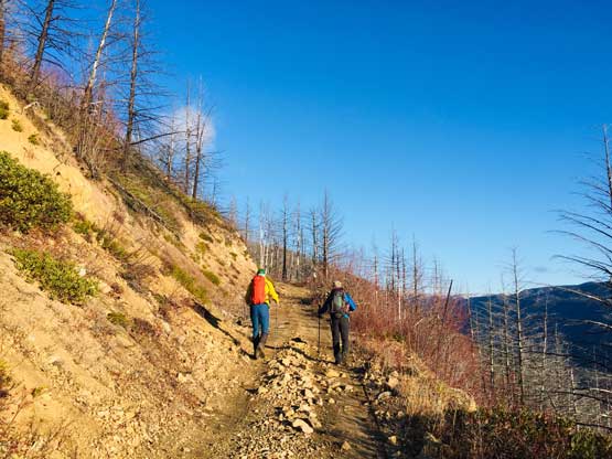
We left Vancouver at 5 am and made good time to Hope and then up the Fraser Canyon. This was my first time driving past Boston Bar up Highway 1 and the road was better than expected. We cruised to Lytton and had no problem locating the Botanie Valley Road. The Gaia GPS map had all of the road information we needed for Conte Peak including where exactly was that Botanie Fire Lookout Road. I’m sure that in the old days one needs precise odometer reading to locate the not obvious and unmarked start of that road, but in this new era all we needed was to pay attention to my phone’s screen. The road wasn’t too bad at the start but in less than one kilometer it had become more of an ATV track. I agreed with most sources that this is not just a high-clearance road, but rather a 4WD road that one should come with preparations to deal with the worst. The grade is one of the steepest I’ve ever driven and the track was so narrow that passing each other would be impossible. Thankfully the surface wasn’t too loose and the water bars weren’t as deep as I thought, although very careful maneuvering was still needed. I kept pushing until a long, southward switchback where Alex had to step out to remove a fallen tree. I parked at the next switchback where we also got some nice views looking down into Lytton and the Fraser Canyon. In retrospect we could keep driving for at least another 1-2 km but I didn’t want to risk any further. When it comes to dealing with the unknowns I’m definitely on the cautious side.

Me and my Taco at the parking pull out. Photo by Alex R.
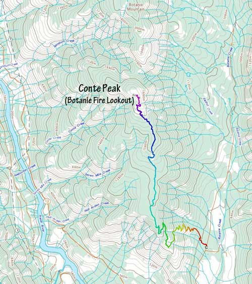
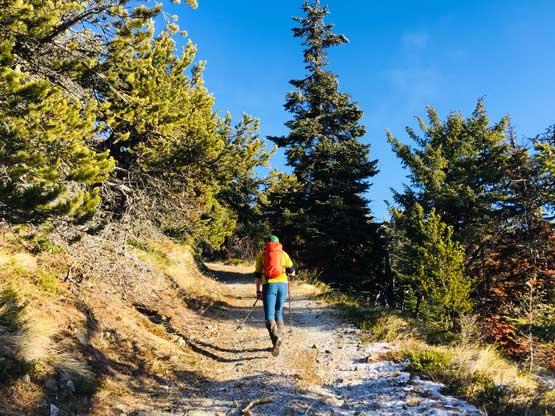
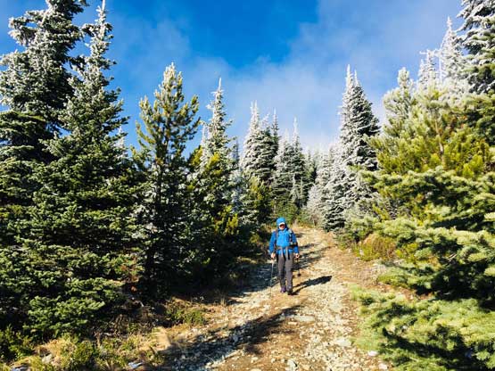
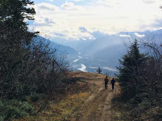
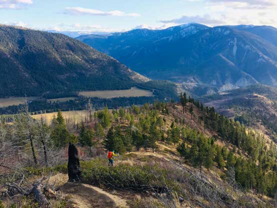
There appeared to have a trail short-cutting the next switchback so we took that and shaved off some distance of walking. After that we abandoned the trail and followed the road. The road was actually in a better shape once getting onto the long south ridge of Conte Peak but we also started to encounter patches of icy spots, that would definitely turn into slippery mud later in the day. My truck only had stock tires that sucked big time on snow and mud, so we didn’t regret for parking down low. An hour or so later we were getting close to the final rise towards the summit where snow become more continuous.
Alex starting the short-cut trail from where we parked
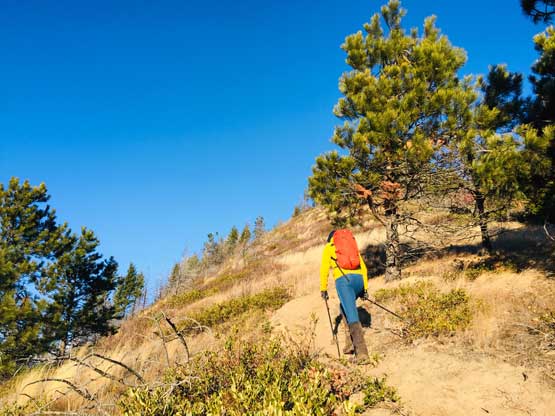
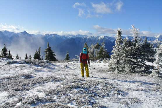
Me and Marius hiking up the trail. Photo by Alex R.
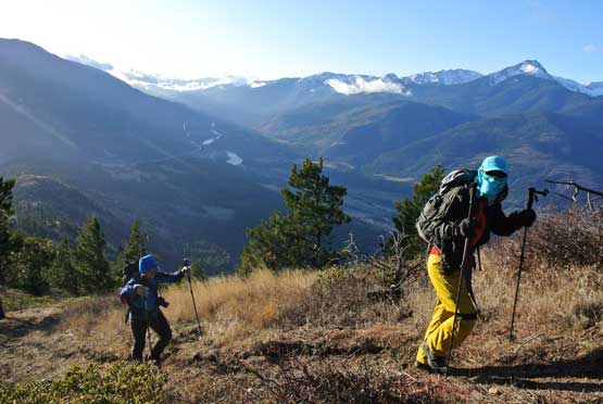
Already gorgeous views

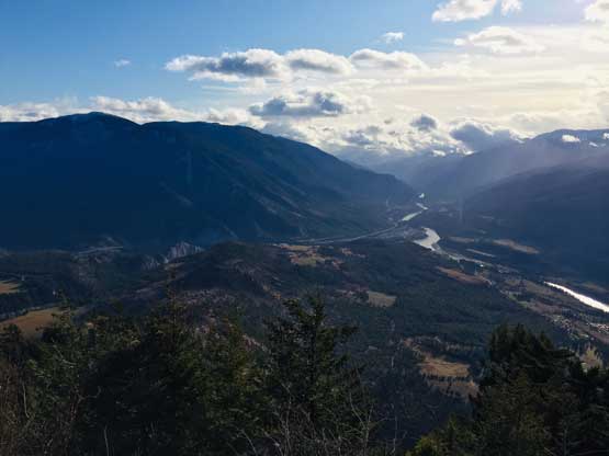
This is looking across Fraser Canyon towards Mt. Roach etc.

A closer look at Mt. Roach
The road walks began here

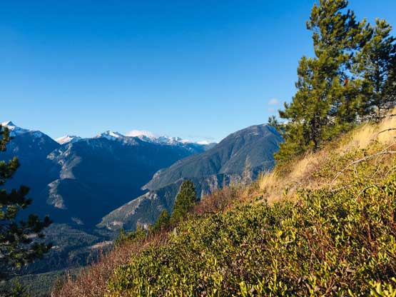
A southern view past Lytton down Fraser Canyon

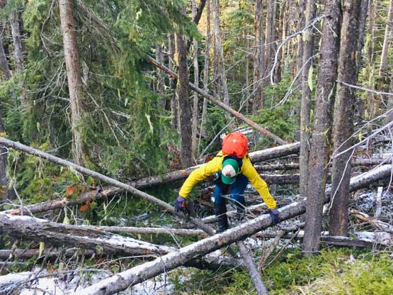
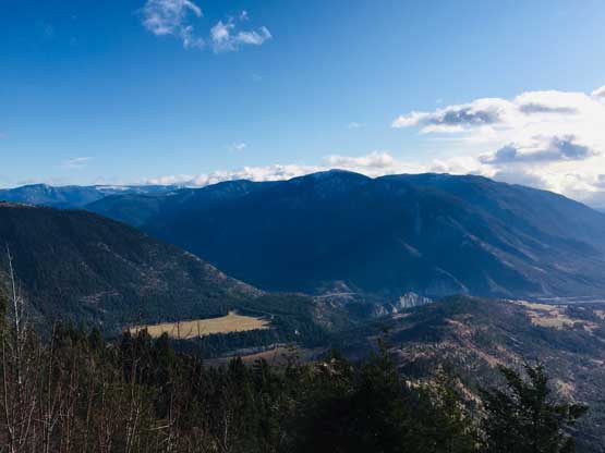
There are lots of dead falls on the long, broad ridge

The summit is still far ahead.

Marius plodding up. This section was never-ending
Alex plodding
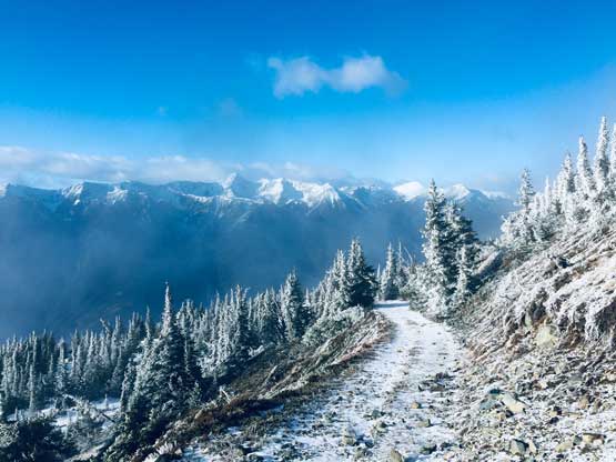
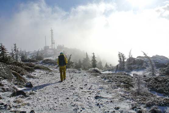
The last several hundred meters of elevation gain took us longer than expected but also offered some nicer-than-expected views. We hiked through intermittent clouds with dramatic scenery looking into the Stein Valley across the Fraser Canyon. The actual summit had a nice lookout as well as at least four or five different building structures but all of them were locked. It was cold and windy so we only stayed there for about half an hour.

Starting to hit continuous snow, mostly a dust of fresh

Alex continuing to plod up…
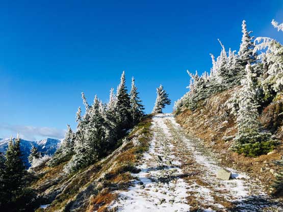
Upwards into the sky. A jacked up 4×4 can still keep going
This picture captures the coldness despite the lack of snow.
Me posing just before the final rise towards the summit.
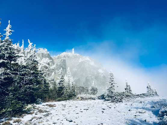
The summit ahead.
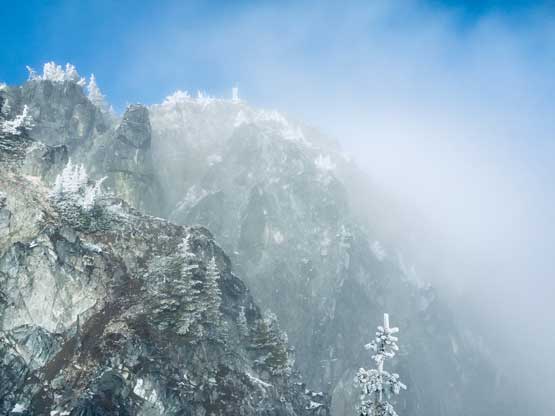
The steep east face and the misty weather created some big terrain feel

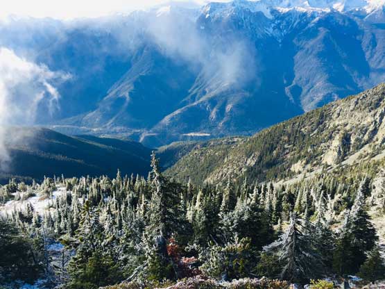
Looking back, we were above the fog layer now

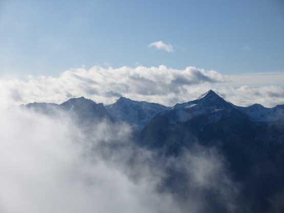
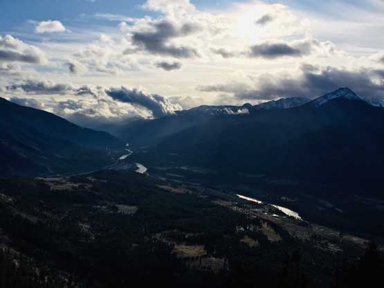
The steep Fraser Canyon and the high peaks by Stein Divide

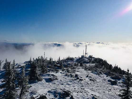
Quite a few structures on the summit area
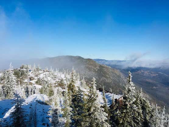
This is a northern view towards Botanie Mountain, our next objective
Looking south from the summit. I love being above the clouds

Partial Summit Panorama from Conte Peak. Click to view large size.

A closer look at Stein Mountain

This is looking towards Askom Mtn. et al. between Lytton and Lillooet
Nikaia Mountain, Mt. Roach and a few more remote summits

The lookout structure. Should we make it Insta famous??

This is an eastern view towards the interior plateau
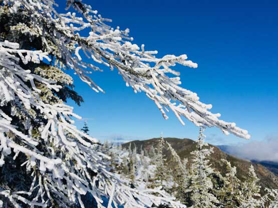
Cool first snow of the season.
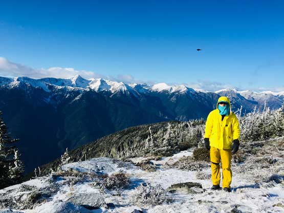
Me on the summit of Conte Peak (Botanie Fire Lookout)
About 100 m down from the summit we met a group of three trucks sending the road and all of them had proper all-terrain tires. The 4Runner was leaking coolant so they stopped to fix that. A quick chat later we realized one of them actually provided the important beta on bivouac.com about this road’s condition updates. After thanking them we resumed our own hike. They were going to turn around but somehow never caught us up.
Me starting the descent back into the mist. Photo by Alex R.

4Runner down. They had to fix it…

The Sequioa still going up…
Fraser Canyon one vertical mile below us…
Marius hiking down the boring fire road
Alex wanted some extras because we hadn’t touched bush yet
Much lower down now
Lytton is where Thompson River joins Fraser River
Mt. Lytton is the highest in this group

Continuing walking down the road
One last photo of Lytton and Fraser Canyon
Back to the connector trail

Taco parked.. Time to drive to our next objective.
We did some calculation about the time and where we were and the conclusion was that we might have a shot on the nearby Botanie Mountain by driving up the Izman Creek FSR, if we could get far up on that road. Nobody wanted to count on that but at least we should try. The drive down Botanie Fire Lookout Road was not too terrible although I did scrape the bottom of my truck on one of the water bars.
