Mount Victoria
July 4, 2015
3467m
Lake O’Hara/Louise, AB/BC
Everybody who has visited the Canadian Rockies should probably have a picture of Mt. Victoria – the giant glaciated peak dominating the backdrop of Lake Louise, a place that sees perhaps millions of tourists every year. I saw it for the first time in the summer of 2009 and during the same trip I hiked up the Plain of Six Glaciers trail to its end and got a closer look at this giant. Five years later I successfully stood on the summit of its northern sub-peak, also known as North Victoria, as well as another giant nearby – Mt. Lefroy. Almost exactly 1 year later, in the early July of 2015, plans lined up nicely between Ben, Ferenc and myself for a summit bid on the true summit of this mountain.

Ascent route for Mt. Victoria and Mt. Huber. GPX DL
Having already bagged 32 11,000ers before this trip I have to admit that Mt. Victoria (and its lower neighbour, Mt. Huber) are no longer on the top of our to-do lists. The access is easy by the 11,000er standard, and in the ‘right’ conditions the technical climbing should be very straightforward to us. However, due to weather and time constraint our choices were limited and eventually we decided on Huber/Victoria at the last minute. As usual for the last-minute decisions we had to face some logistic issues – both the Abbot Hut and the bus ride to Lake O’Hara was full. Solution? Let’s just day-trip them from the parking lot… Oh well..
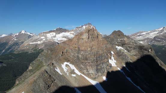
There’re two commonly used routes for Mt. Victoria – the classic SE Ridge starting from Abbot Hut and the W. Face that’s often used as a descent route for folks doing Victoria to Huber traverse. We had good beta for both routes and it seemed like the W. Face would be the most efficient way to bag this mountain as it’s much shorter and more direct than the SE Ridge. Another advantage of going up & down this route is that we’d ascend Huber Ledges first before descending it, so much unlikely to make route-finding mistakes. So at 4:30 am in the morning all three of us gathered together at Lake O’Hara parking lot and shortly after we started the long 11 km slog up the road. It’s a truly tedious and boring process, but at least it’s only a 2-hour hike, so not that terrible.
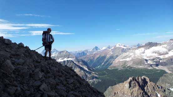
After contouring around the lake for roughly 100 meters we took the side trail branching steeply up the left side slopes. It’s the Wiwaxy Gap “alpine route” and very well maintained. I have no idea why the officials call it an “alpine route”, but I guess there’re a few “exposed” sections by hiker’s standard and the majority of the visitors here are hikers anyway. For us it’s just an easy hike, albeit quite steep. Eventually we made to Wiwaxy Gap, with the twin summits of Wiwaxy Peaks to our left and the impressive lower slopes of Mt. Huber (the Huber Ledges) to the right. The Huber Ledges did not look easy to us but given the vast amount of information we knew it’d go as a Class 4 scramble.

Reflections in Lake O’Hara in the morning
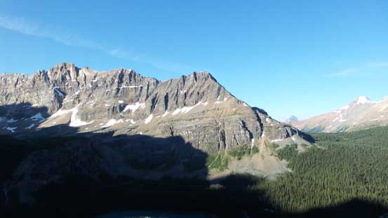
Great view of Mt. Schaffer which I bagged 3 years ago
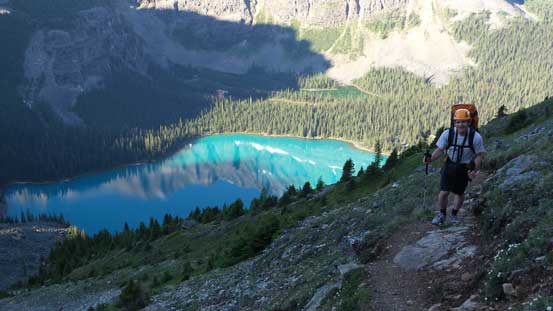
Ferenc coming up Wiwaxy trail, with Lake O’Hara behind

Looking ahead the Huber Ledges. I can’t even tell the exact route we took…
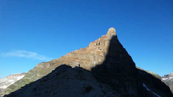
Wiwaxy Peak (East Tower) from the col
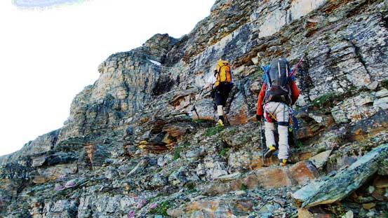
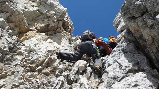
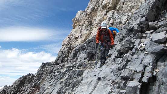
There were paths and cairns here and there leading up climber’s right side of the connecting ridge. Soon enough we crossed over the ridge to the left side and picked up an intermittent trail system. It’s indistinct at sections but generally easy to follow in a diagonally traversing line. The crux came at a 20-meter rock band with no obvious easy route up. We didn’t bother to search around so went relatively straight up and that involved a few tricky and awkward moves to a 2-bolt station. (On the descent Ferenc found an easier zig-zagging line while Ben and I rappeled from the station). After this bit of excitement the terrain became gentler, and again, diagonally up climber’s left on some obvious ledges/paths. Eventually we hit the toe of the Huber’s north glacier. There were two pre-built (flat) bivy spots for folks doing overnight stay. One could fit a large tent and the other was for 1-person tent or a bivy sack.
Starting the Huber Ledges
Almost as high as Wiwaxy Peaks now. I wonder which of the two towers is higher.
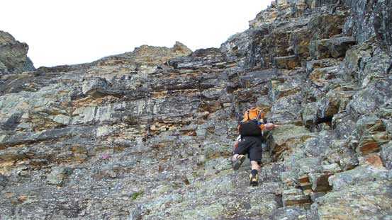
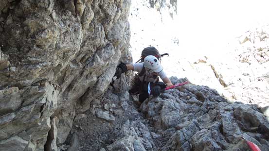
Ferenc starting the crux pitch on Huber Ledges

Ben taking pictures for Ferenc. This picture shows the terrain angle.
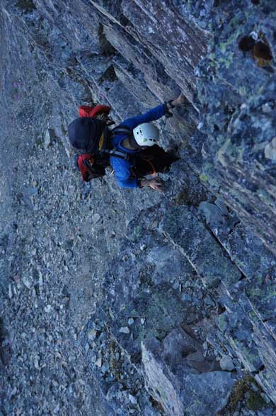
Me climbing up the crux. Photo by Ferenc
Ben continuing the Huber Ledges
Here’s the first glacier
Ferenc just about to drop onto the glacier. Great views already!
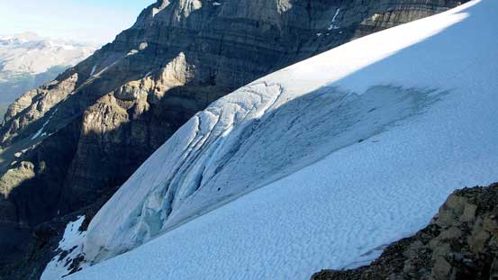
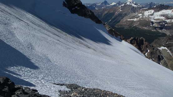
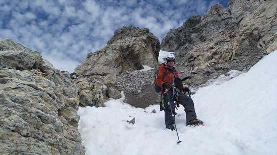
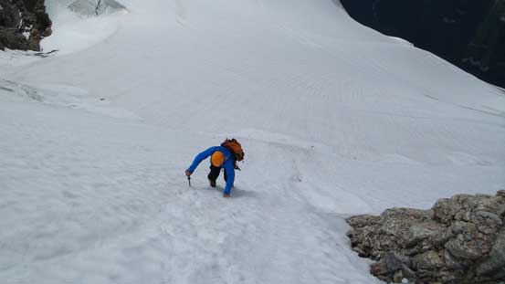
We geared up for the first glacier crossing. It’s relatively easy and short but did show a few holes. On the rear end we had to scramble up a short rock step to gain the upper glacier. With crampons on it’s a bit awkward but nothing overly difficult. Then we were on the upper glacier leading towards Huber/Victoria col. At this point we made the decision to ascend the supposed more-technical Mt. Victoria first. There were quite a few crevasses en route that we crossed on snow bridges, and the bergschrund appeared to be filled in.

Not the greatest photo, but it does show the tricky step after first glacier.
Looking back at the first glacier crossing

Now we were on the upper glacier

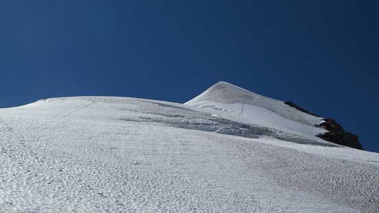
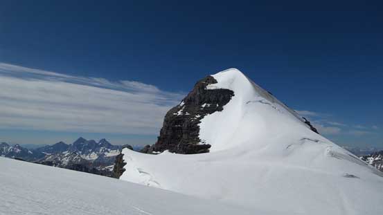
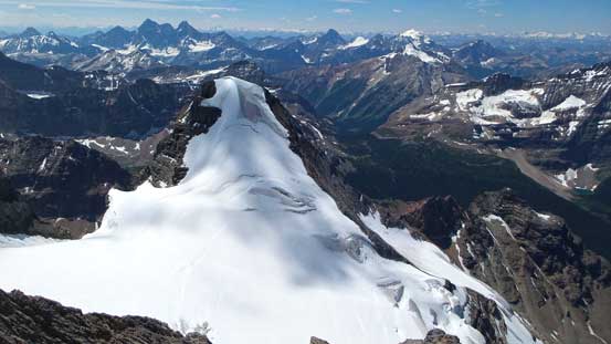
Our objective – Mt. Victoria
Mt. Huber starts to show a lot of ice on its routes

Ahead would be the bergschrund and then the west face
Looking back towards Mt. Huber – our next objective
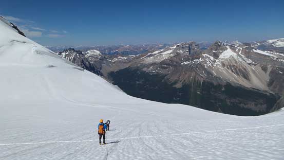
Gaining a lot of height on this glacier apparently
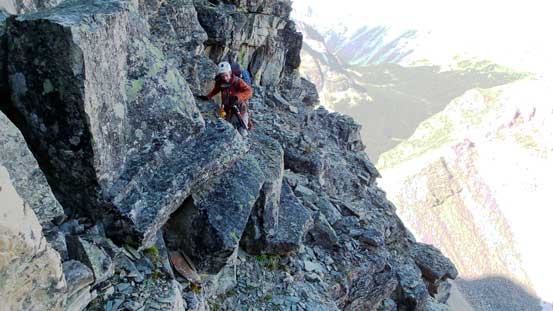
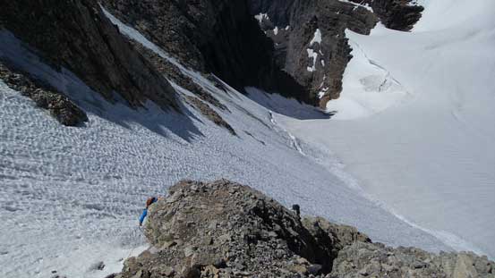
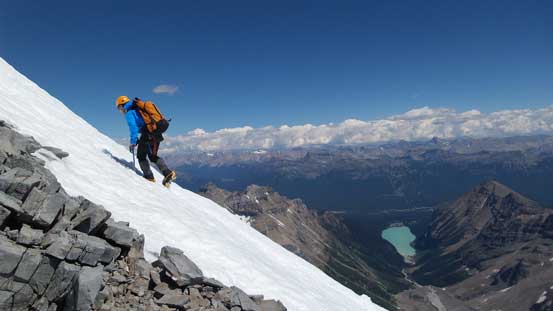
Some easy snow climbing after crossing the bergschrund brought us into a large gully system. We exited the snow on climber’s left side onto piles of loose rock. It’s almost impossible to avoid rock falls here and I knocked down quite a few chucks towards Ferenc and Ben just when transitioning onto the dry ground. From here it’s almost impossible to tell the exact route we took but by following basic sense we managed to stay entirely on (loose) rock avoiding the temptation to hit that icy gully. I believe the icy gully was the “normal” route according to Bill Corbett’s 11,000ers book, but as non-ice climbers we all preferred loose 4th class terrain. The terrain brought us to a tight chimney and after ascending it we topped out on the upper SE Ridge of Mt. Victoria.
Finishing the steep snow section above the ‘schrund

Ferenc scrambling up the typical loose terrain
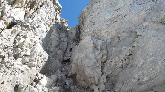
This is the chimney we ascended
Ben coming up the chimney
Ferenc picked a different line up
Topped out on the ridge now
Finally could look down at Lake Louise!!
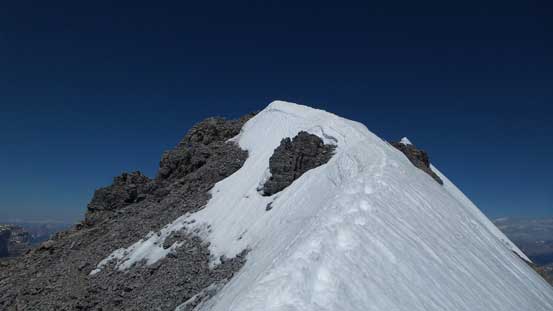
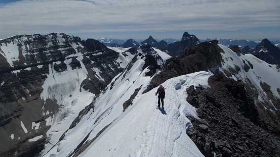
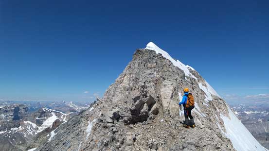
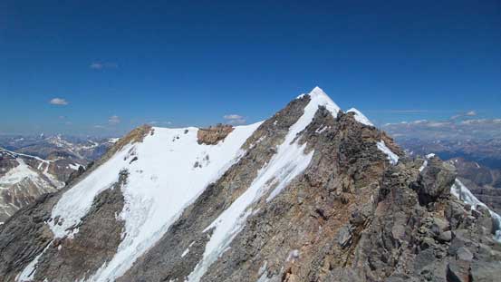
From here on to the summit of Mt. Victoria was nothing more than “easy mountaineering” for roughly 30-40 minutes given our conditions. All the rocks were scrambling only and the exposure was pretty tame despite what’s usually described by other sources. There were a few snow aretes to ascend but those were easy given our experiences on snow. I honestly thought the snow aretes on S. Ridge of Mt. Willingdon to be more difficult than Victoria’s, but that could just due to the perfect conditions we had. From the summit, Mt. Huber looked fairly icy but still presented snow climbing lines; Mt. Lefroy looked like ugly late-season conditions; North Victoria looked just like a bump on the ridge and the Victoria/Collier col was dry but the bergschrund was still filled in.
Ahead was the first snow arete
Ben ascending the first snow arete
Ferenc on the snow
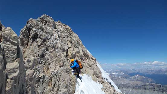
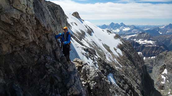
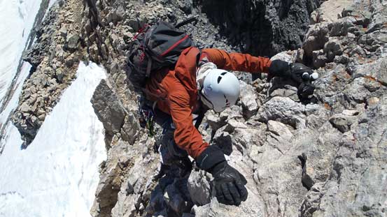
Ferenc ascending a trickier rock section

Me climbing up the rock step. Photo by Ferenc
Another rock step ahead
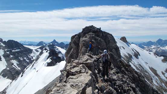
Still quite a ways to go!!
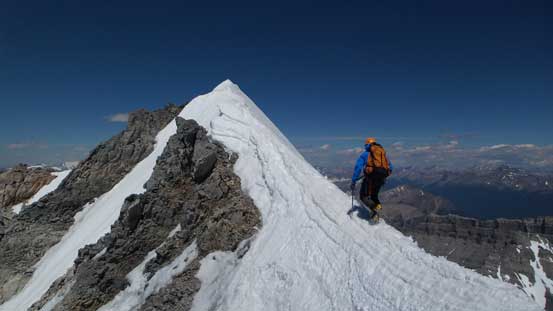
Ferenc on the last snow arete leading towards the summit

Ben ascending onto the arete
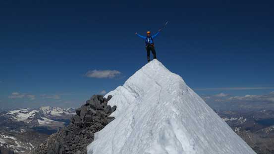
Ferenc on the summit of Mt. Victoria
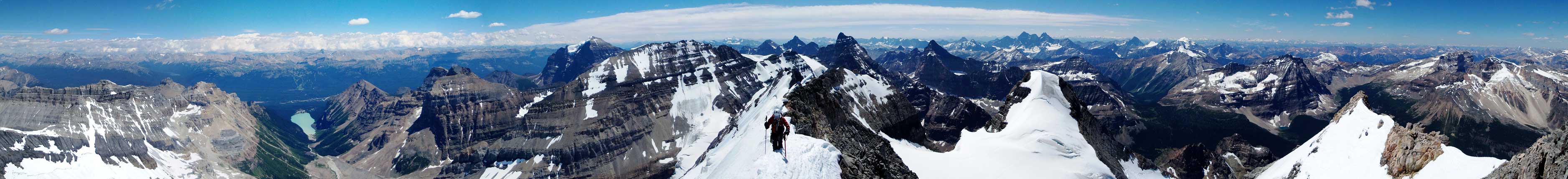
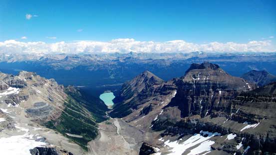
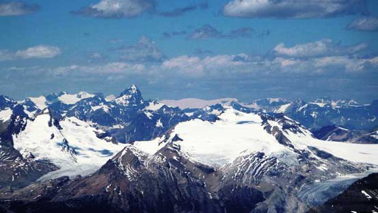
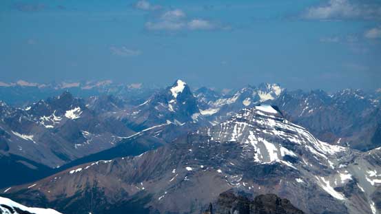
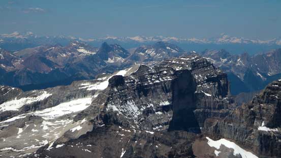
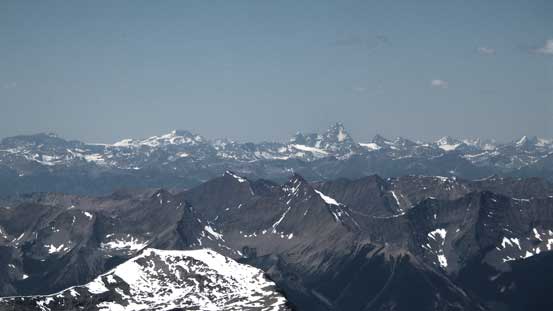
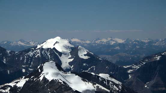
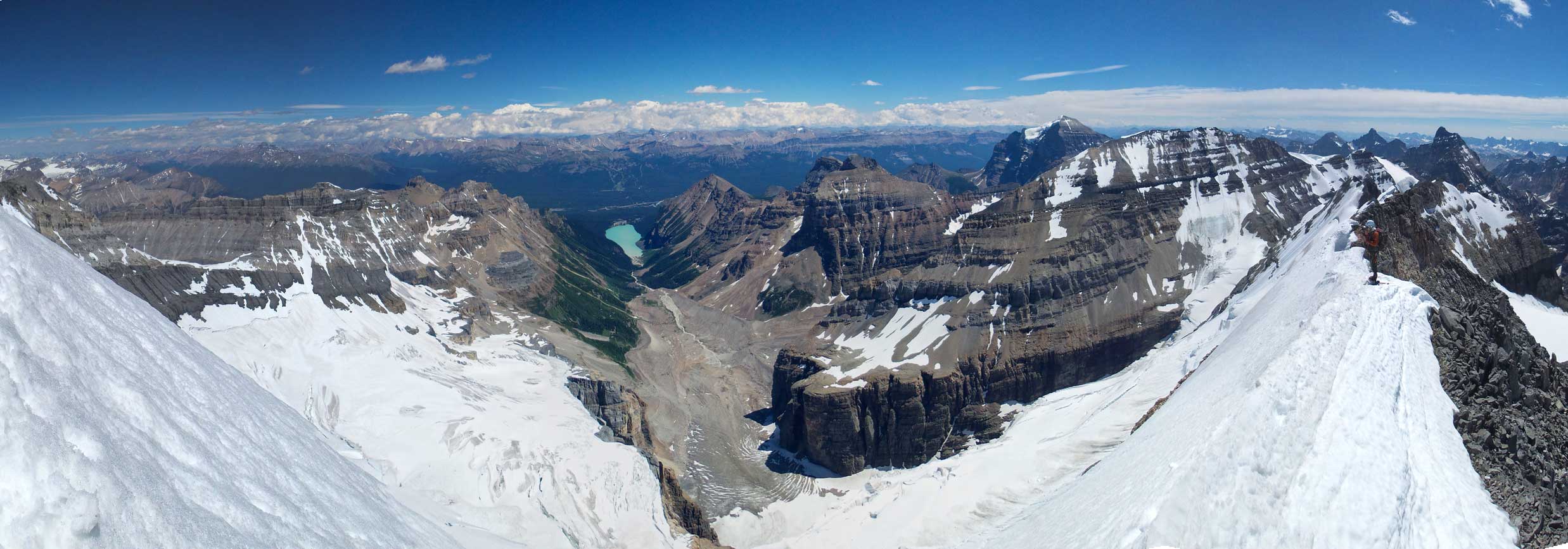
Summit Panorama. Click to view large size.
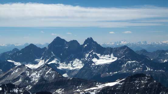
The three peaks on Mt. Goodsir
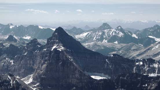
Mt. Biddle. Not an 11,000er but worth a shot in its own majesty

Mt. Douglas and Mt. St. Bride in the backcountry of Skoki
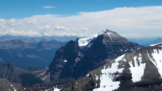
Mt. Temple is always the massive one
Mt. Hector – my 2nd 11,000er
Mt. Daly and part of the Wapta Icefield
The Presidents and Mt. Mummery behind
Mt. Forbes pokes behind. Bagged earlier in this year
Mt. Laussedat would be interesting to ascend someday…
Strangely I haven’t done Mt. Stephen yet…
The Rogers Pass classic – Mt. Sir Donald. Bagged last year
The majestic Mt. Vaux – on my to-do list…

Peaks on the Rockwall in Kootenay N. Park
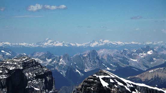
Mt. Sir Sandford and the Adament Group
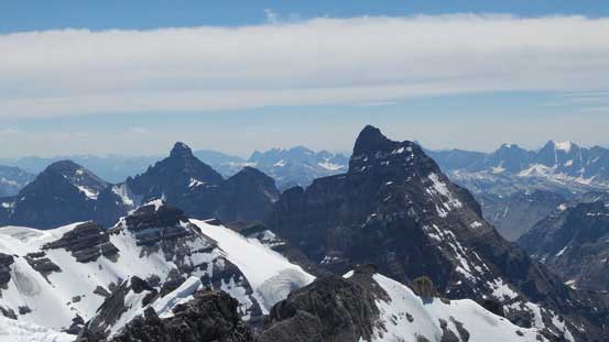
Hungabee and Deltaform – this year, hopefully…
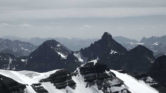
A closer look at Deltaform Mountain. To its left is Mt. Allen
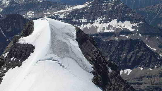
Mt. Huber our next objective
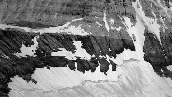
The “black bands” up towards Victoria/Collier col – a key accessing col for North Victoria
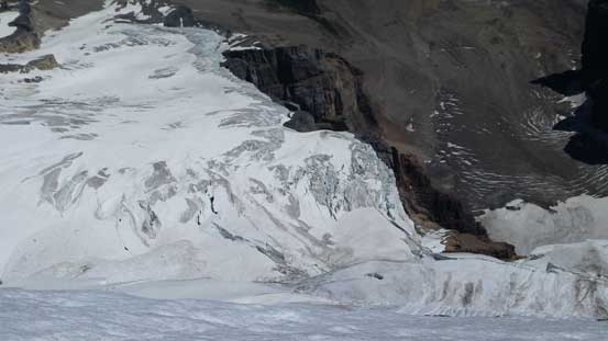
The very fractured Victoria Glacier
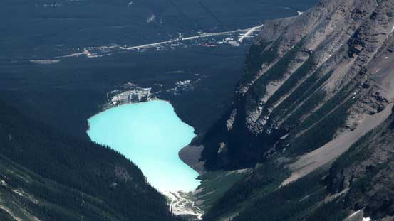
A view of Lake Louise. I wonder how many tourists were taking picture of us at the same time!
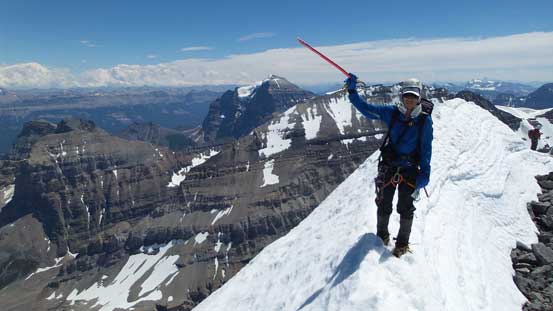
Me on the summit of Mt. Victoria, my 33rd 11,000er!
Another panorama from the summit. Click to view large size.
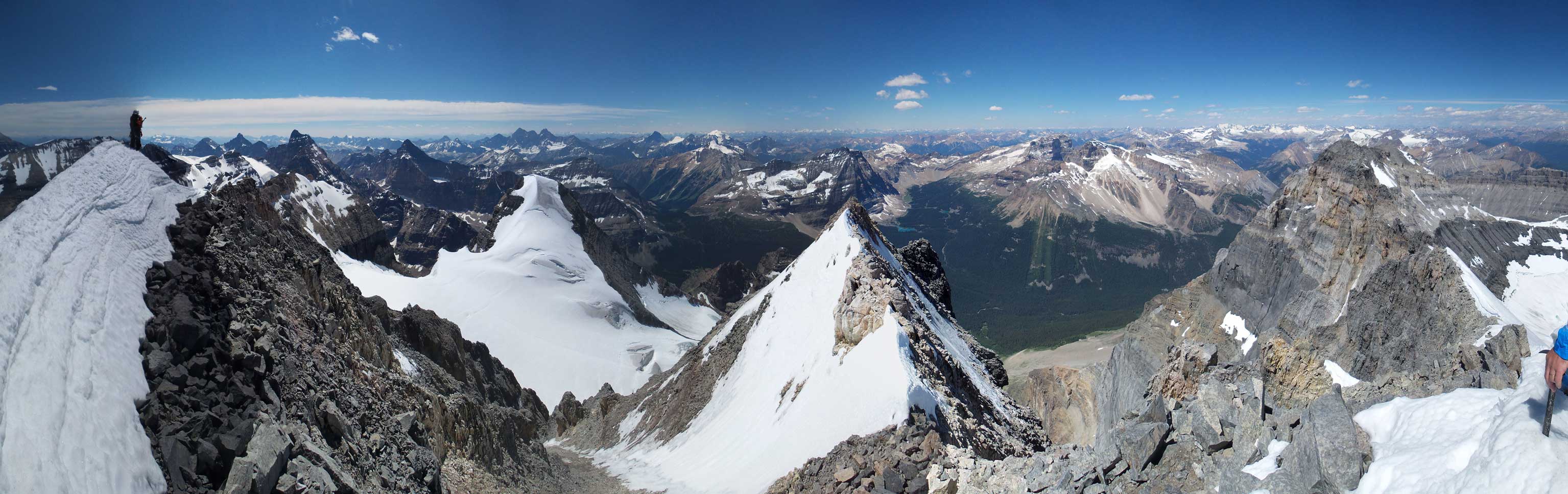
Another panorama from the summit. Click to view large size.
The descent went uneventful until we started the face part. The down-climbing was straightforward but avoiding rock fall was a different matter. To make it possible we all went down fairly slowly and close to each other. Back to the snow we strapped the crampons on, walked down the slope and easily crossed the ‘schrund. Now it’s time to think about our next objective, Mount Huber.

Ben down-climbing a rock step on the SE Ridge
Another look at Mt. Huber
Yet another rock step
Now, time to down-climb the tight and loose chimney
The typical Rockies’ choss…
Onto the snow
It’s steep for a while so we had to face inwards
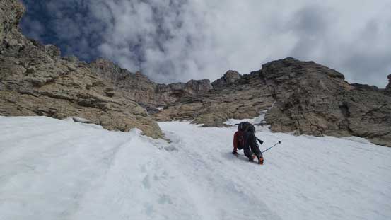
Ben down-climbing snow

Easily crossed the bergschrund
Now after finishing the Lake Louise classic snow-and-ice 11,000ers (North Victoria, Lefroy, Victoria, Huber) I actually think the main summit of Mt. Victoria is the easiest one (at least given the conditions we had). The other three all involved steep snow climbing but for Victoria it’s mostly a scramble with some easy snow and glacier travel.

These one was a big mystery to me till now. incredible hike!!!!!! thanx for sharing !!!!! Stay safe !
This one was a big mystery for me till now. great description and pics !!!!!! stay safe !!!