Grintovec
August 1, 2025
2558m
Kranj, Slovenia
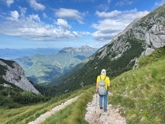
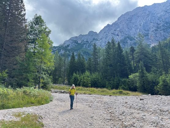
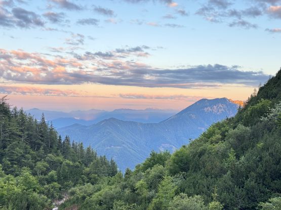
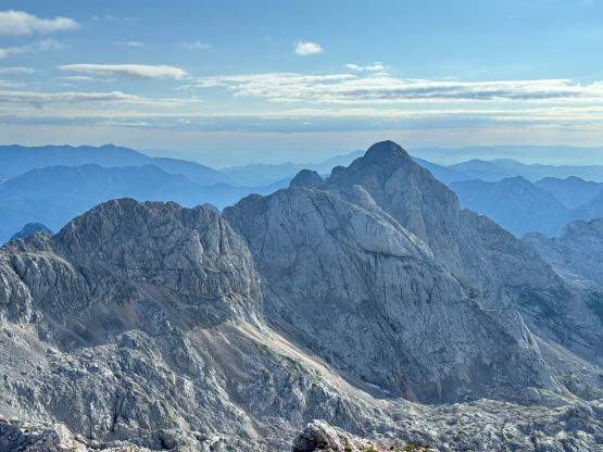
Grintovec is the highest peak in Kamnik-Savinja Alps of northern Slovenia and is also the 2nd most prominent peak in the country. This peak boasts over 1700 m prominence. The “standard route” at least according to the various trip reports on peakbagger.com is nothing fancier than a long plod with a bit of scrambling here and there, but involves about 1600 m elevation gain so this is a sizeable hike that should not be treated lightly. I was struggling to find a suitable objective for this Friday because the weather was unstable with a major system coming in at around 11 am. Adam and I were hoping for Triglav, the country’s highest peak but decided to go for something less consequential in case the system came a little bit earlier. The weather was supposed to come in from the west so by driving farther towards east we should theoretically earn ourselves at least two extra hours, and Grintovec is also 300 m lower than Triglav.
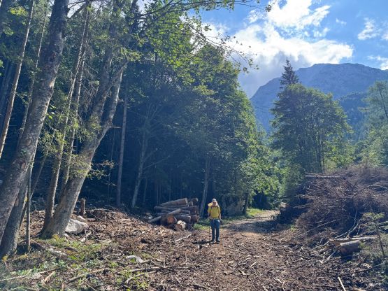
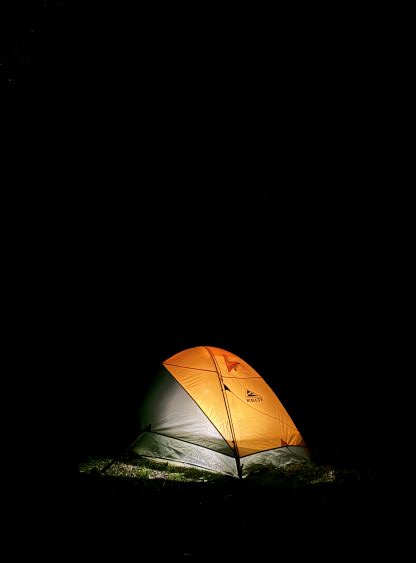
We had just completed 4 peaks in Austria in the previous day so we were quite tired, but due to the thunderstorm forecasts we still had to get up at an ungodly hour. On the bright side the trail-head camping situation is much more relaxed in Slovenia so we wouldn’t be worrying about getting caught and/or kicked out at midnight. The border crossing into Slovenia did have a queue but was as easy as one could expect. There’s no passport checking but they did collect 8 euros of fee. The last few kilometers to the trail-head was unpaved but imposed no issue to the rental 2WD Toyota and we pulled in at 10:30 pm after doing some grocery shopping. We were the only vehicle parked at the trail-head so we took advantage of the space, pitching out our respective tents. The plan was to start hiking no later than 5 am so the alarms were set at 4:15 am (myself) or 3:30 am (for Adam)!
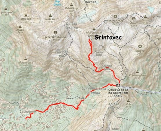
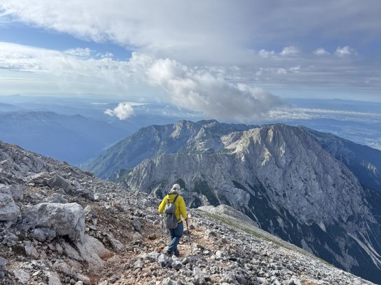
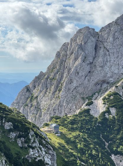
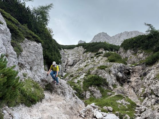
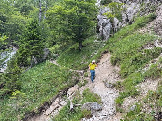
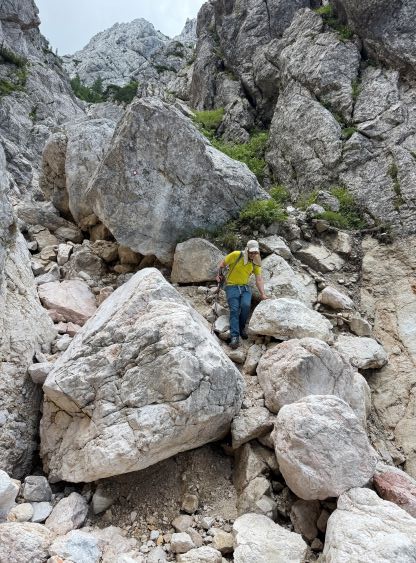
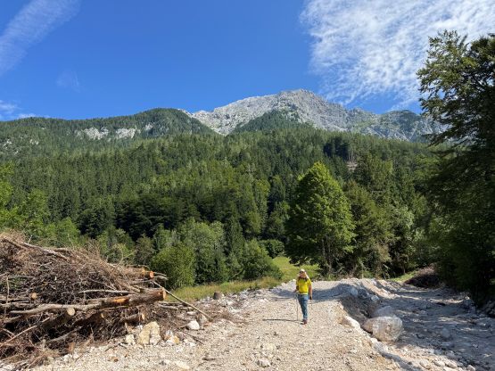
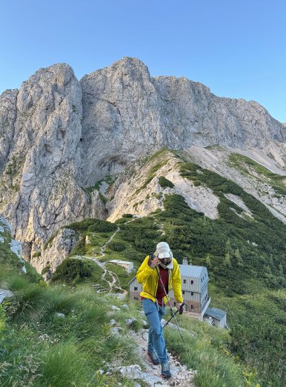
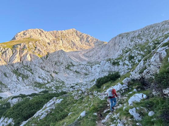
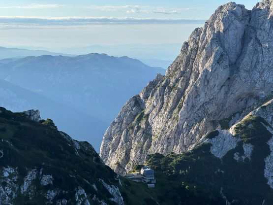
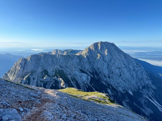
In the previous evening I had opted to briefly invest the possibilities to drive up higher on these unpaved roads but the result was negative. In retrospect we could have driven slightly higher following the hiking GPX track downloaded from peakbagger.com because the initial bits of this route was actually plodding up the logging road, and this road was not gated. We could however maximumly save 15 minutes of walking each way so it wouldn’t matter much in the end. Little did we know that the lower part of this route was significantly destroyed by some mudslides that the route is officially “closed” at the moment. This explained the difficulty we encountered in route-finding. The trail was poorly marked that for various occasions I had to consult with the phone or rely purely on GPS navigation in the dark. We even did some cross country travel in the forest but thankfully the bushwhacking was “light” or non-existing. For a long while we were plodding up a dry creek bed and it was obvious to me that the trail was heavily damaged by some recent flooding events, but we kept going because we could still follow the route especially with the help from the current era’s technologies. The via ferrata at 1300 m was completely gone but we found a scrambling bypass that was 3rd class, and quickly gained the traversing ledge leading into Suhadolnikova planina. From there we ascended more loose terrain on poorly defined paths all the way to the hut at Grintovec/Kalški greben saddle where we finally decided to take the first, much needed break of the day. We had gained 900 m elevation by this point and I hadn’t ate nor drunk anything yet.

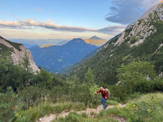

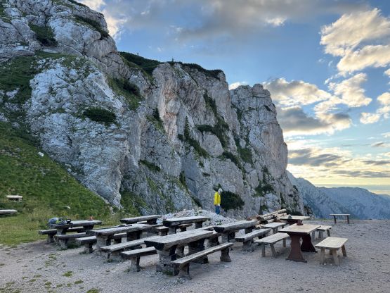
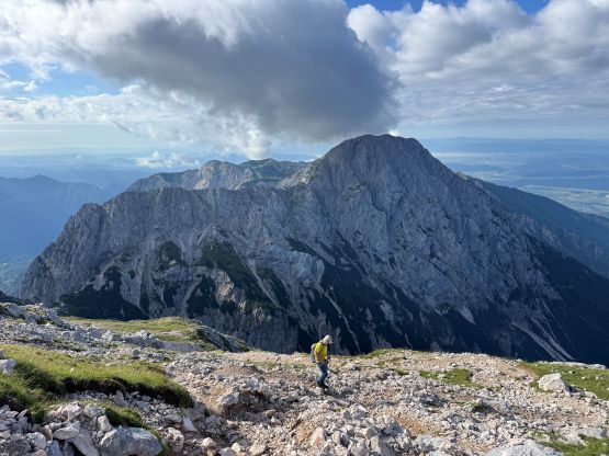
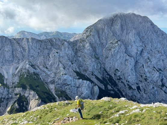
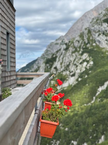
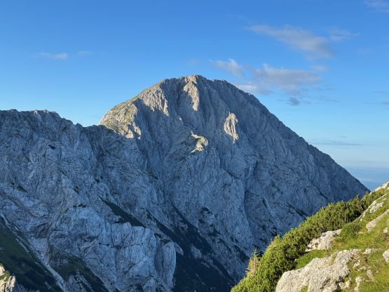
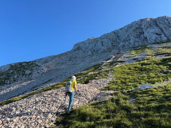
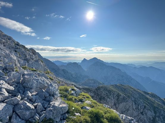
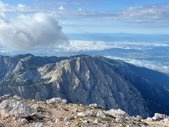
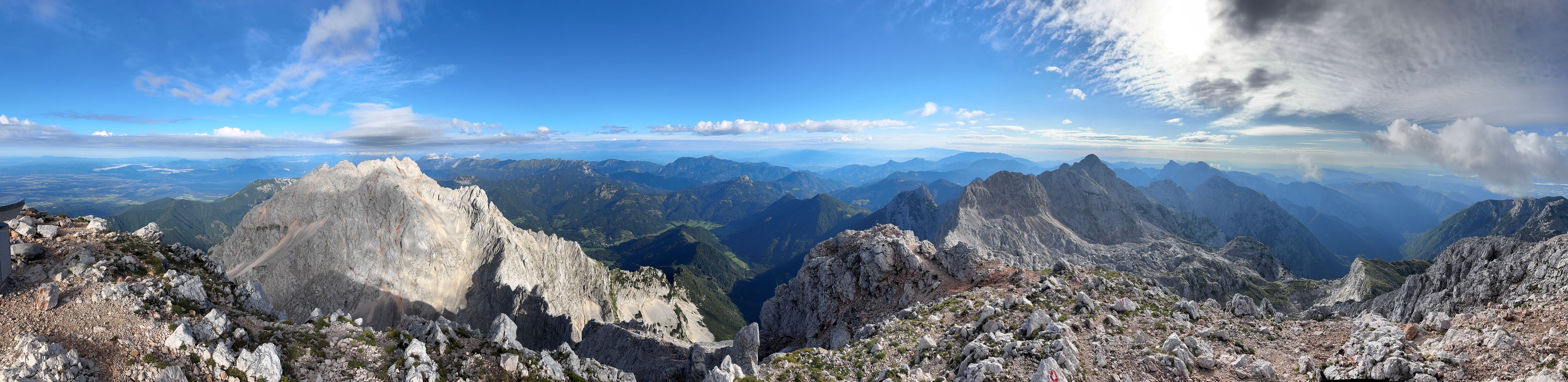
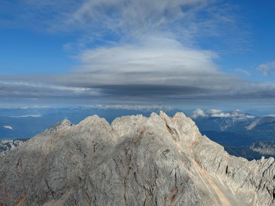
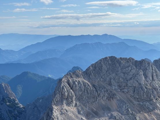
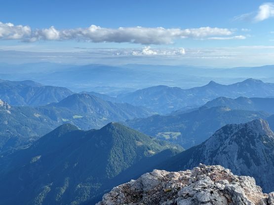
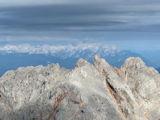
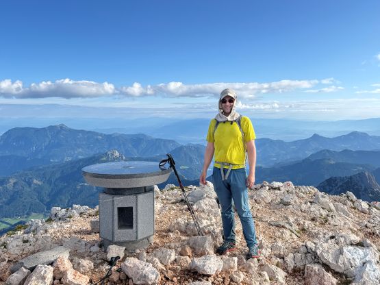
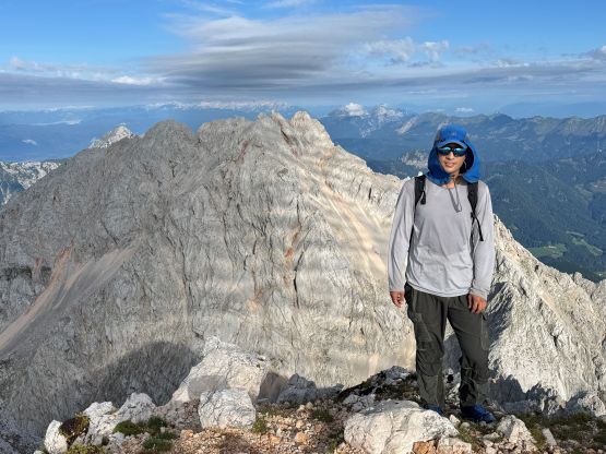
I was hoping to get some hot water from the hut but the welcoming words from the receptionist was “are you looking to buy anything”. Adam told me later that nothing’s free in these European huts so we might as well forget about these luxurious stuffs that we shouldn’t be relying on anyway. Those services are not affordable by the averaged “dirt baggers” coming from North America. We could have afforded a cup of coffee or tea but that’s not something we desperately needed. After about half an hour of resting we resumed the plodding and the next stretch was also a horizontal traverse into another bowl. We finally got some sun beams after getting onto the broad south ridge of Grintovec. The terrain and the view was very foreshortened as we still had over 500 m elevation to gain, even though the summit seemed to be “right there”. These final stage dragged on forever but after what seemed like eternity we arrived at the summit, 3 hours 15 minutes after leaving the car. I had no clue how Matt J. managed this ascent in 2.5 hours without running uphill. Maybe he took no break along the way. We could definitely see the weather system coming in from the west with lenticular clouds building up, but the atmosphere was still pleasant on the summit of Grintovec.
It was quickly becoming windy and cold so we put on the layers and started the descent. I decided to follow Adam for most of the way down because I was tired of thinking. Without realizing we were already down to the hut and took another longer-than-needed break soaking in the European experience which was new and quite interesting to me. I didn’t bother to go into the hut this time because I didn’t want to give out my cash. We then noticed that “trail closed” sign so the people in this hut must have come up from a different way or were doing some multi-day traverses. I assumed any other route would be longer than the one we did. The descent through the water-damaged canyon was a bit rough but wasn’t too bad. Our round trip time was under 6 hours and we succeeded in beating the rain. This ascent turned out to be quite tiring but the weather was better down south so we must take advantage of that. There’s one P1000m objective in that direction and we also planned to enter Croatia for a bonus P600m drive-up ascent. Adam had booked a hotel (90 USD) for the night in Ljubljana so we still had a loads of work left for the rest of the day.