Mount Elgon (Wagagai & Koitoboss)
January 4, 2024
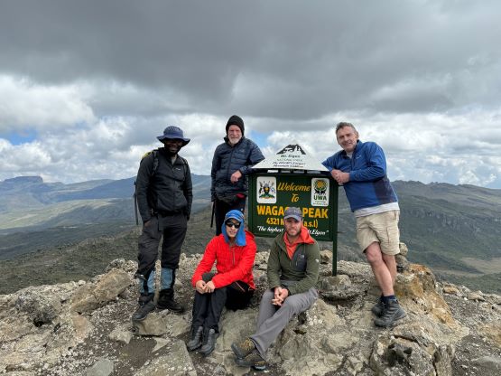
4321m
Kenya/Uganda
Mt. Elgon is one of the taller peaks in Africa and straddles the border between Kenya and Uganda. The true summit (Wagagai Peak) is on the Uganda side of the border and is traditionally approached from that side as well. However, the trail-head elevation is very low and the trek usually takes three days. Our friends Petter and Adam did it that way. Rob, Alastair and I hired Julian Wright, the owner of African Ascents in this trip and Julian knows the “beta” of these peaks really well. In fact, Julian has already guided another group day-tripping Wagagai Peak from Kenyan side. The trails are much less defined and in fact more than half of the trekking would be off-trail, but one could drive to 3500 m elevation making an one-day assault possible. There’s some complicated logistics associated with crossing the border up high on the peak, but Julian had arranged Ugandan rangers to trek in from that side and meet us on the summit. They would stamp our passports so our unofficial border crossings would be legal after all.
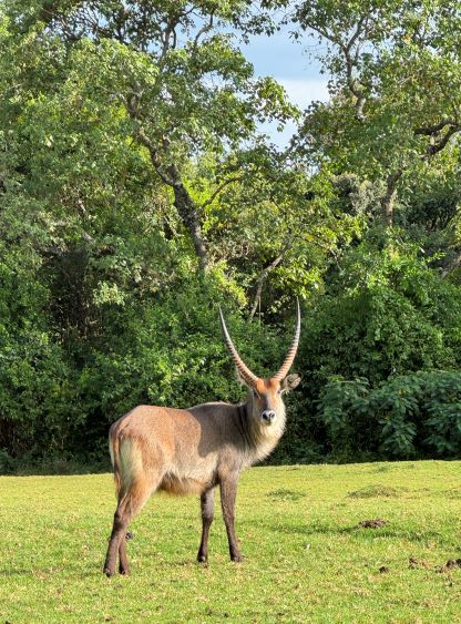
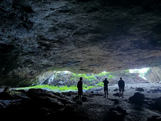
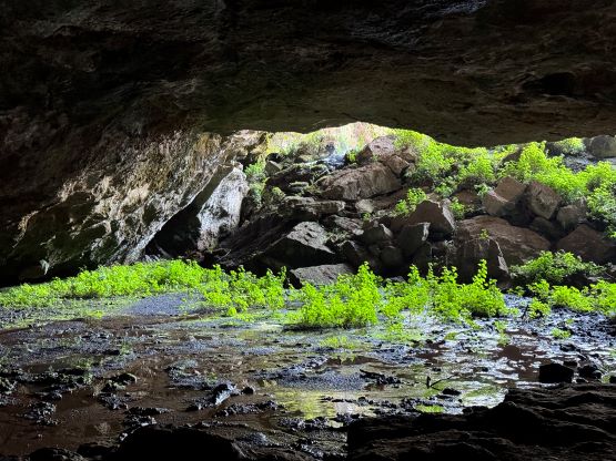
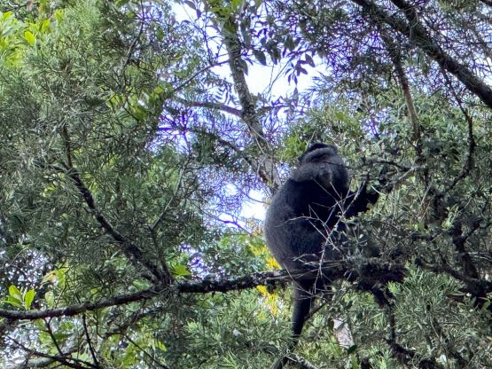
The day prior to the ascent was supposed to be a “buffer day”, but we had no delay whatsoever so this buffer day had essentially become a “rest day”. We only needed to drive from Kitale to the campsite at Mt. Elgon National Park’s east side gate, and the drive would take no more than 4 hours. We made to the campsite in the mid-morning and spent the rest of the day exploring the lower slopes of the park. Julian knows biology really well and showed us all kinds of wildlife by driving us around. We also explored a cave (Kitum Cave). This required about 1 km of walking but the reward was worthwhile. I am usually not keen on doing extra stuffs but I was glad to have come for this short tour. We even saw lots of signs of the presence of elephants in this area, but too bad we couldn’t see one ourselves.


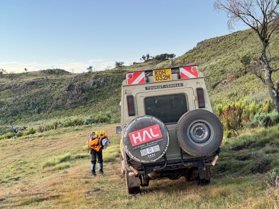
The next morning we woke up at 4.15 am and the breakfast was ready by 4:30 am. The plan was to start hiking at the first light and there’s still at least an hour of driving to the trail-head. The drive was entirely on a rough singletrack and was longer than expected. We did push the Landcruiser to the drivable end at above 3500 m elevation, but did not manage to start trekking until sunrise.
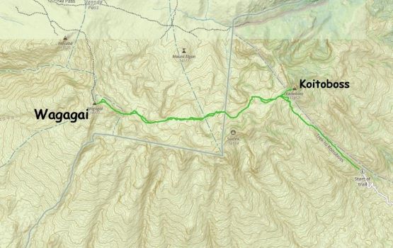
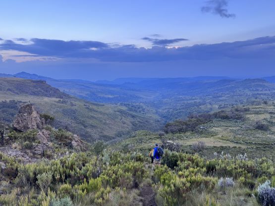
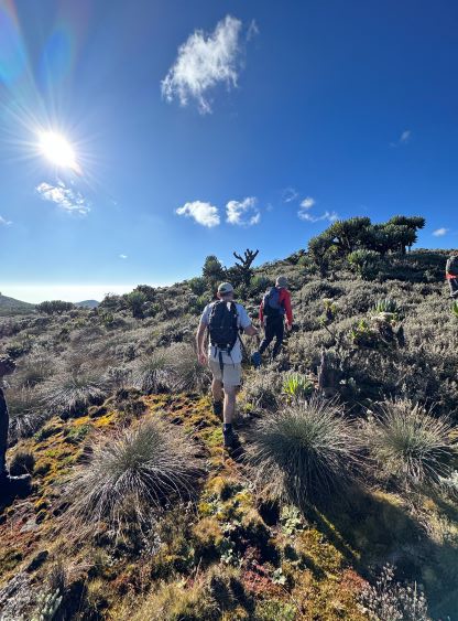
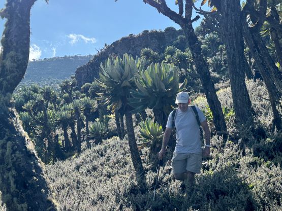
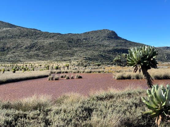
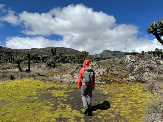
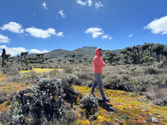
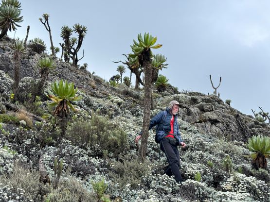
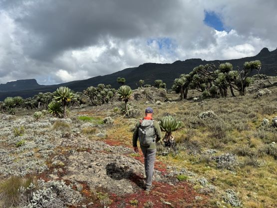
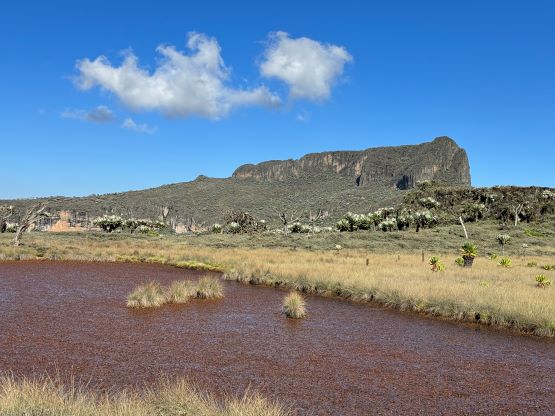
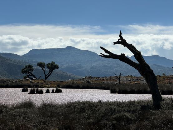
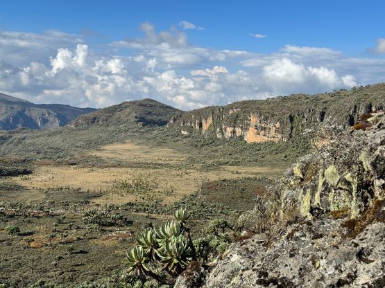
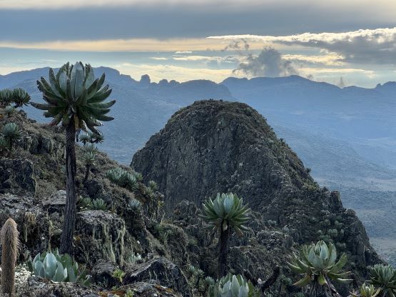
This trek was long (over 30 km distance), but the net elevation gain was only 800 m. It’s a flat and undulating one. The first stage was to traverse into a shallow valley with a creek and then plod up this valley to the 4050 m saddle under Koitoboss Peak. This section was mostly on a well-defined trail but some portions were muddy and swampy. Unfortunately this was the only on-trail portion of the trip. The Kenyans use this trail to access Koitoboss Peak but hardly anyone ventures beyond the border towards the true summit of Mt. Elgon. As a result, the upper 2/3 of the trek was off-trail. We were able to find game paths here and there but they weren’t continuous and were rather difficult to follow. The most confusing stage was actually at the beginning after leaving the Koitoboss saddle. We simply followed Julian’s lead as he had done this route before, but we weren’t able to find the path until after bushwhacking for at least a kilometer or two. The bushes were not thick nor thorny, but the going was slow and tedious. We thankfully found the game trail and were able to follow this trail for a while afterwards but there’s a section of annoying descent, with at least 50-100 m elevation loss. This would have to be regained later on the return, unfortunately.


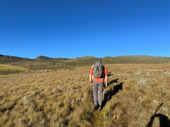


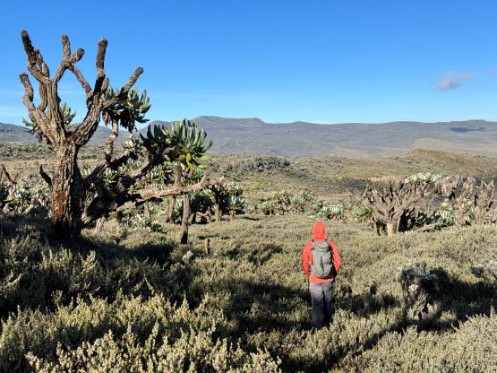


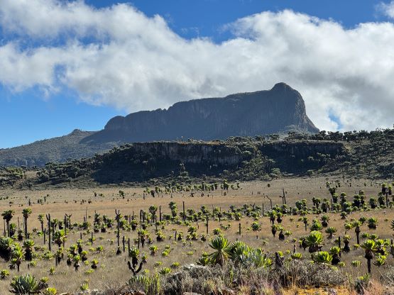


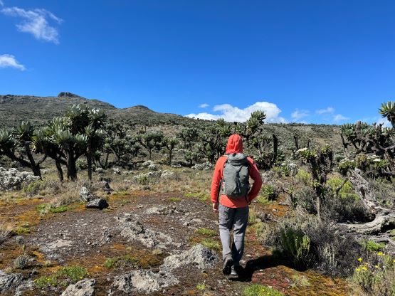
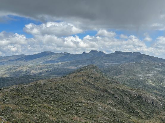
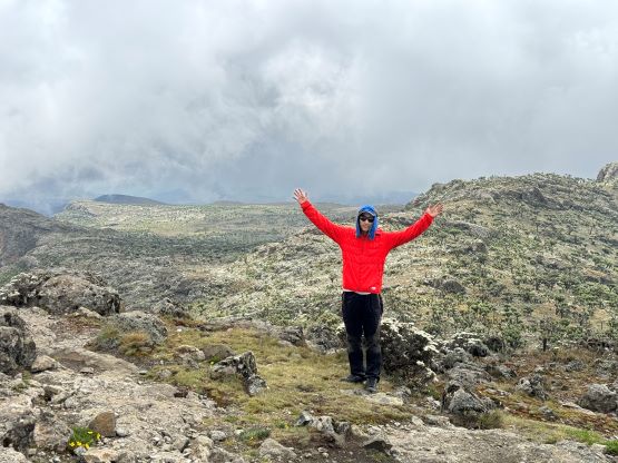
From this low point under Sudek Peak it was then a long and gradual ascent towards Wagagai Peak and the straight line distance was still over 6 km. We only encountered minor up-and-downs and were able to find game trails here and there, but the going was painful and exhausting, especially considering the altitude. The worst were the swamps but I was able to stay alert and managed to keep the feet dry. Julian was leading a very comfortable pace so despite the monotonous terrain I was actually able to enjoy the trek. Towards the summit we crossed another swamp and ascended onto the ridge on climber’s left. This involved some minor scrambling. There was no more trail afterwards but the plod to the summit was easy and straightforward. It had taken us almost 6 hours to get here. The Ungandan ranger was still patiently waiting on the summit to be paid, and did not bother to check our passports. Julian paid him 30 dollars of tip as he had made there quite a few hours earlier. The ridge to the north appeared just as high so I made a quick dash to check that out. I think it’s lower and Rob confirmed with his hand level thing.


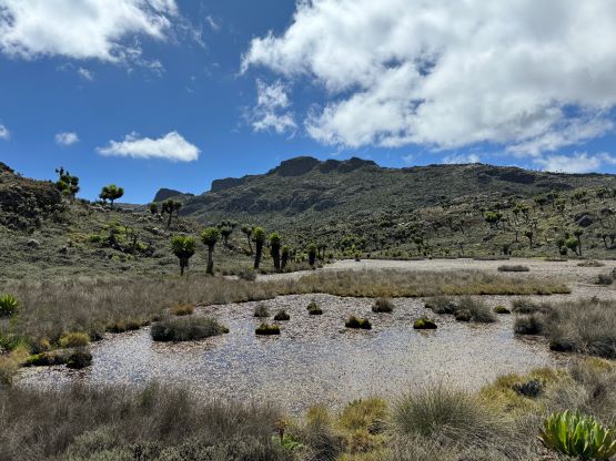


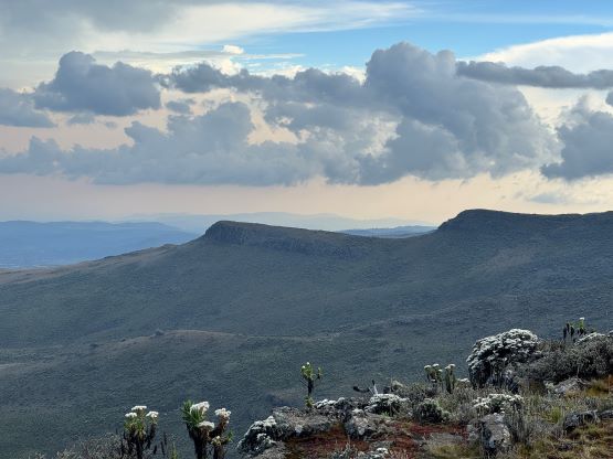
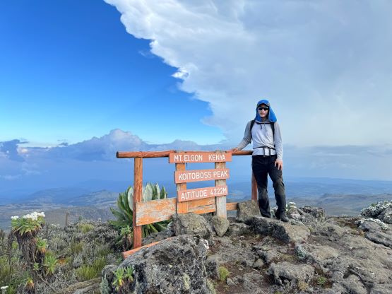
We were doing okay on time but it’s an ambitious plan to day-trip Mt. Elgon after all, so we had to start descending soon. By following Julian’s lead we no longer needed to use our brains by much, but we did get briefly off route a few times. We also took a lot of breaks probably due to the altitude, but I felt fully acclimatized after Lesatima etc. I eventually went ahead and soloed Koitoboss Peak. It’s a striking looking summit with almost 200 m prominence, so I wouldn’t give it a miss as long as I still had reserved energy. I was really glad to have made this detour as the views were rewarding. The ascent was a bit longer than I thought though with some up-and-downs to work around cliff bands.


By the time I finished this ascent and were almost back to the 4050 m col I could not find the rest of the crew. I thought the plan was to meet at the col but I wasn’t sure if the communication was clear enough. I ended up waiting and yelling for almost 20 minutes but I rationalized there’s no way for them to be behind me. I then dashed down the trail and found some footprints pointing downwards. I subsequently jogged for most of the downhills hoping to catch up to the rest of the crew somewhere as I was quite concerned of being alone with lions and leopards around. In fact, it was used to be mandatory to hire armed rangers to trek in this area. We did not do so as it’s no longer required by law, but hiking alone in the dark would definitely not be ideal. My goal was to dash down to the truck before dark no matter what and I ended up catching up to Elijah and Alastair minutes before the trail-head, finishing the round trip in 11 hours 45 minutes. We quickly got ourselves reorganized and drove down to the campsite in the dark. Everyone was exhausted from the long day at higher altitude so it’s good that we could descend to this 2100m camp to spend the night. Our cook had been guarding our food and tents from the monkeys and the dinner was ready within another hour. It was a long day, so sleep came rather easily. We unfortunately did have to wake up early again as the plan was to cross the border (officially) into Uganda, drive all the way to Mt. Kadam and trek to the high camp in the evening.