Hex Mountain
December 1, 2024
1534m
Cle Elum, WA
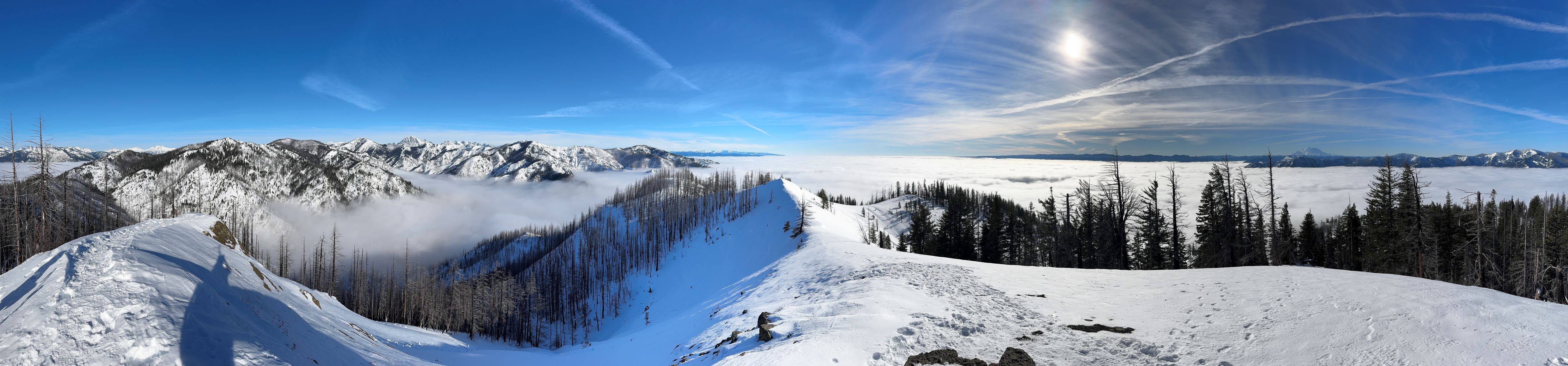
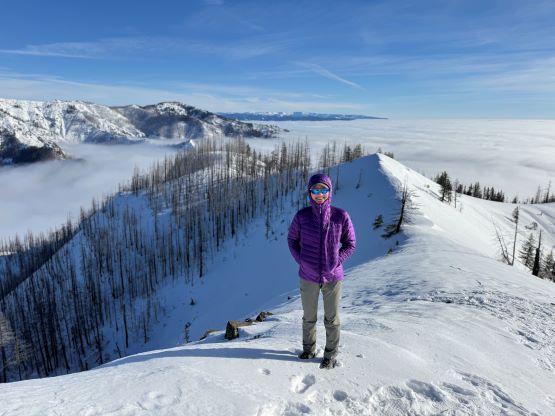
Hex Mountain in the vicinity of Cle Elum Lake is one of the winter classics for Washingtonians due to the expansive views and the lack of challenging terrain. This objective however, does not offer much prominence nor any mountaineering value. The driving distance is also a wee bit too long for us Canadians so I was never overly keen, but when time and motivation was lacking this might make the most sense. Erica and I had ordered an expedition tent to be shipped to the Feathered Friend store in Seattle and that needed to be picked up, and on top of that I needed to be back home no later than 7 pm for work in the evening. The weather was too good to not do anything so I proposed that we should finally go check out Hex Mountain. There had been a discussion about the access situation on social media a month or so ago, that apparently the authorities had installed a new gate with “no trespassing” sign. I thought this was actually a good thing because that sign could put the crowds at bay. I of course, would ignore it as always.
Regardless whether there’s a “no trespassing” sign or not the parking situation was never great along the Salmon la Sac road, that car-camping was the only way to secure a parking spot on a sunny weekend. We managed to leave Surrey at around 11 pm after work, and did not get to the trail-head until almost 3 am in the morning. My sleeping schedule had been messed up recently but that’s the sole reason why I was able to handle 4 hours of driving immediately after a long day at work. The correct (legal) parking spot was about 200 m to the south of the gate along the side of the road, and can take ~10 vehicles. Instead of pitching the tent we simply slept on the front seats of the car, and we slept straight to 8 am in the morning when my alarm went off. I was too tired and decided instantly to extend the sleep by an hour, and we subsequently did not manage to start hiking until almost 10 am.
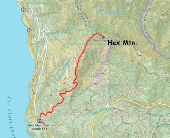
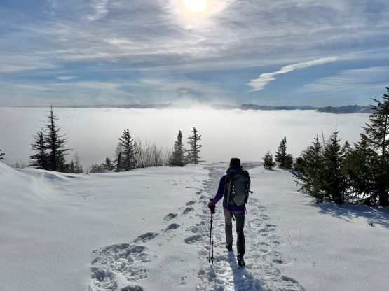
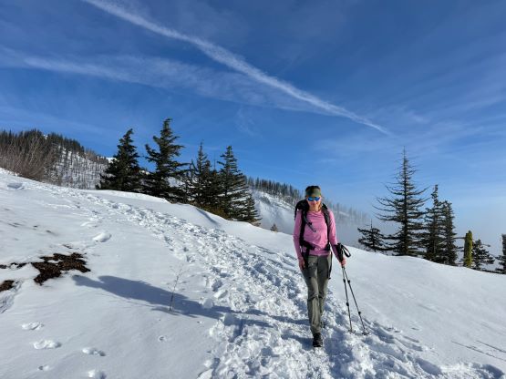
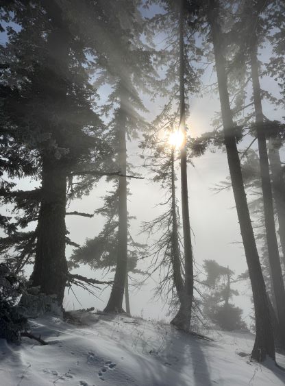
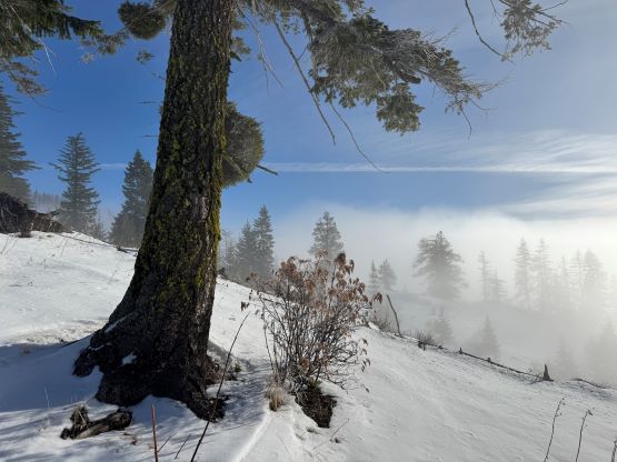
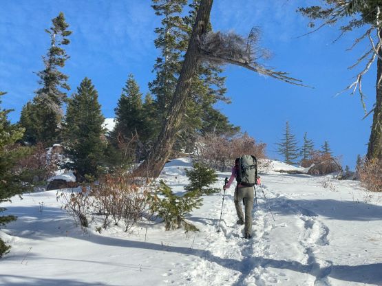
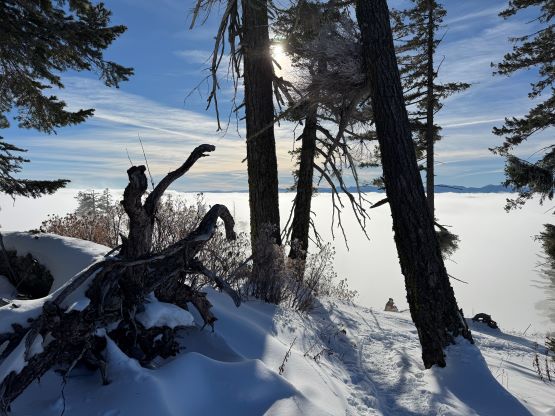
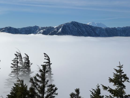
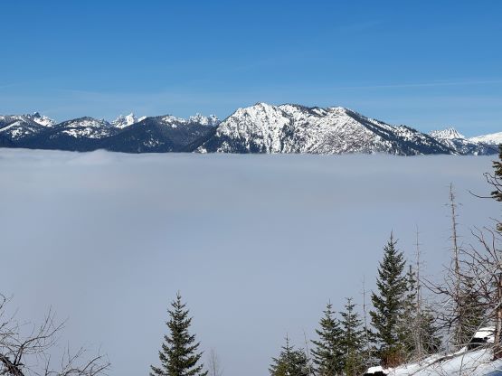
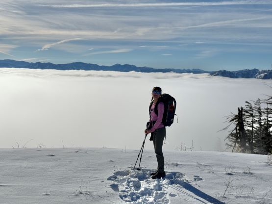
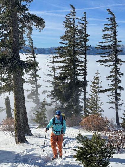
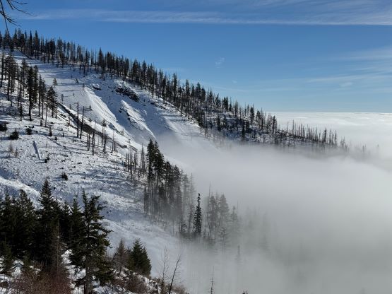
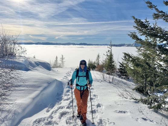
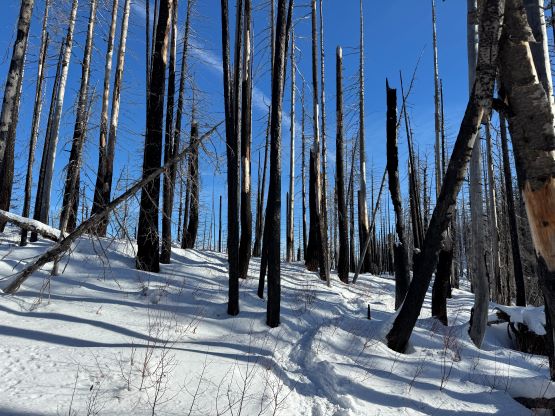
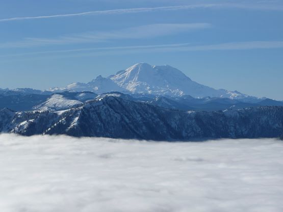
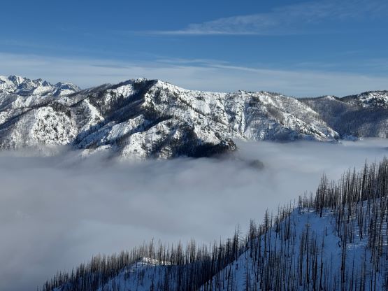
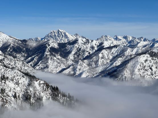
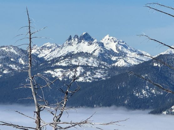
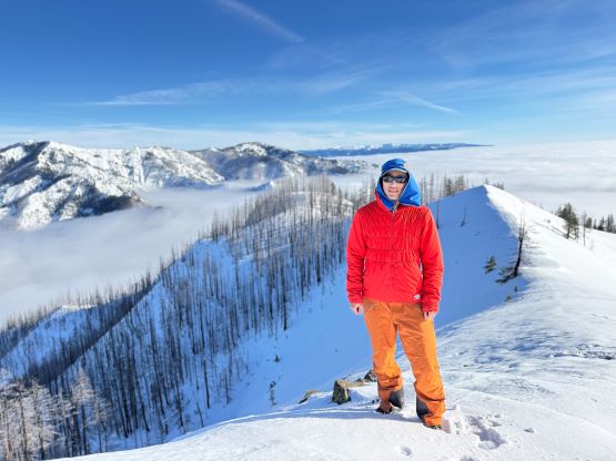
The weather was cold and overcast which was contrary to the forecast, but based on the past experience I thought this might be an inversion. I was definitely correct. The first few kilometers was plodding up the private FSR and can be confusing without a map. We almost made a mistake at the second (yellow) gate. The tire tracks all went left but the correct hiker’s route goes through that yellow gate. About halfway up the mountain we finally finished the FSR plodding and arrived at the official trail-head, and the trail was well packed by hikers’ traffics. We only encountered one other group of hikers (on our descent) but apparently this route was still very popular despite the recent change in the access situation. Thank to the foot traffics we never ended up needing the snowshoes. At around 1250 m elevation which was 2/3 of the way up the mountain we finally broke through the inversion layer. This was Erica’s first time above the sea of clouds so our stoke level was very high. The rest of the ascent was longer than expected and there was substantial amount of plodding in the forest, but the summit itself offered even better views.


It had taken us 2 hours to reach the summit so we weren’t doing particularly great on time. I was budgeting 3 hours for the round trip so we must hurry up on the descent. We ended up jogging most of the way down and managed to finish the round trip in 3 hours 20 minutes. Not doing any unnecessary lingering I drove us 1.5 hours west straight into the city of Seattle. The parking at Feathered Friends was free on Sunday and we spent about an hour shopping. We then took turn driving northwards back into Canada and the border situation was surprisingly good. As a result we earned ourselves enough time to have a proper dinner before showing up at work. I worked for 1.5 hours and then we drove home, concluding another exhausting day out.