Ortles (Ortler)
August 16-17, 2025
3905m
Trentino-Alto Adige Region, Italy
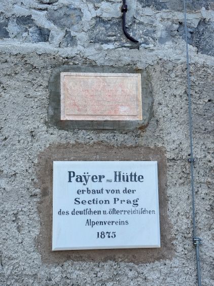
This is the highest peak in the Italian side of the Tyrolean Alps north of Bolzano and the absolute crown jewel of the area. The more commonly used name is Ortler which is the German spelling, but since this is technically still in Italy I personally prefer the Italian name. This peak was not on the original itinerary because the majority of the trip would be in August, and the standard route on Ortles requires significant amount of glacier travel. Usually I would aim to avoid glacier travel in the “late season”, but a few days prior to the ascent I started to think about Ortles again. Erica, Caspar and I needed a higher peak to acclimatize for Matterhorn and it’s even better if we could stay at least one night in one of those higher huts. The most ideal plan would be Monte Rosa or Grand Combin but it was not possible to book those busy huts at the very last minute. While brainstorming I remembered Ortles and asked Caspar to check the availability of the hut. The website is in Italian and there was no way to book/check unless one makes a phone call. That’s beyond my capability but thankfully we had an European local here and Caspar got the job sorted out. To my surprise there was still room for 3 at the last minute even for a Saturday/Sunday window, so I made Caspar to book the hut right away.
I wasn’t too positive about the conditions but reluctantly agreed to give it a try. I figured with the popularity of these European peaks it’s very probable that any pitch of ice would have cut steps. I was definitely correct. Caspar, being more familiar with the European climbing culture, actually called the hut about the condition of the glacier. The ranger (or maybe one of the guides) confirmed that the glacier was still in the “normal shape”, so we would leave the ice climbing gears behind, carrying only the basic glacier travel equipment. The weather was also 50/50 but at least there wasn’t a major system nor some high chances of thunderstorms. Adam would sit this one out or bag his own peaks. In the previous day the 4 of us, in two separate vehicles all made the long drive to the vicinity of the trail-head. Adam and I got there at around 9 pm and settled to camp on the dirt road heading towards a private restaurant. Erica and Caspar actually came to inspect this spot a few hours later, but decided on somewhere else. They did give me the rope as my plan was to take the chairlift to shorten the approach.
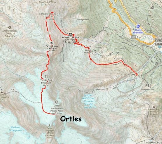
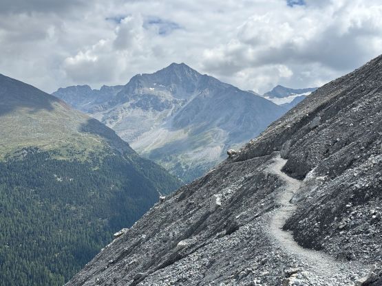
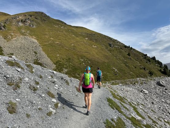
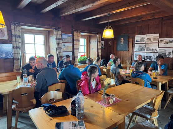
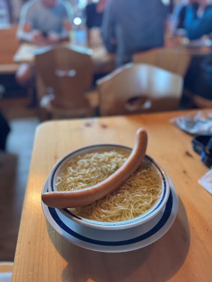
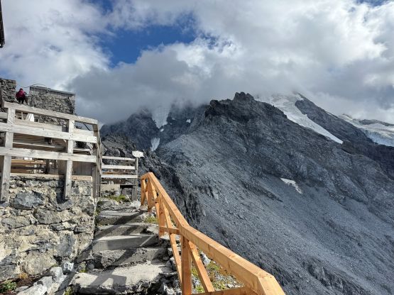
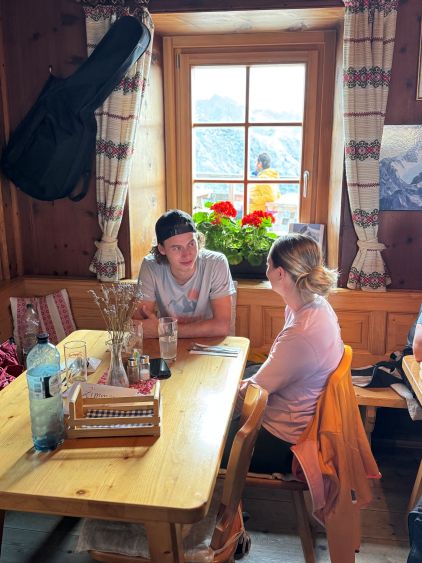
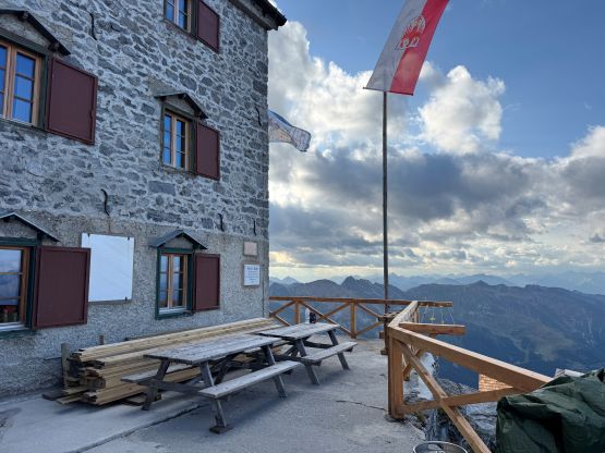
The next morning Adam dropped me off at the chairlift station at around 9 am. I never got the firm response from the other two, but I assumed they would be hiking up from the bottom to be cheap, and they usually preferred to be later than earlier. There’s no point for me in waiting, so I decided to ride the chairlift up and hike to Payer Hut on my own. This was the correct decision for many reasons. The weather was not cooperating with isolated showers throughout the day, so the earlier I started the drier I could stay. Erica and Caspar also ended up driving a portion of the road (illegally) and then took a Grade E ferrata, without knowing the difficulty nor having the right gears. They thankfully made it without mishap, but were at least a few hours late. There’s not much worth noting about my hike to Payer Hut other than I got there in about 2 hours. There’s a designated trail for us lazy hikers taking the chairlift, and there’s some minor exposure after gaining the ridge heading for the hut. The rain came for the last 100 m elevation gain but I sped up and didn’t get too soaked. The staffs in the hut asked me right away for payment. They also “warned” me that the water from the toilet was not for drinking and I must pay something like 10 EUR to buy the 1.5L bottled water. I refused to do that, and simply took my chance drinking from the toilet water. I never got sick. I did buy an additional lunch (ramen with sausage) for 12 EUR, which I thought was way too expensive for the quality. The stay in this hut for one night with half board was 70+ EUR. That’s reasonable, but I paid for nothing else beside the ramen. The hut was extremely crowded such that I was being asked to leave after finishing my dinner so that they could fit more people in. I of course refused to leave, as if they were actually short on sitting space then that means they were overbooked. That’s not my fault.

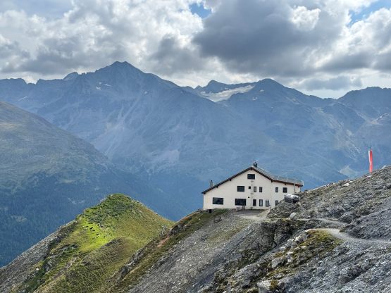
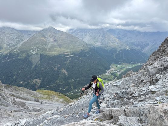
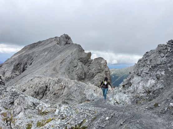

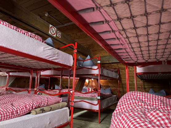
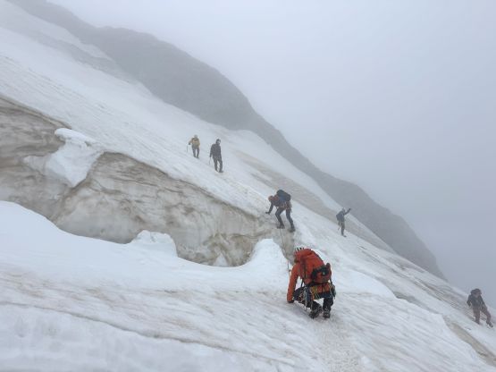
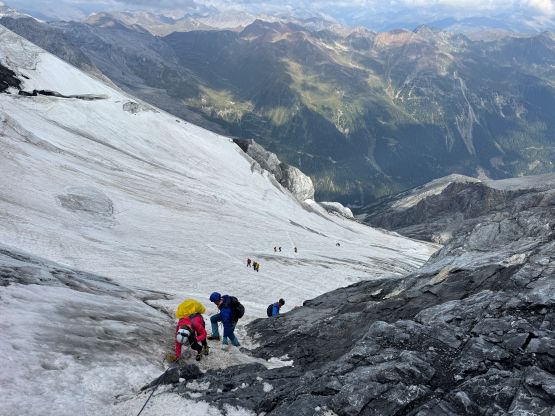
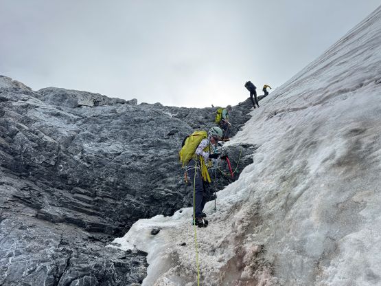
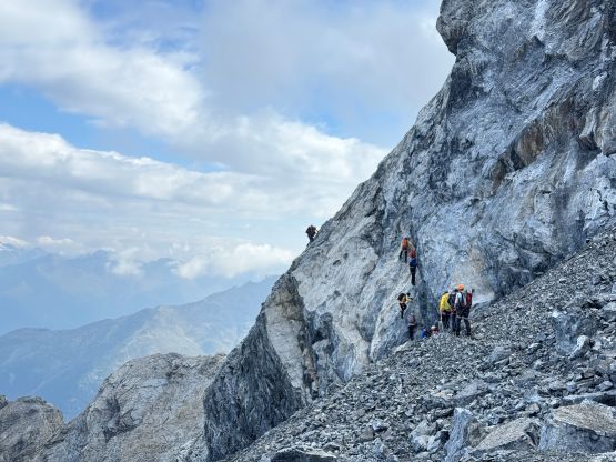
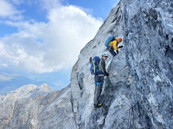
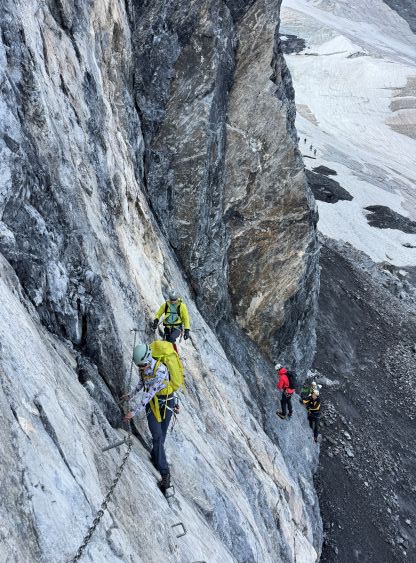
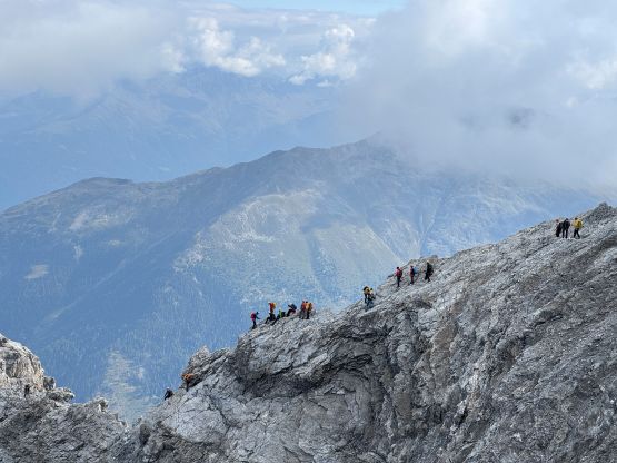
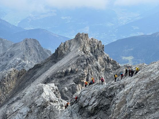
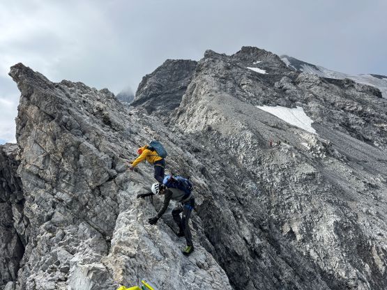
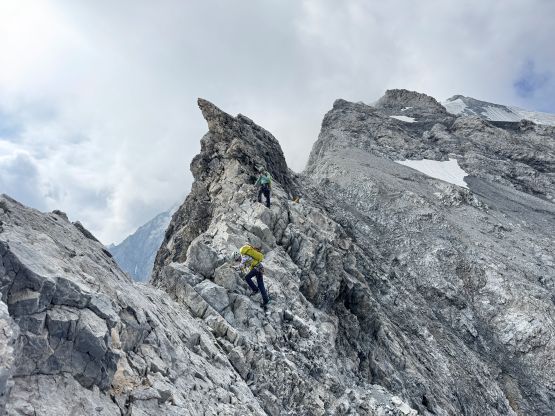
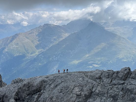
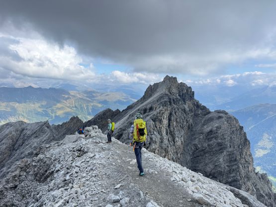
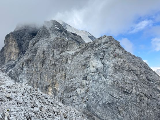
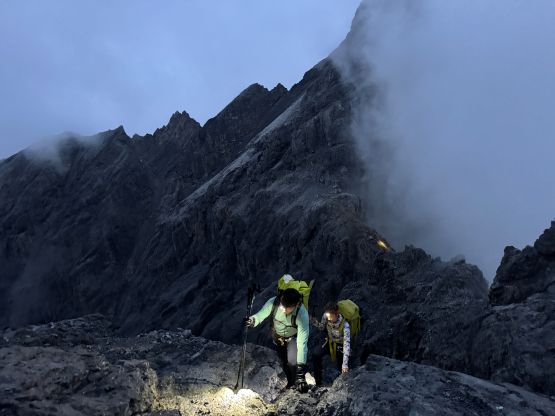
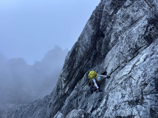
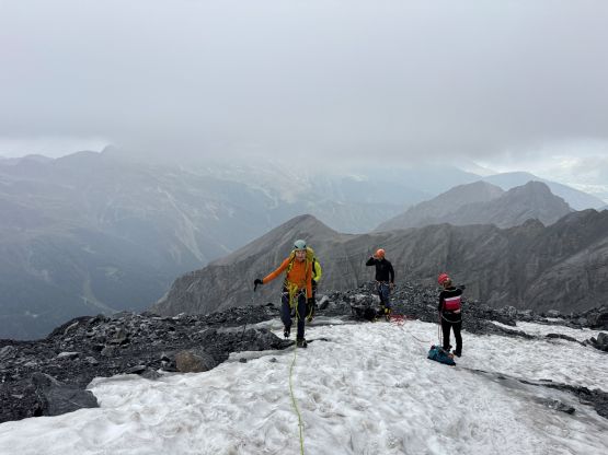
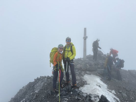
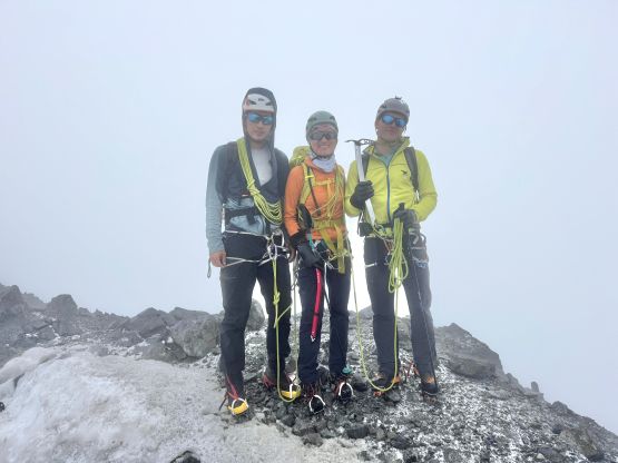
We learnt that the guided parties would all depart somewhere around 4:30-5 am so our plan was to wake up at 4:30 am to start at 5:30 am. I thought we could easily catch up to the guided parties as we were used to the slow clients in North America. We were not correct in that. There’s another problem that they would stop making breakfast by 5 am but none of us was told when checking in. I was in the kitchen at 4:58 am and they did serve me some food, but Erica and Caspar got nothing. They also locked the dinning room sharply after we exited but Caspar’s phone was still there. We knocked the door very hard but got no response, so Caspar did this climb without taking any picture. This was my first ever European hut experience and I cannot say I was impressed. I’d much rather prefer the do-your-own-shit style in the land of freedom called British Columbia. As mentioned earlier we weren’t be able to catch up to the fast European guides so we basically did the route-finding ourselves on the 3rd/4th class rocky ridge, which was much more involved than I thought. The weather was foggy and drizzling, and that didn’t help. We passed one independent party who got confused just like us, and that’s why my 10+ years of mountaineering experience paid off. There’s at least one or two major up-and-down sections with considerable amount of exposure, and lots and lots of 3rd class terrain, sometimes with the chains and pitons and sometimes without. There’s one 4th class difficult move without the aid by those artificial stuffs, and I didn’t quite understand as that move was considerably trickier than everything else. At that point we had just caught up to a guided party and the guide assured us that we were indeed “on route”. The nastiest was definitely the final ferrata section getting onto the glacier, which involved several very difficult moves at the very end. The feet were absolutely black and the chains and ropes were slanted and slippery.


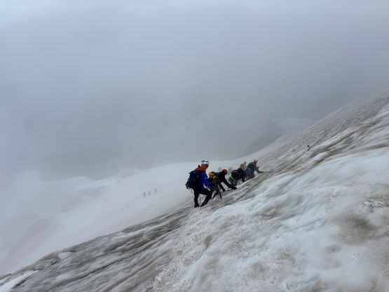
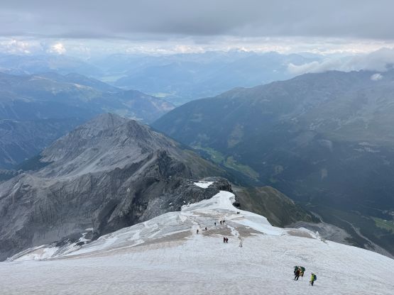
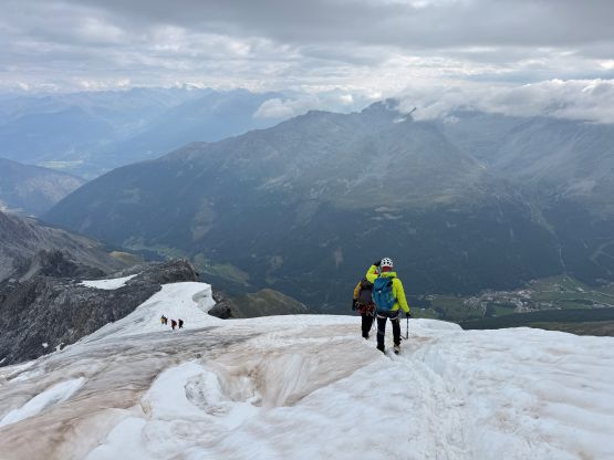
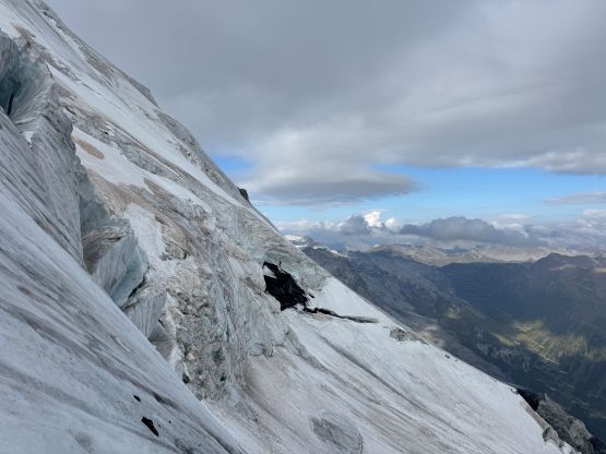
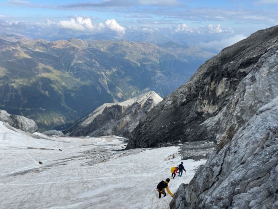
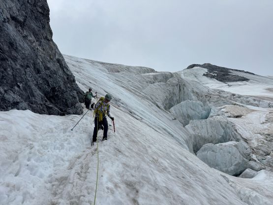
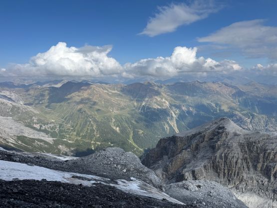
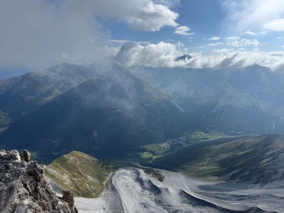
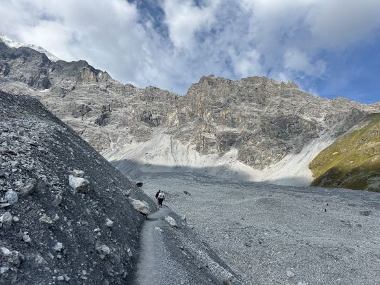
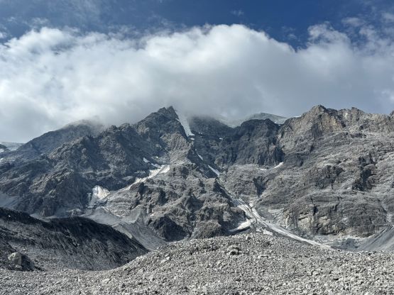
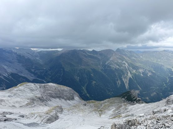
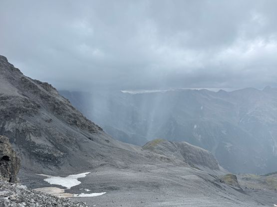
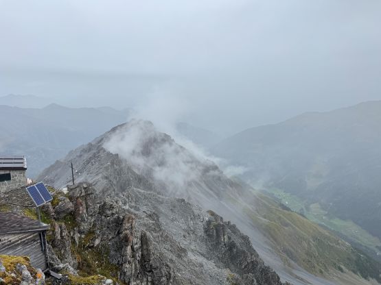
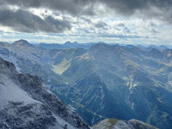
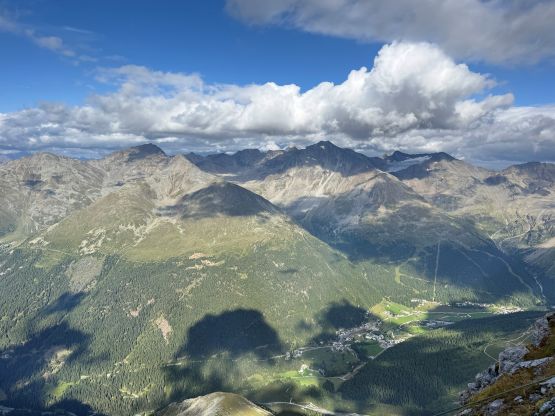
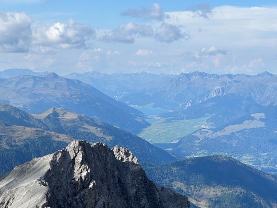
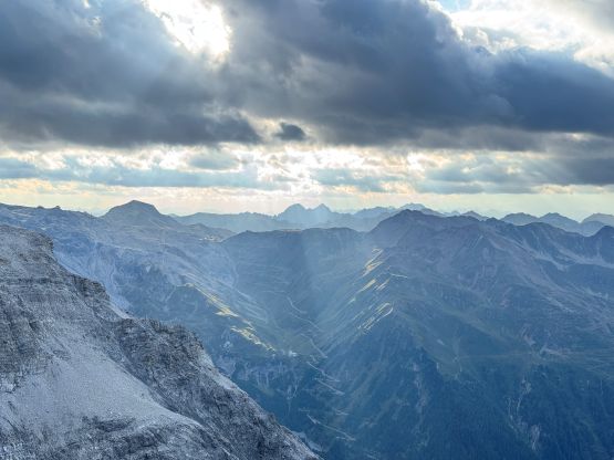
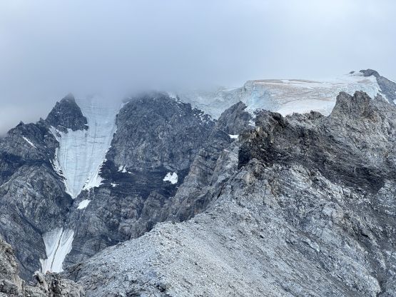
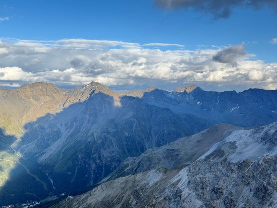
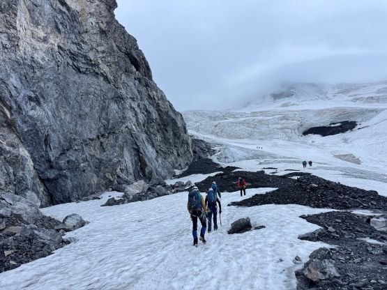
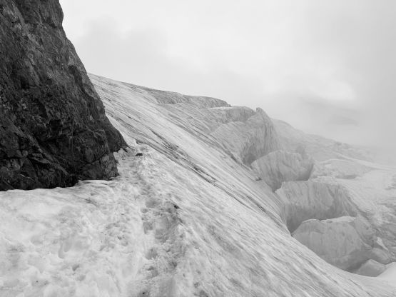
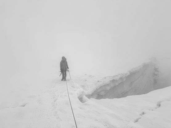
The weather was still completely overcast but the drizzling had stopped. I actually caught some cell reception and did some last minute weather checks. None of the models indicated rain on Sunday so I thought it must be just a layer of morning fog, and I was mostly correct. Later on the descent this layer of clouds dissipated revealing some incredible views, but the ascent was entirely done in the fog. I knew from the satellite images that this glacier was supposed to be quite serious in the late season so we properly roped up, and that was definitely the right call. We encountered numerous sketchy snow bridges and there was absolutely no overnight freeze. There was thankfully a well-defined path so we had no route-finding issues. We encountered two patches of low-angled ice with a little bit of easy mixed terrain. The second pitch of ice had a short stretch of 35-40 degrees but the steps had been cut, so I wouldn’t classify this as “ice climbing”. Higher up the terrain became mellower but we encountered a few more sketchy snow bridges, with one being particularly spooky. At this point we had caught up to and passed several guided parties but also started to encounter the descending parties. I asked if they had broke through the cloud layer and the answer was negative, so we reluctantly accepted the white-out view from one of the more important summits in the Alps.
The guided parties were considerably slower than us on the descent so we finally started to pass them one after another. It took us no time to descend to that aforementioned spooky snow bridge and upon closer examination we decided to follow some guides detouring around it. Descending the icy patches in the queue required lots of care. In one occasion I was on purposely giving the party ahead some space as I knew the three of us could catch them up easily, but the guide behind me shouted at us and he wasn’t even speaking English. I understood that he probably thought I was taking pictures or was scared, but that’s not true. I yelled back and initiated a verbal fight as I absolutely hated being told what to do. I honestly don’t understand why a lot of friends of mine had that “European dream” because for one, I hated the food there, and two, I found a lot of the Europeans are very rude. Maybe it’s because the Canadians are too nice. In any case we kept descending and passed more parties. We kept the rope tight all the way to the end of the glacier, and then scrambled up the ferrata and passed more parties. The re-ascent of that sketchy section felt much simpler. There were considerably more queueing on the rocky ridge. There’s no point in rushing anymore as the weather was actually improving and the views were starting to reveal. Once back to Payer Hut I quickly repacked and dashed down the trail, because Adam was waiting for me and I needed to drive 4+ hours towards Zermatt to position myself for Matterhorn on the following two days. Erica and Caspar had a slightly different Matterhorn itinerary that allowed them to take their time, so we did not descend together, but that’s okay.