The Defendant and The Witness
June 20-21, 2026
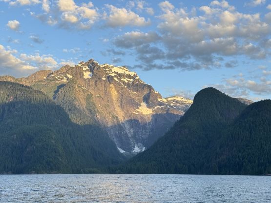
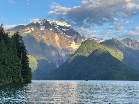
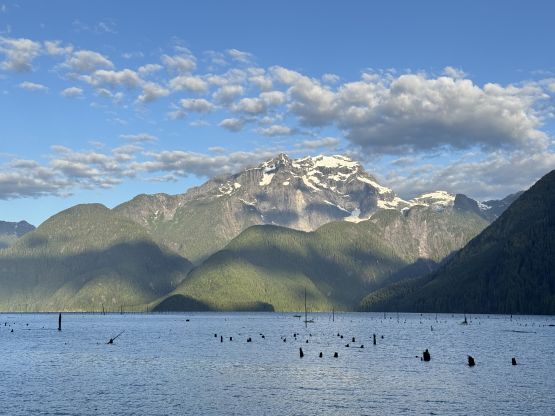
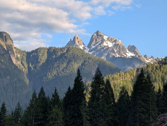
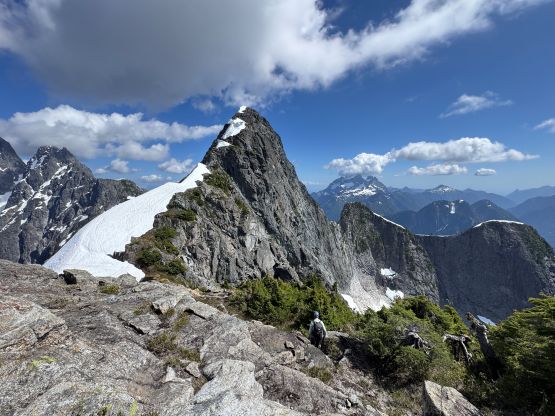
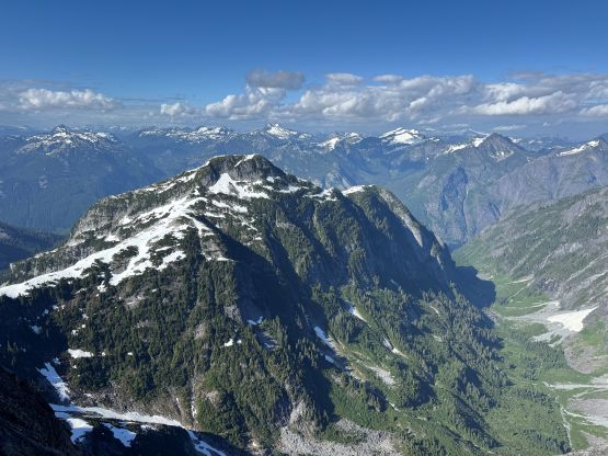
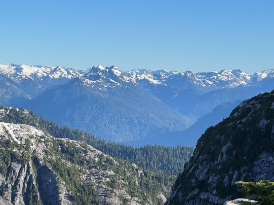
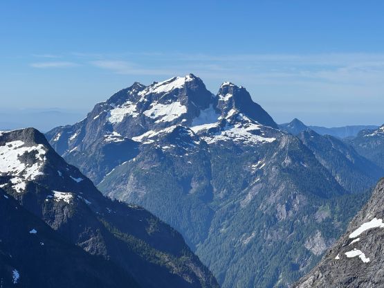
1884m
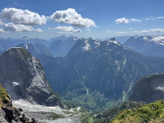
Golden Ears Provincial Park, BC
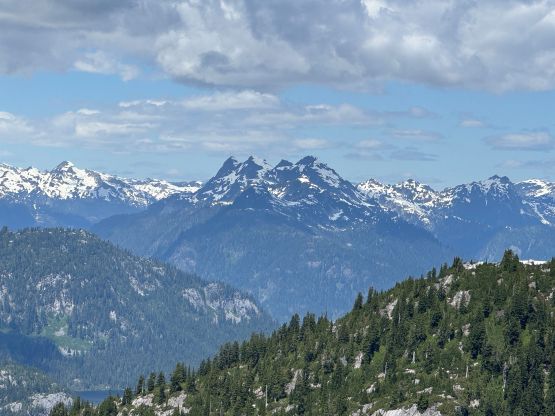
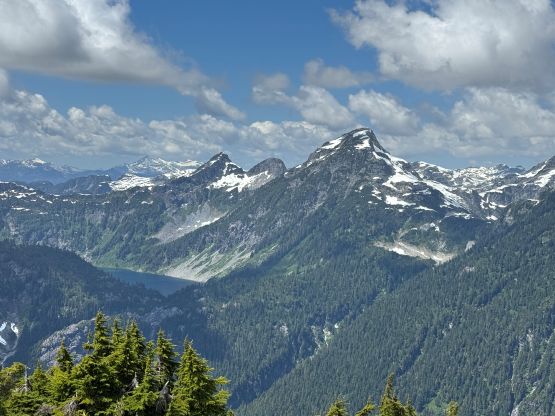
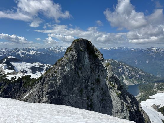
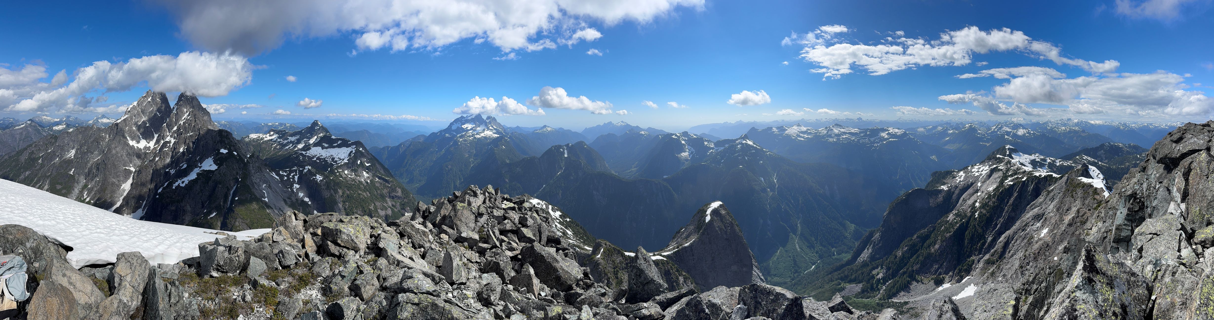
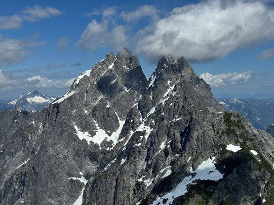
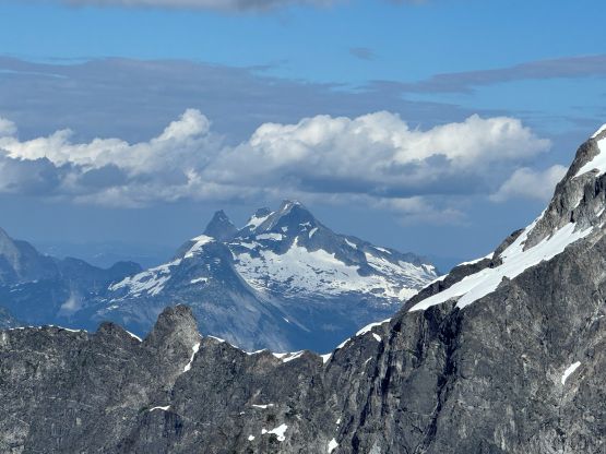
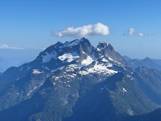
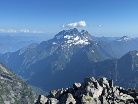
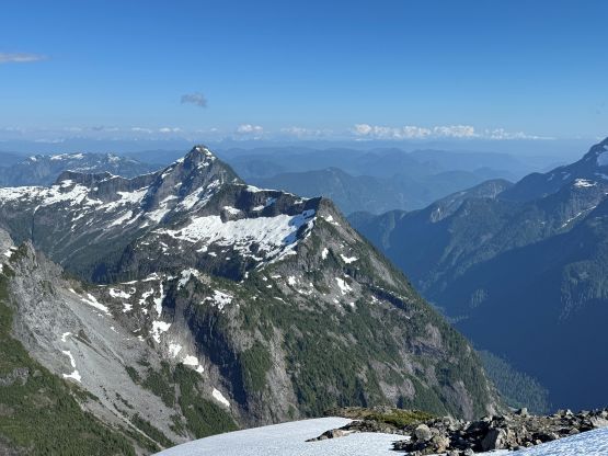
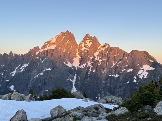
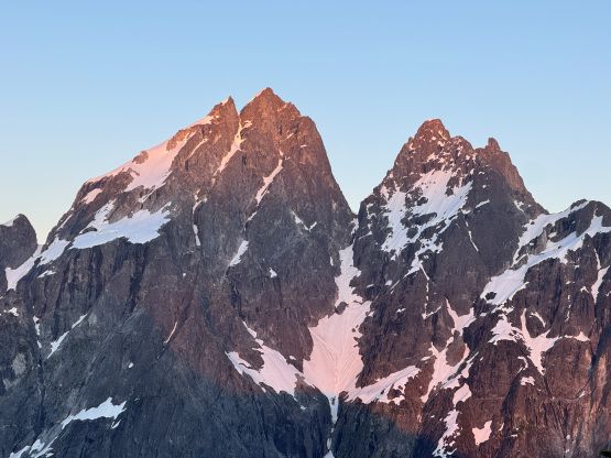
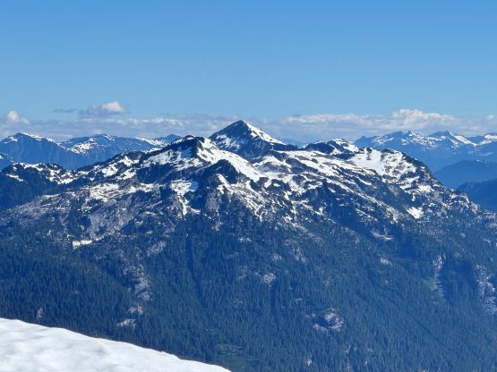
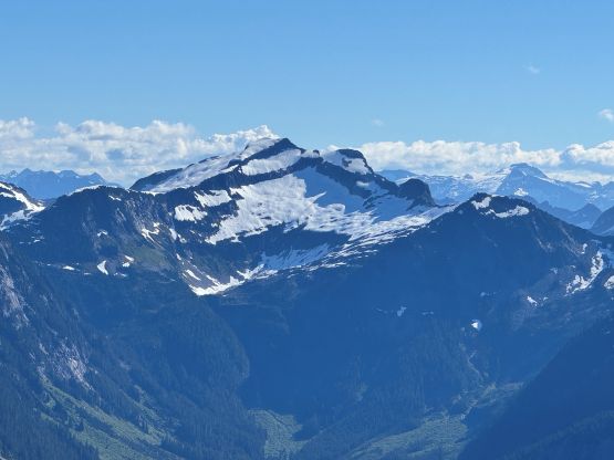
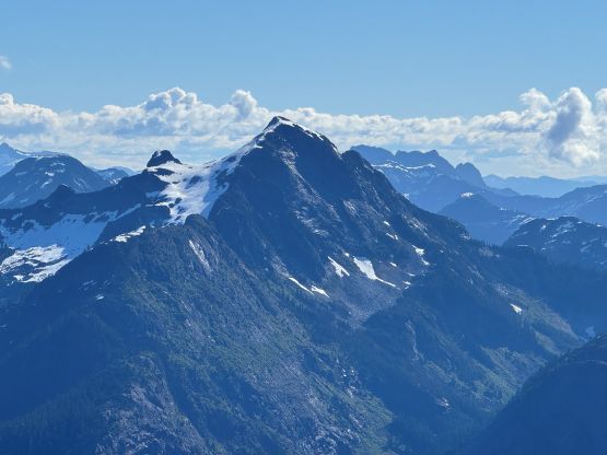
The Defendant is tucked behind and somewhat overshadowed by Mt. Judge Howay but itself boasts over 800 m prominence above Defendant/Judge Howay saddle, and has some very esthetic and rugged looking profiles. This is a rarely known objective and in fact, there were only three documented ascents – the FA (1991 John Clarke et al.), the Michaels (2022) and the Gulkas (2023), all by different approaches but all climbed via the NW Ridge. The Witness is less challenging but presents its own obstacles, but for those approaching from the Stave River valley The Witness can be tagged as an “add-on” without too much trouble. I had these peaks “planned” for quite a few years since I finally found a local contact who’s willing to boat me (and my team) up the Stave Lake followed by providing a ride up the Stave River FSR, but I was too busy with international travelling in the past few years. This year happened to be the first one in a while that I no longer had summer travelling plans, so the trigger was finally pulled. I convinced Trevor and Francis to come along, and by skipping the canoeing and biking parts of the expedition we thought these peaks could easily be done over a weekend home-to-home, and we were correct. In fact, with this trip report coming out they should be very doable as a single day push from the river, as our “moving time” was only 11 hours, but I do think the bivy high up on the ridge is a spectacular one that we were all glad to have that part of the experience soaked in.
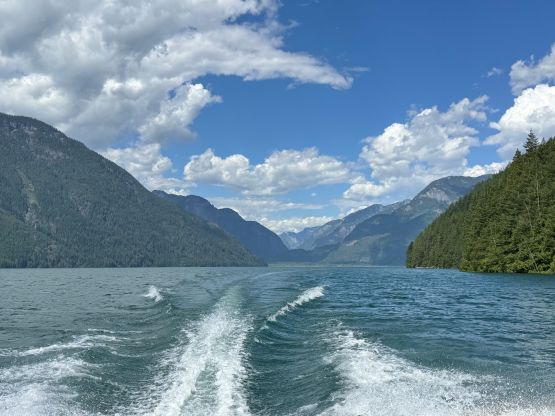
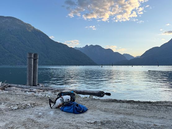
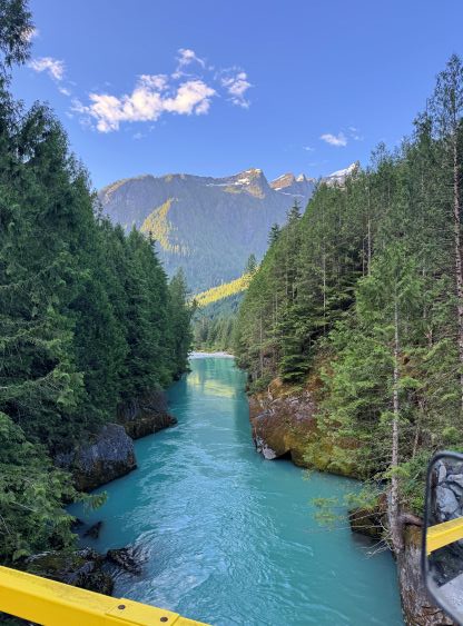
The local contact wanted to stay low key so I’m not allowed to provide much information and in fact, the deal was made specifically that this is not going to turn into a public service for Mt. Judge Howay so don’t even bother to ask me how we got there with such efficiency unless you are one of my regular climbing partners. Anyway the three of us met our boat driver at the Stave Lake’s boat launch at 5 AM on Saturday and within an hour we were on the far side of the lake. Another hour later we were at 23.5 km up the FSR gearing up for the bushwhack. My original plan was to simply follow the Gulkas’ route as they had the GPX and “beta” published but apparently it took them over 9 hours for the bushwhack from the river to the bivy under The Witness, and those guys are animals when it comes to bushwhacking. Trevor dived a bit further on the internet and “deduced” that the Michaels must have gone up a different way based on one of their comments on Chris Gulka’s Mt. Kranrod’s video or trip report. Francis and I then went back to the maps and our hypothesis was that the most logical way would be by thrashing up to Judicator Lake since there’s also some indications that they had visited that place. After a bit of thinking the three of us made an agreement on the plan, that if there’s indeed a “better way” then this had to be it, and I even thought we should make a circumnavigation of Judicator Lake counterclockwise. The trip had suddenly turned into an exploratory mission, but we were actually more excited about that. In terms of the gear I opted for the ultralight combo – open bivy, trail runners, aluminum ice axe and crampons. We did carry two 30 m ropes and a very light rock rack but as expected, those turned out to be training weight. If the Gulkas were able to scramble everything then we most likely also could, and we were correct.
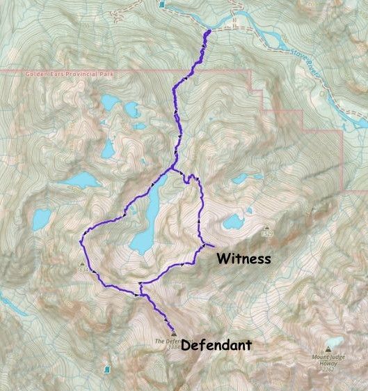
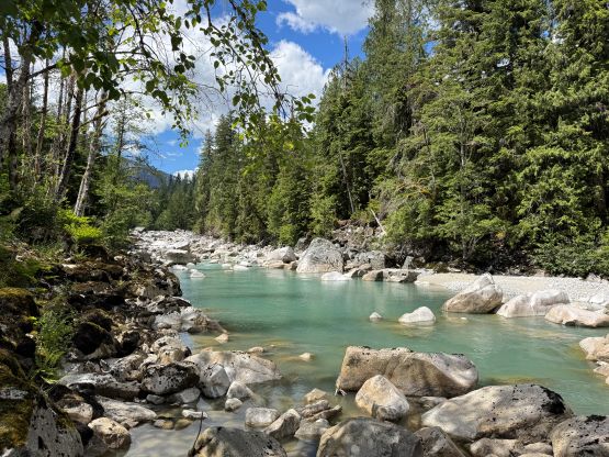
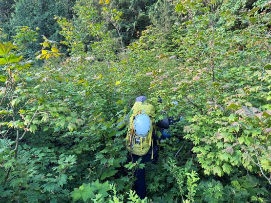
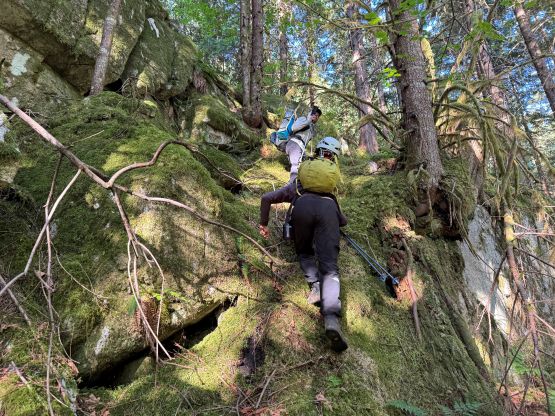
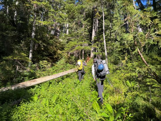
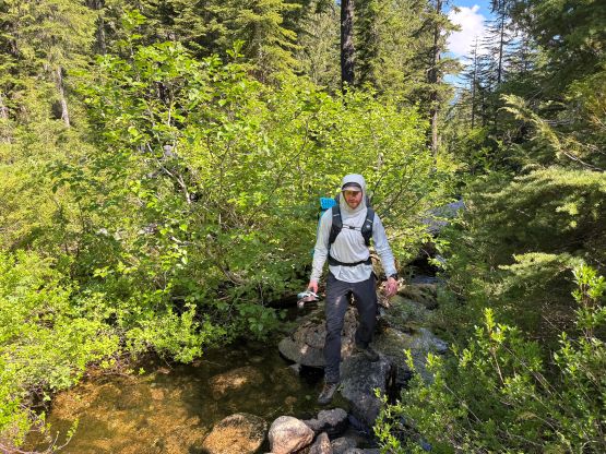
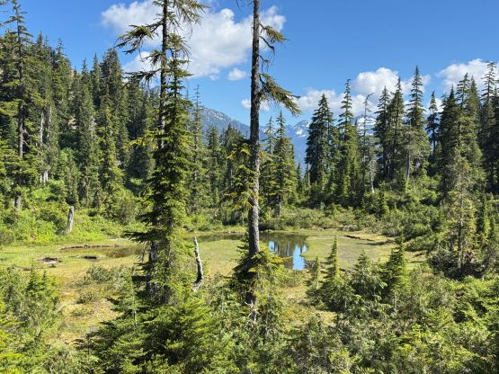
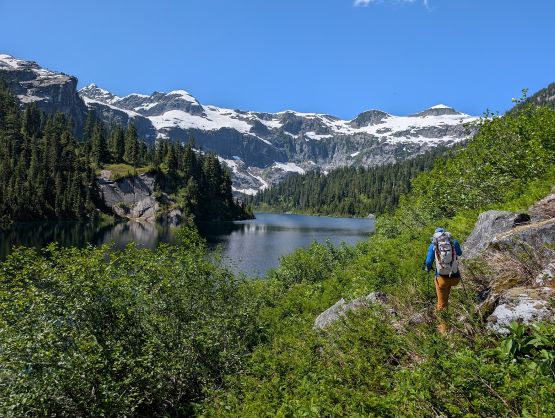
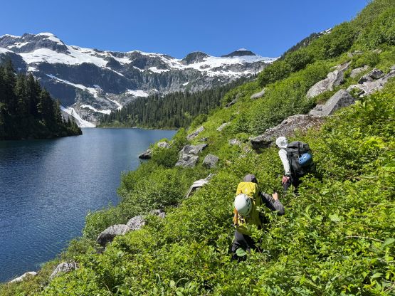
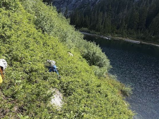
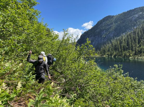
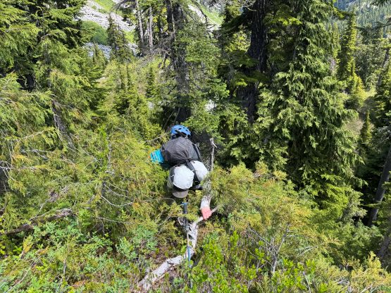
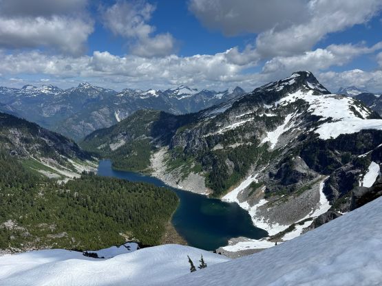
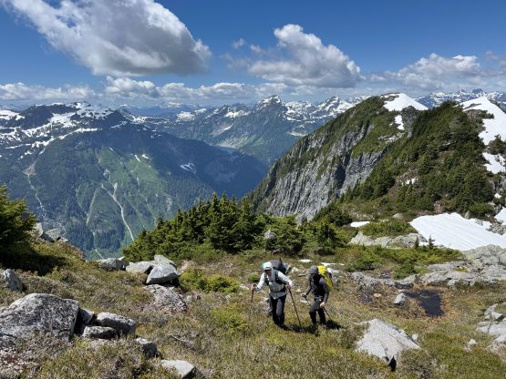
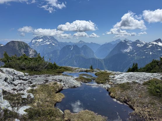
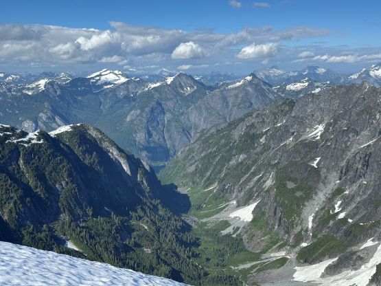
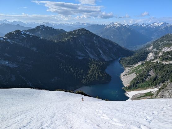
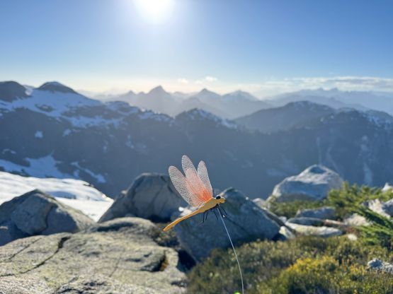
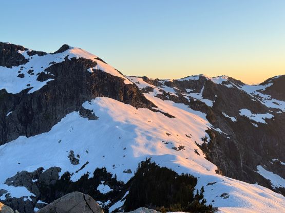
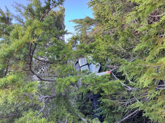
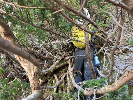
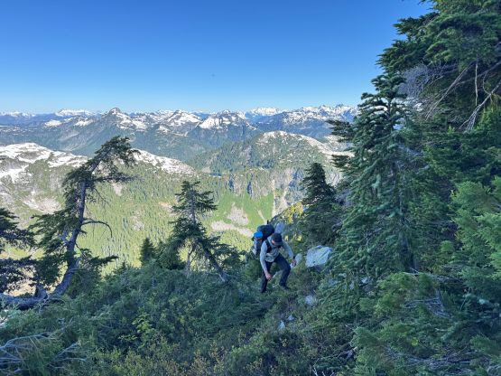
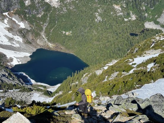
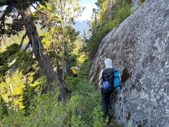
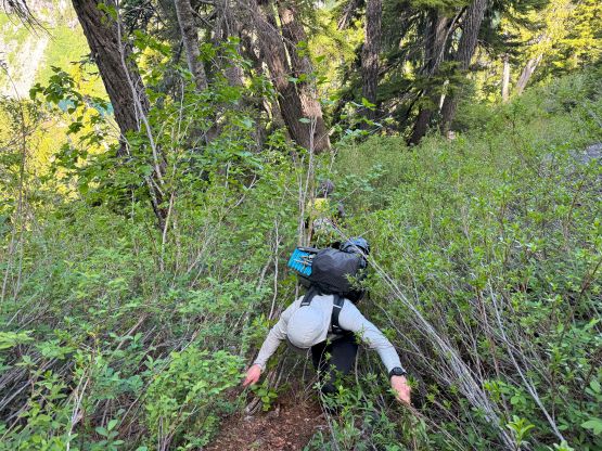
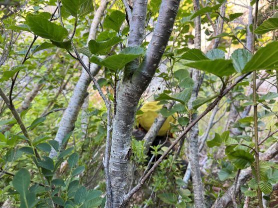
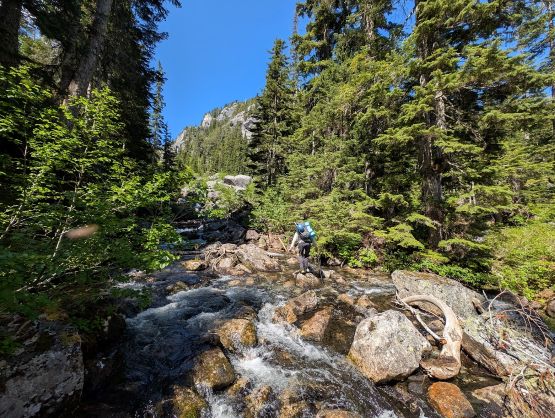
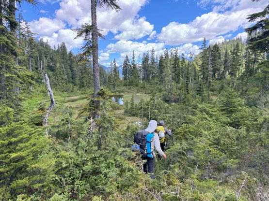
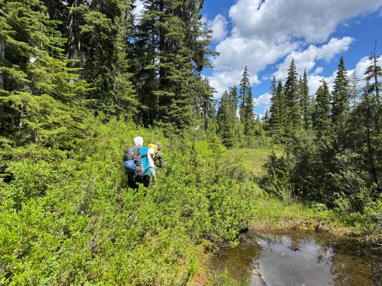
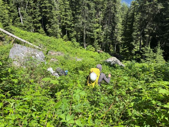
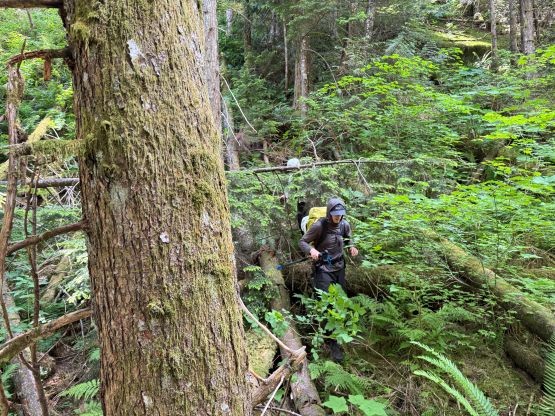
The main creek that drains from Judicator Lake was basically a waterfall so we drove a little bit up “Lamont Creek FSR” to scout things out. The decision was eventually made to stay on the west (climber’s right) side of the creek and the plan worked out reasonably well. Francis had the LiDAR map whereas I had both Outmap and Gaia with multiple layers loaded for offline use. There’s an intense band of alders right at the start but the forest opened up nicely afterwards. We then had a cruise sail to the park’s boundary, gaining 400 m elevation in no time. Passing the park’s boundary the going became rougher but the bushwhacking was still very tolerable, at least by this area’s standard. We scrambled up a bluff (class 4) to scout things out and I took out the dragonfly toy for the first time. It did seem like it’s working a little bit in keeping the mosquitoes at bay. The terrain or the path of the least resistance then “forced” us up towards climber’s right away from the main creek but thankfully we checked the GPS and confirmed that we were quite a ways off course at 800 m elevation. We then did a long rising traverse towards a “key gully” at 900 m and this traverse sucked with lots of BW3 bushwhacking. We stayed too high and had to deal with some nasty devil’s clubs as well as at least one class 4 step to cut into the aforementioned gully but it appeared that we could partially avoid that on the return, so we took note about that. The gully itself was greasy with more thorny plants but the going wasn’t too ridiculous. Before realizing we were already traversing onto the kilometer-long meadow leading towards the lake’s outflow. This meadow wasn’t as smooth going as I was hoping for, but was still better than the forest below. There was fair amount of swamps to negotiate, and the last 50 m elevation gain to the lake involved lots of car sized boulders. Nevertheless we made to Judicator Lake in less than 3 hours from the start and this was certainly not shaping up to be a “9-hour bushwhacking ordeal”.
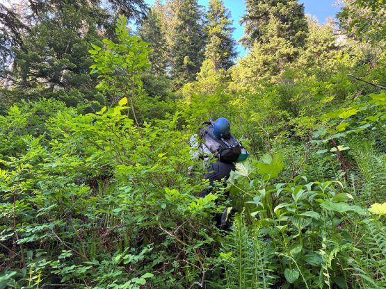
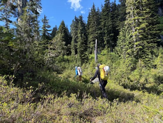
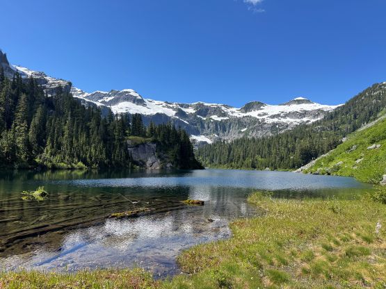
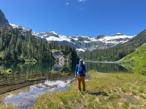
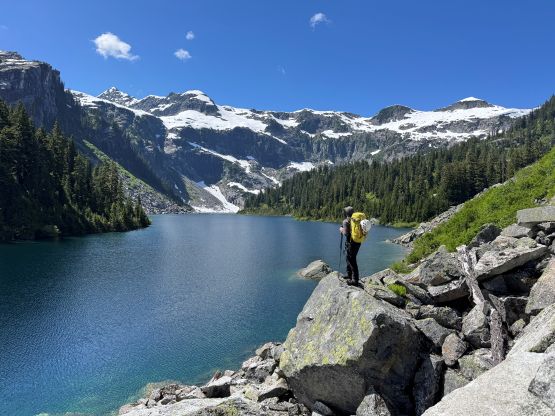
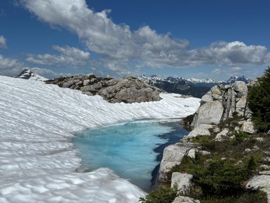
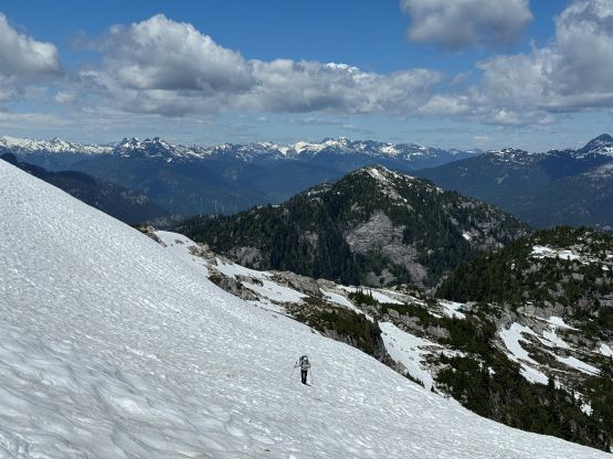
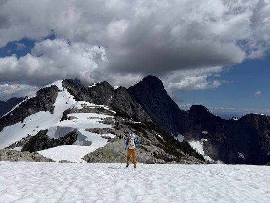
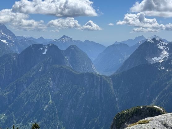
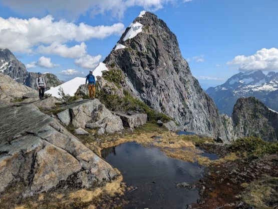
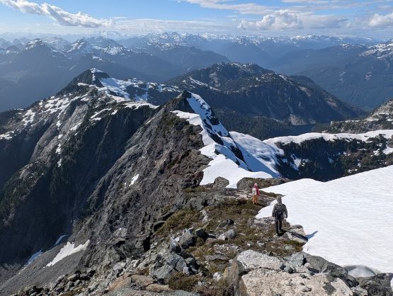
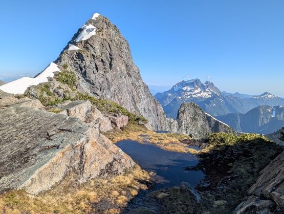
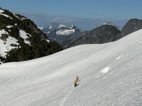
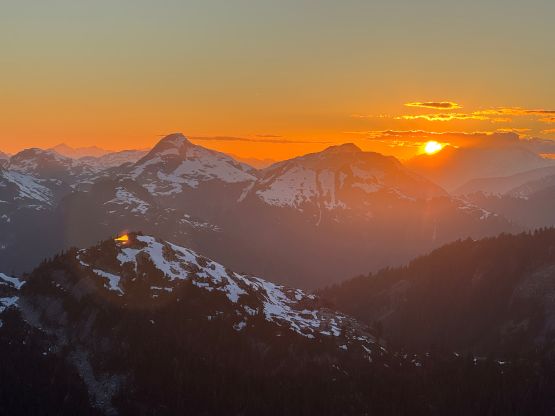
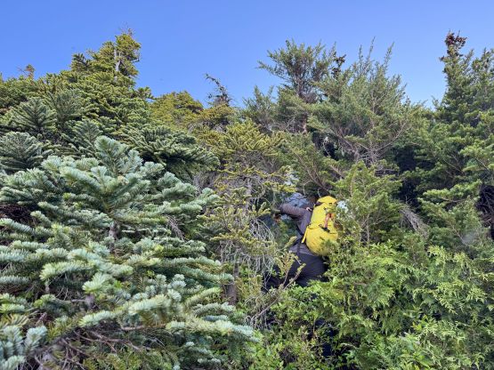
After a mandatory break at the lake’s outflow mostly to filter the water and stay hydrated we discussed our options. The decision was to keep the original plan, that was to thrash around some nasty stuffs to a series of boulder fields visible on the satellite images. They hopefully could lead us onto the ridgeline without too much issues. The bushwhacking around the lake was indeed heinous with lots and lots of thorny plants. At one point the going was too thick that we were forced to make a contrived way by going up and around some stuffs. The boulder fields were separated by more thick brushes but at least the going was mostly in the open. We took a couple more breaks refilling the water bottles but eventually we did dragged our tired asses onto the ridgeline. There are two P100m objectives (possibly unclimbed?) behind but they weren’t attractive and we weren’t in the mood of backtracking. We then bypassed the first major bump by side-hilling on soft snow (no ice axe/crampons needed), but then went up and over the second bump. It seemed like we were moving too quickly and the clouds were starting to engulf the peaks. I happened to catch some sporadic cell reception on the ridge and the weather forecast predicted a clearing tread in the second half of the day, so we took our shoes off and took at least an hour-long break. It seemed like the clouds were lifting so we relocated to the point where the Gulkas’ GPX track joined ours, ditched some gears and took another long break.
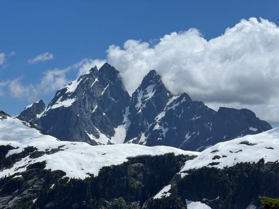
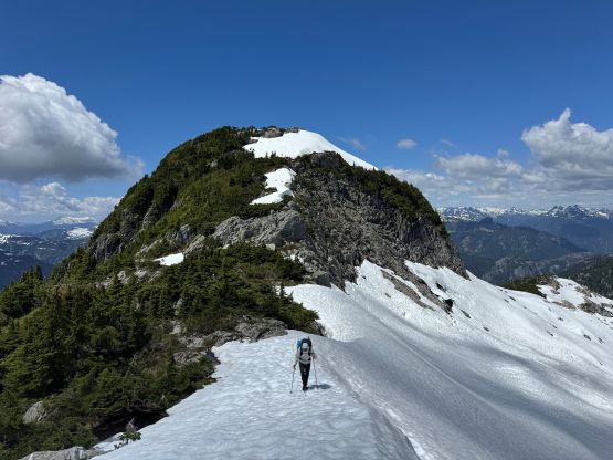
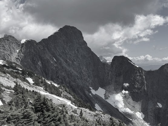
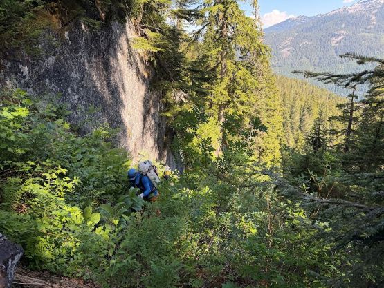
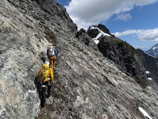
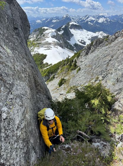
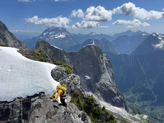
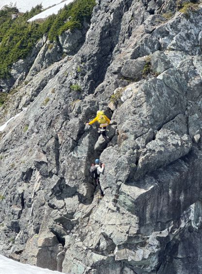
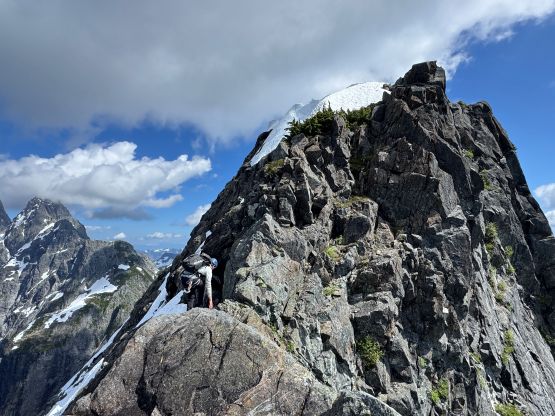
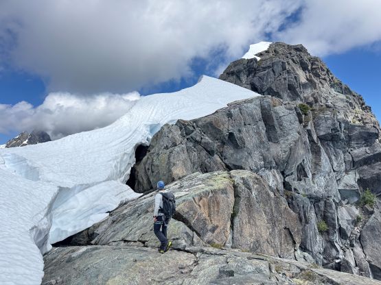
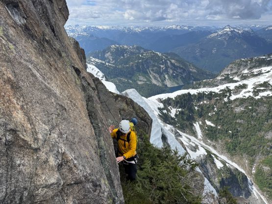
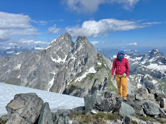
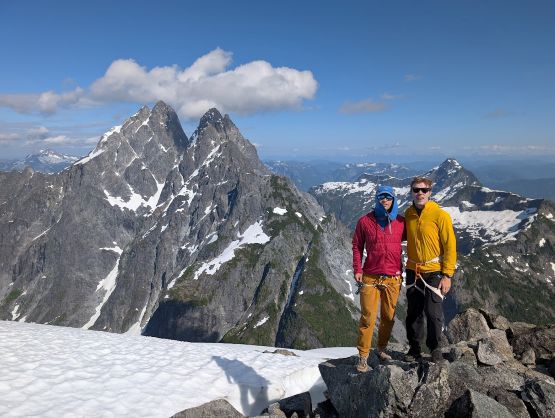
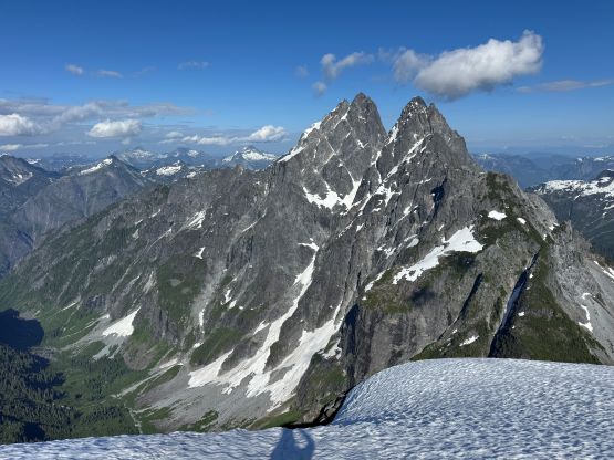
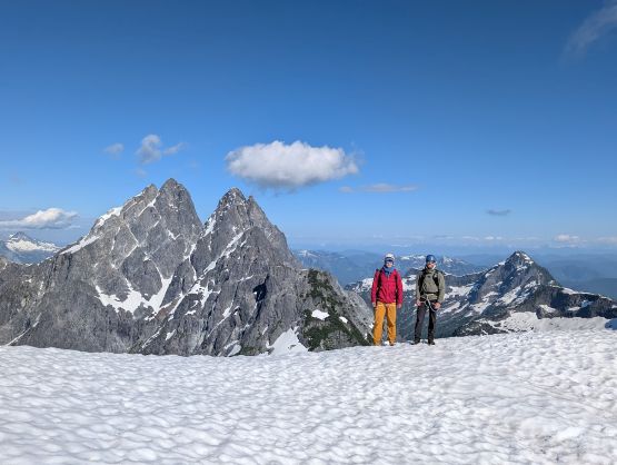
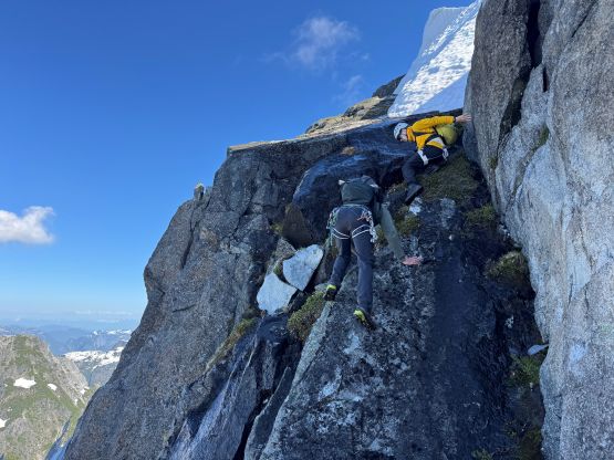
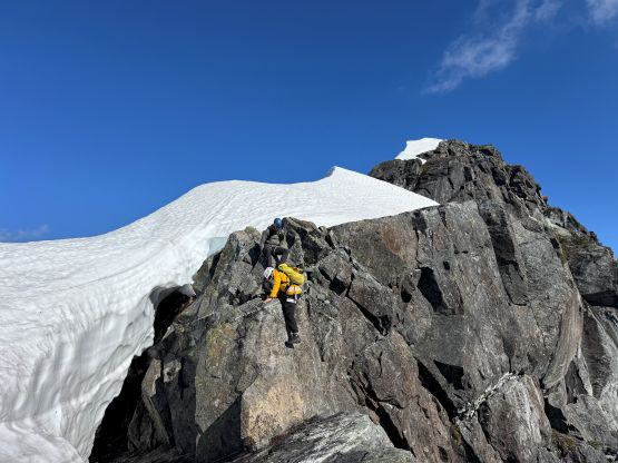
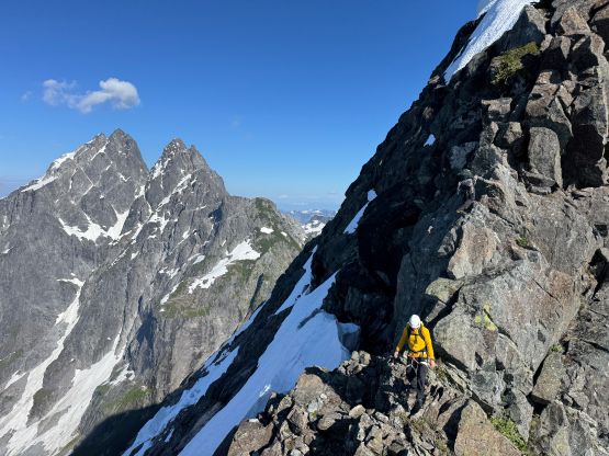
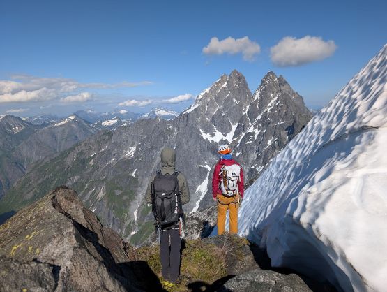
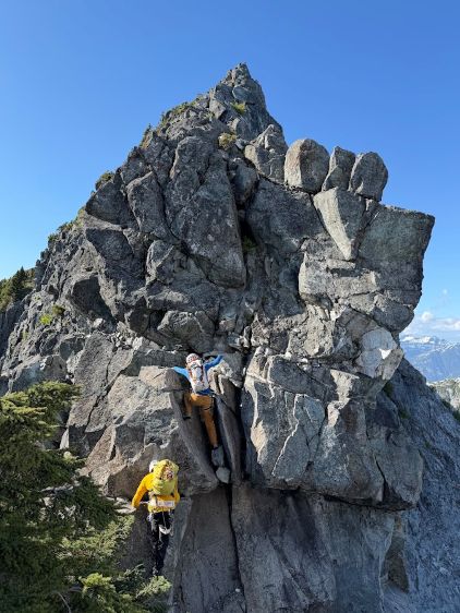
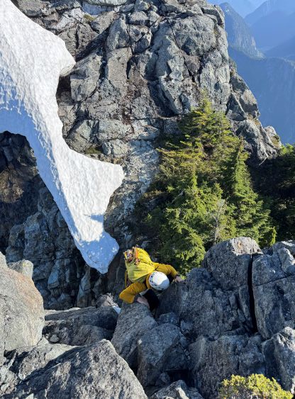
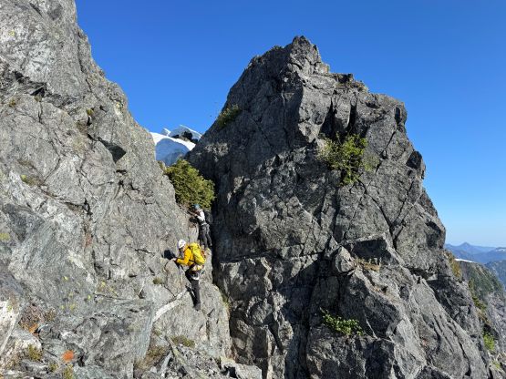
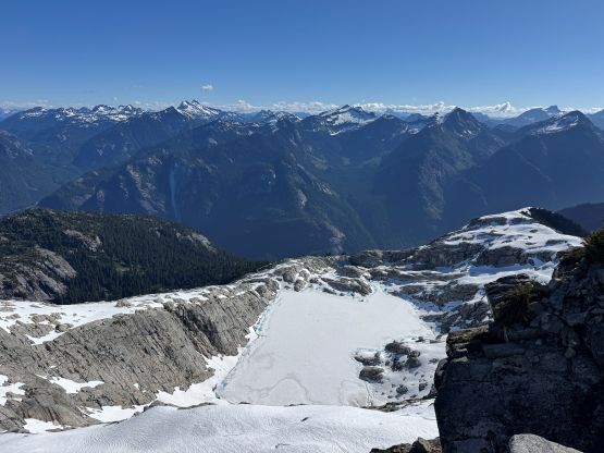
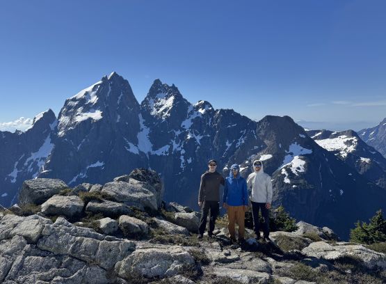
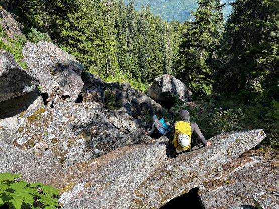
After donning harnesses we started up the NW Ridge. I actually did not read about the route description on bivouac nor bothered to dig out the Michael’s pictures posted on another Facebook group, as we were confident on our own route-finding. We ended up doing exactly as described by the first ascent party on bivouac.com, minus the rappel off the second bump. The first bump was indeed bypassed on the SW side on ledges and some class 4 scrambling in a bushy chimney brought us back up on the ridge. Down-climbing from the second bump had some very exposed moves on questionable rocks, but the terrain stayed within the realm of “class 3/4” until the last 10 m. I actually didn’t know that John Clarke’s group rappelled it and I thought it was somewhat doable by down-climbing. I was also wearing the Arc’teryx approach shoes so I just did the down-climb which felt like around 5.5. Francis and Trevor are much better rock climbers so they had no issues following, and little did we know that this was basically the crux of the route. There were a few more class 3/4 sections until the upper crux where the Gulkas described as a boulder problem. I couldn’t remember the details as my chat with Seb about that section was already 2 years ago. Attacking directly would be at least mid 5th class (not quite soloable for me) so I led a line traversing left on some wet and greasy ledges. This brought us to a step that I instantly recalled from the Gulka’s trip report. A few 5.4 ish moves later I went further climber’s left onto another wet and greasy ledge, which was followed by a chimney climb with one side stemming on snow (low 5th class). Reading the Gulkas’ report later I think they went right after that vertical 5.4 step, but either way worked as “low 5th class”. Minutes after that we were on the summit. It had taken us only 8.5 hours from the river to the summit so there’s no point in rushing. We lingered up there for at least another hour before deciding to descend. I also caught some sporadic services but the reception was only strong enough to make a Peakbagger update.
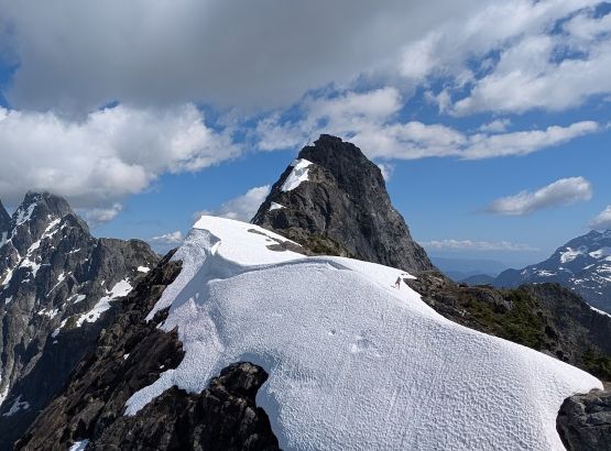
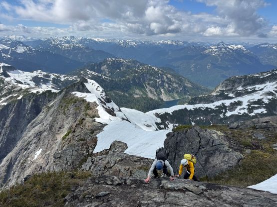
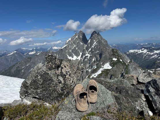
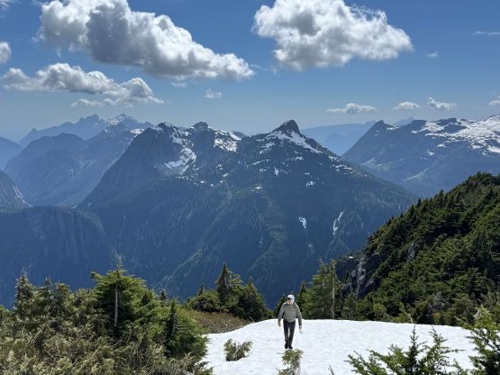
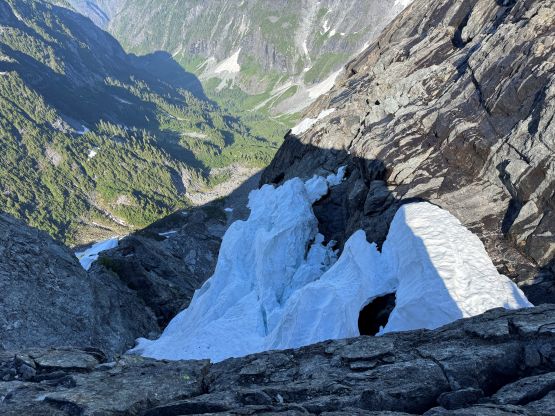
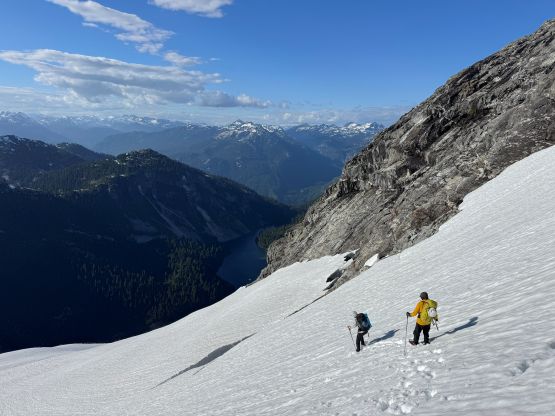
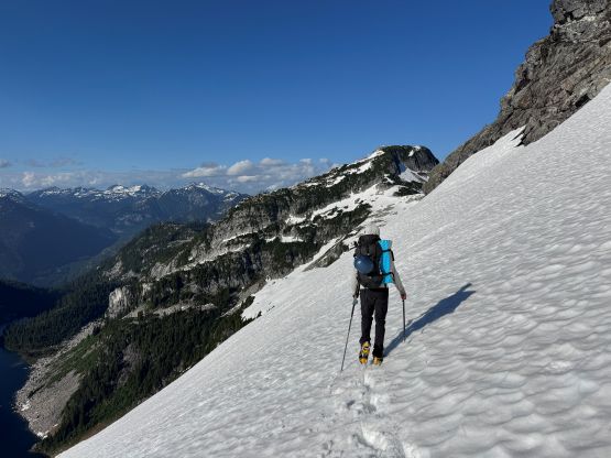
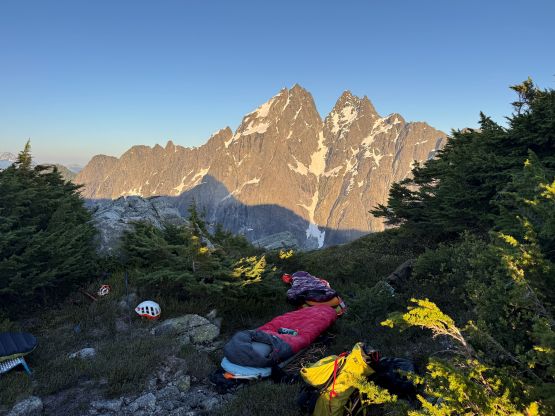
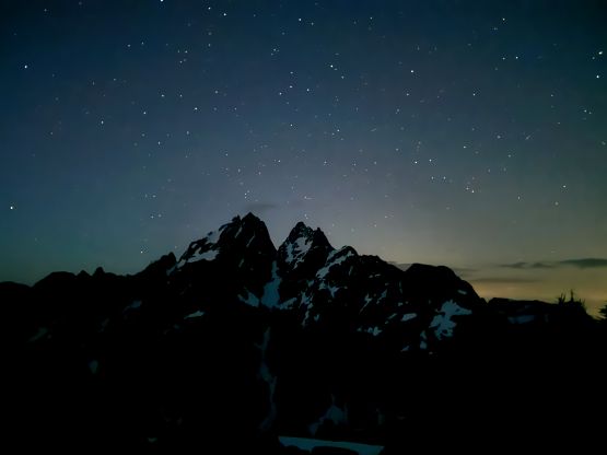
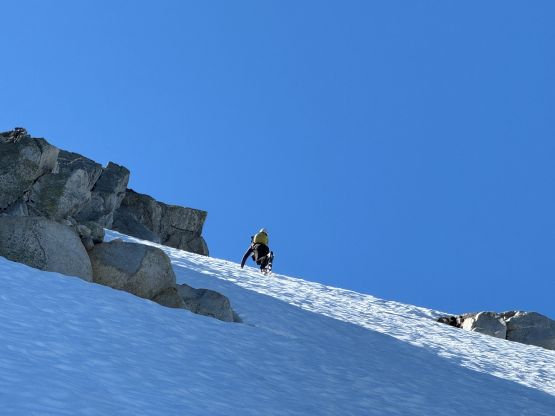
Down-climbing that upper “boulder problem” step felt harder than on the way up, but with patience I was able to solve the sequence of the moves. We then had a cruise sail down the ridge enjoying the views. Up-climbing the lower crux was infinitely easier, that in no time we were back to the notch between the first two bumps. We each had ditched one trekking pole there so we picked them up and down-climbed that bushy 4th class chimney, and that’s basically it for The Defendant. The plan was to camp somewhere between The Witness and The Defendant so we had to descend the steep snow around the bottom of the NW Ridge. This was good as the snow would be easier to descend in the late afternoon when it’s soft. We all strapped the crampons on and took one ice axe out, but I didn’t think they were “needed” in the end. I could have walked down in just the trail runners. There was no obvious camping spot at the Witness/Defendant col so we slogged all the way to the 1550-m bump on the south ridge of The Witness. We found one area that could lay three sleeping bags and there’s one pool of water around. The water was not running so we had to take the filter out, but that was still much better than melting snow. We still had about 2 hours of daytime so we took the evening routine leisurely. My shoes and socks were already dry by the time we headed to bed, but the condensation was bad. My sleeping bag was already wet by just laying there. I had brought an emergency tarp and ended up using it. The night was also quite cold in the +2C sleeping bag, and that tarp provided a bit of extra warmth as well. I also wore everything that I had brought including the bug jacket, but I did get a good night of sleep.
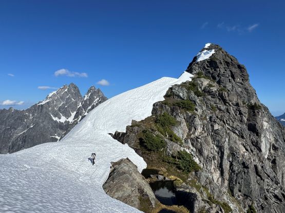
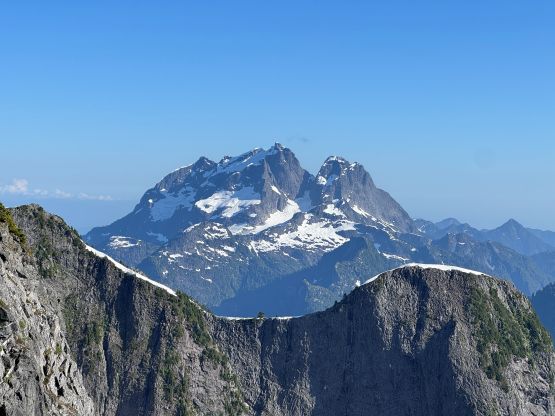
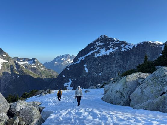
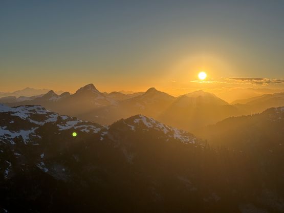
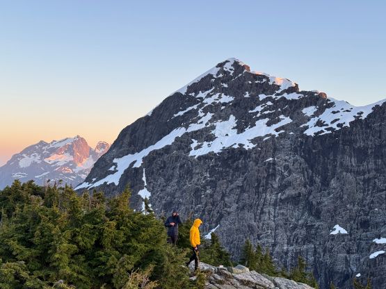
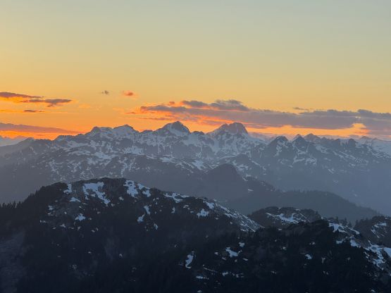
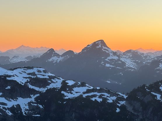
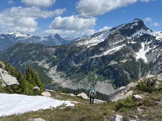
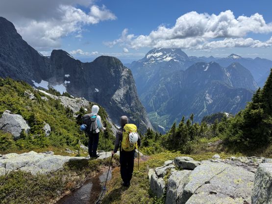
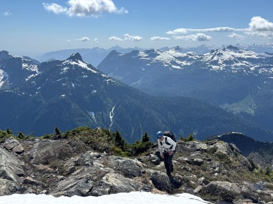
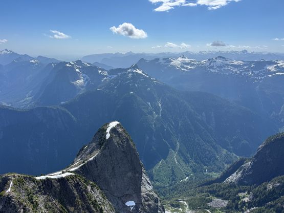
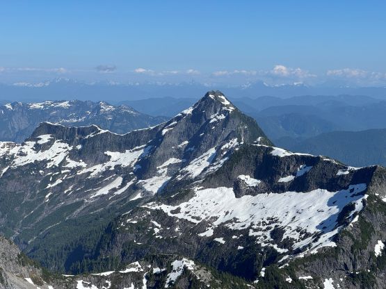
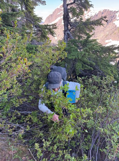
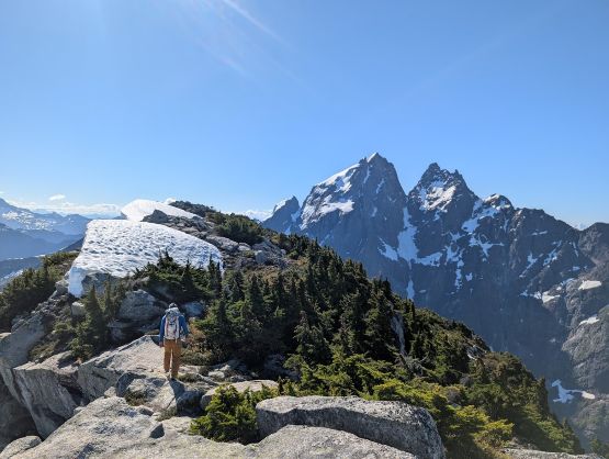
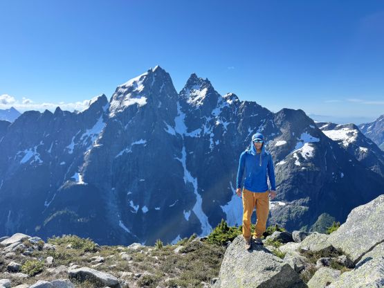
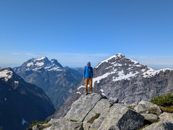
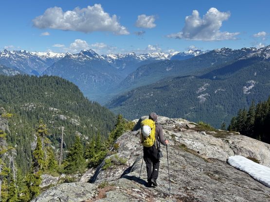
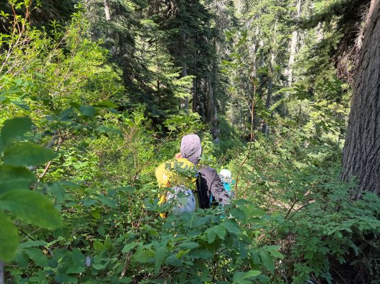
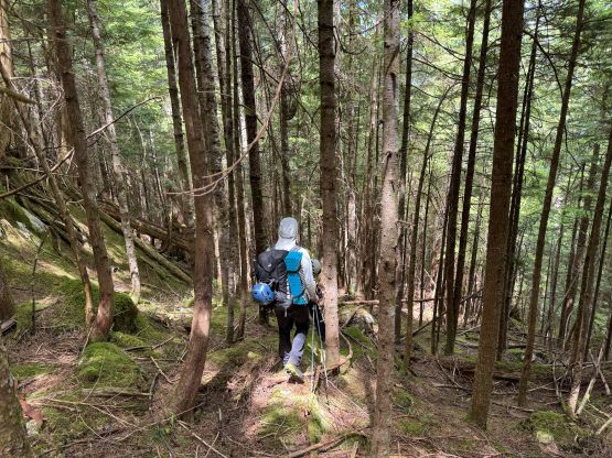
The next morning we slept in till 7 AM when we finally got hit by the sun. It went from “too cold” to “too hot” within 15 minutes. We talked about the options to get up The Witness and there weren’t really many. We agreed to more or less follow the Gulkas’ GPX track but once the bushwhacking started we were too focused to check the GPS screen, so we ended up doing our variation and stayed mostly climber’s right of the Gulkas’ route. There were several stretches of class 4 vertical jungle and needless to say, the going was intense. The route worked out though, and we soon found ourselves traversing the foreshortened summit ridge towards the second summit of this trip. The views were also excellent with a slightly different perspective of Mt. Judge Howay.
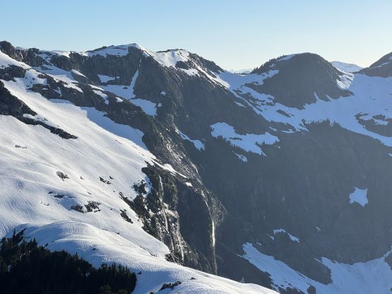
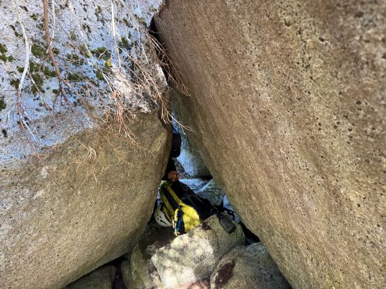
After another long break we reversed the summit ridge and descended the NW flanks. The intension was to follow the ridge but it became obvious that descending the snow slopes was quicker and easier. We did have to take the ice axes out for one stretch but the crampons weren’t needed. Getting down towards the outflow of Judicator Lake was the experimental part of this loop traverse that I had no idea if it would go as a “scramble”. That’s the main reason why we opted to do the counterclockwise loop, as we could always rappel using the 60 m ropes we had brought. The three of us took turn leading and we really resisted the temptation to start rappelling, so by weaving back and forth with the aid from the Outmap 3D pro maps we indeed nailed a “scramble route”. There were a lot of intense vertical thrashing and vege belay, that ascending this route would be ultimately tedious, if not impossible. Francis then led another stretch of intense bushwhacking to get us down to the meadows under the lake’s outflow. I had concerns about the crossing of the main creek but we ended up finding a spot to hop across on boulders. We didn’t even need to take the shoes off. The rest of the descent was uneventful but took 2.5 hours. We mostly stayed on our own track but did a few variations particularly around that gully-of-devils-club. I also got impatient at the very end and missed the “easier” exit. I ended up doing some BW5 bashing to get back to the road but the others found the better way around.
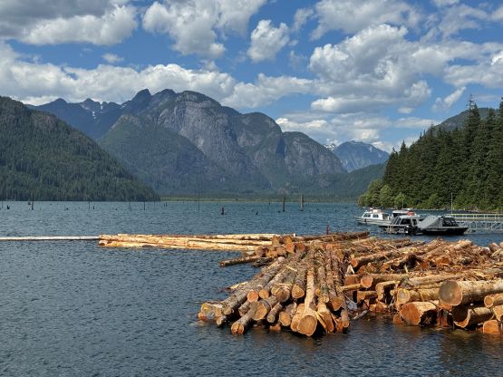
We all went down to Stave River for some refreshment since we were about 20 minutes faster than anticipated. The pick up however, showed up slightly earlier than expected so we rushed back to the road and then enjoyed a scenic ride down to Stave Lake. The boat ride was also uneventful but scenic. I unfortunately lost my sun glasses in the bushwhacking so the lake crossing was a bit sore on my eyes, but it all worked out. We finished the trip by “mid afternoon” and another hour later I was already home waiting for dinner. Another thing worth noting is that I had brought a brand new pair of gardening gloves from Home Depot and used that for pretty much all of the bushwhacking sections, and I was glad to have them. Some sort of hand protection won’t be a bad idea for the thrashing in this area, particular.