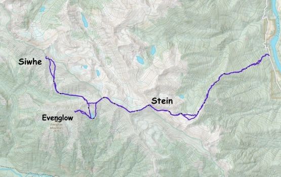
Stein Mountain, Siwhe Mountain and Evenglow Mountain
June 13-15, 2026
2843m
Lytton, BC
Siwhe Mtn. is one of the highest peaks in the loosely defined region of SW British Columbia with the nearest higher peak being Mt. Brew, somewhat 25+ km away to the north. These peaks are connected via some high ridge systems so there’s only 800 m prominence. What really makes Siwhe Mtn. special is the remoteness as at a distance reasonably close to Vancouver this peak requires at least 1 full day to approach no matter what. The most logical way had been from Texas Creek but the road’s gated and decommissioned by the First Nations a couple years ago, that even a dirt bike couldn’t have made it. Nowadays one has to climb it from Fraser River which is basically a sea-level assault, and any of the 4 published approach options involves arduous amount of up-and-downs on mostly unpleasant terrain. Because this peak is known to be tough for decades I’m giving a bit of a review besides providing my own trip report.
- Walk or bike up Texas Creek FSR to near Devil Peak
- Bushwhack up Siwhe Creek to either N/NE Ridge (Fred Touche, 2003) or contour further E. and to SE Face (ClubTread, 2012)
- Stein Valley to Ponderosa Creek (Ben and Amy Eby, 2024)
- High traverse from Stein, north side bypass (Alastair Ferries 2011)
- High traverse from Stein, south side bypass (Seb Gulka, Dean Perez, 2026)
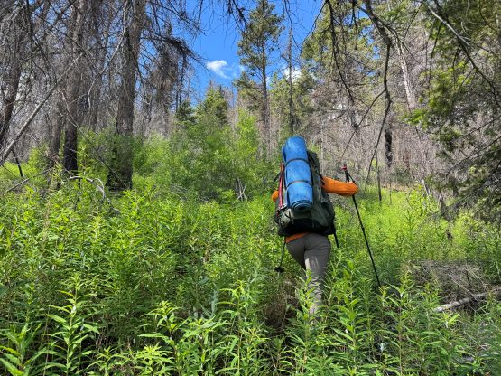
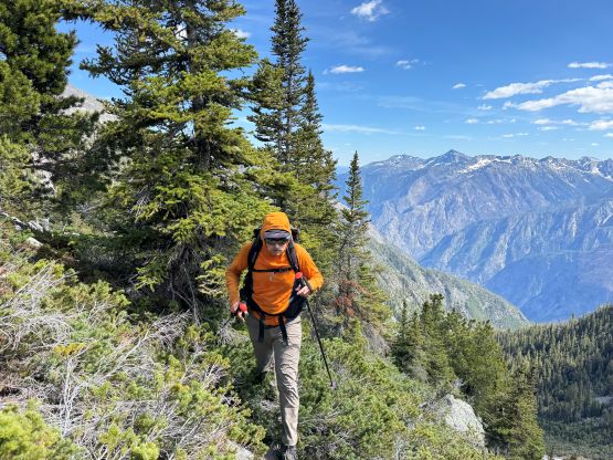
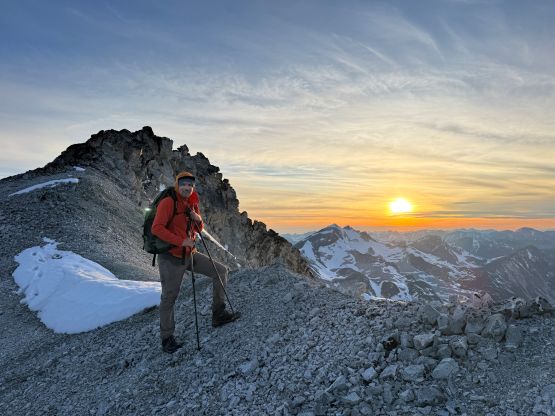
As usual I didn’t come up with the idea until Seb did his trip 3 weeks prior so I actually hadn’t read about these amazing sufferfests until coming home AFTER the trip. They all sounded harder than what we just did, even though our trip involved over 5000 m elevation gain entirely on boulders, bushes, choss and snow. Seb’s beta was sufficient enough to get the job done as my plan was to basically copy and paste his itinerary, but over 3 days and with the addition of Evenglow Mtn. I didn’t feel the need to gather more “beta” from the other approaches but those trip reports listed above are legendary and should be read by anyone interested in the peak or the area in general. With a favourable weather window coming up I managed to convince Vlad and Alex R. to come along and this was basically the most ideal team for these kind of adventures – remote but not technical. In terms of the gears I opted to go “ultralight”, wearing trail runners for the entire trip carrying only aluminum ice axe and crampons. The crampons were actually needed so good thing we didn’t leave them behind like Seb and Dean did. I’ll make a list of the gears I used on this trip at the end of this trip report for those interested, as going light and fast was absolutely essential for the success when the stats get this big. There’s no water for the entire 1900-m approach so we unfortunately had to carry 3L of water each. Again, contrary to Seb’s trip (only 1 L) all three of us drank most of the water that we brought on the first day.
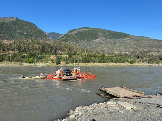
To further complicate things Lytton Ferry had been closed for a while due to high water but the local mountaineer Ben Eby provided the important last minute update that it had just started to run again. That saved us at least 2 hours of detouring through Lillooet. Ben also helped to confirm that most, if not all of the fresh snow had melted, so the final trigger was pulled. The three of us left Surrey at 5 AM and made quick work up the Fraser Canyon. The ferry was indeed running, so we got to the “trail-head” by mid-morning. This was excellent as with the entire day ahead we wouldn’t need to rush. Alex had done Stein Mtn. over a decade ago so he knew where exactly to park (in front of a spur road that only lasts for 100 m). We all had Seb’s GPX loaded so with the modern technology we really didn’t need to rely on Alex’s knowledge from the previous trip. Reading Fred Touche’s trip report afterwards I could see how the paradigm had shifted in the past 25 years when it comes to beta gathering and navigation.
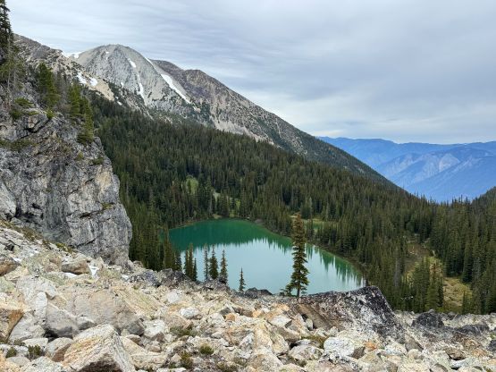
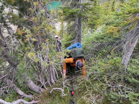
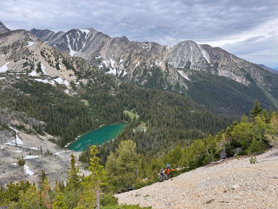
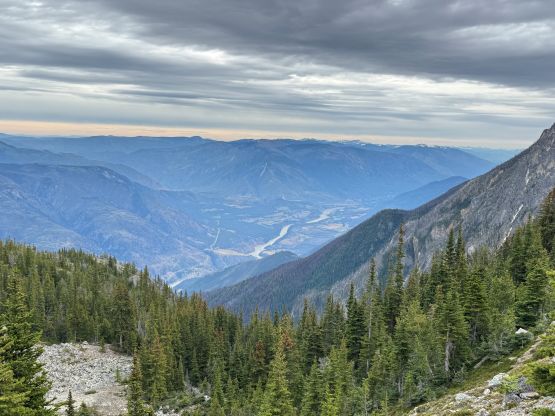
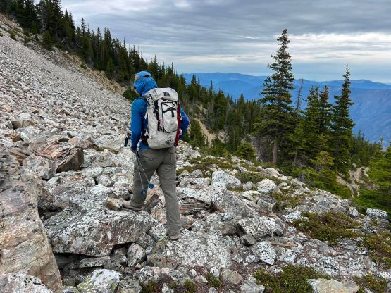
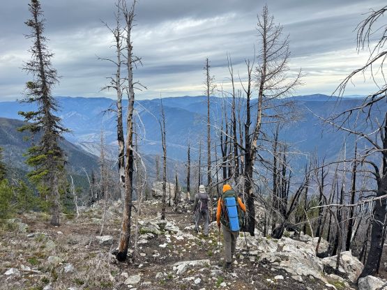
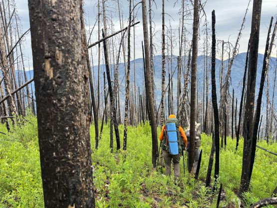
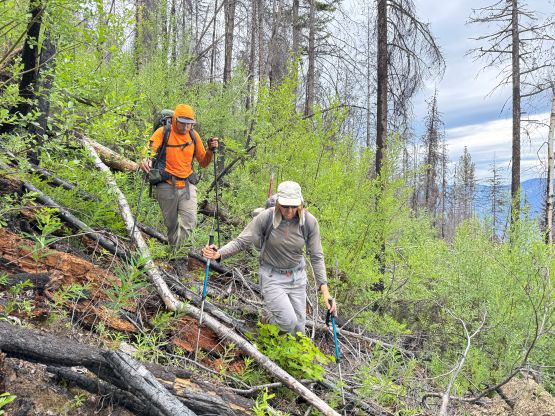
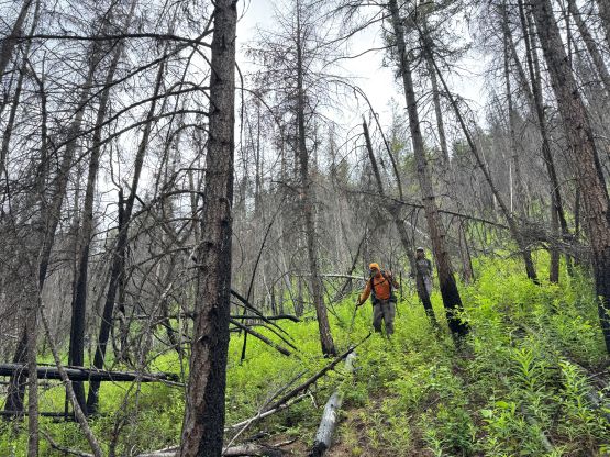
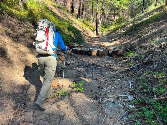
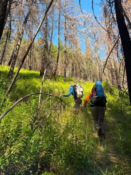
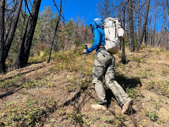
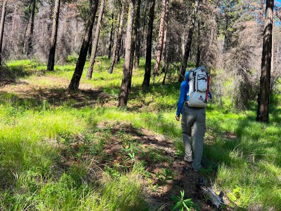
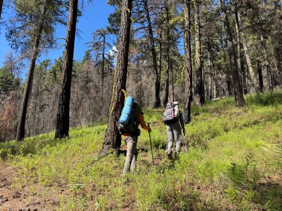
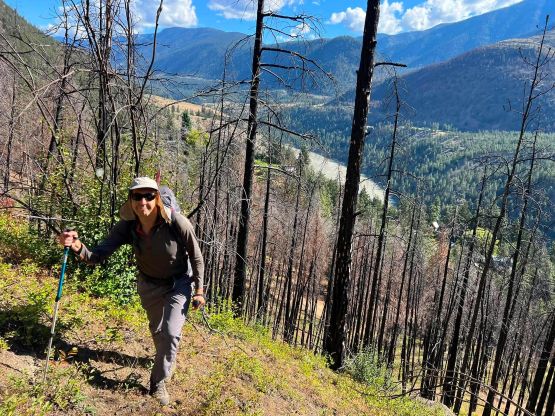
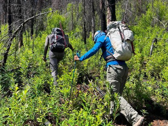
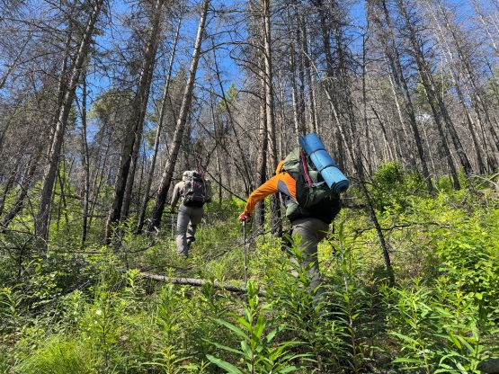
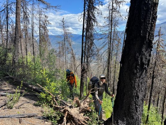
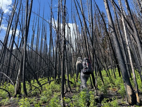
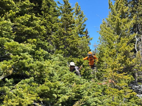
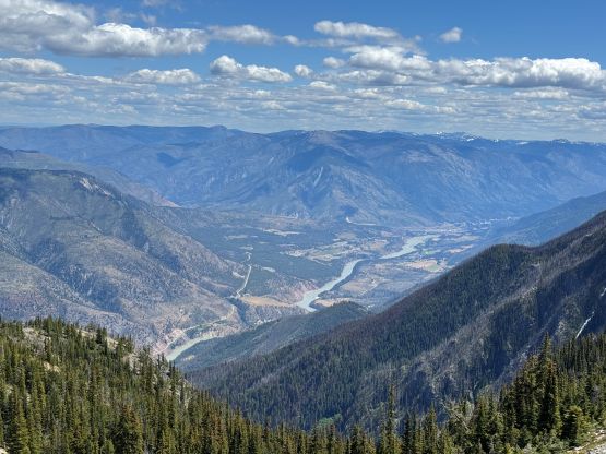
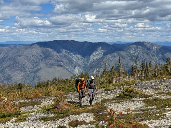
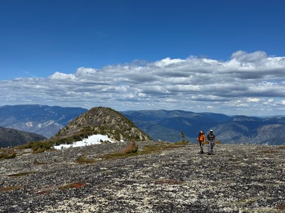
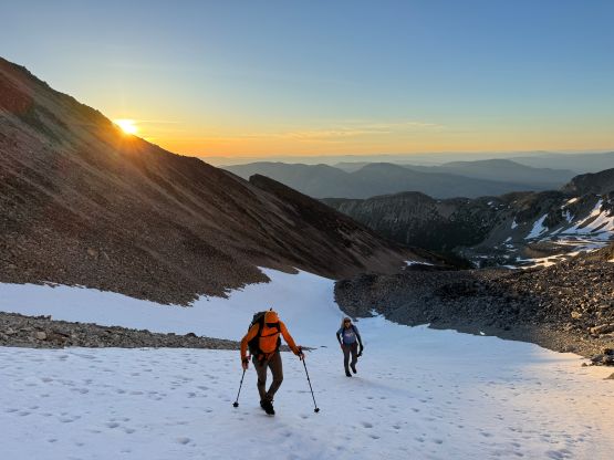
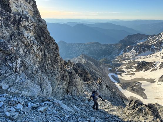
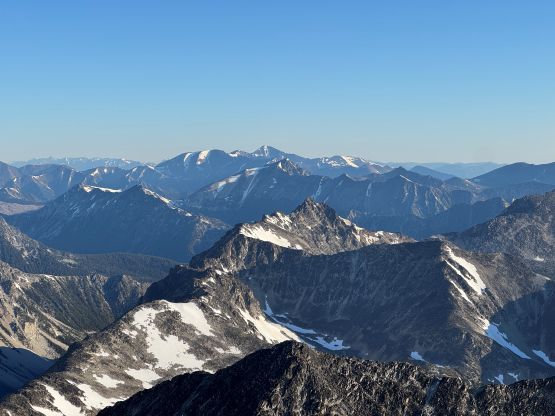
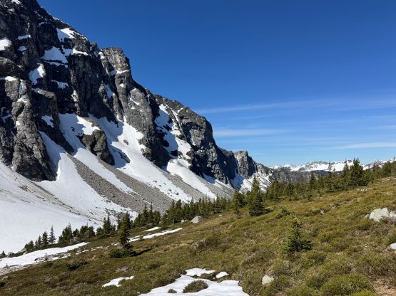
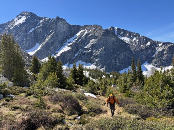
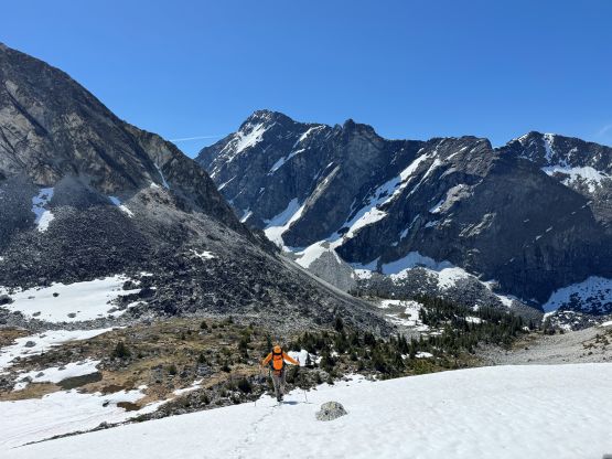
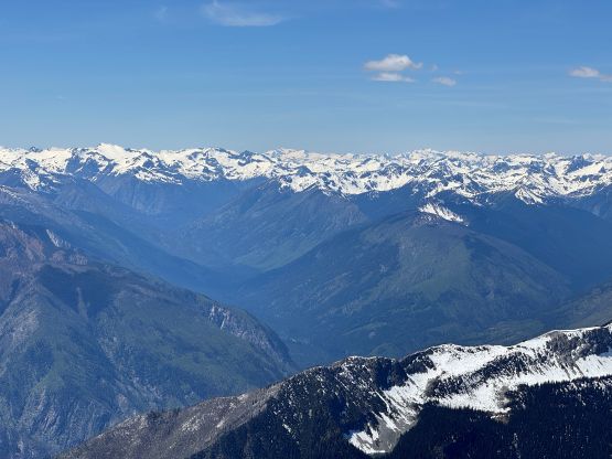
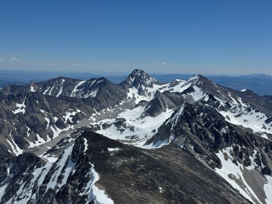
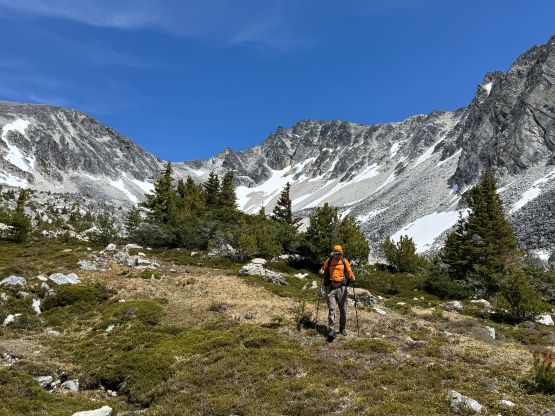
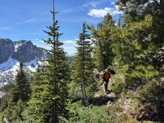
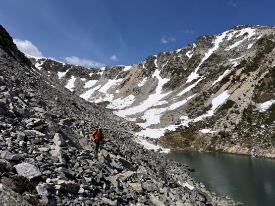
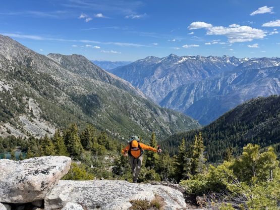
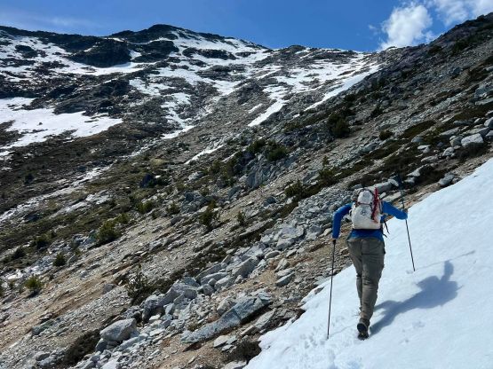
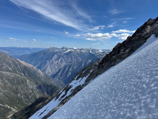
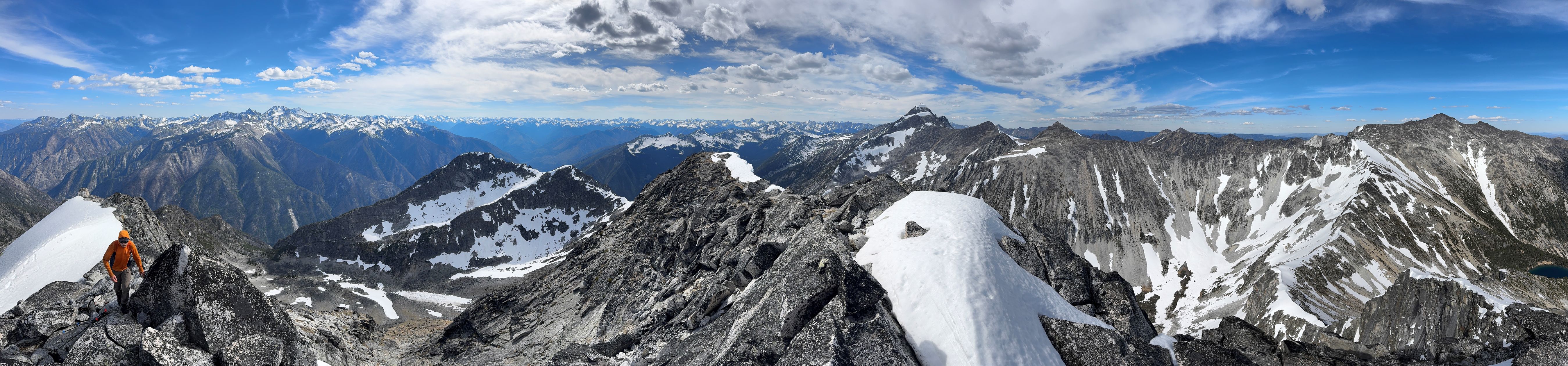
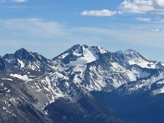
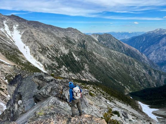
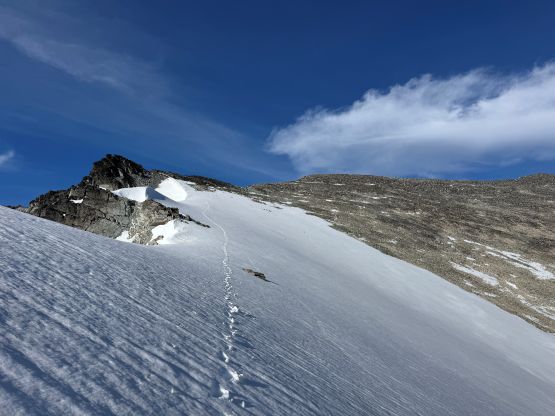
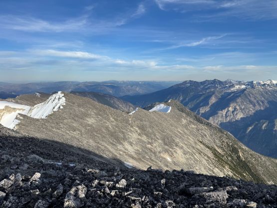
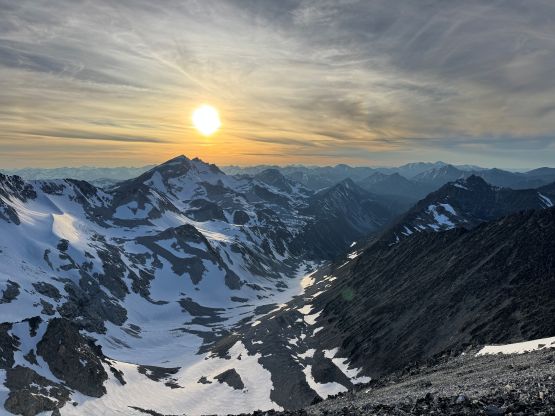
As expected there’s no trail on Stein Mtn. whatsoever. The spur road quickly gave way to a path but the path disappeared shortly after in the middle of a gulch feature. We bashed up the climber’s left side and ascended the rib paralleling the gulch. The going was decent for a while but the terrain quickly became some of the worst choss I’ve encountered in SW BC considering it was far below treeline. The feeling felt volcanic but I know it’s not, and to make it worse the entire forest had been burnt so we had ashes and charcoal on top of the choss making the upward progress tediously slow. I nevertheless led the initial 450 m elevation gain in an hour and we took a break afterwards. Vlad then led the next 200 m gain before calling for the next break. This was going to be a brutal grunt that’s nowhere as “easy” as Seb/Dean made it sound like. We also encountered bands of bushwhacking with fair amount of route-finding to avoid the worst of the bushes, even with the help of an existing GPX track. Higher up the pick-up sticks gave way to the 2-ft tall fire weeds and eventually we crested the long and undulating NE Ridge system at 1500 m elevation. The ridge was not much easier with a few steep stretches but I helped us optimizing Seb’s route higher up by bypassing the obvious bump on the left/east side. Alex claimed that they went up and over it back in 2012 as well but I saw no point in doing that. Indeed, my hypothesis worked out excellently with only one annoying side-hilling section on talus. The forested travel eventually gave way to an open and scenic ridge walk as we rambled southwards along the broad ridge. We could see Lytton and Fraser River 2000 vertical meters down and our first objective another 700 m higher up.


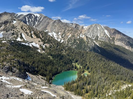
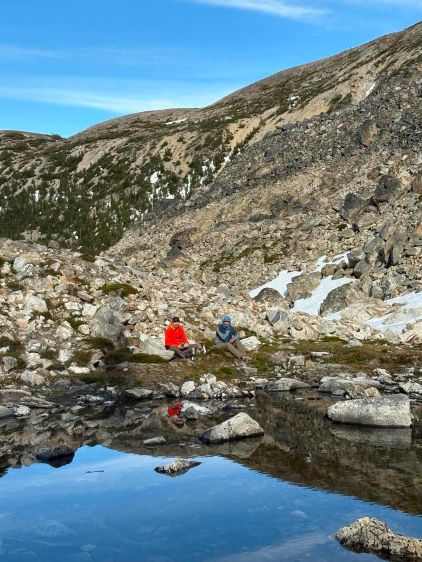
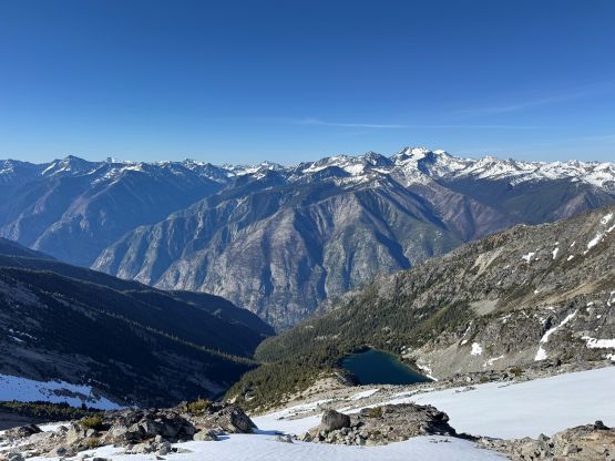
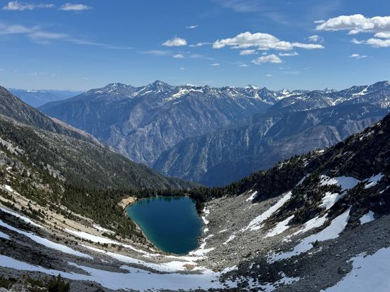
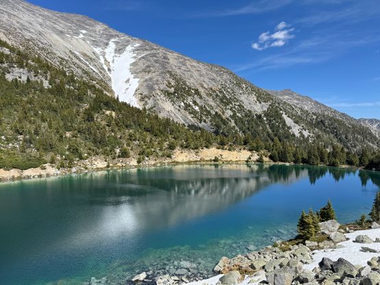
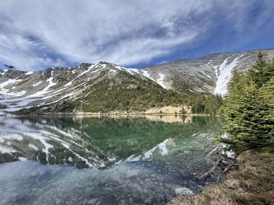
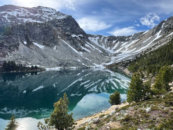
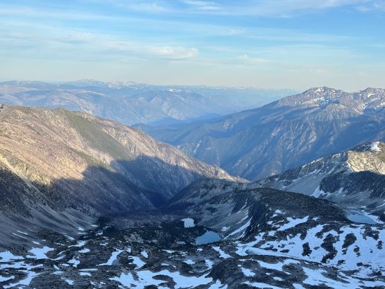
There’s a sting in the tail for this approach as we must somehow make our way down towards the lake with roughly 200 vertical meters of loss. That’s where Dean and Seb camped, but again I challenged their “beta” by stating that we could traverse and stay higher and camp 100 m above the lake. I think we found the best optimization between “too much elevation loss/regain” and “too much side-hilling on choss/boulder” on the return but our route going in wasn’t too bad neither. We stayed too high and encountered some massively unstable boulders. I think at one point in history this area was covered in a glacier so the rocks hadn’t stabilized yet. The area circled by Seb indeed had a tarn but there’s no running water. We did find a reasonable spot to pitch two tents but weren’t fully satisfied about this camping location. Alex and I went around to scout things out and confirmed that we wouldn’t having running water until much higher up in the valley, and who knows if we could find a flat spot to camp that’s also not on snow, so we reluctantly accepted this camping location without flowing water. I did bring a filter and that was surely handy in situation like this. It had taken us 6 hours to get here with lots and lots of long breaks, and Vlad stated that we weren’t even that much slower than Dean/Seb’s pace so we could probably on par with their time on the summit day.
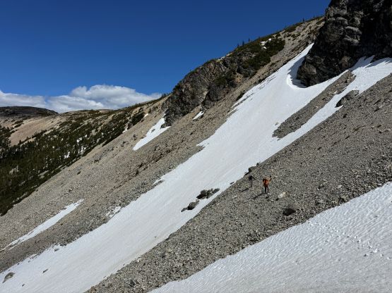

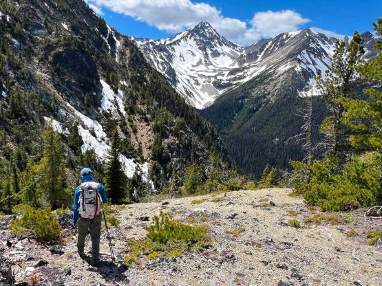
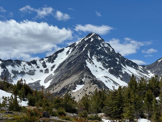
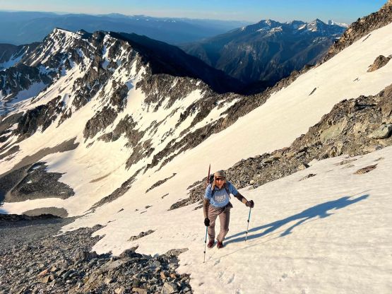
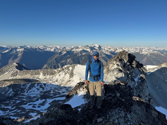
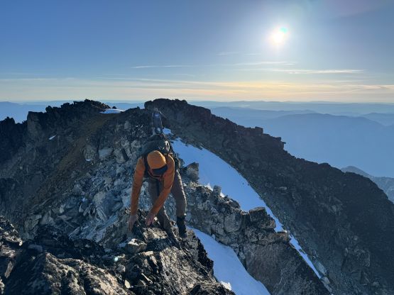
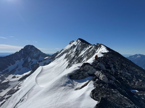
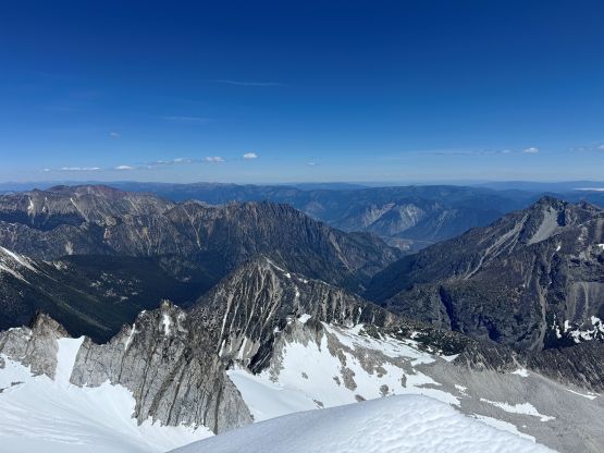
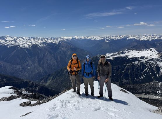
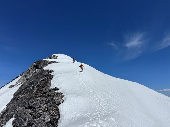
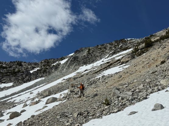
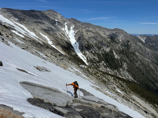
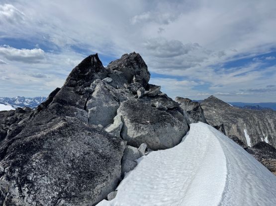
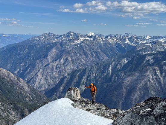
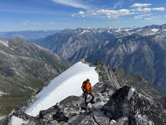
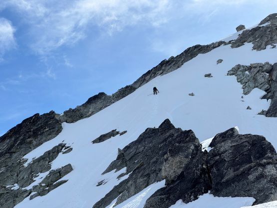
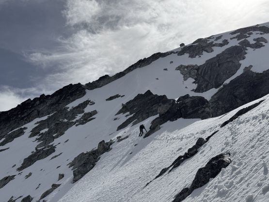
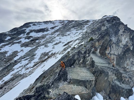
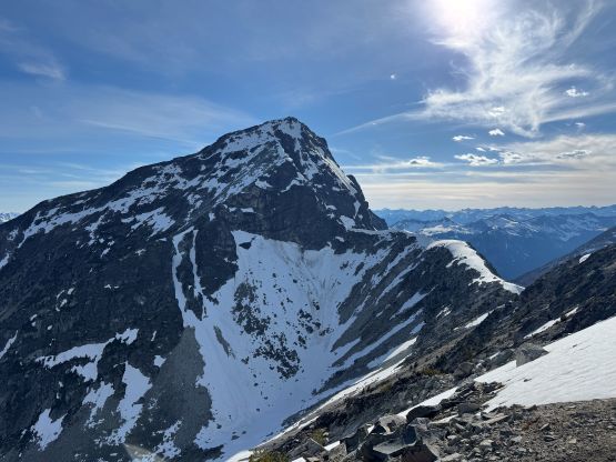
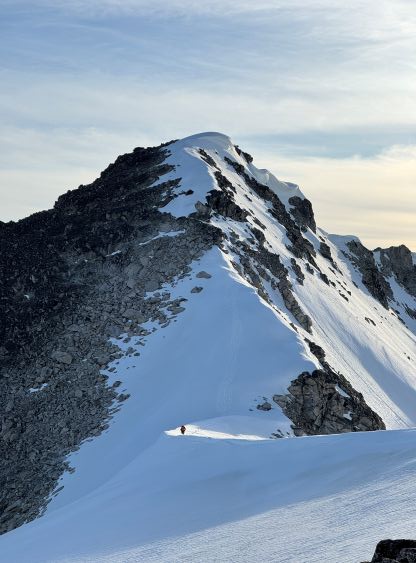
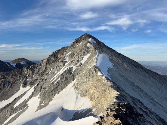
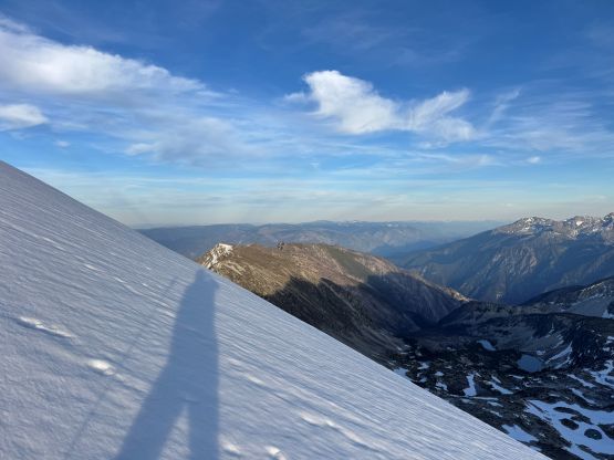
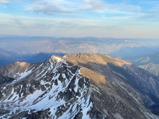
The plan was to start hiking by 4:30 am so we got up at 3:30 am to cook breakfast. The night was a bit chillier than forecasted and as a result, the snow had undergone refreeze. I had debated about taking Seb/Dean’s east ridge or Alex/Dean’s SE Face up Stein Mountain and the final decision was made in the morning to go the SE Face, staying on snow for as much as we could. I made my own judgement here that the valley travel on snow should no way be slower than boulder hopping on the ridge. The going up the valley was a cruise but we did eventually need to strap the crampons on. This was my first time testing the theory provided in this video clip, and honestly it worked out fairly well on the uphills. The heel pieces weren’t as locked in as I was hoping for but maybe I hadn’t strapped them on hard enough. In any case the crampons needed no adjustment for the entire way up the SE Face on 35-40 degrees firm snow and that itself was impressive for a pair of ultralight set up. We did eventually merged climber’s right onto rock once the terrain became more “steppy”, as the choss lower down didn’t seem inspiring at all. The scrambling was mostly class 2 with occasional class 3 moves mostly to avoid dropping choss down on each other. This peak was quite loose even by Rockies standard and I wondered if the rest of the way to Siwhe Mtn. would be similar to this. I was hoping for a negative answer. There are several summits on Stein Mountain and the highest is the easternmost, which required a few exposed moves over a subsidiary pinnacle. Alex could have bypassed it but opted to summit Stein Mtn. a second time with Vlad and me. The views were stunning as expected, but I was mostly looking at the rest of the route.

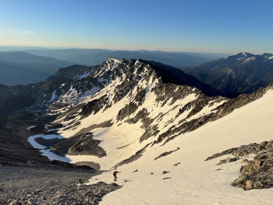
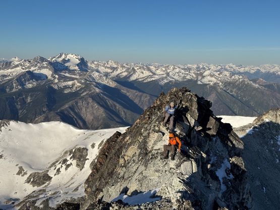
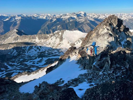
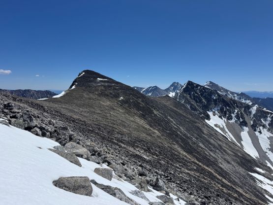
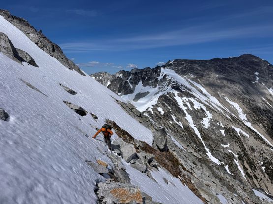
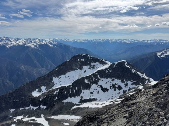
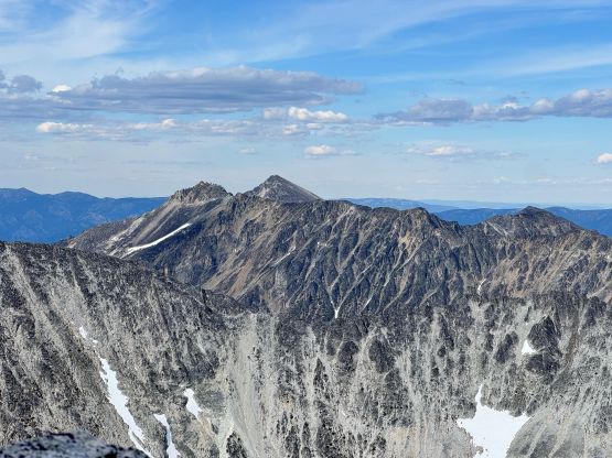
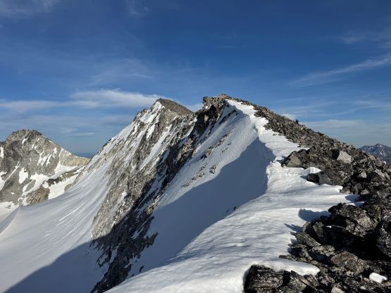
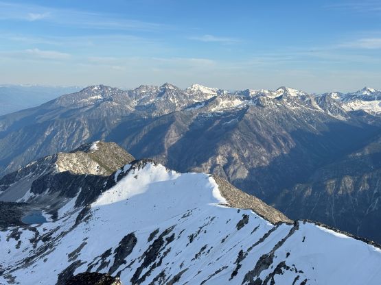
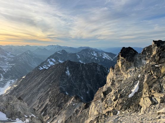
We quickly scrambled down the summit block and started down the west ridge, knowing a little bit that Dean and Seb had opted to bypass some sketchy snow patches. The snow was still frozen solid but we had crampons. With the traction devices we didn’t feel the need to bypass anything so stuck entirely on the crest of the ridge down to Stein/Stein W2 saddle. There was some annoying choss between the two snowy stretches and managing rockfall was once again, problematic in a group of 3 anywhere on Stein Mountain. “Stein W2” had enough prominence to be a peak in its own and it basically had to be traversed directly up and over both ways. There are at least two subsidiary summits and all of them had to be attacked head-on. The terrain was nothing but boulders covered in lichen and some of those boulders were quite loose. Any attempt to take a more direct route by traversing on the south face would result in dealing with more loose (and bigger) boulders. The next stage involved more complicated travel down to Stein W2/Evenglow saddle but again, the idea was to stick to the ridge crest for as much as possible. The snow had finally softened that the crampons were no longer needed for the rest of the day, but we still carried them for contingency purposes. Judging by the GPX the previous party had bypassed at least two troublesome sections on the ridge but I decided spontaneously to attack them head-on, if possible. The first down-climb wasn’t too bad with a few layback moves (class 4) but the second down-climb was a serious one. Vlad and Alex opted for a bypass following the GPX track but such resulted in at least 50 m extra elevation loss (and regain). I evaluated my options and eventually decided to down climb using a narrow ledge system. There were some serious class 4 scrambling with at least two spots with class 5 moves but such didn’t impose too much problem, and the result was more than half an hour’s chilling at the saddle waiting for Alex and Vlad.
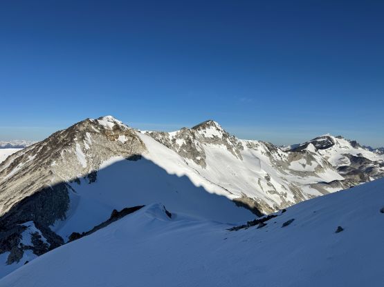
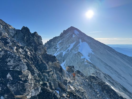
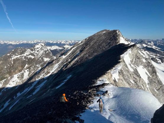
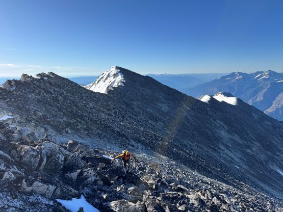
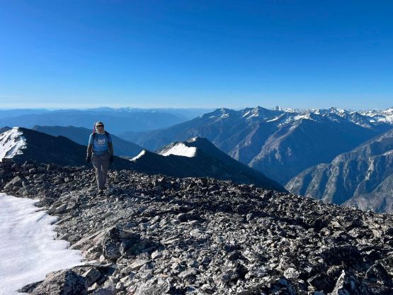
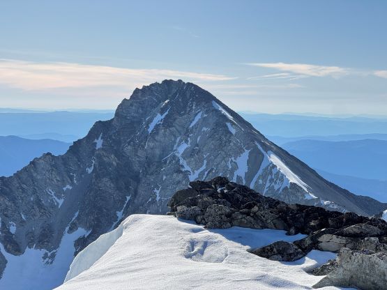
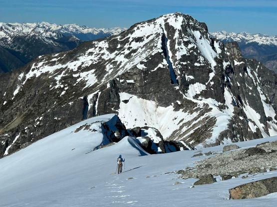

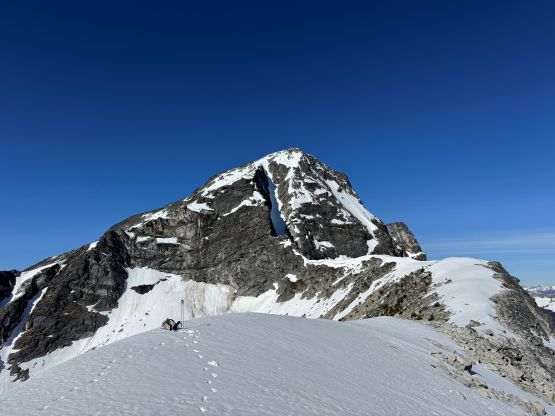
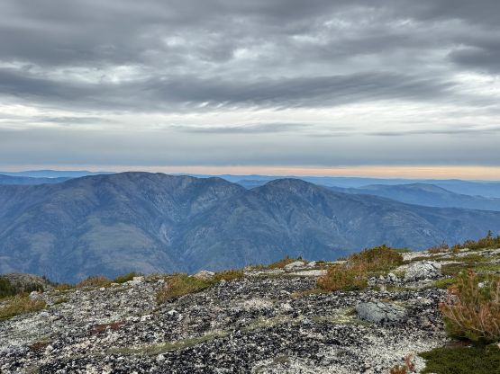
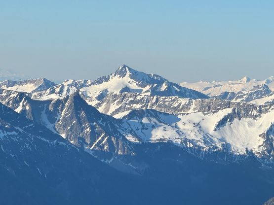
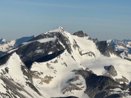
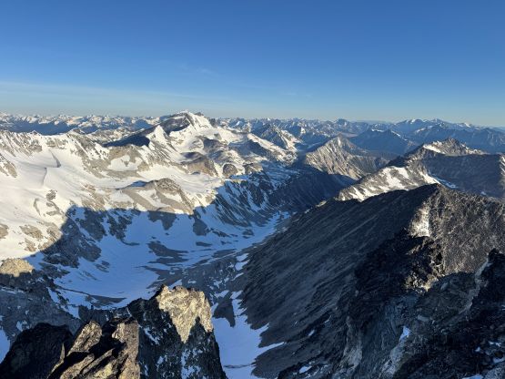
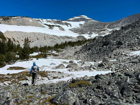
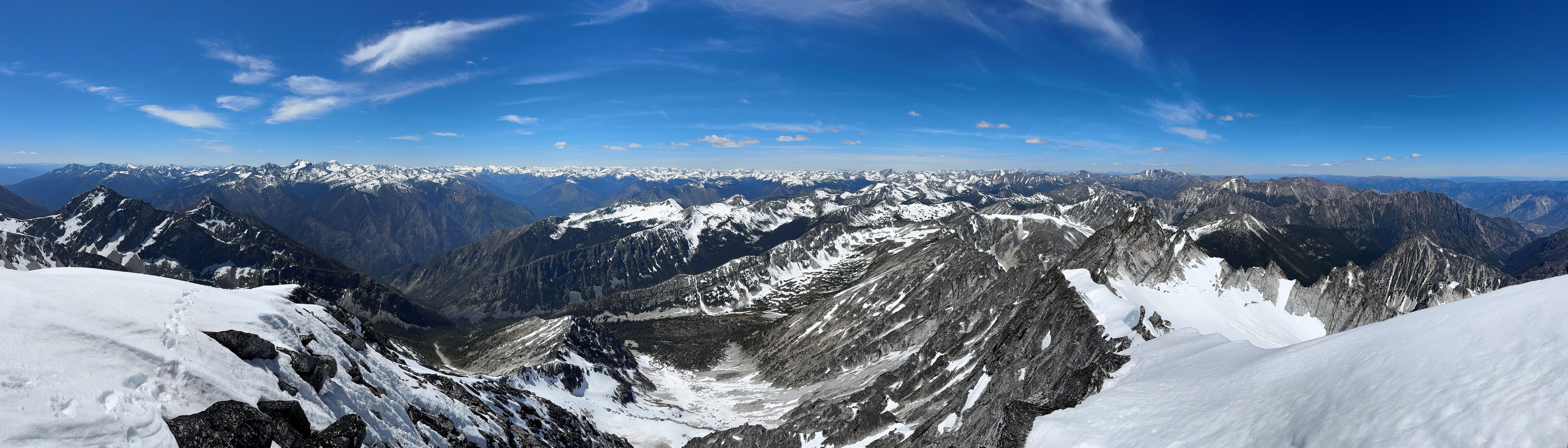
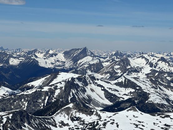
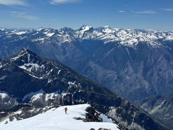
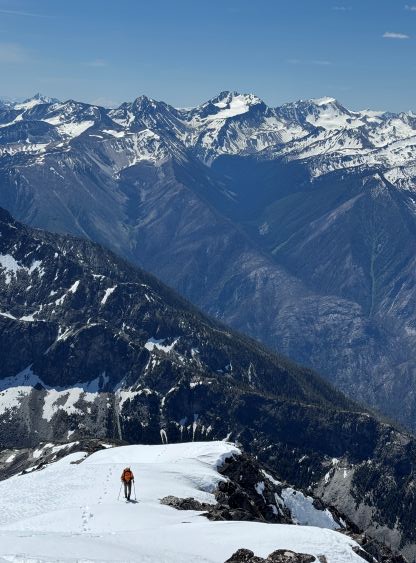
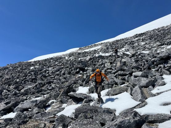
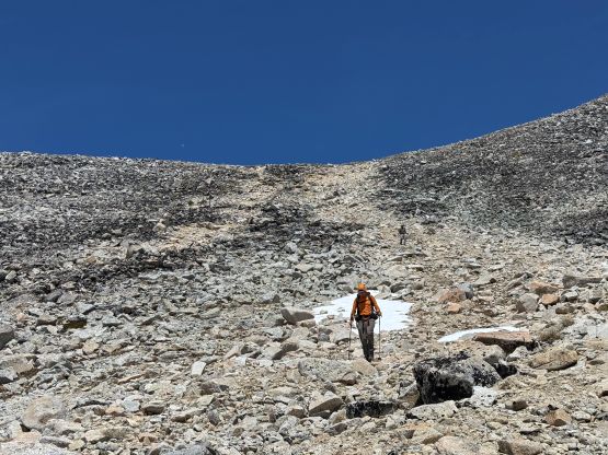
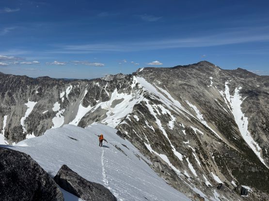
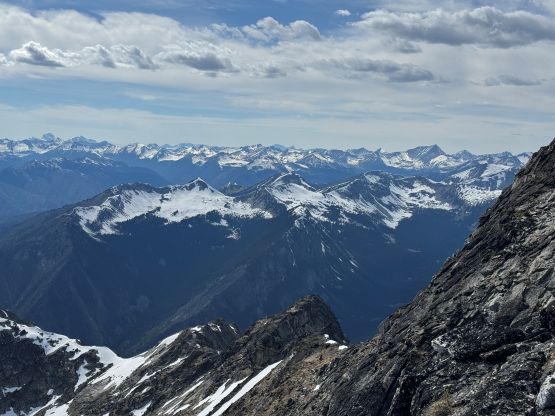
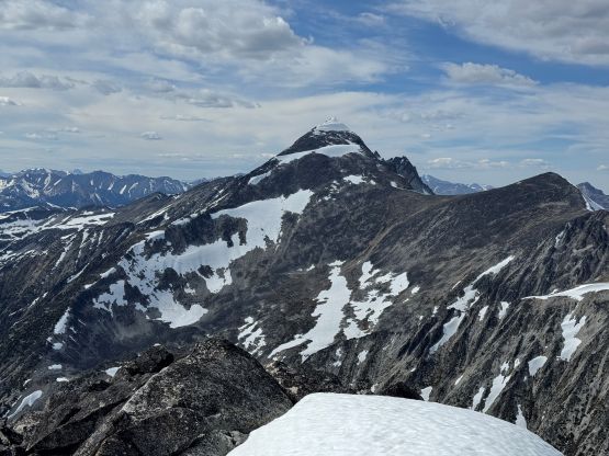
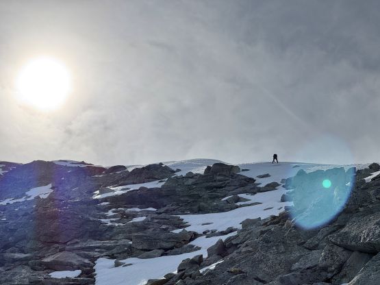
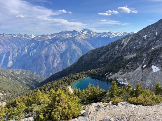
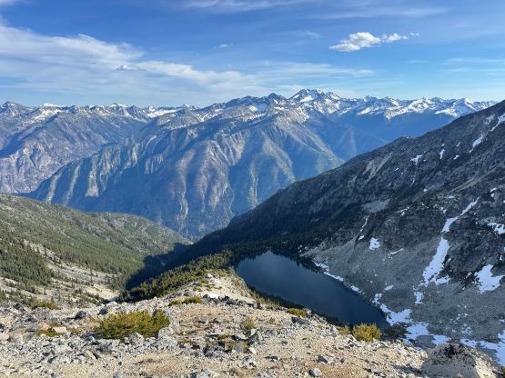
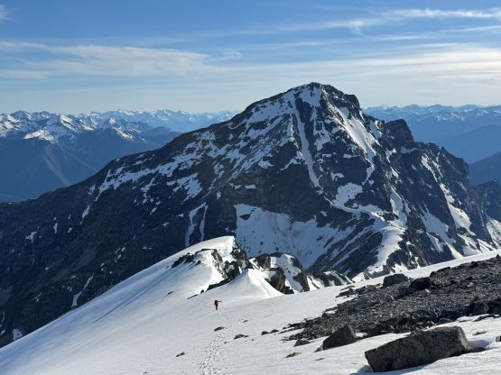
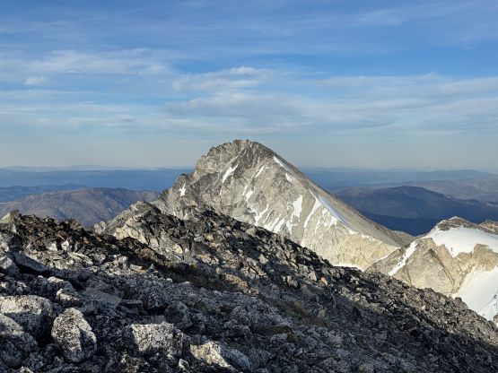
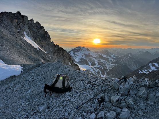
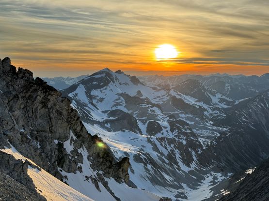
We decided to finally ditch some weight as we definitely would be returning via Stein W2/Evenglow saddle. The weight that I ditched was the head-lamp, extra pair of socks and the battery pack. I had opted to carry the battery for this summit push as I anticipated an extremely long day. Based on the previous experience I knew the phone could last ~17 hours with GPX recording as well as taking several hundred photos, and I thought this day would be pushing it. We then plunged down the north side of the col on soft snow and it was generally easy travel down to the basin north of Evenglow Mountain. There were plenty of water sources here but we waited until the final chance to load up the water bottles. We strictly followed Seb’s GPX track traversing just above the 2050 m elevation band resisting any temptation to gain elevation too quickly. This involved some bushwhacking and some side-hilling on boulders but was generally smooth going. We took the next break at the base of Siwhe Mountain’s south slopes. This spot could make an excellent camp as well, but it wouldn’t be efficient for us. The final 800 m elevation gain was done in a single shot. We stayed more on boulders (sometimes too big and not very stable) on the way up but found a better way coming down staying on the lighter coloured choss. The upper route had a few permanent snow fields and we encountered a soloist’s tracks, whom was apparently “Matt” a day prior from Texas Creek. I got a heads up from Ben Eby that we might have company so we weren’t surprised. The final traverse to the summit of Siwhe Mtn. via the south ridge was scenic but the very top of the mountain was still a cornice so we didn’t get that perfect 360-degree panoramic view.

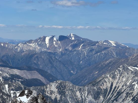
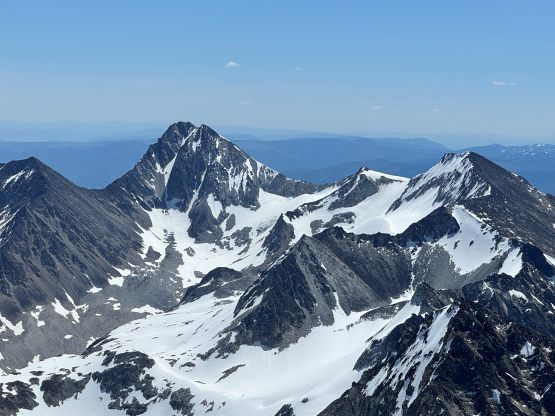
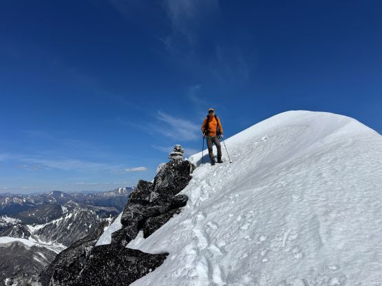
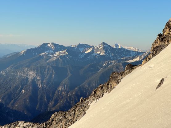
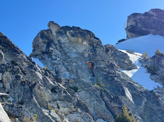
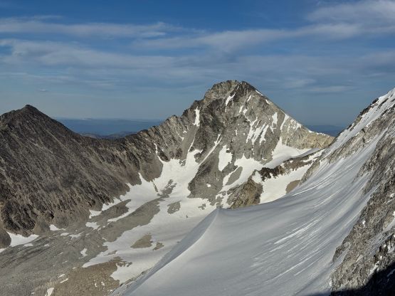
After another long break drying the shoes we decided to head back. In a single shot we got down to the valley and loaded up the water bottles, and in another shot we reversed our route back to Stein W2/Evenglow saddle. I wasn’t anticipating Alex and Vlad to come along for Evenglow Mtn. as this would add 700 m elevation on top of the 2500+ m day, but Alex was still keen on adding the bonus peak. Vlad would slowly make his way back to camp and wait for us. I had skimmed through Fred Touche’s trip report but either way I wouldn’t be attempting that “triangular face” nor the “snow couloir”. Down and around via the E/SE side was the only route that I had contemplated about anyway. This unfortunately added 200 m extra elevation loss down to the lake but at this point we might as well make a long day even longer. I knew very little about the route and in fact, there’s no recorded ascent between Fred’s 2003 FRA and ours in 2026 at least on the internet. After scrambling up the bushy SE Ridge I convinced myself that the easier attack should be more on the face than the ridge, but mostly because we seriously needed to find a creek to fill up the water bottles. The SE Face had a lot of slabby terrain covered in thin and melting snow, and the travel was sketchy and slow. We eventually made do and got ourselves onto the uppermost east ridge. The final pitch onto the summit ridge was on 40-degree snow and thankfully it was soft. I managed to do the entire ascent and descent in just trail runners and trekking poles. The ice axe and crampons stayed in the pack for weight training. We also found the tiny cairn that Fred built in 2003.

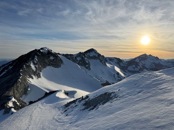
After another long break mostly to de-water from the socks and shoes we started down, staying more on the ridge than the face dealing with some unknowns. There was some steep snow climbing and exposure but I still think the ridge direct worked better than the slabs on the face. There was no water but such was expected, so our only chance to load up the bottles would be from the lake’s outflow at the base of the mountain. The mosquitoes were unfortunately horrendous as it’s that time of a day and they chased us from the lake all the way up the ridge to the snowline. This part of the grunt was brutal but at least the views were improving in the evening light. The rest of the way plodding back to Stein Mountain was mostly uneventful and we even had Vlad’s fresh tracks to follow. At this time of a day the post-holing had taken over and I finally started to feel very tired after doing 5000 m elevation gain in two days. After waiting for Alex to show up while watching an amazing sunset (ish) we zoomed down the SE slopes of Stein Mountain staying as much as possible on snow. The snow was already starting to firm up so we did some scrambling on choss, but eventually boot-skied down the lower snow slopes. It was a fast return to camp to conclude the 17-hour day. I had to stay up for another hour to cook the double dinner, and sleep didn’t come easily due to the massive amount of exertion. Fortunately the mosquitoes weren’t too bad at 10 pm so I was able to mostly enjoy the dinner time.

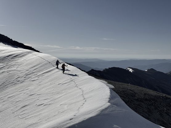
The next morning was quite windy and overcast so we slept in till around 8 am. The bugs were out but not too bad, so we leisurely packed up the tents and headed down. We chose a route in between Seb’s and our own and the optimization worked out nicely. There wasn’t too much boulder hopping and we didn’t have to descend all the way to that lake. I then led us grunting back up onto the approach ridge and we again, bypassed that 50-m bump on the east side. The three of us then took turn leading down the 1900-m forested descent. The going was not too bad especially on the softer ground, but it was a brutal slog as our bodies and minds were already numbing at this stage. The Lytton Ferry was still running and that again, saved us 2 hours of driving detour. Vlad and I took turn driving home, and I had to show up for 3 hours of work in the evening plus another hour of driving. I don’t know how I managed to push through situations like this but I’m Chinese and I grew up with huge amount of pressure almost every damn single day, so I’m used to it.
The gears that I used. At the start of the trip, over half of my pack weight was food and water.
- Tent – Samaya 2.0
- Stove system – MSR Reactor
- Footwear – Arc’teryx Vertex Alpine (2nd gen)
- Poles – BD Distant Carbon Z
- Crampons – Petzl Leopard Flexlock
- Ice Axe – Camp Corsa Nanotech 45cm
- Backpack – Hyperlite 50L
- Sleeping Bag – Western Mountaineering +2C
- Mattress – Thermarest XLite (Women’s)