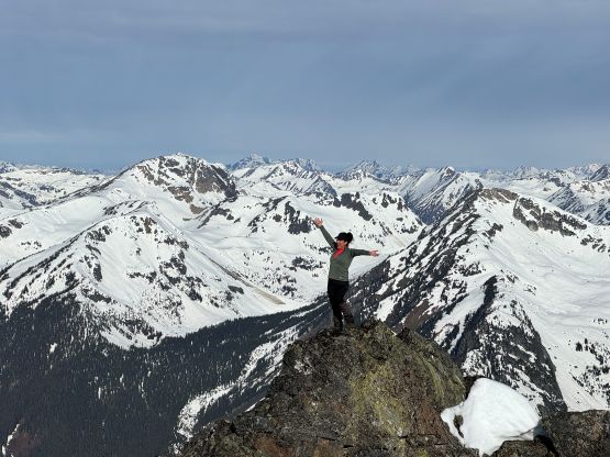
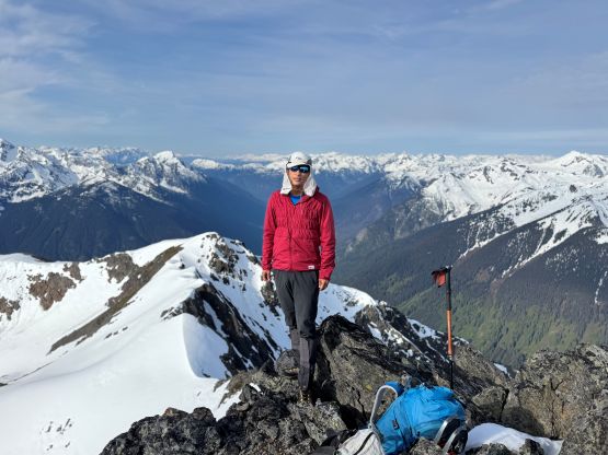
“Phelix Peak”
May 21, 2026
2305m
Pemberton / Birkenhead Lake Area, BC
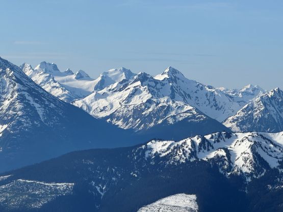
“Phelix Peak” is the unofficial name of the peak that overlooks Phelix Creek and boasts over 500 m prominence. There was however, not a lot of information on the internet. The lower flanks look bushy enough that a summer attempt is probably not the wisest idea, but the access road has to be “melted out enough” for an ascent on snow. This means the ideal window is rather narrow – from the second half of April to the first half of May, depending on the year. To further complicate things Phelix Creek FSR is technically “closed” in this time frame for vehicular traffic for some kind of conservation that I don’t even care about knowing. All I know was that in the past few years the closure was never enforced. There used to be a barrier or some sort at the start of the road but a recent update confirmed that the blockage was not placed in 2026, so I wanted to make sure to get “Phelix Peak” in this season.
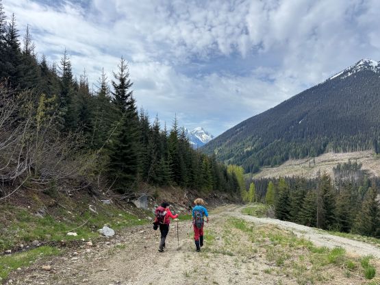
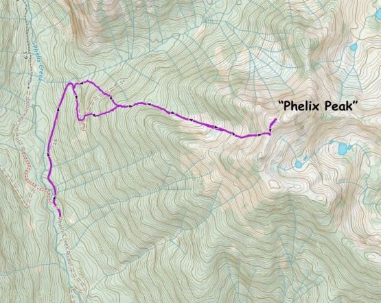
Simon had laid out a route utilizing the complicated ridge system over 15 years ago but upon studying the map layers I thought the west-facing valley north of Simon’s route would make the most sense. I always prefer the route to be as direct as possible. The plan was made a few weeks earlier but I ended up doing something else. When another window formed it was a bit on the late side of the spectrum. The most recent satellite images were however from exactly 2 weeks ago so I actually didn’t know the up-to-date conditions. The condition turned out to be very dry with lots of bushwhacking lower down, but the snowshoes were still required. There wasn’t much information regarding the route I planned to take, so two axes, steel crampons and mountaineering boots were brought to be safe. They turned out to be essential. Tanja and I made the plan together but Miranda joined the team at the last minute. To take advantage of the firm conditions in the morning we agreed to leave Squamish at 2 AM. I convinced Miranda to car-camp at the start of Mamquam FSR so that I could at least try to get a bit of sleep. The driving from Squamish to the Birkenhead River FSR was uneventful but took a while. The Phelix Creek FSR was also in a rough shape with many water bars but I was able to drive the stock Subaru to the landslide mentioned in the previous trip reports. Without that landslide I could have driven 2 km further but being able to drive to Brian Waddington Hut’s trail-head was already “good enough”.
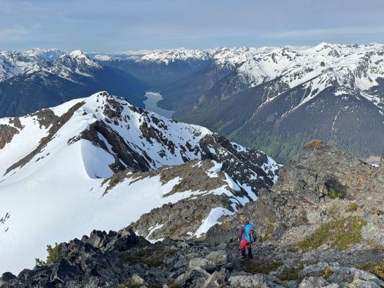
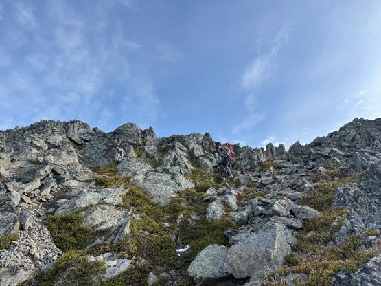
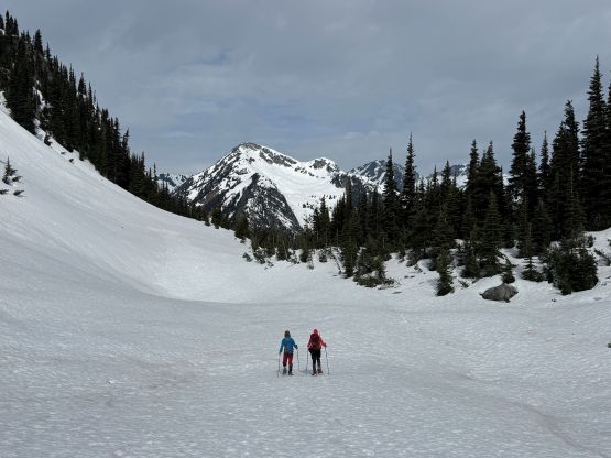
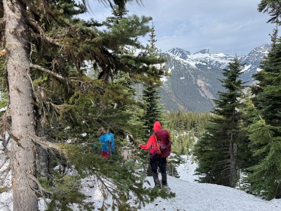
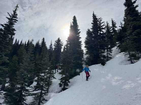
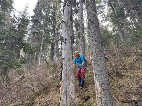
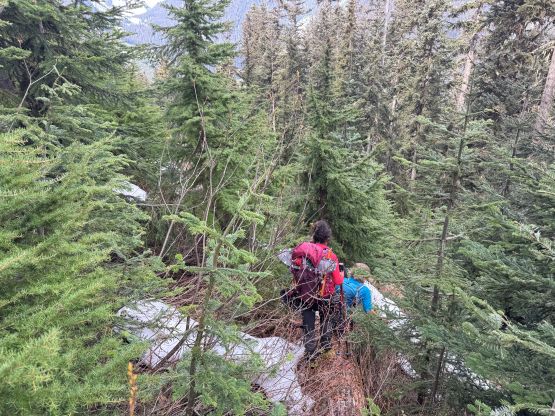
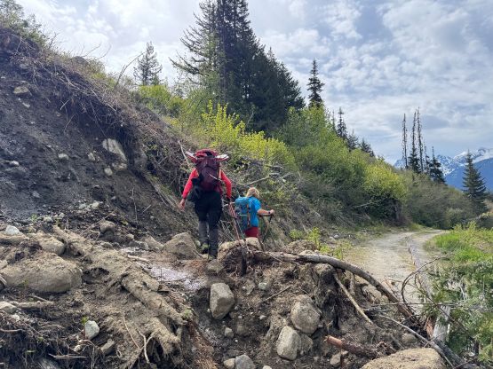
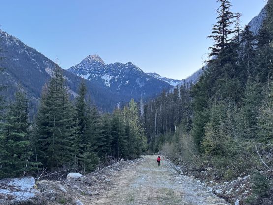
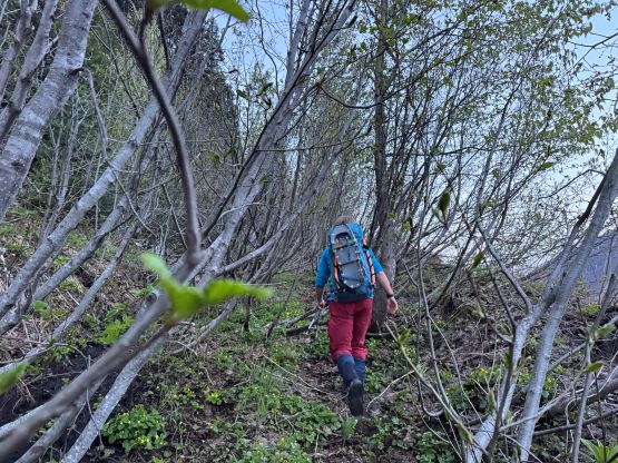
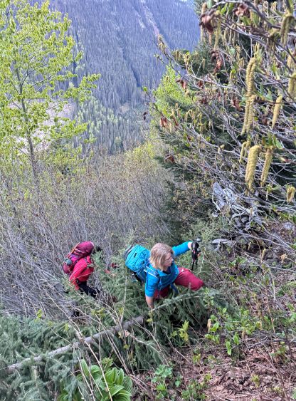
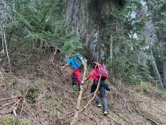
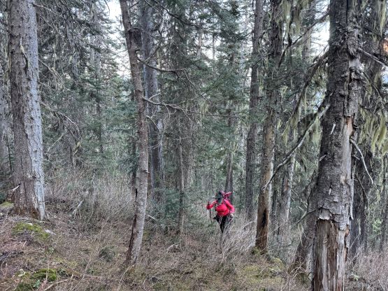
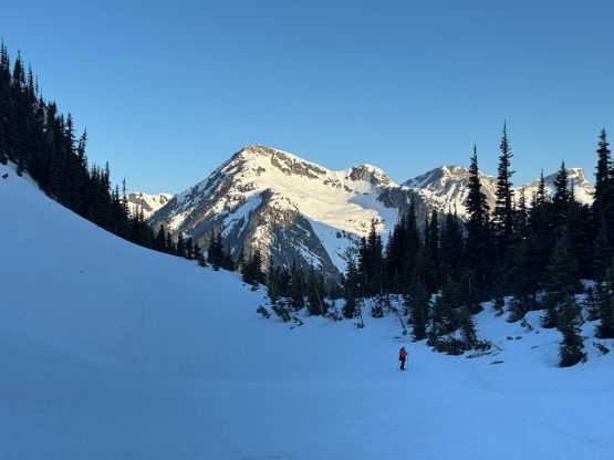
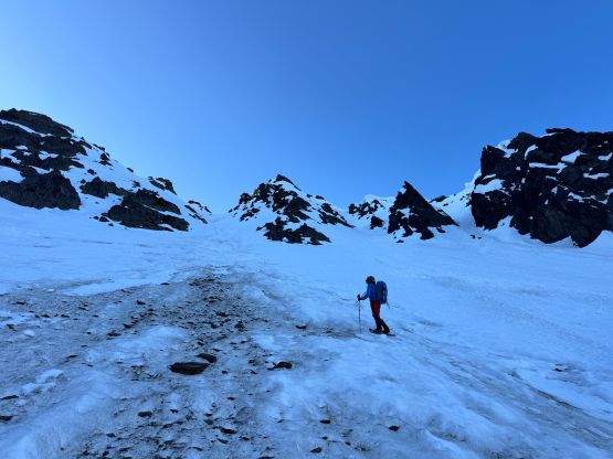
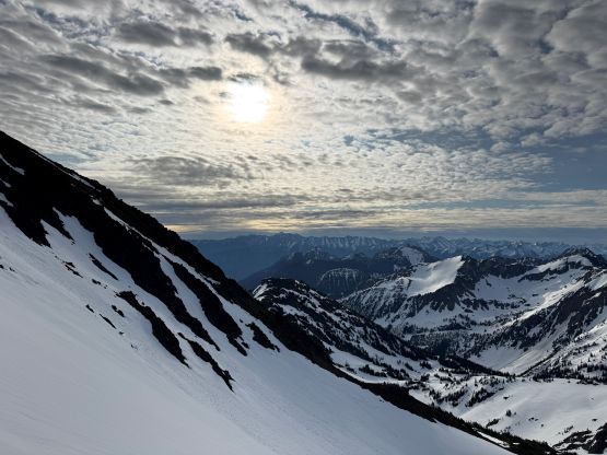
The head lamps were only used for 10 minutes so despite the all-nighter push, this wasn’t as early of a start as I was originally hoping for. This was actually good because the snow condition was on the firmer side and there’s no avalanche concern whatsoever. There was some recent logging activities on the lower part of the access road but nothing’s been pushed beyond 1350 m elevation. The wide-and-open road quickly gave way to a tangled mess of alders. We attempted to follow the “road” labelled on the various map layers but gave up before reaching the next switchback. The alders were thick enough that bushwhacking in the forest would simply be quicker. There was a lot of Devil’s Clubs though. We didn’t hit snow until 1600 m which was much higher than anticipated. I then took the first break of the day swapping footwear from the trail runners to the mountaineering boots. I opted to carry the trail runners to a more obvious spot as ditching them in the middle of the jungle wouldn’t be too smart. I then led a steep traverse towards climber’s left and we quickly hit the open areas of the aforementioned valley. I ditched the trail runners and we quickly donned snowshoes. Despite the overnight freeze the snow was still unsupportive at the treeline zone.
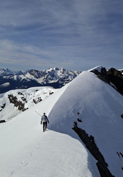
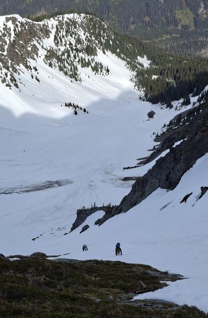
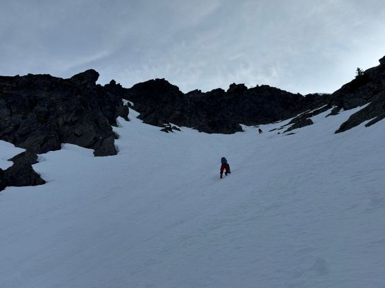
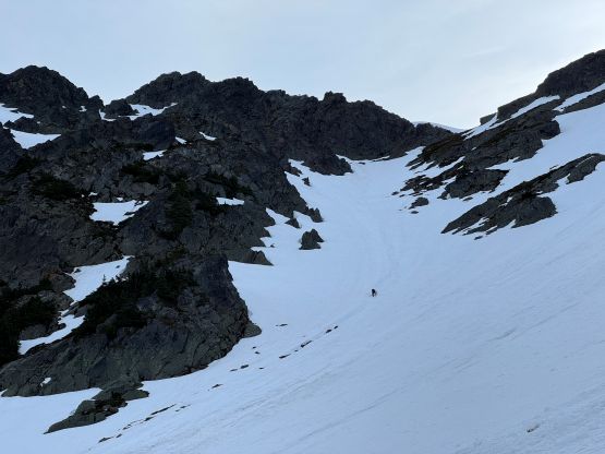
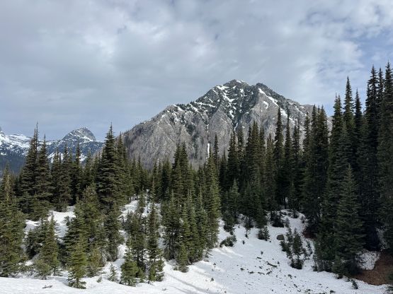
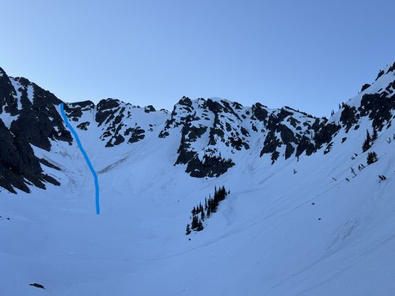
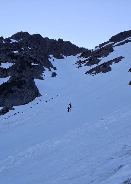
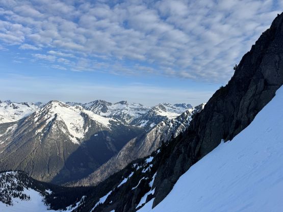
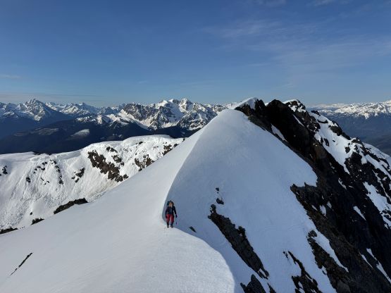
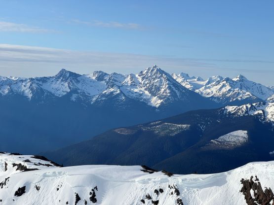
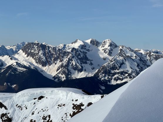
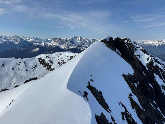
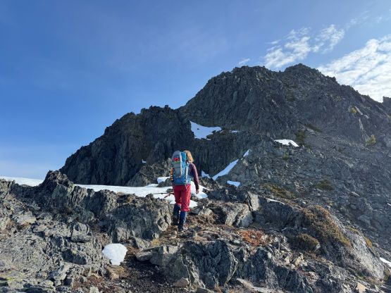
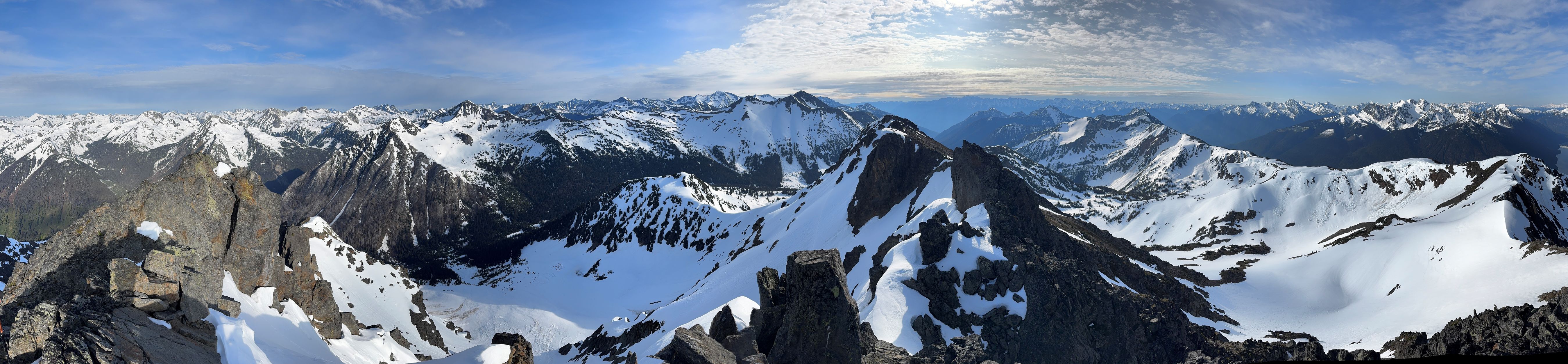
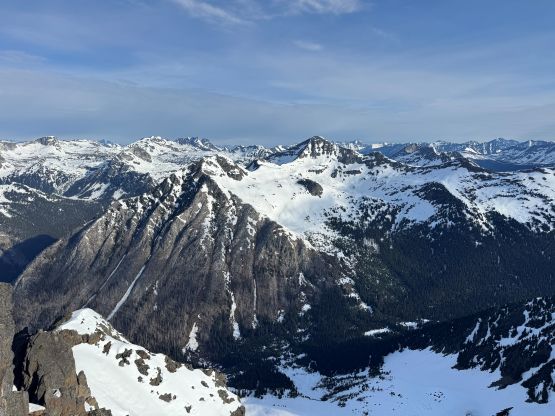
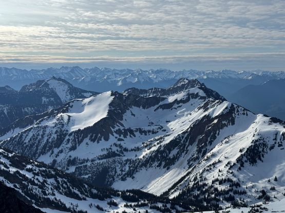
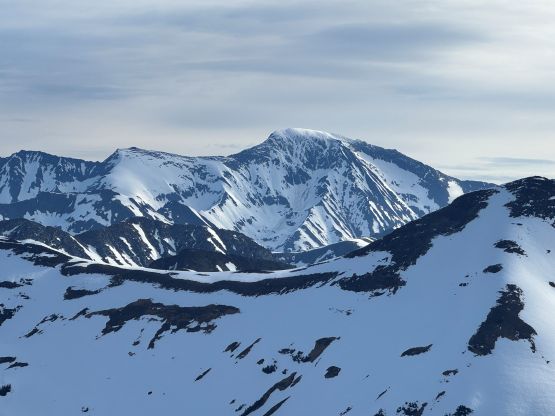
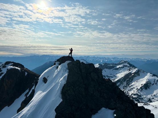
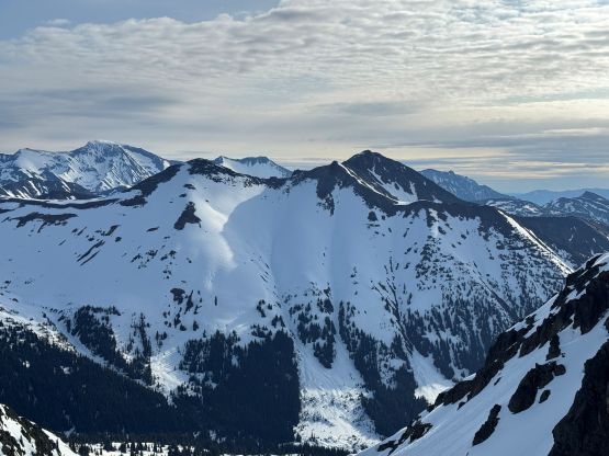
The plodding up this valley was foreshortened but this was still a short route after all. I kept thinking about the various route possibilities as there’s no “sure beta” about this route. We could have climbed a lower-angled gully to hit the ridge to the south if we wanted, but I preferred one of the steeper couloirs at the head of this valley. I was thinking about the one on the right but Tanja preferred the far climber’s left option. I thought it would be steeper but agreed to give it a try. Needless to say the snowshoes were quickly swapped for crampons, and the second ice axe were then taken out. We had about 200 vertical meters of 40-45 degrees front pointing, and sometimes the picks of the ice axes could only go halfway in. This was definitely a calf burning exercise and I regretted taking the Trango Tech boots instead of the G5s. Fortunately I had come with “real crampons” so this combination of the footwear could still make do. The finish of this line was already melted out revealing some steep heather and dirt on down-sloping terrain. Honestly this would require ice tools and crampons as well. After finishing the couloir we only had a short class 2 scramble via the south ridge to the “west peak” labelled on the Gaia map. I thought we would have to climb both peaks just to be sure, but the one labelled “east peak” seemed considerably lower by visual inspection, so we didn’t bother.
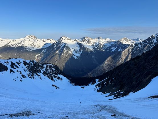
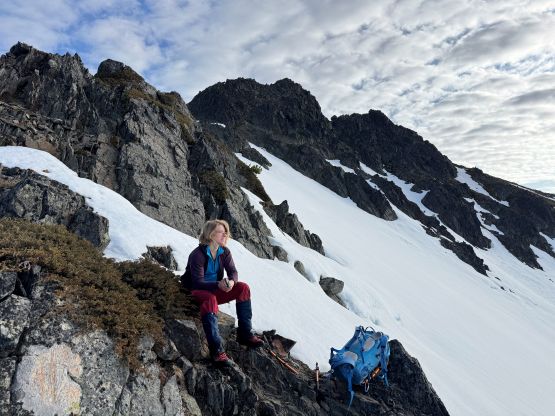
We quickly scrambled down and it’s time to deal with the front-pointing down-climb. It would still a few hours for the sun rays to hit the west-facing slopes so there’s no point in waiting. This would be a good climb to put the front pointing muscles in use anyway. A long while later we all got down with no mishap. About halfway down the flatter part of the valley we still needed to strap the snowshoes on as the snow was getting mushy. Tanja then led a different route down taking a more direct bearing, and we managed to avoid the nastiest bushwhacking. The route eventually joined the trail that I had used for Mt. Taillefer 10 years ago and the trail seemed way more overgrown than what I remembered. Our round trip time was 5 hours 45 minutes. I only had enough energy to drive us back to about halfway between D’Arcy and Pemberton but Tanja took over and got us back to Squamish. I was able to catch at least an hour of sleep, which was essential. I then drove Miranda back to Vancouver without a problem before embracing the horrendous rush hour traffics back to Surrey (this was honestly the crux of the day). I took another nap, had dinner at home and then drove to White Rock for 2 hours of work in the evening.