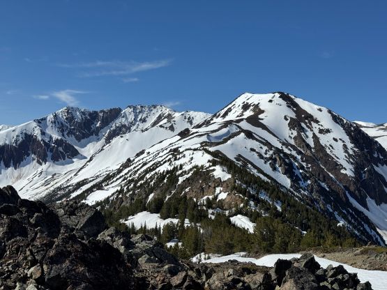
Mount Noel
May 27, 2026
2541m
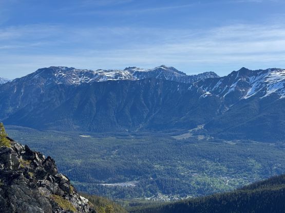
Bralorne / Gold Bridge, BC
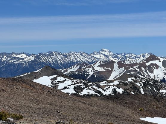
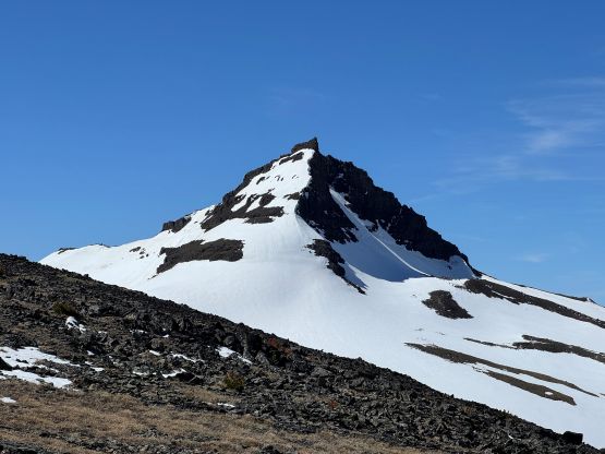
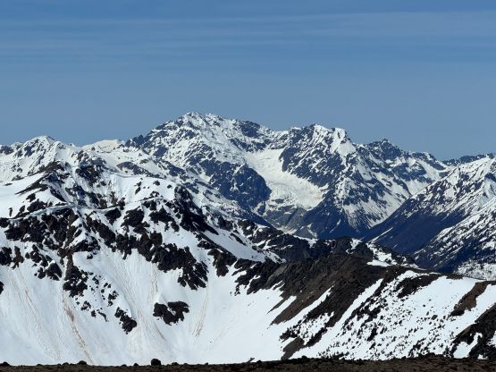
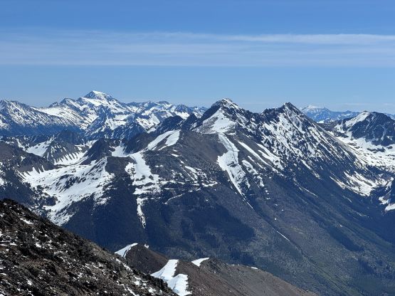
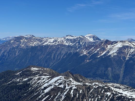
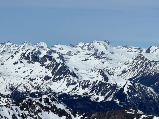
Mt. Noel is the highest peak along the ridge system SW of the historic gold mining village of Bralorne not far from Gold Bridge. This peak boasts over 600 m prominence but is relatively obscured in the peak-bagging community. A few years ago Alexandru R. had made an ascent by traversing clockwise from the end of the Carl Creek FSR via the NE/E Ridge and that was also the route I wanted to take, until Matt J. put up a track via the N/NW Ridge last weekend. Matt’s route has a steeper/bushier start but is overall more direct and also avoids the nasty traverse near the summit that the other route requires. Given the time of a year there wasn’t much of a track to poach anymore but Matt confirmed the spur road’s currently in a good shape, and to me that’s the most important “beta”. There’s even new logging that pushed the end of the road further, so I decided instantly to follow up as soon as the next window became available, which happened to be a mere couple days after Matt’s trip. I also don’t understand the obscurity of this objective, as either route can be done as a day-trip without notable technical nor approach difficulties. I guess most people just don’t have the time/money to justify making the long drive to this area.
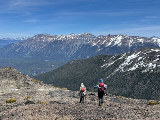
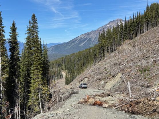
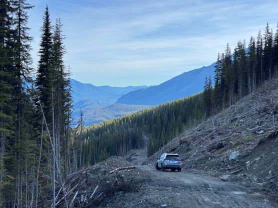
As usual despite the last minute plan Miranda and Adam W. decided to join. Adam even provided his Wilderness Subaru which is slightly more reliable than my stock one. There’s no way for us to make this objective in home-to-home style so we left Surrey at 7 pm in the previous evening. Adam drove most of the way to Boston Bar but the night shift was all on myself. I got us all the way to Gun Creek camping site by 12:30 AM and I wasn’t even that exhausted. The roads in Bridge River valley were mostly in good condition except for about 20 km of gravel, which was also not too terrible. We pulled in at the empty campground and settled for about 5 hours of sleep. The next morning we got up at 6:30 am and did the rest of the drive to the end of Carl Creek FSR. There was still fair amount of ways to go but the Carl Creek FSR was in a surprisingly good shape. This was easily one of the best “spur roads” that I had driven in SW BC. We parked at the same spot as Matt did due to a minor landslide, but we couldn’t have driven much farther anyway.
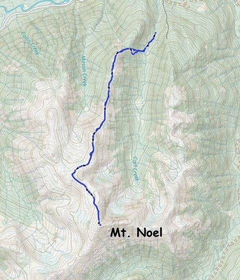
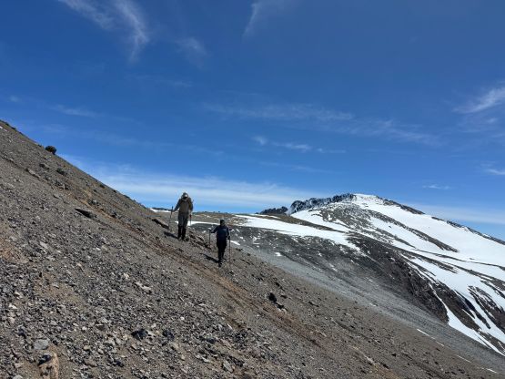
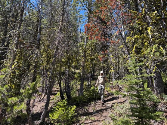
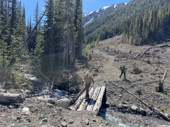
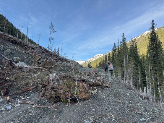
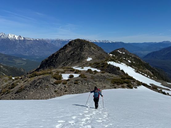
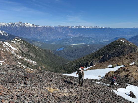
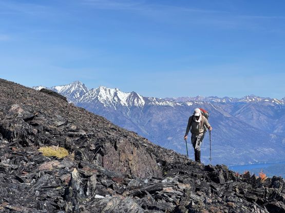
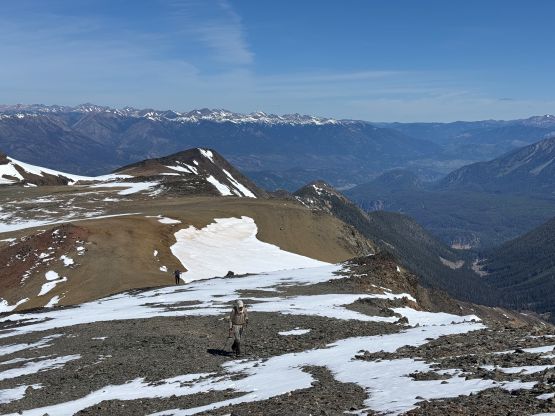
The route required crossing Carl Creek which was running quite fast. Fortunately the bridge at the first available spot was still intact. This bridge would not be possible to drive across in a vehicle anyway so that’s why I said we couldn’t have gotten much farther even if there’s no such landslide. The road beyond the bridge was seriously deactivated but wasn’t too overgrown yet. We bailed into the steep forest at the exact spot as Matt’s group but then we stayed more on climber’s right side of his GPX track. I honestly didn’t check the GPS screen that often so we ended up deviating from Matt’s route. We probably dealt with more loose rock and scrambling but the bushwhacking was non-existent until much higher up, where we did have to briefly touch the brush a few times. I probably wouldn’t even call this route “bushwhacking” anyhow. A long while later we crossed the top part of Matt’s ascending gully and then gradually started to encounter patches of snow. I kept pushing all the way to the first opening spot on the N. Ridge system before swapping the footwear from trail runners to the mountaineering boots. I did have to do some post-holing in the trail shoes and the snow was quite soft, but there wasn’t enough post-holing to wet my feet.
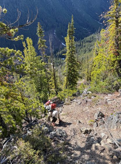
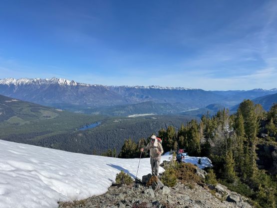
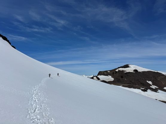
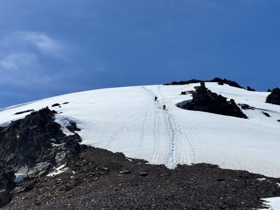
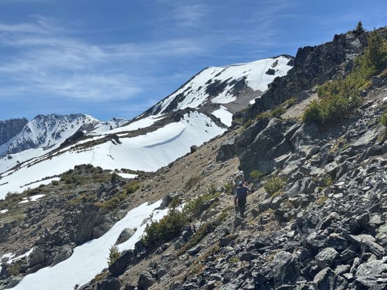
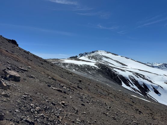
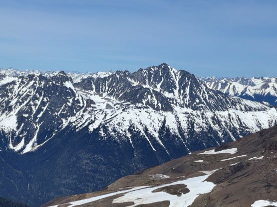
The route appeared quite dry but Matt mentioned the use of snowshoes (just a few days prior), so we decided to carry them to see where exactly they would be required. They ended up being not “required” after all, but we did benefit a little bit from having them. There were a few notable bumps to traverse up and over on the north ridge and they were a bit annoying mostly due to the boring terrain. The going was mostly plodding except for one traverse on loose talus and one section of 40-degree snow. That snow climbing part provided the only bits of excitement and I was glad this wasn’t exactly a “walk up”. The snow was soft enough that the ice axe and crampons weren’t required, and I even ditched the crampons earlier on after seeing how soft the condition was.
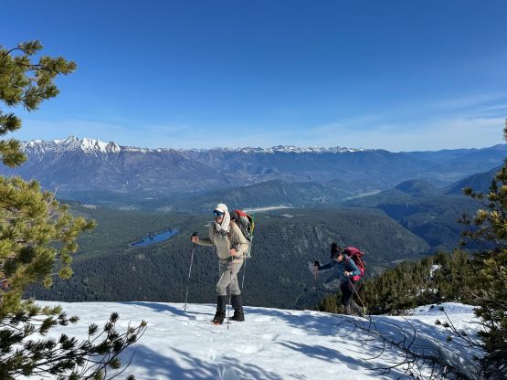
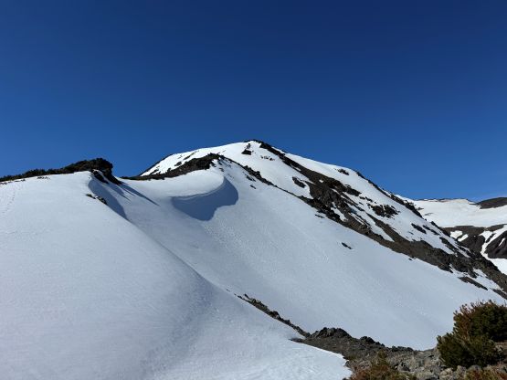
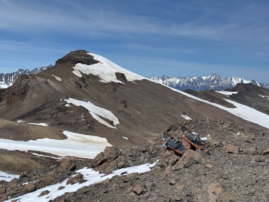
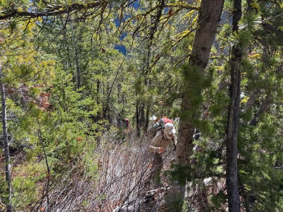
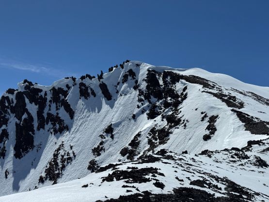
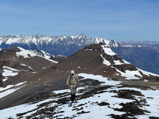
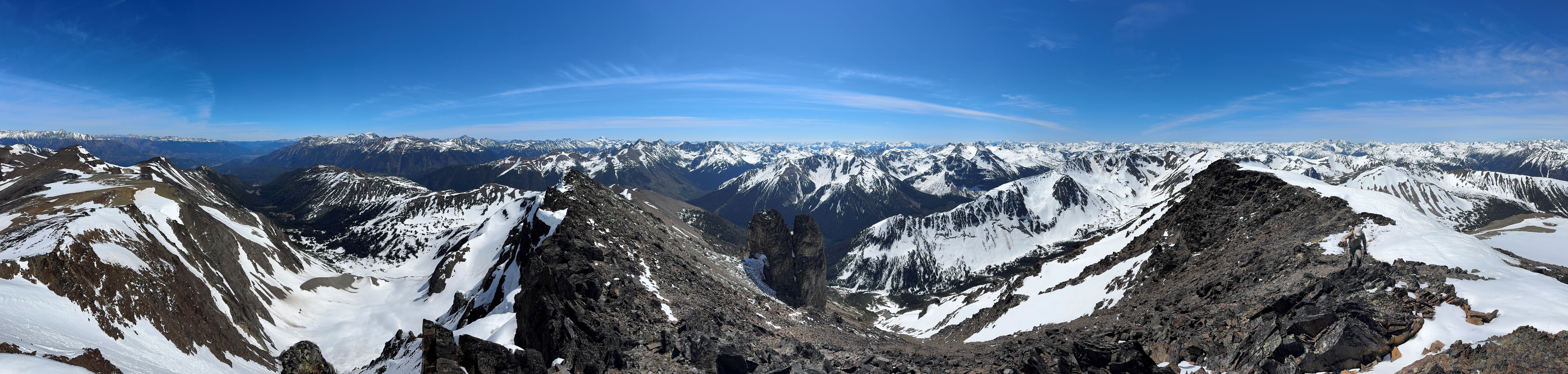
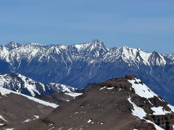
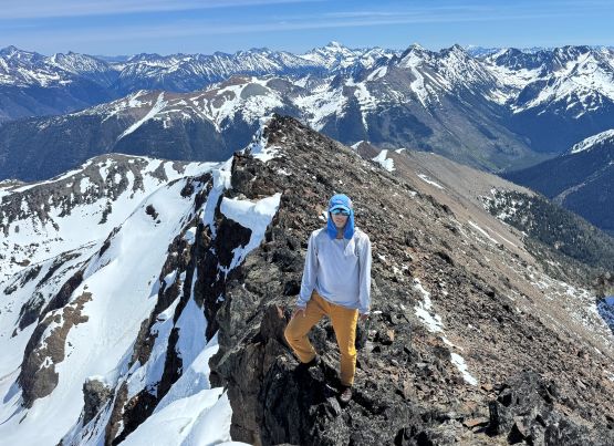
There’s one substantial and pointy bump to bypass and we followed Matt’s route traversing 270 degrees around the north, west and south sides. I was considering taking a short-cut across the east face but there were probably still avalanche concerns on a hot day like this, so we might as well stick to the known. The snowshoes were used briefly for the first leg of the traverse but they weren’t totally needed. Adam broke half of the straps in this 1-km side-hilling stretch as this was his first time using the snowshoes in 10 years, so the rubbers had all gone shit. I did bring a ski strap but that wouldn’t be enough to fix both of his snowshoes. Fortunately the rest of the route was mostly on dry ground. The final bits of the terrain on the north ridge appeared steep but turned out to be straightforward. This was my first time bringing the Jake’s memorial register up a mountain but there’s already a NSH register placed 20 years ago. That one was soaked wet and barely readable so we left ours anyway.
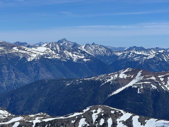
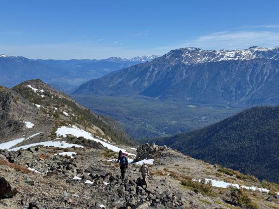
It was then the time to go down. Miranda and I still used the snowshoes for that traverse but Adam opted to boot-pack, which wasn’t slower at all. Adam did discover a few knee+ deep holes. Descending that steep snow pitch was quite fun using the “rabbit jump” techniques, but the rest of the descent was uninspiring. The final 400 m descent down the steep forest in trail runners did test my concentration skills as the terrain was very slippery and the navigation wasn’t no-brainer. I accidently led us deviating quite a ways from our own GPX track so did some steep traverses to correct the bearing. Our round trip time was less than 7 hours and we took a lot of long breaks, so this was definitely not a “long hike” by the SW BC standard. It was only 2 PM so I didn’t want to go home yet. I had Pearson Ridge in mind for a number of years as a back-up or bonus objective in the area, so we had to go check it out.