Mount Benson
September 29, 2019
1023m
Nanaimo / Vancouver Island, BC
Mt. Benson is a very popular hike locates immediately west of Nanaimo in the southern Vancouver Island. The peak itself is rather a lowly hill, but the hike does involve about 700 m elevation gain with some fantastic views from the summit. A road goes all the way to the summit from the “backside” but I haven’t heard anyone that drove up that road so I assume it’s either gated, or impassible. Almost every trip report I found used the trail network system on the north-east slopes starting from Witchcraft Lake. A hike up Mt. Benson was the secondary objective among Adam, Connor, Vlad, Mel and myself after ascending Mt. Arrowsmith earlier in the morning. The ascent of Mt. Arrowsmith only took 3.5 hours round trip and considering the expenses to get onto Vancouver Island we just had to bag another peak. The drive between the two peaks were about 1.5 hours, navigated purely by Google Map app on my iPhone.

Mt. Benson hiking route. GPX DL
There are many trails criss-crossing each other on the lower flanks that it really doesn’t matter which exact trail to take. They all lead uphill and eventually onto the summit plateau. We picked one that seemed the most direct on the Gaia GPS map. The trail quality was a bit worse than expected given the popularity of this hike. I was sure that there existed a smoother trail but we were too lazy to research and figure it out, so up we went picking whatever that seemed “right”. After a couple hundred meters of gain we crossed an old logging road. In another while we came to a neat viewpoint on the upper 1/3 of the hike. A short descent after the viewpoint we were soon back into the steep forested grunt, and the next viewpoint was pretty much on the NW (false) summit.

Our group hiking across the wooden bridge over Witchcraft Lake

Witchcraft Lake at the start
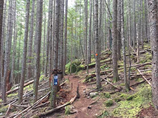
The typical trail condition on the lower flanks

Marching up. Photo by Mel O.

The view into Straight of Georgia from the first viewpoint

Mel hiking up above the viewpoint
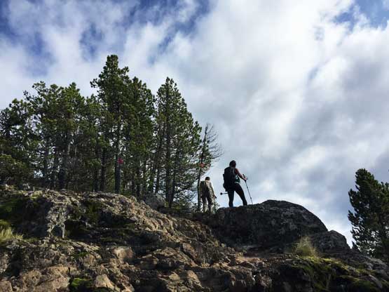
Almost onto the summit ridge now

Partial Panorama from the NW summit of Mt. Benson. Click to view large size.

A Canadian flag on the NW summit of Mt. Benson
On the map the name of this peak is labelled on the SE summit, about 200 horizontal meters away with some elevation loss in between, so we had to traverse there. Getting onto the summit required a short step of 3rd class scrambling and that’s quite fun. This summit was less scenic because of the radio towers. Connor and I opted to climb onto a concrete block for extra fun, before returning back to the NW summit that actually holds the “summit sign”.

Vlad scrambling the 3rd class step onto the SE summit
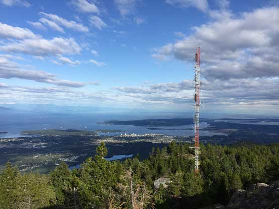
The radio tower on the SE summit, with Straight of Georgia behind

Partial Panorama from the SE summit of Mt. Benson. Click to view large size.

This is zooming-in towards Powell River across the straight
Zooming-in towards North Shore Mountains across Straight of Georgia
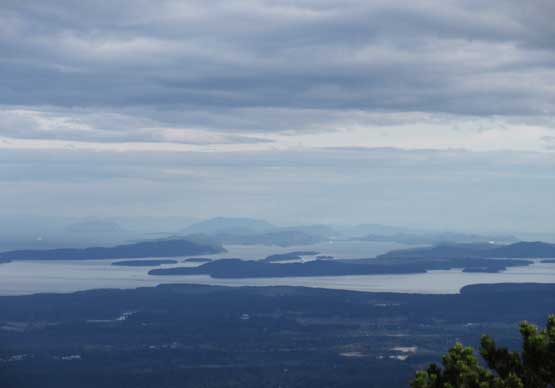
This is looking south towards Southern Gulf Islands
Mt. Tantalus in the distance from a not-so-often seen perspective

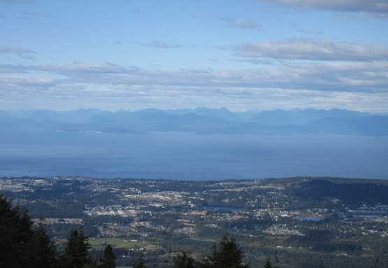
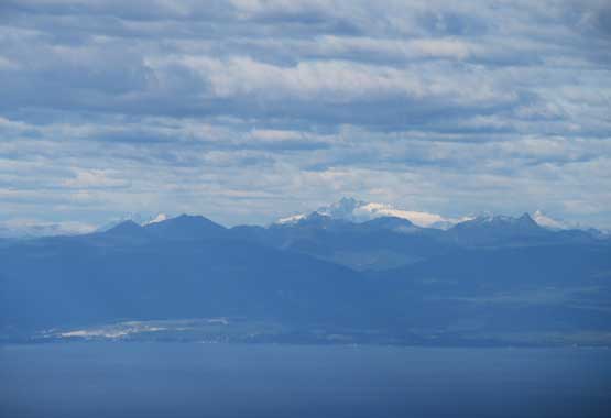
This is looking towards the taller summits on southern Vancouver Island

Me climbing the concrete block. Photo by Mel O.

Me mentle up the “true summit”… Photo by Mel O.
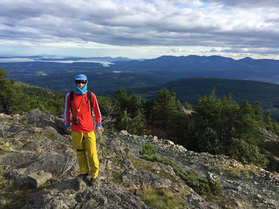
Me on the summit of Mt. Benson

Mel playing with a curious bird…
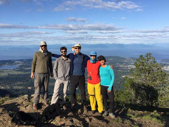
Our group shot on the summit of Mt. Benson
In order to catch the 8 pm ferry back to the mainland we didn’t want to linger too long on the summit. The descent was done in one single push on a fast pace. Our round trip time was 2.5 hours and that counted the lengthy wondering on the summit plateau.
Not wasting much time we immediately started the engine and directed towards Departure Bay which wasn’t far away. We got there at around 6:15 pm with almost 2 hours of spare but we were told that “the 8 pm ferry might or might not have a spot”. That really sucked but at this point we were committed to the gamble. I opted to take a short nap while the others wondered around while waiting. When 8 pm came we were in some long lines. The signal turned red a couple times but we somehow did manage to get onto the ferry, so all good. Two hours later we arrived at Horseshoe Bay and joined the hordes rushing into North Vancouver. I decided to drop both Mel and Vlad off at their respective houses before resuming the drive back to White Rock, where Adam and Connor had left their vehicles at my home. It was a long and exhausting, but very satisfactory day.
