Ts̓ekwts̓úkw
May 17, 2026
760m
Pemberton, BC
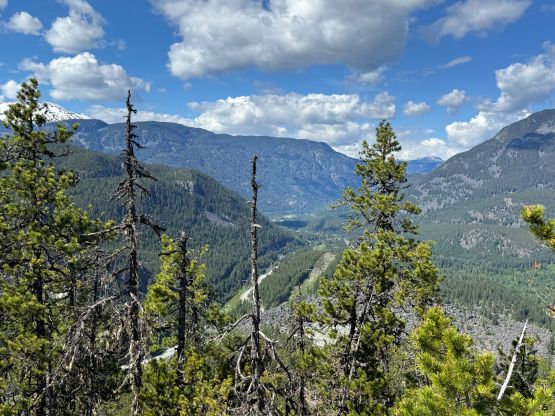
“Ts̓ekwts̓úkw” is the native name of the forested bump overlooking the start of Soo River FSR right next to the Sea to Sky Highway. This bump boasts over 200 m prominence but I hadn’t come across this name until the most recent year and I don’t think the status of this name is official. In fact, I have no clue about the origin of this name but apparently Open Street Map (OSM) has been using it and the database of peakbagger.com has adopted it as well. There are probably 100 biking trail on and in the vicinity but one can easily use a combination of these MTB trails to hike to the summit, and there are actually some views so don’t do it on a rainy day.
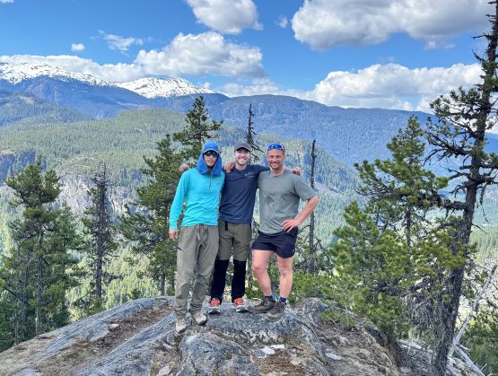
Harry, Rob and I happened to be in the area after hiking “Aunt Peak” with Elise, Tanja and Francois. We were travelling in two vehicles and the other team had gone straight back home. I proposed that we should add a secondary objective since “Aunt Peak” was too short for an outing. My original idea was the P200m bump at the end of Soo FSR but I was sure that nobody would be too keen on wallowing in the isothermal snow, so this lower one made more sense. The idea was easily sold so I drove us to one of the obvious starting points. Harry actually caught some cell reception and pulled Tareef’s trip report out. I of course didn’t bother to read anything as the trails are well labelled on the “Gaia Hike” map.
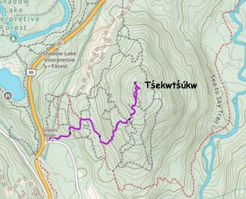
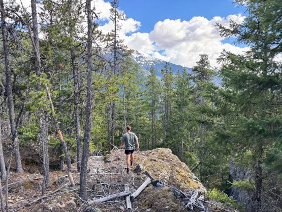
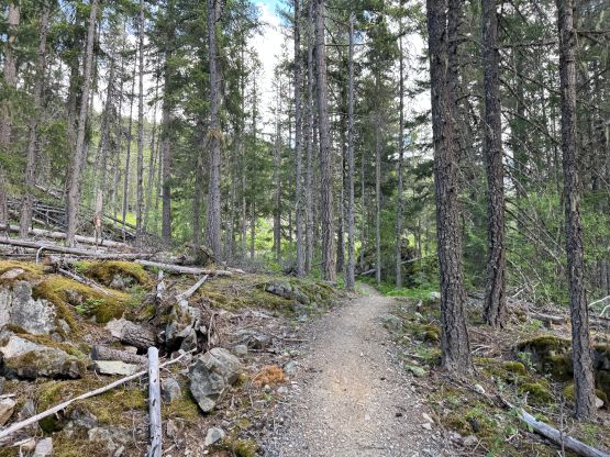
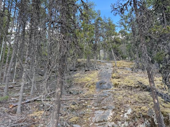
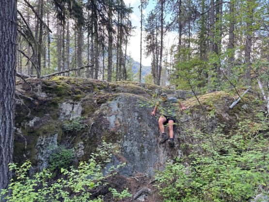
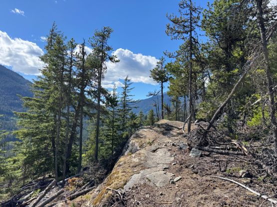
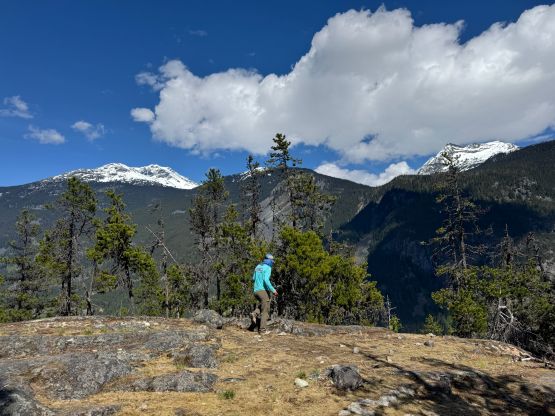
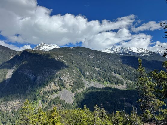
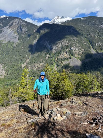
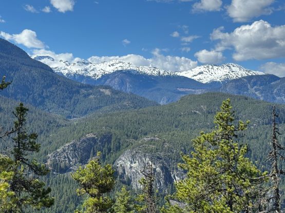
There’s more elevation gain and distance than I thought so this wasn’t a “freebie”, but we still decided to carry absolutely nothing. I forced in some water and food and then changed the footwear to the trail-runners that I had brought for “Aunt Peak” but didn’t use. The navigation was surprisingly tricky given the maze of MTB trails and some parts of the trails were literally on some FSRs. Without the GPS map it would be impossible to find the right way. I simply led us up taking the most obvious link-up and I think the route was overall quite efficient. There were some class 3 scrambling (no idea how the bikers descend those sections), as well as some up-and-downs. We got to the summit in exactly half an hour. The true summit is the northernmost point but the eastern edge offers the best views.
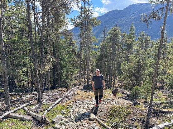
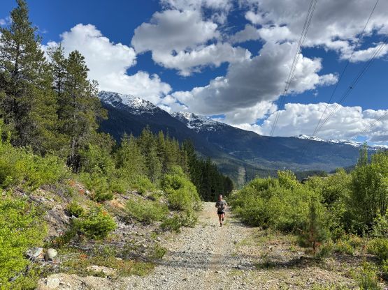
After taking in enough of the views we descended, roughly following the same route that we had taken. It was necessary to pull the GPS screen out a few times to make sure we stayed on course. Our round trip time was less than an hour and then I immediately drove us south to Whistler for some gas station drinks. I then pushed all the way back to White Rock for work in the evening.