Grigna Settentrionale
August 23, 2025
2410m
Lombardy Region, Italy
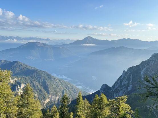
The Grigna massif locates on the east side of Lake Como in the Italian Alps not far from Milan. The higher north peak, Grigna Settentrionale or Grignone, boasts over 1500 m prominence and is one of the 44 “ultra-prominent peaks” in the Alps. This peak might not be the highest in the vicinity but is detached from the rest of the range. This is not a difficult objective but is also not a “freebie”. The standard route from the NW would take half of a day so my plan was to budget one full for the objective but also use this day as sort of a “rest day”. In the previous day I managed to ascend Säntis and Grauspitz in addtion to driving 8 hours from Germany down to Italy.
Adam and I did not pick the best place to pitch our tents in the previous night. It was 11:30 pm when we finally pulled in and I was simply too spent to search so we just camped at the very trail-head. The first thing was a cow grazing at midnight with a stupid bell. I wasn’t too bothered but Adam could not sleep with a cow ringing a bell around, so he threw some rocks towards that cow and it finally cooled down after an hour or two. Our plan was to start hiking at around 7 am but by 5 am the other hikers showed up and started to talk loudly next to our tents. I was still able to keep sleeping but Adam was not very happy about the situation. As a result Adam actually started 20 minutes earlier, and his plan was to tag the bonus peak M. Pilastro before meeting me somewhere along the standard route. Due to the 2000m elevation gain in the previous day I decided to skip this bonus peak.
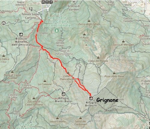
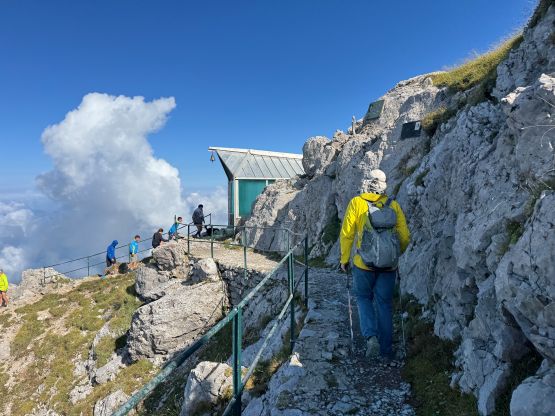
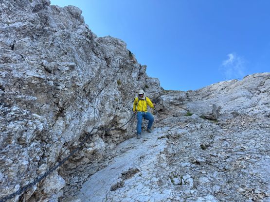
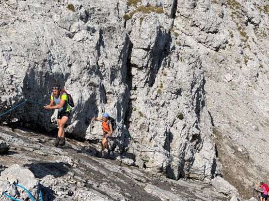
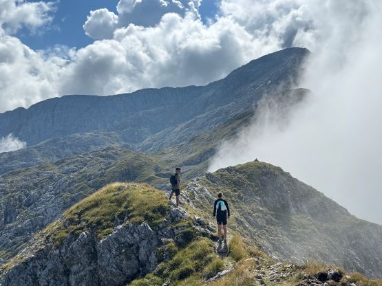
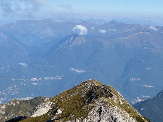
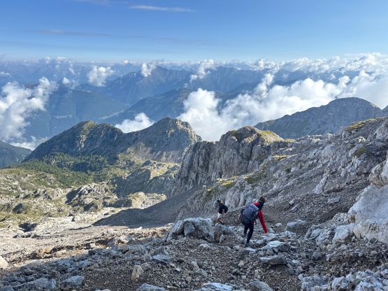
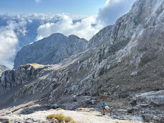
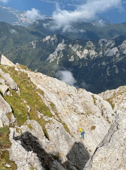
This route might not seem like much on the maps but involves fair amount of up-and-downs and micro-terrain, such that it’s still a sizable day. The trail to the saddle between Grignone and M. Pilastro was trivial but then the trail afterwards more or less became a scramble route. There are lots of variations judging by the number of trails shown on the Gaia map, but I had only downloaded the GPX track for the NW Ridge route. This seems like the “standard route” on peakbagger.com. I would rather call this a “scramble” than a “hike” although the route is well marked. About 3/4 of the way up I finally saw Adam showing up on one of the bumps behind me, so waited for him to close in the gap. Adam however, decided to skip a few exposed traverses by staying far below the ridge crest, so I resumed my way by staying on the crest of the ridge. Our routes did not merge until very much near the summit. We encountered a few slabby sections aided by chains. Adam’s route had a 4th class step whereas mine skipped that crux move. There weren’t a lot worth noting but definitely do not underestimate this objective. There’s more work than I thought.
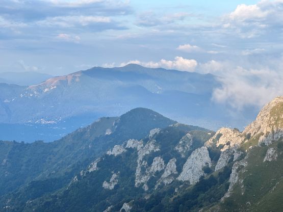
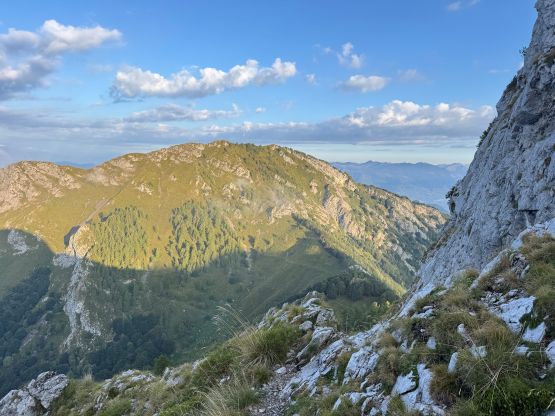
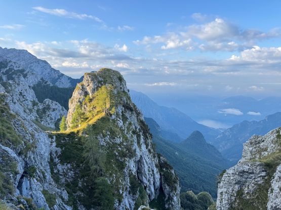
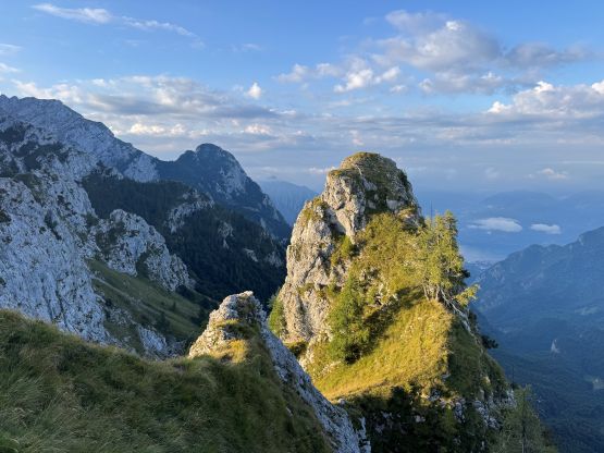

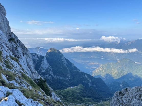

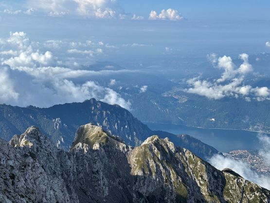
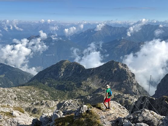


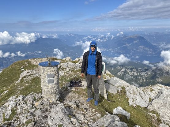
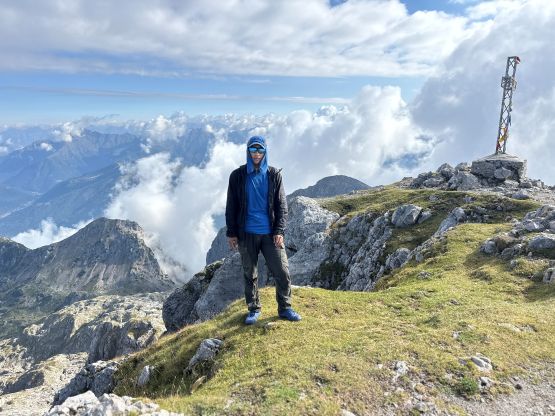
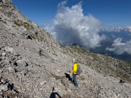
As a result we didn’t summit this objective as early as I was hoping for. The views were still nice, but the clouds were already starting to close in. On the descent I opted to follow Adam so that I could give myself a bit of a mental break, but I didn’t like the idea of deviating too much from the ascent route. A while later I called it and traversed back onto the NW Ridge, whereas Adam would keep descending the north valley to Rifugio Arnaldo Bogani. I thought his route was definitely longer but Adam caught up to me 2 km from the trail-head so our routes were very similar in time. Our round trip time was 4 hours 45 minutes including all of the stops. The plan was made to deal with the 2100+ m grunt up Pizzo di Coca on the next day, but we still decided to do at least one bonus objective in the afternoon.