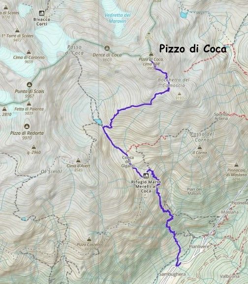
Pizzo di Coca
August 24, 2025
3050m
Lombardy Region, Italy
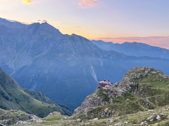
Pizzo di Coca, more commonly known as Pizzo Coca is the highest peak in Bergamo Alps of northern Italy. It subsequently boasts over 1800 m prominence and is one of the 44 “ultra prominent peaks” in the Alps. The normal route is not technically difficult but is very physically demanding with over 2100 m elevation gain. The scramble should not be taken lightly neither, as the entire summit block of 300 m elevation gain is mostly on 3rd class terrain with questionable rock quality. Most parties would spend a night or two in the rifugio about 40% of the way up but Adam and I planned to knock this one off in a single day, by car-camping near the trail-head. We disliked the booking system of these huts and we preferred the most efficient way of bagging these peaks to maximize the quantity in the 35-day period. In the previous day we tagged another “ultra” in the vicinity, Grigna Settentrionale in addition to 2 bonus objectives, and then drove all the way to Valbondione. We found a pull-out that’s reasonably quiet and private and settled for a few hours of sleep. I insisted on starting hiking no later than 5 am due to the not-so-perfect weather forecast. The weather turned out to be even worse than forecasted, but was still good enough for us to get the job done.
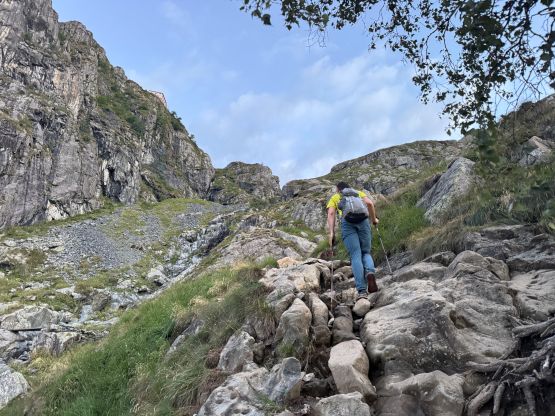
The air was humid and wet as expected, such that our sleeping gears were all soaked even though it was not raining. We dragged our tired asses out of the comfortable sleeping bags, packed the tents and drove to the trail-head in the pitch dark. We opted to follow Reed Russel’s route instead of Rob Woodall’s mostly because the parking situation for Rob’s starting point was grim. I wasn’t in the mood of risking another parking ticket so we drove back to Reed’s starting point and started from there. I knew nothing about this objective beside knowing it’s not difficult, and the ascent would be done on a trail. I was only partially correct. I had learnt gradually in this trip that, the trails in Italy are generally not as well-engineered. There were a shit ton amount of roots and rocks on most of these trails. As a result this objective was even more physically demanding than the stats suggested. There were also a shit ton of spider webs but Adam was leading the pace so I wasn’t going to complain. About halfway to the hut we could turn off the head-lamps but we also saw some thunderstorm clouds to the south. The weather was currently clear above us, but I turned off the airplane mode and checked the forecasts. Not to my surprise, the forecast had downgraded but there’s nothing we could do at this point. The system seemed to be making their way along the E-W axis so hopefully we wouldn’t get hit hard.


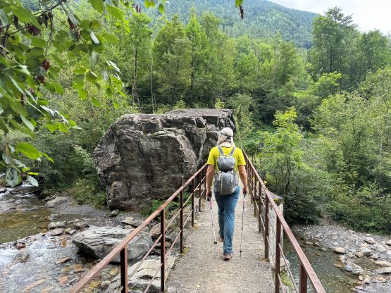
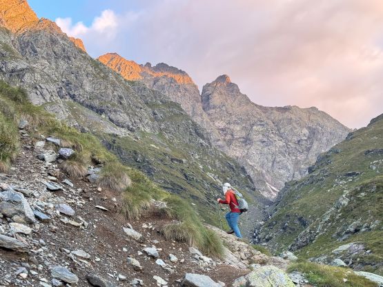
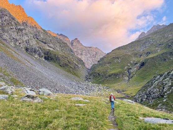
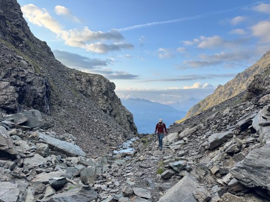
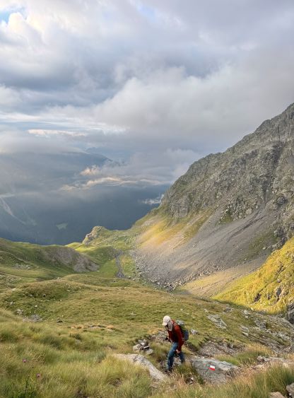
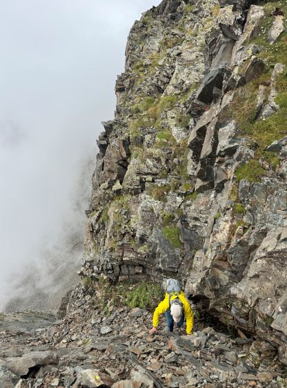
Adam needed a food break about 200 vertical meters below the hut but I was hiking shirtless and was feeling cold, so I resumed and waited for him to catch up at the hut. I didn’t bother to go inside because I used a short-cut trail to bypass the hut. Plodding into the hanging valley ahead we hopped across a creak and loaded up the water bottles there. The next short while was very scenic with some morning colours and surreal landscape. I checked the forecast again and now it seemed like the system was heading our way. The blue skies quickly gave way to clouds and fog, but fortunately the precipitation and the thunders never arrived. From Lago di Coca we picked up the climber’s path up through the talus fields, and the next while was a steady but tedious grunt up the SW flanks of Pizzo di Coca. Because there was no view we simply kept plodding all the way to the start of the scrambling section. I thought about to go ahead but I quickly encountered a difficult chimney with a few 4th class moves. I could not find an obvious bypass so waited for Adam to catch up. The weather was also improving, thankfully.


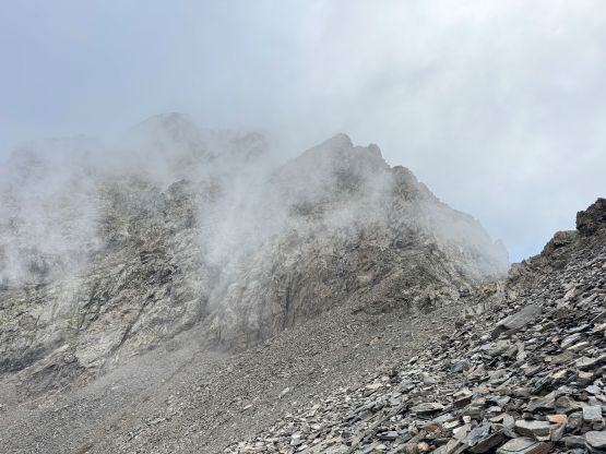
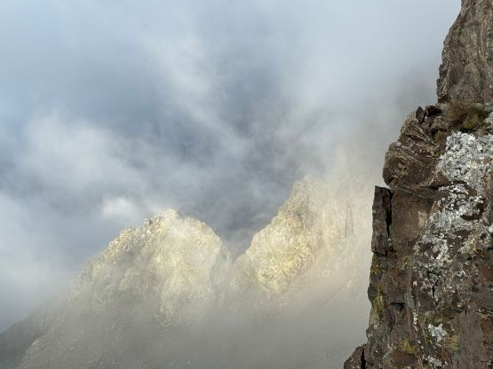


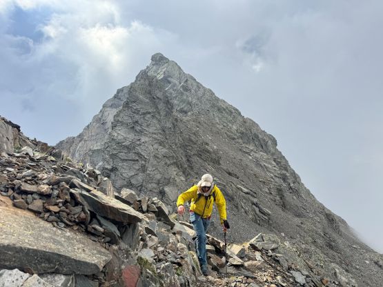
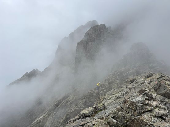
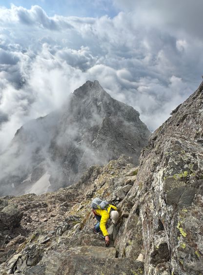
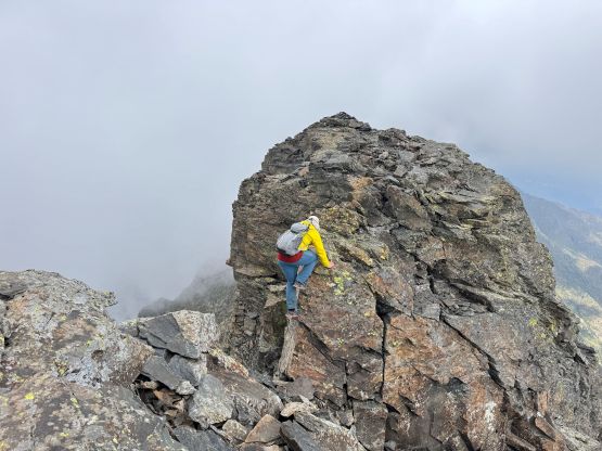
Adam admitted that the scrambling was quite stiff so this was not as easy as I was hoping for. We had 300 m elevation gain left, and most of which would be 3rd class terrain with route-finding. The route was reasonably well marked with the painted arrows but it wasn’t obvious enough for me to shut the brain off. There were several ledge traverses to the climber’s right followed by a section of near-vertical scrambling albeit with good holds. This was followed by a short ridge traverse with moderate exposure. The upper half of the summit block had some rotten rocks so we had to be uber careful as none of us had brought a helmet. The scrambling was also mostly class 3. Upon arriving at the summit I noticed another contender to the NW that appeared equally high. The traverse over to the NW high point was the actual crux of the route with a few 4th class steps, but it was quite fun. Adam reluctantly followed. My GPS readings showed the two contenders of equal height but the LiDAR likely showed the original summit to be higher (as otherwise the peakbagger.com database would be updated). I nevertheless thought it’s always worthwhile to add some extra work in to be 120% sure in situation like this. Who knows if another survey would get conducted.


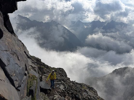


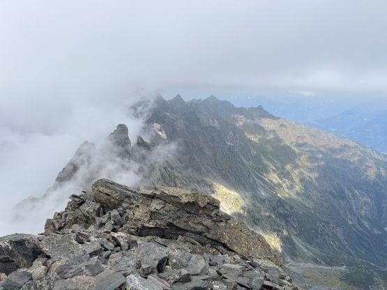


It was also obvious that we wouldn’t be getting much in terms of the summit views so we made our way down, taking our time on the scrambling sections. We noticed more clouds coming in and the air was starting to get saturated. While descending the hanging valley towards the hut we got hit by some showers. We went into the hut this time to dodge the weather but didn’t purchase anything. The shower stopped but it was still foggy, but we went out anyway. There was thankfully no more rain but the descent into the valley took forever. Our round trip time was 8.5 hours which was faster than expected. At this point I had to make a decision about the objective sequence in the following days. The weather would be still good for a number of days. Adam voted for Cima Dódici but I thought the easy one had to be saved for a bad weather day much later. The goal was to tag one “ultra” each day until the end of the trip, 10 days away so we needed to plan strategically. I eventually forced us to drive another hour and half further east than Cima Dódici to settle on Col Nudo on the next day, and the following day would be Antelao.