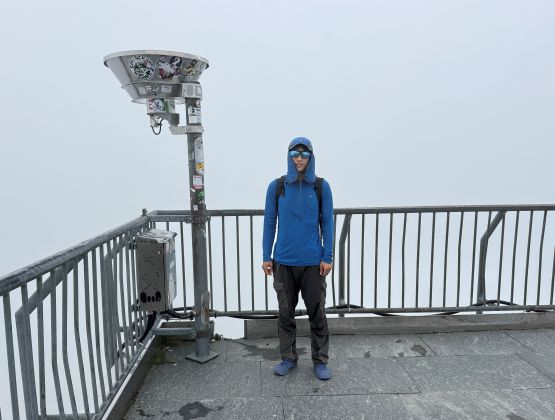
Säntis
August 22, 2025
2502m
Switzerland
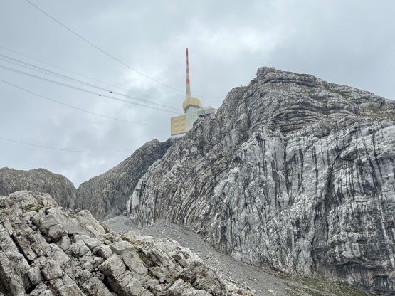
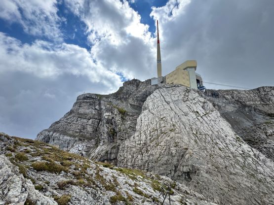
Säntis is the highest peak in “Alpstein” in northeastern Switzerland which forms its own range completely detached from the main parts of the Alps, making Säntis boast over 2000 m prominence even though the elevation is far from being lofty by the Alps standard. This peak is not terribly far from Zurich or Lake Constance and is heavily developed for tourism. There’s a large museum with a restaurant on the very summit, and tourists can take a gondola ride all the way to the top. The cost is not even that crazy. For 29 CHF (one way) I would consider this “cheap” especially compared to other gondola-assisted peaks in the Alps. After putting Säntis on the itinerary I knew I wouldn’t be fully satisfied to take the tram up but I did plan to take the lift down to save my knees. Adam wanted to take full advantage of the access so we would be doing this objective separately, albeit on the same day.
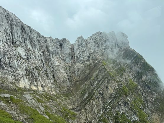
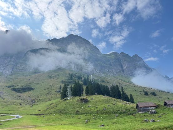
The hike to the top involves over 1200 m elevation gain and should take me somewhere around 2-3 hours. The weather was not ideal but at least I spotted a few hours of window in the morning without rain. I most likely wouldn’t get much views but I still didn’t want to just take the tram up. Adam had booked our hotel more than 1.5 hours away from the objective so we still had to get up reasonably early. The weather wasn’t as terrible as expected, such that the impressive NE Face was still in view by the time we parked the vehicle at Schwägalp. Adam confirmed once again that he would be taking the tram up and I also confirmed once again that I would be hiking up, so I quickly started my trip.
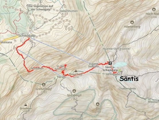
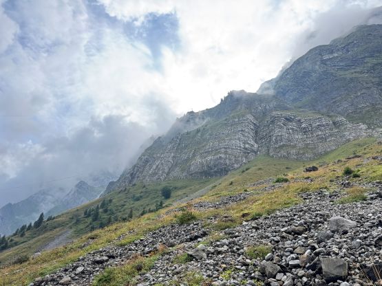
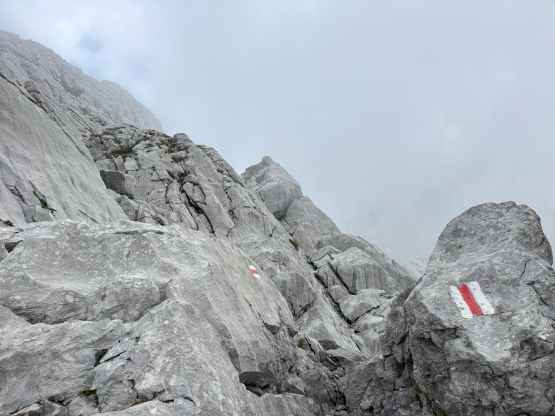
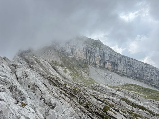
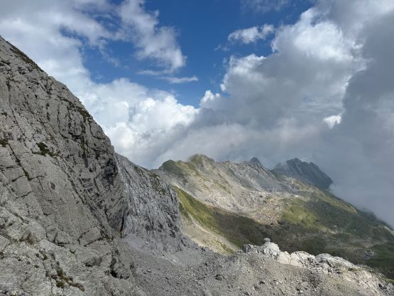
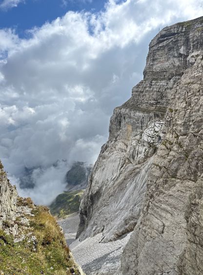
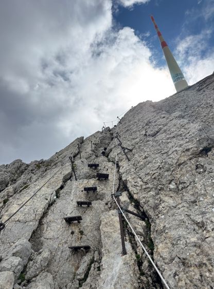
The only research I did was to download Matt Juhasz’s GPX track as that’s the one showing up first on the peakbagger.com website. For an objective that’s rated as a “hike” I disliked spending too much time digging or reading. Instead, I would simply let the story unfold itself. The objective was definitely daunting but again, on limestone peaks like this there are always hidden ledges not visible from the bottom. Indeed, the route traverses across many of those ledges and never became too difficult. I probably would rate this as a “scramble” instead of a “hike” as many parts were assisted by chains and pitons and there were considerable amount of exposure here and there. The weather was mostly as expected, foggy but not rainy. And because of that, I didn’t end up taking too many pictures.

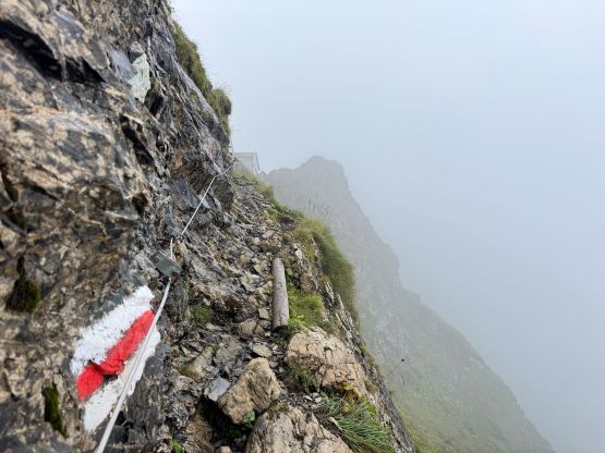
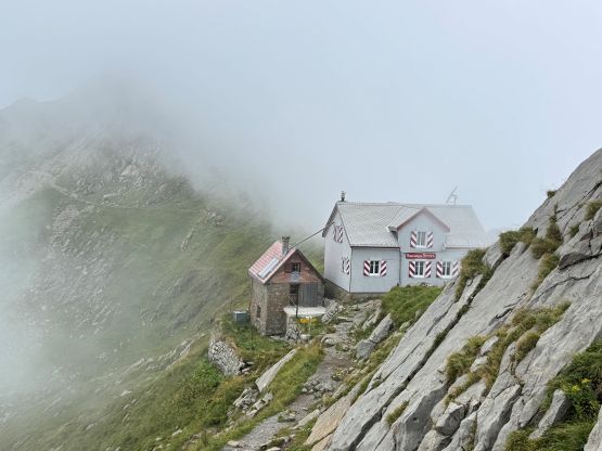
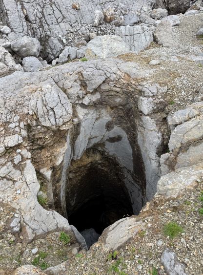
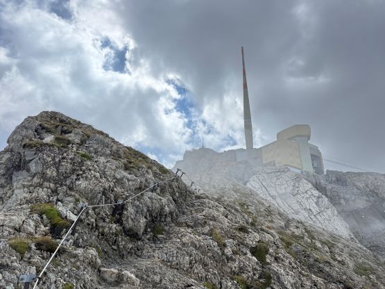
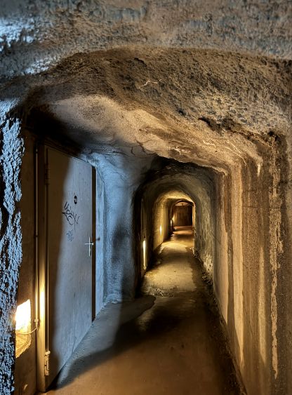
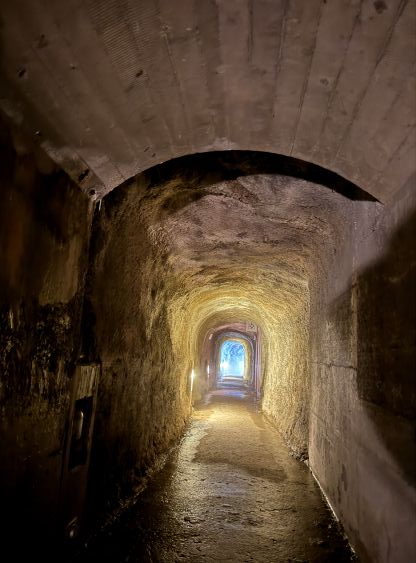
After a long haul I was on the SW Ridge shoulder where a hut was located. I didn’t know if that hut was in use or not because I saw nobody around. I wasn’t interested in checking that out anyway, so resumed my way towards the summit. The next stage was more complicated than I thought with some micro-terrain to content with, and then I came across a work zone with lots of signages. I ignored some of the marked routes because the route was doing unnecessary switchbacks, but found a few 30+ m deep caves. That’s probably the reason why the officials wanted the hikers to stay on the trail. To my surprise I actually got some views while scrambling up the north slopes but I couldn’t see the distant Alps giant. The final ascent was a solid 3rd class scramble aided by chains and pitons. Without the artificial stuffs this ascent would probably be at least borderline climbing. The most interesting part of the ascent was actually the finish. I followed the marked route entering a shallow tunnel which quickly turned into a deep tunnel inside the mountain. There were enough illumination such that I didn’t need to turn on my phone’s flashlight, but it felt definitely quite strange. The tunnel gave way to a spiral staircase and that brought me to the bottom of the restaurant/tram/museum. I climbed at least several floors and eventually found an exit, and tagged the summit which required more walking on staircases than I thought. Adam later tole me that even his “ascent” took 16 minutes.
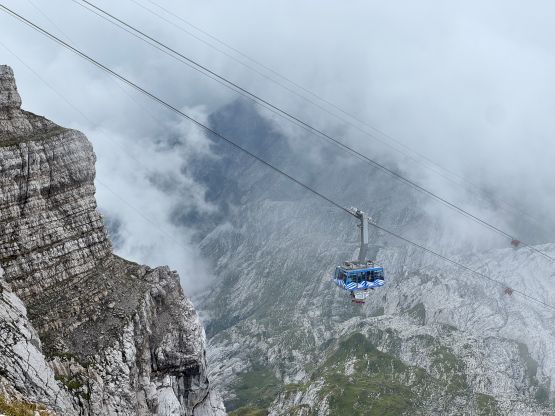
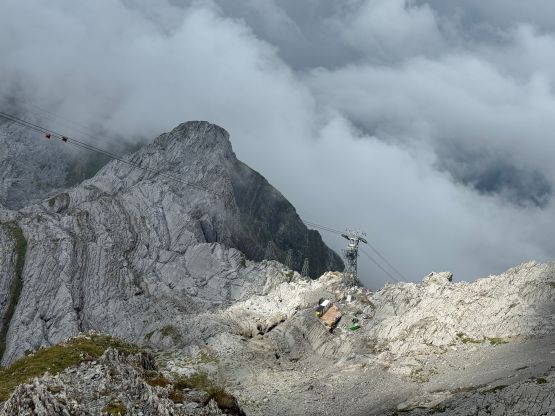
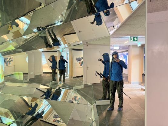
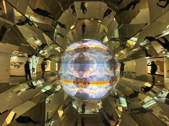
Since there was no view I quickly descended. The route I chose to descend the building complex brought me into that museum, which was free. I wasn’t planning to actually visit the museum but since there was no additional charge, why not. This was actually quite cool. I then bought myself an one-way ticket but had to spend half an hour waiting for the ride down. The plan for the rest of the day was to simply drive a few hours southwards to Gringa Settentrionale but I changed my mind after realizing we’d be travelling through the small country of Liechtenstein. A quick search on Google had me deciding spontaneously to tag the country’s high point, as we were literally there.