Monte di Tremezzo and Monte Galbiga
August 23, 2025
1700m
Lombardy Region, Italy
Monte di Tremezzo is one of the more accessible P600m objectives in the vicinity of Lake Como that the “ascent” is short enough to be basically a “freebie”. I noticed this objective by browsing the World’s P600m map on the Peakbagger app. I started to formulate a plan to squeeze it in after completing Grigna Settentrionale which was the primary objective of the day, but I wasn’t sure if we’d have enough time. The driving direction was “wrong” because the objective for the next day was Pizzo di Coca so I checked with Adam about his thoughts. To my surprise Adam was very optimistic so the trigger was pulled. Adam even wanted to grab another P1300m “Ribu” but I wasn’t too sure about that. Further research showed that the nearby M. Galbiga is only 2 m lower which is too close for comfort. Fortunately the two peaks share the same access and tagging M. Galbiga would only add 100 m elevation gain into the outing.
The crux was definitely the drive because of the winding and narrow roads. We wanted to drive to at least the col between these two peaks as the road leading to that point is almost entirely paved. There’s even a restaurant and a hut at the col. The drivable end is another kilometer beyond the col towards M. Tremezzo. I wasn’t too positive about that stretch but we proved that it’s possible drive a rental 2WD all the way there. This final, unpaved section was likely not meant to be driven but there’s no physical gate so why would I care. For the driving direction the Google Map was mostly correct but I wasn’t entirely sure if we had taken the easiest way, as there was an unpaved stretch in the middle with lots of pot-holes. However, we encountered at least 10, if not 30 downhill vehicles on various stages of this drive (including the unpaved section), so there’s probably no better way. In any case I had recorded the driving GPX in addition to the hiking track, for future reference.
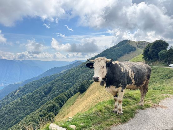
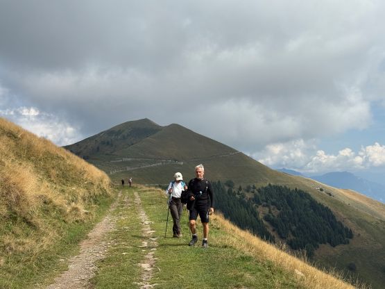
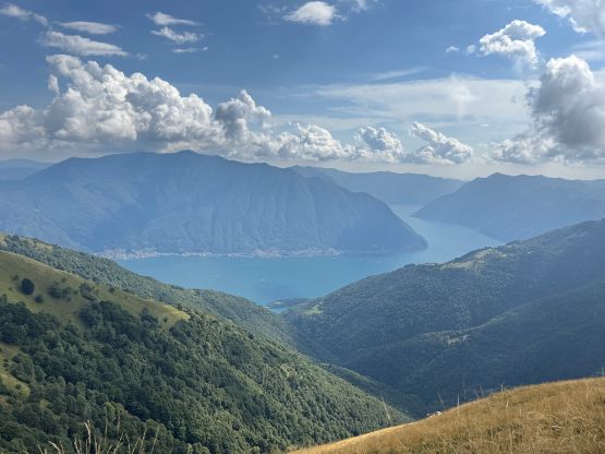
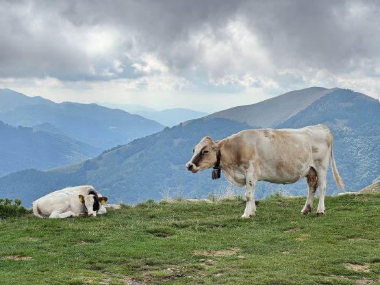
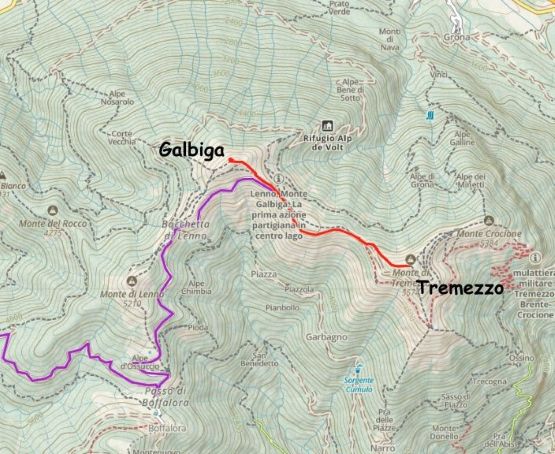
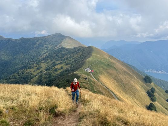
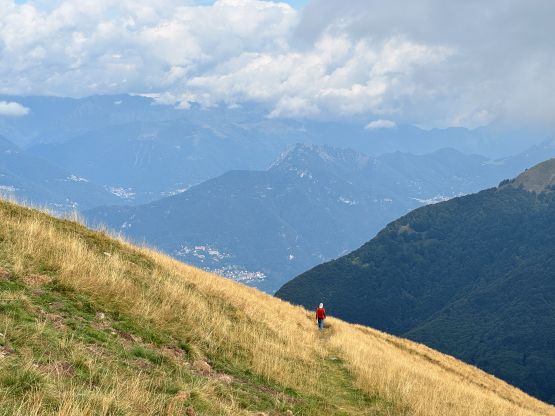
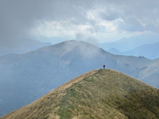
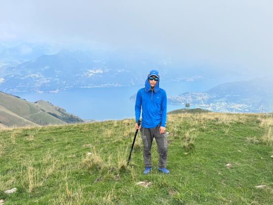
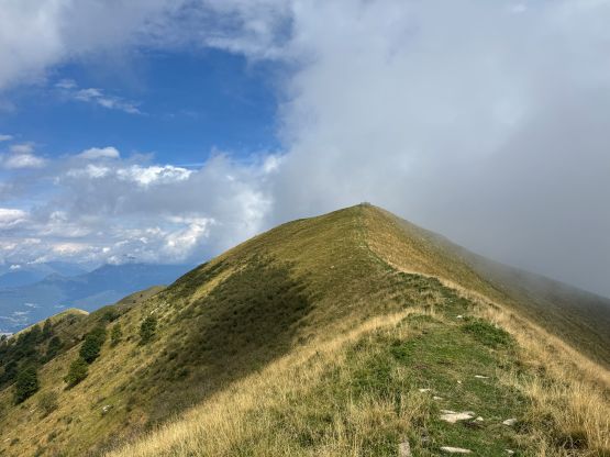
There was only space to turn around and park a vehicle or two at the absolute drivable end and there were several cows around. I hoped that our vehicle wouldn’t get kicked by these cows because this spot is mostly visited by hikers on foot. The views were already excellent from the upper portion of the driving access as well as the parking area. I still wanted to hurry up because the clouds were building and there was chances of thundershowers according to the forecasts. The weather was not a problem in the end, but I wanted to be very sure. There was still over 100 m elevation gain to the summit of Monte di Tremezzo but the route was obvious and the trail was reasonable. This was however definitely not a very often visited summit judging by the quality of this trail on the west ridge. The clouds were mostly obscuring the views from the summit so we quickly descended and then drove back towards the restaurant.
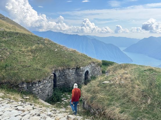
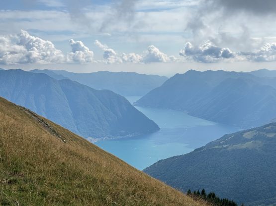
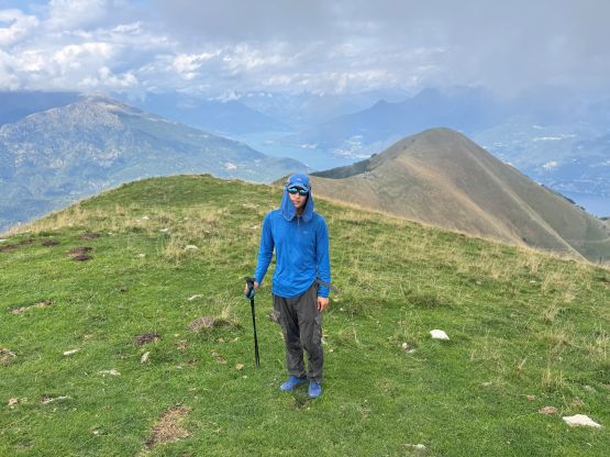
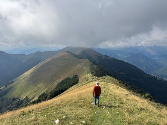
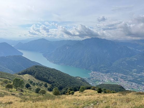
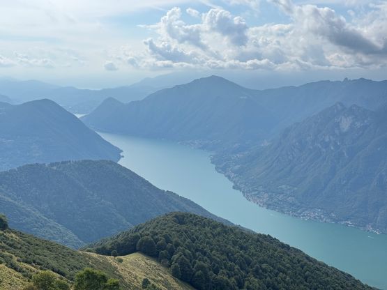
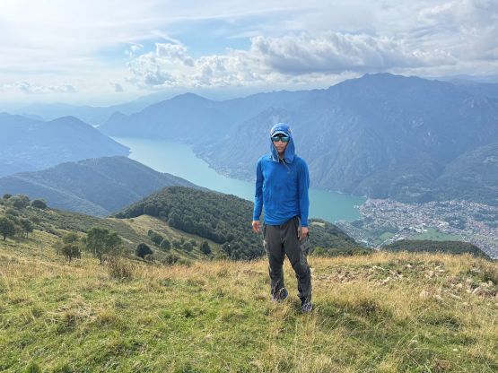
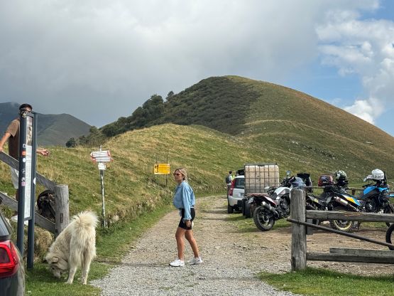
I wasn’t sure if we could legally park at the restaurant’s designated lots because we weren’t paying anything there, but I found a spot to squeeze the vehicle beside the dirt road slightly away from the restaurant. Tagging the summit of M. Galbiga wasn’t complicated via the SE Ridge. There’s only 100 m elevation gain. The lower half was on a road and the upper part was done by taking a short-cut trail. The summit was more scenic than I thought especially with views of Lago di Lugano to the west. We didn’t linger too long up there due to the long drive ahead. The winding roads were still nerve-wrecking but at least we didn’t encounter too much traffic in the opposite direction. The drive down into the city of Como, the grocery and gas stops and then the eastwards travel past Bergamo towards the trail-head for Pizzo di Coca at Valbondione was very exhausting. I barely had enough energy to get us there and since our arrival was late, we wouldn’t be getting too many hours of sleep.