Estero Peak
May 3, 2026
1664m
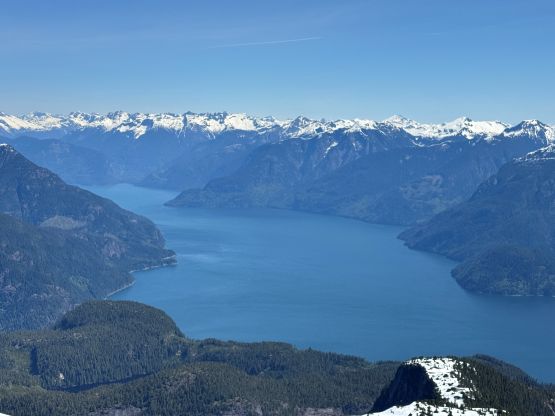
Bute Inlet, BC
Estero Peak overlooking Bute Inlet is one of the three coastal “ultra prominent peaks” that can be fairly easily accessed by chartering a boat out of Campbell River vicinity on Vancouver Island. Over the past two years I had already done Mt. Van der Est and Mt. Addenbroke and the plan was to go with the same boating company on similar itinerary. Alex, Trevor and I had been discussing Estero Peak for this entire past winter season and this was the second time that we checked in with Peter from S.S. Fun Ship. The first time was in February but Peter wasn’t available. Once confirming Peter’s availability on this past Sunday we recruited a group of 6 to fill in the boat. We did have to travel to the island in two vehicles so there’s more ferry and gasoline cost, but that’s alright. Erica and Trevor would go with me from Tsawwassen on the 5:45 pm ride whereas Francis and Brayden would hop into Alex’s vehicle for the 7 pm ride out of Horseshoe Bay.
Peter had texted me about a more direct route from the south side and in fact, his neighbour had even “carried his 5-year-old son to the summit” so Estero Peak could potentially be a much simpler outing. However, Peter himself knew fairly little about the route and certainly had no GPX track nor any detailed information. Not wanting to take a chance with the gnarly sea level bushwhacking we opted to go with the knowns. Chris Hood had gone up via the west ridge roughly following a route that he obtained from the Powell River legend Jason Addy, and Chris kindly passed that GPX track to me. The west ridge is considerably longer but we had a time constraint (wanted to go all the way back to Vancouver on the same day) and it made no sense to push into the unknowns. Furthermore I was able to dig out another GPX track from Gaia’s public track database, that someone had gone up Chris Hood’s route in summer time but over 3 days. Chris’ round trip time was over 14 hours so I estimated it to be around 11 hours for the 6 of us. It turned out to be 8.5 hours with only 6.5 hours of moving, but we had a very strong team and were going pretty hard on the pace.
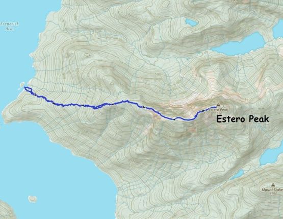
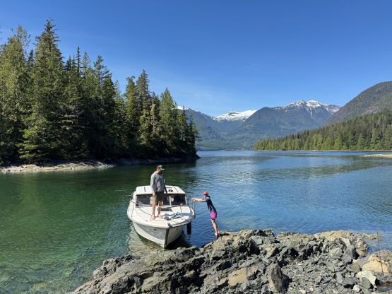
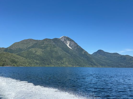
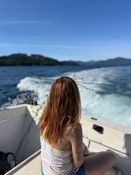
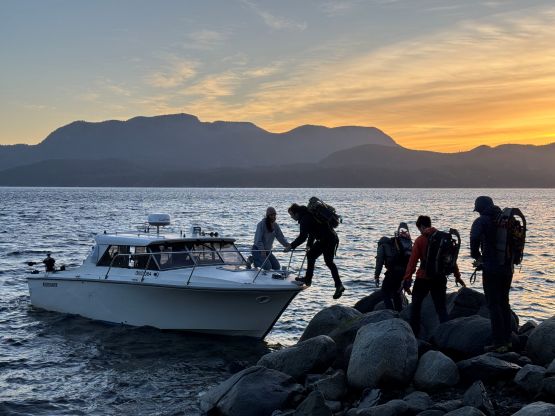
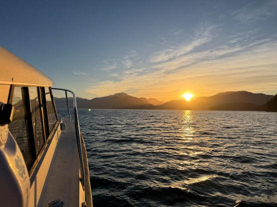
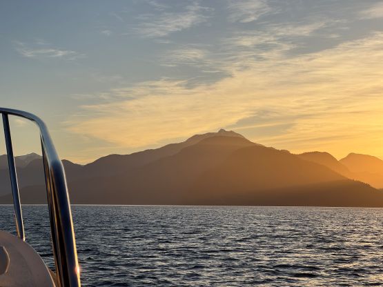
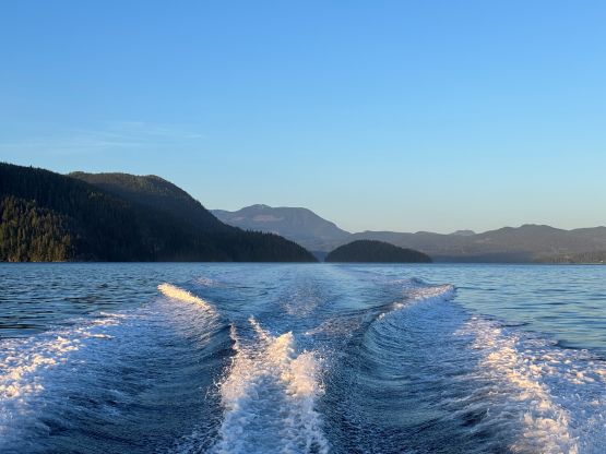
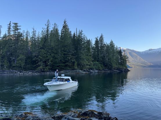
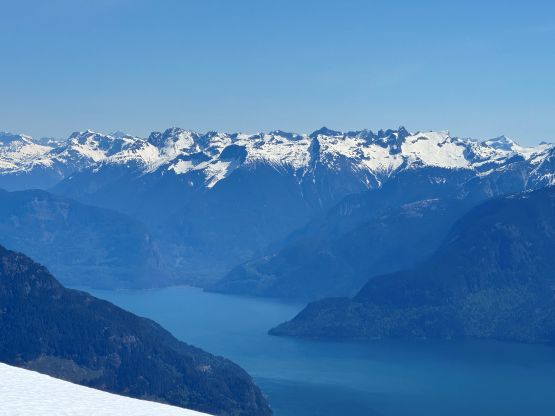
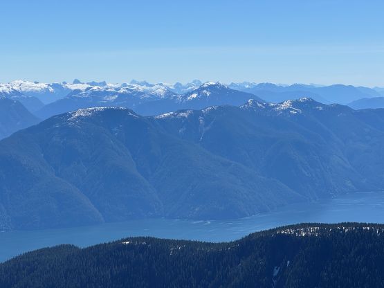
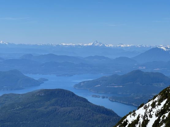
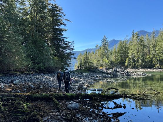
The 6 of us got to Elk Bay at around 11 pm and I texted Peter that we were ready for the pick-up at 6 am. I would have preferred an earlier departure time but Peter could no longer boat us across the straight in the dark, so 6 am was realistically the earliest possible time. Peter’s wife came with us in the morning as I told him that none of us was fat. The sub-1 hour ride was uneventful and we got some nice morning views. Contrary to the last trip the water was quite calm. Finding a spot to drop us off turned out to be a bit tricky as the obvious beach was too shallow for the boat to safely approach. None of us was wearing water shoes neither so we weren’t looking at jumping into the water. We eventually found a rock and made do, but the point was slightly south of where the reference GPX track started.
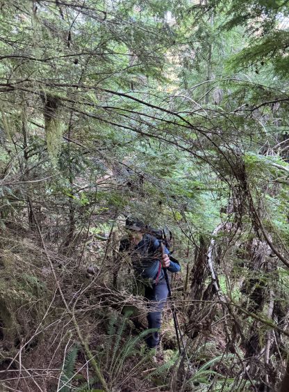
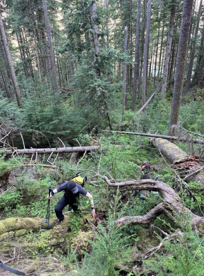
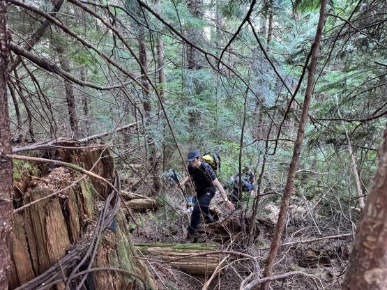
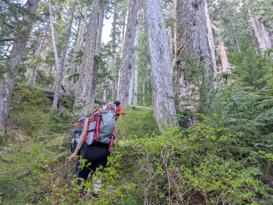
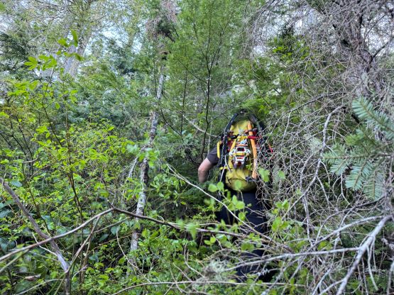
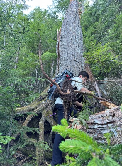
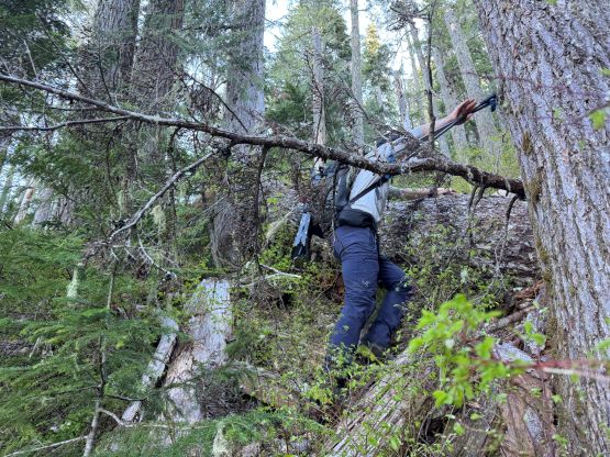
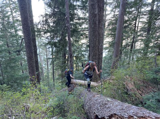
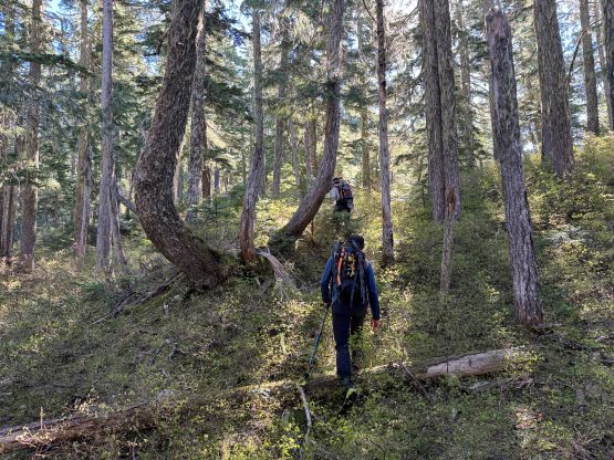
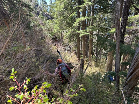
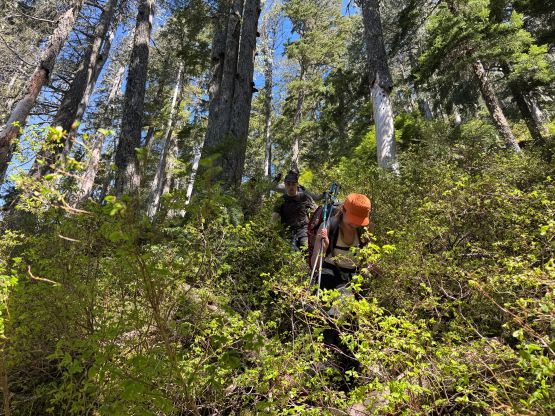
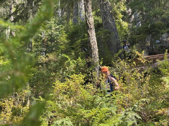
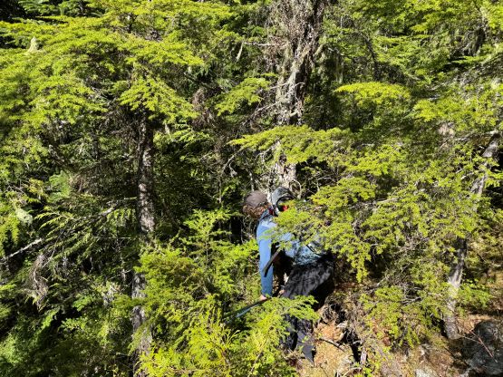
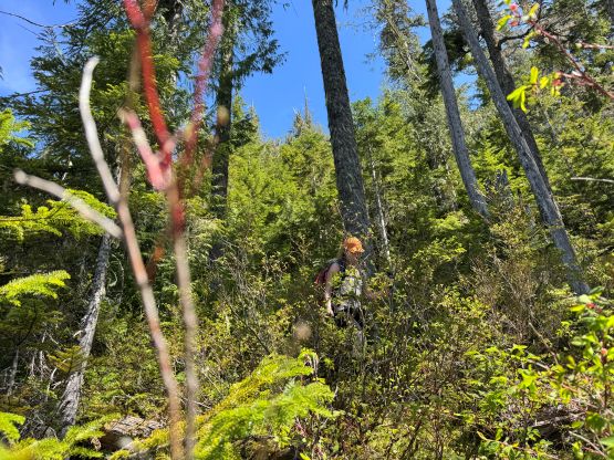
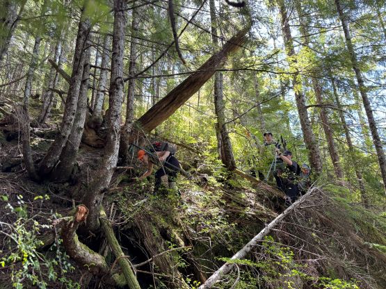
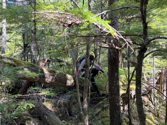
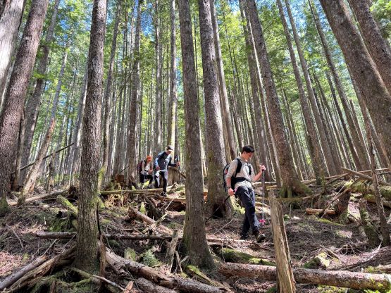
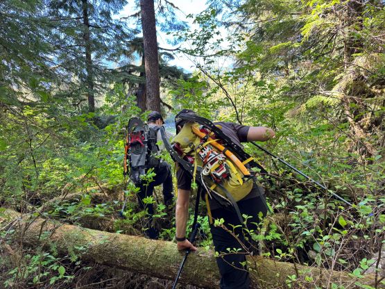
Upon having our eyes on the conditions we decided to ditch the avalanche gears but still carried the ice axes, crampons and snowshoes. The snowshoes turned out to be crucial as the heat wave had really taken a toll on the snowpack, but the ice axes and crampons were training weight for the day. Chris didn’t make the bushwhacking sound like much of a deal but he’s also been doing this kind of shits for over 30 years. I thought the bushwhacking was quite brutal. The initial 200 m gain was bad with lots of rotten dead-falls, muddy flats and prickly plants and the zone from 750 m to 1000 m was chocked with dense underbrush and tight timbers similar to this elevation band on Mt. Denman, such that the thrashing was sustained “level 3+” for at least half of the route. The middle section around 500 m was thankfully mostly in open forest and we even picked up a bunch of flagging. I think in retrospect we should have timed an earlier window in January or February as having snow from 750 m onward could significantly reduce the amount of work load. I also got poked quite hard in the eye within 100 m from the start and my left eye went blurry for a couple hours afterwards. My vision thankfully came back later in the day as the situation was quite concerning, frankly speaking. I thought I might have to go for a surgery or something but thankfully it didn’t seem like a doctor’s check would be needed.
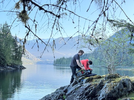
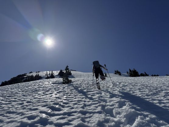
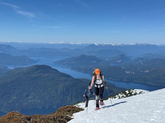
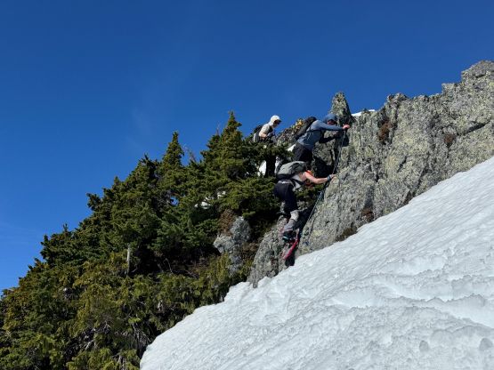
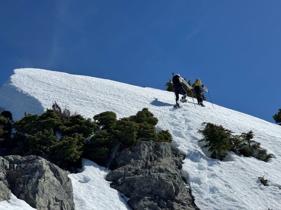
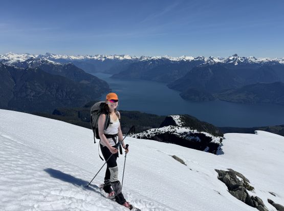
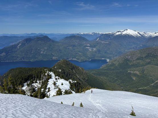
At around 1200 m elevation we suddenly hit snow and the snow quickly became continuous. After post-holing for a few hundred meters I made the call to swap footwear from the trail runners to mountaineering boots. I was the only one doing the footwear change as everyone else had opted to wear boots for the entire day. I also donned snowshoes as based on my experience the depth of the snow would go from zero to several meters within a few hundred meters, and I was correct. The others had to make a snowshoe transition very soon. We also luckily found the only trickle source of water on the entire route, and filled up our water bottles. The steep section at 1350 m was indeed quite committing with some 40+ degree slopes. The soft conditions made it possible to cut several tight switchbacks on snowshoes, as otherwise we would have to don the crampons. Alex and Trevor went further climber’s left and needed to take their ice axes out. I led the rest of us traversing climber’s right and it wasn’t too bad.
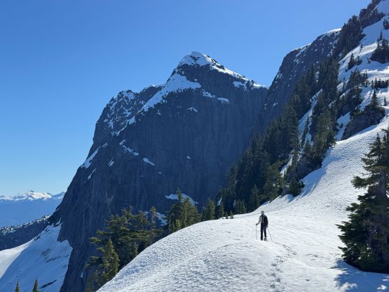
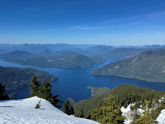
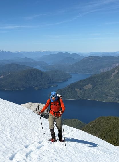
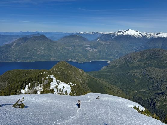
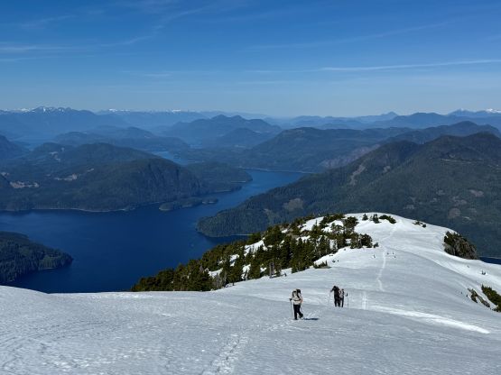
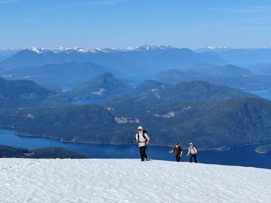
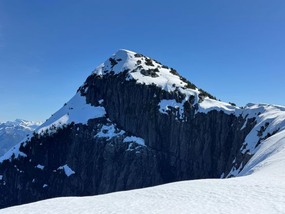
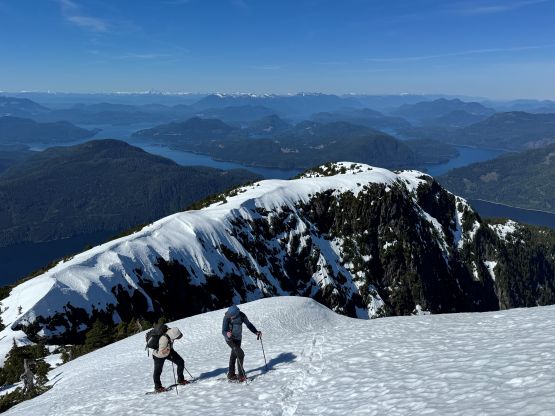
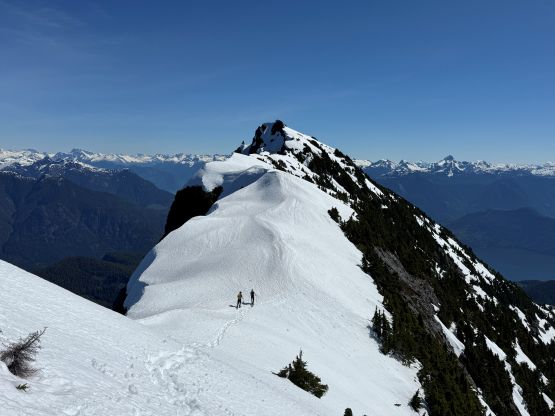
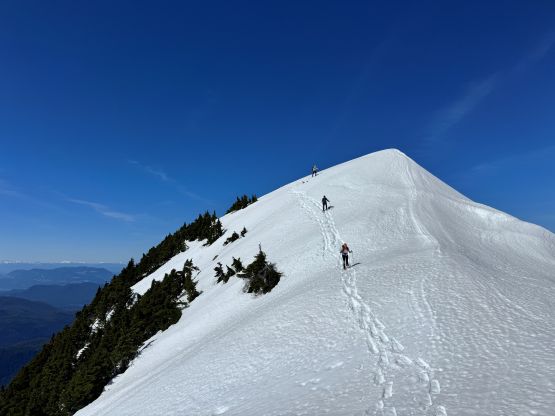
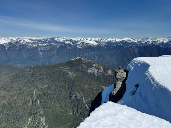
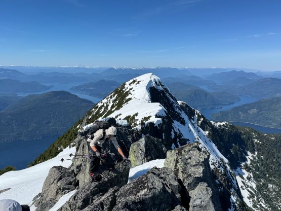
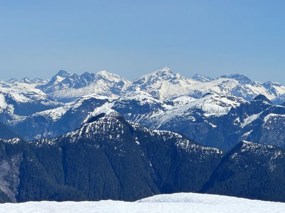
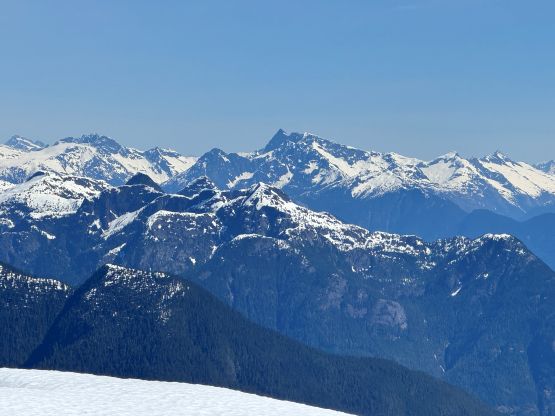
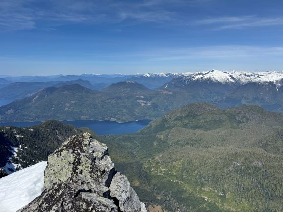
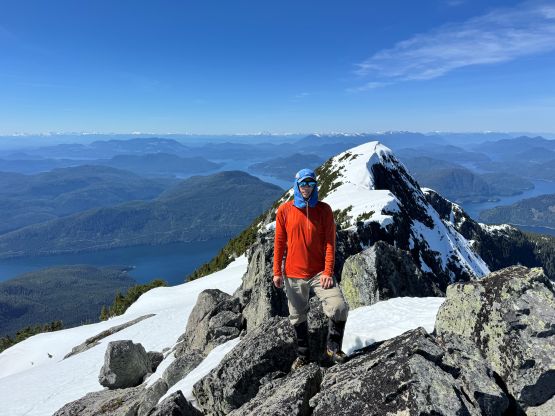
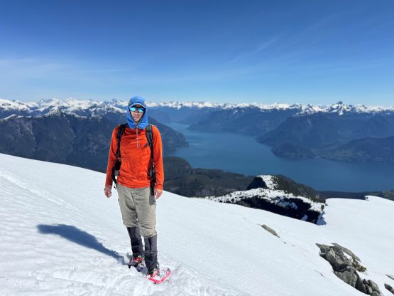
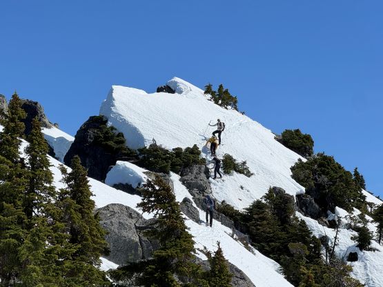
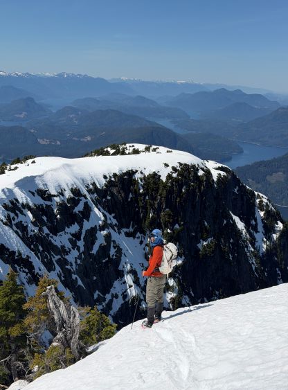
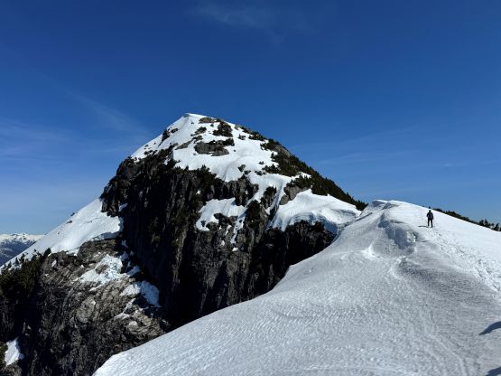
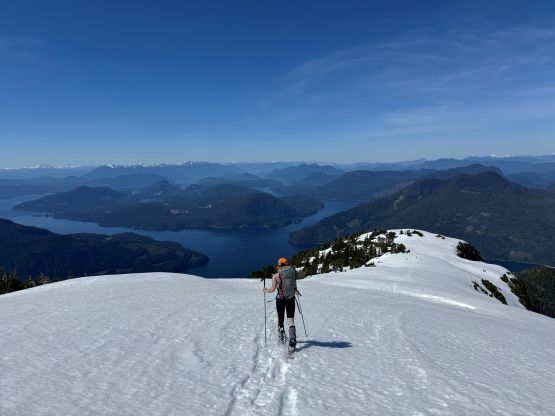
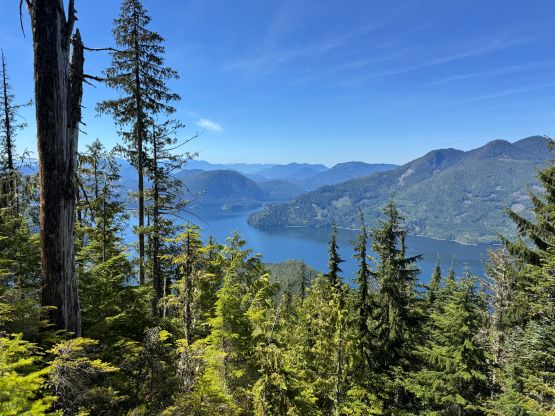
We then had at least 1 km of plodding on mostly flat and open ridgeline until the steep rise to the false summit. This section was also steeper than I thought and needed some care. We again, all managed to just snowshoe to the top of the false summit. The traverse to the true summit appeared intimidating and it was was not super straightforward. Alex and Trevor went ahead so I mostly just followed their steps. At various occasions we were quite close to the cornices so some steep side-hilling on the south side was required. We all had seen the north face of Estero Peak from Mt. Van der Est and none of us would want that 1-way ticket down. A few more technical snowshoeing sections including a 3rd class down-climb (on snowshoes) later we all arrived at the true summit. Traversing slightly beyond the true summit offered some unobstructed views into Bute Inlet and a few of us did that.
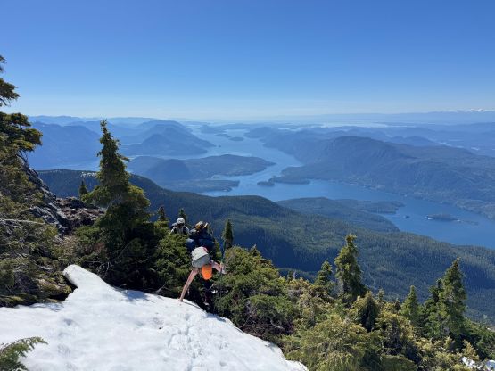
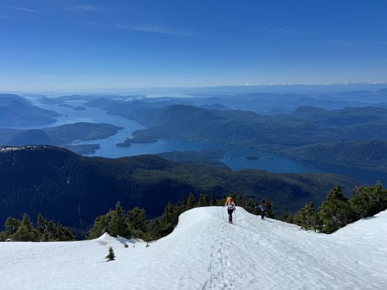
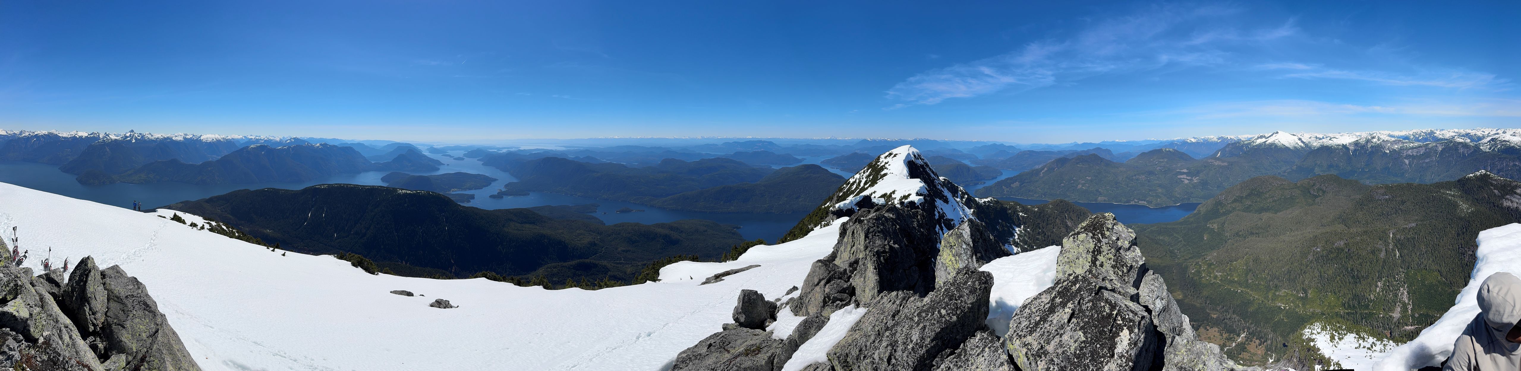
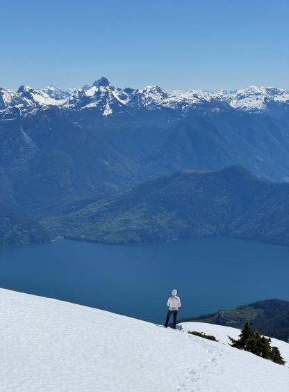
There’s also enough cell reception so I texted Peter about our progress, which was considerably faster than expected. I also updated the Peakbagger account as that’s something I always do if there’s service on the summit. To descend we simply reversed the summit ridge which involved fair amount of “technical snowshoeing” in less than ideal snow conditions. That 40+ degrees stretch at 1350 m elevation surely put my snowshoeing skills in test. Erica opted for multiple glissades but I disliked doing that while wearing the snowshoes, and I was also too lazy to take the ‘shoes off. I managed to gingerly descend the entire stretch without having to take the snowshoes off nor taking a spill. The 1000 m bushwhacking down to the Frederick Arm was a terror show. Frankly speaking it wasn’t that bad, but the thrashing was quite sustained. Francis and Alex had that GPS Garmin watch thing so they were able to navigate in the bushes without taking the phone out. I mostly just followed their leads which saved me a lot of work as I usually had to check the phone’s screen 100 times if I were to navigate ahead.
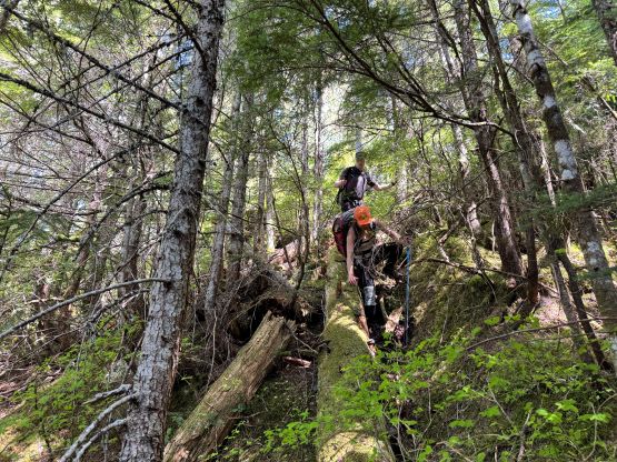

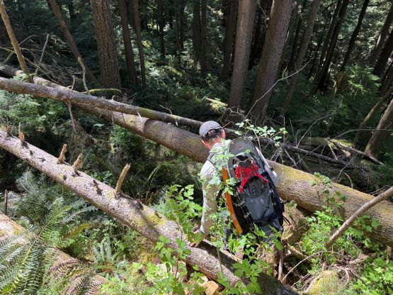
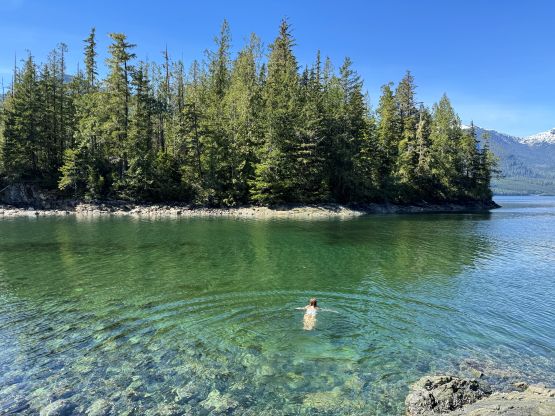
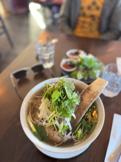
We mostly stuck to the route that we took but didn’t trace the track exactly. We down-climbed several very difficult bluffs mostly following Francis’ lead but all of us were climbers here so that didn’t impose any problem. We eventually finished the round trip in 8.5 hours and that included about 2 hours of “stopping time”. My muscles were however, quite tired for two days afterwards so despite the stats this was still a big ass day. A few of us wanted to dip into the water so we gave Peter enough time contingency to not rush for the pick-up. He eventually showed up at 4 pm and in less than hour we were back to Elk Bay. We stopped for a deserved but luxurious dinner in Campbell River before driving to Nanaimo for the 9:25 pm ride back to Horseshoe Bay. This ferry was however, late by more than half an hour so I didn’t get home until 1 am. To make it more “fun” most of us would have to work on Monday but at least I didn’t have to get up early.