Wood Peak and Kootenay Mountain
July 1, 2025
2456m
Creston, BC
Kootenay Mountain is one of the “ultra prominent peaks” in the SE British Columbia but despite the lack of technical challenges, the ascent is apparently an ordeal according to the trip reports on peakbagger.com. This peak was used to be a bike-and-hike ascent but that requires 40 km round trip and the road had been taken by the alders. The most recent ascent using that route by Adam W. and Dave G. confirmed that it’s no longer a “go”, but Chris Hood had explored the route from the SW by traversing up and over Wood Peak as well as a P100m subsidiary summit. This route also involves substantial amount of bushwhacking, boulder-hopping and the various types of “unpleasant terrain” but stays high the entire way and gets two bonus peaks, and in my opinion should be the new-standard route nowadays. Still, nobody but the prominence-based peakbaggers would dare to make an ascent of Kootenay Mtn. by any mean. The view from the summit is gorgeous but do not expect a classic and fun type of outing.
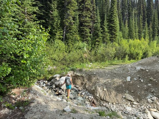
I managed to sell this objective to Erica but I skipped the horrendous part of the stories. All I told Erica was to not read Adam’s trip report and we would be taking Chris Hood’s route. After completing a traverse of Cond Peak and the Kokanee Glacier massif we drove south and then east from Salmo. The Google Map correctly directed us to the start of Jersey Creek FSR but there’s a “road closed” sign right at the start. Apparently this road had been decommissioned but local 4-wheel-drivers had been doing their user maintenance that the access was still currently “doable”. At least the road was not gated. The road was rough from the start but never imposed a show-stopper for the stock Subaru. I had to drive extremely carefully but an hour or so later we turned onto the final spur road leading to Matt Juhasz’s starting point. It was obvious why Matt had turned around and parked due to an impasse (landslide) so we did the same. The bugs were quite bad even at midnight and we decided to sleep in till whenever we wanted. Driving all the way to the “doable end” was already a bonus so we knew we would have a success no matter how late we dared to start.

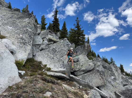
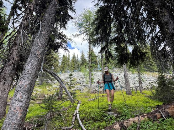
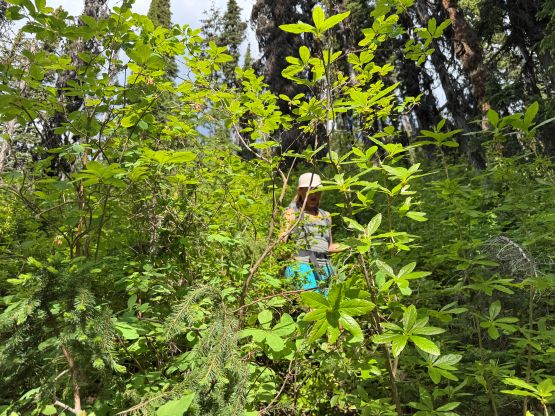
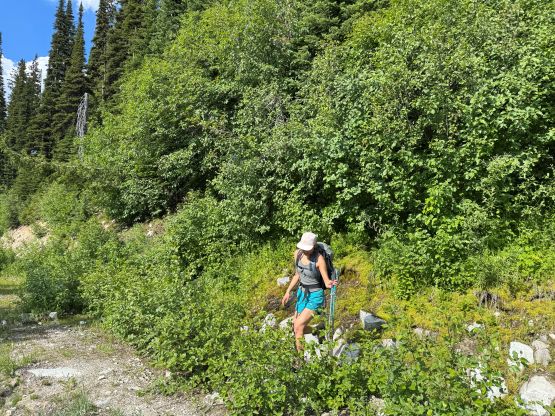
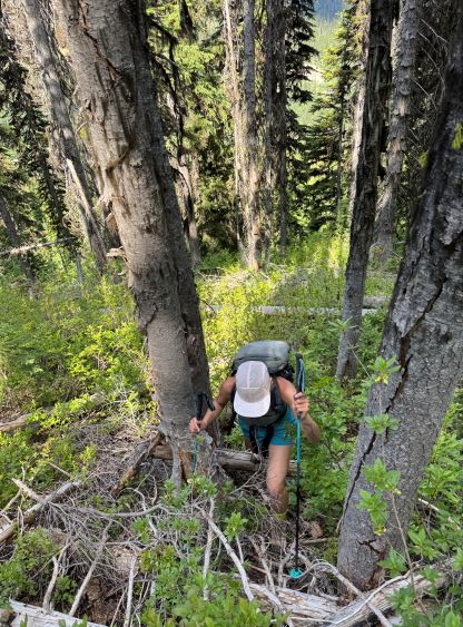
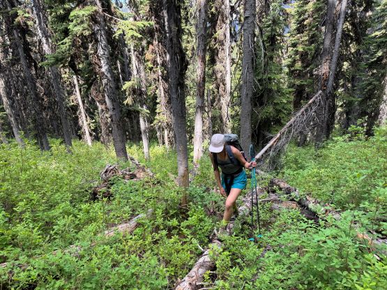
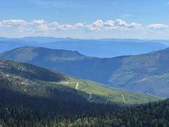
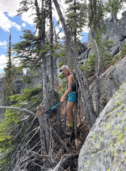
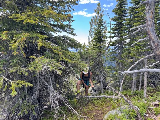
The next morning we slept in till 8:30 am and didn’t get going until almost an hour later. The mosquitoes were terrible as we prepped for the breakfast but the bug spray seemed to be working. This eventually turned out to be a day with the bugs as we were constantly attacked by all kinds of bugs throughout the day, that the situation was quite bad even on the summit. The initial 1.5 km of road plodding was still pleasant without alders but as soon as we turned into the forest the bushwhacking began. We followed Matt’s GPX track and the bottom part of the forest was quite bad with lots of pick-up-sticks and underbrush. The going was painfully slow as we must balance ourselves on top of the sticks and sometimes it was quite an ordeal to climb overtop of them. I had no idea how Erica managed the entire day wearing shorts while not making a single sentence of complaint. The pick-up-sticks fest eventually gave way to the sub-alpine forest and we had a trouble-free ascent to the top of the first bump, the bonus P100m objective of the day.

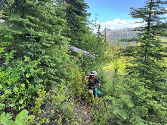
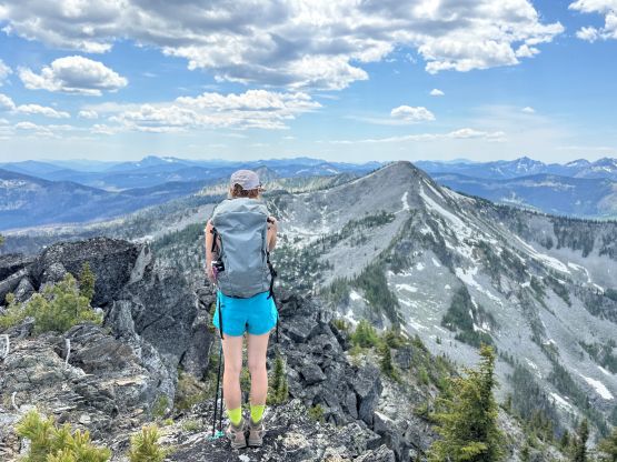
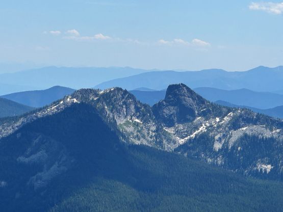
After a mandatory energy break I led us down the NE Ridge of this P100m bump and the going was generally straightforward. There’s an intermediate bump between this bonus peak and Wood Peak and the traverse up and over that bump was quite unpleasant. We could not have stayed exactly on the crest of the ridge due to bushes so had to do some side-hilling on boulders on either side. The descent off the other side (north) also involved a few tricky scrambling moves. We didn’t know much of the details so stuck to the ridge crest and made the down-climbs. We decided to ascend Wood Peak first as it’s officially named and has over 100 m prominence and the bearing would be the easiest to traverse over this peak as well. The ascent took longer than I thought, but we eventually made the summit. There were a zillion ladybugs and some were flying around but we took a break on the summit nevertheless.

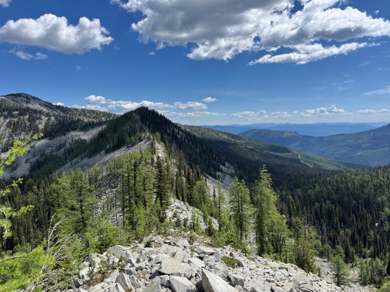
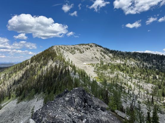
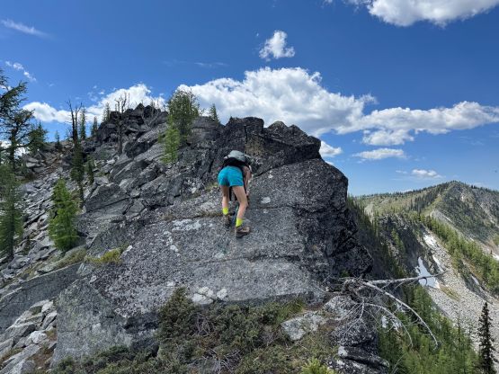
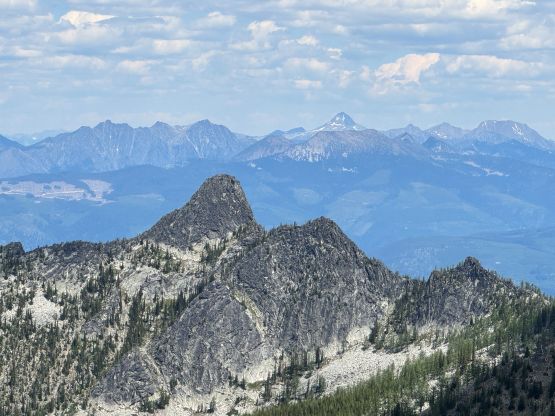
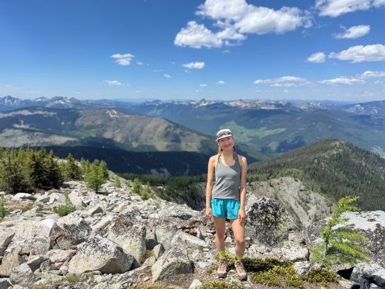
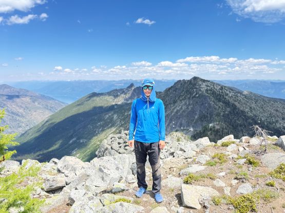
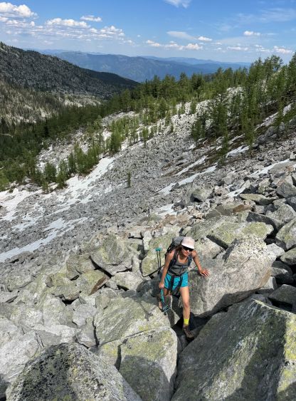
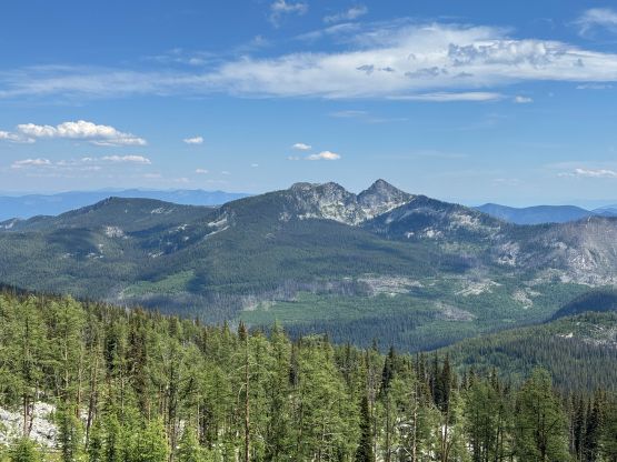
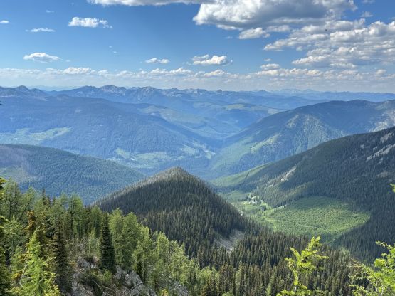
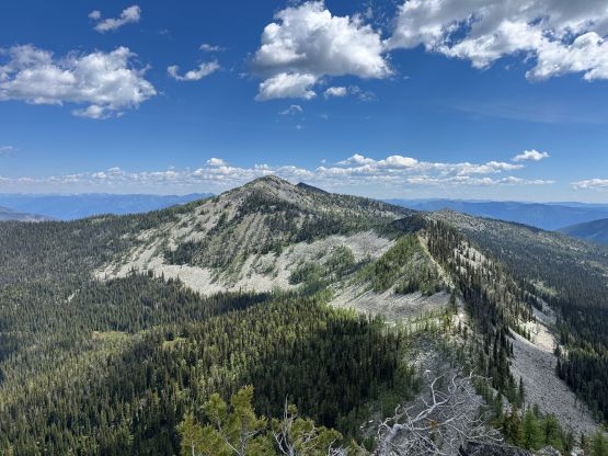
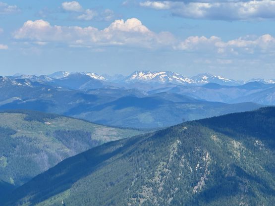
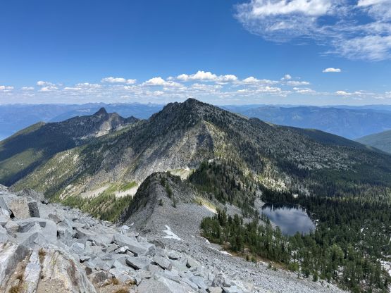
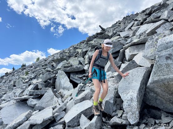
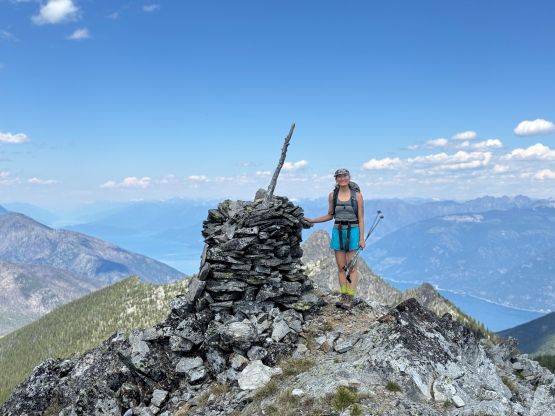
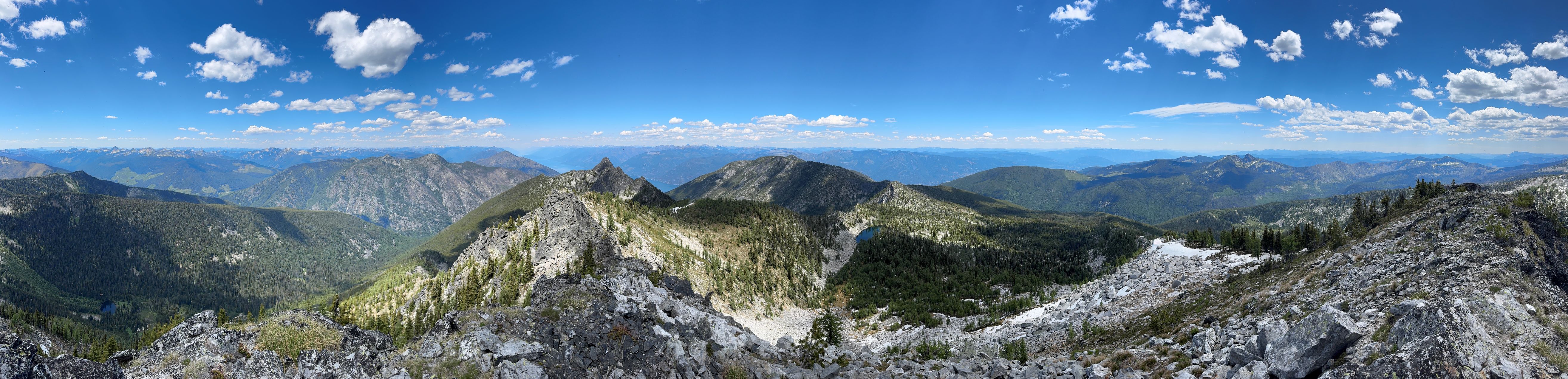
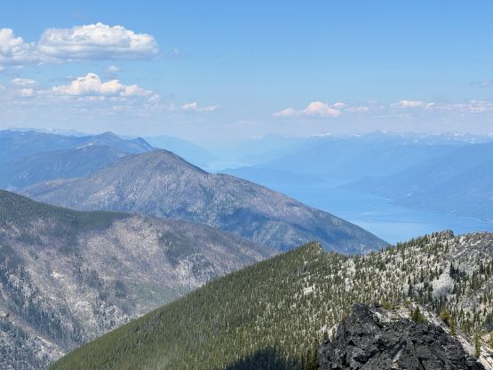
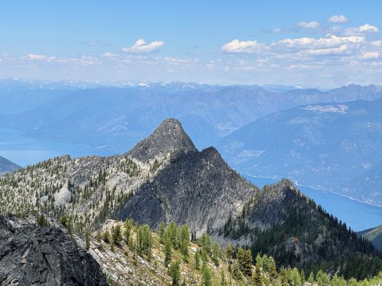
The descent off the NE Ridge of Wood Peak marked the start of the boulder-hopping. This ridge was quite steep and some of the boulders were car sized. Wearing the approach shoes helped the grips but care must be taken descending this type of terrain. The section between Wood Peak and Kootenay Mtn. also involved some micro-terrain that we had to find a way around on either side, and the final ascent of Kootenay Mtn. via the SW Ridge was also unpleasant with lots of boulders and route-finding through krummholz field. We never encountered any terrible bushwhacking in this stage but I had to constantly look for the easiest path. Thankfully the weather was gorgeous and the views from the summit was excellent. This was my first time seeing Kootenay Lake so it was quite cool. We were doing great on time (half of what other parties had taken using the other route) so did a rather long stay on the summit soaking in the views.
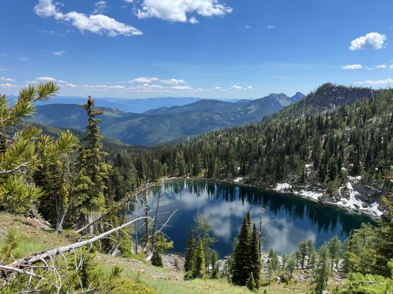

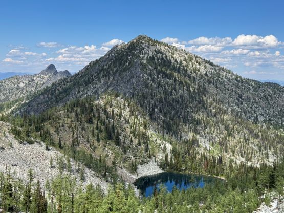
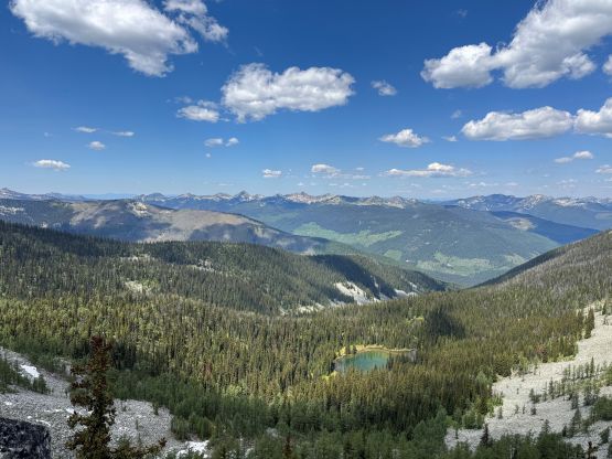
It was eventually the time to descend. Working our way down the SW Ridge of Kootenay Mtn. was not fun but at least I knew where exactly to go, and then we made the decision to bail into the basin draining that lake where Matt’s party visited. There’s no need for us to actually visit the lake but the running water above the lake would offer some refreshment. I needed this detour even just for refilling the water bottles. We then traversed over the east shoulder of Wood Peak dealing with more side-hilling and boulder-hopping and then rejoined the route on the south side of Wood Peak. I thought about doing more fancy things but decided to simply stick to the ridge crest for the rest of the return, up and over both bumps and then stuck to the GPS track through the forest. The bushwhacking seemed to be much easier on the descent but it was still a real thrash. Our round trip time was 7.5 hours including the long stay on the summit so this was still an efficient route to tag the summit, and for competent parties it shouldn’t be that big of a deal. Erica was not keen on making the 4th day longer than necessary but I managed to sell her in doing “Borg Peak” near Osoyoos. I couldn’t justify driving home without tagging anything, so why not the almost-a-drive-up P600m objective.