Church Mountain [WA]
October 6, 2024
1925m
Mt. Baker Highway, WA
There are two Church Mountains in the vicinity of the Fraser Valley not terribly far from each other, both officially named. The easier of the two is on the Canadian side of the border. I had done that one 8 years ago in similar time of the year. This is the one on the U.S. side of the border and requires exposed 3rd class scrambling with complicated route-finding. It seemed like a lot of attempts ended up in failures because people weren’t patient enough to wait for that perfectly dry conditions. I understood the reason because there are simply too many “better” objectives when the conditions are at the prime. On the other hand if one comes prepared with mixed climbing equipment and experience then this objective should be perfectly doable in the so-called shoulder season when there’s some snow but not enough to impose avalanche concerns. This happened to be the case of this weekend when a system dumped up to 15 cm of fresh snow above 1700 m on Friday. The reports from Saturday in the vicinity showed significant amount of accumulation. I made the plan with Francis, Andrea and Alex a few days ago and after some discussion we decided to bring a 60 m rope, a rock rack, proper mountaineering boots, ice tools and steel crampons to treat it as a mixed climb. The approach isn’t terribly long so if the route turned out to be dry then we could consider this as a conditioning trip for the upcoming winter season.
The weather was supposed to be warm on Sunday so there’s little point in starting too early. We all wished the sun could melt some, if not all of the fresh snow so the decision was made to meet in Abbotsford at 6 am. I then drove the four of us across the border in my trusty Tacoma and arrived at the Church Mountain’s trail-head roughly an hour later. The road reports made me bring the Tacoma down but the road was nowhere as bad as the Washingtonians made it sound like. I did agree that taking the Corolla would be a bad idea but that “gnarly washout” 1.5 km from the end of the road should be doable in any SUV by an averaged BC backcountry driver.
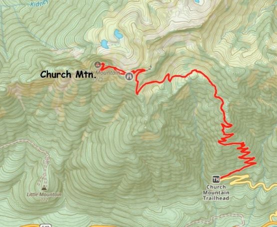
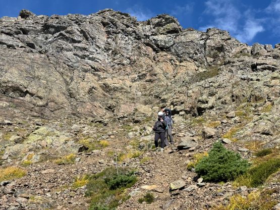
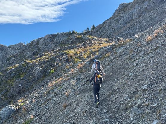
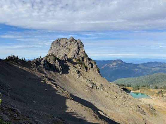
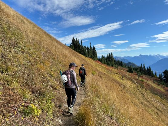
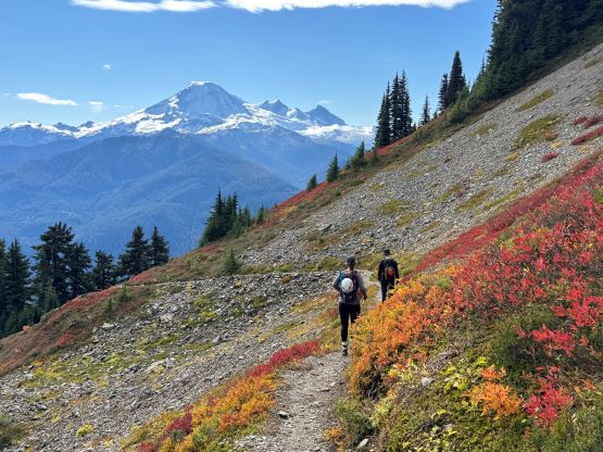
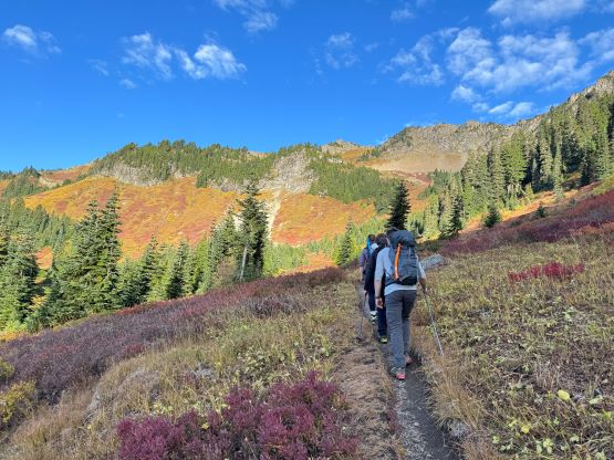
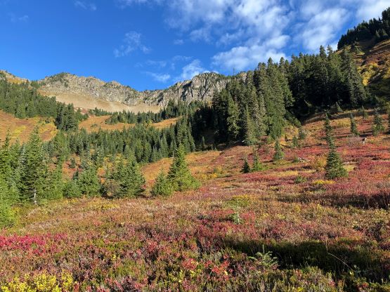
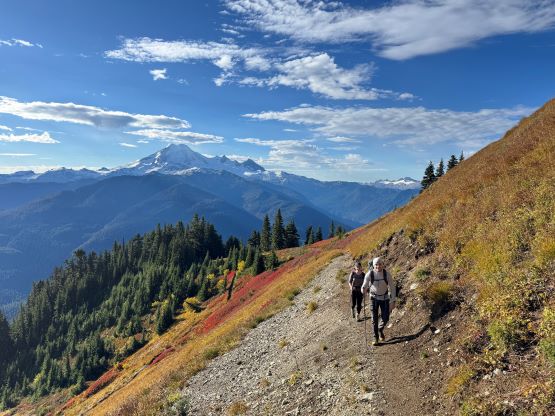
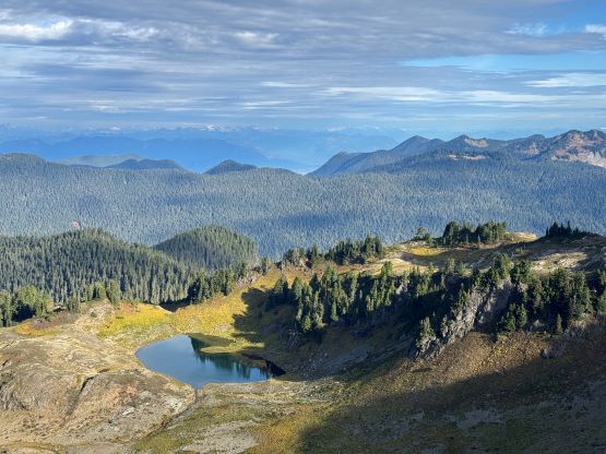
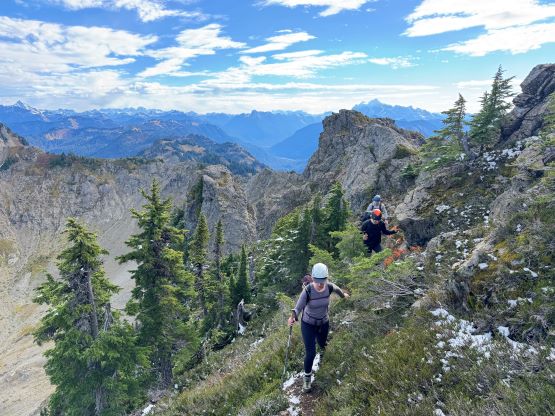
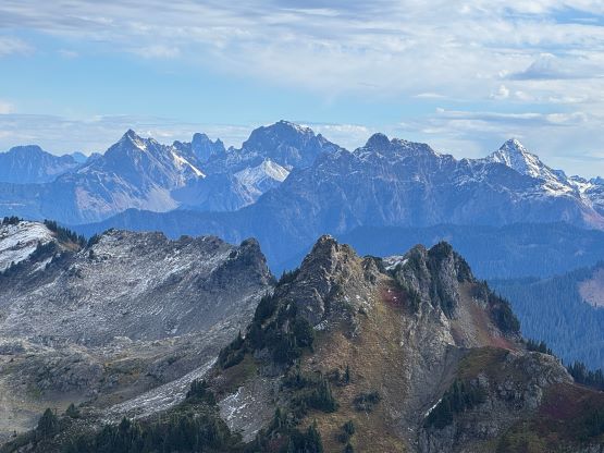
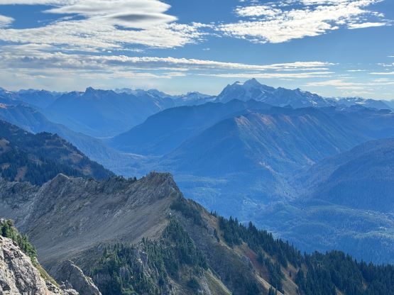
We shouldered the heavy ass packs and started the approach. The Washingtonians do maintain their trails at an unbelivable standard that even this mediocre destination has a trail with quality no worse than the Garibaldi Lake’s. I did think there were too many switchbacks and I would prefer the trail to be shorter but steeper, but in any case it didn’t take us long to reach the meadows at 1500 m elevation. We took a break donning sun protection and then took our time grunting upwards to the old fire lookout. For the last 20 m elevation gain we took the decommissioned “cable route” that involved some scrambling. Most of the hikers would stop at this point but that’s considered unacceptable for us. In fact, a simple search in Washington’s Church Mountain results in more trip reports claiming “Church Mountain” by only reaching the old lookout site. What a shame. The warm temperatures had apparently done us a favour by melting most of the new snow, that the entire south face of the summit scramble appeared bone dry. We nevertheless decided to carry all of the gears to the top to complete this weight training program. To descend the north side of the old lookout side Andrea and I picked a direct but sketchy route whereas Francis and Alex went around to find a more suitable way. We then joined together and took the “high route” variation by staying mostly on the connecting ridge to the saddle where we could cut onto the south face of the summit block. The ridge was slow going but not difficult.


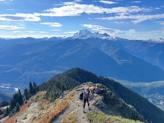

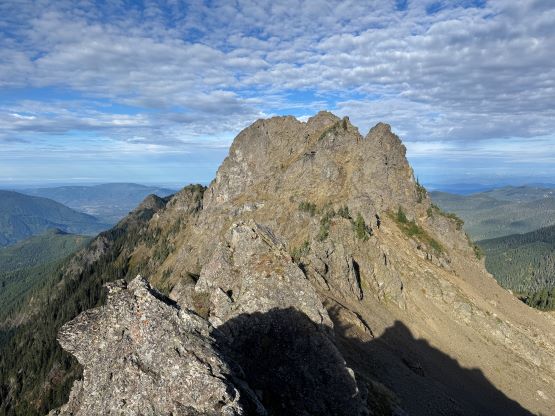
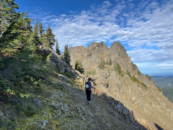
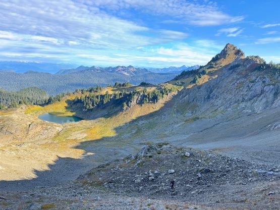
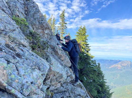
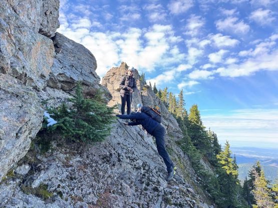
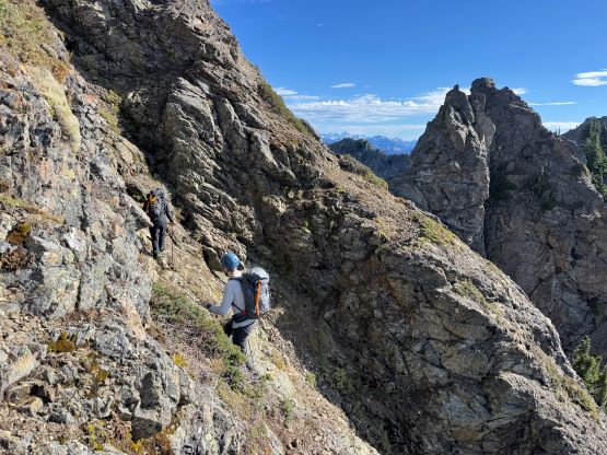
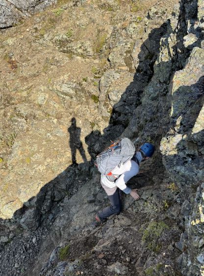
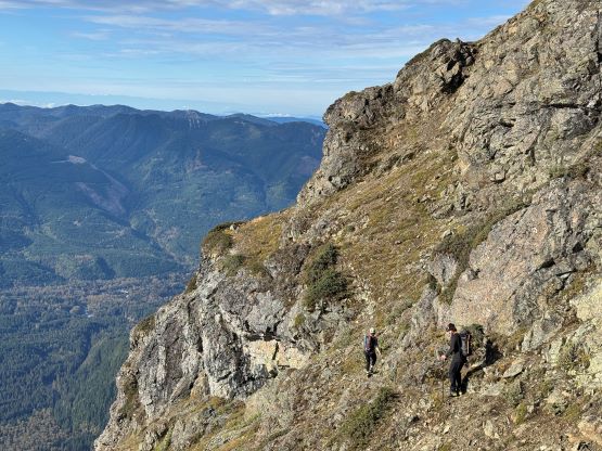
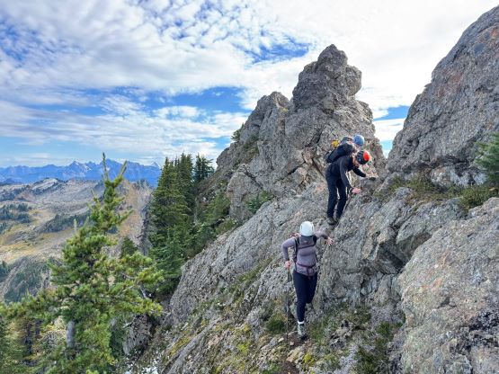
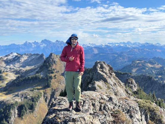
After traversing back into the sunshine we took another break mostly for me to swap footwear from the trail-runners to the Trango Tech mountaineering boots. I had opted to wear the Salomon runners on this outing and they weren’t nearly as good as the Arc’teryx approach shoes especially on wet and greasy terrain. We then traversed into and out of a couple gullies with one involving a few committing 3rd class moves, a long ways across the south face to that diagonal “ramp” trending NE. Ascending this ramp all the way to the east ridge, east of the false summit was the easiest part of the route but there were lots of loose pebbles on down-sloping terrain that warranted caution. I knew some parties took the route up and over the false summit but we opted for simplicity, traversing down onto the narrow path on the north side. There was unfortunately still some snow but not a lot. This entire traverse on the north side of the ridge was wet and greasy but no gear was needed. We had to thrash through some bushes, climb some steep heather and deal with at least one more exposed class 3 section but the true summit was quickly attained.
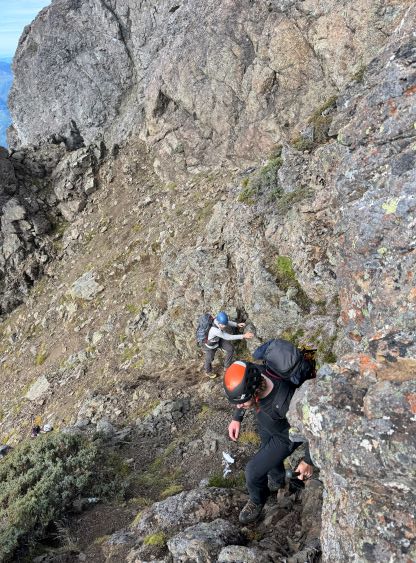

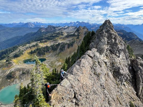

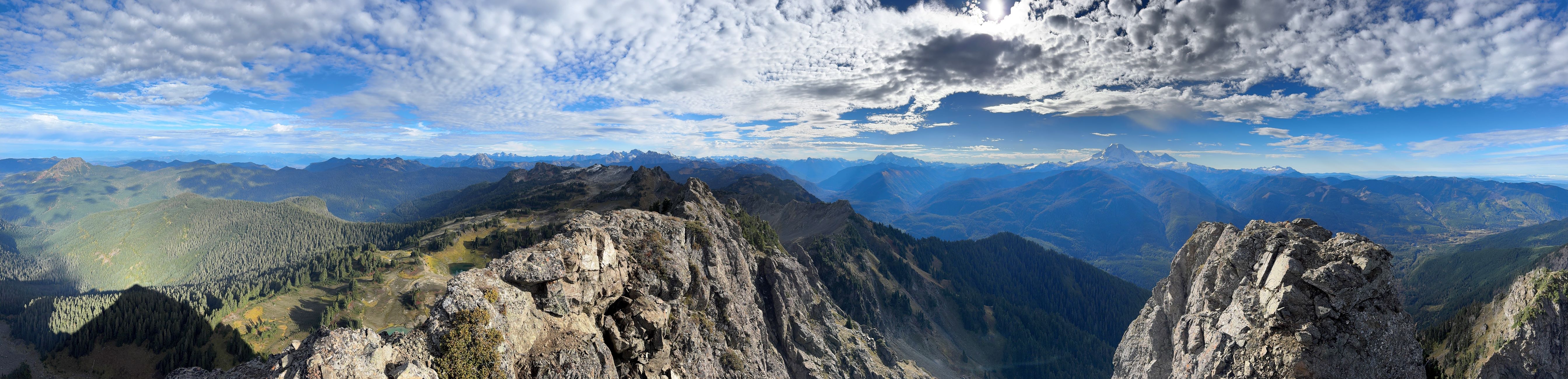

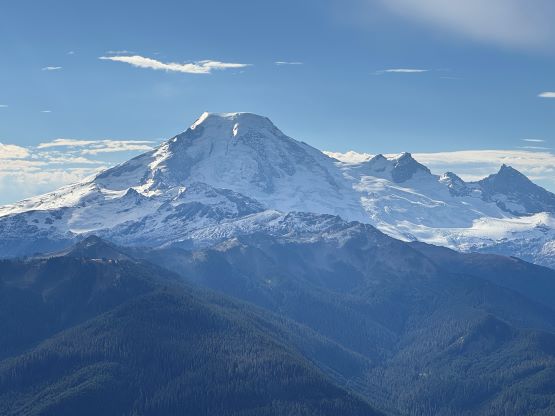
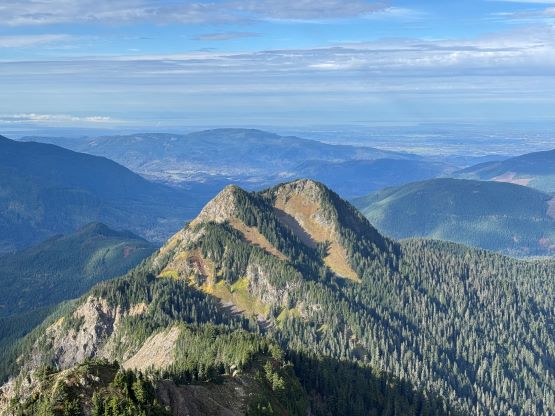
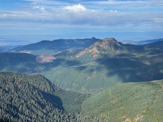

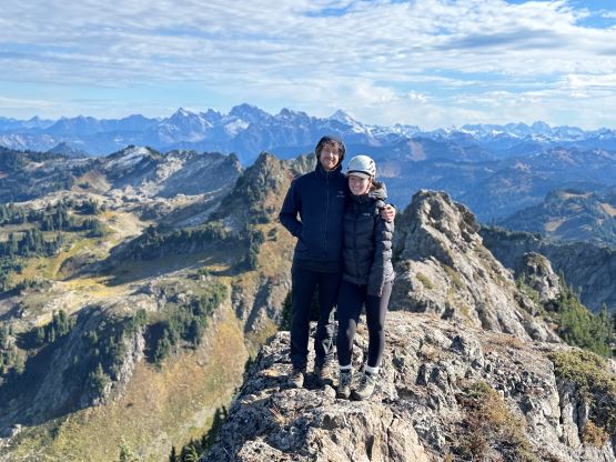
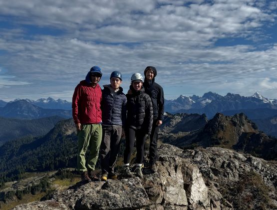
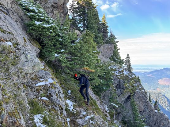
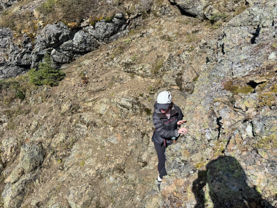
We lingered up there for more than half an hour to fully soak in the views but eventually it was the time to descend. I thought about taking the false summit variation but given the greasy conditions it was smarter to tackle the devil that we knew, so down the north side ledge we went. A few delicate moves later we were back on the sunny south side of the face and had a quick descent back to that aforementioned saddle. I picked up the ditched shoes and decided to swap them on later, after finishing all of the chossy terrain. This time we opted to take the “low route” variation traversing across the entire north face of that old fire lookout without grunting back onto its summit, and then took a short-cut down some steep heather to rejoin the trail. The rest of the descent was uneventful and we finished the round trip in just over 5.5 hours. While driving north across the border I did some math. I would be home no later than 4 pm, but I had no work booked in the evening. Instead of wasting an entire evening at home I made the spontaneous decision to do a bonus trash bag. Mission was only half an hour away and there’s indefinitely amount of dumpster supplies. I tend to go for the worst when I go out alone, so I picked “Weatherhead Peak”.