“Weatherhead Peak”
October 6, 2024
1137m
Mission, BC
“Weatherhead Peak” is essentially an unnamed forested bump on Mt. St. Benedict massif but it does boast over 100 m prominence. The gate at the bottom of Murdo Creek FSR had been opened these days making the access straightforward for those with a capable 4×4 vehicle, but the peak itself is a “trash bag”. There wasn’t a lot of “beta” about this objective but one doesn’t need much besides the Google satellite images and the Gaia’s topographic map to make a plan. I honestly had been thinking about this one for a couple years as it would make a perfect before-work trip, but I ended up tagging it as a bonus objective after completing Church Mountain in Washington. The primary objective was too short to fill in the day and I didn’t want to waste the afternoon/evening sitting at home doing nothing. After dropping off my friends I made the spontaneous decision to drive out again, this time to Mission to bag another peak solo.
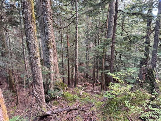
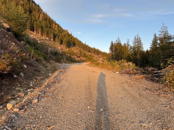
The condition on Murdo Creek FSR was nowhere as good as I remembered from “Murdo Peak” a year ago, but imposed no problem to the Tacoma. I did have to switch to 4Low to crawl up one particularly steep and loose hill, but after passing the Mt. St. Benedict’s trail-head the condition actually improved. I encountered numerous water bars after Murdo Peak’s junction and parked the truck immediately after crossing the bridge. I did not bother to consult with any “beta” and the shortest possible way would be the south-east slopes. This turned out to be terrible idea as the route was entirely in secondary growth mess and the bushwhacking was horrendous. I ended up descending a different way which was definitely easier but much longer, so pick your poison.
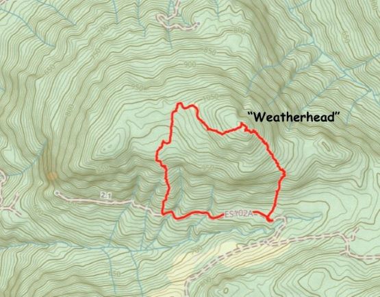
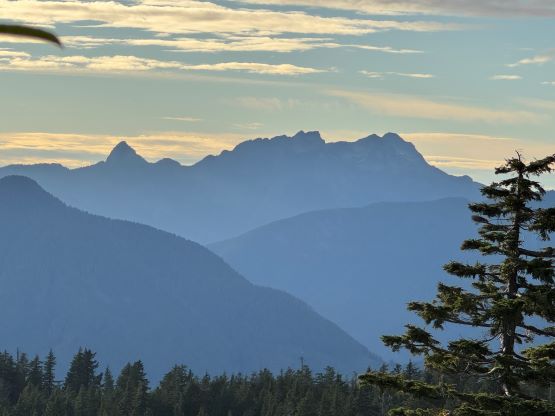
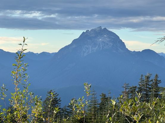
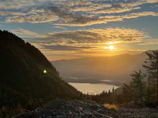
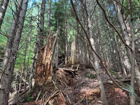
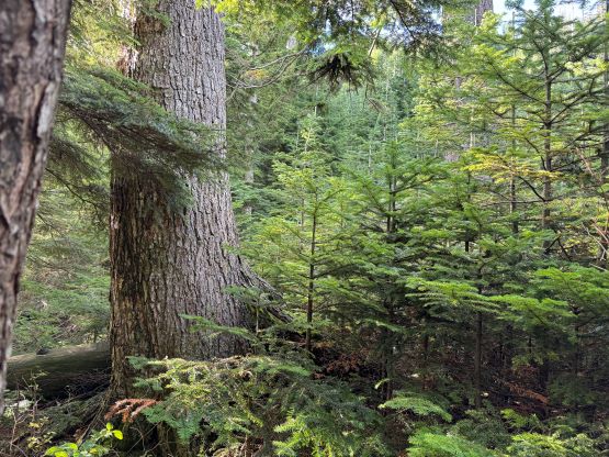
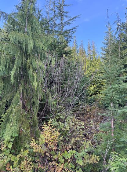
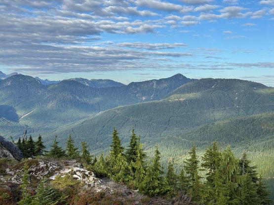
The first section was grunting up a cut-block which wasn’t too bad and then I trended slightly climber’s right after entering the forest. The start of the forest was also not terribly bad but at around 900 m I started to encounter numerous bluffs. I wasn’t patient enough to search for the easiest possible way so did some 4th class “vege” scrambling. The trekking poles were quickly becoming the liability so I took a break to store them in the pack. I wished to have brought my bushwhacking gloves as the next hour was an intense battle in the thick brush, sometimes thorny. The bluffs were also never-ending and basically there was no break. I had to take the poles out at some point because of the brambly shits, but higher up I encountered more 3rd class bluffs. I questioned my sanity a few times and I was already thinking about an alternative route down, but I must make the summit first. Thankfully with perseverance I eventually got to the top, surprisingly with some decent views.


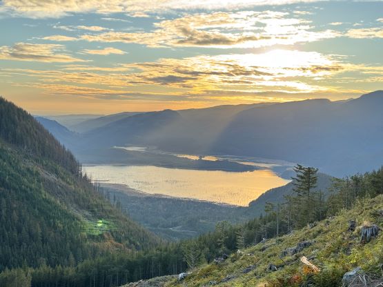
After sending out a few texts I started traversing westwards down towards some decommissioned FSRs visible on the satellite images. I wasn’t sure about their conditions but at least they should be better than the shit that I encountered on the SE Ridge. They turned out to be overgrown but not terrible so I made quick work down to above 1000 m elevation where I dashed southwards into some mature forest. The going was straightforward for a while but there was some micro-terrain. I had to cross one deep ravine two times and both required some scrambling and lots of route-finding. Thankfully the bushes were never too thick on this route but the terrain was quite steep. The cut-block at the bottom was worse than the one I used on the ascent, that there’s a shit ton of brambles. I also had to plod more than a kilometer back to the truck at the end on the FSR, with more than 50 m elevation regain. I was surprised that this little dumpster peak took me 2.5 hours round trip but I did mange to finish before sunset. I then quickly drove away, had dinner in Mission and eventually got back home at a reasonable hour. All in all I would not recommend this objective but if you must bag it like myself, then do it in the winter with a snowpack to cover the bushes.