Tin Hat Mountain
January 26, 2025
1193 m
Powell River (Qathet), BC
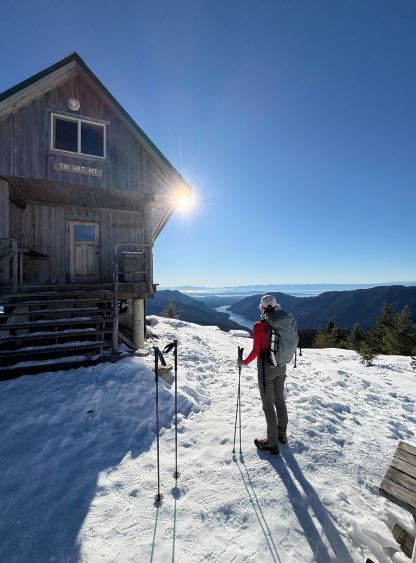
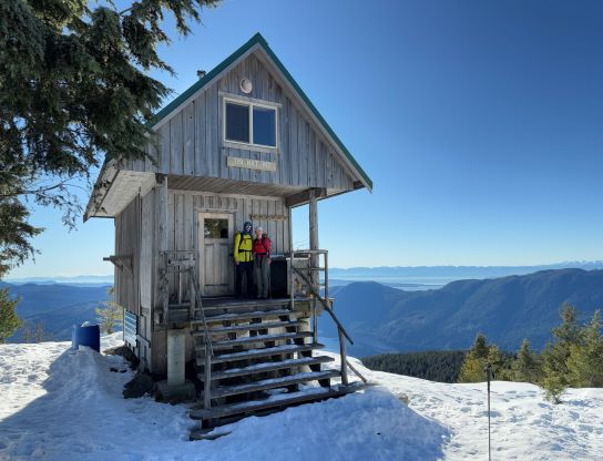
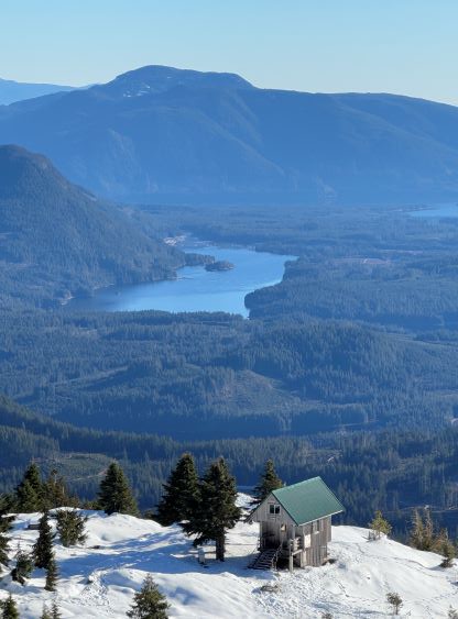
Tin Hat Mountain is one of the more popular destinations in the vicinity of Powell River or “the Qathet” due to the good views, easy access and the cabin not far below the summit. This peak has since gained significant attention on the social media over the past few years. It’s also one of the peaks out there that boast over 900 m prominence despite the relatively low elevation. A trip to this area requires taking two ferries each way but despite that, I had been contemplating a foray for at least 5-6 years. It never happened because in summer I was most likely elsewhere and in winter (my work season) it’s not possible to do peaks there as a day-trip. That perfect oppourtunity finally lined up during the school season’s term break, when I finally had some flexibility to have two consecutive days away from work. This was still not the “Plan A” as the L/L/L avalanche forecast strongly suggested that Erica and I should have gone for something bigger. We did have a bigger objective in mind (Abandoned Peak), but Erica’s toes were suffering from Lane Peak’s climb two days prior. The problem originated from Aconcagua almost a month ago and had only been gradually improving. I thought it might be smarter to take things more conservatively. Furthermore the midweek of the following week was still looking “green” so we had another chance at doing something big, so we might as well save that (turned out to be Big Four Mountain) for the last day of this prolonged weather/condition window.
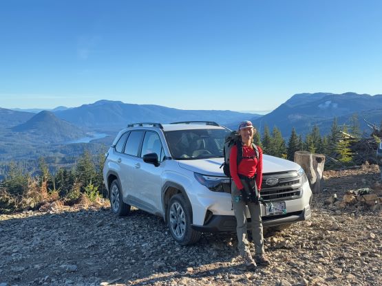
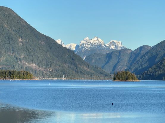
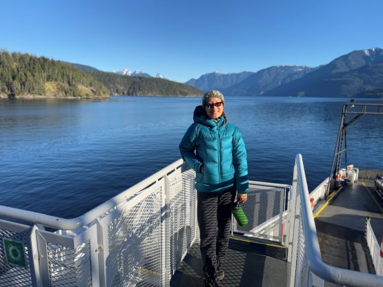
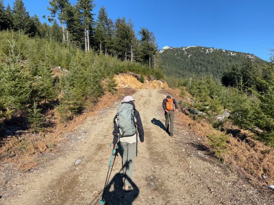
The primary objective would be Mt. Freda but by having two days we could have done something smaller on the day of arrival. I estimated that by taking the first ferry from Horseshoe Bay we could have started at 1 pm, and Tin Hat Mountain made sense. I connected with the local legend Jason Addy who was oddly more known for his self-propelled climbs on the mainland of SW BC, mostly to get some GPX tracks for Mt. Freda but also to check the FSR conditions. I remembered seeing a recent post about Mt. Freda on the Powell River’s Facebook group but I needed more details. After a few messages back and forth Jason actually decided to join us on Tin Hat Mountain even though he had been up there many times. This would be a Sunday, after all. I made the decision at literally the very last minute so the saver’s fares were all gone, but the ferries were surprisingly not that expensive especially comparing with the ones to Vancouver Island. Erica made the reservation for the 7:30 am ride and we were soon on our way to Sunshine Coast. The second ferry from Earl’s Cove to Saltery Bay would be new ground for me so I stayed the entire course on the sun deck for views. The views were honestly not as impressive as I hoped for, but nevertheless it was fun to figure out the names of these peaks that we could see. We grabbed Jason from Long Bay Store and in about an hour we were at Tin Hat’s trail-head. The Subaru did fine on the FSRs and there was no snow whatsoever all the way to 850 m elevation.

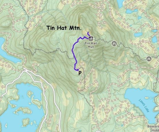
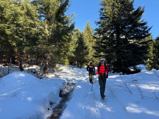
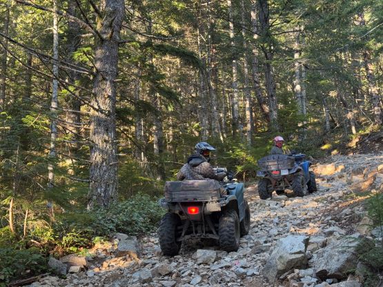
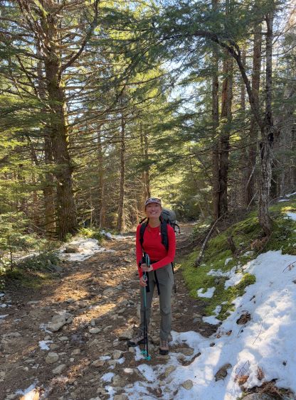
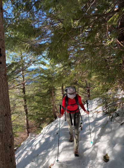
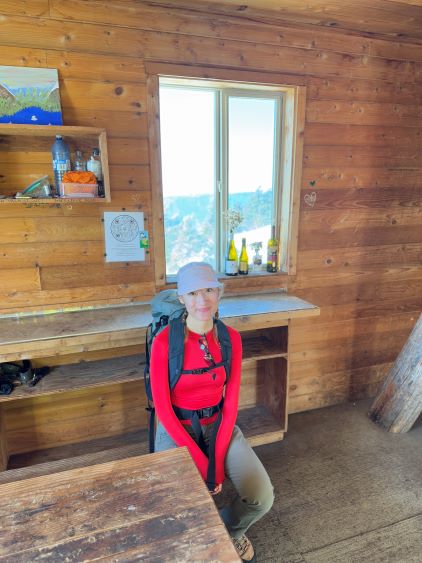
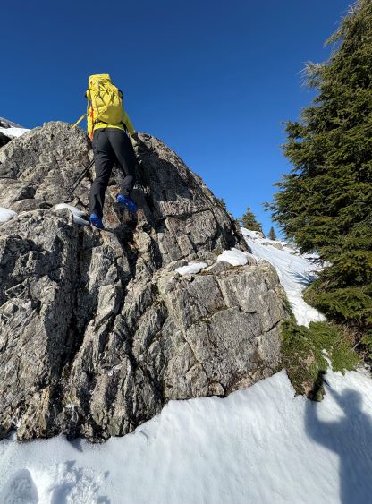
I decided in situ to use this trip as an oppourtunity to break in my new Arc’teryx trail/approach shoes. My first pair of that shoes was given directly by the company but as size 42 and this new pair was sized 41 1/3 which I thought would be better. I did opt to carry the La Sportiva mountaineering boots as well as crampons to be 100% sure of the success. The snowshoes stayed in the Subaru given the dry conditions in the area. The lower trail was essentially an ATV track and we did see several ATVs attempting the drive-up on the return. A serious, lifted 4×4 vehicle could have gone further but this hike’s already short enough. The trail quickly became an ice rink but I stubbornly kept the trail runners on. None of us donned any traction even though microspikes would clearly make things easier. I told Erica that she might as well take this as an oppourtunity to get comfortable on ice, which might or might not help her snow climbing confidence. Jason quickly led us to the hut and after taking some obligatory photos we post-holed our way to the true summit. The snow above the hut or off the beaten path was surprisingly facetted and unsupportive. I again, stubbornly opted to keep the trail runners as I wanted to test their snow-resistance performance.
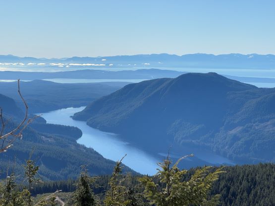
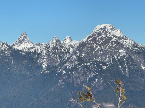
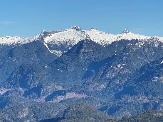
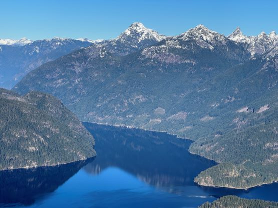
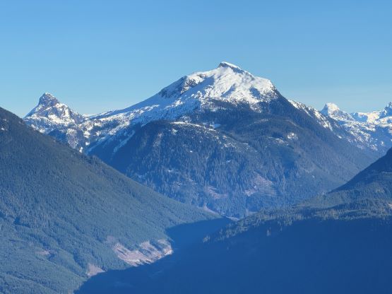
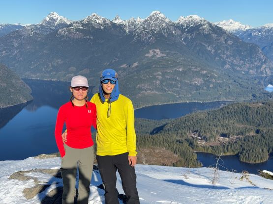

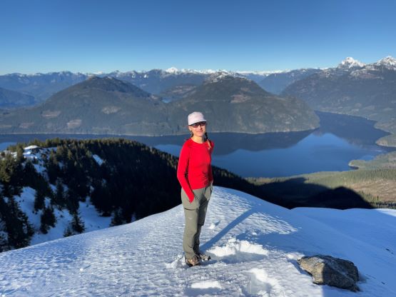
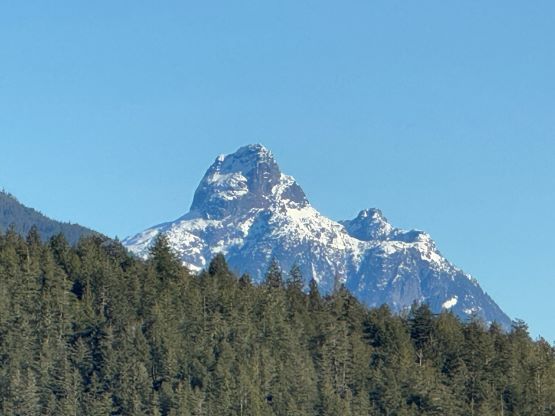
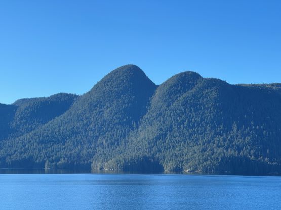
Jason kindly showed us (me mostly as I did have some ideas of the region) most, if not all of the peaks in the vicinity and I was able to memorize most, if not all of the names. Visiting a new area always excites me. The Qathet is surely a new playground that I should come back sooner than later. It was eventually the time to descend and I again, stubbornly opted to only wear the trail runners. I slipped a few times but only took one spill. Erica, on the other hand, played smartly and donned her microspikes. I told Erica that I came from the Rockies and using microspikes would get me laughed at, so I almost never bring them. For me, the traction devices are either crampons or snowshoes. It turned out that we would have at least an hour of daylight time to spare so we made the decision to check out Valentine Hill, one of the three P100m objectives in the vicinity of the town.