Mount Freda
January 27, 2025
1904m
Powell River (Qathet), BC
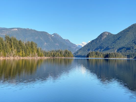
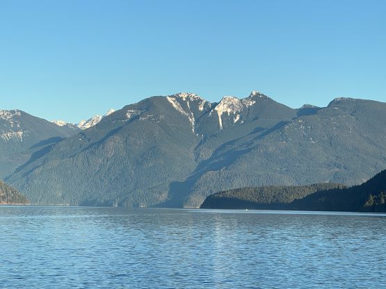
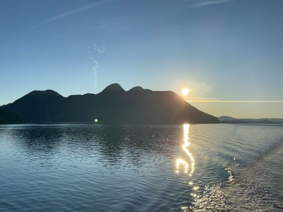
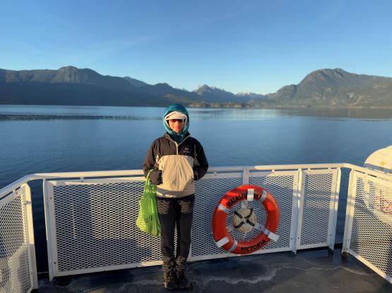
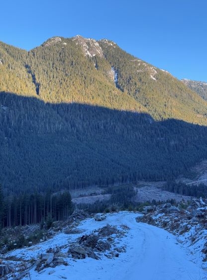
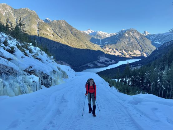
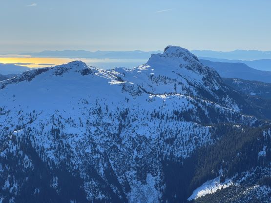
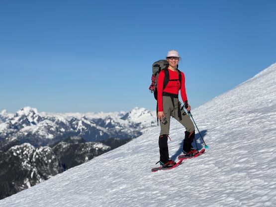
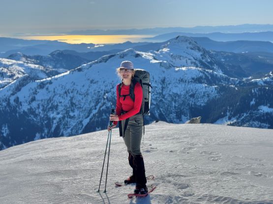
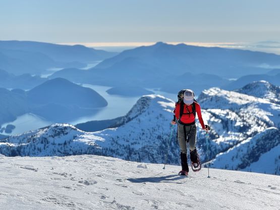
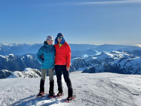
Mt. Freda is one of the taller and more prominent objectives in the vicinity of Powell River but also one of the easiest in the area. This is a mere “half day hike” in either summer or winter. I couldn’t believe that only one person had logged the ascent prior to ours on peakbagger.com. Currently the standard route goes up the north side from Alpine Main and this logging road system is also popular for the snowmobilers. I was particularly keen on a winter ascent, simply because the view would be much more dramatic in the winter time. A recent post from the sledders reminded me once again that my first foray to the Qathet had been long overdue. Despite the requirement of taking 4 ferries I finally pulled the trigger with Erica for 2 days. The primary objective would be Mt. Freda but used our arrival day efficiently and tagged Tin Hat Mountain as well as the pimple of Valentine Hill together with the local alpinist Jason Addy. We spent the night in Jason’s house and then drove 1.5 hours to the frozen Freda Lake on mostly good FSRs. We even managed to drive 1.5 km up Alpine Main and parked at 780 m elevation. A more aggressive vehicle with tire chains could have made at least a kilometer further but there’s no point for us to push.
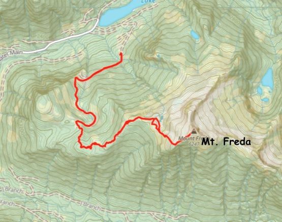
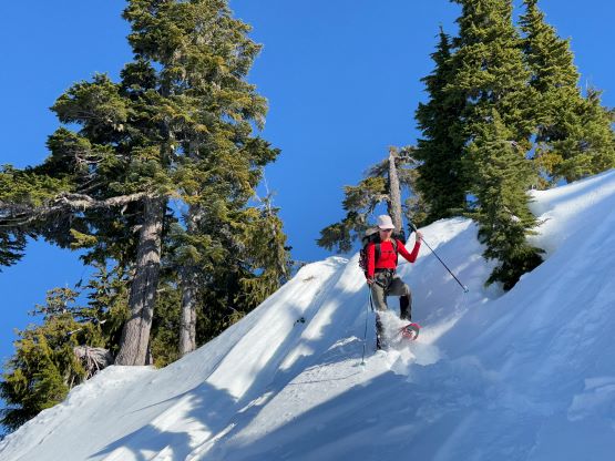
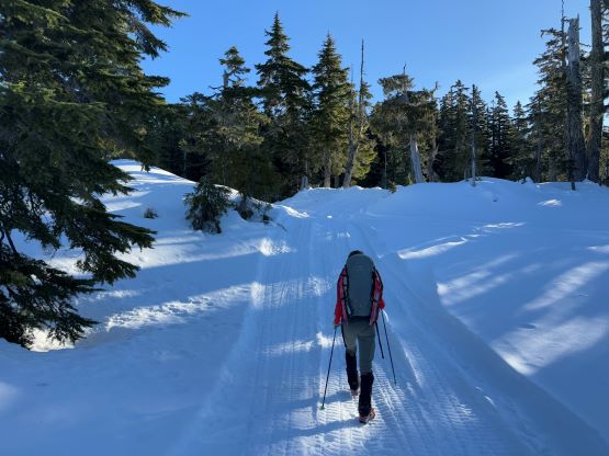
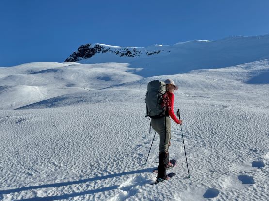
Microspikes could have helped on the initial few kilometers of plodding but we didn’t bother. We opted to wear the mountaineering boots from the start and carried the snowshoes. I thought we might not need the snowshoes at all but they were actually needed. There’s not much worth documenting about the few kilometers of plodding up the Alpine Main as all we needed was to put one foot in front of another on the snowmobile tracks. The day started out very cold (-7 C) but there’s an inversion going on. The temperature in the alpine was actually much warmer. We then picked up the signed “Mt. Freda trail” and we were still following the sledders’ tracks. There’s some annoying undulating terrain at around 1300 m elevation and the sledders surely took an even-more meandering way. We did some optimization a few hours later on the return. We then took the first break of the day not far below treeline and also donned snowshoes there.
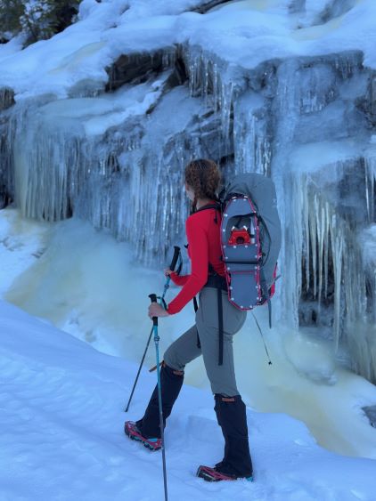

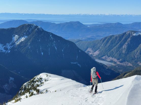
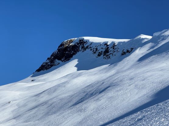
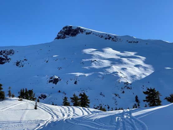
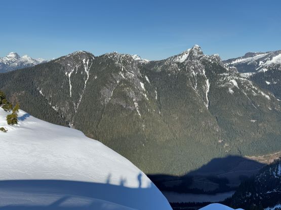
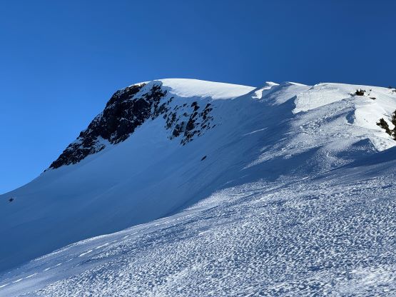
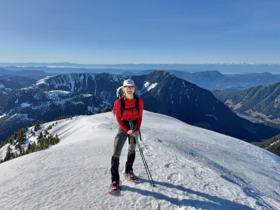
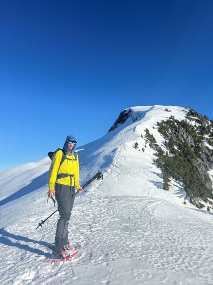
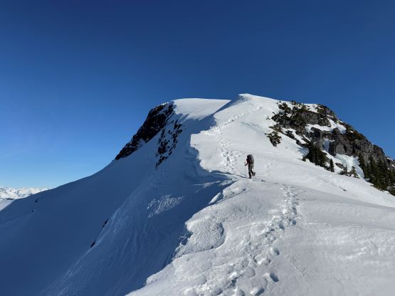
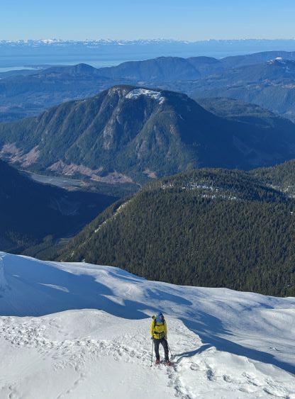
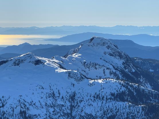
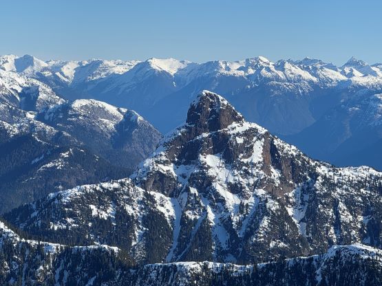
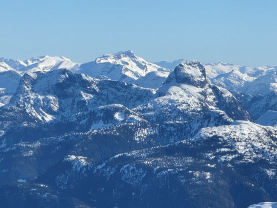
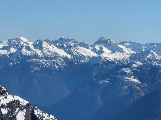
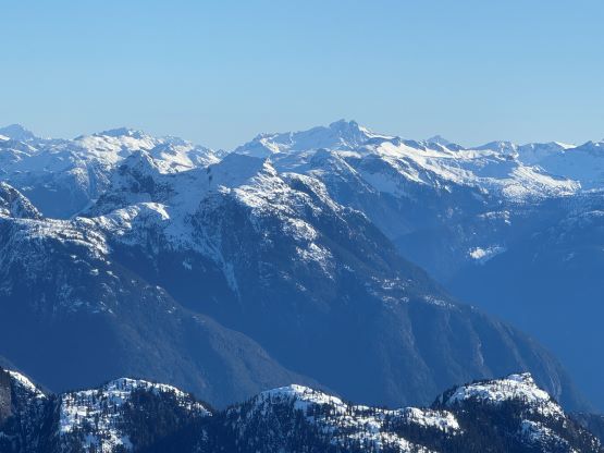
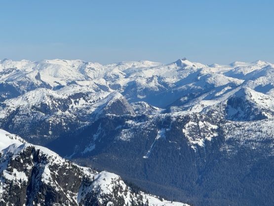
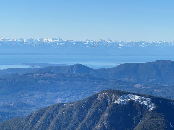
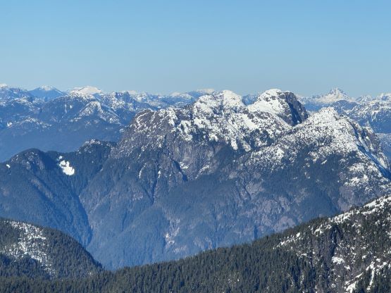
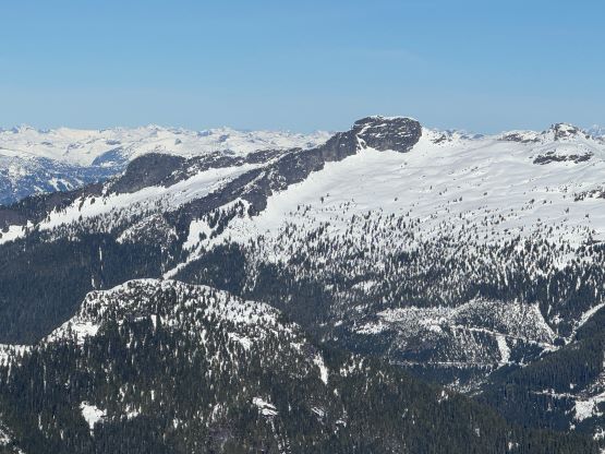
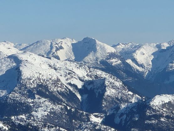
The sled tracks that we had been following were made of two parallel sets and they couldn’t be two snowmobiles travelling exactly side by side. A few days later at home I found out the post, that apparently these tracks were made by a “Bob’s Sled”, a modified vehicle pulling participants in an avalanche course to the alpine. We encountered more undulating terrain at 1550 m elevation and did our own optimization to avoid unnecessary elevation loss. We then followed the existing snowshoe tracks taking a rising traverse aiming steeply towards the SW Ridge of Mt. Freda on the skyline. This section was steeper than I thought and definitely required the stable conditions to ascend safely. A particularly steep roll in the middle of this stretch even put our snowshoeing skills in test. The previous party that made the tracks for us had opted to boot-pack. After getting onto the SW Ridge the scenery finally opened up revealing lots of rarely seen peaks in the vicinity. We took our time soaking in the views, and the summit was attained shortly after. I was able to catch some sporadic cell reception so did more planning for the Wednesday’s climb in Washington.


Meanwhile I did some mental math and determined that we could not have made the 3:50 pm ferry back to Earl’s Cove especially given the fact we had to make a detour back to Jason’s house as Erica forgot to bring the sleeping bag. In retrospect we did make that ferry but not without some aggressive speeding, so we should have started the descent at least 10 minutes earlier. The descent was much faster than I thought. We did a variation at that 1550 m undulating zone (not recommended) and then kept the snowshoes on all the way back to the official trail-head. We then took the ‘shoes off and jogged the Alpine Main down to the vehicle in under 5 hours round trip. At this point I thought we might actually have a chance in catching that earlier ferry back home so did some rushing on the FSRs as well as the highway. We made some illegal overtakes, encountered multiple cops but did not get caught. We did manage to catch that ferry but only with 5 minutes of spare. By the time we pulled in they were already boarding. About 2 hours later we were on the next ferry to Horseshoe Bay, and then made a quick stop in North Vancouver’s MEC before going home.