Grauspitz
August 22, 2025
2600m
Liechtenstein/Switzerland
With only 300+ m prominence Grauspitz is far from being geologically significant by the Alps standard, but it’s reasonably well known for being the highest peak in Liechtenstein. This is a very small country sandwiched between Austria and Switzerland but it’s still an independent country, and thereafter Grauspitz qualifies as one of the 100+ country high points in the world. I’m never a big fan of the political boundaries but if I happened to be in a country I wouldn’t resist the temptation to tag the highest peak, if it’s relatively feasible. In this case I did not give myself a specific buffer time to add this objective into the insanely-packed itinerary but I determined at the very last minute that it would be feasible, if I managed to drive the rental 2WD (illegally) to the drivable end, namely Alp Ijes on the Swiss side.
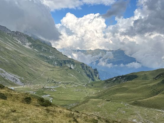
Adam and I happened to be travelling southwards next to Liechtenstein after completing an ascent of Säntis in Switzerland. The original plan was to have a bit of a break by spending the rest of this day solely driving into the lakes region of northern Italy, but I decided to check the Peakbagger app while doing a grocery stop. We made a short detour into this small country for food hoping that the prices would be cheaper than in Switzerland, but the reality was cruel. Liechtenstein also uses CHF as their national currency and the prices were at least as high, if not higher. Later at home I did some digging, that this is apparently one of the richest countries in the world. I spent about half an hour digging on the internet and found the shortest/easiest possible way of tagging the country’s highest peak. I wasn’t sure if I could drive the rental car all the way to the very end and the weather was a bit of an unknown factor, but we were already there so I must give it a try. Adam decided to sit this one out even if I managed to drive to the very end, as the objective would still require 700 m elevation gain over some rough terrain.
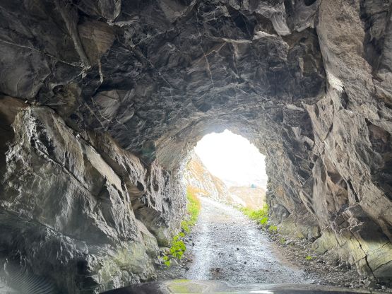
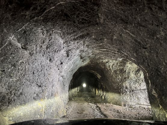
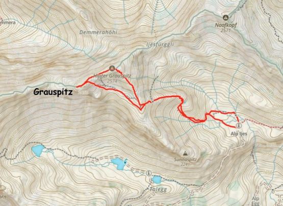
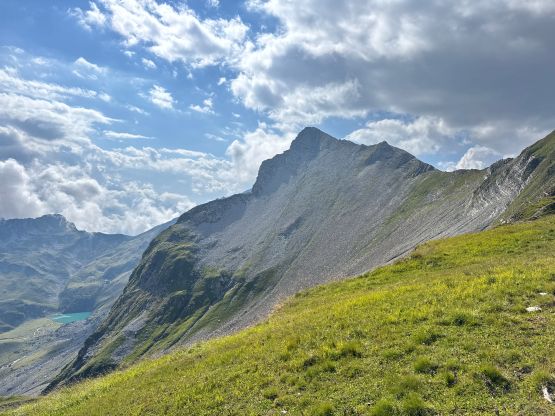
Not to my surprise the drive turned out to be the crux, as most of the road was unpaved with sections being quite steep. The entire road was also private with some prohibitive signs meaning I was definitely not supposed to drive the rental 2WD up there, but at least one other member (on peakbagger.com) did the same. I’ve also learnt that the private roads in Europe are mostly never gated, unlike in North America so who cares. The roads are generally well marked on Google Map and Gaia but there are many confusing junctions so I’ve also attached the driving GPX for those interested in. The last few kilometers were quite rough and I also ended up driving through two interesting tunnels, but despite being steep and unpaved, this road was doable in a 2WD by a confident and skilled driver. I wouldn’t say anybody can drive any 2WD up there, but it wasn’t problematic for me. For those not daring to make the illegal drive, the options include taking the chairlift from the SW (Älplibahn) or doing the full 2000-m gain from the valley bottom. By either mean, tagging Grauspitz would consume most of a day and neither was an option for me.
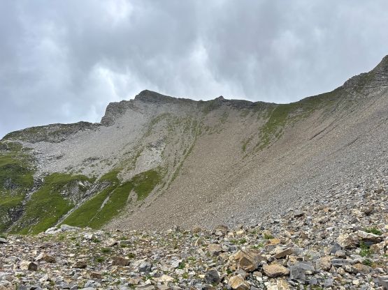
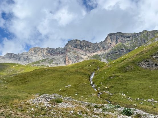
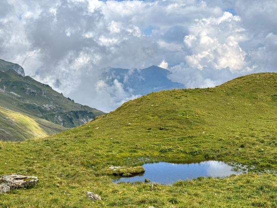
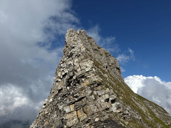
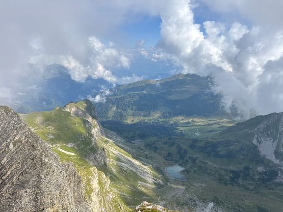
The weather was better than expected though there were definitely clouds around and the forecasts were calling for chances of showers. Adam confirmed once again that he would give Grauspitz a miss so I took off alone. I quickly realized that the trail marked on the Gaia map was mostly a “route”. After plodding through the initial farm fields I was able to pick up the trail but the quality of this trail was not impressive. I was able to follow a path but I lost this path several times in the tall grass. I ended up doing some cross country travel and thankfully there weren’t many stinging nettles around. After a while I gained the east-facing ridge which brought me to the south ridge of Schwarzhorn (or Hinter Grauspitz) and I naively thought this was the actual summit of my objective. I did not download a GPX track beforehand, nor did I do much research. The S/SE Ridge of Schwarzhorn involved some exposed scrambling and just when I started to wonder why this peak was harder than expected, I realized I ascended the wrong peak. This sub-peak doesn’t even have 100 m prominence, so it’s not even a bonus point. Damn it.

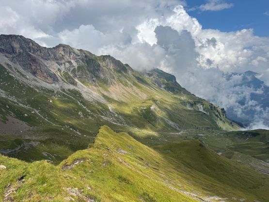
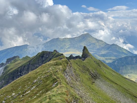
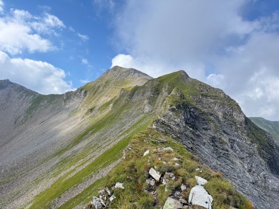
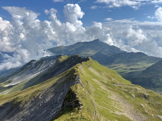
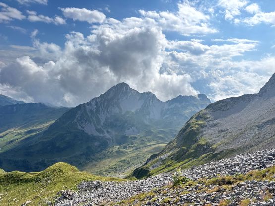
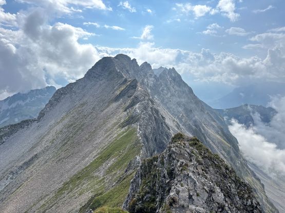
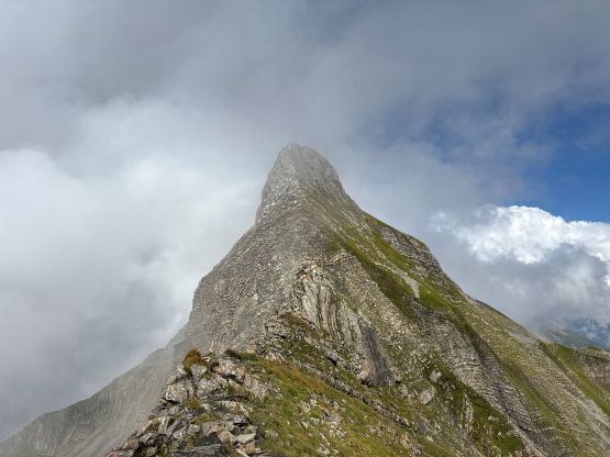
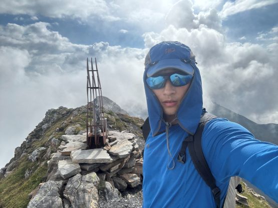
I had no time nor energy to descend 250 m and re-ascend it so my only option was to traverse the ridge connecting Schwarzhorn towards Grauspitz. There’s no “route” marked on the Gaia map, and the terrain appeared difficult. I thought I was screwed but I gave it a try nevertheless. I stowed the poles and made a committing 4th class down-climb with lethal exposure, and thankfully that was basically the crux of the traverse. There were more tricky steps and narrow ledges coming up but nothing was overly difficult. The traverse did take me a while due to the complexity of the terrain but at least I got the job done. The true summit of Grauspitz was also farther than I thought, which all made this objective more of a “prize”. Liechtenstein might be a tiny country but its high point was far from being a “giver”. Combined the ascents of Säntis and Grauspitz I had earned close to 2000 m elevation gain on a day that I was supposed to have some rest… At this point I was thinking maybe I should aim to have 0 rest day in this trip.

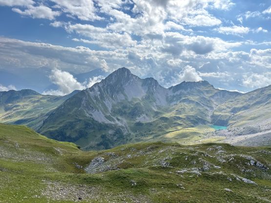
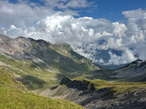
I was also glad that the weather worked for me because this objective would be very tricky, if not impossible in the wet conditions, at least not by the route I took. I then descended the SE Face standard route, which was easy but tedious. The grass and the dirt was very slippery requiring a lot of care. I then traversed back onto the lower part of Schwarzhorn’s SE Ridge and then followed the normal route back to the vehicle. My round trip time was less than 2.5 hours which was longer than the time I promised to Adam (2 hours). I really took my time driving down the access road because getting a flat in the private fields was not an option and would likely get me a huge fine. I was able to drive us out without mishap, thankfully. The rest of the evening was spent driving a few hours due south to the trail-head for Grigna Settentrionale. Most of the route was on winding and narrow roads. I don’t know why Google directed me over Splügen Pass but boy this is a difficult drive in the dark. I was downright exhausted by the time we got to the destination, but sleeping didn’t come easily with a cow grazing and ringing the bell at 11:30 pm and that lasted for an hour or two. Adam ended up throwing some rocks to that cow which seemed to have worked…